Hawk Fire: Wildland-Urban Interface and Mass Evacuation
Why in News?
A fast-moving wildfire near Reno, Nevada, expanded evacuation zones as shifting winds threatened homes and complicated firefighting, prompting a multi-agency emergency response.
- The Hawk Fire spread through rugged foothills ringed by homes and businesses, illustrating exposure at the wildland-urban interface.
- Authorities used a GO NOW zone and an adjacent warning zone, allowing evacuation instructions to change with the evolving threat.
- A resident reported that a fire-tracking application lagged behind actual conditions, showing how alert latency can distort household risk perception.
- Officials described the fire as human-caused but had not established whether ignition was accidental or intentional in the verified reporting.
- No event-attribution evidence reviewed for this note connects this individual fire to climate change; the article focuses on observed weather, exposure and response.
- Wildfire becomes a disaster when a moving fire front intersects exposed people, buildings, utilities, roads and institutions that cannot avoid or absorb its effects.
- Wind speed and direction can change flame spread, ember transport, smoke and safe routes within minutes, making static perimeters unreliable for household decisions.
- Mass evacuation is a network problem: warnings, transport, traffic control, shelters, health support, animal care and security must work under one operational picture.
UPSC Relevance
Prelims Relevance
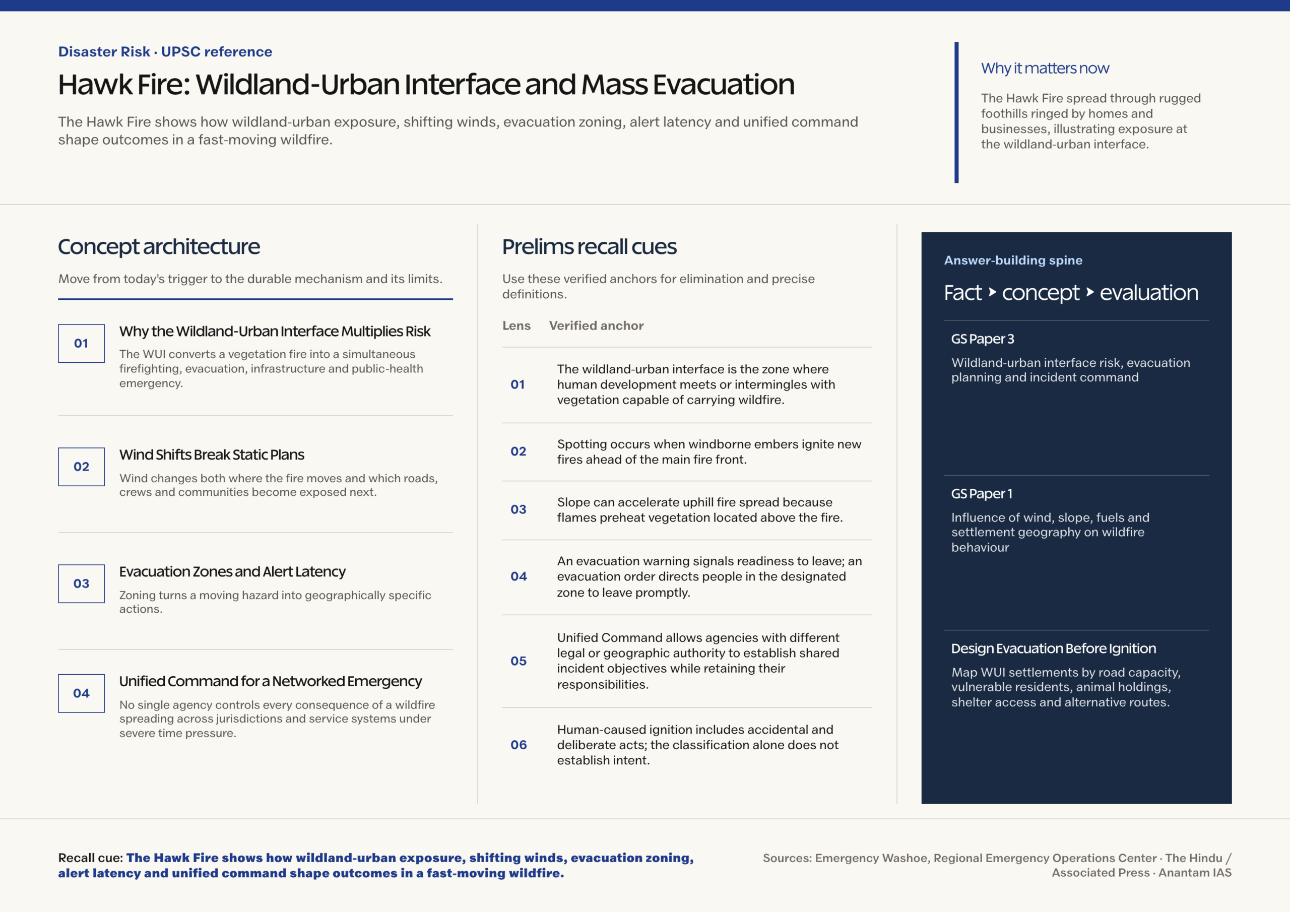
- The wildland-urban interface is the zone where human development meets or intermingles with vegetation capable of carrying wildfire.
- Spotting occurs when windborne embers ignite new fires ahead of the main fire front.
- Slope can accelerate uphill fire spread because flames preheat vegetation located above the fire.
- An evacuation warning signals readiness to leave; an evacuation order directs people in the designated zone to leave promptly.
- Unified Command allows agencies with different legal or geographic authority to establish shared incident objectives while retaining their responsibilities.
- Human-caused ignition includes accidental and deliberate acts; the classification alone does not establish intent.
Mains Relevance
GS Paper 3
- Wildland-urban interface risk, evacuation planning and incident command
- Early warning, last-mile communication and resilient critical infrastructure
GS Paper 1
- Influence of wind, slope, fuels and settlement geography on wildfire behaviour
Essay
- A warning succeeds only when accurate information reaches people early enough for safe action.
Background and Context
Why the Wildland-Urban Interface Multiplies Risk
The WUI converts a vegetation fire into a simultaneous firefighting, evacuation, infrastructure and public-health emergency.
- In an interface setting, buildings border a larger vegetated area; in an intermix setting, homes and vegetation are distributed through the same landscape.
- Roads may serve arriving fire crews and departing residents at once, creating congestion precisely when wind narrows the evacuation window and smoke reduces visibility at junctions.
- Combustible roofs, decks, fences and ornamental plants can carry embers from wildland fuels into neighbourhoods even before the flame front arrives.
- Risk reduction needs defensible space, ember-resistant construction, maintained access, backup utilities and land-use decisions that account for evacuation capacity.
Wind Shifts Break Static Plans
Wind changes both where the fire moves and which roads, crews and communities become exposed next.
- Stronger wind tilts flames toward unburned fuel, increases oxygen supply and transports embers, potentially creating spot fires beyond control lines.
- A direction shift can turn a flank into the head of the fire, requiring rapid reassessment of evacuation zones and crew safety positions before map updates reach residents.
- Topography interacts with wind: ridges, canyons and slopes can channel flow, limit access and produce local behaviour not visible in broad forecasts.
- Operational forecasts should be updated through weather observations and field reports, then translated into trigger points for zone expansion or route closure.
Evacuation Zones and Alert Latency
Zoning turns a moving hazard into geographically specific actions, while latency determines whether residents receive those actions in time.
- A warning zone lets households prepare medicines, documents, transport and animals; an order zone prioritises immediate movement rather than belongings.
- Alert latency accumulates across detection, verification, command decision, map editing, message distribution, device receipt, comprehension and household departure; each handoff can introduce delay.
- A consumer map may refresh slowly or lose connectivity, so official alerts should use redundant channels such as cell broadcast, SMS, radio, sirens and door-to-door notification during network or power failure.
- Messages should name the zone, required action, time, safe direction, shelter and update source; vague county-wide language creates delay and unnecessary traffic.
Unified Command for a Networked Emergency
No single agency controls every consequence of a wildfire spreading across jurisdictions and service systems under severe time pressure.
- Fire services manage suppression, police manage evacuation and access, medical agencies handle casualties, while utilities reduce power, gas and infrastructure hazards.
- Shelter agencies, transport providers and animal services need the same zone map and operational periods so households receive compatible instructions.
- Unified Command establishes shared objectives, priorities and resource allocation without erasing the statutory authority of participating agencies.
- A common operating picture should record fire behaviour, road status, alerts, shelter capacity, vulnerable facilities and unresolved information gaps with timestamps and named ownership for each update.
Way Forward
Design Evacuation Before Ignition
- Map WUI settlements by road capacity, vulnerable residents, animal holdings, shelter access and alternative routes, then test assumptions through drills.
- Set pre-agreed weather and fire-behaviour triggers for warnings, orders and zone expansion while preserving incident-command discretion for unexpected change.
- Audit alert systems end to end, including map refresh, telecom failure, multilingual comprehension and the time households actually need to depart.
- Use post-incident review to compare forecast, decision, message and movement timestamps, then correct the slowest link rather than blaming residents generically.
Conclusion
- The Hawk Fire’s durable lesson is that wildfire mortality is shaped before flames arrive by settlement exposure, warning speed and evacuation capacity.
- A Mains answer should connect wind-sensitive zoning with redundant alerts and Unified Command, while separating observed incident facts from unproved intent or climate attribution.
UPSC Practice Questions
Prelims MCQ 1
With reference to wildfire behaviour, consider the following statements:
- Windborne embers can ignite spot fires ahead of the main fire front.
- A sudden wind-direction change can alter which flank becomes most dangerous.
- Slope generally has no effect on the rate of uphill fire spread.
How many of the above statements are correct?
(a) Only one (b) Only two (c) All three (d) None
Answer: (b) Only two
Explanation:
Statements 1 and 2 are correct. Fire commonly spreads faster uphill because flames and hot gases preheat vegetation above the fire.
Prelims MCQ 2
What is the primary purpose of Unified Command in a multi-agency disaster?
(a) To transfer every agency’s legal authority to the fire department (b) To establish shared objectives and coordinated resource use across responsible agencies (c) To replace field observations with one public map (d) To delay evacuation until all agencies agree unanimously
Answer: (b) To establish shared objectives and coordinated resource use across responsible agencies
Explanation:
Unified Command coordinates agencies with different responsibilities while each retains its legal authority and accountability.
UPSC Mains Questions
- Why does development in the wildland-urban interface turn wildfire response into a land-use and evacuation-governance problem?
- Alert latency can make an accurate warning operationally useless. Discuss the institutional measures required for timely mass evacuation during a fast-moving hazard.
Sources: Emergency Washoe, Regional Emergency Operations Center and The Hindu / Associated Press.
Frequently Asked Questions
What is the wildland-urban interface?
It is the zone where homes, businesses or infrastructure meet or intermingle with vegetation capable of carrying wildfire, exposing people and structures to flames and embers.
Why are wind shifts dangerous during wildfire?
They can rapidly redirect the fire, transport embers, invalidate safe routes and turn a previously less active flank toward crews or settlements.
What is alert latency?
Alert latency is the delay from hazard detection through official decision, message delivery and comprehension to protective action by the person at risk.
Does human-caused mean the fire was deliberately set?
No. Human-caused ignition may be accidental or intentional. The classification does not establish motive, and officials had not reported intent in the verified sources.
Was climate change proved to have caused the Hawk Fire?
No event-attribution evidence reviewed here establishes that claim. Weather, fuels and exposure shaped the incident, but attribution requires a separate scientific analysis.