Dedicated Satellite Capacity for Himalayan Forest-Fire Monitoring
Why in News?
The Indian Express reported a parliamentary push for dedicated satellite capacity to monitor forest fires in the Himalayan region, bringing the gaps in detection and response into policy focus.
- The Rajya Sabha Department-related Parliamentary Standing Committee on Science and Technology, Environment, Forests and Climate Change presented its 405th Report on 9 March 2026 while examining the Environment Ministry’s Demands for Grants for 2026-27.
- The committee observed that forest fires were becoming more frequent and damaging forests, biodiversity and wildlife; it specifically noted the recurring summer fire problem in Uttarakhand.
- It recommended a Himalayan fire-dousing protocol and exploration of satellites, drones, artificial intelligence and data-driven systems for early detection, alerts and assessment of the cause and nature of fires.
- The report also asked for adequate budgetary support to states, recognising that a warning is useful only when field teams can reach, verify and contain the fire.
- A dedicated monitoring capability is best understood as an end-to-end public system: suitable sensors, frequent observations, fast processing, interoperable alerts and accountable ground action, not merely a spacecraft launch.
- Himalayan terrain creates a difficult response environment: steep slopes, remote forests, wind-driven spread and weak road access can turn a small ignition into a large incident before crews arrive.
- Satellite thermal observations can watch large and inaccessible areas consistently, but orbital revisit time, cloud, smoke, sensor resolution and alert latency affect what is detected and when.
- Forest fire is both an ecological and governance issue. It affects habitat, soil, water regulation, local livelihoods, public health, carbon storage and the safety of frontline personnel.
UPSC Relevance
Prelims Relevance
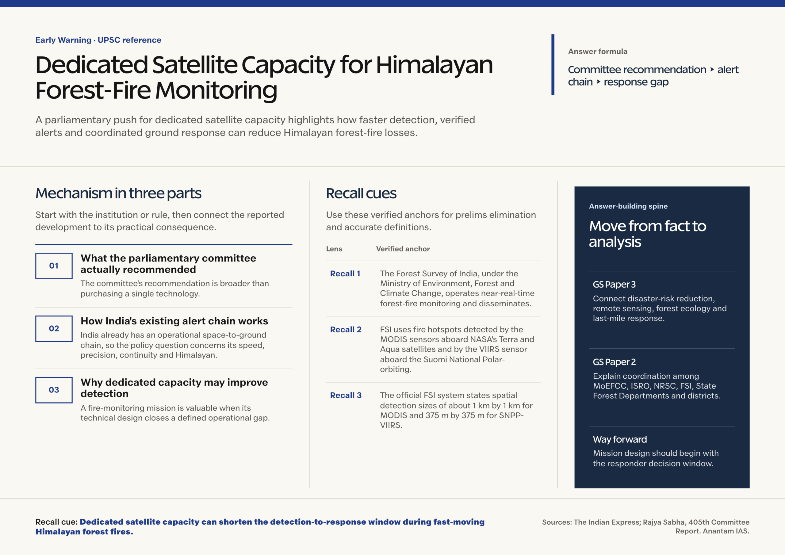
- The Forest Survey of India, under the Ministry of Environment, Forest and Climate Change, operates near-real-time forest-fire monitoring and disseminates alerts to State Forest Departments.
- FSI uses fire hotspots detected by the MODIS sensors aboard NASA’s Terra and Aqua satellites and by the VIIRS sensor aboard the Suomi National Polar-orbiting Partnership satellite.
- The official FSI system states spatial detection sizes of about 1 km by 1 km for MODIS and 375 m by 375 m for SNPP-VIIRS; these are hotspot pixel scales, not precise burnt-area boundaries.
- FSI receives the hotspot data through the National Remote Sensing Centre’s Shadnagar Earth Station, processes it using standard algorithms and sends alerts through email, KML files and registered SMS services.
- The Large Forest Fire Monitoring programme uses VIIRS data and identifies a candidate large fire when at least three contiguous VIIRS pixels are detected; it then tracks the estimated boundary across later satellite passes.
- The FSI system continues scanning a large-fire area for three days after apparent inactivity to detect a possible dormant-fire restart.
Mains Relevance
GS Paper 3
- Use the issue to connect disaster-risk reduction, remote sensing, climate adaptation, forest ecology and last-mile response capacity.
- Evaluate dedicated satellite capacity through four criteria: spatial resolution, temporal frequency, detection latency and integration with field command systems.
GS Paper 2
- Examine cooperative governance among MoEFCC, ISRO and NRSC, FSI, State Forest Departments, district administrations and disaster-management authorities.
- Use parliamentary scrutiny of scheme expenditure to show how legislative committees link public finance, administrative performance and policy redesign.
Essay
- Technology becomes public capacity only when information reaches the right institution in time and produces action on the ground.
Background and Context
What the parliamentary committee actually recommended
The committee’s recommendation is broader than purchasing a single technology.
- It called for a protocol that can be followed when a forest fire occurs in the Himalayan belt, addressing the need for common operational steps across jurisdictions.
- It asked the Environment Ministry to explore modern technologies, including satellites and drones, for early detection, alerts, cause assessment and fire characterisation.
- It urged a proactive model based on artificial intelligence and data, coupled with adequate financial support to State Governments.
- Its budget discussion places technology alongside field infrastructure, watchers, water storage, equipment and prevention work.
How India's existing alert chain works
India already has an operational space-to-ground chain, so the policy question concerns its speed, precision, continuity and Himalayan suitability.
- Polar-orbiting satellites carrying MODIS and VIIRS observe thermal anomalies during their passes. FSI overlays detections with forest information and converts relevant observations into alerts.
- FSI states that it alerts State Forest Departments at least six times in 24 hours. Alerts are shared with Principal Chief Conservators of Forests, forest-fire nodal officers and registered users.
- The Van Agni geoportal, KML layers and web-map services support visualisation. Large-fire monitoring adds repeated tracking and escalation to district or disaster authorities.
- ISRO and NRSC provide Earth-observation capacity, FSI turns detections into forestry alerts, and states retain the decisive field role.
Why dedicated capacity may improve detection
A fire-monitoring mission is valuable when its technical design closes a defined operational gap.
- Higher temporal resolution can reduce the wait between observations. This matters where heat, wind and dry fuel cause rapid spread between polar-orbiting passes.
- Finer spatial resolution may identify smaller ignitions and better separate forest hotspots from nearby settlements, roads or agricultural burns, subject to sensor performance and validation.
- Mid-wave and long-wave infrared sensing can support day-and-night fire detection. On-board processing and priority downlink can reduce latency if the ground segment and alert rules are designed with the spacecraft.
- A Himalayan service could combine hotspots with slope, vegetation, wind, dryness, settlements and access routes to generate a risk-ranked operational picture.
Why a satellite alone cannot solve the problem
Early detection creates decision time; it does not itself put out a fire.
- Cloud, dense smoke, terrain effects and the relationship between fire size and sensor pixel can produce missed detections or uncertain locations. Every alert needs a stated confidence level and a route for field confirmation.
- A dedicated low-Earth-orbit satellite still has revisit limits. Continuous coverage may require a constellation, suitable geostationary observations, data-sharing with other missions or a blended architecture.
- Detection of heat does not automatically prove the ignition source. Claims about negligence, deliberate burning or land-use activity need field evidence and due process.
- Remote Himalayan locations may lack crews, communications, water, equipment or safe access. More alerts without response capacity will not reduce loss.
- Fire exclusion everywhere can be ecologically unsound. Management should distinguish destructive wildfire from carefully governed controlled fire where science and local conditions support it.
Way Forward
Define the capability before choosing the spacecraft
- Specify minimum detectable fire, revisit frequency, night capability, acceptable alert latency, Himalayan coverage, cloud limitations and the intended escalation path.
- Compare a dedicated satellite, hosted payload, constellation, geostationary sensor and shared domestic or international data against life-cycle cost and service reliability.
- Create an open technical evaluation and independent validation plan using known fires and field observations before operational acceptance.
Conclusion
- Dedicated satellite capacity can give Himalayan responders something scarce during a fast-moving forest fire: time .
- India should treat the proposal as a disaster-governance mission rather than a stand-alone space project.
UPSC Practice Questions
Prelims MCQ 1
With reference to near-real-time forest-fire monitoring in India, consider the following statements:
- The Forest Survey of India uses detections from both MODIS and SNPP-VIIRS sensors.
- SNPP-VIIRS fire detections used by FSI have a finer stated spatial resolution than MODIS detections.
- A satellite thermal hotspot by itself conclusively establishes the cause of a forest fire.
How many of the above statements are correct?
(a) Only one (b) Only two (c) All three (d) None
Answer: (b) Only two
Explanation:
Statements 1 and 2 are correct. FSI uses MODIS and SNPP-VIIRS detections, with stated pixel sizes of about 1 km and 375 m respectively. A hotspot shows anomalous thermal activity; field evidence is needed to determine cause and status.
Prelims MCQ 2
Which one of the following best describes the Forest Fire Prevention and Management Scheme?
(a) A Central Sector Scheme implemented exclusively by ISRO (b) A Centrally Sponsored Scheme supporting States and Union Territories (c) A statutory fund administered by the National Disaster Management Authority (d) A component of the National Clean Air Programme limited to the Himalayan states
Answer: (b) A Centrally Sponsored Scheme supporting States and Union Territories
Explanation:
The Environment Ministry provides financial assistance to States and Union Territories under the Centrally Sponsored Forest Fire Prevention and Management Scheme for prevention, infrastructure, equipment, communication, watchers and related measures.
UPSC Mains Questions
- A dedicated forest-fire satellite can improve warning time, but it cannot substitute for last-mile state capacity. Discuss with reference to the Himalayan region. (250 words)
- Examine how remote sensing, artificial intelligence and community-based forest management can be integrated into an accountable Himalayan forest-fire response system. (250 words)
Sources: The Indian Express and Rajya Sabha, 405th Committee Report.
Frequently Asked Questions
What did the parliamentary committee recommend on Himalayan forest fires?
It sought a common protocol for dousing forest fires in the Himalayan belt and asked the Environment Ministry to explore satellites, drones, artificial intelligence and data-driven methods for prevention, early detection, alerts and assessment. It also called for adequate financial.
Does India already monitor forest fires from space?
Yes. The Forest Survey of India uses MODIS and SNPP-VIIRS hotspot detections received through the National Remote Sensing Centre, processes them automatically and sends alerts to State Forest Departments. FSI also operates large-fire tracking, a geoportal and fire-danger-related services.
Why might dedicated satellite capacity still be useful?
A purpose-designed service could improve observation frequency, spatial detail, night detection and alert latency for India’s operational needs. The benefit depends on payload choice, orbit or constellation design, ground processing, communications and integration with responders, not on the label ‘dedicated’.
Can a satellite identify who caused a forest fire?
Not conclusively. Thermal and optical data can locate heat, estimate spread and provide contextual clues, but attribution needs field inspection, witness accounts and other evidence. Public systems should separate detection confidence from claims about negligence or deliberate ignition.
What is the main limitation of technology-led forest-fire policy?
A fast alert has little value if there is no crew, water, equipment, communications or safe access. Technology must sit inside an end-to-end system that covers prevention, verification, dispatch, containment, responder safety, community participation and post-fire ecological restoration.