Stalled monsoon: India’s 41% rainfall deficit and why it matters
Why in News?
India is facing a roughly 41% all-India rainfall deficit in the early weeks of the 2026 southwest monsoon, after the seasonal rains stalled over Maharashtra and failed to advance on schedule into central and northern India. The Hindu’s national monsoon tracker reported that the monsoon’s northward progress has paused, leaving large swathes of the country waiting for rain at the very start of the kharif season.
The India Meteorological Department (IMD) flagged sharp regional variation in the rainfall departure from normal. The Indian Express Explained desk asked why the monsoon’s advance stalled mid-June and when the rains are likely to resume, framing the pause as a classic monsoon break with implications for sowing, drinking water and the rural economy.
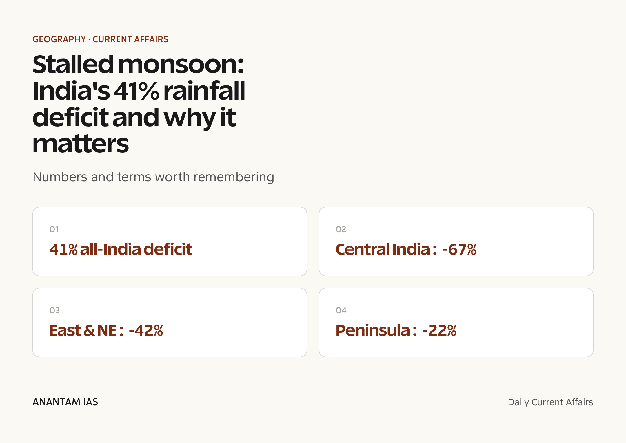
- All-India deficit of about 41% below the Long Period Average (LPA) in the season’s opening phase.
- Region-wise IMD departure: central India ~67% deficit, the worst-hit zone covering Maharashtra and Madhya Pradesh.
- East and northeast India ~42% deficit, despite usually being among the wettest regions early in the season.
- Southern peninsula ~22% deficit and northwest India ~6% deficit, the least affected.
- Monsoon’s onward march has stalled over Maharashtra, delaying coverage of the core kharif belt.
The development matters in the context of:
- Matters for kharif sowing: paddy, soybean, cotton and pulses depend on timely June-July rain.
- Matters for reservoir storage and drinking-water security ahead of the dry months.
- Matters for rural demand and inflation, since a weak start can dent farm incomes and push food prices.
UPSC Relevance
Prelims Relevance
- Long Period Average (LPA): 50-year average rainfall (1971-2020 baseline) used to define a ‘normal’ monsoon.
- Normal monsoon band: seasonal rainfall within 96-104% of LPA.
- Southwest monsoon season runs June to September; onset over Kerala is the official start.
- Two branches: the Arabian Sea branch and the Bay of Bengal branch.
- Inter-Tropical Convergence Zone (ITCZ) and its seasonal shift drive monsoon circulation.
- Monsoon break: a spell when the rain belt weakens or shifts to the Himalayan foothills.
- Madden-Julian Oscillation (MJO): an eastward-moving tropical disturbance that pulses monsoon rain.
- El Nino / La Nina (ENSO) and the Indian Ocean Dipole (IOD) modulate monsoon strength.
- IMD rainfall categories: deficient (below 90% LPA), below normal, normal, above normal, excess.
- Kharif crops are sown with the southwest monsoon and harvested in autumn.
Mains Relevance
GS Paper 1
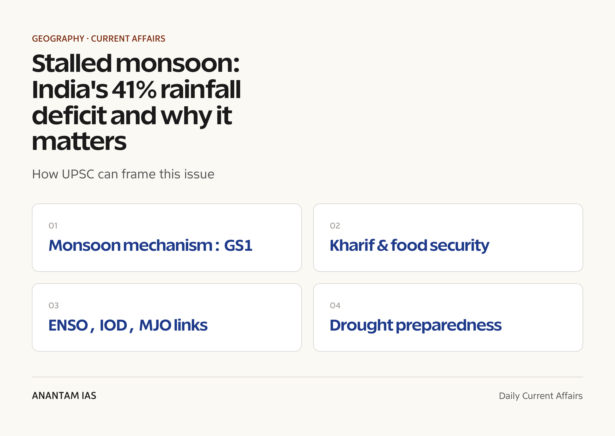
- Mechanism of the Indian monsoon: ITCZ shift, differential heating, the two moisture branches and the role of the Tibetan Plateau.
- Spatial variability of rainfall across India and how monsoon failure produces regional droughts.
- Influence of global teleconnections (ENSO, IOD, MJO) on the timing and intensity of the southwest monsoon.
GS Paper 3
- Monsoon dependence of Indian agriculture, kharif cropping and the link to food security and inflation.
- Water-resource and reservoir management under variable monsoon onset and break spells.
- Disaster management and drought preparedness: contingency cropping, crop insurance and irrigation buffers.
Essay
- Climate variability and the fragile foundations of an agrarian economy.
- When the rains fail: nature, livelihoods and the limits of planning.
Background and Context
What the southwest monsoon is
The southwest monsoon is the seasonal reversal of winds that brings India most of its annual rainfall between June and September.
- Driven by differential heating: the landmass heats faster than the surrounding oceans, creating a low-pressure zone over northwest India that pulls in moist sea winds.
- The Inter-Tropical Convergence Zone (ITCZ) shifts north over the subcontinent in summer, anchoring the rain belt.
- Moisture arrives in two streams: the Arabian Sea branch feeding the west coast and central India, and the Bay of Bengal branch feeding the east and northeast.
- The season delivers around 75% of India’s annual rainfall, making its timing decisive for farming and water supply.
Onset, advance and the LPA benchmark
IMD measures monsoon performance against a long-term average and tracks how the rains advance across the country.
- Onset over Kerala (normal date around June 1) marks the official start; the monsoon then advances north and west over several weeks.
- The Long Period Average (LPA) is the 50-year mean seasonal rainfall used as the ‘normal’ reference.
- A season is normal when rainfall lands within 96-104% of the LPA; below 90% is deficient.
- A stalled advance means large areas stay rain-free past their normal coverage dates, as seen with the stall over Maharashtra this year.
Reading the 2026 deficit numbers
The 41% all-India shortfall hides sharp regional contrasts in the IMD departure data.
- Central India carries the deepest gap at about 67% below normal, hitting Maharashtra and Madhya Pradesh hardest.
- East and northeast India sit near 42% deficit, unusual for an early-season period that is normally wet.
- The southern peninsula is closer to normal at roughly 22% below, and the northwest at about 6% below.
- Early-season percentages swing widely because the base rainfall is small, so a few missed spells can show up as a large shortfall.
Why the monsoon stalled: the break phase
A monsoon break is a natural lull when the rain-bearing systems weaken, and several factors can trigger one.
- In a monsoon break, the rain belt shifts toward the Himalayan foothills, leaving the plains dry.
- The Madden-Julian Oscillation (MJO), an eastward-moving band of cloud and rain, can suppress convection over India when it sits in an unfavourable phase.
- A lack of low-pressure systems and depressions over the Bay of Bengal slows the inland push of moisture.
- Weak monsoon trough activity and dry mid-level winds can hold up the northward advance, exactly the pattern that paused the rains over Maharashtra.
The teleconnections: ENSO, IOD and the global picture
India’s monsoon is shaped not just by local systems but by ocean-atmosphere patterns across the Pacific and Indian Oceans.
- El Nino (warm central Pacific) usually weakens the monsoon, while La Nina tends to strengthen it.
- A positive Indian Ocean Dipole (IOD) generally favours stronger monsoon rain, a negative IOD does the opposite.
- These are seasonal modulators, not switches; a favourable ENSO-IOD setup can still coincide with shorter dry breaks.
- Forecasters watch these indices together to judge whether a stall is a passing break or a sign of a weaker overall season.
Agriculture and the kharif risk
The early-season deficit lands precisely when farmers depend on rain to begin sowing.
- Kharif crops such as paddy, soybean, cotton, maize and pulses are sown with the June-July rains.
- A delayed or patchy start can push back sowing windows, shorten the growing period and lower yields.
- Roughly half of India’s net sown area remains rain-fed, so monsoon timing directly drives output for millions of small farmers.
- A weak start raises the case for contingency cropping plans and short-duration seed varieties.
Water, reservoirs and the wider economy
Beyond the fields, a stalled monsoon strains water storage and ripples through prices and demand.
- Low early rain delays reservoir refilling, tightening irrigation and drinking-water buffers for the dry season.
- Weak farm incomes can soften rural demand for goods, denting consumption-led growth.
- Supply shortfalls in vegetables, pulses and cereals can stoke food inflation.
- Hydropower generation and groundwater recharge also depend on a healthy, well-spread monsoon.
Way Forward
Forecasting and early warning
- Strengthen IMD’s extended-range and district-level forecasts so farmers get usable lead time on break and revival spells.
- Push agro-advisories through Krishi Vigyan Kendras and mobile alerts tied to local rainfall.
Building agricultural resilience
- Promote short-duration and drought-tolerant varieties and ready-made contingency cropping plans for delayed onset.
- Expand micro-irrigation and watershed work to cut dependence on a single good monsoon.
Water and safety-net management
- Prioritise reservoir and groundwater conservation early in the season to hedge against a weak finish.
- Keep crop insurance and rural employment schemes ready to absorb income shocks in deficit districts.
Conclusion
A 41% early-season deficit is a reminder that the Indian monsoon is a system of starts and stops, not a steady tap. A stall over Maharashtra in mid-June can still be followed by a strong revival, and seasonal totals often recover once the break ends and low-pressure systems return over the Bay of Bengal.
The deeper lesson for an agrarian economy is preparedness over panic. Better forecasting, resilient cropping, careful water storage and ready safety nets turn a difficult monsoon from a crisis into a manageable risk, even as climate variability makes each season harder to predict.
UPSC Practice Questions
Prelims MCQ 1
With reference to the Indian southwest monsoon, consider the following statements:
- The Long Period Average (LPA) is the basis on which IMD defines a normal monsoon.
- A monsoon break occurs when the rain belt shifts towards the Himalayan foothills, leaving the plains dry.
- El Nino conditions are generally associated with a stronger-than-normal Indian monsoon.
How many of the above statements are correct?
(a) Only one (b) Only two (c) All three (d) None
Answer: (b) Only two
Explanation:
Statements 1 and 2 are correct: IMD measures rainfall against the LPA, and a break phase pushes the rain belt to the foothills. Statement 3 is wrong: El Nino is usually linked to a weaker monsoon, while La Nina tends to strengthen it.
Prelims MCQ 2
A season is classified by IMD as a ‘normal’ monsoon when seasonal rainfall lies within which band of the Long Period Average?
(a) 90-110% (b) 96-104% (c) 80-120% (d) 98-102%
Answer: (b) 96-104%
Explanation:
IMD defines a normal monsoon as seasonal rainfall between 96% and 104% of the LPA. Below 90% is deficient and above 110% is excess; the 96-104% band is the official ‘normal’ range.
UPSC Mains Questions
- Explain the mechanism of the Indian southwest monsoon, including the role of the ITCZ and its two moisture branches. How do global teleconnections such as ENSO and the Indian Ocean Dipole modulate its strength? (250 words)
- A large early-season rainfall deficit poses serious risks to an agrarian economy. Discuss the implications of a stalled monsoon for kharif agriculture, water security and rural incomes, and suggest measures to build resilience. (250 words)
Sources: The Hindu and Indian Express Explained.
Frequently Asked Questions
What does a 41% monsoon deficit mean?
It means all-India rainfall so far this season is about 41% below the Long Period Average, the normal benchmark. Such early-season figures can swing sharply, since the base rainfall is small, and totals often recover once the rains revive across the country.
What is a monsoon break?
A monsoon break is a natural lull when the rain-bearing systems weaken and the rain belt shifts towards the Himalayan foothills, leaving the plains dry. Breaks are a normal part of the season and usually end when fresh low-pressure systems form over the Bay of Bengal.
Why did the monsoon stall over Maharashtra?
The advance paused because of weak monsoon-trough activity, a shortage of low-pressure systems over the Bay of Bengal, and an unfavourable phase of the Madden-Julian Oscillation that suppressed rainfall, holding up the northward push into central India.
How does the monsoon affect Indian agriculture?
The southwest monsoon delivers about three-quarters of India’s annual rain and waters the kharif crop. Roughly half of the net sown area is rain-fed, so delayed or patchy rain can shorten sowing windows, cut yields and squeeze the incomes of millions of small farmers.
What is the LPA in monsoon forecasting?
The Long Period Average is the 50-year mean of seasonal rainfall that IMD uses as the ‘normal’ reference. A season is called normal when rainfall falls within 96-104% of the LPA, and deficient when it drops below 90% of that average.
Can the monsoon recover after a stall?
Yes. A stall in mid-June is often followed by a strong revival once the break ends and fresh systems form over the Bay of Bengal. Seasonal totals can return to near normal even after a weak start, which is why forecasters track break and revival cycles closely.