Samudra Manthan: India Approves a National Offshore Exploration Mission
Why in News?
The Union Cabinet approved Samudra Manthan , formally the National Offshore Exploration Scheme, on 31 July 2026.
- The mission will support drilling of 60 deepwater exploration wells with an allocation of ₹43,200 crore.
- Government support can cover up to 50% of eligible drilling cost or ₹675 crore per well, whichever is lower.
- A further ₹28,534 crore is assigned to modern offshore seismic-data acquisition, processing and record-building.
- Shared offshore infrastructure hubs receive ₹10,000 crore, while oil-and-gas manufacturing and service zones receive ₹2,000 crore.
- The scheme includes ₹350 crore for monitoring and support activities, taking the total outlay to ₹84,084 crore.
- It matters in the context of energy security: PIB placed India’s annual petroleum import bill at about $144 billion, or roughly ₹13 lakh crore.
- It matters in the context of investment risk: a single deepwater exploratory well can cost about $125-150 million, while a discovery is never assured.
- It matters in the context of declining mature fields: existing oil and gas fields face a natural production decline of about 6-7% a year.
UPSC Relevance
Prelims Relevance
- Samudra Manthan is a central sector scheme under the Ministry of Petroleum and Natural Gas, not a coastal-development or fisheries programme.
- Its implementation period runs through financial year 2030-31, with the first phase approved up to 31 March 2031.
- The mission covers offshore seismic data, deepwater wells, common infrastructure hubs, and domestic equipment and service capacity.
- Seismic surveys use reflected energy waves to infer subsurface geological structures; they indicate prospects but do not prove commercially recoverable hydrocarbons.
- The National Data Repository supports storage, reprocessing and access to Indian exploration and production data.
- Deepwater prospects highlighted by the government include the Krishna-Godavari, Cauvery and Mahanadi basins and the Andaman region.
Mains Relevance
GS Paper 3
- Energy security, import dependence and the role of domestic oil and gas during India’s transition to a lower-carbon economy.
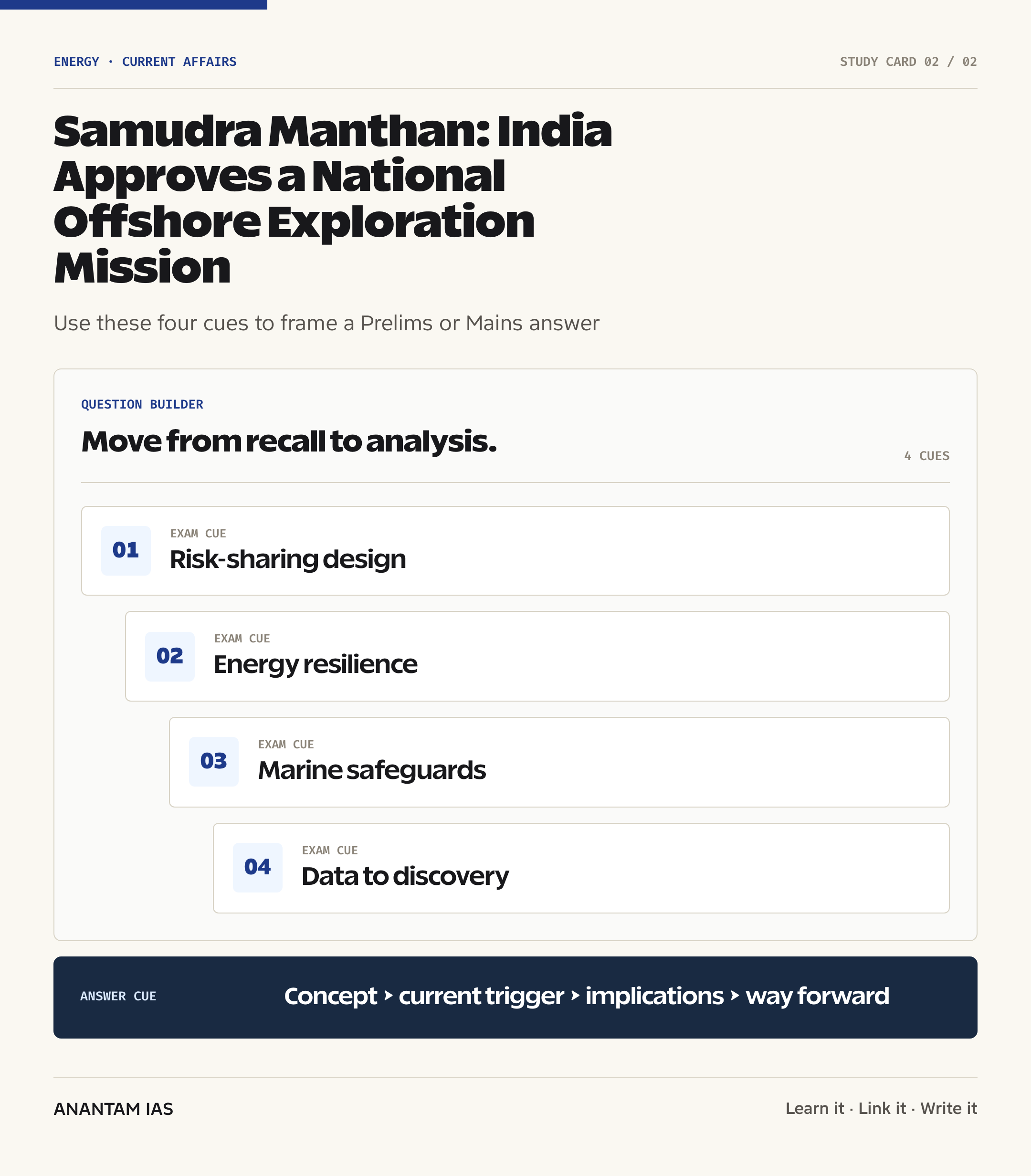
- Public risk-sharing in capital-intensive exploration, crowding-in of private investment and the conditions needed for fiscal accountability.
GS Paper 2
- Design of a central sector scheme, regulatory certainty, contract enforcement and transparent allocation of public support.
- Balancing Union control over mineral oil resources with coastal-state interests, fishing livelihoods and environmental governance.
Essay
- Energy independence is built through resilience and diversification, not through a single fuel or a single source.
Background and Context
Why offshore exploration needs public risk-sharing
Offshore exploration combines high upfront costs, uncertain geology and a long delay before any possible revenue.
- PIB estimates that the journey from award of an exploration block to commercial production normally takes five to ten years.
- A deepwater exploratory well may cost about $125-150 million, yet drilling can still produce a dry well or a non-commercial discovery.
- Private firms may underinvest where the geological risk is high, infrastructure is absent and payback is distant. The scheme uses capped public support to reduce part of that first-mover risk.
- Risk-sharing is not the same as underwriting profits: public payment should be tied to eligible expenditure, technical milestones, open data and audit trails.
- Existing fields lose output naturally. The cited 6-7% annual decline makes continuous exploration important even before demand growth is considered.
How the ₹84,084-crore package is structured
The mission links geological knowledge, exploratory drilling, evacuation infrastructure and industrial capability rather than funding wells alone.
- Offshore data acquisition: ₹28,534 crore. PIB breaks this into ₹12,000 crore for basin-wide 2D seismic coverage, ₹12,534 crore for 3D seismic and other technologies, and ₹4,000 crore for National Data Repository reprocessing.
- Deepwater exploration: ₹43,200 crore. This supports 60 wells, with assistance capped at 50% of eligible drilling cost or ₹675 crore per well, whichever is lower.
- Common offshore hubs: ₹10,000 crore. Shared facilities can lower the threshold for bringing separate discoveries into production by avoiding complete duplication of costly infrastructure.
- Manufacturing and service zones: ₹2,000 crore. The aim is localisation of critical equipment, maintenance and specialised services across the exploration and production value chain.
- Monitoring and support: ₹350 crore. Digital measures, evaluation, human resources, awareness and programme administration complete the total outlay.
From seismic signal to commercial production
Each stage reduces a different uncertainty, and success at one stage does not guarantee success at the next.
- A 2D seismic survey provides broad subsurface profiles across a basin; 3D seismic produces a more detailed volume model for prospect selection and well planning.
- Geoscientists integrate seismic interpretation with gravity, magnetic, geological and existing well data to identify a prospect that may trap hydrocarbons.
- Only an exploratory well can directly test whether the predicted reservoir contains oil or gas in potentially recoverable quantities.
- An appraisal programme then estimates the discovery’s size, flow characteristics and commercial viability. Development needs platforms, subsea systems, pipelines, processing facilities and safety systems.
- Shared hubs can improve the economics of smaller discoveries, but commercialisation still depends on reservoir quality, prices, regulation, technology and environmental clearance.
Priority basins and the licensing context
The next exploration frontier lies in deeper waters where geological potential and technical difficulty rise together.
- PIB identifies the Krishna-Godavari, Cauvery and Mahanadi basins and the Andaman region as important deepwater and ultra-deepwater prospects.
- The government says more than 99% of earlier offshore no-go areas have been removed, opening over one million square kilometres of India’s exclusive economic zone for exploration.
- The Hindu reported that OALP Round X offered one deepwater and 12 ultra-deepwater blocks, while Round XI includes one deepwater and four ultra-deepwater blocks.
- For maritime context, compare exploration rights inside the EEZ with India’s wider high-seas governance responsibilities.
Way Forward
Make risk-sharing measurable
- Publish basin-wise selection criteria, eligible-cost rules, assistance released and the technical milestones achieved for every supported well.
- Use independent cost verification and disclose the treatment of dry wells, cost overruns, relinquished blocks and commercially successful discoveries.
- Design contracts so that public support earns public value through data access, capability-building and an appropriate share of upside.
Conclusion
- Samudra Manthan is an attempt to solve a real coordination failure: companies face expensive frontier geology, limited common infrastructure and long payback periods, while India remains exposed to imported energy.
- But public risk-sharing must produce public knowledge and accountable outcomes.
UPSC Practice Questions
Prelims MCQ 1
With reference to the Samudra Manthan National Offshore Exploration Scheme, consider the following statements:
- It is a central sector scheme of the Ministry of Petroleum and Natural Gas.
- It provides government support of up to 50% of eligible drilling cost or ₹675 crore per deepwater well, whichever is lower.
- It is limited to acquiring seismic data and does not support common offshore infrastructure.
How many of the above statements are correct?
(a) Only one (b) Only two (c) All three (d) None
Answer: (b) Only two
Explanation:
Statements 1 and 2 are correct. Statement 3 is incorrect because the mission also allocates ₹10,000 crore for common offshore infrastructure hubs, apart from data, wells and manufacturing-service zones.
Prelims MCQ 2
What is the primary purpose of a 3D seismic survey in offshore hydrocarbon exploration?
(a) To confirm the commercial flow rate of a discovered reservoir (b) To create a detailed subsurface volume model for identifying and planning prospects (c) To measure the exclusive economic zone from the coastline (d) To replace the need for exploratory drilling
Answer: (b) To create a detailed subsurface volume model for identifying and planning prospects
Explanation:
A 3D seismic survey improves the geological image used to select and plan a prospect. It cannot prove a commercial discovery; an exploratory well and later appraisal are still required.
UPSC Mains Questions
- India’s National Offshore Exploration Scheme seeks to socialise part of the geological risk while attracting private capital. Examine the economic rationale for this design and suggest safeguards that can ensure fiscal accountability, open data and a fair public return.
- Domestic oil and gas exploration can improve energy resilience but may create marine ecological and carbon lock-in risks. Discuss how Samudra Manthan should be implemented within a diversified energy-security and environmental-governance framework.
Sources: PIB, Ministry of Petroleum and Natural Gas and The Hindu Explained.
Frequently Asked Questions
What is Samudra Manthan?
Samudra Manthan is the Ministry of Petroleum and Natural Gas’s National Offshore Exploration Scheme. The central sector scheme funds better offshore data, 60 deepwater exploration wells, common production infrastructure, and domestic manufacturing and services. Its approved outlay is ₹84,084 crore.
How much support can one well receive?
For an eligible deepwater exploration well, government support may cover up to 50% of eligible drilling cost or ₹675 crore, whichever is lower. The ceiling shares part of the geological and capital risk; it does not assure that drilling will.
Which offshore basins are important?
PIB identifies the Krishna-Godavari, Cauvery and Mahanadi basins and the Andaman region as major deepwater and ultra-deepwater frontiers. These areas may hold future hydrocarbon potential, but they need advanced seismic interpretation, costly drilling and careful marine environmental assessment.
Why are seismic surveys used?
Seismic surveys record reflected energy waves to infer rock structures below the seabed. Two-dimensional surveys provide broad profiles, while three-dimensional surveys create a more detailed subsurface model. They help identify prospects and plan wells, but only drilling can directly test.
Will the mission end oil imports?
No. The government projects higher domestic output and potential annual import savings if exploration succeeds. Actual gains depend on discoveries, recoverable volumes, costs and production timelines. India will still need a broader strategy of supplier diversification, efficiency, electrification, renewables and.