Nepal Flash Flood: How a Glacial Collapse Became a Transboundary Himalayan Disaster
Why in News?
The USGS reclassified an August 26 seismic signal near the Nepal–Tibet border as a glacial collapse and debris flow, not an earthquake, after reviewing seismic and satellite evidence.
- The signal occurred near the border at 8:37 a.m. local time and was initially reported as a magnitude 4.4 earthquake.
- USGS analysis used nearby seismic stations, long-period waves and satellite imagery to revise the event interpretation.
- The moving ice and debris produced seismic energy and severe downstream impacts across a connected mountain river system.
- The evidence supports a glacial-collapse and debris-flow cascade; it does not by itself confirm that a glacial lake breached.
- Himalayan valleys can convert a high-altitude slope failure into a fast, sediment-rich flood with little warning time.
- Because headwaters and downstream assets cross borders, hazard monitoring must link cryosphere observations, river gauges and emergency communication across jurisdictions.
- The episode demonstrates why disaster labels should follow verified mechanisms, not preliminary interpretations issued during rescue operations.
UPSC Relevance
Prelims Relevance
- A glacial collapse is the sudden failure and downslope movement of glacier ice, often mixed with rock and sediment.
- A debris flow is a gravity-driven mixture of water, sediment and larger material that can travel rapidly through steep channels.
- A GLOF requires the sudden release of water stored in or near a glacier, commonly after failure or overtopping of a natural dam.
- Seismic instruments record ground motion from non-earthquake sources, including landslides, avalanches, explosions and large mass movements.
- The Sendai Framework for Disaster Risk Reduction 2015–2030 promotes understanding risk, preparedness, resilient investment and stronger disaster governance.
Mains Relevance
GS Paper 3
- Multi-hazard monitoring for glacier, slope, debris-flow and flash-flood cascades in the Himalayas
- Risk-sensitive planning for hydropower, roads, bridges and settlements in narrow mountain valleys
GS Paper 2
- Cross-border data sharing and last-mile warning protocols for transboundary Himalayan river basins
Essay
- Disasters often emerge from interacting natural processes and human exposure, not from a single isolated hazard.
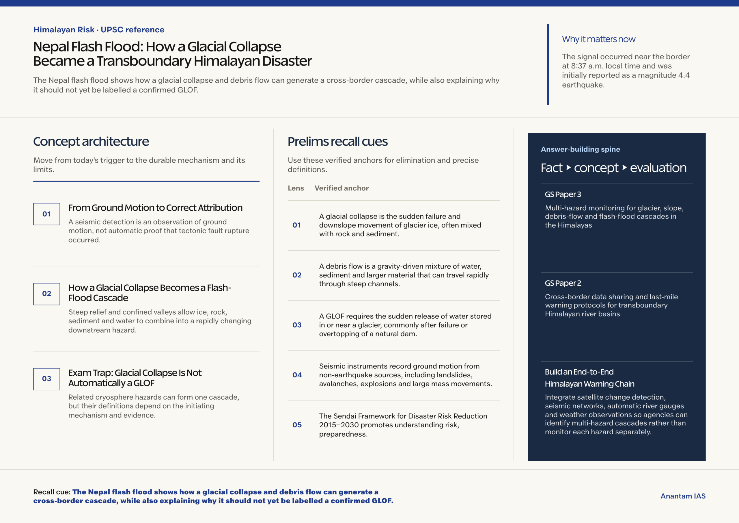
Background and Context
From Ground Motion to Correct Attribution
A seismic detection is an observation of ground motion, not automatic proof that tectonic fault rupture occurred.
- Earthquakes usually generate identifiable seismic phases from fault rupture; large landslides or ice collapses produce signals shaped by sustained surface mass movement over uneven terrain.
- An automatic earthquake catalogue can provide a useful first alert, but analysts must compare waveforms, station records and event location before assigning a final physical cause.
- Long-period seismic waves can reveal the slower force history of a moving mass that differs from the abrupt rupture pattern expected in many tectonic earthquakes.
- Satellite imagery supplies missing spatial evidence by showing collapse scars, displaced ice, altered channels or deposits that ground instruments cannot directly identify or map.
- The USGS revision illustrates scientific correction: an early classification was updated when independent observations supported a non-tectonic explanation of the recorded ground motion.
How a Glacial Collapse Becomes a Flash-Flood Cascade
Steep relief and confined valleys allow ice, rock, sediment and water to combine into a rapidly changing downstream hazard.
- A collapsing ice mass can entrain loose rock and sediment, increasing its volume and converting the initial failure into a dense debris flow with greater impact force.
- When debris enters a channel, it may displace water, temporarily block flow or add sediment until the moving surge behaves differently from an ordinary rainfall-fed river flood.
- A temporary blockage can impound water and later fail, creating a second pulse whose timing, sediment load and magnitude remain difficult to forecast during an unfolding emergency.
- Narrow gorges concentrate flow, while steep gradients increase velocity and erosive power; downstream bends, tributaries and confluences can redistribute water and debris unpredictably.
- Roads, bridges, hydropower works and communications often occupy valley floors, so one upstream failure can disable evacuation routes, electricity and essential services together.
Exam Trap: Glacial Collapse Is Not Automatically a GLOF
Related cryosphere hazards can form one cascade, but their definitions depend on the initiating mechanism and evidence.
- A glacial lake outburst flood begins with sudden drainage of water stored in a glacier-related lake after a moraine dam, ice barrier or natural blockage fails.
- A glacial collapse can generate a debris flow without any lake breach, so the presence of ice, floodwater and sediment downstream does not prove a GLOF mechanism.
- A mass movement may also strike a lake, produce a displacement wave and trigger a breach; only verified lake involvement and drainage would support that combined interpretation.
- Preliminary earthquake, avalanche and GLOF explanations should remain hypotheses until field evidence, remote sensing, seismic analysis and channel deposits establish the event sequence.
- For Mains answers, separate hazard, exposure and vulnerability: the collapse initiates danger, while valley development, infrastructure siting and weak warning coverage shape losses.
Way Forward
Build an End-to-End Himalayan Warning Chain
- Integrate satellite change detection, seismic networks, automatic river gauges and weather observations so agencies can identify multi-hazard cascades rather than monitor each hazard separately.
- Adopt impact-based thresholds that convert upstream detections into clear downstream evacuation actions, including redundant sirens, mobile alerts, radio and community volunteers.
- Share upstream observations across borders through pre-agreed formats, named contact points and joint exercises for rivers whose warning time depends on another jurisdiction.
- Apply risk-sensitive siting, protective design and emergency shutdown plans to hydropower, roads, bridges and settlements exposed along confined valleys.
Conclusion
- The durable lesson is not to attach every Himalayan flood to an earthquake or GLOF, but to reconstruct the complete hazard cascade from evidence.
- A strong UPSC answer should combine scientific attribution, transboundary monitoring, resilient infrastructure and last-mile warning as parts of one mountain-risk strategy.
UPSC Practice Questions
Prelims MCQ 1
With reference to cryosphere-linked hazards, consider the following statements:
- A glacial lake outburst flood necessarily involves the sudden release of water stored in or near a glacier.
- A seismic station can record ground motion caused by a large landslide or glacial collapse.
- Every glacial collapse that enters a river is classified as a glacial lake outburst flood.
How many of the above statements are correct?
(a) Only one (b) Only two (c) All three (d) None
Answer: (b) Only two
Explanation:
Statements 1 and 2 are correct. A GLOF requires sudden lake-water release, while seismic instruments can detect non-tectonic mass movements. A collapse without a lake breach is not automatically a GLOF.
Prelims MCQ 2
Which combination is most appropriate for identifying a glacial-collapse and debris-flow cascade in a remote mountain basin?
(a) Electoral records and census maps alone (b) Seismic waveforms, satellite imagery and river observations (c) Surface temperature at one downstream city only (d) A single early social-media report
Answer: (b) Seismic waveforms, satellite imagery and river observations
Explanation:
Seismic records help identify mass movement, satellite imagery locates landscape changes, and river observations track downstream effects. Their combination supports attribution and operational warning.
UPSC Mains Questions
- Explain how a glacial collapse can evolve into a debris-flow and flash-flood cascade in the Himalayas. Why is precise hazard attribution important for disaster management?
- Transboundary Himalayan disasters require an end-to-end warning system rather than isolated monitoring networks. Discuss with reference to cryosphere-linked hazards and infrastructure exposure.
Sources: The Hindu, citing the United States Geological Survey and United Nations Office for Disaster Risk Reduction.
Frequently Asked Questions
Did an earthquake cause the Nepal flash flood?
The USGS revised the initial interpretation after analysing seismic stations, long-period waves and satellite imagery. It classified the signal as a glacial collapse and debris flow, stating that no earthquake occurred.
Was the event a confirmed glacial lake outburst flood?
No confirmed lake breach was established in the cited USGS revision. A GLOF requires sudden release of glacier-related lake water; glacial collapse and debris flow alone do not satisfy that definition.
Why can a glacial collapse look like an earthquake on instruments?
A large mass of ice, rock and sediment transfers force to the ground while moving. Seismic stations record that motion, although detailed waveforms can distinguish it from tectonic fault rupture.
Why are Himalayan flash floods difficult to warn against?
Steep slopes, small headwater basins and confined gorges can produce rapid surges with little lead time. Sparse monitoring, damaged communications and cross-border headwaters can shorten the response window further.
What should a transboundary early-warning system include?
It should combine upstream seismic, satellite, weather and river observations with agreed data-sharing, impact thresholds, named emergency contacts, redundant public alerts, community drills and pre-planned evacuation routes.