ORV Sagar Manthan: From Ship Launch to Ocean Research
Why in News?
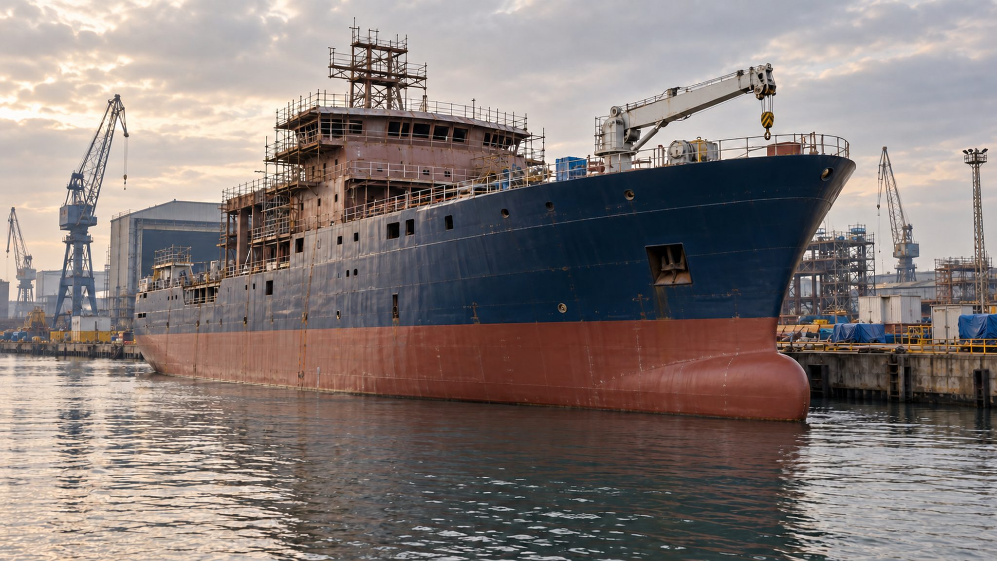
ORV Sagar Manthan was launched at Kolkata on September 9, 2026, beginning another construction phase before its scheduled delivery for commissioning in 2028.
- GRSE is building the ocean research vessel for the National Centre for Polar and Ocean Research, under the Ministry of Earth Sciences.
- Superstructure erection, system integration and sea trials remain after launch; the ship has not entered operational research service.
- The vessel supports the Deep Ocean Mission, with planned seabed surveys, water-column studies and environmental observations.
- Ocean observations help connect underwater geology, water properties and atmospheric conditions, giving researchers evidence that a surface view cannot supply.
- Scientific capability depends on working instruments, trained teams and usable observations, alongside the physical research platform.
UPSC Relevance
Prelims Relevance
- ORV: Ocean Research Vessel.
- NCPOR: an institution under the Ministry of Earth Sciences.
- Bathymetry: underwater depth and seabed topography.
- CTD: conductivity, temperature and depth profiling.
- Sub-bottom profiling: imaging structures beneath the seabed.
Mains Relevance
GS Paper 3
- Domestic scientific infrastructure and ocean technology.
- Resource exploration, environmental baselines and evidence-based ocean management.
GS Paper 1
- Ocean-floor relief and the physical properties of ocean water.
Essay
- Scientific self-reliance requires dependable knowledge production, alongside domestic manufacturing.
Background and Context
What the launch does, and what remains
The launch marks progress in construction; readiness for scientific cruises requires further work on the ship and its integrated systems.
- Launch means the vessel entered the water for its next construction phase. The official account records a transfer between docks, not the departure of a fully equipped ship on an ocean expedition.
- Superstructure erection remains on the project schedule. This makes the unfinished ship an especially useful example of why a floating hull should not be confused with a completed oceanographic platform ready for service.
- System integration brings the vessel and its equipment together. For research, the practical question is whether ship operations and scientific instruments can function reliably as a combined platform during planned work at sea.
- Sea trials must precede final delivery for commissioning, scheduled for 2028. The announcement supplies a future milestone rather than evidence that every performance requirement has already been demonstrated in actual ocean conditions.
- NCPOR is the intended scientific recipient under the Earth Sciences Ministry. Construction by a defence public sector shipyard does not change the stated ocean-research purpose into a naval combat or submarine-rescue role.
Match the instrument to the research question
Different instruments observe different parts of the ocean; combining their findings is more useful than treating every survey as the same measurement.
- Multibeam bathymetry maps seabed depth across a swath by timing returning sound pulses. It answers where underwater ridges and depressions lie; a depth map alone does not identify commercially recoverable mineral deposits.
- CTD profiling records conductivity and temperature with depth in the water column. Conductivity helps derive salinity, allowing scientists to examine changing water properties rather than merely produce another outline of the ocean floor.
- Sub-bottom profiling uses sound to investigate sediment structures beneath the seabed. Its target differs from bathymetry: the question concerns buried layers, not simply how deep the seabed lies beneath the research vessel.
- Multichannel seismic systems record reflected signals through multiple receivers to study subsurface structure. Such profiles require geological interpretation; recording reflections is not equivalent to directly seeing or extracting an underground mineral resource.
- Complementary observations improve measurement quality as well as coverage. NOAA explains that CTD information supports sound-speed profiles for accurate sonar bathymetry, showing how water-column measurements can help correct a map of the seabed.
How exploration becomes useful public knowledge
The proposed research programme links geological exploration with environmental observations; the value comes from interpreting both together rather than counting equipment installed.
- Mid-ocean-ridge exploration is part of the planned programme, including identification of multi-metal hydrothermal sulphide mineralisation. An exploration objective describes what researchers intend to investigate, not a confirmed inventory of economically recoverable resources.
- Environmental baselines establish reference conditions for interpreting later observations. They help separate an existing ecosystem condition from a subsequent change, but a baseline survey itself cannot establish that a future intervention is harmless.
- Water-column sampling and atmospheric observations widen the research beyond minerals. Studying the ocean together with conditions above it supports multidisciplinary questions; no single new ship can independently deliver an entire forecasting or warning system.
- ROV and AUV deployment facilities are planned aboard the vessel. These extend the range of research operations, but the provision of deployment infrastructure is not evidence that a particular underwater vehicle mission has occurred.
- Domestic construction can strengthen experience with complex scientific platforms. The longer-term test should be dependable research operations and useful observations, rather than treating the launch ceremony as proof that scientific independence is already complete.
Way Forward
Track readiness and research quality
- Publish clear integration and trial milestones, distinguishing completed work from delivery targets.
- Prepare scientific teams, calibration procedures and maintenance support alongside the remaining construction work.
- Plan environmental baseline observations with geological surveys, so resource assessment does not proceed without ecological context.
- Make validated research data and methods accessible where appropriate, with uncertainty and sampling limitations clearly explained.
Conclusion
- ORV Sagar Manthan illustrates the chain from shipbuilding to scientific capability: launch enables further work, trials test readiness, and research operations eventually produce evidence. Each stage deserves a separate assessment.
- For ocean policy, connect measurement, interpretation and responsible use. Bathymetry, water-column profiles and subsurface surveys answer different questions; their combined value depends on reliable equipment, competent teams and careful treatment of uncertainty.
UPSC Practice Questions
Prelims MCQ 1
With reference to ORV Sagar Manthan, consider the following statements:
- Its September 2026 launch marked its commissioning into operational research service.
- It is being built for NCPOR under the Ministry of Earth Sciences.
- Multibeam bathymetry and CTD profiling measure different aspects of the ocean.
How many of the above statements are correct?
(a) Only one (b) Only two (c) All three (d) None
Answer: (b) Only two
Explanation:
Statements 2 and 3 are correct. Launch preceded remaining construction, integration and sea trials; delivery for commissioning is scheduled for 2028.
Prelims MCQ 2
Which instrument is most directly suited to examining how conductivity and temperature vary with depth in seawater?
(a) Weather radar (b) Multichannel seismic system (c) CTD profiler (d) Sub-bottom profiler
Answer: (c) CTD profiler
Explanation:
CTD stands for conductivity, temperature and depth. It profiles water-column properties, while sub-bottom and seismic methods investigate structures beneath the seabed.
UPSC Mains Questions
- Explain how complementary oceanographic instruments improve understanding of the ocean. Distinguish bathymetry, CTD profiling and subsurface surveys. (150 words)
- Domestic construction of a research vessel is a foundation for scientific self-reliance, but not its final measure. Discuss with reference to ORV Sagar Manthan. (250 words)
Sources: PIB, Ministry of Earth Sciences and NOAA Ocean Exploration; US Geological Survey.
Frequently Asked Questions
Has ORV Sagar Manthan been commissioned?
No. It was launched on September 9, 2026. Superstructure erection, system integration and sea trials remain, with final delivery for commissioning to NCPOR and the Earth Sciences Ministry scheduled for 2028.
Is ORV Sagar Manthan a warship?
The announced platform is an ocean research vessel being built for NCPOR under the Ministry of Earth Sciences. Its construction by GRSE, a defence public sector shipyard, does not make its stated mission naval combat.
How does bathymetry differ from CTD profiling?
Bathymetry measures underwater depth and maps seabed relief. CTD profiling examines conductivity and temperature through the water column, helping derive salinity and understand how water properties change with depth.
Does mineral exploration mean seabed mining has started?
No. Investigating mineralisation is an exploration objective. It does not establish commercially recoverable deposits, demonstrate that extraction is environmentally acceptable, or show that mining operations have started at a surveyed location.