Daily Digest
UPSC · Civil Services Examination
Current Affairs · Sunday, 28 September 2025
Current affairs curated and edited by Anantam IAS faculty — pulled from The Hindu, PIB, IDSA, Foreign Affairs and the ministries. Read, annotate, revise.
Old Rajinder Nagar · Delhi 110005 · anantamias.com
Punjab Floods 2025: Relief, Rehabilitation, and Disaster-Management Architecture
Introduction
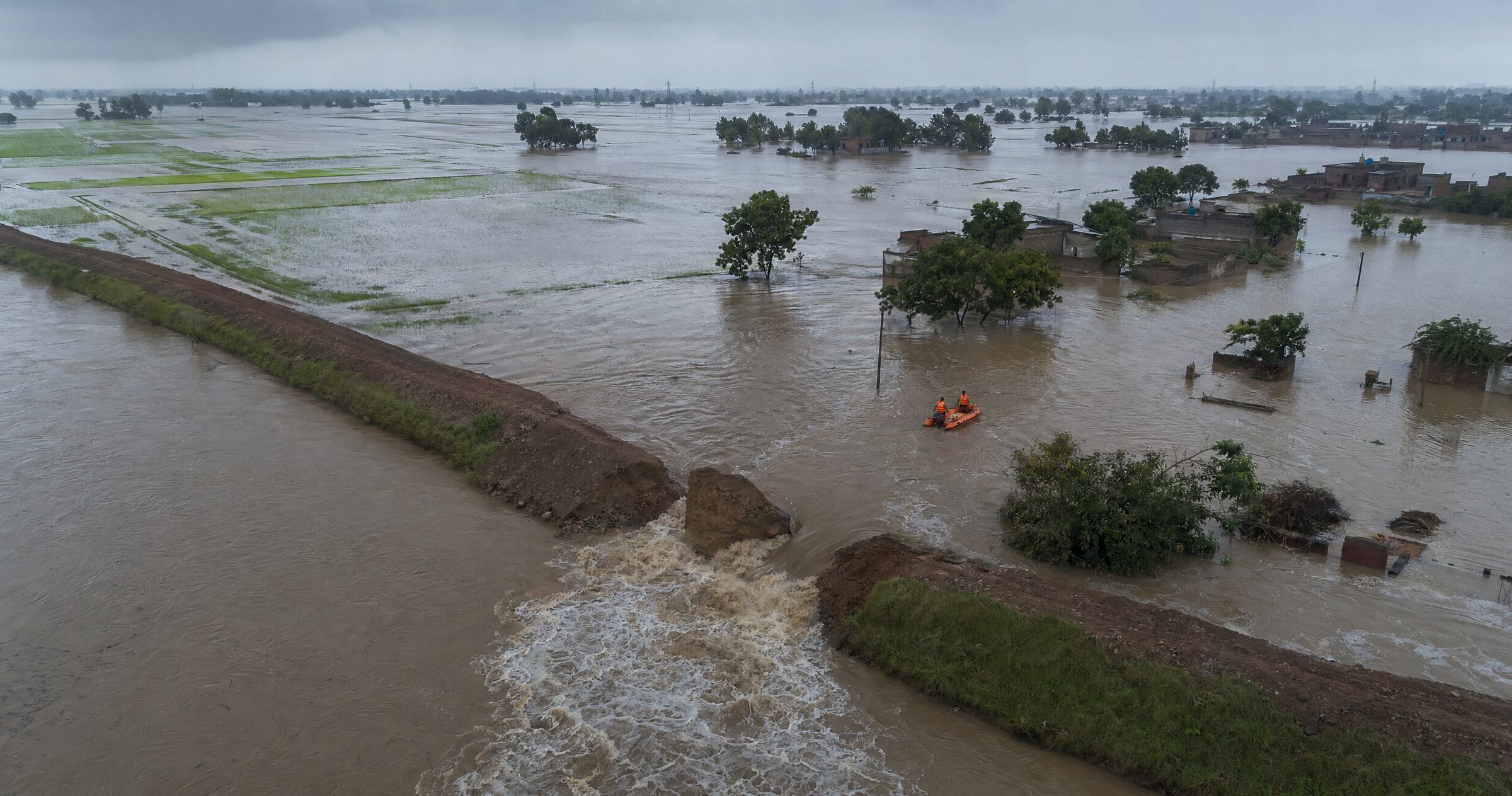
By the closing week of September 2025, Punjab was grappling with one of its most devastating monsoon flood episodes in recent memory. Triggered by repeated bursts of high-intensity rainfall over the upper catchments of the Sutlej, Beas and Ravi rivers in late August and through September, the floods caused multiple embankment breaches across Ferozepur, Kapurthala, Gurdaspur, Pathankot, Hoshiarpur and Fazilka districts. Lakhs of residents were displaced, standing paddy and basmati crops over several lakh hectares were submerged, and rural infrastructure — roads, schools, primary health centres, tubewells — was extensively damaged. State authorities, the National Disaster Response Force (NDRF), the State Disaster Response Force (SDRF), the Indian Army and the Indian Air Force were jointly engaged in evacuation, relief distribution and embankment plugging operations.
The episode is significant for the UPSC aspirant on three counts. First, it offers a live case study of India’s multi-tier disaster governance architecture under the Disaster Management Act, 2005, including the role of the National Disaster Management Authority (NDMA), the State Disaster Management Authority and District Disaster Management Authorities. Second, it foregrounds long-standing structural concerns — ageing embankments, weak flood-plain zoning, inter-state water management through the Bhakra Beas Management Board (BBMB), and silt-laden river beds. Third, the relief and rehabilitation phase reveals how the State Disaster Response Fund (SDRF), the National Disaster Response Fund (NDRF Fund), the Pradhan Mantri Fasal Bima Yojana (PMFBY), and ex-gratia relief from the PM National Relief Fund (PMNRF) interlock in practice. (Source: NDMA; Government of Punjab.)
Quick Facts at a Glance
| Indicator | Status (as on 28 Sep 2025) | Source / Agency |
|---|---|---|
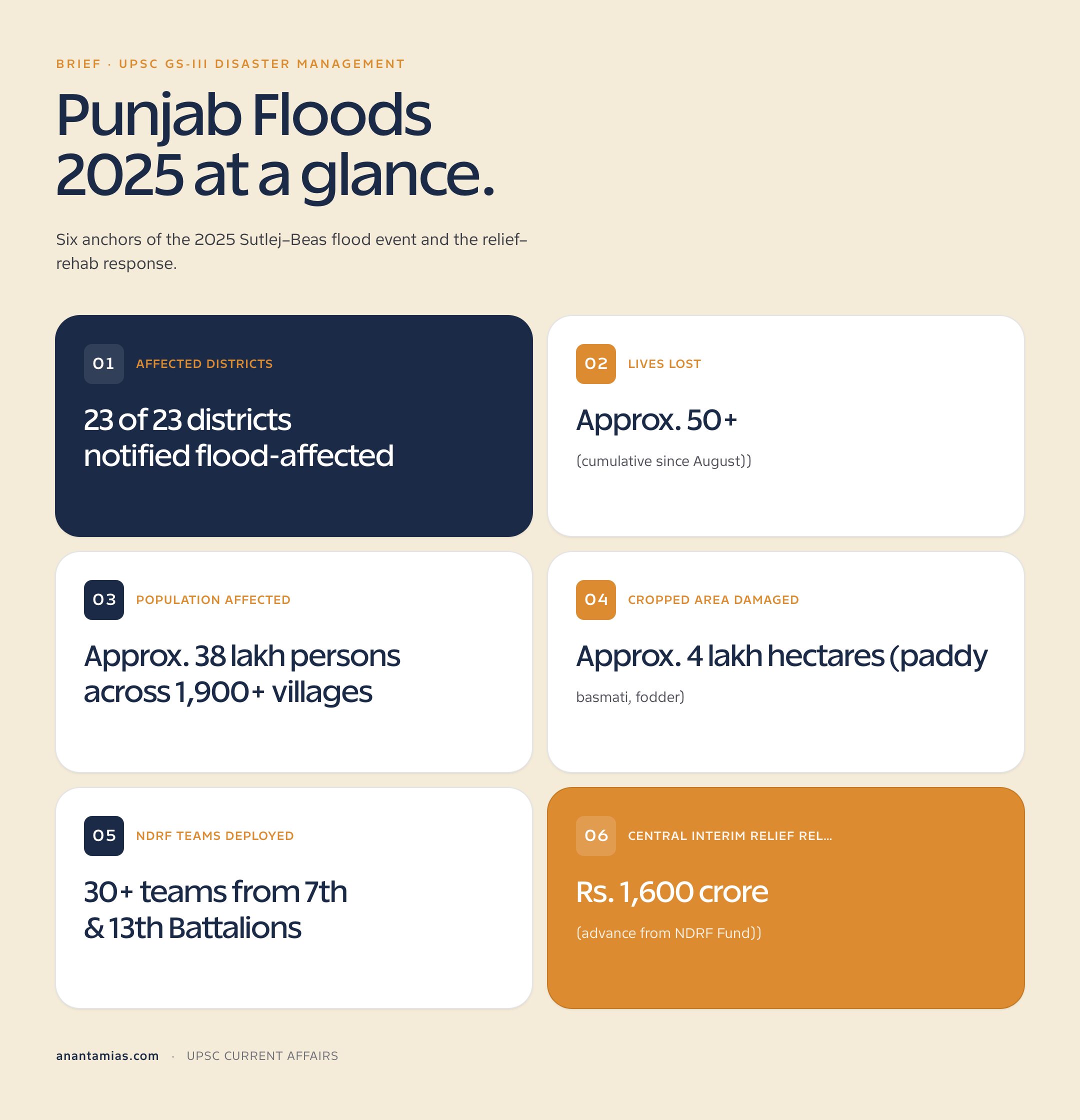
| Affected districts | 23 of 23 districts notified flood-affected | Punjab Revenue & Disaster Management Dept. |
| Lives lost | Approx. 50+ (cumulative since August) | SDMA Punjab / NDMA situation reports |
| Population affected | Approx. 38 lakh persons across 1,900+ villages | Punjab Govt. press briefing |
| Cropped area damaged | Approx. 4 lakh hectares (paddy, basmati, fodder) | Department of Agriculture, Punjab |
| NDRF teams deployed | 30+ teams from 7th & 13th Battalions | NDRF |
| Central interim relief released | Rs. 1,600 crore (advance from NDRF Fund) | Ministry of Home Affairs |
| State relief package announced | Rs. 20,000 per acre crop loss; Rs. 4 lakh ex-gratia | Chief Minister’s Office, Punjab |
Background and Historical Context
Punjab’s relationship with its three perennial rivers — Sutlej, Beas and Ravi — has historically oscillated between abundance and catastrophe. The 1988 Punjab floods, triggered by record releases from the Bhakra dam and the Pong dam after extreme rainfall in Himachal Pradesh, remain the benchmark disaster: nearly two-thirds of the state’s villages were inundated, more than 1,500 people died, and the Indian Army mounted what was then the largest peacetime rescue operation in the country. The 1993 floods repeated several of these patterns, prompting the first serious push for a state-wide flood-management master plan and stronger embankment maintenance protocols. More localised episodes followed in 2008, 2019 and most recently in 2023, when Sutlej breaches in Rupnagar and Ferozepur affected over 1,400 villages.
The recurring dynamics are well understood. The catchments of the Sutlej and Beas lie largely in Himachal Pradesh and the western Tibetan plateau; cloudbursts and prolonged monsoon spells in those upper catchments rapidly fill the Bhakra and Pong reservoirs, forcing the BBMB to release water downstream into a Punjab landscape characterised by silt-choked river beds, encroached flood plains, and ageing embankments — many built in the 1950s and 1960s. The Central Water Commission (CWC) issues flood forecasts, but the lag between forecast, dam release and ground response is often short. The 2025 floods, like those before them, sit at the intersection of climatic intensification, hydraulic infrastructure stress, and governance gaps in disaster management in India. (Reference: Central Water Commission.)
Key Features / Highlights
Trigger and hydrological profile
The 2025 episode was driven by an unusually persistent monsoon trough over the western Himalaya, with Himachal Pradesh recording rainfall 30–50% above the long-period average through August and September. Inflows into the Bhakra reservoir on the Sutlej and the Pong reservoir on the Beas crossed danger thresholds repeatedly, forcing controlled releases that, when superimposed on local rainfall in Punjab, overtopped embankments at multiple points. Breaches at Dhussi bundhs in Ferozepur and Kapurthala, and on the Ravi near Dera Baba Nanak, were particularly damaging.
Response architecture activated
The Punjab State Disaster Management Authority (PSDMA), chaired by the Chief Minister, coordinated district-level operations through District Disaster Management Authorities. The Centre activated the Inter-Ministerial Central Team (IMCT) mechanism to assess damage for additional assistance from the NDRF Fund. NDRF battalions stationed at Bathinda (7th Bn) and Ghaziabad (8th Bn) were augmented by columns from the Indian Army’s Western Command, while IAF helicopters undertook food airdrops in cut-off villages.
Relief, rehab and crop insurance
Relief camps numbering over 200 were operational across the worst-hit belts. The Punjab government announced Rs. 20,000 per acre for crop losses, Rs. 4 lakh ex-gratia for next-of-kin of the deceased, and concessional housing reconstruction grants. PMFBY claims processing was fast-tracked for enrolled farmers, while uninsured farmers were folded into the SDRF-funded input subsidy regime. The Centre released an advance tranche from the NDRF Fund pending the IMCT’s final report.
Significance for UPSC
- Live application of the Disaster Management Act, 2005, NDMA guidelines on floods, and the three-tier NDMA–SDMA–DDMA architecture relevant to GS-III.
- Federal financing of disasters: interplay of SDRF, NDRF Fund, 15th Finance Commission recommendations and the new mitigation funds (NDMF/SDMF).
- Climate-disaster nexus: monsoon intensification, Himalayan cloudbursts, and the case for flood-plain zoning legislation long pending since the 1975 model bill.
- Inter-state water and reservoir management — relevance of BBMB, Indus Waters Treaty obligations, and the long-pending Sutlej–Yamuna Link (SYL) dispute (see SYL canal dispute).
- Agricultural distress angle: paddy-centric cropping pattern, stubble burning, soil saturation and the case for crop diversification — links to MSP and procurement.
- Institutional learnings: CAG performance audits on flood management, NITI Aayog reports on disaster resilience, and India’s commitments under the Sendai Framework.
Detailed Analysis
The governance architecture invoked during the 2025 Punjab floods illustrates both the strengths and the seams of India’s post-2005 disaster regime. The Disaster Management Act, 2005 creates a top-down planning chain — the NDMA at the apex, SDMAs at the state level, and DDMAs at the district — but the operational backbone in floods remains state government departments (Revenue, Irrigation, Agriculture, Health) supported by central forces. In Punjab, the Department of Water Resources is the nodal agency for embankment maintenance, while the Department of Revenue and Rehabilitation handles relief. The 2025 response was notable for the speed with which NDRF teams were pre-positioned after the India Meteorological Department (IMD) red alerts of mid-September, signalling improving forecast-to-deployment integration.
However, the operational picture also revealed familiar weaknesses. Embankments breached at multiple points where maintenance had been deferred — a recurring CAG audit finding. Coordination with the BBMB on reservoir release schedules was scrutinised, with Punjab arguing that earlier and more graduated releases from Bhakra and Pong might have moderated peak flows. The CWC’s flood forecasting performed reasonably for the main stems but had limited granularity for tributaries and seasonal drains (choes), where much of the localised flooding originated.
On the relief side, the use of digital land records and the girdawari (crop inspection) process, conducted jointly by Patwaris and Agriculture Department teams, allowed quicker compensation calculations than in 2023. Direct Benefit Transfer of input subsidies through Aadhaar-linked accounts reduced leakage. Yet, the PMFBY coverage gap — Punjab’s enrolment under the scheme has historically been modest because of state-level reservations on premium and claim settlement design — meant that a large share of damaged crop area fell back on SDRF norms, which are typically lower than insurance payouts.
The rehabilitation phase, which extends well beyond the immediate relief window, will test the state’s capacity for Build Back Better — the Sendai Framework principle India has formally adopted. Sustainable rehabilitation in Punjab requires de-silting of river beds, structural reinforcement of Dhussi bundhs, demarcated and enforced flood plains, and a serious conversation about the paddy-water nexus that keeps groundwater overdrawn while leaving surface-water management under-invested.
| District | Cropped area damaged (approx. ha) | Relief released (Rs. crore, state + central interim) |
|---|---|---|
| Ferozepur | 62,000 | 185 |
| Kapurthala | 48,000 | 140 |
| Gurdaspur | 55,000 | 160 |
| Pathankot | 22,000 | 75 |
| Hoshiarpur | 34,000 | 110 |
| Fazilka | 40,000 | 120 |
| Tarn Taran | 30,000 | 95 |
| Other districts (combined) | 1,09,000 | 315 |
Challenges and Criticisms
The most visible failure was structural: multiple breaches in Dhussi bundhs on the Sutlej and Ravi at locations that had been flagged as vulnerable in earlier post-flood reviews. Successive CAG performance audits of state flood-management programmes have noted under-utilisation of central allocations under the Flood Management and Border Areas Programme (FMBAP), deferred maintenance of embankments, and weak implementation of the 1975 model flood-plain zoning bill — only a handful of states have enacted analogous legislation. Punjab, despite its vulnerability, has not enforced flood-plain zoning, allowing settlements and intensive paddy cultivation up to the embankment toe.
A second criticism concerns reservoir operations. The BBMB, an inter-state body under the Ministry of Power, must balance hydropower, irrigation and flood-moderation objectives — but the rule curves governing Bhakra and Pong releases have been debated as insufficiently pre-emptive. Civil society and academic commentators have called for transparent, climate-adjusted rule curves, real-time public dashboards of inflows/outflows, and faster co-ordination protocols between BBMB, the CWC and the Punjab Irrigation Department. Finally, the paddy stubble–monsoon nexus — saturated, recently harvested paddy fields with little soil-water absorption capacity — remains a politically sensitive but under-addressed dimension of flood risk in the state.
Prelims Pointers
- NDMA is a statutory body under the Disaster Management Act, 2005, chaired ex-officio by the Prime Minister.
- The NDRF is a specialised force raised under Section 44 of the DM Act, 2005; currently 16 battalions across the country.
- NDRF battalions in/near the north-west include the 7th Bn at Bathinda (Punjab) and the 8th Bn at Ghaziabad (UP).
- The Sutlej originates from Rakshastal near Mansarovar in Tibet and enters India through the Shipki La pass in Himachal Pradesh.
- The Beas rises near Rohtang Pass in Himachal Pradesh and joins the Sutlej at Harike in Punjab.
- The Ravi originates from the Bara Banghal range in Himachal Pradesh; the Ranjit Sagar Dam (Thein Dam) lies on it.
- The Bhakra Beas Management Board (BBMB) is constituted under the Punjab Reorganisation Act, 1966 (originally as BMB; expanded in 1976).
- The Central Water Commission functions under the Department of Water Resources, RD & GR, Ministry of Jal Shakti.
- SDRF and NDRF Fund are constituted under Sections 48 and 46 of the DM Act, 2005, respectively.
- India is a signatory to the Sendai Framework for Disaster Risk Reduction (2015–2030).
- PMFBY was launched in 2016, replacing earlier crop insurance schemes; it is administered by the Ministry of Agriculture & Farmers’ Welfare.
- The Indus Waters Treaty (1960) allocates the Sutlej, Beas and Ravi (eastern rivers) to India.
Mains Practice Questions
- Discuss the institutional architecture for flood management in India under the Disaster Management Act, 2005, with reference to the 2025 Punjab floods. (GS-III, 250 words)
- “Recurring floods in Punjab are as much a problem of governance and infrastructure as of climate.” Examine. (GS-III, 250 words)
- Critically evaluate the role of the Bhakra Beas Management Board in flood moderation, hydropower and irrigation, and suggest reforms. (GS-II/III, 250 words)
- Explain the financing of disaster relief in India through SDRF, NDRF Fund and the Finance Commission framework. (GS-III, 150 words)
- “Flood-plain zoning has remained a paper instrument in India.” Discuss with examples and the way forward. (GS-III, 250 words)
Conclusion
The 2025 Punjab floods are, in one sense, a familiar story — Himalayan cloudbursts, reservoir releases, embankment breaches, paddy fields under water, and a vast humanitarian response mounted by the NDRF, the Army and state agencies. But each iteration of this story compresses the time available for structural reform. The damage estimates running into thousands of crores, the cropped area lost in a state that anchors national food security through wheat and paddy procurement, and the displacement of lakhs of citizens together demand that flood management graduate from episodic relief to anticipatory resilience. That requires investments not only in physical infrastructure — embankments, de-silting, storm-water drainage — but also in institutions: stronger DDMAs, an enforced flood-plain zoning regime, and a transparent BBMB rule curve framework adjusted for climate non-stationarity.
For the UPSC aspirant, the episode should be revised as a composite case study tying together GS-I (geography of the Indus system), GS-II (centre–state and inter-state coordination), GS-III (disaster management, agriculture, climate change) and the Ethics paper (priorities in resource allocation between irrigation, hydropower and flood moderation). The deeper lesson is that India’s disaster law and institutions have matured significantly since 2005, but the next frontier is mitigation — preventing the disaster, not only managing it. As India translates its Sendai commitments into local action plans, Punjab’s floods become a test case for whether the country can shift from a relief-centric to a risk-informed development paradigm. (See also: NDMA and disaster management; NDMA; Punjab government.)
FAQ
Q1. What caused the 2025 Punjab floods?
A combination of above-normal monsoon rainfall over the upper catchments of the Sutlej, Beas and Ravi in Himachal Pradesh, large controlled releases from the Bhakra and Pong reservoirs, and breaches in ageing Dhussi bundhs across Ferozepur, Kapurthala, Gurdaspur and adjoining districts.
Q2. Which agencies led the relief response?
The Punjab State Disaster Management Authority and District Disaster Management Authorities, supported by the NDRF (notably the 7th Battalion at Bathinda), SDRF, the Indian Army’s Western Command, the Indian Air Force, and the IMD/CWC for forecasting and warnings.
Q3. What is the legal basis for India’s disaster management framework?
The Disaster Management Act, 2005, which creates the NDMA, SDMAs and DDMAs, and constitutes the SDRF and NDRF Fund for disaster financing.
Q4. What role does the BBMB play in flood management?
The Bhakra Beas Management Board operates the Bhakra and Pong reservoirs and decides release schedules balancing hydropower, irrigation and flood moderation across Punjab, Haryana, Himachal Pradesh and Rajasthan.
Q5. How are crop losses compensated?
Through PMFBY claim settlements for enrolled farmers, SDRF-funded input subsidies under State Disaster Relief norms, and ex-gratia announcements by the state government — Rs. 20,000 per acre in the 2025 episode.
Q6. What is flood-plain zoning and why does it matter?
Flood-plain zoning regulates land use in flood-prone areas to restrict permanent settlement and high-value assets in zones of recurring inundation. India circulated a model bill in 1975, but very few states have enacted enforceable legislation, including Punjab.
Q7. How is the central government’s interim relief released?
Through an advance from the NDRF Fund based on a state memorandum, pending assessment by an Inter-Ministerial Central Team, with final additional assistance approved by the High-Level Committee chaired by the Union Home Minister.
Q8. What are the key UPSC takeaways from the 2025 Punjab floods?
The episode integrates disaster law and finance, inter-state water management through the BBMB, climate-monsoon dynamics, agricultural vulnerability of paddy-centric Punjab, and the unfinished agenda of flood-plain zoning and Build Back Better under the Sendai Framework.
Source: https://anantamias.com/current-affairs/punjab-floods-2025-relief-status/