Oceansat-3A: India Plans a Year-End Ocean-Observation Launch
Why in News?
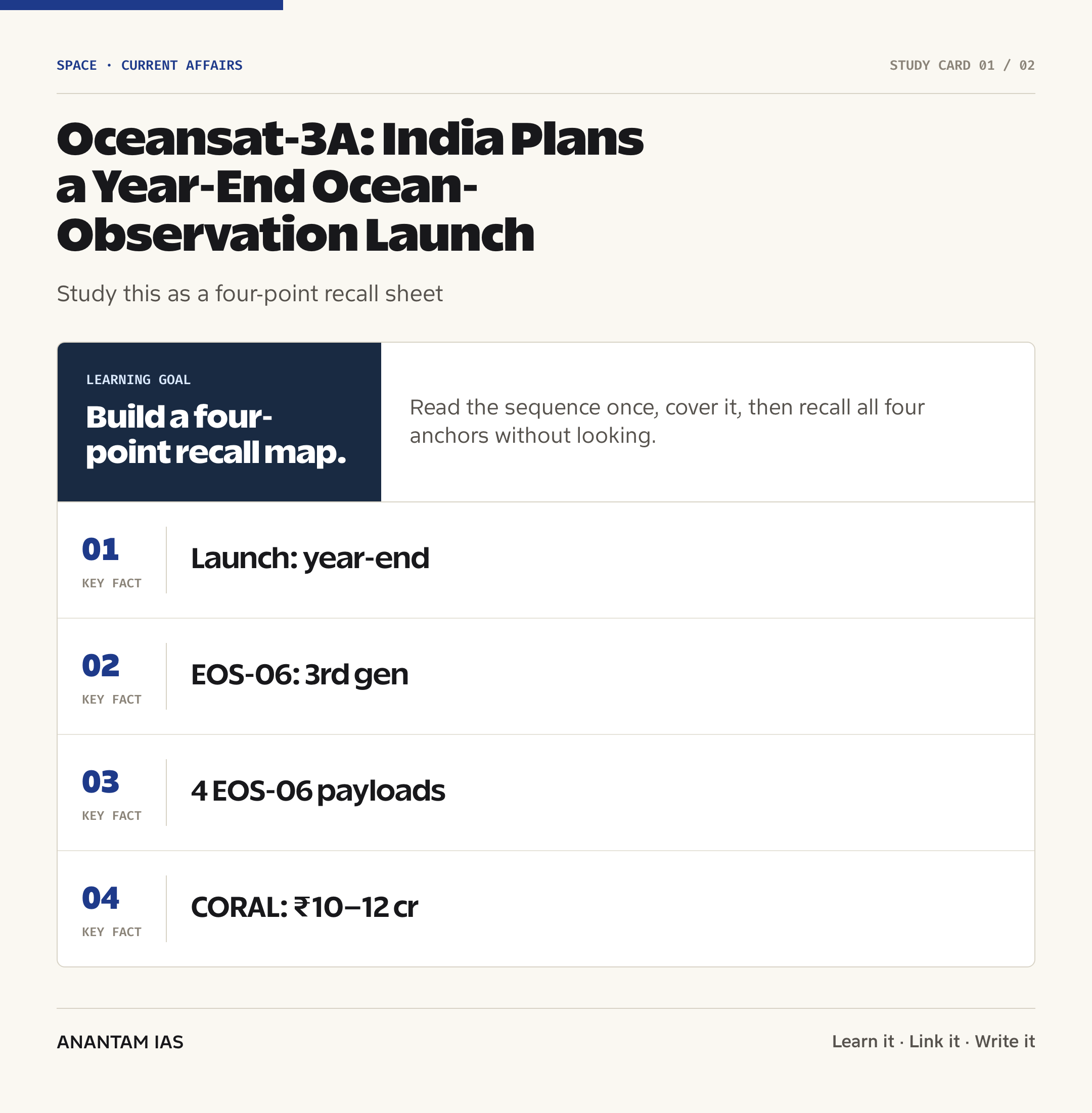
National Remote Sensing Centre (NRSC) Director Prakash Chauhan said in Visakhapatnam on July 17 that the Oceansat-3A satellite was likely to be launched before the end of the year. The Hindu reported the announcement after the inauguration of a coastal observation laboratory at Andhra University.
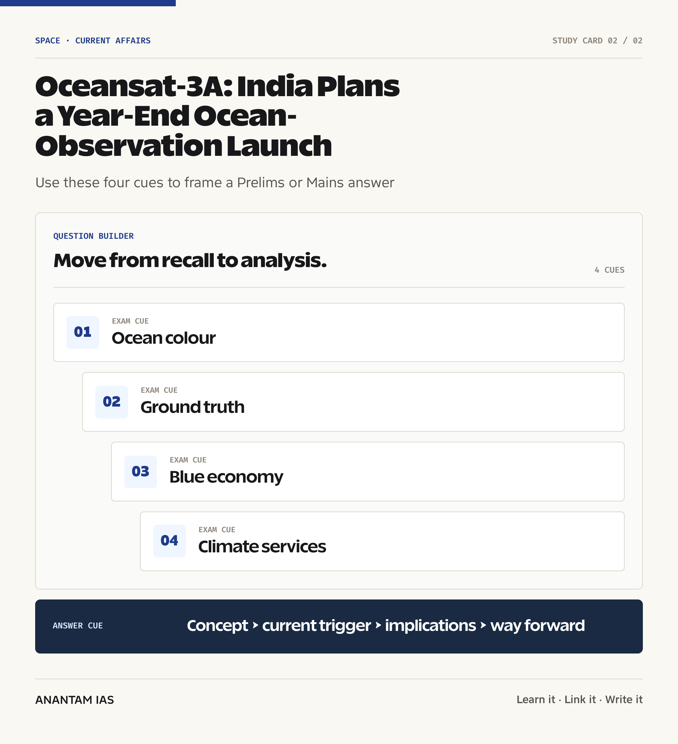
The update matters because the Oceansat programme supplies observations of ocean colour, surface winds and sea-surface conditions. These measurements support marine science, weather and climate services, coastal management and parts of India’s blue economy.
- Launch window: The NRSC Director described a likely year-end launch, but the sources reviewed don’t yet provide a firm date, launch vehicle or final Oceansat-3A payload list.
- New laboratory: The NICES-Coastal Observation Research Laboratory (CORAL) was inaugurated at Andhra University’s Centre for Studies on Bay of Bengal in Visakhapatnam.
- Ground observations: The laboratory is designed to collect in-situ measurements that can help interpret and validate space-based ocean observations.
- Project support: Andhra University said NRSC had sanctioned about ₹10 crore–₹12 crore in phased funding for equipment procurement, installation and maintenance.
- Research field: Planned cruises along selected Bay of Bengal transects will examine ocean-atmosphere and land-sea interactions and their effects on marine ecosystems.
The development matters in the context of:
- Data continuity is central to Earth observation: long, consistently calibrated records are more useful for detecting change than isolated satellite snapshots.
- Calibration and validation connect a sensor’s signal with measurements taken in the water, reducing uncertainty in products such as chlorophyll concentration.
- Public value emerges when satellite observations are converted into usable products for fishers, forecasters, researchers, coastal administrators and disaster managers.
UPSC Relevance
Prelims Relevance
- Oceansat-3 is also designated EOS-06; ISRO describes it as the third-generation satellite in the Oceansat series.
- EOS-06 was launched by PSLV-C54 from Satish Dhawan Space Centre on November 26, 2022.
- The four EOS-06 payloads are the Ocean Color Monitor-3 (OCM-3), Sea Surface Temperature Monitor, Ku-band Scatterometer-3 and ARGOS.
- Ocean colour is inferred from sunlight leaving the ocean in different spectral bands and can indicate chlorophyll-bearing phytoplankton and suspended matter.
- A scatterometer measures microwave backscatter from the sea surface to derive near-surface wind speed and direction.
- Sea-surface temperature is an important input for understanding air-sea heat exchange, ocean fronts and weather-climate processes.
- NRSC, an ISRO centre, acquires, processes, archives and enables applications of Earth-observation data.
- NICES stands for the National Information System for Climate and Environment Studies and operates as a multi-institutional programme led through NRSC.
- Ground truth means observations collected at or near the Earth’s surface to calibrate or validate satellite-derived measurements and algorithms.
- Ocean colour isn’t the physical colour of seawater alone; it is a remote-sensing signal shaped by water, phytoplankton, sediments and dissolved material.
Mains Relevance
GS Paper 3
- Indigenisation and public applications of space technology, including Earth-observation missions and downstream data products.
- The role of ocean remote sensing in fisheries, disaster management, climate services, marine ecosystem assessment and the blue economy.
- Why calibration-validation infrastructure, open data, institutional coordination and user-oriented products determine the social return from a satellite.
GS Paper 1
- Physical geography of ocean-atmosphere interaction, sea-surface winds, upwelling, coastal processes and the Bay of Bengal.
- Spatial observation of phytoplankton, suspended sediments and other ocean-colour features as indicators of marine conditions.
GS Paper 2
- Centre-university collaboration through NRSC, NICES and Andhra University as a model for building scientific capacity and sharing public research infrastructure.
Essay
- Seeing from space, measuring at sea: credible public science combines broad satellite coverage with patient local observation.
- Blue economy with ecological limits: better information can support livelihoods only when marine productivity and ecosystem health are monitored together.
Background and Context
What an Ocean-Observation Satellite Measures
An ocean-observation satellite repeatedly measures electromagnetic signals from the sea surface and atmosphere, turning them into geophysical products.
- Ocean-colour sensors measure reflected sunlight across selected wavelengths; algorithms estimate properties such as chlorophyll concentration, suspended sediments and water clarity.
- Microwave scatterometers can derive ocean-surface wind vectors by measuring how radar energy is scattered by wind-roughened waves.
- Thermal observations help estimate sea-surface temperature, a variable linked with air-sea heat exchange, fronts, convection and cyclone-supporting ocean conditions.
- ARGOS is a data-collection and location system that relays measurements from compatible platforms, complementing imaging and geophysical sensors.
- Remote sensing offers repeat coverage across large areas, but it doesn’t remove the need for ships, buoys, coastal stations and laboratory analysis.
Oceansat Lineage and the Continuity Principle
The value of the Oceansat series lies in maintaining observations over time while improving sensor capability and applications.
- ISRO identifies EOS-06/Oceansat-3 as the third generation of the series and says its purpose includes continuity of ocean-colour and wind-vector services.
- PSLV-C54 placed EOS-06 and eight nano-satellites into their intended sun-synchronous polar orbits on November 26, 2022.
- EOS-06 carries OCM-3, SSTM, SCAT-3 and ARGOS; these instruments shouldn’t be automatically treated as the confirmed Oceansat-3A payload because an official final payload list wasn’t found in the sources reviewed.
- Mission continuity allows researchers to compare seasons and years, identify anomalies and separate short-lived variability from longer changes.
- Continuity also requires cross-calibration: an apparent change in a record must reflect the ocean, not a difference between sensors or processing methods.
- Like the radar-based NISAR mission, Oceansat shows that the usefulness of Earth observation depends on matching sensor design with a clearly defined measurement problem.
Why Ground Truth Is Indispensable
Ground-truth observations test whether satellite-derived values correspond to conditions measured directly at sea or on the coast.
- Calibration establishes or corrects the relationship between a sensor’s response and a known reference; validation independently checks the accuracy of the derived product.
- Coastal waters are optically complex because sediments, coloured dissolved matter, plankton and shallow bottoms can influence the signal together.
- The official NICES programme calls for in-situ data to support calibration and validation of data products, science products and algorithms.
- The new NICES-CORAL facility is expected to analyse dissolved inorganic carbon, nutrients, plankton and dissolved oxygen, among other variables reported by Andhra University.
- Reported equipment includes a high-performance liquid chromatograph, FTIR spectrophotometer, flow cytometer and sensors for carbon dioxide, sunlight and ozone.
- Research cruises across selected Bay of Bengal transects can connect point measurements with simultaneous satellite scenes and ocean-atmosphere conditions.
From Raw Signal to Public Service
A satellite creates public value only after its measurements are processed, validated, interpreted and delivered in a form that supports decisions.
- Ocean-colour products can help monitor chlorophyll patterns, algal blooms, sediment plumes and changes in coastal water quality.
- Surface-wind products support marine weather analysis, ocean-state modelling and the study of circulation driven partly by wind stress.
- Sea-surface temperature contributes to the assessment of fronts, upwelling zones, ocean heat patterns and air-sea interactions.
- Potential fishing-zone advisories combine relevant ocean indicators to identify areas likely to be productive; satellites guide search effort but don’t directly count fish.
- For a broader view of livelihood policy, connect these observations with India’s fisheries and Blue Revolution, where data must support both productivity and resource sustainability.
- Disaster management can use space-based data across preparedness, monitoring and damage assessment, as the NRSC Director noted in his lecture at Andhra University.
Climate, Coasts and the Bay of Bengal
The Bay of Bengal is a useful natural laboratory because monsoon rainfall, river discharge, cyclones and dense coastal populations connect land, ocean and atmosphere.
- River-borne sediments and freshwater alter salinity, turbidity and biological conditions, making coastal algorithms harder to design than open-ocean algorithms.
- Ocean-atmosphere exchanges redistribute heat, moisture and carbon, affecting weather variability and the climate system.
- Marine ecosystems respond to changes in temperature, nutrients, oxygen, circulation and acidity; no single satellite variable captures the whole system.
- Long records can reveal changes, while ship and laboratory measurements help explain the processes behind observed patterns.
- The relationship between warming, deoxygenation, acidification and ecosystems is covered in climate change and the oceans.
- Coastal observation also supports planning around erosion, pollution, ports, aquaculture and ecosystem restoration when combined with administrative and field data.
Institutional Architecture
Ocean observation is a chain of institutions rather than a single satellite or laboratory.
- ISRO develops and operates space missions, while NRSC serves as a major centre for Earth-observation data reception, processing, dissemination and applications.
- NICES brings ISRO centres, government departments and national institutions into a programme for climate and environment data, products and research.
- Andhra University’s Centre for Studies on Bay of Bengal adds coastal access, laboratories, researchers and student training to the partnership.
- Universities can widen the validation network, test region-specific algorithms and train people who understand both instruments and local marine systems.
- Operational agencies and users must translate scientific products into advisories, planning tools and warnings that are timely, comprehensible and accountable.
- Ocean observation complements, but doesn’t duplicate, the Deep Ocean Mission, which covers deep-sea technology, resources, biodiversity and exploration.
Limits and Governance Questions
The Oceansat-3A announcement should be read as a mission plan, not as proof that every downstream challenge has been solved.
- Launch uncertainty remains until ISRO publishes a firm mission schedule, launch vehicle, payload configuration and successful orbital commissioning.
- Cloud cover and aerosols can constrain optical ocean-colour retrieval, while microwave sensors answer different questions and have their own resolution and calibration trade-offs.
- Coastal complexity makes algorithms developed for clear open water unreliable in some estuaries, turbid plumes and shallow zones unless locally validated.
- Data gaps can arise from launch delays, sensor degradation, orbital constraints, processing changes or inadequate field sampling.
- Last-mile delivery matters: a technically sound product has limited value if fishers or district agencies receive it too late or can’t act on it.
- Open standards, metadata and uncertainty labels are needed so researchers can reproduce results and administrators don’t treat modelled products as error-free observations.
Way Forward
Publish a Transparent Mission Baseline
- ISRO should release the confirmed Oceansat-3A payloads, orbit, launch vehicle, product plan and commissioning milestones once finalised.
- A public continuity and cross-calibration plan should explain how the new mission will connect with EOS-06 and other ocean datasets.
Build a Dense Validation Network
- Link NICES-CORAL with buoys, research vessels, coastal laboratories and university partners across different Indian marine environments.
- Synchronise field sampling and satellite overpasses, archive quality-control information and publish representative validation results.
Design Products Around Users
- Co-design services with fishers, disaster managers, coastal regulators and researchers so that delivery time, scale and uncertainty fit actual decisions.
- Provide regional-language interfaces, simple risk explanations and feedback channels without overselling the precision of satellite estimates.
Join Blue Growth with Ecosystem Safeguards
- Use observations to track marine productivity, harmful blooms, sediment, heat stress and pollution alongside economic indicators.
- Treat long-term data stewardship, interoperable formats and open scientific access as core infrastructure, not post-launch extras.
Conclusion
Oceansat-3A can strengthen India’s ability to observe a changing ocean, but a launch is only the beginning of the public-service chain. Stable sensors, validated algorithms, reliable archives and timely products determine whether orbital data becomes usable knowledge.
The new NICES-CORAL laboratory captures the larger lesson: wide satellite coverage and detailed field measurements are complements. India’s blue-economy ambitions will be more credible when growth decisions rest on measurements that also reveal ecological stress and uncertainty.
UPSC Practice Questions
Prelims MCQ 1
With reference to EOS-06/Oceansat-3, consider the following statements:
- It is described by ISRO as the third-generation satellite in the Oceansat series.
- It carries an Ocean Color Monitor and a Ku-band scatterometer.
- It was launched by the Geosynchronous Satellite Launch Vehicle.
How many of the above statements are correct?
(a) Only one (b) Only two (c) All three (d) None
Answer: (b) Only two
Explanation:
Statements 1 and 2 are correct. EOS-06 carries OCM-3, SSTM, SCAT-3 and ARGOS. It was launched by PSLV-C54, not GSLV.
Prelims MCQ 2
In ocean remote sensing, the term ground truth most directly refers to:
(a) A political boundary map used to georeference satellite images (b) Direct observations used to calibrate or validate satellite products (c) A backup command transmitted from a terrestrial control station (d) The ocean-floor elevation derived only from satellite gravity
Answer: (b) Direct observations used to calibrate or validate satellite products
Explanation:
Ground-truth or in-situ measurements provide reference observations against which satellite signals, retrieval algorithms and derived products can be checked.
UPSC Mains Questions
- Earth-observation missions create value through a chain that extends far beyond launch. Explain how Oceansat-series observations, ground-truth infrastructure, calibration-validation and last-mile services can jointly strengthen India’s fisheries, coastal governance and climate resilience.
- The blue economy requires both productive use of marine resources and credible measurement of ecological limits. Discuss the contribution and limitations of satellite ocean observation, with special reference to ocean colour, surface winds, sea-surface temperature and field validation.
Sources: ISRO and National Remote Sensing Centre and The Hindu.
Frequently Asked Questions
What is Oceansat-3A?
Oceansat-3A is a planned Indian ocean-observation satellite in the Oceansat programme. The NRSC Director said it was likely to launch before year-end. A firm date, launch vehicle and final payload list weren’t stated in the sources reviewed, so those details should await an official ISRO mission announcement.
Is Oceansat-3 the same as EOS-06?
Yes. EOS-06 is commonly identified as Oceansat-3, the third-generation satellite in the Oceansat series. ISRO says it was launched by PSLV-C54 in November 2022 to continue ocean-colour and wind-vector services while adding enhanced observations, including sea-surface temperature.
What does an ocean-colour monitor measure?
An ocean-colour monitor records sunlight emerging from the ocean in multiple spectral bands. Algorithms use that signal to estimate variables such as chlorophyll concentration, suspended sediments and water clarity. Coastal waters need careful validation because several substances and shallow bottoms can influence the same signal.
Why is ground truth needed?
Ground truth supplies direct measurements from ships, buoys, coastal sites or laboratories. These observations calibrate sensors and validate satellite-derived products. Without them, a broad satellite image may show a pattern, but researchers have less confidence about its accuracy, cause and suitability for local decisions.
What is NICES-CORAL?
NICES-CORAL is the coastal observation research laboratory inaugurated at Andhra University’s Centre for Studies on Bay of Bengal. The reported project will analyse coastal-water and atmosphere-related variables and support field cruises, helping connect in-situ evidence with ISRO’s ocean-observation programme.
How can Oceansat data help fishers?
Ocean-colour, temperature and surface-wind products can help identify marine conditions associated with productive zones and support ocean advisories. Satellites don’t directly detect or count fish. Their observations must be combined with models, validation data, local knowledge and timely communication to reduce search effort responsibly.