Oman Tanker Spill: Risks to the Arabian Sea’s Marine Ecosystem
Why in News?
The Hindu reported that the grounded tanker Caroline Bezengi was sitting deeper in the water off Qibliyah Island in Oman’s Dhofar region as crude oil continued to leak into the surrounding Arabian Sea.
- The tanker had remained grounded near Qibliyah Island in the Hallaniyat archipelago for weeks; satellite imagery reviewed by news organisations showed oil reaching the island’s shores and the vessel becoming more submerged.
- Oman’s government said authorities were monitoring the area through satellite images, field surveys and technical models and preparing measures for possible effects on marine life and navigation safety.
- Independent analysts published changing estimates of the visible oil-sheen footprint. A sheen’s surface area is not the same as the volume discharged, because thickness, oil type, wind, waves, currents, evaporation and dispersion all affect its.
- No reliable official figure for the total quantity released was publicly established in the material reviewed for this note. UPSC answers should avoid repeating a cargo estimate as though the entire cargo had entered the sea.
- The location is ecologically sensitive: the Hallaniyats Bay is recognised in Convention on Migratory Species material as a core habitat for Arabian Sea humpback whales, while the wider island ecosystem supports seabirds and other marine.
- The Arabian Sea connects major energy routes, fisheries, coastal economies and biologically productive waters. Pollution near Oman can be carried beyond the immediate casualty site by monsoon-season winds and currents.
- Oil-spill response is time-sensitive but not one-size-fits-all. Booms, skimmers, sorbents, dispersants, shoreline cleaning and natural recovery each have limits, and a poorly chosen intervention can shift harm from the surface to the water column or seabed.
- The case illustrates why disaster management must protect both people and ecosystems. Sensitive-habitat maps, wildlife rescue, seafood testing, evidence preservation and compensation claims must begin alongside salvage and pollution control.
UPSC Relevance
Prelims Relevance
- The Arabian Sea is the northwestern part of the Indian Ocean; the Hallaniyat Islands lie off the Dhofar coast of Oman.
- An oil slick is a layer of oil on the water surface; a visible sheen can spread over a large area even when the layer is thin, so area alone cannot establish spill volume.
- The International Convention for the Prevention of Pollution from Ships, or MARPOL, is the principal global treaty for preventing pollution from ships; Annex I addresses oil pollution.
- MARPOL Annex I contains ship-design and operational controls, including oil-discharge rules; it is not the international compensation fund for spill victims.
- Under MARPOL Annex I Regulation 37, oil tankers of 150 gross tonnage and above and all ships of 400 gross tonnage and above must carry an approved Shipboard Oil Pollution Emergency Plan.
- The OPRC Convention, 1990 creates a framework for national preparedness, reporting, contingency planning, exercises, cooperation and assistance during major oil-pollution incidents.
Mains Relevance
GS Paper 3
- Explain oil spills as compound marine disasters involving vessel stability, pollution transport, biodiversity loss, fisheries, shoreline contamination and hazardous clean-up operations.
- Assess the response chain: source control and salvage, surveillance, trajectory modelling, containment and recovery, shoreline assessment, wildlife rehabilitation, seafood safety and ecological restoration.
GS Paper 2
- Examine the role of international institutions and treaties such as IMO, MARPOL, OPRC, CLC and the Fund Convention in prevention, response cooperation and compensation.
- Discuss the governance difficulty created when ownership, flag, insurer, cargo interests, sanctions, salvage rights and coastal-state jurisdiction do not align neatly.
Essay
- The sea connects economies faster than law assigns responsibility.
Background and Context
What is known, and what remains uncertain
Good disaster analysis separates direct observations from estimates and unresolved questions.
- The directly reported facts are that the tanker was grounded near Qibliyah Island, oil was visible in surrounding waters and on parts of the shore, and later satellite images suggested that the hull was more deeply.
- Omani authorities described a monitoring response using remote sensing, field work and technical modelling. Public reporting did not establish the full condition of every cargo tank or a final discharged quantity.
- Satellite sensors can identify a surface anomaly and help map its movement, but interpretation requires wind, wave, current and vessel data. Dark areas on radar imagery may have causes other than oil and should be corroborated.
- A reported slick area cannot be converted into barrels without defensible information on thickness and composition. The exam-safe formulation is that the extent appeared to expand, while the released volume remained uncertain.
- The immediate operational questions are whether the source can be isolated, whether oil can be lightered safely, whether the hull can be stabilised or salvaged, and which habitats lie in the forecast path.
Why the Hallaniyat ecosystem is sensitive
Exposure matters as much as quantity when oil reaches a biologically important island and coastal system.
- The Hallaniyat Islands lie in the Arabian Sea off southern Oman. Their isolation, rocky shores and surrounding waters support marine and coastal species that cannot be treated as replaceable open-ocean habitat.
- UNEP-linked Convention on Migratory Species material identifies Hallaniyats Bay and the Gulf of Masirah as core habitats associated with Arabian Sea humpback whales, based on surveys and telemetry off Oman.
- Arabian Sea humpback whales are unusual because this population is resident in the northern Indian Ocean rather than making the long migrations typical of many other humpback populations. Its small, isolated status magnifies the importance of.
- Petrels and other seabirds are vulnerable when oil damages the waterproof and insulating structure of feathers. Ingestion during preening and contaminated prey can add toxic exposure.
- Fish, shellfish, turtles and marine mammals face different exposure pathways. Ecological assessment should cover water, sediment, shoreline, prey species and reproduction over time, not only visible mortality.
How oil behaves after entering the sea
Oil changes continuously after release, so response choices must follow the product and local conditions.
- Spreading creates a thinner surface layer, while evaporation, dispersion, emulsification, dissolution, oxidation and biodegradation alter the oil over hours, days and longer periods.
- Wind and surface currents move a slick, waves break part of it into droplets, and weathering can create persistent water-in-oil emulsions. Some residues may strand, mix with sediment or sink after attaching to particles.
- Monsoon conditions can accelerate mixing and make at-sea containment unsafe or ineffective. A less visible sheen after rough weather does not prove that ecological risk has ended; oil may have dispersed, weathered or moved outside the.
- Shoreline type changes clean-up options. High-pressure washing or aggressive sediment removal may cause more damage than carefully monitored natural recovery in some habitats.
- Dispersants can reduce surface oil and shoreline exposure but increase oil droplets in the water column. Their use needs product-specific authorisation and a net environmental benefit assessment, especially near sensitive species and fisheries.
The international prevention and response framework
Different treaties answer different questions: prevention, emergency cooperation and financial liability.
- MARPOL Annex I sets construction and operational rules to prevent oil pollution from ships. Its safeguards include segregated ballast arrangements, double-hull requirements for newer tankers and controls on oily discharges.
- The OPRC Convention requires parties to establish national response systems with a designated authority, operational contact point, contingency plan, equipment, communication arrangements, training and exercises.
- OPRC also creates a channel for international cooperation and mutual assistance. A large incident near a remote protected area may exceed locally available salvage, surveillance, wildlife-response or clean-up resources.
- A Shipboard Oil Pollution Emergency Plan connects onboard reporting and initial action with the coastal state’s system. It does not replace national command, salvage expertise or shore-based capacity.
- The legal status of a ship or cargo may complicate contracting and finance, but the coastal state’s first priority remains protection of life, navigation and the marine environment. Sanctions compliance and environmental emergency action must be.
Way Forward
Stabilise the source and build one operating picture
- Combine satellite imagery, aircraft or drone observations where lawful, vessel inspection, hydrography, weather forecasts and current models under a single incident-command structure.
- Prioritise crew and responder safety, hull stabilisation, leak isolation, safe lightering and salvage options based on specialist assessment.
- Publish verified situation reports that distinguish cargo on board, estimated discharge, observed sheen area and confirmed shoreline impact.
Conclusion
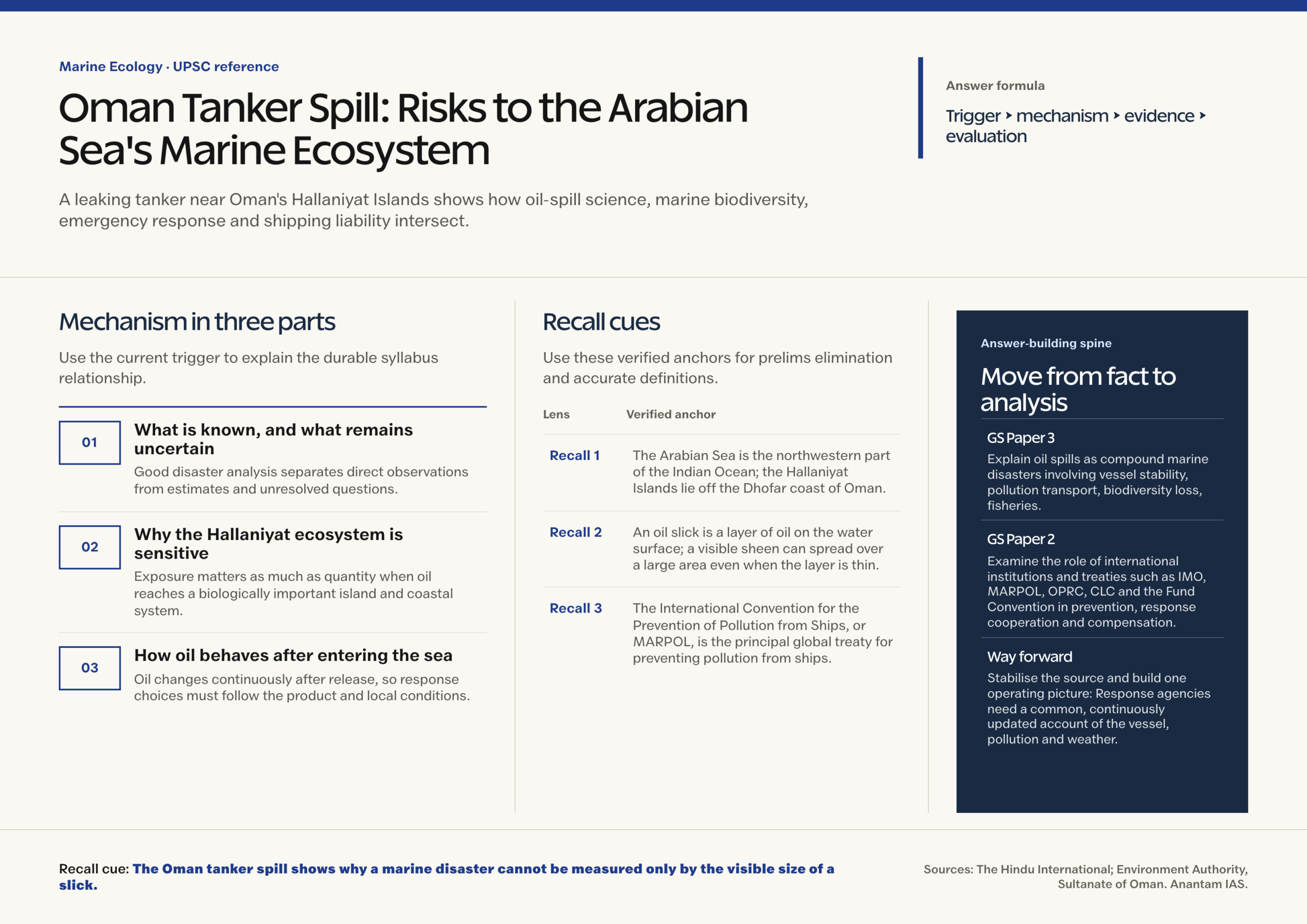
- The Oman tanker spill shows why a marine disaster cannot be measured only by the visible size of a slick.
- For India, the durable lesson is preparedness before landfall: enforce MARPOL, exercise OPRC-style coordination, map sensitive habitats, preserve evidence and connect salvage with long-term ecological monitoring.
UPSC Practice Questions
Prelims MCQ 1
With reference to the international framework for marine oil pollution, consider the following statements:
- The OPRC Convention requires parties to establish measures for preparedness and response to oil-pollution incidents.
- MARPOL Annex I establishes the International Oil Pollution Compensation Fund for victims of tanker spills.
- The 1992 Civil Liability Convention can cover reasonable preventive measures taken against a grave and imminent threat of pollution damage.
How many of the above statements are correct?
(a) Only one (b) Only two (c) All three (d) None
Answer: (b) Only two
Explanation:
Statements 1 and 3 are correct. OPRC provides the preparedness and cooperation framework, while the 1992 CLC covers tanker-pollution liability and certain preventive measures. MARPOL Annex I regulates prevention of oil pollution from ships; the separate 1992 Fund Convention establishes the supplementary compensation fund.
Prelims MCQ 2
In oil-spill response, a net environmental benefit assessment is best understood as:
(a) Choosing the cheapest response technique regardless of habitat (b) Estimating compensation only after all clean-up work ends (c) Comparing response options to select the action likely to reduce overall environmental harm (d) Assuming natural dispersion is always safer than intervention
Answer: (c) Comparing response options to select the action likely to reduce overall environmental harm
Explanation:
Response techniques move risks among the sea surface, water column, shoreline and responders. A net environmental benefit assessment compares feasible options, ecological sensitivities and likely outcomes so that the chosen intervention reduces overall harm. It does not prescribe one technique for every spill.
UPSC Mains Questions
- An oil spill near a marine protected area is both an environmental emergency and a governance test. Discuss with reference to the tanker incident off Oman. (250 words)
- Differentiate the roles of MARPOL, OPRC 1990 and the international civil-liability and compensation regime in addressing tanker pollution. (250 words)
Sources: The Hindu International and Environment Authority, Sultanate of Oman.
Frequently Asked Questions
What happened to the tanker off Oman?
The Caroline Bezengi remained grounded near Qibliyah Island in Oman’s Hallaniyat archipelago and was reported to be leaking crude oil. Later satellite images suggested that the vessel had become more deeply submerged, while oil was observed in surrounding waters and.
Why is the spill’s location ecologically important?
The casualty is near an Arabian Sea protected area in the Hallaniyat Islands. CMS material identifies Hallaniyats Bay as a core habitat associated with the small and endangered Arabian Sea humpback whale population. The island system also supports seabirds and.
Does a large satellite oil sheen mean the same volume of oil was discharged?
No. Satellite imagery can help identify and map a likely sheen, but surface area is not volume. Thickness, oil type, weathering, wind, waves, currents and sensor conditions affect what is visible. A thin film may cover a wide area, so.
What is the difference between MARPOL and OPRC?
MARPOL is the main treaty for preventing pollution from ships; its Annex I addresses oil through ship-design, equipment and operational rules. OPRC 1990 focuses on preparedness and response, requiring national systems, contingency plans, reporting, equipment, exercises and cooperation when a.
Who is liable for damage from a tanker oil spill?
Under the applicable 1992 Civil Liability Convention framework, liability for persistent-oil pollution from a covered tanker is generally channelled to the registered shipowner, backed by compulsory insurance or financial security. The 1992 Fund may provide supplementary compensation when the first.