Umngot River: India’s Cleanest River in Dawki, Meghalaya — Geography & Tourism Guide for UPSC
Complete guide to the Umngot River in Dawki, Meghalaya -- India's cleanest river. Covers crystal-clear waters, Jaintia Hills geography, Bangladesh border, conservation, and UPSC relevance.
The Umngot River in Meghalaya is widely regarded as India's cleanest river. Located near the small border town of Dawki in the West Jaintia Hills district, the river is famous for its crystal-clear turquoise waters where boats appear to float in mid-air. For UPSC aspirants, the Umngot River is relevant for Geography (river systems, northeast India), Environment (water conservation), and General Studies (tourism and border areas).
Geographical Overview
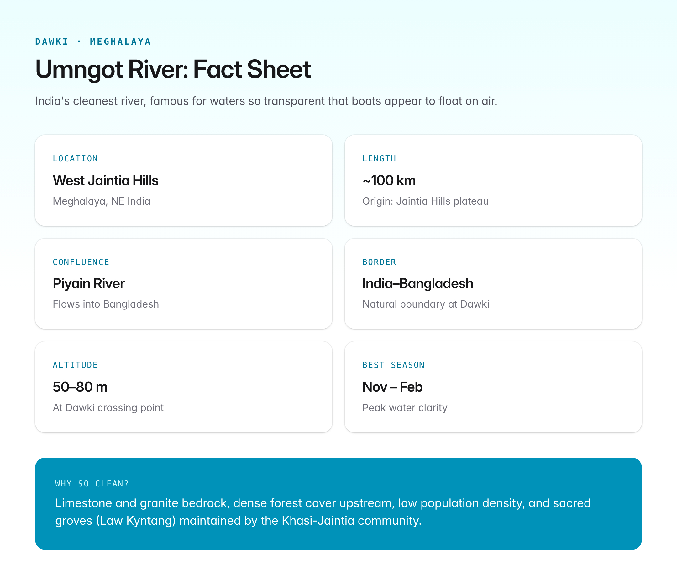
| Feature | Detail |
|---|---|
| Location | Dawki (also spelled Dauki), West Jaintia Hills district, Meghalaya |
| Origin | Jaintia Hills plateau |
| Course | Flows through deep gorges in the Jaintia Hills before reaching the plains near Dawki |
| Confluence | Joins the Piyain River (also called Piyan), which flows into Bangladesh |
| Length | Approximately 100 km |
| International border | Forms a natural boundary between India and Bangladesh at Dawki |
| Altitude at Dawki | Approximately 50-80 metres above sea level |
| Best season | October to May (post-monsoon to pre-monsoon); water is clearest in winter (November-February) |
Why Is the Umngot So Clean?
The Umngot's remarkable clarity results from a combination of natural and human factors.
Natural Factors
| Factor | Explanation |
|---|---|
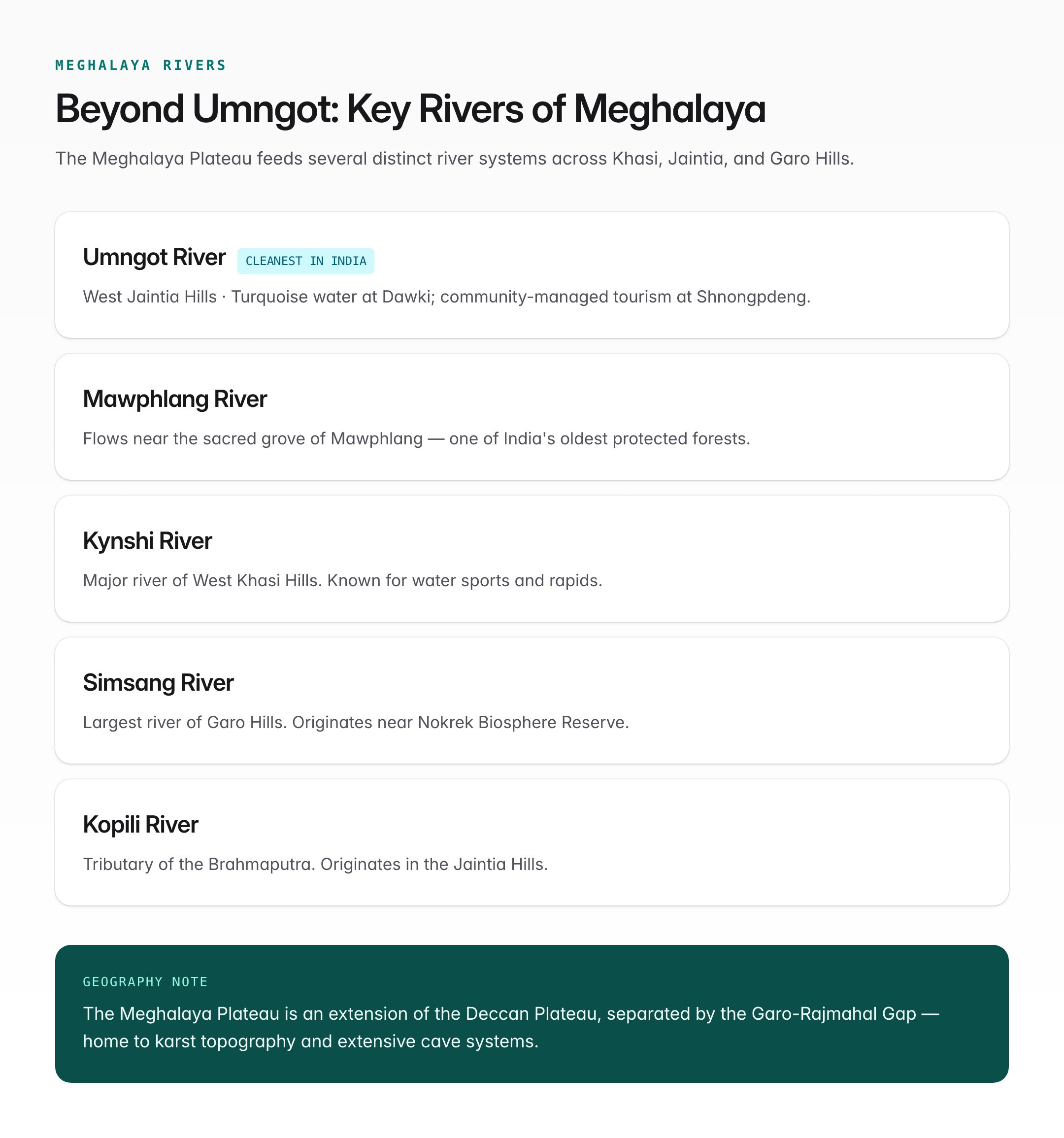
| Geological substrate | The river flows over limestone and granite bedrock, which produces minimal suspended sediment |
| Limestone filtration | Karst topography in the Jaintia Hills acts as a natural water filter |
| Low silt load | Dense forest cover in the upper catchment prevents soil erosion |
| Fast-flowing current | The river's gradient prevents stagnation and promotes natural oxygenation |
| Minimal agricultural runoff | The surrounding area has low-intensity agriculture with limited use of chemical fertilisers |
Human Factors
| Factor | Explanation |
|---|---|
| Low population density | The Jaintia Hills region is sparsely populated |
| Community conservation | Indigenous Khasi-Jaintia communities have traditional systems of natural resource management |
| Limited industrialisation | No major industries discharge effluents into the river |
| Sacred groves and forests | Community-protected forests (sacred groves or Law Kyntang) in the catchment area maintain ecological balance |
The Jaintia Hills Region
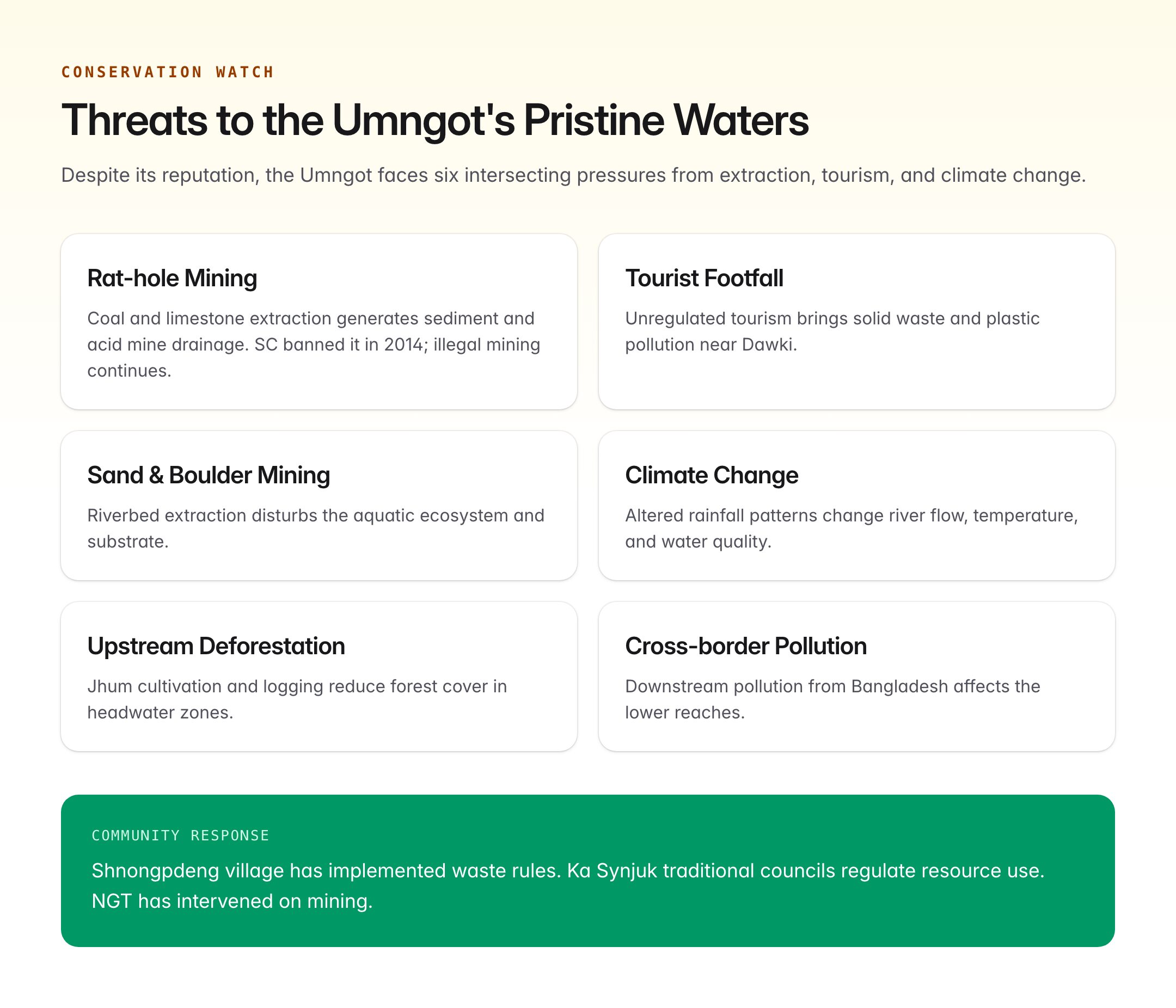
The Umngot River is part of the broader Jaintia Hills landscape, which has distinct geographical features.
| Feature | Description |
|---|---|
| Plateau topography | The Jaintia Hills are part of the Meghalaya Plateau (extension of the Deccan Plateau, separated by the Garo-Rajmahal Gap) |
| Karst landscape | Extensive cave systems, underground rivers, and limestone formations |
| Rainfall | The region receives heavy rainfall (2,000-4,000 mm annually), though less than the Khasi Hills (Cherrapunji/Mawsynram belt) |
| Biodiversity | Subtropical broadleaf forests; home to diverse bird species, orchids, and endemic plants |
| Coal and limestone deposits | Significant mining activity in eastern Jaintia Hills — a major conservation concern |
Dawki: The Border Town
Dawki is a small town that serves as the India-Bangladesh border crossing point on the Meghalaya side. The Dawki-Tamabil land customs station is one of the busiest trade points between northeast India and Bangladesh.
| Aspect | Detail |
|---|---|
| Border trade | Export of coal, limestone, and agricultural products to Bangladesh |
| Nearest major town | Shillong (~95 km) |
| International bridge | A single-lane bridge across the Umngot connects the Indian and Bangladeshi sides |
| Strategic significance | Part of the Act East Policy connectivity corridor; proposed Indo-Bangladesh waterway link |
Tourism
The Umngot River has become one of Meghalaya's most-visited tourist attractions.
Activities
| Activity | Details |
|---|---|
| Boating | Wooden boats operated by local Jaintia boatmen; the transparent water creates the famous "floating boat" illusion |
| Snorkelling | Clear waters allow visibility up to several metres |
| Photography | The river is one of the most photographed natural sites in northeast India |
| Camping | Riverside campsites available near Shnongpdeng village |
| Cliff jumping and zip-lining | Adventure activities at Shnongpdeng, upstream from Dawki |
| Fishing | Local communities practise traditional fishing methods |
Shnongpdeng Village
Located upstream from Dawki, Shnongpdeng has emerged as a community-managed eco-tourism hub. The village offers:
- Homestays and community-run campsites
- Kayaking and boating on pristine stretches of the Umngot
- Scuba diving during the clear-water season
- A model of community-based sustainable tourism
Conservation Challenges
Despite its pristine reputation, the Umngot faces several environmental threats.
| Threat | Description |
|---|---|
| Coal and limestone mining | Rat-hole mining in eastern Jaintia Hills generates sediment and acid mine drainage; the Supreme Court banned rat-hole mining in 2014, but illegal mining continues |
| Increasing tourist footfall | Unregulated tourism generates solid waste; plastic pollution near Dawki |
| Sand and boulder mining | Extraction from the riverbed disturbs the ecosystem |
| Climate change | Altered rainfall patterns affect river flow and water quality |
| Upstream deforestation | Jhum cultivation and logging in some areas reduce forest cover |
| Cross-border pollution | Downstream pollution from the Bangladesh side can affect the lower reaches |
Conservation Efforts
| Initiative | Description |
|---|---|
| National Green Tribunal (NGT) orders | NGT has intervened in mining regulation in Meghalaya |
| Community conservation | Shnongpdeng village has implemented waste management rules for tourists |
| State tourism policy | Meghalaya government promoting eco-tourism and sustainable tourism models |
| Meghalaya Aquaculture Mission | Supports sustainable fishing and river conservation |
| Ka Synjuk (traditional councils) | Jaintia community councils regulate natural resource use |
Other Notable Rivers of Meghalaya
| River | Feature |
|---|---|
| Mawphlang River | Flows near the sacred grove of Mawphlang |
| Kynshi River | Major river of West Khasi Hills; known for water sports |
| Simsang River | Largest river of Garo Hills; origin near Nokrek Biosphere Reserve |
| Kopili River | Tributary of the Brahmaputra; originates in Jaintia Hills |
UPSC Relevance
| Paper | How It Appears |
|---|---|
| Prelims (GS) | Cleanest river in India, location (state, district), geographical features of Meghalaya |
| Mains GS-I (Geography) | River systems of northeast India, Meghalaya Plateau, karst topography |
| Mains GS-III (Environment) | River conservation, mining impacts, eco-tourism as a conservation tool |
| Mains GS-II (Governance) | Community-based resource management, Act East Policy |
Key terms to remember: Umngot River, Dawki, West Jaintia Hills, Meghalaya Plateau, cleanest river in India, karst topography, Shnongpdeng, rat-hole mining, sacred groves, community-based tourism, India-Bangladesh border.
Previous Year Questions (Themes)
- Discuss the geographical features of the Meghalaya Plateau. (GS-I)
- Examine the role of community-based conservation in protecting river ecosystems in India. (GS-III)
- How does mining activity affect river water quality? Discuss with examples from northeast India. (GS-III)
The Umngot River is a reminder that community stewardship and natural geological advantage can preserve river ecosystems in a way that large-scale governmental interventions often cannot. Its story also highlights the tension between resource extraction, tourism growth, and environmental conservation — a dynamic highly relevant to UPSC discourse.