

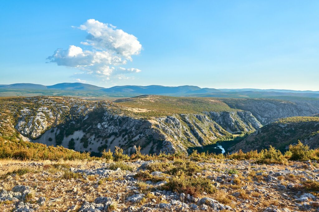
Karst topography is the distinctive landscape that develops on soluble rock, mostly limestone but also dolomite and occasionally gypsum, when groundwater dissolves the rock over geological time. The word comes from the Karst plateau in present-day Slovenia, where the features were first described in the nineteenth century, and the name has spread to every region in the world where the same geology produces the same landforms. Karst landscapes are diagnostic: pockmarked surfaces, sinking streams, dry valleys, and entire river systems that disappear underground only to re-emerge as springs many kilometres away.
The chemistry of karst is the chemistry of solution weathering, one branch of the broader types of weathering family. Rainwater absorbs carbon dioxide from the atmosphere and from soil organic matter, forming a weak carbonic acid. Where this acid encounters limestone, the calcium carbonate of the rock reacts with it to form calcium bicarbonate, which is soluble in water and carried away in solution. Over millions of years the slow chemical removal of the rock opens fissures, widens joints, creates caves, and produces the surface features that make karst recognisable.
India has limestone in several regions, mostly in the Cuddapah and Vindhyan basins, in parts of the Himalaya, and in the Meghalaya plateau. Where rainfall is high and the limestone is thick enough, classic karst features have developed. The Borra caves in Andhra Pradesh, the Belum caves in the same state, and the Mawsmai and Krem Liat Prah caves of Meghalaya are the textbook Indian examples and turn up regularly in geography papers.
The Chemistry of Karst Formation
The chemistry is simple enough to write in a single line. Carbon dioxide combines with water to form carbonic acid, and carbonic acid reacts with calcium carbonate to form calcium bicarbonate. The bicarbonate is soluble and washes away. The pure form is the equation CaCO3 + H2O + CO2 -> Ca(HCO3)2. Every molecule of limestone that the equation runs through is a molecule removed from the rock. Run the equation for ten million years on a thick limestone unit in a humid climate and you have caves.
The acidity of the water determines how aggressive the solution is. Pure rainwater has a pH of about 5.6 because of dissolved atmospheric CO2. Water that has passed through soil takes on additional CO2 from root respiration and organic decomposition, dropping the pH further. Acid rain from pollution can drop it further still. The combination of higher CO2 and lower temperature in temperate climates often makes karst more aggressive there than in the tropics, although tropical karst exists wherever the rainfall is high enough.
Importantly, the same equation runs in reverse where conditions change. When calcium-bicarbonate-rich water enters a cave and CO2 escapes from the water into the cave air, the calcium carbonate precipitates back out of solution. This is how stalactites, stalagmites, and other cave deposits form, and it is why karst landscapes display both removal features (sinkholes, caves, valleys) and deposition features (cave formations, travertine).
Why Limestone, Not Other Rocks
The chemistry depends on the rock being made mostly of calcium carbonate, which is true of limestone and, to a lesser extent, dolomite (calcium magnesium carbonate). Most other common rocks are silicates, which dissolve far too slowly to produce karst features in any reasonable time. Gypsum and salt produce their own karst-like features but on a smaller scale, because they are even more soluble than limestone and the resulting landforms collapse faster than they can stabilise. The classic, large-scale karst landscape is a limestone landscape.
For karst to develop into a recognisable topography, four conditions need to come together. The rock must be thick, pure, and well-jointed. The climate must supply enough rainfall to drive the chemistry. The drainage must be able to carry the dissolved load away from the site. And the time must be sufficient, usually millions of years, for the slow chemistry to produce visible features.
Surface Karst Features
Sinkhole and Doline
The sinkhole is the simplest and most diagnostic surface karst feature, and the international term is doline. A doline is a closed depression, roughly circular or elliptical, that drains directly into the underlying karst aquifer instead of into a surface stream. Dolines form in two ways. A solution doline grows when surface water collects in a slight depression, dissolves the limestone below, and slowly sinks. A collapse doline forms when the roof of an underground cave gives way and the surface drops into the void. Both end up as bowl-shaped or funnel-shaped hollows scattered across the landscape, sometimes a few metres across, sometimes hundreds.
Dolines often align along joint sets in the limestone, and a map of dolines on a well-developed karst surface looks like a constellation of pockmarks that ignores the surface drainage entirely.
Uvala
When several adjacent dolines merge as they grow, the result is a uvala, a compound depression with a scalloped outline reflecting the original separate dolines. Uvalas are larger than individual dolines, sometimes a kilometre or more across, but smaller and more irregular than a true polje. The transition from doline to uvala happens gradually as solution removes the walls between adjacent depressions.
Polje
The polje is the largest of the surface karst depressions, a flat-floored elongated basin sometimes tens of kilometres long. Poljes typically have a steep wall on one side, a long flat floor that floods seasonally as the karst aquifer rises, and one or more swallow holes called ponors that drain the floor into the underground system. The classic poljes are in the Dinaric karst of the western Balkans, where the term originated, but the basic landform appears in any well-developed limestone region with enough rainfall.
Karren and Lapies
On a smaller scale, the bare limestone surface develops a fluted, grooved, or pitted micro-relief called karren, or in French terminology lapies. The grooves run along the lines of running surface water, and the pits sit where soil pockets concentrate organic acids. A walk across an exposed karst surface is a walk across centimetre-scale solution sculpture. The Yangshuo karst of southern China and the Burren of western Ireland are the textbook examples, but karren appears on every exposed limestone surface in a wet climate.
Disappearing Streams and Dry Valleys
Surface drainage on karst behaves strangely. Streams may flow across the surface, reach a doline or a fissure, sink into the rock, and disappear. The valley they leave behind, called a dry valley, was cut by surface water when the karst was still in an early stage of development and has since been abandoned as the drainage shifted underground. The Karst plateau of Slovenia is full of dry valleys with no rivers in them. The same pattern appears in parts of the Meghalaya karst and in the Himalayan limestone belts.
Subsurface Karst Features
Caves
The cave is the signature subsurface feature of karst. Caves form when groundwater concentrates flow along joints, bedding planes, and fault zones in the limestone, dissolving the rock preferentially along these conduits until passages large enough for humans to walk in have opened up. Indian caves include the Borra caves in the Ananthagiri hills of the Eastern Ghats, the Belum caves near Tadipatri in Andhra Pradesh (the second-longest cave system in India), the Krem Liat Prah and Krem Mawmluh caves of Meghalaya (the longest in the country, both in Jaintia and Khasi hills), and the Mawsmai caves near Cherrapunji.
Each Indian karst region tells a slightly different story. The Borra caves are in the Khondalite-Limestone band of the Eastern Ghats, with the Gosthani river flowing through part of the system. The Belum caves of Andhra Pradesh are in Cuddapah limestone and run almost three and a half kilometres horizontally. The Meghalaya caves are in Cretaceous-Tertiary limestone exposed across the southern flank of the plateau, where the rainfall in Cherrapunji and Mawsynram is among the highest in the world. The combination of thick limestone, intense rainfall, and significant elevation drop has produced the largest cave systems in the country.
Stalactites and Stalagmites
Inside a cave, the same chemistry that dissolved the limestone runs in reverse to build new deposits. Calcium-bicarbonate-rich water seeping through the roof loses CO2 to the cave air, and calcium carbonate precipitates out as a crystal. Drips that hang from the ceiling and add layer after layer build a stalactite (from the Greek for that which drips). Drips that strike the floor and build upward form a stalagmite (from the Greek for that which drips down). When a stalactite and a stalagmite grow toward each other and join, the result is a column, sometimes also called a pillar.
The mnemonic that Indian textbooks teach is “stalactites hang tight” (from the ceiling, with the C of ceiling) and “stalagmites might grow up” (from the ground, with the G of ground). The growth rate is slow: a few centimetres in a century is typical, sometimes faster in caves with very active dripping and sometimes slower in colder or drier caves. The cave formations of Borra are particularly striking, with light from the partly-open entrance illuminating long stalactites in colours that depend on trace iron and manganese.
Flowstone and Other Decorations
Beyond the standard stalactite-stalagmite pair, caves develop a vocabulary of secondary deposits collectively called speleothems. Flowstone is a sheet of calcium carbonate deposited where water flows across a wall or floor rather than dripping in one spot. Helictites are twisted irregular stalactite forms that grow against gravity, driven by capillary action. Soda straws are thin hollow tubes that form when each drip leaves only an outer ring before falling. Cave pearls form in shallow pools where water agitation keeps small carbonate spheres rolling. The full inventory is large and the names somewhat specialist, but speleothems collectively make caves visually distinctive and scientifically informative, because they record past climates in their growth layers.
Underground Rivers and Phreatic Conduits
Beneath the water table in a karst system, the rock is fully saturated, and the underground rivers flow under hydraulic pressure rather than gravity. These phreatic conduits can move large volumes of water over long distances. Where the conduits intersect the surface, they emerge as karst springs, sometimes with discharge that rivals a large surface river. The springs at the head of the Meghalaya valleys, the springs feeding the Krem Mawmluh system, and the seasonal springs of the Cuddapah karst are Indian examples.
Indian Karst Regions
The major karst regions in India follow the limestone outcrop pattern.
The Meghalaya plateau, particularly the southern Khasi and Jaintia hills, hosts the longest and most numerous cave systems in the country. The rainfall here, fed by the orographic uplift of the Bay of Bengal monsoon against the Meghalaya scarp, is among the highest on earth. Combined with thick Cretaceous-Tertiary limestone, this has produced cave systems of several tens of kilometres of mapped passage in Krem Liat Prah alone.
The Andhra Pradesh karst of the Cuddapah basin includes the Belum caves and the Borra caves, both visited regularly as tourist sites and studied in earth science. The limestone here is older than the Meghalaya limestone, of Proterozoic age, and the cave systems are smaller but well-developed.
The Himalayan limestones of Uttarakhand and Himachal Pradesh host smaller karst features and a few notable caves, although the steep topography and active tectonics tend to remove karst features as fast as they form. The Patal Bhuvaneshwar cave in Uttarakhand is the best-known Himalayan example, with religious significance attached to its formations.
The Bastar plateau and parts of the Vindhyan limestone outcrops also show karst features, though smaller and less developed than the major regions above.
Karst, Hydrology, and Hazards
Karst landscapes have hydrology that does not behave like ordinary surface hydrology. Pollutants entering a sinkhole can travel many kilometres through underground conduits in days, reaching springs and groundwater wells that surface-watershed thinking would not predict. Karst aquifers are vulnerable to contamination, and the modelling required to protect them is more complex than for ordinary porous aquifers. The dependence of much of the Meghalaya plateau population on karst springs makes this directly relevant to drinking water policy.
The other hazard is collapse. Cavities in the karst rock can grow to the point that the overlying surface gives way, sometimes catastrophically. Sinkholes that swallow buildings appear regularly in news from Florida, Mexico, and parts of southern China. Indian karst regions have not seen large urban collapses on the same scale, mostly because the inhabited karst areas are rural, but engineering on karst always requires geotechnical assessment for collapse risk.
The connection to broader Indian geomorphology runs through several other chapters. Karst weathering is a special case of the chemical solution covered in types of weathering. Karst landscapes coexist with fluvial landforms where surface rivers feed into the underground system. Karst soils tend to be thin and patchy and bear no resemblance to the deep alluvial soil of the Indo-Gangetic plain or to the black soil of the Deccan, but the contrast itself is a teaching point.
Karst Topography and the UPSC Syllabus
For UPSC, the testable points cluster around three themes. First, the chemistry: carbonic acid acting on limestone to dissolve calcium carbonate, with the reverse precipitation in caves producing stalactites and stalagmites. Second, the landform inventory: dolines, uvalas, poljes on the surface and caves, stalactites, stalagmites, columns, speleothems in the subsurface. Third, Indian examples: Borra and Belum in Andhra Pradesh, Krem Liat Prah and Mawsmai in Meghalaya, Patal Bhuvaneshwar in Uttarakhand.
Prelims questions usually ask for one landform with one defining process or one example. Mains questions tend to ask about water resources, ecological vulnerability, or the contrast between karst landscapes and other geomorphic systems. The cross-reference to types of weathering is direct, because karst is essentially the surface and subsurface expression of solution weathering on a soluble rock.
Frequently Asked Questions
What is karst topography?
Karst topography is the landscape that develops on soluble rock, mostly limestone, where groundwater dissolves the rock over geological time. It produces a distinctive set of features including sinkholes, caves, disappearing streams, and underground river systems.
What rocks form karst?
Mostly limestone, which is made of calcium carbonate. Dolomite, a related rock with magnesium, also forms karst but more slowly. Gypsum and salt produce karst-like features at smaller scales because they are even more soluble than limestone but less stable.
How does limestone dissolve to form karst?
Rainwater absorbs carbon dioxide to form a weak carbonic acid. When this acid contacts limestone, it reacts with the calcium carbonate to form soluble calcium bicarbonate, which is carried away in solution. Over millions of years this slow removal opens caves, sinkholes, and other karst features.
What is the difference between a stalactite and a stalagmite?
Stalactites hang from the ceiling of a cave, growing downward as drips of calcium-bicarbonate water lose CO2 and deposit a ring of calcium carbonate at the tip. Stalagmites grow upward from the floor, fed by the same drips striking the ground. When the two meet, they form a column.
What is a sinkhole or doline?
A doline, also called a sinkhole, is a closed depression in a karst landscape. It forms either by gradual solution of the limestone surface or by sudden collapse of the roof of an underlying cave. Dolines drain directly into the underground karst aquifer instead of into surface streams.
Where are the famous karst caves in India?
The Krem Liat Prah and other Meghalaya caves in the Khasi and Jaintia hills are the longest in India. The Borra caves and Belum caves in Andhra Pradesh are both major systems and accessible to tourists. Patal Bhuvaneshwar in Uttarakhand is the best-known Himalayan cave with religious significance.
What is a polje?
A polje is the largest karst surface depression, a flat-floored elongated basin sometimes tens of kilometres long with a swallow hole called a ponor that drains the floor into the underground system. Poljes typically flood seasonally as the karst aquifer level rises.
How does karst differ from normal hydrology?
In karst, much of the drainage runs underground through conduits in the rock rather than across the surface. Surface streams may sink into dolines and reappear at distant springs. The rapid underground flow means that pollutants travel further and faster than in ordinary aquifers, making karst water supplies particularly vulnerable to contamination.
Tell Google you want more of this.
Add Anantam IAS as a preferred sourceOne tap, and this site shows up more often in your own Top Stories, AI Overviews and AI Mode. Remove it any time.






