Flash Floods:

Why in news:
Flash floods have increasingly affected various parts of India in 2024, including Himachal Pradesh, where over 100 people recently died due to landslides and floods. A new study titled “Drivers of flash floods in Indian sub-continental river basins” (IIT Gandhinagar) identifies the most vulnerable zones, driving factors, and climate change implications for flash flood disasters in India.
UPSC CSE Relevance:
This article on flash floods in India is highly relevant for GS Paper III (Disaster Management) UPSC has asked questions on these topics like Types of flash floods, Vulnerable regions and basins, Driving factors and impacts, Adaptation strategies etc. As you can see below questions related to flood.
UPSC CSE Mains PYQ 2020:
Question: Account for the huge flooding of million cities in India including the smart ones like Hyderabad and Pune. Suggest lasting remedial measures.
Key Findings of the Study:
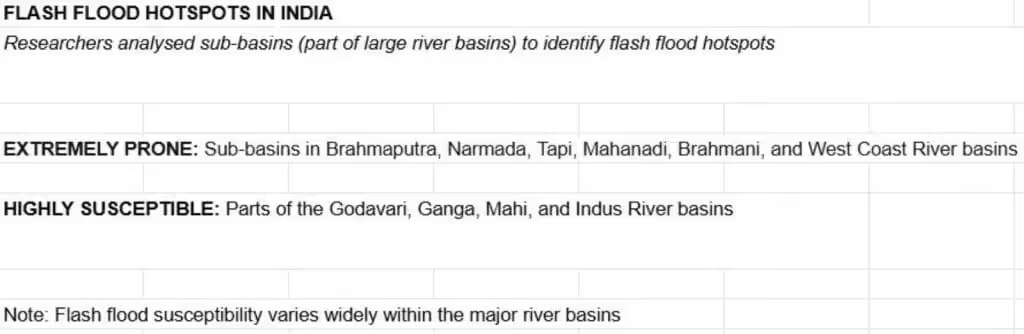
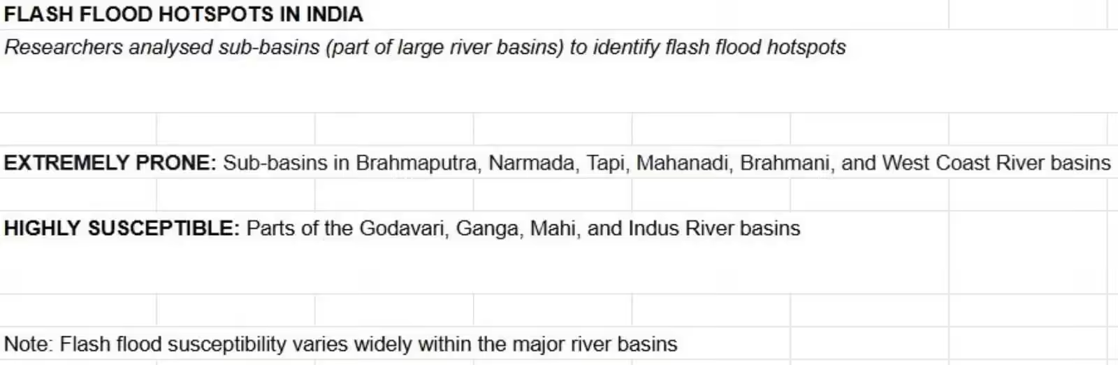
Flash floods occur most frequently in:
- West Coast of India
- Himalayas
- Central India
Causes of Flash Floods:
Immediate Causes:
- Only 25% of flash floods occur due to extreme rainfall within six hours.
Terrain-Related Causes:
- Steep slopes and high relief (like Himalayas)
Climate Change Link:
- Every 1°C increase in temperature raises moisture in air by 7%, intensifying rainfall.
- Between 1981 and 2020, frequency of extreme rainfall doubled during pre-monsoon in India.
- Rainfall increased in monsoon, post-monsoon, and winter by:
- 56%, 40%, and 12.5% respectively.
What is Flood:
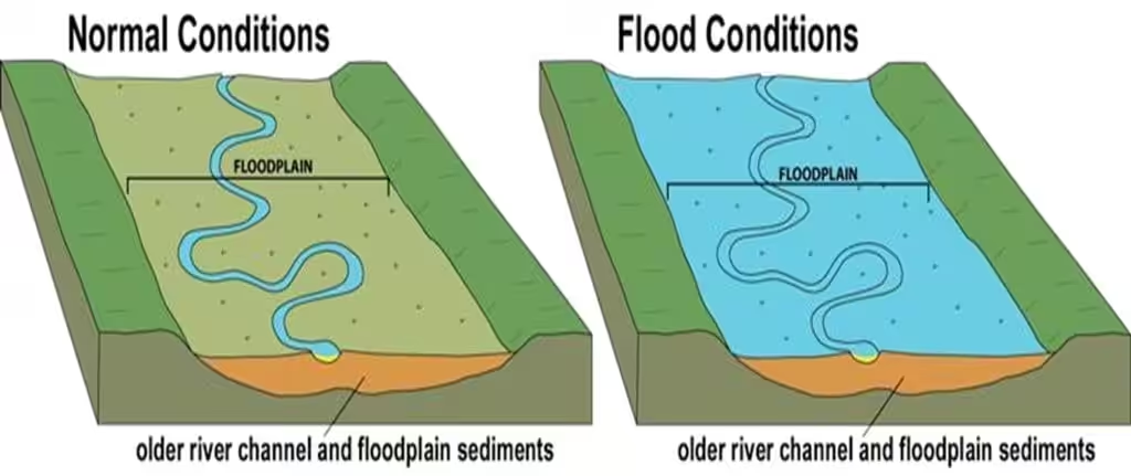
| According to National Weather service: An overflow of water onto normally dry land. The inundation of a normally dry area caused by rising water in an existing waterway, such as a river, stream, or drainage ditch. Ponding of water at or near the point where the rain fell. Flooding is a longer term event than flash flooding: it may last days or weeks. |
What is Flash Floods:
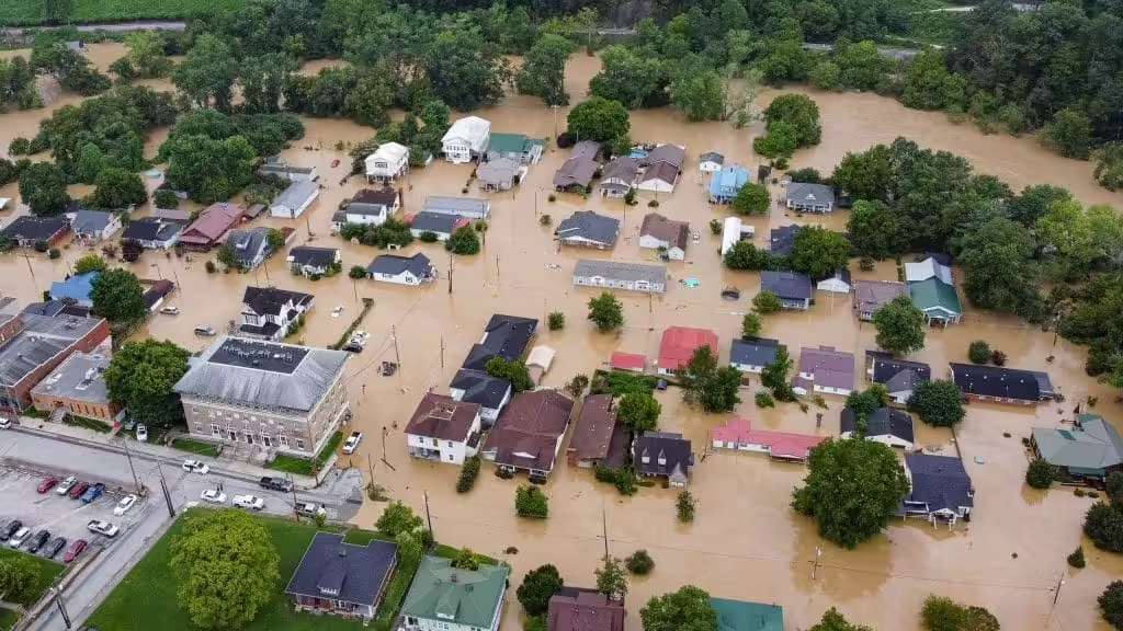
According to National Weather service: A flood caused by heavy or excessive rainfall in a short period of time, generally less than 6 hours. Flash floods are usually characterized by raging torrents after heavy rains that rip through river beds, urban streets, or mountain canyons sweeping everything before them.
Flood prone areas in India:
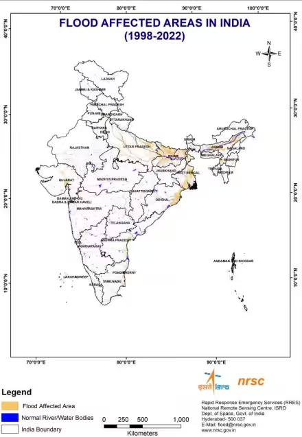
Flood Atlas of India:
According to NDMA:
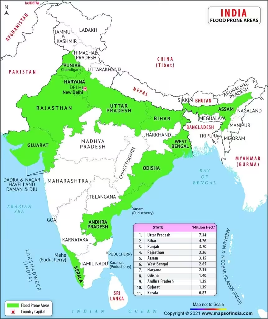
- India is highly vulnerable to floods. Out of the total geographical area of 329 million hectares (mha), more than 40 mha is flood prone.
- The average annual flood damage in the last 10 years period from 1996 to 2005 was Rs. 4745 crore as compared to Rs. 1805 crore, the corresponding average for the previous 53 years.
- An average every year, 75 lakh hectares of land is affected, 1600 lives are lost and the damage caused to crops, houses and public utilities is Rs.1805 crores due to floods.
Causes:
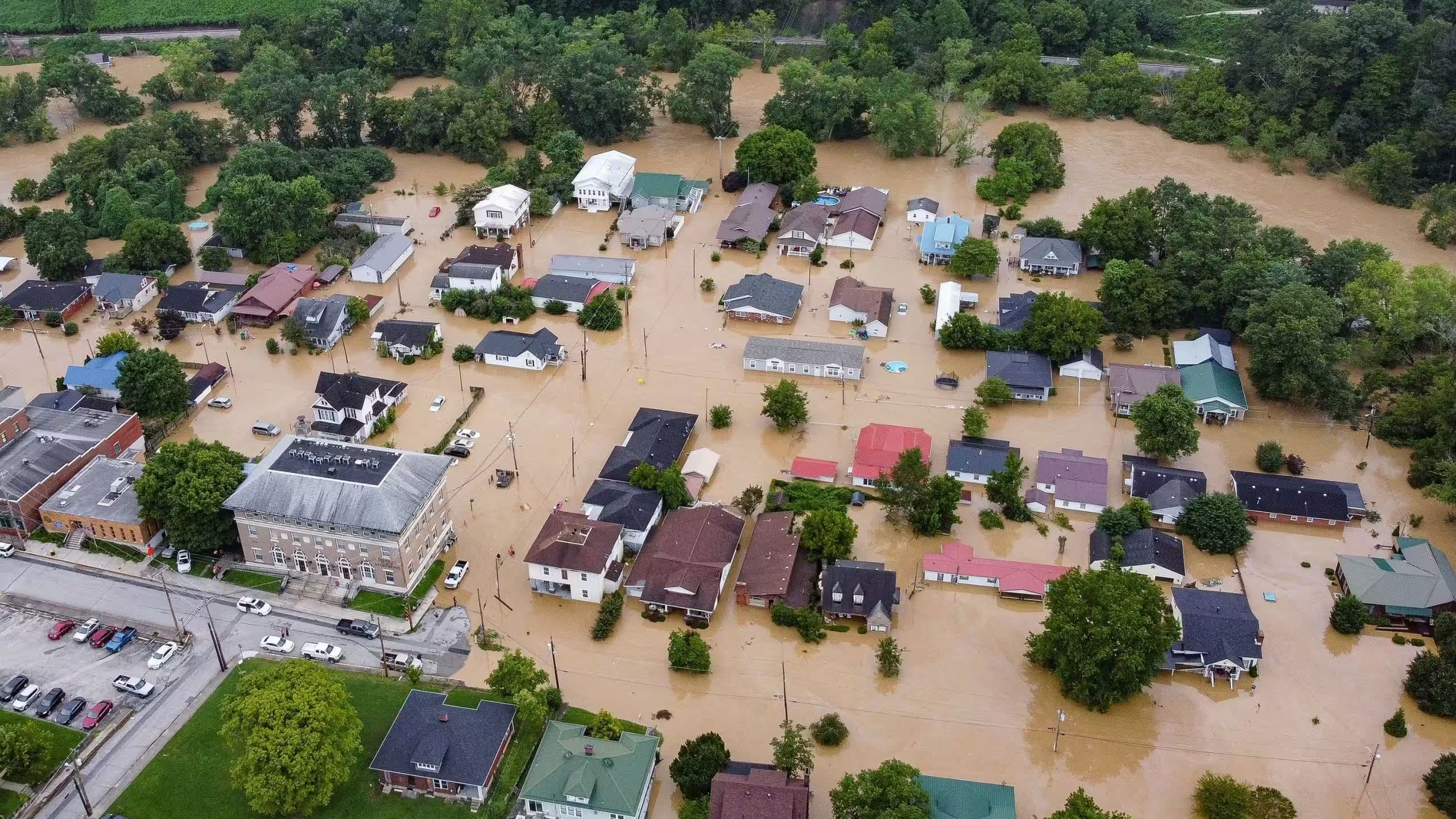
- More rain in less time.
- Unplanned urbanisation.
- Inadequate investment in drainage infrastructure.
- Deforestation in catchment areas.
- Extinction of natural water resources.
- Silting of sewer lines.
- Cloud Burst.
- Cyclone.
- Global Warming etc.
- Himalayas, geomorphological factors — such as steep slopes, and high relief (when a landscape has a significant difference between a high point and a low point) — contribute to flash floods.
Impact:
- Human Loss and Property Loss: Every year, millions of people become homeless and washed away due to floods like Uttarakhand flood incident 2013 more than 5700 people died.
- Spread of Communicable Diseases: Waterborne diseases like cholera, typhoid fever, hepatitis, and leptospirosis spread in flood-affected areas. Floods also lead to vector-borne diseases, transmitted through parasites and pathogens such as a mosquito. As a result, the health of flood victims deteriorates.
- Destruction of Crops: Every year, floods destroy a large number of crops.
- Loss of Livestock: Like humans, livestock also get displaced during floods and die due to the loss of their habitats.
- Economic and Social Disruption: The economy comes to a standstill as people are forced to move to another place, and revival of this situation takes time.
- Heavy traffic due to water logging.
- Landslides- like in Wayanad Kerala
Case studies:
Ladakh:
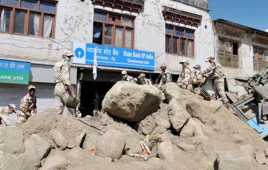
In 2010, there were flash floods due to cloud burst in Leh in Ladakh region of North India. It rained 14 inches in 2 hours, causing loss of human life and destruction. The civil hospital of Leh was badly damaged and rendered dysfunctional. 234 persons died and over 800 were reported missing. Almost half of the people who died were local residents (49.6%) and foreigners (10.2%).
Wayanad Flood:
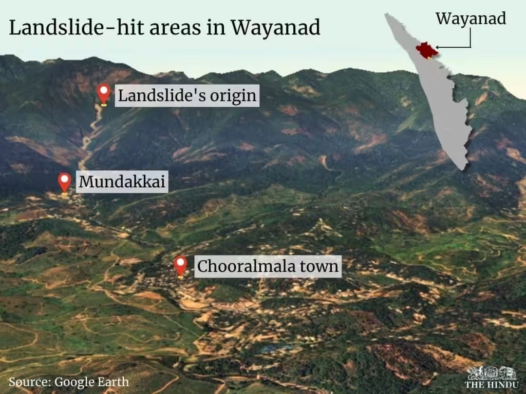
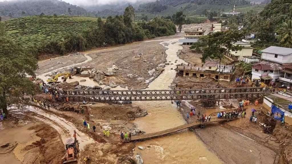
On July 30, 2024, devastating landslides struck the villages of Mundakki, Chooralmala, and Vellarimala in Wayanad District, Kerala, after days of heavy rainfall. The landslides caused severe damage, claiming lives, destroying homes, and affecting infrastructure. According to the State Emergency Operational Centre (SEOC) Kerala, 231 bodies and 212 body parts were recovered. In total, 630 people were injured, 214 rescued, and 119 remain missing.
Chennai:
The Chennai metropolitan region (CMA), with an area of 1,189 sq kms and a population of 8,653,521, is the fourth-largest populated city in India. This city, located in north eastern part of Tamil Nadu is a flat plain bounded on the east by Bay of Bengal and on the remaining three sides by Chengalpattu and Thiruvallur districts. Expansion in terms of area as well as population has led to a shift in land use and land cover patterns across the region. Chennai is exposed to violent storm surges and flooding during northeast monsoons (September to November). In November-December 2015, when a devastating flood affected more than 4 million people, claimed more than 470 lives and resulted in enormous economic loss.
Major NDMA Guidelines:
- Maximizing the national hydro-meteorological network
- Use of Doppler weather radar – weather forecasting and warning
- Design of road and rail bridges – development of under-drainage systems
- Every building in the urban area should have rain water harvesting as an integral part of the building utility.
- Pre-monsoon desilting of all major drains is to be completed by 31st March every year.
GOI Steps:
- River Linking Project
- Amrit Sarovar Mission-Development and rejuvenation/rejuvenation of 75 water bodies in each district of the country.
- Wetland Conservation
Best practice model in world to resolve flood Issue:
China Sponge City:
- Sponge City is an urban construction model capable of tackling weather conditions such as monsoons, swelling, flooding or other water events, through drainage systems or areas that prevent the accumulation of water.
- China has one of the highest numbers of sponge cities, with the objective of having 80% of its urban areas absorbing 70% of water by 2030. As the country deals with extreme weather conditions, it has long sought to make its highly populated cities less vulnerable to flooding and drought. A Sponge City integrates natural and engineered systems to manage rainwater sustainably, mimicking the natural water cycle within the urban environment.
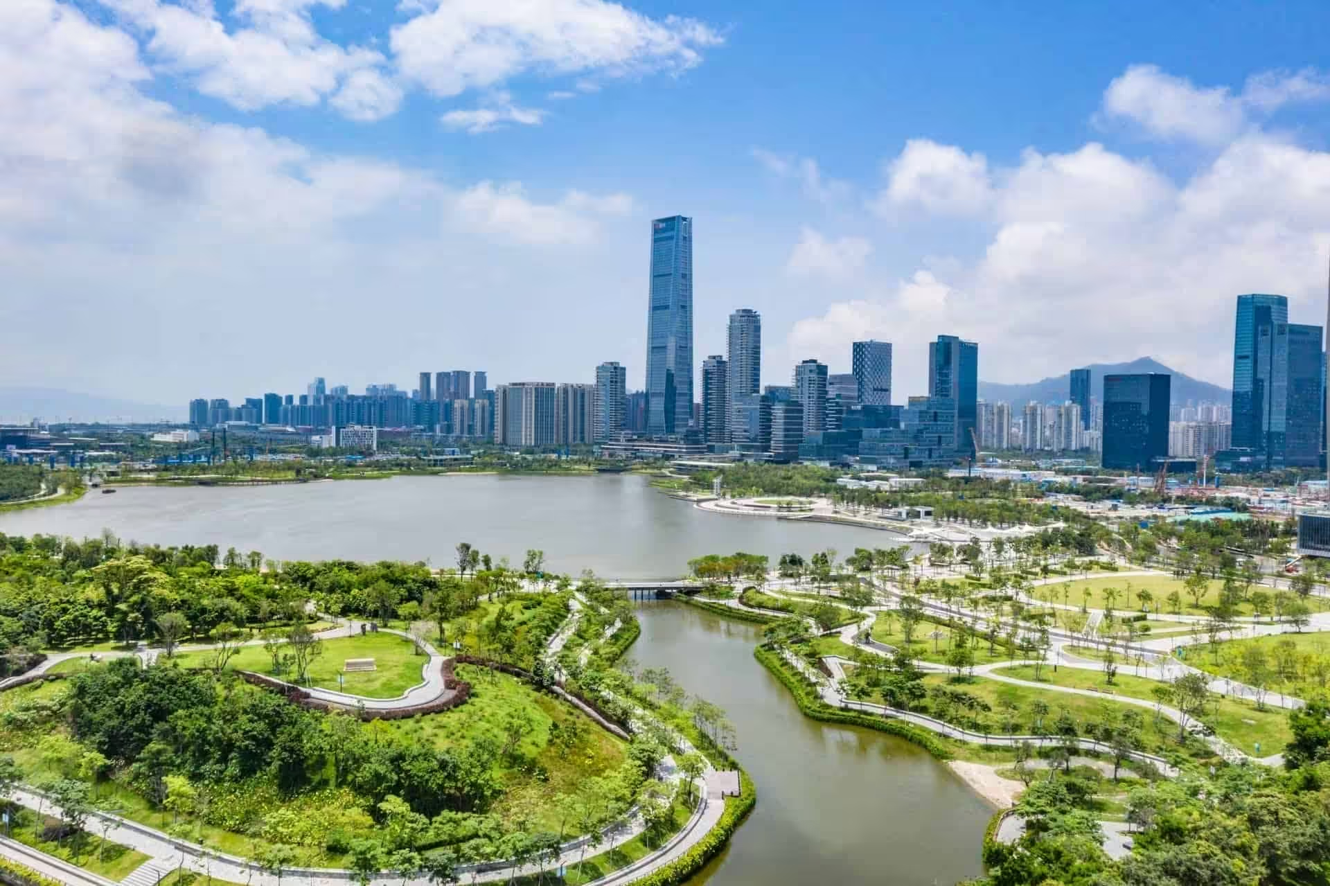
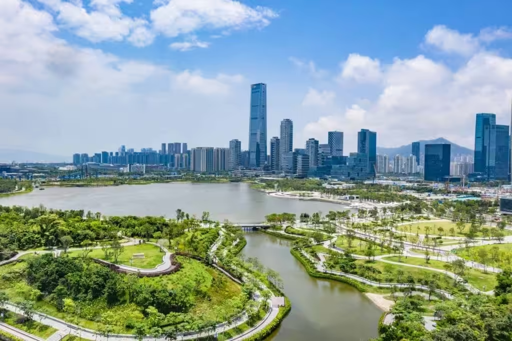
- Shenzhen, a city in China, exemplifies this initiative. Shenzhen Talent Park features floodable greenways around a coastal lake, acting as a sink for canals diverting runoff from the ultra-dense Houhai neighbourhood.
Wuhan
Wuhan is one of the pioneering cities in China to implement the sponge city initiative. The Wuhan Sponge City Programme aims to reduce waterlogging and improve water quality through the ecological remediation of existing urban water systems and the development of blue and green infrastructure to collect and store rainwater.
Japan Model:
Japan’s flood control system is a comprehensive approach combining structural and non-structural measures, with a strong emphasis on utilizing underground spaces to mitigate the impacts of heavy rainfall and typhoons. Key elements include large-scale underground reservoirs and tunnels, advanced monitoring and early warning systems, and a network of levees and floodgates.