Earthquakes in India: Zones, History & Preparedness
Complete guide to earthquakes in India — seismic zones, major earthquakes, preparedness guidelines, and NDMA framework. Essential for UPSC Geography.
Earthquakes in India: Zones, History & Preparedness
India is one of the most earthquake-prone countries in the world. About 59% of India’s land area is vulnerable to moderate to severe seismic activity, and the Himalayan belt — home to hundreds of millions — sits on one of the most active tectonic boundaries on Earth. For UPSC, understanding seismic zones, the tectonic basis of Indian earthquakes, disaster management frameworks, and building code compliance is essential across Geography and Disaster Management papers.
Why Is India Earthquake-Prone?
India’s seismicity is driven primarily by the ongoing collision of the Indian Plate with the Eurasian Plate. This collision, which created the Himalayas 50 million years ago, continues today — the Indian Plate pushes northward at approximately 5 cm per year, building enormous stress along fault lines.
Key Tectonic Features
| Feature | Significance |
|---|---|
| Main Central Thrust (MCT) | Boundary between Greater and Lesser Himalayas; highly active |
| Main Boundary Thrust (MBT) | Boundary between Lesser Himalayas and Siwaliks |
| Himalayan Frontal Thrust (HFT) | Southernmost thrust; boundary with Indo-Gangetic Plain |
| Kutch Rift Basin | Intraplate fault zone; caused 2001 Gujarat earthquake |
| Andaman Subduction Zone | Indian Plate subducts under Burma Plate; caused 2004 tsunami |
Two types of seismicity affect India:
- Interplate earthquakes — along the Himalayan boundary and Andaman subduction zone
- Intraplate earthquakes — within the Indian Plate (Kutch, Koyna, Latur) — less predictable and often more destructive for their magnitude
Plate Tectonics: Continental Drift Theory
Seismic Zones of India
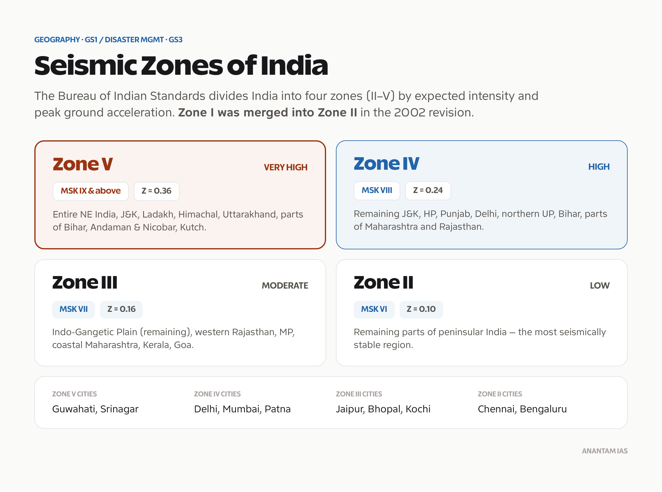
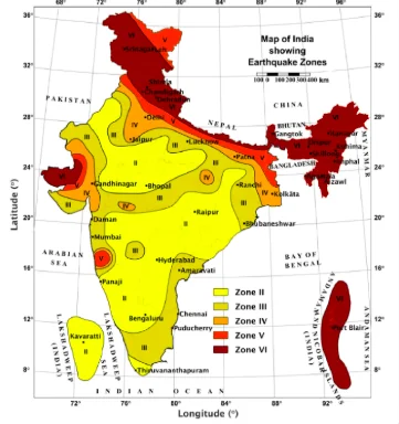
The Bureau of Indian Standards (BIS) divides India into four seismic zones (Zones II to V) based on the Modified Mercalli Intensity (MMI) scale and expected peak ground acceleration.
Zone Classification
| Zone | Intensity (MSK) | Risk Level | Key Regions |
|---|---|---|---|
| Zone V | IX and above | Very High (most severe) | Entire northeast India, J&K, Ladakh, Himachal Pradesh, Uttarakhand, parts of Bihar, Andaman & Nicobar, Kutch (Gujarat) |
| Zone IV | VIII | High | Remaining parts of J&K, HP, Punjab, Delhi, northern UP, Bihar, parts of Maharashtra, Rajasthan |
| Zone III | VII | Moderate | Indo-Gangetic Plain (remaining), western Rajasthan, Madhya Pradesh, coastal Maharashtra, Kerala, Goa |
| Zone II | VI | Low | Remaining parts of peninsular India |
> Note: Zone I was merged with Zone II in the 2002 revision, reducing the total from five to four zones.
Zone V — Highest Risk Areas
Zone V includes:
- Entire northeast India — sits on the junction of the Indian, Eurasian, and Burma plates
- Kashmir Valley — active fault systems along Himalayan boundary
- Kangra-Chamba region (HP) — site of the devastating 1905 Kangra earthquake
- Kutch region (Gujarat) — intraplate fault zone; 2001 Bhuj earthquake
- Andaman & Nicobar Islands — subduction zone; 2004 tsunami epicentre was nearby
Comparison of Seismic Zones
| Parameter | Zone V | Zone IV | Zone III | Zone II |
|---|---|---|---|---|
| Seismic Coefficient (Z) | 0.36 | 0.24 | 0.16 | 0.10 |
| Expected Intensity | IX+ | VIII | VII | VI |
| Building Code Stringency | Maximum | High | Moderate | Basic |
| Key Cities | Guwahati, Srinagar | Delhi, Mumbai, Patna | Jaipur, Bhopal, Kochi | Chennai, Bengaluru |
Major Earthquakes in Indian History
| Earthquake | Year | Magnitude | Deaths | Key Facts |
|---|---|---|---|---|
| Assam Earthquake | 1897 | 8.1 | ~1,500 | Destroyed Shillong; one of the first great earthquakes to be scientifically studied |
| Kangra Earthquake | 1905 | 7.8 | ~20,000 | HP; destroyed Kangra and Dharamsala |
| Bihar-Nepal Earthquake | 1934 | 8.1 | ~10,000 | Destroyed Munger, Muzaffarpur; liquefaction in Gangetic plain |
| Assam-Tibet Earthquake | 1950 | 8.6 | ~1,500 | One of the largest ever recorded; massive landslides, Brahmaputra flooding |
| Koyna Earthquake | 1967 | 6.3 | ~177 | Reservoir-induced seismicity (RIS) — triggered by Koyna Dam reservoir |
| Uttarkashi Earthquake | 1991 | 6.8 | ~768 | Garhwal Himalayas |
| Latur (Killari) Earthquake | 1993 | 6.2 | ~7,928 | Peninsular India (considered low-risk zone); led to national building code revision |
| Chamoli Earthquake | 1999 | 6.8 | ~103 | Garhwal Himalayas; Chamoli-Rudraprayag area |
| Bhuj (Gujarat) Earthquake | 2001 | 7.7 | ~20,000 | Republic Day earthquake; $5.5 billion damage; led to major disaster management reforms |
| Kashmir Earthquake | 2005 | 7.6 | ~80,000+ (mostly Pakistan) | ~1,300 deaths on Indian side |
| Sikkim Earthquake | 2011 | 6.9 | ~111 | Damaged infrastructure; triggered landslides |
| Nepal Earthquake | 2015 | 7.8 | ~9,000 (Nepal) | Felt across north India; Bihar and UP affected; damaged heritage sites |
Lessons from the 2001 Bhuj Earthquake
The Bhuj earthquake was India’s watershed moment for disaster management:
- It struck on Republic Day (26 January), amplifying its psychological impact
- Exposed inadequate building codes and enforcement
- Revealed gaps in emergency response coordination
- Directly led to the Disaster Management Act, 2005
- Prompted creation of NDMA, SDMAs, DDMAs, and NDRF
Earthquake Preparedness in India
National Disaster Management Authority (NDMA) Guidelines
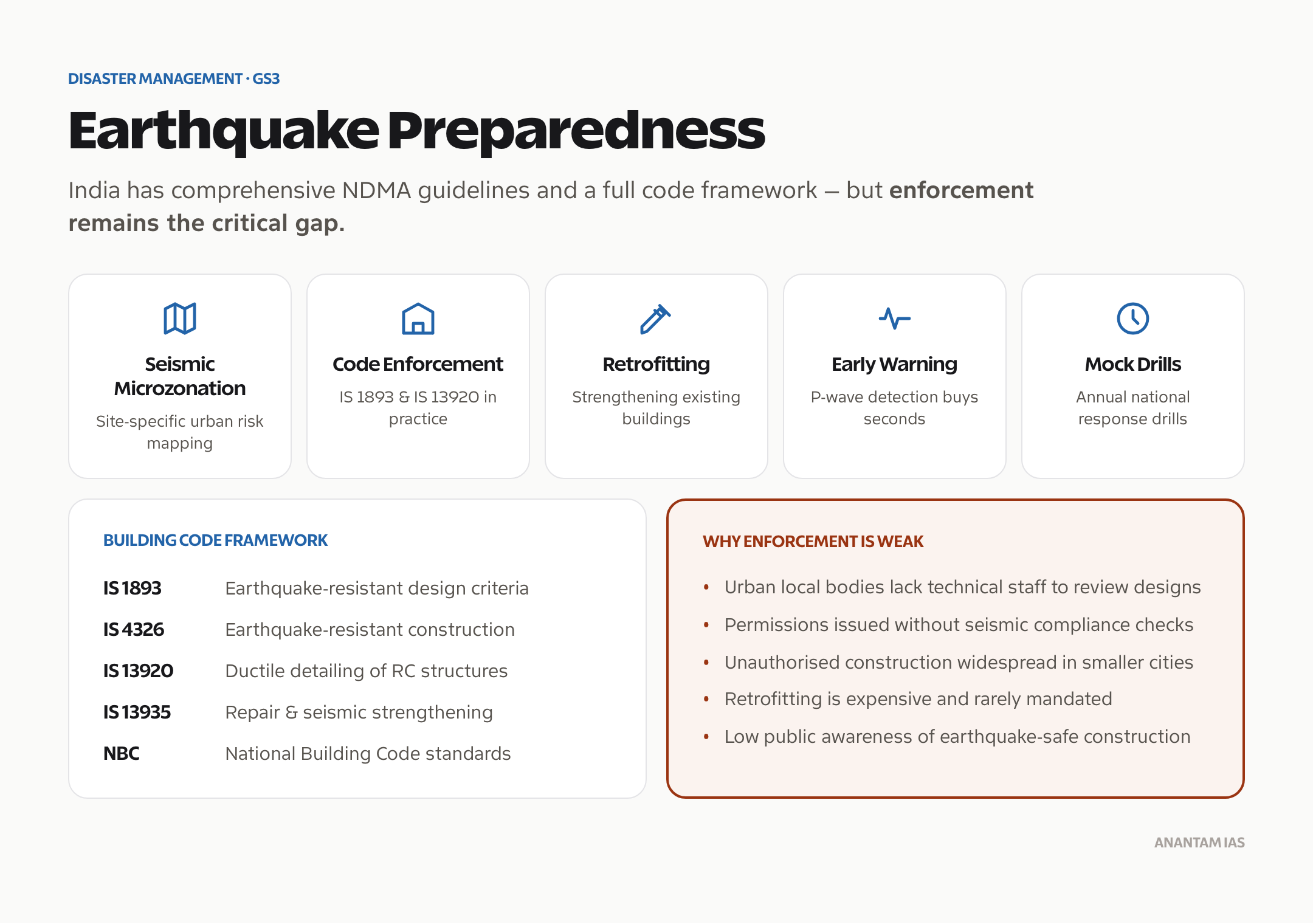
NDMA has issued specific guidelines on earthquake risk mitigation:
- Seismic Microzonation — detailed mapping of urban areas for site-specific risk assessment
- Building Code Enforcement — IS 1893 (earthquake-resistant design) and IS 13920 (ductile detailing)
- Retrofitting — strengthening existing structures to withstand earthquakes
- Early Warning Systems — though earthquake prediction remains impossible, P-wave detection can provide seconds of warning
- Mock Drills — annual national mock drills on earthquake response
Building Code Framework
| Code | Purpose |
|---|---|
| IS 1893 | Criteria for earthquake-resistant design |
| IS 4326 | Code of practice for earthquake-resistant construction |
| IS 13920 | Ductile detailing of reinforced concrete structures |
| IS 13935 | Repair and seismic strengthening of buildings |
| NBC 2016 | National Building Code — comprehensive construction standards |
Why Enforcement Is Weak
Despite comprehensive codes, enforcement remains the critical gap:
- Urban local bodies lack technical staff to review structural designs
- Building permissions often issued without seismic compliance checks
- Unauthorized construction is widespread, especially in smaller cities
- Retrofitting existing buildings is expensive and rarely mandated
- Public awareness about earthquake-safe construction remains low
Seismic Gap Theory
The Seismic Gap Theory suggests that segments of fault lines that haven’t experienced large earthquakes for a long time are more likely to produce one. In the Himalayan context:
- Central Himalayan Gap — the stretch from western Nepal to Uttarakhand hasn’t experienced a great earthquake (>8.0) since 1505
- Kashmir Gap — the western Himalaya segment hasn’t ruptured in a major earthquake since 1555
Scientists warn that these gaps have accumulated sufficient strain for earthquakes potentially exceeding magnitude 8.0 — which would affect tens of millions in the densely populated Indo-Gangetic Plain.
Reservoir-Induced Seismicity (RIS)
The 1967 Koyna earthquake (M 6.3) near the Koyna Dam in Maharashtra was one of the first scientifically documented cases of reservoir-induced seismicity. The weight of impounded water and its infiltration into underground faults can trigger earthquakes in otherwise stable regions.
Other suspected RIS cases in India:
- Tehri Dam — micro-seismicity monitored since impoundment
- Sardar Sarovar Dam — seismic monitoring ongoing
- Warna Dam — near Koyna; continued seismic activity
Earthquake vs Cyclone: Disaster Comparison
| Parameter | Earthquake | Cyclone |
|---|---|---|
| Predictability | Cannot be predicted | Can be tracked 3-5 days before landfall |
| Warning Time | Seconds (P-wave detection) | Days |
| Primary Killer | Building collapse | Storm surge, flooding |
| Duration | Seconds to minutes | Hours to days |
| Aftershocks | Yes — can continue for weeks | No aftershocks |
| Evacuation | Not possible before event | Mass evacuation is primary strategy |
| Mitigation Focus | Earthquake-resistant buildings | Early warning + evacuation |
Frequently Asked Questions
How many seismic zones does India have?
India is divided into four seismic zones (Zone II to V) by the Bureau of Indian Standards. Zone V is the most severe, covering the entire northeast, Jammu & Kashmir, Himachal Pradesh, Uttarakhand, Kutch, and the Andaman Islands. Zone II is the least severe, covering stable Peninsular India. The original Zone I was merged with Zone II in 2002.
What caused the 2001 Bhuj earthquake?
The 2001 Bhuj earthquake (M 7.7) was an intraplate earthquake caused by movement along the Kutch Mainland Fault. Unlike Himalayan earthquakes caused by the India-Eurasia collision boundary, the Bhuj event occurred within the Indian Plate, triggered by ancient rift faults reactivated by tectonic stress. It killed about 20,000 people.
Can earthquakes be predicted?
No. Despite decades of research, reliable earthquake prediction (specifying time, location, and magnitude) remains scientifically impossible. What exists is probabilistic seismic hazard assessment — identifying zones likely to experience earthquakes based on geological analysis and historical records. Early warning systems can detect P-waves seconds before destructive S-waves arrive.
What is the Seismic Gap Theory and why does it matter for India?
The Seismic Gap Theory identifies fault segments that haven’t ruptured recently and are therefore more likely to produce large earthquakes. The Central Himalayan Gap (western Nepal to Uttarakhand) and the Kashmir Gap are accumulating stress for potentially devastating earthquakes exceeding magnitude 8.0 — threatening hundreds of millions in the densely populated Indo-Gangetic Plain.