


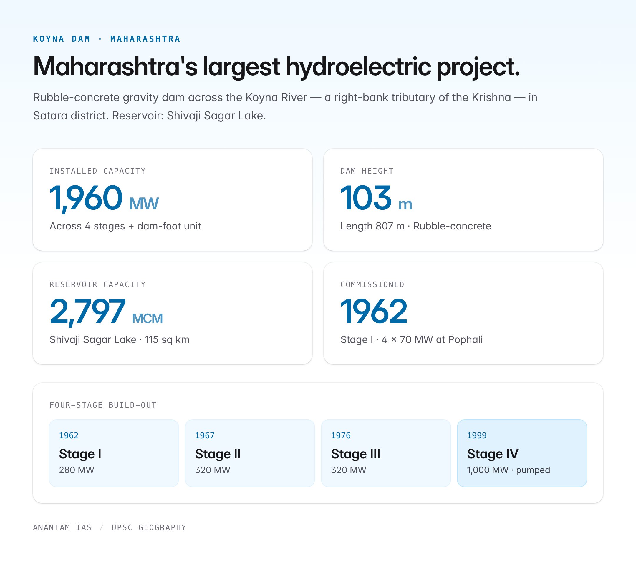
The Koyna Dam is a 103-metre-tall rubble-concrete gravity dam built across the Koyna River in Satara district, Maharashtra. Commissioned in 1962 and progressively expanded through four stages, the Koyna Hydroelectric Project is the largest completed hydroelectric power station in Maharashtra and among the biggest in India, with an installed capacity of 1,960 MW. Beyond its engineering stature, Koyna is globally significant for an unusual reason — it is the textbook example of reservoir-induced seismicity (RIS), the hypothesis that large water impoundments can trigger earthquakes. The magnitude 6.6 Koyna earthquake of 11 December 1967 remains the largest RIS event ever recorded.
Geography and Location
The Koyna River rises in the Mahabaleshwar region of the Western Ghats at an altitude of about 1,438 m and flows southward for roughly 130 km before joining the Krishna River at Karad. Because the Koyna flows through a narrow, steep-sided valley enclosed by the Sahyadri escarpment, it is one of the few rivers in the Deccan that flows north–south rather than east–west, and offers ideal hydrological conditions for storage: narrow gorge, high rainfall (>5,000 mm annually), and hard basaltic bedrock.
| Feature | Detail |
|---|---|
| River | Koyna, a right-bank tributary of the Krishna River |
| Location | Koyna Nagar, Satara district, Maharashtra |
| Nearest range | Western Ghats (Sahyadri) |
| Type | Rubble-concrete gravity dam |
| Height | 103 m |
| Length | 807 m |
| Reservoir | Shivaji Sagar Lake |
| Reservoir capacity | ~2,797 million cubic metres |
| Catchment area | 891 sq km |
The reservoir — Shivaji Sagar Lake — stretches roughly 50 km upstream and covers about 115 sq km at full capacity. The water is diverted through a 4 km long tunnel across the Ghats, dropping nearly 500 m to power houses on the western (Konkan) slope. This trans-Ghat transfer makes Koyna a rare example of inter-basin, inter-slope water diversion.
The Koyna Hydroelectric Project: Four Stages
The project was developed in four stages between the 1950s and 2000s, each adding generation capacity without raising the dam significantly.
| Stage | Commissioned | Installed Capacity | Location |
|---|---|---|---|
| Stage I | 1962 | 4 × 70 MW = 280 MW | Pophali (surface) |
| Stage II | 1967 | 4 × 80 MW = 320 MW | Pophali (surface) |
| Stage III | 1976 | 4 × 80 MW = 320 MW | Kolkewadi (underground) |
| Stage IV | 1999–2000 | 4 × 250 MW = 1,000 MW | Underground, pumped storage |
| Dam Foot | 1999 | 2 × 20 MW = 40 MW | At dam toe |
| Total | 1,960 MW |
Stage IV functions as a pumped-storage project — water is pumped back to the upper reservoir during off-peak hours and released during peak demand, effectively acting as a giant battery for the western grid.
The 1967 Koyna Earthquake and Reservoir-Induced Seismicity
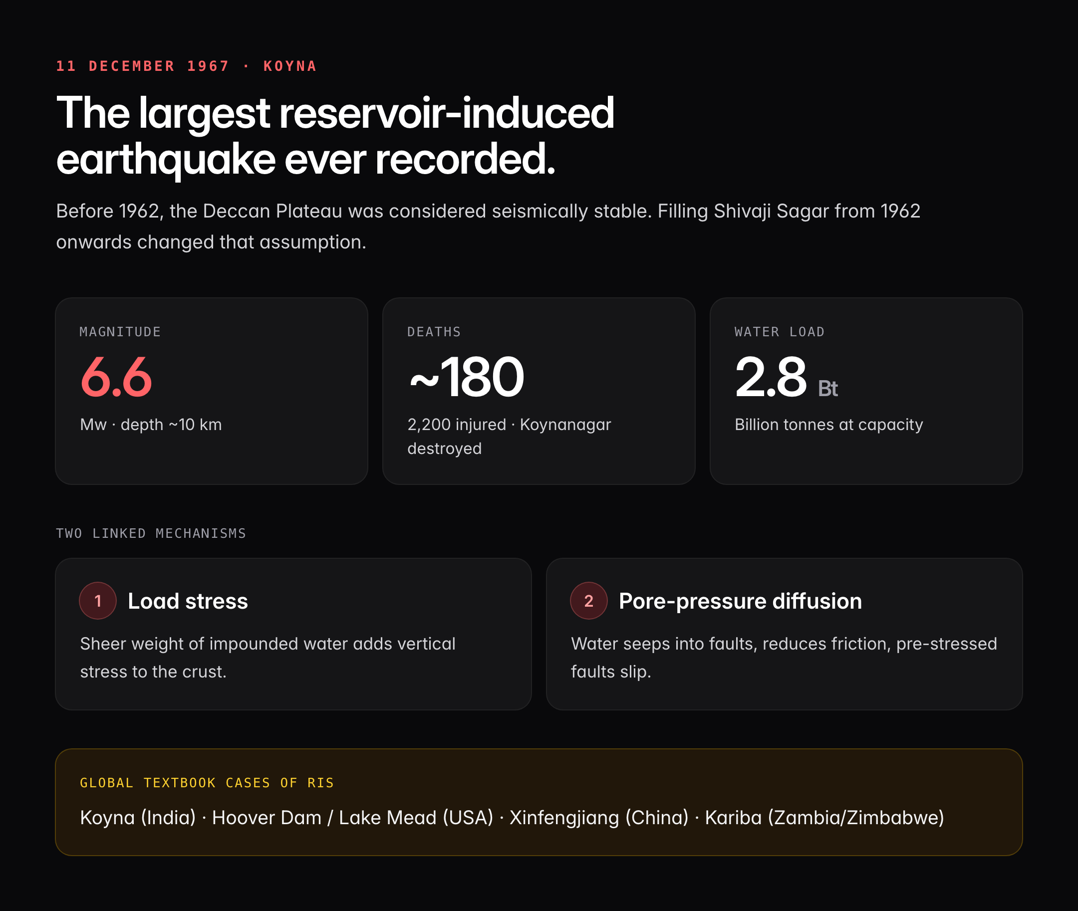
Before impoundment, the Deccan Plateau was considered seismically stable — a classic cratonic Peninsular Shield. Filling of the Shivaji Sagar reservoir from 1962 onwards changed that assumption dramatically.
- Date: 11 December 1967
- Magnitude: Mw 6.6
- Depth: ~10 km
- Casualties: ~180 dead, 2,200 injured
- Damage: Koynanagar township destroyed; cracks appeared on the dam
Crucially, seismologists had recorded increasing tremor activity from 1963 as the reservoir level rose. The earthquake did not damage the dam structurally, but it forced a retrofit with post-tensioned cables and buttressing. Koyna remains the most seismically monitored dam in India, with the Koyna–Warna region showing continuous low-magnitude activity to this day.
Why Reservoirs Induce Earthquakes
Reservoir-induced seismicity works through two linked mechanisms:
- Load stress: The sheer weight of impounded water (Shivaji Sagar holds about 2.8 billion tonnes of water at capacity) adds vertical stress to the crust.
- Pore-pressure diffusion: Water percolates along existing joints and faults, reducing effective friction and allowing pre-stressed faults to slip.
The Koyna region had unmapped pre-existing faults beneath the Deccan Traps, and the reservoir reactivated them. This insight transformed global dam-siting protocols; Koyna is cited in textbooks alongside Hoover Dam (Lake Mead), Xinfengjiang (China), and Kariba (Zambia/Zimbabwe).
Strategic Importance of Koyna
Koyna is more than a power station. It is a multi-role asset:
- Peak-load management: Because hydropower can be ramped up in minutes, Koyna supplies grid-balancing power to the Maharashtra–Western Regional grid.
- Irrigation: Tail-race water feeds the Krishna basin through the Koyna–Krishna canal system.
- Drinking water: Supplies towns along the Krishna downstream.
- Western slope development: Diverted water to Vashishti river supports Konkan industries and fisheries.
- Scientific research: Hosts the Koyna Deep Borehole Observatory, a 3 km-deep hole drilled by the Ministry of Earth Sciences to study earthquakes in situ — the first such observatory in India.
Environmental and Social Concerns
The project submerged around 100 villages and displaced several thousand families — many of whom received delayed rehabilitation. The reservoir sits inside the Koyna Wildlife Sanctuary, part of the Sahyadri Tiger Reserve and the Western Ghats UNESCO World Heritage cluster. Reservoir-induced siltation, downstream ecological changes in the Krishna, and recurring seismic activity remain long-term concerns. The Warna reservoir built later in the same fault zone has added to seismic loading.
Comparison With Other Major Indian Dams
| Dam | River | State | Installed Capacity |
|---|---|---|---|
| Koyna | Koyna (Krishna) | Maharashtra | 1,960 MW |
| Tehri | Bhagirathi | Uttarakhand | 2,400 MW |
| Sardar Sarovar | Narmada | Gujarat | 1,450 MW |
| Bhakra | Sutlej | HP/Punjab | 1,325 MW |
| Srisailam | Krishna | Andhra Pradesh | 1,670 MW |
Koyna remains the largest hydroelectric project in Maharashtra and the largest completed hydroelectric project on the Krishna system.
UPSC Relevance
Koyna Dam is a recurring favourite across the UPSC cycle. For Prelims, memorise: river (Koyna, tributary of Krishna), reservoir (Shivaji Sagar Lake), state (Maharashtra, Satara), capacity (1,960 MW), and the 1967 earthquake (Mw 6.6). A question linking Koyna to reservoir-induced seismicity or to the Koyna Deep Borehole Observatory (Ministry of Earth Sciences) has high Prelims probability. For GS Paper I (Geography), Koyna illustrates hydrological potential of the Western Ghats, inter-basin water transfer, and Peninsular drainage. In GS Paper III, it maps onto energy security, disaster management (earthquake preparedness), and environmental impact of large dams. The Narmada Bachao-style displacement and rehabilitation debate also draws on Koyna data. Link Koyna with Sahyadri Tiger Reserve (Environment), Western Ghats UNESCO site, and Krishna Water Disputes Tribunal for multidimensional answers. Treat Koyna as a case study of engineering ambition meeting geological reality — the kind of integrated example examiners reward.
Tell Google you want more of this.
Add Anantam IAS as a preferred sourceOne tap, and this site shows up more often in your own Top Stories, AI Overviews and AI Mode. Remove it any time.






