Hooghly River: Distributary of the Ganga — Complete Guide
UPSC guide to the Hooghly River — Bhagirathi-Hooghly system, course, Farakka Barrage, Kolkata port, Ganga dolphin, and distributary dynamics.
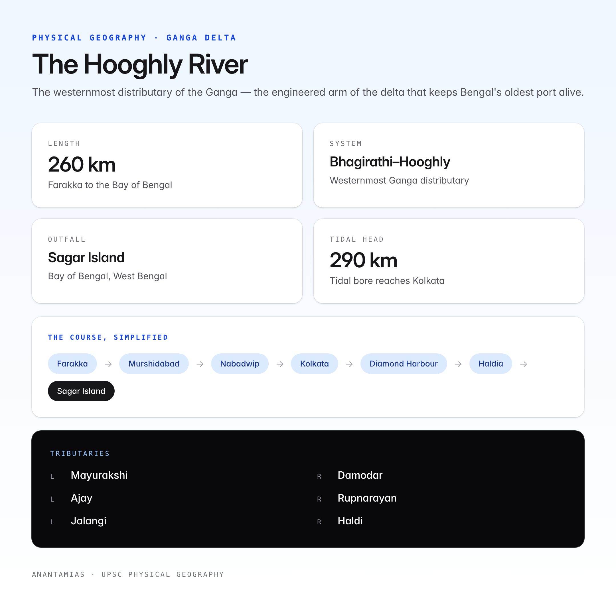
The Hooghly River — also spelled Hugli — is the westernmost distributary of the Ganga and the lifeline of West Bengal's economy. It flows for about 260 km through the Gangetic delta, past Kolkata and Howrah, before meeting the Bay of Bengal at Sagar Island. Together with its upper arm the Bhagirathi, the river forms the Bhagirathi-Hooghly system, one of the most important distributaries in the world's largest delta.
The Hooghly has shaped Bengal's colonial history, supported India's first industrial heartland, and today underpins debates on upstream diversion, siltation, port viability, and the conservation of the endangered Ganges River Dolphin.
Physical Profile
| Feature | Detail |
|---|---|
| Status | Distributary of the Ganga |
| Upper segment | Bhagirathi (offtake from Ganga at Farakka, Murshidabad) |
| Lower segment | Hooghly (below Nabadwip confluence with Jalangi) |
| Total length | ~260 km (Farakka to Bay of Bengal) |
| Outfall | Bay of Bengal at Sagar Island, West Bengal |
| Tidal head | ~290 km inland from the sea — tidal bore reaches up to Kolkata |
| Major cities | Murshidabad, Berhampore, Nabadwip, Bandel, Hooghly-Chinsurah, Kolkata, Howrah, Diamond Harbour, Haldia |
Bhagirathi–Hooghly System
- At Farakka in Murshidabad district, a portion of the Ganga's discharge is diverted south through the Feeder Canal into the Bhagirathi.
- The Bhagirathi flows past Murshidabad, Plassey, Katwa, Nabadwip.
- At Nabadwip, the Bhagirathi meets the Jalangi (a separate spill distributary of the Padma in Nadia district). Below this confluence, the river is called the Hooghly.
- Further south, the Hooghly is joined on its right (western) bank by the Damodar, Rupnarayan, and Haldi rivers, and on its left by the Mayurakshi, Ajay and smaller streams.
Course and Major Cities
| Stretch | Features |
|---|---|
| Farakka → Berhampore | Feeder Canal controls flow; monsoon discharge highest |
| Berhampore → Nabadwip | Historic Murshidabad; confluence with Jalangi |
| Nabadwip → Bandel | Early European settlements (Portuguese at Bandel, 1580) |
| Kolkata → Howrah | Industrial core; Vidyasagar Setu and Howrah Bridge (Rabindra Setu) |
| Budge Budge → Diamond Harbour | Ship anchorage, port facilities |
| Haldia → Sagar Island | Estuarine zone; Haldia port; Gangasagar Mela |
Tributaries of the Hooghly
| Tributary | Bank | Origin | Joins Hooghly at |
|---|---|---|---|
| Mayurakshi | Left | Trikut Hills, Jharkhand | Katwa area |
| Ajay | Left | Chota Nagpur Plateau | Katwa |
| Damodar | Right | Chota Nagpur Plateau | Near Falta |
| Rupnarayan | Right | Chota Nagpur (as Dhaleshwari) | Geonkhali |
| Haldi | Right | Formed by Kansai + Kaliaghai | Haldia |
The Farakka Barrage and the Hooghly
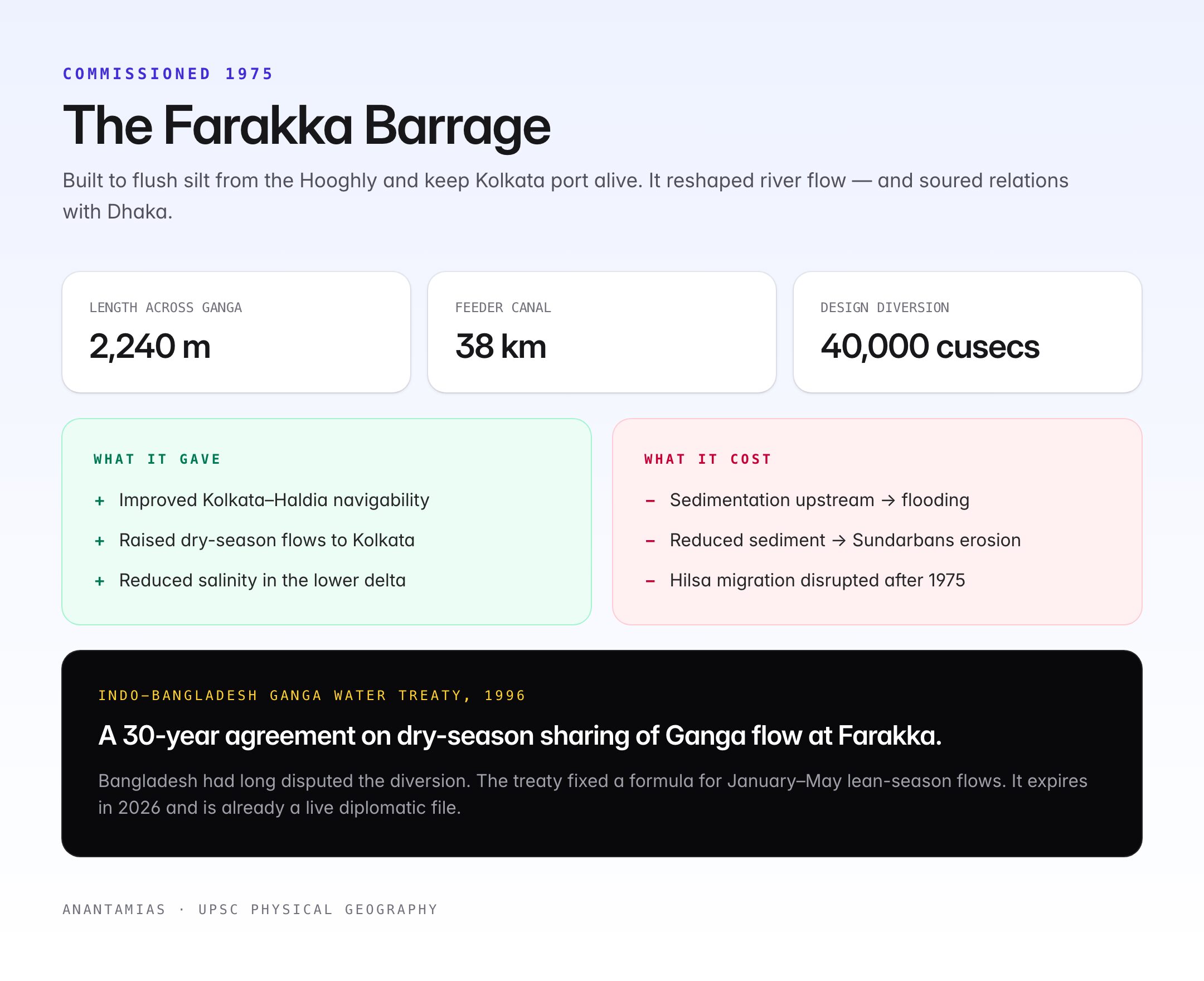
Commissioned in 1975 on the Ganga near Farakka, the Farakka Barrage was built to flush silt from the Bhagirathi-Hooghly system and keep Kolkata port navigable. Key facts:
- Length: ~2,240 m across the Ganga.
- Feeder Canal: 38 km long, carries water from the Ganga to the Bhagirathi.
- Design diversion: Up to 40,000 cusecs to the Hooghly during lean season.
Impact on the Hooghly
- Improved navigability of the Kolkata–Haldia channel.
- Raised dry-season flows and allowed river-based water supply to Kolkata.
- Reduced salinity intrusion in the lower delta.
Consequences and Disputes
- Bangladesh disputes the diversion — resolved by the Indo-Bangladesh Ganga Water Treaty (1996), a 30-year agreement on dry-season sharing.
- Sedimentation upstream of the barrage has raised flood risk in Bihar and Murshidabad.
- Reduced sediment flow to the delta has accelerated erosion of the Sundarbans.
- Fish migration — especially the hilsa — was disrupted; hilsa catches above Farakka fell dramatically after 1975.
Kolkata Port / Syama Prasad Mookerjee Port
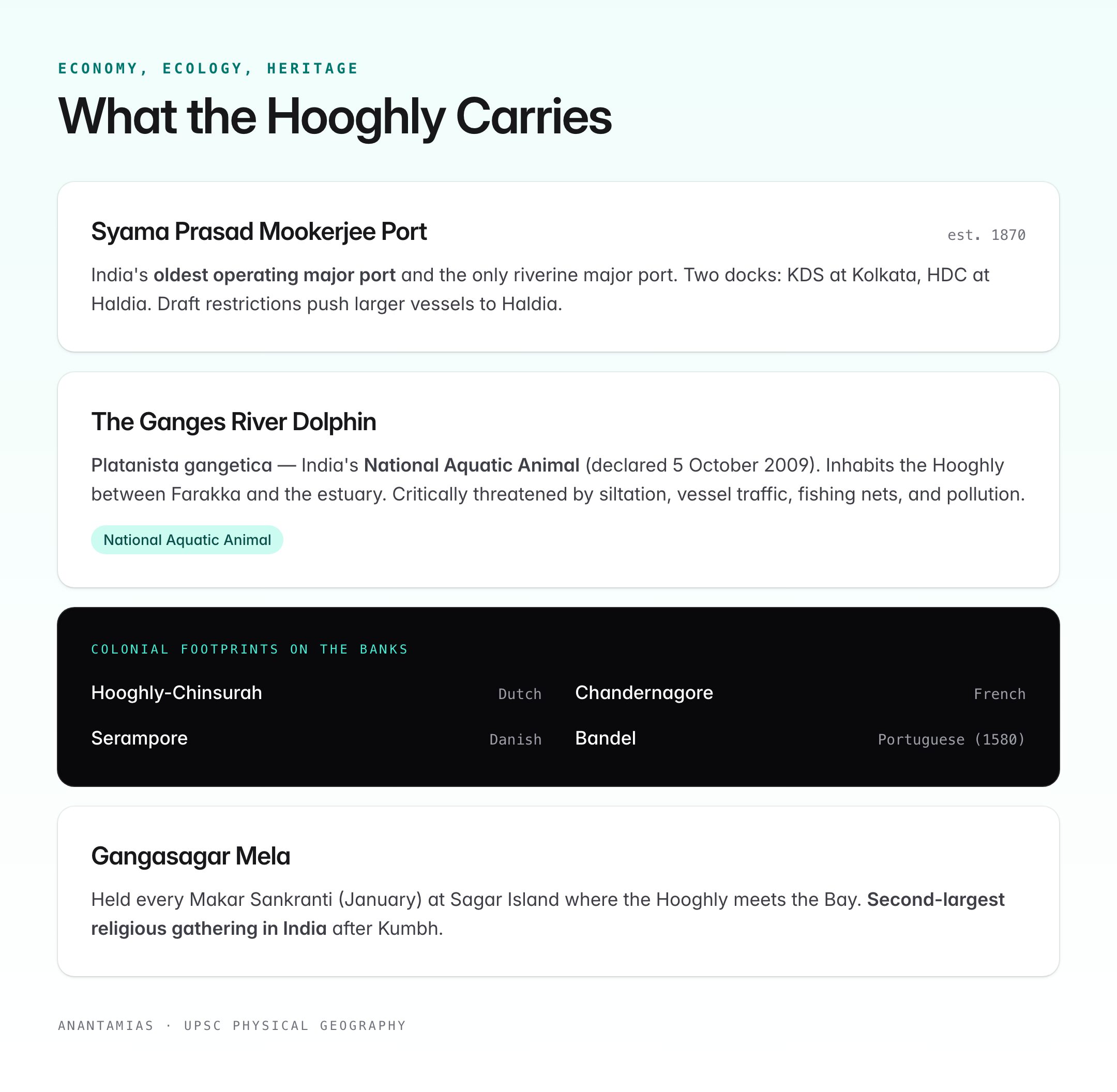
- Established 1870 as Calcutta Port; renamed in 2020.
- India's oldest operating major port and the only riverine major port.
- Two docking systems — Kolkata Dock System (KDS) at Kolkata and Haldia Dock Complex (HDC) at Haldia.
- Handles bulk commodities, tea, jute, containers; challenged by silting of the Hooghly channel.
- Draft restrictions mean Kolkata handles smaller vessels; larger ships use Haldia.
Industrial and Urban Importance
- The Hooghly banks host India's first industrial belt: jute mills, cotton textiles, engineering, chemicals, paper, shipbuilding.
- Supplies drinking water to Kolkata, Howrah, Hooghly and adjoining districts via water-treatment plants at Palta, Garden Reach, and Dhapa.
- Supports fishing livelihoods for ~2 lakh families in the lower delta.
- Bridges: Rabindra Setu (Howrah Bridge, 1943), Vidyasagar Setu (1992), Nivedita Setu (2007), Jubilee Bridge at Bandel, and the Ishwar Gupta Setu at Kalyani.
Ecology: Ganges River Dolphin and More
- The Ganges River Dolphin (Platanista gangetica) — India's National Aquatic Animal (declared 5 October 2009) — inhabits the Hooghly, especially between Farakka and the estuary.
- Critically threatened by siltation, vessel traffic, fishing nets, and pollution.
- Other wildlife: estuarine crocodiles (lower Sundarbans), horseshoe crabs, hilsa, bhetki, prawns.
- Sundarbans Tiger Reserve and Bhagabatpur Crocodile Sanctuary lie in the river's estuary.
Cultural Significance
- Gangasagar Mela at Sagar Island — held every Makar Sankranti (January) where the Hooghly meets the Bay of Bengal. Second largest religious gathering in India after Kumbh.
- Dakshineswar (Ramakrishna Paramahamsa's temple) and Belur Math (Ramakrishna Mission HQ) sit on opposite banks.
- Hooghly-Chinsurah (Dutch), Chandernagore (French), Serampore (Danish), Bandel (Portuguese) — old European settlements line the river.
- Featured in Tagore's writings and the novels of Sharatchandra and Bankim Chandra Chattopadhyay.
Pollution and Conservation
- Namami Gange / National Mission for Clean Ganga covers the Hooghly as part of the Ganga basin.
- Major pollutants: untreated sewage from Kolkata-Howrah, industrial discharge, religious waste (immersion of idols), and dumping from ships.
- Tannery relocation from Tangra to Bantala helped reduce industrial load on the Hooghly's tributaries.
- Ganga Action Plan (1985, Phase I) and Namami Gange (2014) have invested in STPs but coverage remains partial.
Hooghly in the Ganga Delta Context
The Ganga splits into two main branches at Farakka–Pakur:
| Branch | Direction | Outcome |
|---|---|---|
| Padma | Eastward into Bangladesh | Joins Meghna, then Bay of Bengal |
| Bhagirathi-Hooghly | Southward through West Bengal | Reaches Bay at Sagar Island |
Most of the Ganga's flow (and nearly all its sediment) now goes down the Padma. The Bhagirathi-Hooghly is the smaller, engineered arm — kept alive partly by Farakka diversions.
Quick Revision
- System: Bhagirathi-Hooghly, westernmost Ganga distributary.
- Length: ~260 km.
- Key barrage: Farakka (1975).
- Major port: Syama Prasad Mookerjee Port (Kolkata + Haldia).
- Iconic species: Ganges River Dolphin.
- Treaty: Indo-Bangladesh Ganga Water Treaty 1996.
UPSC Relevance
Prelims (GS Paper I): Map-based questions on Bhagirathi-Hooghly, Farakka, Haldia, Sundarbans, and tributaries appear regularly. Questions on the Ganga Water Treaty and the Ganges River Dolphin are recurring.
Mains (GS Paper I — Geography):
- Discuss the Bhagirathi-Hooghly distributary system as a case of deltaic river dynamics and human intervention.
- Evaluate the role of Farakka Barrage in managing the Hooghly and its downstream consequences.
Mains (GS Paper II — International Relations): Indo-Bangladesh Ganga Water Treaty, trans-boundary water sharing, and Hilsa diplomacy.
Mains (GS Paper III — Environment / Economy): Ganga cleaning, riverine ports, Ganges River Dolphin conservation, delta subsidence, and climate-induced sea level rise in the Sundarbans.
Essay: "Rivers and civilisations," "engineering rivers vs working with rivers," and "the cost of keeping a port alive" map cleanly onto the Hooghly.