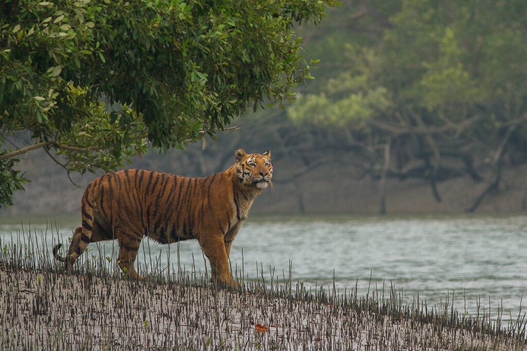
Sundarbans National Park is the Indian portion of the world’s largest contiguous mangrove forest, the only mangrove ecosystem on Earth that supports a sustained population of tigers, and a UNESCO World Heritage Site since 1987. Spread across roughly 1,330 sq km of tidal creeks, mudflats, and Heritiera-dominated estuarine forest at the edge of the Ganges-Brahmaputra-Meghna delta in the South 24 Parganas district of West Bengal, the park is the most ecologically distinctive protected area in India.
The Sundarbans National Park is the core of a much larger conservation landscape. It is the inviolate centre of the Sundarbans Tiger Reserve (notified under Project Tiger in 1973 — making it one of the original nine reserves), and the heart of the Sundarbans Biosphere Reserve declared in 1989. On the eastern side, across the international boundary, lies the larger Bangladesh portion of the Sundarbans, taking the combined cross-border mangrove landscape to roughly 10,000 sq km.
The park’s Royal Bengal Tigers are unique. They swim between islands, hunt in waist-deep saline water, drink brackish water for parts of the year, and have been the subject of repeated behavioural studies for their unusual willingness to enter human habitations. They are the same Panthera tigris tigris as the tigers of central India, but the Sundarbans population has been shaped by an environment that resembles no other tiger habitat on the planet.
Location and Geography of Sundarbans National Park
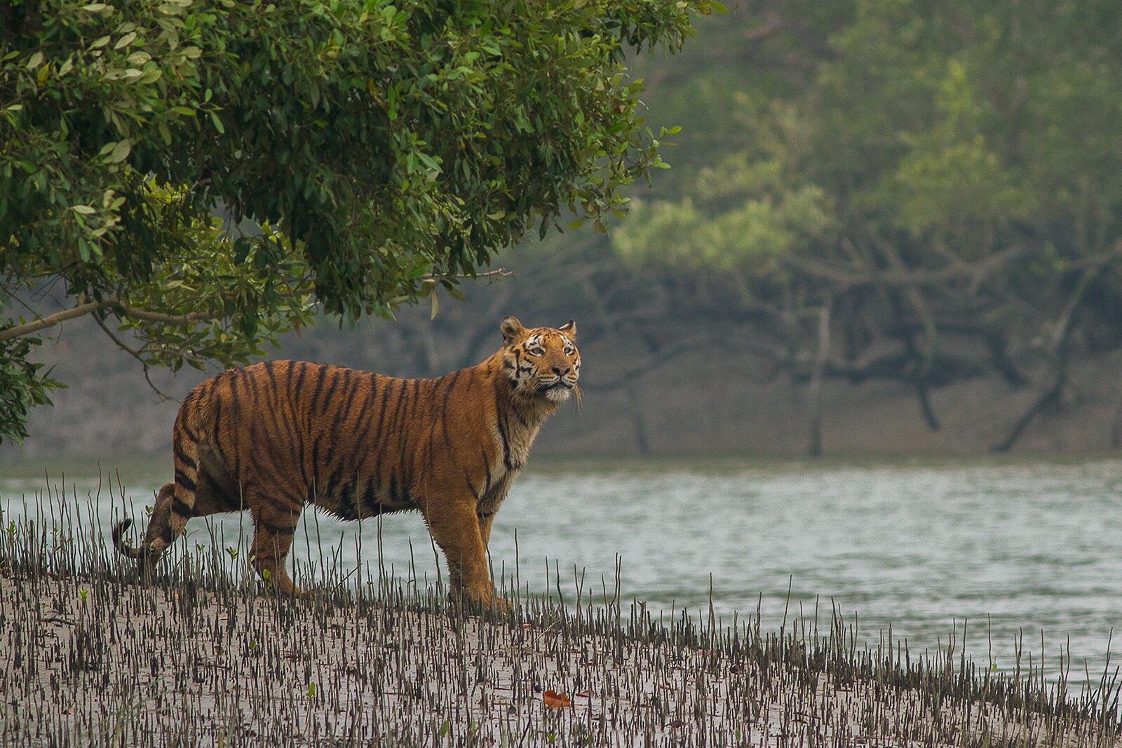
The park is located in the South 24 Parganas district of West Bengal, between the Hooghly river on the west and the Ichamati-Raimangal river on the east, where these rivers braid into the Bay of Bengal. The terrain is a textbook tidal delta — flat, low-lying, intersected by hundreds of creeks (locally called “khals”), and dominated by sediment supplied by the Himalayan headwaters of the Ganga and Brahmaputra.
A Daily Tidal Forest
The defining ecological feature of Sundarbans National Park is the semi-diurnal tide. Twice every 24 hours, brackish water rises by up to 6 metres and inundates large portions of the forest floor. Mangrove species have evolved specialised adaptations — pneumatophores (breathing roots that project above the mud), viviparous seed germination (seeds sprout on the parent tree), and salt-secreting leaves — to survive this rhythm.
Islands, Creeks, and Mudflats
The Indian Sundarbans contains 102 islands, of which 54 are inhabited and 48 lie within the protected reserve area. Sundarbans National Park itself contains no permanent human settlements inside its core, although fishers and honey collectors enter the buffer with permits.
Vegetation: A Mangrove Forest Like No Other
The Sundarbans takes its name from the Sundari tree (Heritiera fomes), the dominant mangrove species in the region, although its share has been declining due to top-dying disease and salinity stress.
Major mangrove species in Sundarbans National Park include:
- Sundari (Heritiera fomes)
- Gewa (Excoecaria agallocha)
- Goran (Ceriops decandra)
- Keora (Sonneratia apetala)
- Bain (Avicennia spp.)
- Garan and Passur
The forest also supports salt-marsh grasses, the climbing palm Phoenix paludosa (hetal), and patches of beach forest on more elevated islands. In total, over 80 plant species have been recorded.
Fauna: Tigers That Swim
Royal Bengal Tiger
The Royal Bengal Tiger of the Sundarbans is the flagship species. The 2022 All-India Tiger Estimation placed the Sundarbans Tiger Reserve population at around 100 individuals. They are smaller and leaner than their central Indian counterparts, with a documented capacity to swim distances exceeding 5 km between islands. They feed on chital, wild boar, rhesus macaque, and aquatic prey including fish and crabs.
Estuarine Crocodile and Aquatic Megafauna
Sundarbans National Park is one of the strongest Indian habitats for the estuarine or saltwater crocodile (Crocodylus porosus). The estuarine waters also support the Endangered Ganges River Dolphin (Platanista gangetica) and the Vulnerable Irrawaddy Dolphin (Orcaella brevirostris). The water-monitor lizard (Varanus salvator) is common.
Other Mammals
The park supports spotted deer (chital), wild boar, rhesus macaque, fishing cat, jungle cat, smooth-coated otter, and small Indian mongoose. Domesticated cattle and goats from buffer villages occasionally enter the park and become prey.
Birds and Reptiles
The Sundarbans is an Important Bird Area with over 300 recorded species. The Masked Finfoot, an extremely rare and globally Endangered waterbird, has been recorded here. The Olive Ridley, Hawksbill, and Green Sea Turtle nest on outer-island beaches. The endemic Northern River Terrapin (Batagur baska) and the Critically Endangered Olive Ridley have ongoing recovery programmes.
Legal Status: A Triple-Layered Protected Area
Sundarbans National Park is one of the most layered protected areas in India. Its full statutory profile includes:
- National Park notified in 1984 (effective; declared 1973 under WLPA framework) under the Wildlife (Protection) Act 1972
- Core of the Sundarbans Tiger Reserve, one of the original Project Tiger sites notified in 1973
- UNESCO World Heritage Site inscribed in 1987 under natural criteria (ix) and (x)
- Sundarbans Biosphere Reserve declared in 1989, included in the UNESCO Man and the Biosphere Programme network in 2001
- Ramsar Site since 2019 — the largest protected wetland in India (see Ramsar Sites of India)
This layered protection is unique among Indian parks and is critical because the Sundarbans is simultaneously a tiger habitat, a wetland, a delta system, and a coastal carbon sink.
Climate Change and Sea-Level Rise: The Defining Threat
If Kaziranga’s defining threat is the intensifying monsoon flood, the Sundarbans’ defining threat is sea-level rise.
Land Loss
Multiple studies — including those by the School of Oceanographic Studies, Jadavpur University and by ISRO satellite assessments — have documented that the Indian Sundarbans has lost over 100 sq km of land area in the last four decades. Some inhabited islands, including Lohachara and large parts of Ghoramara, have either submerged or shrunk drastically.
Salinity Intrusion
Rising sea level and reduced upstream freshwater flow (due to dams and abstractions) have raised salinity across the delta. The Sundari tree is particularly sensitive, and the gradual replacement of Sundari by more salt-tolerant species like Gewa and Keora is changing the forest composition.
Cyclone Intensification
Cyclones Aila (2009), Bulbul (2019), Amphan (2020), and Yaas (2021) caused severe damage to the mangrove forest, embankments, and wildlife. The mangrove itself functions as a storm-surge buffer for the population of West Bengal, making its protection a matter not only of conservation but of disaster mitigation. Sundarbans National Park is the linchpin of that buffer.
Carbon Sink Value
Per hectare, mangroves sequester three to five times more carbon than tropical upland forests, most of it stored in waterlogged sediment (“blue carbon”). The Sundarbans is among the most important blue-carbon ecosystems in Asia.
Human Dimensions
Sundarbans National Park sits within one of the most densely populated rural deltas in the world. The buffer zone of the tiger reserve is home to roughly 4.4 million people, dependent on fishing, honey collection, prawn-seed gathering, and small agriculture.
Tiger-Human Conflict
Sundarbans is one of the few Indian landscapes with a long, documented history of tiger attacks on humans. Honey collectors and fishers entering the forest are particularly vulnerable. Mitigation includes the use of masks worn on the back of the head, nylon-mesh fencing around villages, and ex-gratia compensation schemes.
Livelihood-Conservation Trade-offs
Strict zoning under the tiger reserve framework limits resource extraction inside the core. The challenge is to maintain inviolate space for tigers and dolphins while sustaining millions of dependent livelihoods just outside.
Sundarbans National Park and UPSC
For Civil Services aspirants, Sundarbans is one of the most frequently tested protected areas because it intersects geography, environment, climate change, and disaster management. Key testable points:
- Notification as a national park (1984), UNESCO inscription (1987), Biosphere Reserve (1989), Ramsar Site (2019), Tiger Reserve (1973)
- Largest mangrove forest in the world (combined with Bangladesh)
- Only mangrove forest with a sustained tiger population
- Sundari tree, pneumatophores, viviparous seeds
- Royal Bengal Tiger swimming behaviour
- Sea-level rise, salinity, and cyclone impact
- Blue carbon sequestration
For wider context cross-read Jim Corbett National Park, Kaziranga National Park, Kanha National Park, and biodiversity hotspots of India.
Outlook
Sundarbans National Park is the most physically dynamic of India’s flagship reserves. Its boundary is not a line on a map — it shifts every cyclone season, every full-moon spring tide, and slowly, every decade, as the Bay of Bengal advances. The question for the next twenty years is whether India and Bangladesh together can manage an upstream-water sharing regime, a delta-scale adaptation plan, and a community-centred buffer strategy that lets the Sundarbans persist as a functioning tiger forest. If they can, Sundarbans National Park will remain the most globally distinctive piece of the Indian protected-area network. If they cannot, the loss will be felt far beyond the boundaries of West Bengal.
Frequently Asked Questions
Where is Sundarbans National Park located?
The park is located in the South 24 Parganas district of West Bengal, on the Indian portion of the Ganges-Brahmaputra-Meghna delta. It covers roughly 1,330 sq km and lies between the Hooghly river on the west and the Ichamati-Raimangal river on the east.
What is special about Sundarbans National Park?
It is the world’s largest contiguous mangrove forest (combined with the Bangladesh portion), the only mangrove forest that supports a sustained population of tigers, and one of the most heavily protected ecosystems in India — simultaneously a National Park, Tiger Reserve, Biosphere Reserve, UNESCO World Heritage Site, and Ramsar Site.
When was Sundarbans inscribed as a UNESCO World Heritage Site?
Sundarbans National Park was inscribed as a UNESCO World Heritage Site in 1987 under natural criteria (ix) and (x). It was declared a Biosphere Reserve in 1989, and included in the UNESCO Man and the Biosphere Programme network in 2001.
Why do tigers in the Sundarbans swim?
The Sundarbans is an island system threaded by tidal creeks. Tigers must swim to move between islands, follow prey, and patrol territory. Their swimming ability is well documented, with individuals covering distances of over 5 km. They also drink brackish water and feed partly on aquatic prey.
What is the Sundari tree and why does it matter?
Sundari (Heritiera fomes) is the dominant mangrove species after which the Sundarbans is named. It is sensitive to salinity, and the gradual replacement of Sundari by more salt-tolerant species like Gewa is one of the clearest signals of salinity stress in the delta.
How is climate change affecting Sundarbans National Park?
Sea-level rise, increasing salinity from reduced upstream freshwater flow, and stronger cyclones (Aila 2009, Amphan 2020, Yaas 2021) are reshaping the forest. The Indian Sundarbans has lost over 100 sq km of land in four decades, and some inhabited islands have submerged or shrunk significantly.
Is Sundarbans National Park a Tiger Reserve?
Yes. The park is the inviolate core of the Sundarbans Tiger Reserve, which was one of the original nine tiger reserves notified under Project Tiger in 1973. The 2022 All-India Tiger Estimation recorded around 100 tigers in the reserve.
How many people live around Sundarbans National Park?
The buffer zone of the tiger reserve supports a population of roughly 4.4 million people, primarily dependent on fishing, honey collection, prawn-seed gathering, and agriculture. Tiger-human conflict is a long-standing concern, and mitigation includes nylon-mesh fencing, masks, and ex-gratia schemes.
Tell Google you want more of this.
Add Anantam IAS as a preferred sourceOne tap, and this site shows up more often in your own Top Stories, AI Overviews and AI Mode. Remove it any time.