Chambal River — Course, Dams, Wildlife Sanctuary, and UPSC Notes
Complete UPSC guide to the Chambal River — origin, course through MP/Rajasthan/UP, major dams, National Chambal Sanctuary, gharial conservation, and ravine geography.
The Chambal River is one of the most ecologically significant rivers of central India and is widely regarded as the cleanest river in North India. A major tributary of the Yamuna River, the Chambal flows through Madhya Pradesh, Rajasthan, and Uttar Pradesh, carving deep ravines through the landscape and supporting a unique ecosystem that includes critically endangered species like the gharial, the Ganges river dolphin, and the red-crowned roof turtle. The river's relative freedom from industrial pollution — a legacy of its historically remote, "dacoit-infested" ravine terrain — makes it an ecological anomaly in the otherwise polluted Gangetic basin.
For UPSC, the Chambal is important in Geography (GS1) for river systems and drainage patterns, in Environment (GS3) for wildlife conservation, and as a case study in clean river ecosystems.
Origin and Course
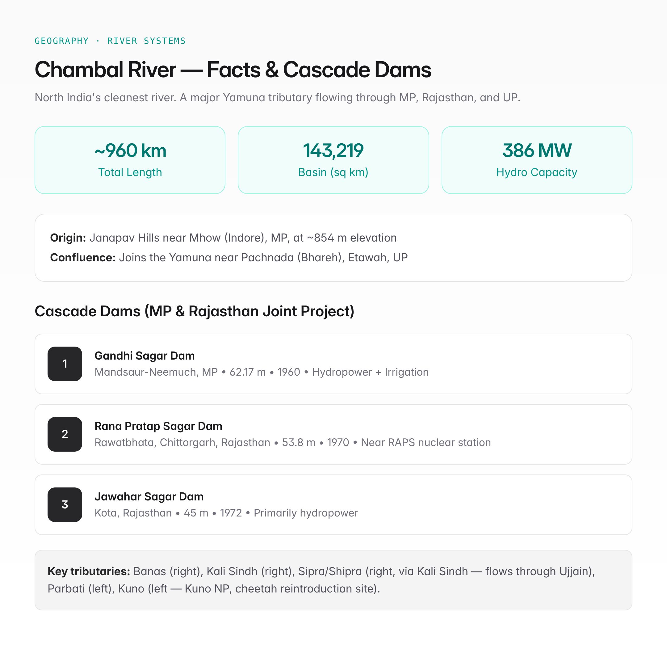
| Feature | Detail |
|---|---|
| Origin | Janapav Hills (also called Janapao), near Mhow/Indore, Madhya Pradesh, at an elevation of ~854 m |
| Total length | ~960 km |
| States traversed | Madhya Pradesh, Rajasthan, Uttar Pradesh |
| Final confluence | Joins the Yamuna River near Pachnada (Bhareh) in Etawah district, UP |
| Drainage basin | ~143,219 sq km |
| Direction of flow | North-northeastward from the Vindhyan Plateau into the Indo-Gangetic Plain |
Detailed Course
- Madhya Pradesh (origin to Chaurasigarh): Rises on the northern slope of the Vindhyan Range; flows northward through Mandsaur, Ratlam, and Neemuch districts
- Rajasthan (entry near Chaurasigarh): Flows through Chittorgarh, Kota, Bundi, Sawai Madhopur, Karauli, and Dholpur districts; the three major dams are located in this stretch
- Rajasthan-UP border: The river forms the boundary between Rajasthan (Dholpur) and Uttar Pradesh (Agra/Etawah) for a significant stretch
- Uttar Pradesh: Joins the Yamuna near Pachnada in Etawah district
Major Dams on the Chambal
The Chambal Valley Development Project, a joint venture of Madhya Pradesh and Rajasthan, includes three major dams built in cascade:
| Dam | Location | Year Completed | Height | Purpose |
|---|---|---|---|---|
| Gandhi Sagar Dam | Mandsaur-Neemuch border, MP | 1960 | 62.17 m | Hydropower + irrigation |
| Rana Pratap Sagar Dam | Rawatbhata, Chittorgarh, Rajasthan | 1970 | 53.8 m | Hydropower + irrigation |
| Jawahar Sagar Dam | Kota, Rajasthan | 1972 | 45 m | Hydropower (primarily) |
Key facts about the cascade:
- The three dams together generate about 386 MW of hydroelectricity
- Irrigation benefits cover parts of both Rajasthan and Madhya Pradesh
- The Kota Barrage (downstream of Jawahar Sagar) diverts water into canal systems for irrigation in Kota, Bundi, and Baran districts
- The Rajasthan Atomic Power Station (RAPS) at Rawatbhata, near Rana Pratap Sagar Dam, uses water from the reservoir for cooling
Major Tributaries
| Tributary | Bank | Key Feature |
|---|---|---|
| Banas | Right | Longest river flowing entirely within Rajasthan; Bisalpur Dam is on this tributary |
| Kali Sindh | Right | Flows through Jhalawar and joins near Nonera |
| Sipra (Shipra) | Right | Flows through Ujjain (site of Kumbh Mela); joins the Chambal via the Kali Sindh |
| Parbati | Left | Major tributary from MP; joins in Rajasthan |
| Mej | Right | Joins near Bundi |
| Kuno | Left | Kuno National Park (home to cheetahs reintroduced from Africa) lies in the Kuno basin |
National Chambal Sanctuary
The National Chambal Sanctuary (also called the National Chambal Gharial Wildlife Sanctuary) is a tri-state protected area along the Chambal River:
| Feature | Detail |
|---|---|
| Established | 1979 |
| States covered | Madhya Pradesh, Rajasthan, Uttar Pradesh |
| Total length along river | ~425 km (from Jawahar Sagar Dam to Pachnada confluence) |
| Total area | ~5,400 sq km (including buffer zone) |
| Primary purpose | Conservation of the gharial (Gavialis gangeticus) |
Key Species
| Species | IUCN Status | Significance |
|---|---|---|
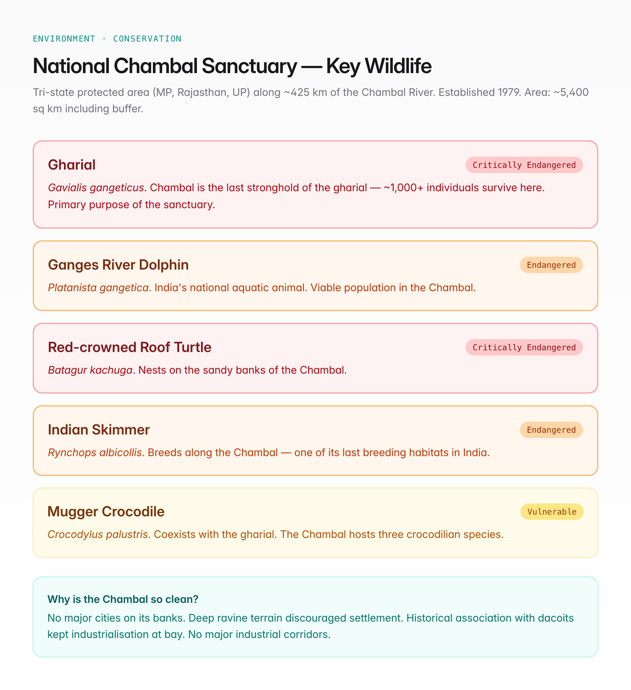
| Gharial (Gavialis gangeticus) | Critically Endangered | Chambal is the last stronghold of the gharial; ~1,000+ individuals survive here |
| Ganges River Dolphin (Platanista gangetica) | Endangered | India's national aquatic animal; viable population in Chambal |
| Red-crowned Roof Turtle (Batagur kachuga) | Critically Endangered | Nests on Chambal's sandy banks |
| Indian Skimmer (Rynchops albicollis) | Endangered | Breeds along the Chambal — one of its last breeding habitats |
| Mugger Crocodile (Crocodylus palustris) | Vulnerable | Coexists with the gharial in the sanctuary |
The Chambal is one of the few rivers in India where three species of crocodilians (gharial, mugger, and occasionally saltwater crocodile) have been reported.
Why the Chambal Is India's Cleanest Major River
Several factors contribute to the Chambal's exceptional water quality:
- No major cities: Unlike the Ganga or Yamuna, no large city sits directly on the Chambal's banks. Kota is the largest town, and its pollution impact is limited
- Ravine terrain: The deep ravines flanking the river discouraged settlement and industrialisation for centuries
- Limited irrigation diversion: While the cascade dams exist, the downstream river still maintains significant flow
- Superstition and banditry: The Chambal ravines were historically associated with dacoits (Phoolan Devi, Man Singh) — this kept development and human encroachment at bay
- No major industrial corridors: The river passes through predominantly agricultural and forested areas
Chambal Ravines
The Chambal ravines (also called badlands) are one of India's most distinctive geomorphological features:
- Formed by erosion of alluvial soil along the Chambal and its tributaries
- Cover approximately 6,000 sq km across MP, Rajasthan, and UP
- Ravine depth can exceed 50 metres in some areas
- Formed due to: loose alluvial soil, seasonal torrential rainfall, deforestation, and lack of vegetation cover
- Ravine reclamation programmes have been ongoing since the 1960s, involving contour bunding, check dams, afforestation, and resettlement
- The ravines remain a security challenge (historically harboured armed gangs) and an environmental concern (severe soil erosion)
UPSC Relevance
GS Paper I: Geography — Indian river systems, tributaries of the Yamuna/Ganga, drainage patterns, geomorphology (ravines/badlands).
GS Paper III: Environment — Gharial conservation, National Chambal Sanctuary, clean river ecosystem, biodiversity hotspots.
Key Points for Prelims
- The Chambal originates at Janapav Hills near Mhow (Indore), Madhya Pradesh
- It is a tributary of the Yamuna River (joins near Etawah, UP)
- Total length: ~960 km; flows through MP, Rajasthan, and UP
- Three cascade dams: Gandhi Sagar (MP), Rana Pratap Sagar (Rajasthan), Jawahar Sagar (Rajasthan)
- Banas and Kali Sindh are major tributaries
- National Chambal Sanctuary (est. 1979) is a tri-state sanctuary protecting the gharial (Critically Endangered)
- The Chambal is considered the cleanest river in North India
- Chambal ravines are a major example of badland topography in India
- The RAPS nuclear power station at Rawatbhata is near Rana Pratap Sagar Dam
- Kuno River (a Chambal tributary) gives its name to Kuno National Park (cheetah reintroduction site)