

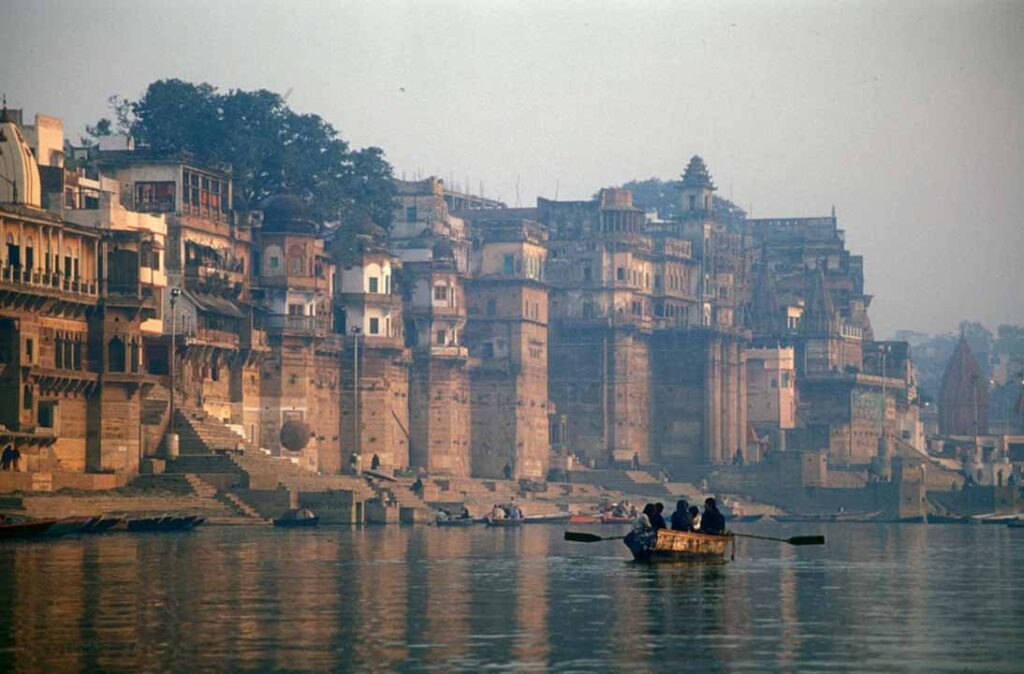
The tributaries of Ganga are the network of rivers that feed water into the main Ganga stem between its source at Gangotri Glacier and its delta at the Bay of Bengal. The Ganga river system drains about 1.08 million square kilometres in India, roughly a quarter of the country’s land area, and supports over 400 million people. The major tributaries of Ganga fall into two clear categories: left bank tributaries (Yamuna, Ramganga, Gomti, Ghaghara, Gandak, Burhi Gandak, Kosi, Mahananda) that descend from the Himalayas across the northern plain, and right bank tributaries (Son, Damodar, Punpun, Tons) that rise on the peninsular plateau.
For UPSC, the tributaries of Ganga are tested through prelims facts (origin, confluence, longest tributary), mains questions (Himalayan vs peninsular regime, flooding behaviour, hydro projects, interstate disputes), and current-affairs angles (Namami Gange, Inland Waterway 1, Farakka issue). This article covers each major tributary in turn.
The Ganga River in Brief
The Ganga begins as the Bhagirathi at the Gangotri Glacier in Uttarakhand. At Devprayag it meets the Alaknanda and becomes the Ganga. It flows through Uttarakhand, Uttar Pradesh, Bihar, Jharkhand, and West Bengal, finally dividing into the Hooghly (which empties through Kolkata) and the Padma (which crosses into Bangladesh and joins the Brahmaputra before emptying as the Meghna). The main Ganga stem is about 2,525 kilometres long. It receives water from all the major rivers of the northern plain and from large rivers of the Chhotanagpur plateau in the south.
The Ganga is the second-largest river of India by drainage area (after the Indus including its Pakistani portion) and by length within India. It is the longest river entirely within India.
Left Bank Tributaries of Ganga
The left bank tributaries are Himalayan rivers. They are snow-fed and glacier-fed in their upper reaches, so they carry water through summer and right through the monsoon. They are perennial. They contribute the bulk of the Ganga’s water.
Yamuna
The Yamuna is the longest tributary of the Ganga and arguably the most important by economy and population.
- Origin: Yamunotri Glacier on the Bandarpunch peak in Uttarakhand
- Length: about 1,376 kilometres
- States: Uttarakhand, Himachal Pradesh, Haryana, Delhi, Uttar Pradesh
- Confluence with Ganga: Allahabad (Prayagraj), the Triveni Sangam
- Major tributaries of Yamuna: Tons, Chambal, Sind, Betwa, Ken (these are peninsular tributaries of Yamuna, which therefore brings peninsular water into the Ganga system)
- Major cities: Yamunanagar, Delhi, Mathura, Agra, Allahabad
The Yamuna is unusual because, although a Himalayan river itself, several of its largest tributaries (Chambal, Betwa, Ken, Sind) are peninsular. This makes the Yamuna basin the connecting link between Himalayan and peninsular hydrology.
Ramganga
- Origin: Dudhatoli range in Uttarakhand
- Length: about 596 kilometres
- States: Uttarakhand, Uttar Pradesh
- Confluence with Ganga: near Kannauj
- Notable feature: the Ramganga river flows through the Jim Corbett National Park
Gomti
The Gomti is unusual among left bank tributaries because it is not a snow-fed Himalayan river. It rises on the foothills, not the high Himalaya.
- Origin: Gomat Taal (Fulhar Jheel) in Pilibhit, Uttar Pradesh
- Length: about 900 kilometres
- States: Uttar Pradesh entirely
- Confluence with Ganga: near Kaithi in Ghazipur district
- Major city: Lucknow
Ghaghara (Karnali)
The Ghaghara, also called the Karnali in Nepal and the Saryu in some Indian sections, is the largest tributary of the Ganga by water volume.
- Origin: Mapchachungo Glacier near Mansarovar in Tibet
- Length: about 1,080 kilometres (about 507 km in India)
- States: Uttarakhand, Uttar Pradesh, Bihar
- Confluence with Ganga: at Doriganj near Chhapra in Bihar
- Major tributaries of Ghaghara: Sarda (Mahakali), Rapti, Sharda
The Ghaghara is the Ganga tributary with the greatest discharge. It is also one of the most flood-prone rivers in India.
Gandak
- Origin: Nepal, near the Tibet border in the Mustang region
- Length: about 814 kilometres
- States: Bihar (in India), passes through Nepal
- Confluence with Ganga: at Hajipur, opposite Patna
- Major tributary: Burhi Gandak (which itself joins the Ganga separately further downstream)
In Nepal the Gandak is called the Narayani and is fed by several smaller rivers including the Trishuli, Marsyangdi, and Kali Gandaki.
Burhi Gandak
- Origin: Someshwar hills in West Champaran, Bihar
- Length: about 320 kilometres
- States: Bihar
- Confluence with Ganga: near Khagaria
- Note: a separate river from the Gandak proper, although both rise close to one another
Kosi (Saptkoshi)
The Kosi is the most flood-prone tributary of the Ganga and is famously called the “Sorrow of Bihar”.
- Origin: Saptakoshi catchment in Nepal and Tibet, formed by the confluence of seven streams including the Sun Kosi, Tama Kosi, Arun, Bhote Kosi
- Length: about 720 kilometres
- States: Bihar (in India)
- Confluence with Ganga: at Kursela in Katihar district of Bihar
- Notable feature: the Kosi has shifted its course westward by about 120 kilometres over the last 250 years, causing major floods
Mahananda
- Origin: Mahaldiram hills near Kurseong in the Darjeeling Himalaya
- Length: about 360 kilometres
- States: West Bengal, Bihar, and lower Bangladesh
- Confluence with Ganga: near Manihari in Bihar (some sources say in Bangladesh after Farakka)
Right Bank Tributaries of Ganga
The right bank tributaries rise on the Chhotanagpur plateau and the central Indian peninsular highlands. They are rain-fed, with strongly seasonal flow. They are typically perennial in the lower courses but reduce dramatically in summer.
Son
The Son is the largest peninsular tributary of the Ganga.
- Origin: Amarkantak plateau in Madhya Pradesh
- Length: about 784 kilometres
- States: Madhya Pradesh, Uttar Pradesh, Jharkhand, Bihar
- Confluence with Ganga: at Maner in Patna district, Bihar
- Notable feature: the Son rises only a few kilometres from the Narmada source at Amarkantak but flows in the opposite direction
Damodar
The Damodar is historically called the “Sorrow of Bengal” because of its severe flooding, although the Damodar Valley Corporation has reduced the flood impact since the 1950s.
- Origin: Chhotanagpur plateau in Palamu district, Jharkhand
- Length: about 592 kilometres
- States: Jharkhand, West Bengal
- Confluence: joins the Hooghly (a Ganga distributary) about 50 kilometres south of Kolkata
- Notable: home to the Damodar Valley Corporation, India’s first multipurpose river valley project, modelled on the Tennessee Valley Authority
Punpun
- Origin: Palamu district, Jharkhand
- Length: about 235 kilometres
- States: Jharkhand, Bihar
- Confluence with Ganga: near Fatuha in Patna district
Tons (Tamasa)
There are two rivers called Tons in the Ganga system. The peninsular Tons (or Tamasa) is a right bank tributary.
- Origin: Maihar in Madhya Pradesh
- Length: about 265 kilometres
- States: Madhya Pradesh, Uttar Pradesh
- Confluence with Ganga: at Sirsa in Allahabad district
The other Tons is a Himalayan river that joins the Yamuna in Uttarakhand and is not a direct tributary of the Ganga.
Tributaries of Ganga: Comparative Table
| Tributary | Bank | Origin | Length (km) | Confluence |
|---|---|---|---|---|
| Yamuna | Left | Yamunotri Glacier, Uttarakhand | 1,376 | Allahabad |
| Ghaghara | Left | Mapchachungo Glacier, Tibet | 1,080 | Doriganj, Bihar |
| Gomti | Left | Pilibhit, UP | 900 | Kaithi, UP |
| Gandak | Left | Mustang, Nepal | 814 | Hajipur, Bihar |
| Kosi | Left | Nepal/Tibet | 720 | Kursela, Bihar |
| Ramganga | Left | Dudhatoli, Uttarakhand | 596 | Kannauj |
| Mahananda | Left | Darjeeling Himalaya | 360 | Manihari, Bihar |
| Son | Right | Amarkantak, MP | 784 | Maner, Patna |
| Damodar | Right | Palamu, Jharkhand | 592 | Hooghly, near Kolkata |
| Tons (Tamasa) | Right | Maihar, MP | 265 | Sirsa, UP |
| Punpun | Right | Palamu, Jharkhand | 235 | Fatuha, Patna |
Himalayan vs Peninsular Tributaries
The contrast between left bank (Himalayan) and right bank (peninsular) tributaries is the single most important conceptual point for UPSC.
| Feature | Left bank (Himalayan) | Right bank (Peninsular) |
|---|---|---|
| Source | Glaciers and high Himalaya | Plateau and central highlands |
| Regime | Perennial, snow-fed and rain-fed | Mostly rain-fed, seasonal |
| Sediment load | Very high (young mountains) | Lower (old, stable rocks) |
| Course | Winding, shifting (especially Kosi) | Generally stable |
| Floods | Severe (Kosi, Ghaghara, Brahmaputra) | Localised (Damodar historically) |
| Hydropower potential | High, several big dams in upper reaches | Moderate, mostly low-head dams |
| Examples | Yamuna, Ghaghara, Kosi, Gandak | Son, Damodar, Tons, Punpun |
Largest, Longest, Most Important: Quick Distinctions
UPSC has asked these specifically in past prelims.
- Longest tributary of Ganga: Yamuna (about 1,376 km)
- Largest tributary by discharge: Ghaghara
- Largest peninsular tributary: Son
- Most flood-prone tributary: Kosi
- Tributary with non-glacial Himalayan origin: Gomti
- Tributary whose tributaries are themselves peninsular: Yamuna (Chambal, Betwa, Ken)
Ganga Tributaries and Major Hydro Projects
Each major tributary supports significant hydro and irrigation infrastructure.
- Yamuna: Tajewala headworks, Wazirabad barrage; the Chambal has the Gandhi Sagar, Rana Pratap Sagar, Jawahar Sagar dams
- Ghaghara: Girijapuri barrage
- Gandak: Valmiki barrage on the India-Nepal border
- Kosi: Kosi barrage at Bhimnagar on the India-Nepal border
- Son: Bansagar dam in Madhya Pradesh, Rihand dam on its tributary the Rihand
- Damodar: Tilaiya, Maithon, Panchet, Konar dams under the Damodar Valley Corporation
- Mahananda: Mahananda barrage in West Bengal
Pollution and the Namami Gange Programme
The Ganga and its tributaries are among the most heavily polluted river systems in India. Industrial effluents from the Kanpur tannery belt, sewage from major cities along the Yamuna, agricultural runoff in the Bihar plains, and religious mass-gathering loads all contribute. The Namami Gange Programme, launched in 2014 with a budget that has grown to over Rs 40,000 crore, targets sewage infrastructure, riverfront development, biodiversity conservation, afforestation, and industrial effluent monitoring across the Ganga basin including the major tributaries.
The Yamuna, despite being the longest tributary, is regarded as the most heavily polluted stretch in the Ganga system, particularly between Wazirabad in Delhi and Etawah in Uttar Pradesh.
Tributaries of Ganga in the UPSC Syllabus
The tributaries of Ganga appear in GS-1 Geography under Indian drainage systems, in GS-3 Environment under river pollution and conservation, and in current affairs under Namami Gange, inland waterways (NW-1 from Haldia to Varanasi), and interstate water disputes. Prelims questions tend to focus on:
- Source and confluence of each major tributary
- Distinguishing left and right bank tributaries
- Length comparison and which is longest/largest
- States traversed
- Major dams and barrages on each
- Cities located on each tributary
Mains Practice Questions
- Compare and contrast the Himalayan and peninsular tributaries of the Ganga with reference to their hydrological regime, sediment load, and flood behaviour. (15 marks)
- Examine the role of the Yamuna and its peninsular tributaries in the Ganga basin’s water budget. (10 marks)
- The Kosi is called the Sorrow of Bihar. Discuss the geomorphic and hydrological reasons for its flooding behaviour and evaluate the measures taken to control it. (15 marks)
- Assess the achievements and limitations of the Namami Gange Programme in the context of the larger Ganga tributary system. (15 marks)
Why Tributaries of Ganga Matter
The tributaries of Ganga are not a list to memorise. They are the structural skeleton of India’s most populous river basin, and each one carries with it a distinct geography, hydrology, and history. The Yamuna carries peninsular water into the Ganga. The Ghaghara carries the highest discharge. The Kosi carries flood disasters. The Son carries the southern Vindhyan and Satpura runoff. The Damodar carries the industrial story of Indian planning. For UPSC, fluency with these eleven major tributaries is the difference between a vague answer and a precise one in any question about the Ganga basin.
Frequently Asked Questions
Which is the longest tributary of the Ganga?
The Yamuna is the longest tributary of the Ganga, at about 1,376 kilometres. It rises at the Yamunotri Glacier in Uttarakhand and joins the Ganga at the Triveni Sangam in Allahabad (Prayagraj).
Which is the largest tributary of the Ganga by water volume?
The Ghaghara (Karnali) is the largest tributary of the Ganga by discharge. It rises near Mansarovar in Tibet and joins the Ganga at Doriganj in Bihar.
How many major tributaries does the Ganga have?
The Ganga has about eleven major tributaries: Yamuna, Ramganga, Gomti, Ghaghara, Gandak, Burhi Gandak, Kosi, Mahananda on the left bank; Son, Damodar, Punpun, and Tons on the right bank. Many more minor streams join the system.
Which tributaries are on the left bank of the Ganga?
The major left bank tributaries are Yamuna, Ramganga, Gomti, Ghaghara, Gandak, Burhi Gandak, Kosi, and Mahananda. All are Himalayan in origin except the Gomti, which rises in the foothills of Pilibhit.
Which tributaries are on the right bank of the Ganga?
The major right bank tributaries are Son, Damodar, Punpun, and Tons (Tamasa). All are peninsular rivers that rise on the Chhotanagpur plateau or the central Indian highlands.
Why is the Kosi called the Sorrow of Bihar?
The Kosi carries an extremely heavy sediment load from the young Himalayas and frequently changes its course across the flat Bihar plain. It has shifted westward by about 120 kilometres over the past 250 years. The resulting floods cause heavy loss of life, livestock, and crops in north Bihar.
Which is the largest peninsular tributary of the Ganga?
The Son is the largest peninsular tributary of the Ganga. It rises at Amarkantak in Madhya Pradesh, only a few kilometres from the source of the Narmada, and joins the Ganga at Maner in Bihar. The Son is about 784 kilometres long.
Which tributary of the Ganga is most polluted?
The Yamuna, particularly the Delhi-Etawah stretch, is widely considered the most polluted tributary of the Ganga. The combination of municipal sewage from Delhi, low summer flows, and limited dilution makes it critical to the Namami Gange Programme.
Tell Google you want more of this.
Add Anantam IAS as a preferred sourceOne tap, and this site shows up more often in your own Top Stories, AI Overviews and AI Mode. Remove it any time.






