CAQM Drone Monitoring: Closing the stubble-burning detection gap
Why in News?
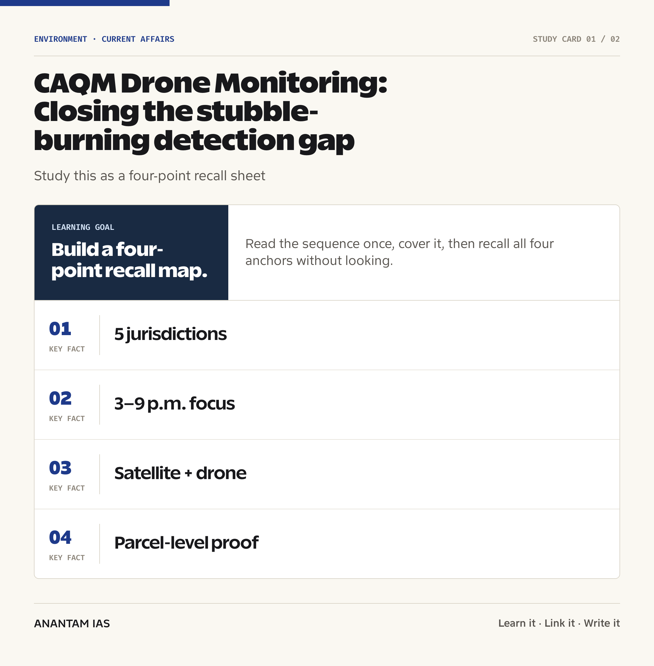
The Commission for Air Quality Management has urged the governments of Delhi, Haryana, Punjab, Uttar Pradesh and Rajasthan to use drone surveillance for monitoring paddy-stubble fires. The Hindu reported the advice on July 30, 2026, ahead of the paddy-harvest season.
The proposed flights would focus on hotspot villages and fire-prone paddy areas, especially from 3 p.m. to 9 p.m. This is the period in which deliberate late burning can be timed to reduce the chance of detection during a satellite overpass.
- Unmanned aerial vehicles can be deployed quickly and can capture high-resolution, near-real-time views below cloud or smoke conditions that may complicate wide-area observation.
- Drone imagery can locate active fires, identify smoke plumes, outline affected fields and create time-stamped visual evidence for field verification.
- States were advised to prepare advance flight plans, estimate the required number of sorties and prioritise historically fire-prone locations.
- Detected incidents should be overlaid on cadastral maps, which show land-parcel boundaries, so officials can identify the affected field more precisely.
- All flights must comply with the Drone Rules, 2021; an environmental objective does not remove aviation-safety and airspace obligations.
The development matters in the context of:
- This matters in the context of a known temporal detection gap: satellites offer broad, repeatable coverage, but they do not watch every field continuously.
- It also tests whether environmental technology can strengthen cooperative federalism without reducing crop-residue policy to punishment alone.
- For background on residue-based alternatives, see bio-bitumen from farm residue and compressed biogas and energy security.
UPSC Relevance
Prelims Relevance
- CAQM is a statutory body under the Commission for Air Quality Management in National Capital Region and Adjoining Areas Act, 2021.
- Section 12 empowers CAQM to coordinate action by Delhi, Punjab, Haryana, Rajasthan and Uttar Pradesh and to issue written directions that authorities must follow.
- CAQM’s territorial remit covers the National Capital Region and adjoining areas insofar as their pollution affects NCR air quality.
- The standard protocol for estimating crop-residue fire events was developed by ISRO with State Remote Sensing Centres and the Indian Agricultural Research Institute, and was issued by CAQM in August 2021.
- IARI’s CREAMS Laboratory publishes daily crop-fire event data using the satellite-based protocol.
- A satellite identifies an active-fire location during an overpass; burn-scar assessment uses suitable imagery to estimate the land area affected after burning.
- A cadastral map records parcel boundaries and supports field-level attribution; it is different from a general topographic or administrative map.
- The Drone Rules, 2021 govern civilian drone operations, including registration, airspace permissions and operational safety.
- Direction No. 99 of 2026 requires Punjab, Haryana and Uttar Pradesh to implement state action plans aimed at complete elimination of paddy-stubble burning in 2026.
Mains Relevance
GS Paper 3
- Technology for air-pollution monitoring, crop-residue management, remote sensing and evidence-based environmental enforcement.
- Trade-offs between in-situ management, ex-situ straw use, crop diversification, farm economics and deterrent action.
- The difference between counting detected fires and measuring their actual contribution to ambient air quality under changing weather.
GS Paper 2
- CAQM as an example of inter-State environmental governance for a pollution airshed that does not follow political boundaries.
- Accountable use of drones: lawful operations, transparent protocols, parcel-level evidence, grievance redress and protection against arbitrary enforcement.
Essay
- Technology can make the State more observant, but durable compliance depends on making the cleaner choice economically workable.
- Air is a shared commons: local farm decisions and regional meteorology create costs across administrative borders.
Background and Context
Why satellites need a ground-level complement
Satellite monitoring remains the regional backbone, while drones fill a narrower spatial and temporal gap.
- Wide-area strength: satellites scan large agricultural regions through a standard, comparable protocol and enable daily reporting across States.
- Overpass constraint: a satellite observes a location at particular times; a fire lit and extinguished between usable observations may escape an active-fire count.
- Drone advantage: district teams can send a UAV to a priority cluster, alter its flight path and gather closer imagery during the higher-risk evening period.
- Complement, not replacement: satellite alerts help allocate scarce sorties; drones refine location; ground officers confirm the incident and initiate lawful action.
- Burn scars: later imagery can show that residue was burnt even where an active flame was missed, but verification still matters because spectral signatures can be misread.
The proposed detection-to-action chain
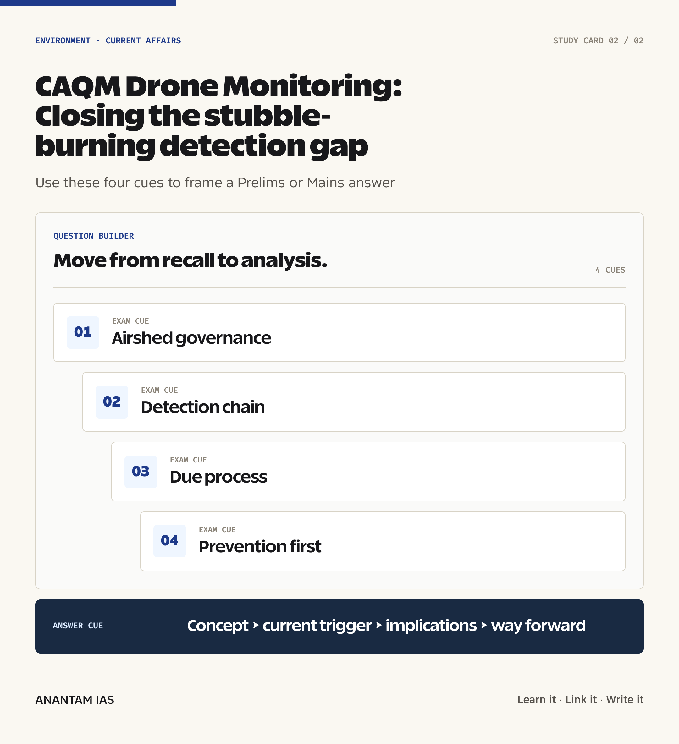
The governance value lies in linking an observation to a verified field response, not in collecting more images.
- Prioritise: combine historical fire data, harvesting progress and district hotspot lists to select villages and flight windows.
- Observe: use a planned sortie to record fire, smoke, coordinates and a reliable timestamp while respecting notified airspace restrictions.
- Attribute: overlay the coordinates on a cadastral map to identify the land parcel; do not treat automated matching as final proof.
- Verify: send a trained field team or designated nodal officer to establish what was burnt, by whom and under what circumstances.
- Respond: record evidence, facilitate residue-management support where needed, and apply compensation or other enforcement only under the applicable legal process.
- Learn: feed confirmed outcomes back into the district dashboard so a false alert, repeat hotspot or machinery gap changes the next intervention.
CAQM's statutory and federal role
CAQM was designed for an airshed problem in which emissions and administrative responsibility cross borders.
- Under the CAQM Act, 2021, the Commission coordinates pollution-control action among Delhi and the relevant adjoining States.
- Section 12 allows it to take measures, seek information, prepare guidelines and issue binding written directions for protecting NCR air quality.
- Direction No. 99, approved in May 2026, asks Punjab, Haryana and Uttar Pradesh to carry out their paddy-residue action plans with a target of complete elimination.
- The Direction calls for farm-level mapping of the planned residue-management route, specific nodal officers, updated inventories of crop-residue management machinery and district-wise real-time dashboards.
- Drone monitoring extends this architecture to Delhi and Rajasthan as well because smoke movement and pollution control require an airshed approach, even where the intensity of paddy burning differs.
- Students should separate CAQM from the Central Pollution Control Board: CAQM is the regional coordinating commission; CPCB remains the national pollution-control board and can support field monitoring.
What the official data establish
Verified fire counts show major improvement, but a lower count should be interpreted with care.
- PIB reported that Punjab recorded 5,114 fire counts during the 2025 paddy season, 53% below 2024.
- Haryana recorded 662 fire counts in the same season, also 53% below 2024.
- The government attributes the decline to State and district action plans, machinery deployment, enforcement, awareness and greater ex-situ use of straw.
- Official monitoring for the 2025 season included 31 CPCB flying squads across 18 Punjab districts and 13 Haryana districts during October-November; they supplied daily updates, photographs and compliance status.
- A fire count is a detected event, not a direct measure of emissions, burnt area or the percentage contribution of stubble smoke to Delhi’s daily pollution.
- Meteorology, other emission sources and detection conditions affect the observed relationship between farm fires and Delhi’s winter air pollution.
Prevention must remain larger than surveillance
Farmers burn residue mainly because the harvest-to-sowing window is short and alternatives can carry access, timing and transport costs.
- In-situ options manage straw within the field through suitable machinery and agronomic practices, reducing transport needs.
- Ex-situ options turn straw into feedstock for biomass energy, industrial boilers, bio-ethanol, compressed biogas, pellets, briquettes, packaging or other products.
- Custom Hiring Centres can widen machinery access; Direction No. 99 calls for rent-free CRM machinery for small and marginal farmers through these centres.
- Crop diversification and shorter-duration paddy varieties can reduce both residue pressure and the time conflict before wheat sowing.
- A credible system should first diagnose whether a hotspot reflects missing machinery, poor repair support, weak straw markets, delayed harvesting or deliberate evasion.
- Surveillance deters only when farmers also see a timely, affordable and reliable non-burning pathway.
Risks and safeguards in drone-based enforcement
High-resolution monitoring improves precision only when its operating and evidentiary rules are equally precise.
- False attribution: coordinates near a parcel boundary, drifting smoke or outdated land records can point to the wrong holder; field verification and an appeal channel are essential.
- Selective enforcement: flights concentrated only where administration is easiest can distort the hotspot picture; sortie criteria and coverage should be disclosed.
- Evidence integrity: authorities need secure timestamps, geolocation, retention rules and an audit trail from image capture to enforcement order.
- Privacy and proportionality: cameras should collect what is needed for crop-fire monitoring, avoid unrelated household surveillance and limit retention of non-evidentiary footage.
- Aviation safety: operators must follow the Drone Rules, 2021, approved airspace conditions, weather limits and competent operating procedures.
- Capacity: drones require trained personnel, maintenance, batteries, data links and rapid ground teams; hardware without an institutional response loop creates only a demonstration.
How to judge whether the intervention works
Evaluation must distinguish better observation from actual environmental improvement.
- Coverage indicator: record the share of identified hotspots covered during the planned risk window, not just the total number of sorties. A large flight count can conceal repeated coverage of easy locations while remote clusters remain unobserved.
- Detection indicator: compare drone alerts with satellite active-fire alerts, later burn-scar assessment and ground reports. The useful question is which genuine incidents each layer adds, not which technology produces the largest raw total.
- Verification indicator: disclose how many alerts were confirmed, rejected or remained unresolved after field inspection. A falling confirmation rate may signal weak targeting, geolocation error or inconsistent evidentiary standards rather than changing farmer behaviour.
- Response indicator: measure the time between an alert and a field visit, the action recorded and whether a residue-management service was offered. Time-stamped imagery loses enforcement and prevention value when the administrative response arrives after the field has changed.
- Equity indicator: compare machinery access, straw collection and enforcement across farm-size groups and villages. A system that penalises cultivators in poorly served areas without correcting the service deficit can be precise in location yet unfair in policy.
- Outcome indicator: track confirmed burning, estimated burnt area and repeat incidents separately. A single large burn and several small burns need not have the same emissions significance, even when both appear as events in a count.
- Air-quality indicator: interpret local fire data with wind, boundary-layer conditions and other emission sources. Lower farm-fire counts support risk reduction, but they don’t establish a fixed daily share in Delhi’s particulate pollution.
- Institutional indicator: audit data quality, lawful flight compliance, grievance disposal, equipment uptime and district coordination. Durable capacity is shown when officials can use the system consistently through the harvest peak, not merely during a launch exercise.
- Learning indicator: require the next season’s action plan to explain how verified gaps changed hotspot selection, machinery placement, custom-hiring capacity and straw-market arrangements. Monitoring becomes governance only when its evidence alters resource allocation.
- Decision rule: expand drone coverage where it adds confirmed incidents or accelerates prevention; redesign it where alerts duplicate satellite data or arrive too late for action. Public spending should follow demonstrated information gain and field response, while savings from low-value sorties should strengthen machinery, repair and straw-lifting services through iterative correction at the district level.
Way Forward
Build a risk-based flight plan
- Combine harvesting calendars, past fire records, weather and live satellite alerts to schedule sorties, with transparent criteria for selecting hotspot villages.
- Reserve the 3 p.m.–9 p.m. window for focused coverage while retaining daytime flights for baseline mapping and operational safety.
- Coordinate district aviation permissions and publish standard operating procedures before the harvest peak.
Create evidence that can withstand review
- Integrate drone records with cadastral layers, but require human verification before fixing responsibility.
- Use a common evidence format for location, time, image, field report and action taken; preserve a tamper-evident audit trail.
- Give affected cultivators notice, access to the relevant record and a prompt grievance mechanism.
Link every alert to prevention support
- Show nodal officers the nearest available CRM machine, repair centre, straw aggregator or ex-situ buyer when an at-risk field is identified.
- Measure response time, machinery availability, verified burning and repeat incidents, not the number of drone flights alone.
- Target scarce public support at small and marginal farmers and villages where a demonstrated service gap makes compliance difficult.
Evaluate outcomes honestly
- Publish detected fires, confirmed fires, burn-scar area, false alerts and action taken as separate indicators.
- Commission independent assessment of whether drone deployment closes the evening gap without producing biased or duplicative enforcement.
- Keep the policy goal centred on less burning and cleaner air, not a technology procurement target.
Conclusion
CAQM’s drone proposal is best understood as a last-mile monitoring layer. Satellites supply consistent regional intelligence; drones can investigate a high-risk place and time; cadastral and field checks can connect the observation to a defensible administrative response.
But detection is only one part of crop-residue governance. The strongest model combines credible enforcement with machinery access, repair support, straw markets, crop choices and accountable inter-State coordination. A drone can show where a fire is burning; policy must make sure the farmer has a workable reason not to light it.
UPSC Practice Questions
Prelims MCQ 1
With reference to monitoring of paddy-stubble burning in India, consider the following statements:
- The standard satellite protocol was developed by ISRO in consultation with State Remote Sensing Centres and IARI.
- IARI’s CREAMS Laboratory publishes daily crop-fire event data under this protocol.
- A cadastral map is primarily used to forecast wind-driven movement of smoke plumes.
How many of the above statements are correct?
(a) Only one (b) Only two (c) All three (d) None
Answer: (b) Only two
Explanation:
Statements 1 and 2 are correct. A cadastral map shows land parcels and boundaries; it helps identify an affected field, not forecast atmospheric transport.
Prelims MCQ 2
Which provision gives CAQM broad power to coordinate action and issue written directions for protecting NCR air quality?
(a) Section 3 of the Environment (Protection) Act, 1986 (b) Section 12 of the CAQM Act, 2021 (c) Section 20 of the Air (Prevention and Control of Pollution) Act, 1981 (d) Section 5 of the National Green Tribunal Act, 2010
Answer: (b) Section 12 of the CAQM Act, 2021
Explanation:
Section 12 sets out CAQM’s powers and functions, including inter-governmental coordination and binding written directions.
UPSC Mains Questions
- Drone surveillance can close a temporal and spatial gap in satellite monitoring of crop-residue fires, but it cannot by itself eliminate stubble burning. Examine the technology’s value and limitations, and propose a detection-to-support framework for accountable environmental enforcement.
- Air pollution in Delhi-NCR is an airshed governance problem rather than a problem confined to one State. Discuss the statutory role of CAQM and the cooperative-federal mechanisms needed to manage crop-residue burning across adjoining jurisdictions.
- Precision monitoring can improve environmental compliance only when precision is matched by due process. Analyse the evidentiary, privacy, aviation-safety and equity safeguards required for using drones in parcel-level farm-fire enforcement.
Sources: CAQM and PIB, Ministry of Environment, Forest and Climate Change and The Hindu.
Frequently Asked Questions
Why does CAQM want drones for stubble fires?
Drones can inspect a selected hotspot quickly, capture close and time-stamped imagery, locate flames and smoke, and map the affected field. They are meant to complement satellite alerts and ground inspections, especially during evening hours when a short-lived fire may fall between usable satellite observations.
Which governments received the drone-monitoring advice?
The advice covered the governments of Delhi, Haryana, Punjab, Uttar Pradesh and Rajasthan. These jurisdictions are linked through the NCR airshed and CAQM’s statutory coordination role, though the intensity and geography of paddy-residue burning are not identical across all five.
Why is the 3 p.m.–9 p.m. window important?
CAQM identified the late-afternoon and evening period as a priority because attempts to avoid satellite detection are considered more likely then. Focused sorties can narrow this temporal blind spot, but flights must still follow aviation-safety, airspace, weather and visibility requirements.
How do cadastral maps help enforcement?
A cadastral map shows individual land parcels and their boundaries. Overlaying verified drone coordinates can help officials identify the field linked to a fire. It should not be treated as automatic proof: boundary errors, smoke drift and land-record issues require on-ground confirmation and an opportunity to contest attribution.
Do drones replace satellite monitoring?
No. Satellites provide repeatable, wide-area surveillance through a standard protocol, while drones offer flexible and higher-resolution inspection of selected areas. A sound system uses satellites to flag risk, drones to refine evidence and field officers to verify facts and connect farmers with support or lawful enforcement.
What is the main policy limitation?
Better detection does not remove the economic and logistical causes of burning. Farmers also need timely machinery, repairs, affordable custom hiring, straw collection and buyers, suitable crop choices and a workable sowing window. Surveillance is credible only when a practical non-burning alternative is available.