Ghaggar River — Saraswati Connection, Course & UPSC Geography Guide
Complete UPSC guide to Ghaggar River — origin in Shivalik hills, course through Haryana and Rajasthan, Saraswati debate, Ghaggar-Hakra system, and IVC connection.
The Ghaggar River is a seasonal (intermittent) river that originates in the Shivalik Hills of Himachal Pradesh and flows through Haryana, Punjab, and into Rajasthan, where it eventually disappears into the sands of the Thar Desert. Known as the Hakra in its lower reaches in Pakistan and Rajasthan, the Ghaggar-Hakra system is at the centre of one of the most debated questions in Indian archaeology and geography — its possible identification with the ancient Saraswati River of Vedic literature.
For UPSC, the Ghaggar River appears in Geography (GS Paper I) for drainage systems and in History (GS Paper I) for the Indus Valley Civilization and its geographic spread.
Origin and Course
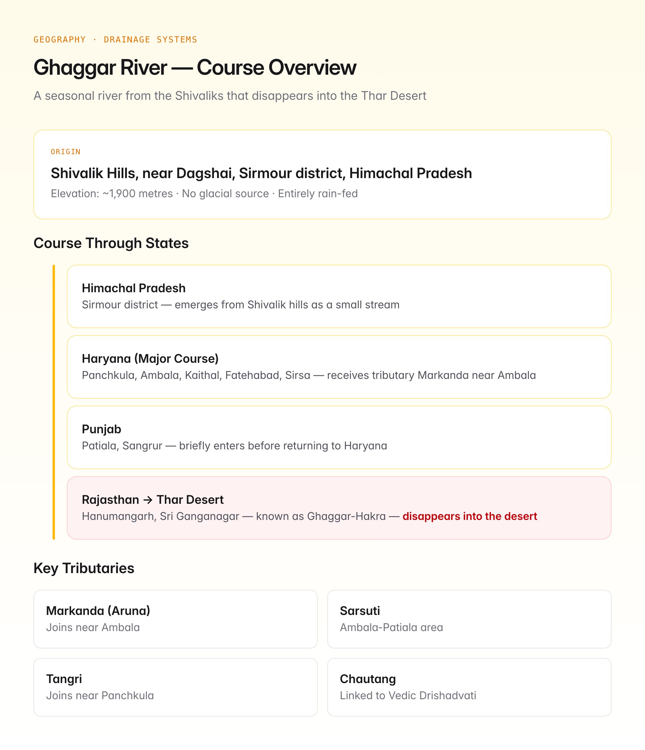
Origin
The Ghaggar River rises in the Shivalik Hills (outer Himalayas) near the village of Dagshai in Sirmour district, Himachal Pradesh, at an elevation of approximately 1,900 metres.
Course Through States
| Stretch | Region | Key Features |
|---|---|---|
| Himachal Pradesh | Sirmour district — origin area | Emerges from Shivalik hills as a small stream |
| Haryana | Panchkula, Ambala, Kaithal, Fatehabad, Sirsa | Major course; receives tributary Markanda near Ambala |
| Punjab | Patiala, Sangrur | Briefly enters Punjab before returning to Haryana |
| Rajasthan | Hanumangarh, Sri Ganganagar | Known as Ghaggar-Hakra; disappears into the Thar Desert near Fortabbas (now in Pakistan) |
Key Tributaries
| Tributary | Origin | Confluence |
|---|---|---|
| Markanda (Aruna) | Shivalik Hills, Ambala | Joins Ghaggar near Ambala |
| Sarsuti | Shivalik Hills | Joins Ghaggar in Ambala-Patiala area |
| Tangri | Morni Hills, Panchkula | Joins near Panchkula |
| Chautang | Shivalik Hills | Historically linked to Ghaggar system; identified by some scholars with Vedic Drishadvati |
Nature of the River
The Ghaggar is a rain-fed, seasonal river that carries significant water only during the monsoon season (July-September). During the monsoon, it can cause severe flooding in parts of Haryana and Rajasthan, particularly in the Sirsa-Hanumangarh corridor. In the dry season, it shrinks to a thin stream or dries up entirely.
Unlike the perennial rivers of the Indus or Ganga systems, the Ghaggar has no glacial source — it is entirely dependent on monsoon rainfall and Shivalik spring flows.
The Saraswati River Debate
The Ghaggar-Hakra system is central to the Saraswati River identification debate, which has significant implications for understanding the Indus Valley (Harappan) Civilization and Vedic geography.
The Vedic Saraswati
The Rig Veda describes the Saraswati as a mighty, glacier-fed river — "best of mothers, best of rivers, best of goddesses" (ambitemae, naditamae, devitamae Saraswati). It was described as flowing from the mountains to the sea, a major river comparable to the Indus.
Arguments for Ghaggar = Saraswati
| Evidence | Detail |
|---|---|
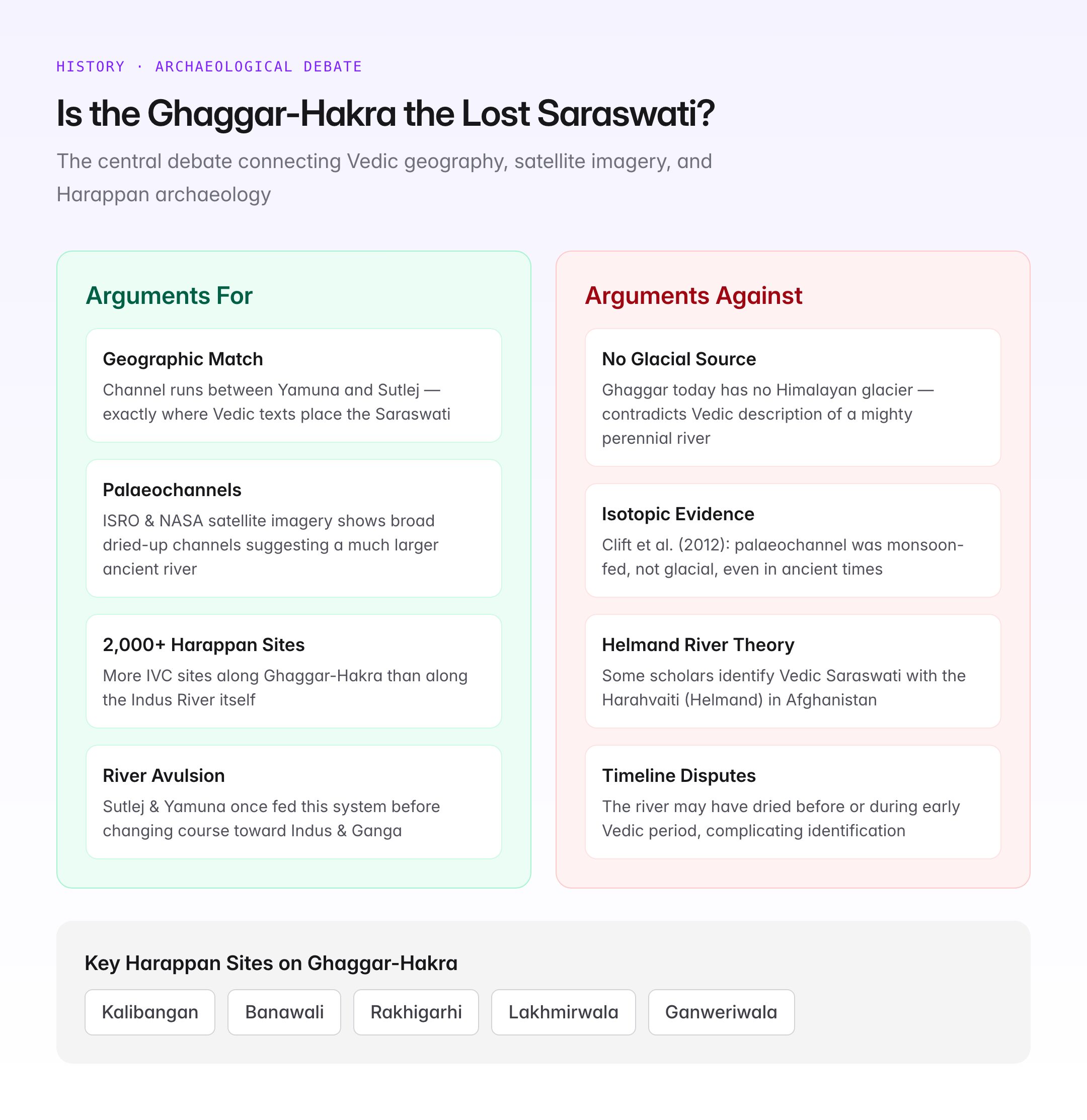
| Geographic match | The Ghaggar-Hakra channel runs through the region described in Vedic texts as the Saraswati's course — between the Yamuna and the Sutlej |
| Palaeochannels | Satellite imagery (ISRO, NASA) shows broad, dried-up palaeochannels along the Ghaggar-Hakra course, suggesting a much larger river once flowed here |
| Harappan sites | Over 2,000 Indus Valley Civilization sites are located along the Ghaggar-Hakra palaeochannel — more than along the Indus itself |
| Geological evidence | Studies suggest the Sutlej and possibly the Yamuna once contributed water to the Ghaggar-Hakra system before changing course (river avulsion) |
Arguments Against
| Counterpoint | Detail |
|---|---|
| No glacial source today | The Ghaggar has no Himalayan glacier source, unlike the Vedic description of a mighty river |
| Isotopic evidence | Some studies (e.g., Clift et al., 2012) suggest the Ghaggar-Hakra palaeochannel was fed by monsoon rain, not glacial melt, even in ancient times |
| Helmand River theory | Some scholars identify the Vedic Saraswati with the Helmand River (Harahvaiti) in Afghanistan |
| Timeline disputes | The river's drying may have occurred before or during the early Vedic period, complicating identification |
Current Scientific Consensus
The debate remains unresolved, but a growing body of geological evidence supports the view that:
- The Ghaggar-Hakra was a significantly larger river system in the past (approximately 8,000-4,000 years ago)
- River avulsion (course change) of the Sutlej towards the Indus and the Yamuna towards the Ganga deprived the Ghaggar-Hakra of glacial water
- This dessication likely contributed to the decline of Harappan settlements along the Ghaggar-Hakra corridor
- Whether this lost river is identical to the Vedic Saraswati is ultimately a question bridging geology and textual interpretation
The Ghaggar-Hakra and the Indus Valley Civilization
The concentration of Harappan and pre-Harappan archaeological sites along the Ghaggar-Hakra channel is among the highest in the entire Indus Valley Civilization:
| Site | Location | Significance |
|---|---|---|
| Kalibangan | Hanumangarh, Rajasthan | Pre-Harappan and Harappan settlement on Ghaggar bank; earliest ploughed field |
| Banawali | Fatehabad, Haryana | Harappan town on the Ghaggar; semi-circular town plan |
| Rakhigarhi | Hisar, Haryana | One of the largest Harappan sites (over 100 hectares); near Ghaggar-Hakra palaeochannel |
| Lakhmirwala | Hanumangarh, Rajasthan | Mature Harappan site on the Ghaggar |
| Ganweriwala | Cholistan, Pakistan | Major Harappan site on the Hakra channel |
The density of settlements suggests the Ghaggar-Hakra was a lifeline for Harappan agriculture and urban centres, comparable in importance to the Indus River itself. Some scholars have proposed renaming the civilisation the “Indus-Saraswati Civilization” or “Sindhu-Saraswati Civilization”, though this remains debated.
Current State of the Ghaggar
Flooding Problem
Despite being a seasonal river, the Ghaggar causes recurring floods in Haryana and Rajasthan during heavy monsoon years. The flat terrain of the Sirsa-Hanumangarh corridor, combined with reduced carrying capacity due to siltation and encroachment, leads to widespread inundation.
Saraswati Heritage Development Board
The Haryana government established the Haryana Saraswati Heritage Development Board to study the palaeochannel, promote archaeological research, and potentially revive a portion of the ancient river channel.
Pollution and Encroachment
Like many Indian rivers, the Ghaggar faces pollution from urban sewage (particularly from towns in Haryana) and agricultural runoff, degrading water quality during its monsoon flow.
UPSC Relevance
GS Paper Mapping
| Paper | Topic | Connection |
|---|---|---|
| GS Paper I | Indian Geography — Drainage Systems | Seasonal river, Shivalik origin, inland drainage |
| GS Paper I | Ancient Indian History — IVC | Ghaggar-Hakra settlements, Kalibangan, Rakhigarhi |
| GS Paper I | Art and Culture | Saraswati in Vedic literature, archaeological debates |
| GS Paper III | Environment | Palaeochannel studies, satellite remote sensing |
Key Points for Prelims
- The Ghaggar River originates in the Shivalik Hills near Dagshai, Sirmour district, Himachal Pradesh
- It is a seasonal (intermittent) river with no glacial source
- In its lower reaches (Rajasthan/Pakistan), it is known as the Hakra
- The Ghaggar disappears into the Thar Desert — it is an example of inland drainage
- Major Harappan sites on the Ghaggar-Hakra: Kalibangan, Banawali, Rakhigarhi
- The Ghaggar-Hakra system is debated as the possible course of the Vedic Saraswati River
- Satellite imagery shows broad palaeochannels suggesting a much larger ancient river
- Key tributaries: Markanda, Sarsuti, Tangri, Chautang
- The Sutlej and Yamuna are believed to have once fed this system before changing course