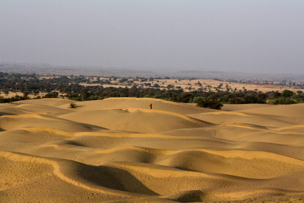
The Thar Desert (also called the Great Indian Desert) is the world's 17th largest desert and the most densely populated desert globally. It covers approximately 200,000 sq km across western Rajasthan and extends into Gujarat, Punjab, Haryana (in India), and Sindh and Punjab provinces of Pakistan. Unlike the Sahara or Arabian deserts, the Thar is a subtropical desert with a unique ecology — it receives some monsoon rainfall, supports significant vegetation, and has a large human population.
For UPSC, the Thar Desert appears in Physical Geography (GS1), Environment (GS3), and is a favourite for map-based Prelims questions.
Location and Extent
Coordinates: Approximately 24°–30°N latitude, 69°–76°E longitude.
Indian states covered:
- Rajasthan: ~60% of the Thar lies in Rajasthan (Jaisalmer, Barmer, Jodhpur, Bikaner, Nagaur, Churu, Jalore districts)
- Gujarat: Kutch and parts of Banaskantha
- Haryana: Southern fringes
- Punjab: Southwestern fringes
Boundaries:
- West: International border with Pakistan (runs through the desert)
- East: Aravalli Range (acts as a natural barrier — moisture-laden monsoon winds are blocked by the Aravallis, contributing to the desert's aridity)
- North: Punjab plains
- South: Rann of Kutch (Gujarat)
Why Is the Thar a Desert?
The Thar's aridity results from several factors:
| Factor | Explanation |
|---|---|
| Aravalli Range orientation | The Aravallis run parallel to (rather than perpendicular to) the monsoon winds — they do not force the moisture-laden winds to rise and precipitate |
| Subtropical high-pressure belt | The Thar lies in the subtropical high-pressure zone (~30°N) where descending dry air suppresses rainfall |
| Distance from moisture sources | Far from the Bay of Bengal branch of the monsoon; the Arabian Sea branch moves parallel to the western coast |
| Hot surface temperatures | High ground temperatures prevent moisture from condensing |
| Continental location | Deep inland position reduces maritime moisture influence |
Climate
| Parameter | Details |
|---|---|
| Rainfall | 100–500 mm annually (decreasing from east to west); Jaisalmer receives ~170 mm |
| Temperature (summer) | 45–50°C (can exceed 50°C in some areas — among the highest in India) |
| Temperature (winter) | 5–15°C (can drop below 0°C on winter nights in western Rajasthan) |
| Diurnal range | Extremely high — 20–30°C difference between day and night temperatures |
| Dust storms | Common in May–June (loo — hot, dry winds) |
| Monsoon | Southwest monsoon reaches western Rajasthan weakly; rain is erratic and unreliable |
The extreme diurnal temperature range (very hot days, very cold nights) is a defining characteristic of desert climates — caused by the absence of cloud cover and moisture to moderate temperatures.
Landforms
The Thar is not a featureless sand sheet. It has diverse landforms:
Sand dunes: The most characteristic feature — longitudinal dunes, transverse dunes, barchans (crescent-shaped), and star dunes. The dunes shift with wind direction.
Rocky desert (Hamada): Exposed rocky surfaces, particularly in the eastern Thar near the Aravallis.
Salt lakes and playas: Sambhar Lake (India's largest inland salt lake), Didwana, Pachpadra, and the Rann of Kutch (seasonal salt marsh).
Luni River: The only significant river in the Thar — rises near Ajmer, flows southwest, and disappears into the Rann of Kutch. It is an inland drainage river (does not reach the sea).
Barren hills and plateaus: Rocky outcrops and mesas break the monotony of sand.
Flora and Fauna
Despite its aridity, the Thar supports significant biodiversity:
Flora: Xerophytic (drought-adapted) vegetation:
- Khejri (Prosopis cineraria) — the state tree of Rajasthan; provides shade, fodder, and fuel; the Bishnoi community traditionally protects khejri trees
- Babool (Acacia nilotica), Rohida, Ber (Ziziphus), Cactus species
- Sewan grass — important fodder grass of the desert
Fauna:
- Great Indian Bustard — critically endangered; the Thar is its last significant habitat (Desert National Park, Jaisalmer)
- Indian Wild Ass — found in the Rann of Kutch (Little Rann of Kutch Wild Ass Sanctuary)
- Chinkara (Indian Gazelle) — relatively common
- Desert Fox, Desert Cat, Spiny-tailed Lizard
- Blackbuck — found in the Thar's grasslands
Desert National Park: Located near Jaisalmer, covering ~3,162 sq km — one of the largest national parks in India. Key species: Great Indian Bustard, desert fox, chinkara.
Indira Gandhi Canal (Rajasthan Canal)
The Indira Gandhi Canal is the longest canal in India (~650 km) and has transformed parts of the Thar:
- Source: Harike Barrage (confluence of Sutlej and Beas rivers, Punjab)
- Route: Runs through Ganganagar, Hanumangarh, Bikaner, Jaisalmer, and Barmer districts
- Purpose: Irrigation, drinking water, afforestation
- Impact: Converted large tracts of desert into cultivable land; Ganganagar and Hanumangarh now produce wheat, cotton, and mustard
- Environmental concern: Waterlogging and soil salinity in areas of excessive irrigation; rise in water table causing secondary salinisation
Strategic Significance
The Thar Desert has significant strategic importance:
- India-Pakistan border runs through the desert — the Radcliffe Line and parts of the international boundary
- Pokhran nuclear test sites (1974 and 1998) are located in the Thar (Pokhran, Jaisalmer district)
- Military installations: Indian Army's desert warfare training centre is at Pokhran; the Thar is the setting for military exercises
- BSF patrols the desert border
UPSC Relevance
GS1 (Geography): Indian physiographic divisions, desert formation, climate, drainage.
GS3 (Environment): Desert ecology, Great Indian Bustard conservation, Indira Gandhi Canal.
Key Prelims facts:
- Area: ~200,000 sq km
- States: Rajasthan (mainly), Gujarat, Haryana, Punjab
- Boundary: Aravalli Range (east), Pakistan (west), Rann of Kutch (south)
- Only river: Luni (inland drainage)
- Largest salt lake: Sambhar Lake
- Indira Gandhi Canal: Longest in India (~650 km), from Harike Barrage
- Desert National Park: Jaisalmer (Great Indian Bustard habitat)
- Nuclear tests: Pokhran (1974, 1998)
- Most densely populated desert in the world
- Rainfall: 100–500 mm (west to east gradient)
Tell Google you want more of this.
Add Anantam IAS as a preferred sourceOne tap, and this site shows up more often in your own Top Stories, AI Overviews and AI Mode. Remove it any time.