Godavari River: Source, Length, Tributaries, Polavaram Project and Delta (UPSC Geography)
UPSC notes on the Godavari River — the Dakshin Ganga. Source at Trimbakeshwar, 1,465 km length (longest peninsular river), basin states, tributaries Pranhita, Indravati, Manjira, Polavaram project, and the Godavari delta in Andhra Pradesh.
The Godavari River is the longest river in Peninsular India and the second-longest in the country after the Ganga. Stretching 1,465 km from its source near Trimbakeshwar in Maharashtra to its mouth in the Bay of Bengal, the Godavari drains roughly 10% of India’s total geographical area and is the largest peninsular river by both length and basin size. Hindus call it Dakshin Ganga (“the Ganga of the South”), reflecting its religious importance and its status as the lifeline of the Deccan plateau.
For UPSC aspirants, the Godavari River is a high-yield topic. The river’s source at Trimbakeshwar (one of the twelve Jyotirlingas), its 1,465-km journey across six states, its three major tributaries (Pranhita, Indravati, Manjira), the multi-purpose Polavaram Project, and the fertile Godavari delta — all show up in geography, environment and current-affairs sections of the syllabus.
Quick Facts About the Godavari River
| Attribute | Detail |
|---|---|
| Source | Brahmagiri hills near Trimbakeshwar, Nashik district, Maharashtra |
| Elevation at source | ~1,067 m |
| Length | 1,465 km — longest peninsular river |
| Basin area | ~312,812 sq km (~9.5% of India) |
| Basin states | Maharashtra, Telangana, Andhra Pradesh, Madhya Pradesh, Chhattisgarh, Odisha, Karnataka, Puducherry (Yanam) |
| Direction | Generally southeast |
| Mouth | Bay of Bengal at Antarvedi, Andhra Pradesh (large delta) |
| Major tributaries | Pranhita, Indravati, Sabari, Manjira, Wardha, Wainganga, Penganga, Purna |
| Major projects | Polavaram, Sriram Sagar, Jayakwadi, Sardar Sarovar’s Godavari counterpart Sriram Sagar |
| Religious title | Dakshin Ganga; Pushkaram festival every 12 years |
Source and Course of the Godavari
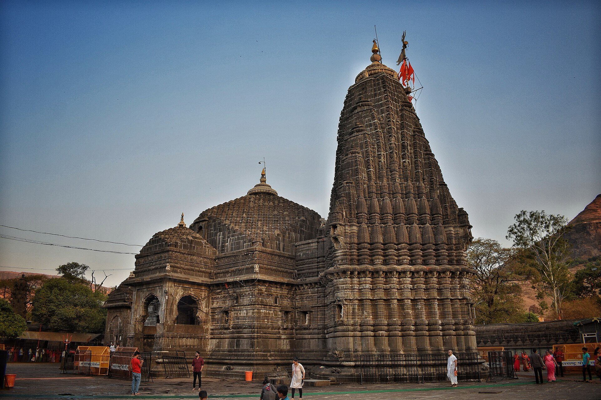
The Godavari rises in the Brahmagiri hills near Trimbakeshwar, about 30 km from Nashik in Maharashtra, at an elevation of approximately 1,067 metres. Trimbakeshwar is also home to one of the twelve Jyotirlingas, which links the river’s source to deep religious significance.

Oxford Student Atlas for India — 7th Edition
- 160 pages, Oxford University Press, the current edition
- India-focused thematic maps: physical, political, rivers, climate, soils, vegetation, plus world maps
- Made for UPSC and state PSC map work; slim enough to stay open beside the textbook
Three Reaches
- Upper reach (Trimbakeshwar to Nanded): the river flows east through Maharashtra, picking up tributaries like the Pravara, the Purna and the Manjira.
- Middle reach (Nanded to Bhadrachalam): the Godavari swings southeast through Telangana, joined by the Manjira (right bank) and the mighty Pranhita and Indravati from the left bank.
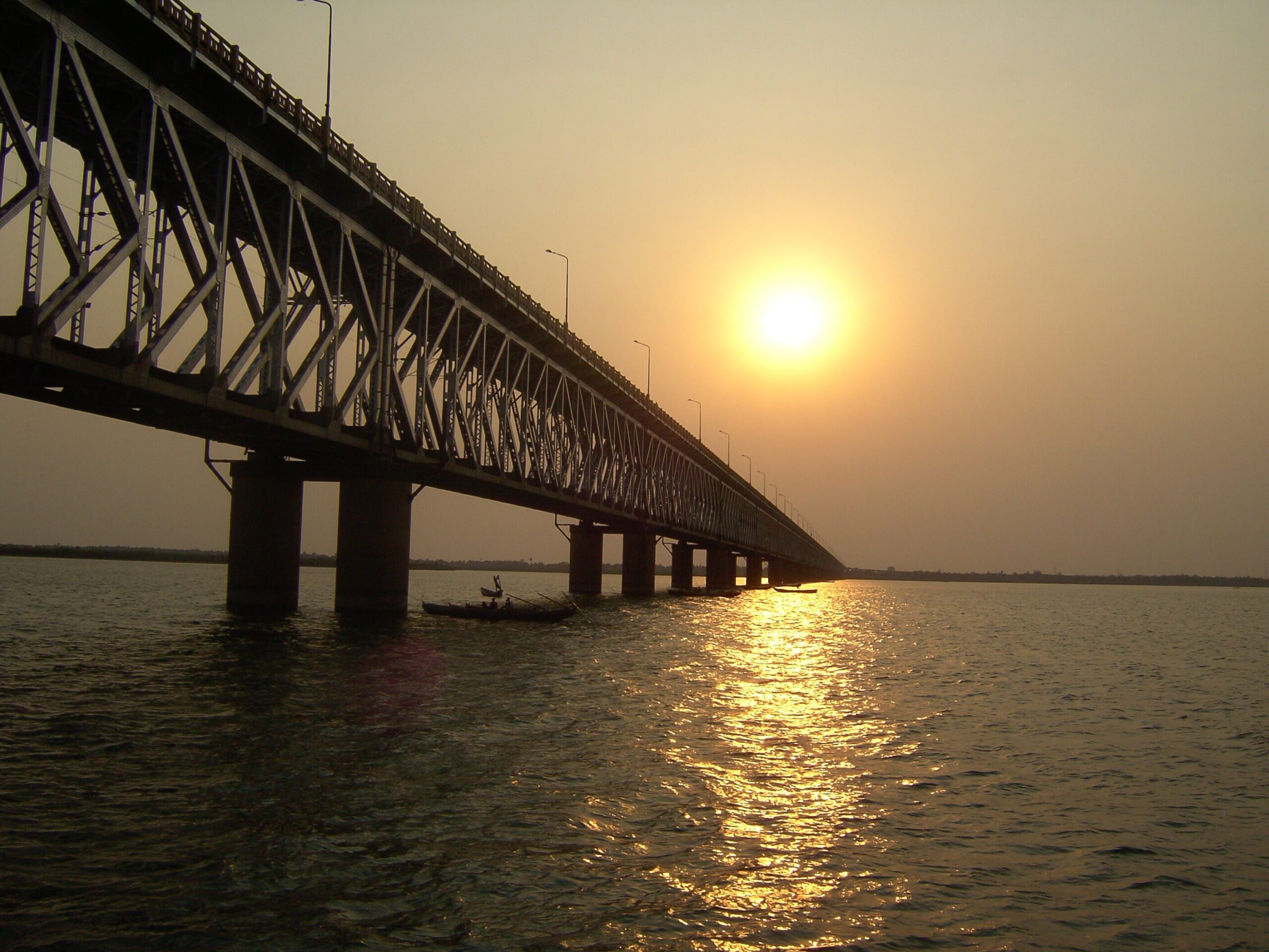
- Lower reach (Bhadrachalam to the Bay of Bengal): the river cuts through the Eastern Ghats at the Papikondalu gorge and finally fans out into a delta downstream of Dowleswaram, near Rajahmundry.
Why is the Godavari Called Dakshin Ganga?
The title Dakshin Ganga (“the Ganga of the South”) reflects three things:
- Length and basin size comparable to the Ganga among Peninsular rivers.
- Religious sanctity — the Godavari is considered as holy as the Ganga; the Pushkaram festival, held every 12 years, draws millions of pilgrims.
- Cultural depth — temple towns like Trimbakeshwar, Nashik, Paithan, Bhadrachalam and Rajahmundry trace their identity to the Godavari.
Tributaries of the Godavari
The Godavari has the densest tributary network of any peninsular river. Tributaries are conventionally classified by bank.
Left-bank Tributaries (longer, drain larger area)
- Pranhita — the largest tributary by discharge; itself formed by the union of the Penganga, Wardha and Wainganga. Drains nearly 3,500 sq km of Vidarbha and Chhattisgarh.
- Indravati — rises in the Dandakaranya plateau of Odisha and traverses Chhattisgarh’s Bastar region; meets the Godavari at the Andhra Pradesh-Chhattisgarh border.
- Sabari — joins the Godavari just upstream of Polavaram.
- Bindusara
Right-bank Tributaries
- Manjira — major right-bank tributary; rises in the Balaghat range and supplies water to Hyderabad through the Nizam Sagar.
- Pravara
- Purna
Basin Hierarchy
Roughly 49% of the Godavari basin lies in Maharashtra, 20% in Telangana, 10% in Chhattisgarh, 6% in Madhya Pradesh, 6% in Odisha, and the rest in Andhra Pradesh, Karnataka and Puducherry (Yanam, on the delta).
Major Multi-purpose Projects on the Godavari
The Godavari basin hosts dozens of dams and barrages. The most consequential are:
Polavaram Project
The Polavaram Project (Indira Sagar) on the Godavari in West Godavari district of Andhra Pradesh is the most ambitious irrigation scheme in the lower Godavari. It is designed to:
- Irrigate 2.91 lakh hectares.
- Generate 960 MW of hydropower.
- Supply drinking water to 540 villages.
- Transfer up to 80 TMC of water from the Godavari to the Krishna basin via a link canal — central to the Godavari-Krishna river-linking plan.
Polavaram was declared a National Project under the Andhra Pradesh Reorganisation Act, 2014. Construction has faced challenges around displacement (about 1.06 lakh families across AP, Telangana, Odisha and Chhattisgarh), inter-state R&R disputes, and revised cost estimates.
Sriram Sagar Project (SRSP)
Built across the Godavari near Nizamabad (Telangana), the Sriram Sagar Project is the largest reservoir on the river within Telangana and is the backbone of irrigation in north Telangana.
Jayakwadi Project
On the Godavari at Paithan (Maharashtra), the Jayakwadi Dam is Maharashtra’s largest earthen dam and irrigates Marathwada’s drought-prone districts.
Kaleshwaram Lift Irrigation Scheme (KLIS)
The Kaleshwaram Lift Irrigation Project lifts Godavari water from the Pranhita confluence at Kaleshwaram (Telangana) through multi-stage pumping to irrigate 18.25 lakh acres. It is the world’s largest multi-stage lift irrigation system.
Nizam Sagar
On the Manjira tributary; supplies Hyderabad and irrigates parts of Telangana.
The Godavari Delta
The Godavari delta begins at Dowleswaram Barrage near Rajahmundry, where Sir Arthur Cotton’s mid-19th-century anicut diverted the river into two principal distributaries — the Gautami and the Vasishta — which fan out across a delta of about 5,200 sq km.
Why the Delta Matters
- One of India’s most fertile rice belts (“the Granary of South India”).
- Hosts the Coringa Wildlife Sanctuary, the second-largest stretch of mangroves on India’s east coast, with the Olive Ridley and saltwater crocodile habitats.
- Site of significant natural gas reserves in the Krishna-Godavari basin.
- The Pushkaram festival is held on the Godavari every 12 years; the most recent took place in 2015.
Godavari Water Dispute and Tribunal
Like other inter-state rivers, the Godavari has had its share of water-sharing disputes. The Godavari Water Disputes Tribunal (GWDT), set up in 1969, gave its final award in 1980, allocating water between Maharashtra, Andhra Pradesh, Madhya Pradesh, Karnataka and Odisha. Post-2014 bifurcation, sharing is now between Maharashtra, Telangana, Andhra Pradesh, Chhattisgarh, MP, Karnataka and Odisha. Fresh disputes — particularly between Telangana and Andhra Pradesh over Polavaram backwaters — are administered under the Inter-State River Water Disputes Act.
Climate, Soils and Crops in the Godavari Basin
- Rainfall: ~1,096 mm annual mean, mostly from the southwest monsoon.
- Soils: Black cotton soils in the upper basin (Maharashtra), red and laterite soils in the middle basin, and rich alluvium in the delta.
- Crops: rice (delta), cotton (Maharashtra), sugarcane, pulses, oilseeds, and chillies.
Cultural and Religious Significance
The Godavari is woven into Hindu epics and folk traditions:
- Trimbakeshwar Jyotirlinga marks the source.
- The Godavari at Nashik is the site of the Kumbh Mela held every twelve years.
- Paithan was the capital of the Satavahanas and remains a Maharashtrian pilgrimage town.
- Bhadrachalam in Telangana is associated with Lord Rama and the Ramayana.
- The Godavari Pushkaram festival, every 12 years, draws tens of millions of pilgrims to Rajahmundry and Bhadrachalam.
Environmental Concerns
The Godavari has faced multiple ecological pressures:
- Pollution from Nashik, Aurangabad, Nanded and Rajahmundry — industrial effluents and untreated sewage.
- Sand mining along the lower Godavari.
- Mangrove loss in the delta due to aquaculture expansion.
- Submergence of forests and tribal villages under Polavaram backwaters.
- Reduction in freshwater discharge to the delta due to upstream dams, harming the KG-basin estuarine ecology.
The river is part of the Namami Gange-like Godavari Rejuvenation Plan under the National River Conservation Plan.
Godavari River — UPSC Significance
The Godavari River is one of the most testable rivers for UPSC:
- GS-I Geography: drainage of Peninsular India, comparison with the Krishna and the Mahanadi, monsoon and basin hydrology, delta formation.
- GS-II Polity: Godavari Water Disputes Tribunal, Article 262, AP Reorganisation Act 2014, Polavaram as a national project.
- GS-III Environment: Coringa mangroves, KG-basin gas, river-linking debate, displacement.
- Prelims: source, length, basin states, major tributaries, dams (Sriram Sagar, Jayakwadi, Polavaram, Nizam Sagar).
For comparative study, see the Cauvery water dispute — another east-flowing peninsular river — and the Brahmaputra inland waterways push for north-Indian river management. The Bhakra Dam and Hirakud Dam offer parallels with Sriram Sagar and Polavaram. The Godavari intersects with flood management in India and drought in India debates.
Frequently Asked Questions
What is the source of the Godavari River?
The Godavari River rises in the Brahmagiri hills near Trimbakeshwar, in Nashik district of Maharashtra, at an elevation of about 1,067 m. Trimbakeshwar is also home to one of the twelve Jyotirlingas.
Why is the Godavari called Dakshin Ganga?
The Godavari is called Dakshin Ganga (u0022Ganga of the Southu0022) because of its length (1,465 km, second only to the Ganga in India), its large basin (~9.5% of India), and the deep religious sanctity attached to it — including the Pushkaram festival held every 12 years.
How long is the Godavari River?
The Godavari is 1,465 km long, making it the longest peninsular river in India.
Which states does the Godavari basin cover?
The Godavari basin covers eight states/UT: Maharashtra (~49%), Telangana (~20%), Chhattisgarh (~10%), Madhya Pradesh (~6%), Odisha (~6%), Andhra Pradesh, Karnataka, and Puducherry (Yanam).
What are the major tributaries of the Godavari?
The left-bank tributaries — Pranhita (largest), Indravati, Sabari — drain a larger area. The major right-bank tributaries include the Manjira, Pravara, and Purna. The Pranhita itself is the combined flow of the Penganga, Wardha and Wainganga.
What is the Polavaram Project?
The Polavaram Project is a multi-purpose dam on the Godavari in West Godavari district of Andhra Pradesh. Declared a national project under the AP Reorganisation Act 2014, it aims to irrigate 2.91 lakh hectares, generate 960 MW, and link the Godavari to the Krishna basin.
Where does the Godavari River meet the sea?
The Godavari meets the Bay of Bengal through a large delta near Antarvedi, downstream of Rajahmundry in Andhra Pradesh. The delta begins at the Dowleswaram Barrage where the river splits into the Gautami and Vasishta distributaries.
What is the Godavari Pushkaram?
The Godavari Pushkaram is a Hindu festival celebrated every 12 years when Jupiter enters the zodiac sign Leo. Pilgrims bathe at sacred ghats along the Godavari — particularly at Rajahmundry, Bhadrachalam, Nashik and Trimbakeshwar.
How does the Godavari compare with the Krishna and the Mahanadi?
Among Peninsular rivers, the Godavari is the longest (1,465 km) and largest by basin (~312,812 sq km), the Krishna is second (1,400 km, ~258,948 sq km), and the Mahanadi is smaller (858 km, ~141,589 sq km). The Godavari and Krishna basins are inter-linked through the Polavaram-Krishna canal, while the Mahanadi flows entirely independently into the Bay of Bengal. All three are east-flowing peninsular rivers, but the Godavari’s basin alone covers roughly 9.5% of India — larger than the Krishna and Mahanadi basins combined.
What is the Godavari-Krishna river-linking plan?
The Godavari-Krishna link is the most advanced segment of the National River Linking Project. Under the Polavaram Project, surplus Godavari waters (about 80 TMC) are diverted through a 174-km canal to the Prakasam Barrage on the Krishna at Vijayawada. This was operationalised through the Pattiseema Lift Irrigation Scheme in 2015 as an interim arrangement before Polavaram’s main reservoir was complete.