Malwa Plateau: Location, Formation, Rivers, Climate and UPSC Notes
Complete guide to Malwa Plateau covering location in MP and Rajasthan, Deccan Trap formation, Chambal and Betwa rivers, climate, crops and major cities.
The Malwa Plateau is one of the three major plateaus of peninsular India, stretching across the western parts of Madhya Pradesh and south-eastern Rajasthan. Formed from the volcanic lava flows of the Deccan Trap, it is bounded by the Vindhyan Range to the south, the Aravalli Range to the north-west, and the Bundelkhand Plateau to the east. The plateau is historically, agriculturally and strategically important, and remains a high-yield region for UPSC physical and economic geography questions.
Location and Boundaries
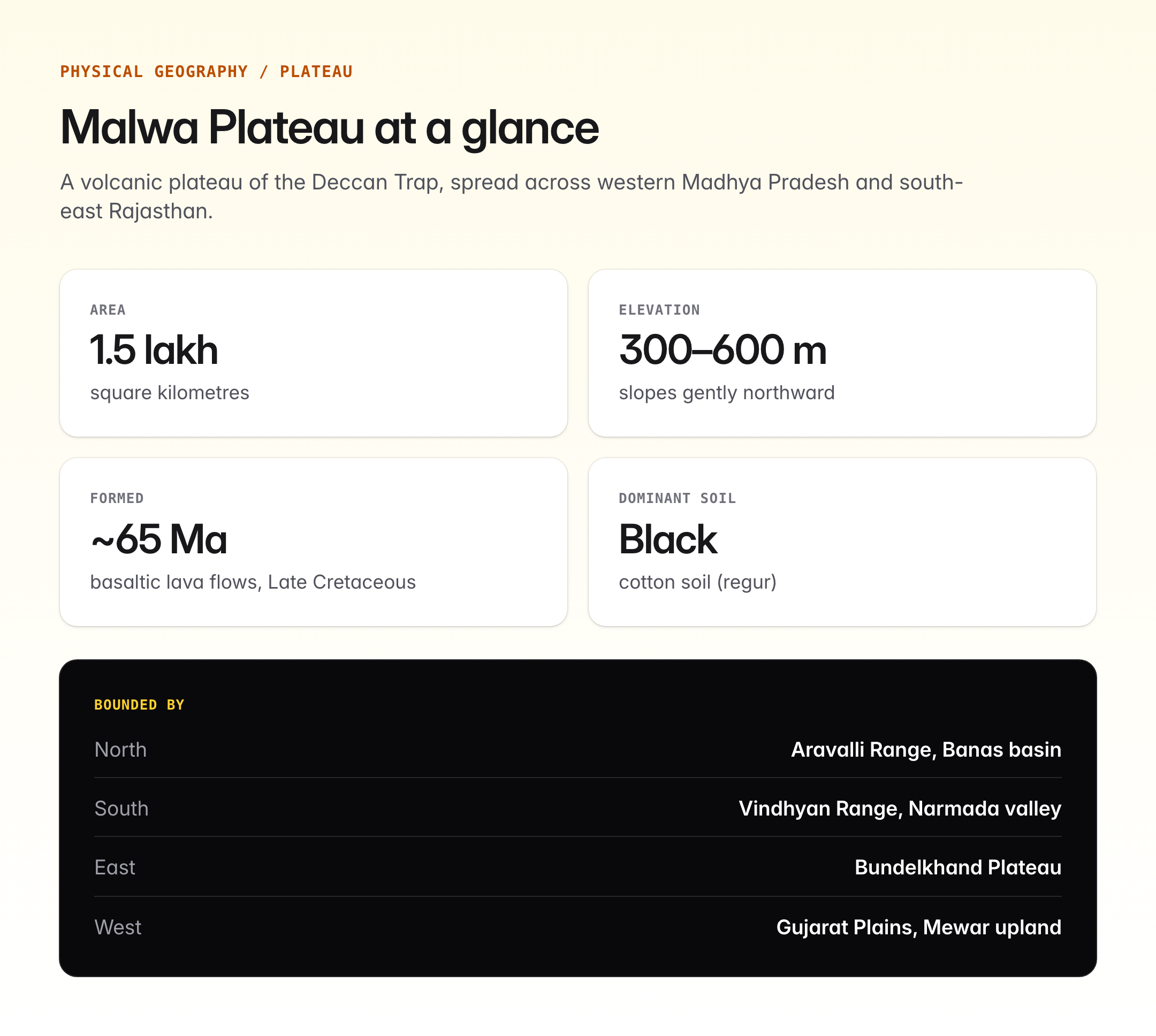
The Malwa Plateau covers an area of roughly 1.5 lakh square kilometres. Its average elevation ranges from 300 to 600 metres, sloping gently northwards towards the Gangetic plain. Administratively, it spans parts of Indore, Ujjain, Dewas, Ratlam, Mandsaur, Neemuch, Shajapur and Bhopal divisions in Madhya Pradesh and Jhalawar, Kota, Bundi, Chittorgarh and Pratapgarh districts in Rajasthan.
| Direction | Boundary |
|---|---|
| North | Aravalli Range and the Banas basin |
| South | Vindhyan Range and Narmada valley |
| East | Bundelkhand Plateau |
| West | Gujarat Plains and Mewar upland |
The plateau is separated from the Deccan Plateau proper by the Vindhya-Satpura system and the Narmada rift valley.
Formation: Deccan Trap Volcanism
The Malwa Plateau is a classic volcanic plateau. It was formed around 65 million years ago during the late Cretaceous period when massive fissure-type volcanic eruptions released successive flows of basaltic lava across the peninsular block. These flows solidified into horizontal sheets stacked one over the other, creating the step-like topography seen in the Vindhyan scarps. The same event produced the larger Deccan Traps, of which Malwa is the northern extension.
Weathering of this basaltic rock over millions of years has produced the black cotton soil (regur) that dominates the plateau. This soil is rich in iron, lime, magnesium and aluminium but poor in nitrogen, phosphorous and organic matter.
Drainage System
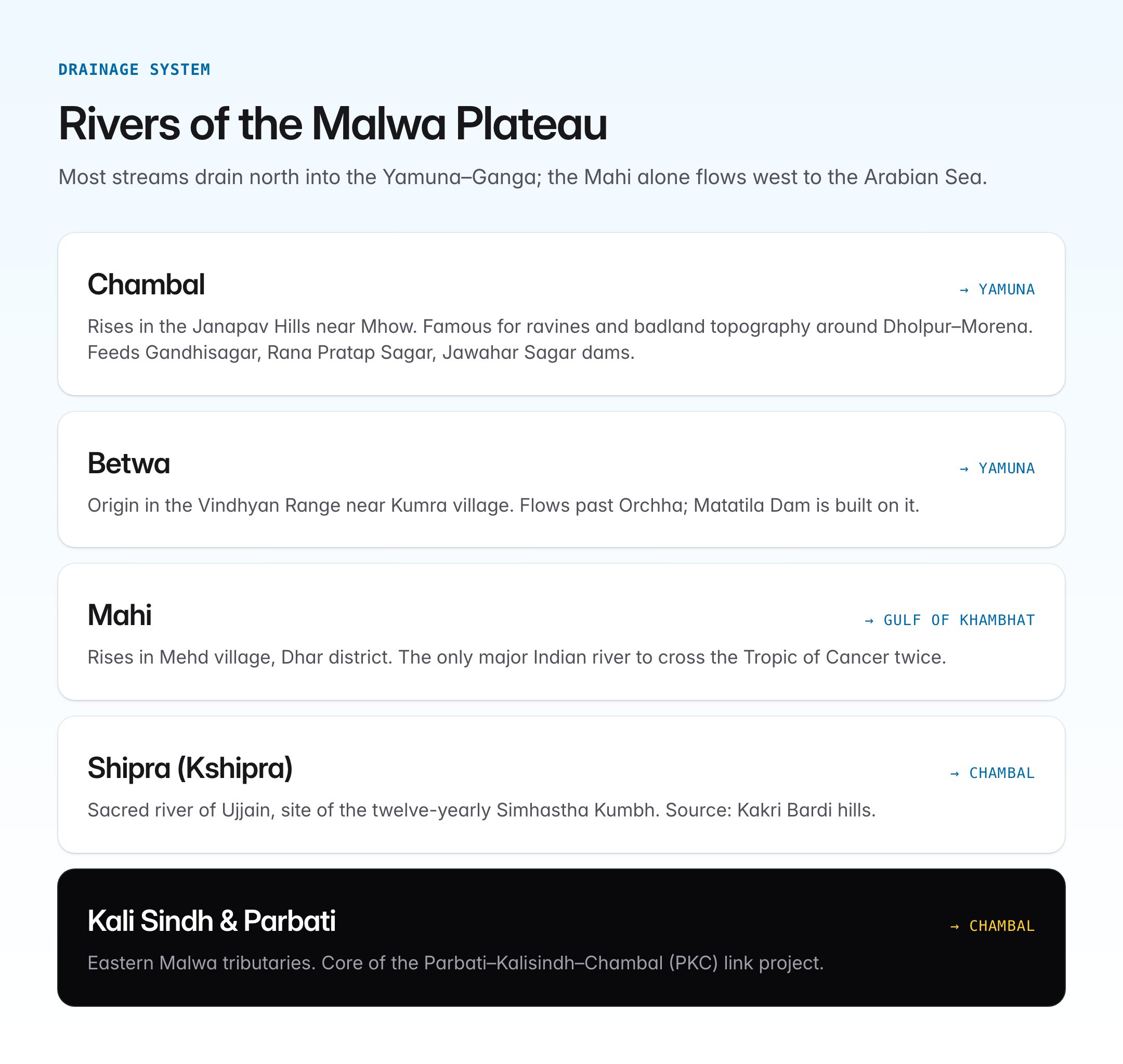
The plateau is drained mainly by north-flowing tributaries of the Yamuna and Ganga, along with the Mahi flowing westwards to the Gulf of Khambhat.
| River | Source | Flows To | Significance |
|---|---|---|---|
| Chambal | Janapav Hills near Mhow | Yamuna | Gandhisagar, Rana Pratap Sagar, Jawahar Sagar dams |
| Betwa | Vindhyan Range near Kumra village | Yamuna | Matatila Dam, flows through Orchha |
| Kali Sindh | Bagli hills, Dewas | Chambal | Irrigates eastern Malwa |
| Parbati | Vindhya Range | Chambal | Parbati-Kalisindh-Chambal link project |
| Mahi | Mehd village, Dhar | Gulf of Khambhat | Crosses Tropic of Cancer twice |
| Shipra (Kshipra) | Kakri Bardi hills | Chambal | Sacred river, Simhastha Kumbh at Ujjain |
The Chambal is the largest river originating in the Malwa Plateau and is famous for its ravines and badland topography around Dholpur and Morena.
Climate
Malwa enjoys a sub-tropical, semi-arid to sub-humid climate moderated by its elevation.
| Season | Temperature | Rainfall |
|---|---|---|
| Summer (March-June) | 35-42 degrees Celsius | Negligible |
| Monsoon (June-September) | 25-30 degrees Celsius | 80-100 cm (SW monsoon) |
| Winter (November-February) | 10-18 degrees Celsius | Occasional western disturbances |
The plateau receives rainfall predominantly from the Arabian Sea branch of the southwest monsoon, with a gradient decreasing from south to north. The elevation ensures cooler nights even in summer, and cities like Pachmarhi (technically on the Satpura but often grouped regionally) and Mandu have long served as hill retreats.
Soils and Agriculture
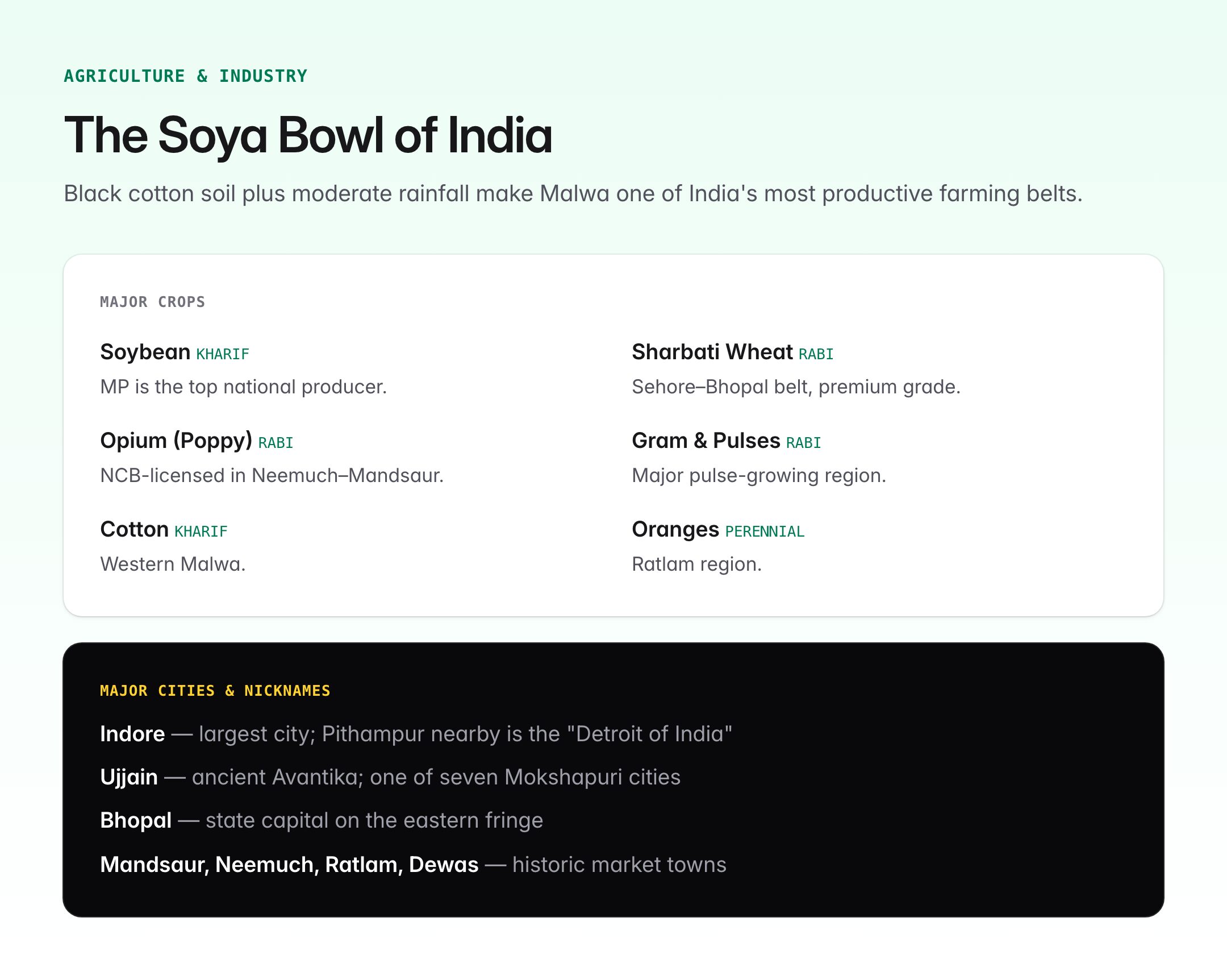
The dominant soil is black cotton soil, ideal for moisture retention. Secondary soils include alluvial, red and mixed red-black soils in river valleys.
Malwa is one of India's most productive agricultural zones.
| Crop | Season | Significance |
|---|---|---|
| Soybean | Kharif | Malwa is the "Soya Bowl" of India, MP is top producer |
| Wheat | Rabi | High-quality Sharbati wheat from Sehore-Bhopal belt |
| Gram and Pulses | Rabi | Major pulse-growing region |
| Opium (Poppy) | Rabi | Neemuch, Mandsaur, Ratlam grow under NCB licence |
| Cotton | Kharif | Western Malwa |
| Oranges and Citrus | Perennial | Ratlam region |
The Malwa wheat belt and the poppy-growing licensed tracts of Mandsaur-Neemuch-Chittorgarh are unique features.
Minerals and Industry
While not as mineral-rich as the Chota Nagpur Plateau, Malwa has deposits of limestone, dolomite, bauxite, manganese and slate. Pithampur near Indore is called the “Detroit of India” for its automobile cluster housing Force Motors, Mahindra, Bridgestone and Volvo-Eicher.
Indore is the largest city and a major financial and educational hub. Other important cities include Ujjain (ancient Avantika, one of the seven Mokshapuri cities), Bhopal (state capital, although on the eastern fringe), Dewas, Ratlam, Mandsaur and Neemuch.
Historical and Cultural Significance
Malwa has been continuously inhabited for over two millennia. It was home to the Avanti Mahajanapada, ruled successively by the Mauryas, Shungas, Shakas, Guptas, Paramaras, Delhi Sultans, Malwa Sultanate, Mughals, Marathas (Holkars and Scindias) and finally the British. The Holkar dynasty of Indore, founded by Malhar Rao Holkar and famously led by Ahilyabai Holkar, shaped its modern identity.
Monuments like Mandu, Maheshwar, Ujjain's Mahakaleshwar Jyotirlinga, Sanchi Stupa (on the eastern margin) and Bhimbetka rock shelters (a UNESCO World Heritage Site) reflect its civilisational depth.
Environmental Issues
- Ravine formation along the Chambal due to gully erosion
- Soil erosion and declining organic matter in black soil from over-cultivation
- Groundwater depletion in wheat-growing districts
- Deforestation of the Vindhyan slopes
- Drought cycles, particularly in western districts bordering Rajasthan
The Chambal Ravines Development Project and watershed management under MGNREGA have helped restore parts of this landscape.
UPSC Relevance
The Malwa Plateau features regularly across Prelims and Mains.
Prelims: Questions may test the source of Chambal/Betwa, Deccan Trap formation, the river that crosses the Tropic of Cancer twice (Mahi), or the state with the highest soybean production (Madhya Pradesh, largely from Malwa). Questions on Sanchi, Bhimbetka and the Simhastha Kumbh are also common.
Mains GS-1 (Geography): The plateau is relevant for questions on distribution of black soil, volcanic landforms of India, drainage patterns, and regional agricultural belts. Link Malwa to the larger peninsular plateau framework and monsoon variability.
Mains GS-3 (Economy, Environment): Issues such as soil degradation, groundwater management, cotton-soybean MSP policy, ravine reclamation and industrial corridors (Delhi-Mumbai Industrial Corridor passes through Pithampur) are high-value themes.
Essay and Ethics: Ahilyabai Holkar's governance ethics and philanthropy is a frequently quoted case study.
Candidates should map Malwa alongside the Chota Nagpur, Deccan, Bundelkhand and Meghalaya plateaus to answer comparative questions on India's plateau geography, and connect its rivers to the Yamuna-Ganga and Mahi-Narmada systems for comprehensive answers.