Introduction
A plateau is an extensive upland with a relatively level surface rising abruptly above the surrounding country. Occupying nearly 45 percent of the Earth’s land area when taken together with the mountains that often flank them, plateaus store two-thirds of the world’s minerals, generate much of the hydroelectric potential on the planet, and shape the climate of entire continents by forcing monsoons and westerlies upward. From the cold deserts of Tibet to the lava-capped Deccan of peninsular India, plateaus are among the most studied and most examinable landforms in UPSC Geography.
For aspirants, plateaus feature in GS1 Geography (Prelims and Mains), are indispensable to understanding Indian peninsula geology, and spill over into GS3 (minerals, hydropower, biodiversity). This guide covers the textbook definition, every major typology, the four principal modes of formation, a world-plus-India inventory, and the economic and ecological significance that typically frames a 250-word Mains answer.
Quick Facts at a Glance
| Parameter | Detail |
|---|---|
| Definition | Elevated flat-topped highland bounded by steep edges |
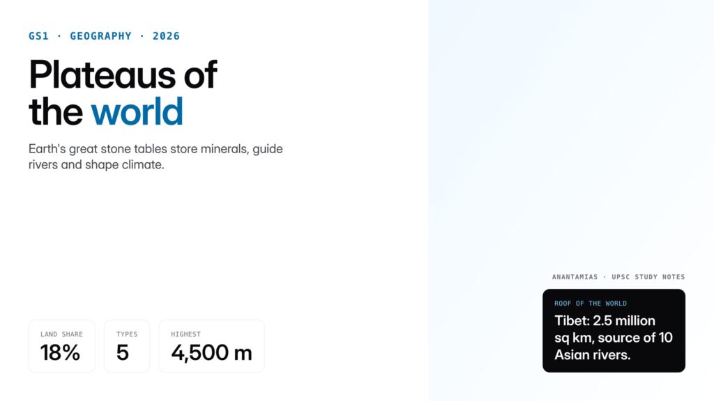
| Land area share | About 18% of Earth’s land surface is plateau (45% if mountain-edge plateaus included) |
| Highest plateau | Tibetan Plateau, average 4,500 m (Roof of the World) |
| Largest plateau | Tibetan Plateau, 2.5 million km squared |
| Oldest plateau | Deccan Plateau of India, Cretaceous to Eocene in age |
| Main types | Intermontane, piedmont, continental, volcanic, dissected |
| Mineral importance | Chota Nagpur and Deccan store 90%+ of India’s coal and iron ore |
| Hydropower potential | Waterfalls at plateau edges (Niagara, Jog, Dhuandhar) |
Background and Historical Context
The scientific study of plateaus developed alongside modern geology in the nineteenth century. William Morris Davis, in his influential 1899 cycle of erosion, treated plateaus as mature landforms that evolved from uplifted peneplains, while later researchers working in East Africa, South America and the Indian peninsula recognised that volcanism, faulting and collision tectonics were equally central. The discovery of the Deccan Traps and dating of its basaltic flows to around 66 million years ago, coinciding with the Cretaceous-Paleogene extinction, placed Indian plateaus at the centre of debates on continental dynamics.
Plate tectonics, formalised in the 1960s, revolutionised the field. The Tibetan Plateau, formerly described as a mysterious high desert, was shown to be the direct product of the India-Eurasia collision around 50 million years ago. Iceland’s basalt plateaus were linked to the Mid-Atlantic Ridge, and the Colorado Plateau’s dramatic canyons were interpreted as the product of isostatic rebound combined with Quaternary river incision.
In the Indian context, the peninsular plateau has been central to geological study since the Geological Survey of India was founded in 1851. It contains the oldest rocks on the subcontinent (Archean gneisses of over 3.5 billion years), the Dharwar schist belts that host gold at Kolar, and the Gondwana coal basins. Understanding the peninsular plateau’s antiquity is therefore fundamental to Indian physical geography.
Key Features
Defining Characteristics
Four diagnostic features distinguish a plateau from other landforms. First, it has a flat or gently undulating surface, sometimes called a tableland. Second, it is bordered by steep scarps or fault lines on at least one side, which is why plateaus support dramatic waterfalls at their margins. Third, it is elevated substantially above the surrounding plain, typically at least 300 metres. Fourth, it is an integrated block, structurally continuous, as opposed to a cluster of peaks or ridges.
Types of Plateaus
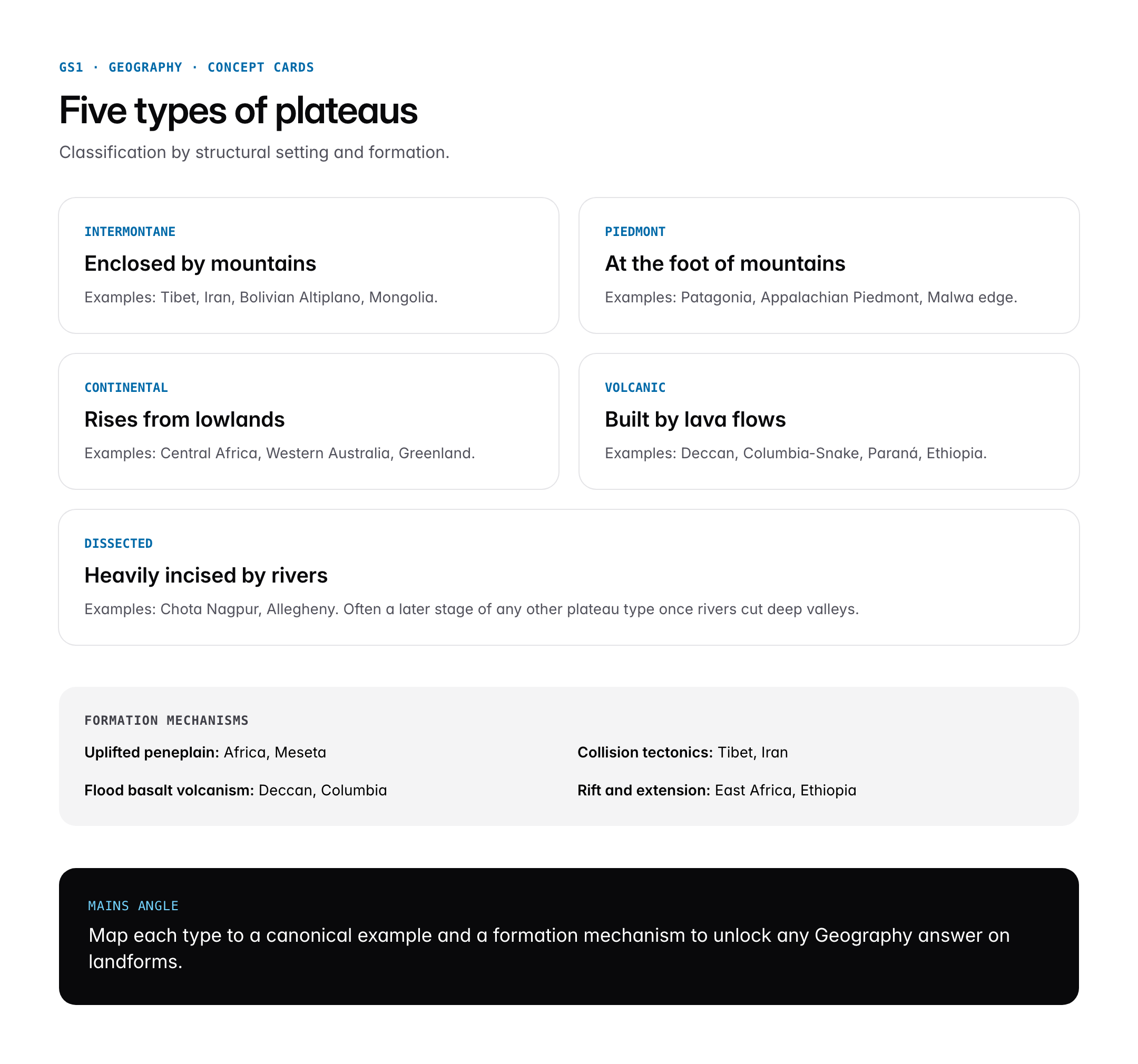
Geographers classify plateaus using formation-based and location-based criteria. The principal types are:
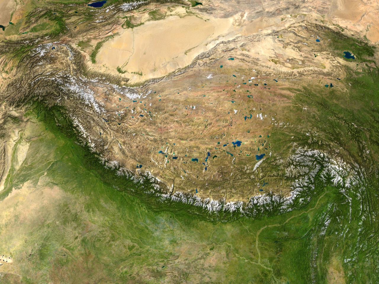
Intermontane plateaus are enclosed by mountain ranges on multiple sides. The Tibetan Plateau, surrounded by the Himalaya, Karakoram, Kunlun and Pamirs, is the type example. The Plateau of Mongolia, the Iranian Plateau and the Bolivian Altiplano all fall in this category. These are typically the highest and largest plateaus on Earth.
Piedmont plateaus lie at the foot of a mountain range, with plains extending on the other side. The Piedmont of the Appalachians in the eastern United States, the Patagonian Plateau of Argentina abutting the Andes, and the Malwa Plateau along the Vindhyan front are prominent examples. They form as mountain erosion products aggrade but are subsequently uplifted.
Continental plateaus rise directly from adjacent lowlands or the sea, without a mountain border. The Plateau of Central Africa, the Western Australian Plateau, and Greenland’s central ice-capped plateau illustrate this type. They often originate as uplifted peneplains or as ancient cratonic blocks.
Volcanic plateaus are built by successive lava flows that solidify into thick basalt sheets. The Deccan Plateau of India, with basalt up to 2,000 metres thick, is the classic case. Other examples include the Columbia-Snake River Plateau in the USA, the Paraná Plateau of southern Brazil and Argentina, and the Ethiopian Plateau of the Horn of Africa.
Dissected plateaus are those that rivers have extensively incised, creating a network of deep valleys and gorges. The Chota Nagpur Plateau in eastern India and the Allegheny Plateau in the Appalachian system are mature examples.
Formation Processes
Plateaus form through four broad mechanisms. Uplift of peneplains: long periods of erosion produce low-lying surfaces, which are then bodily lifted thousands of metres by isostatic rebound or tectonic movement. The African Plateau exemplifies this. Collisional tectonics: where two continental plates converge, the crust thickens and the entire block rises, as in Tibet. Flood basalt volcanism: massive outpourings of lava along deep fissures create layer-cake sheets, as with the Deccan. Crustal extension and faulting: in rift zones, blocks are elevated between parallel faults, producing the East African Plateau. Often, multiple processes combine; the Colorado Plateau, for example, owes its existence to both regional uplift and selective river incision.
Significance for UPSC and General Knowledge
- Plateaus host the lion’s share of global and Indian mineral reserves, with coal, iron ore, manganese, bauxite, mica and gold concentrated on ancient shield plateaus.
- Waterfalls at plateau edges (Angel Falls on the Guiana Plateau, Jog Falls at the Western Ghats scarp, Niagara on the Allegheny escarpment) are major hydropower and tourism sites.
- Highland plateaus act as climate modifiers: the Tibetan Plateau intensifies the Asian monsoon and creates the rain shadow of Central Asia.
- The peninsular plateau of India is the source region of most south-flowing rivers (Godavari, Krishna, Kaveri) and the Mahanadi.
- Plateau soils such as black cotton (regur) of the Deccan are critical to cotton and oilseed agriculture.
- Dissected plateaus offer defensive terrain and have historically been centres of tribal settlement, with consequences for modern policies on forest rights and mining.
Detailed Analysis: Major Plateaus of the World
The following consolidated table anchors the most examinable world plateaus.
| Plateau | Continent | Type | Key facts |
|---|---|---|---|
| Tibetan Plateau | Asia | Intermontane | Highest and largest; average 4,500 m; source of Indus, Brahmaputra, Yangtze, Mekong |
| Deccan Plateau | Asia (India) | Volcanic | 500,000 sq km of basalt; formed c. 66 Ma at K-Pg boundary |
| Chota Nagpur Plateau | Asia (India) | Dissected, continental | Stores coal, iron, mica, bauxite; mineral heartland of India |
| Iranian Plateau | Asia | Intermontane | 3.7 million sq km; bounded by Zagros, Elburz, Hindu Kush |
| Mongolian Plateau | Asia | Intermontane | Hosts Gobi desert; northern limit of Chinese civilisation |
| Anatolian Plateau | Asia Minor | Intermontane | Flanked by Pontic and Taurus mountains |
| East African Plateau | Africa | Continental, rift | Rift lakes, Mt Kilimanjaro; Great Rift Valley |
| Ethiopian Plateau | Africa | Volcanic | Source of Blue Nile; separated by Rift from Somali Plateau |
| Colorado Plateau | North America | Continental, uplifted | Hosts Grand Canyon; 1.8 km of incision |
| Columbia-Snake River Plateau | North America | Volcanic | Miocene flood basalts |
| Appalachian (Allegheny) Plateau | North America | Dissected | Piedmont and dissected plateau pairing |
| Patagonian Plateau | South America | Piedmont | East of Andes; cold desert climate |
| Brazilian (Paraná) Plateau | South America | Volcanic/continental | Serra Geral basalts; Iguazu Falls |
| Guiana Highlands | South America | Continental shield | Tepui table mountains; Angel Falls |
| Massif Central | Europe | Volcanic, uplifted | Volcanoes of Auvergne |
| Meseta | Europe (Iberia) | Continental | Core of Spain and Portugal |
| Western Australian Plateau | Oceania | Continental shield | Ancient craton; Great Victoria Desert |
| Antarctic Plateau | Antarctica | Ice plateau | Highest continental average elevation |
Indian plateaus in greater detail form a second table.
| Indian Plateau | Region | Rock type | Economic role |
|---|---|---|---|
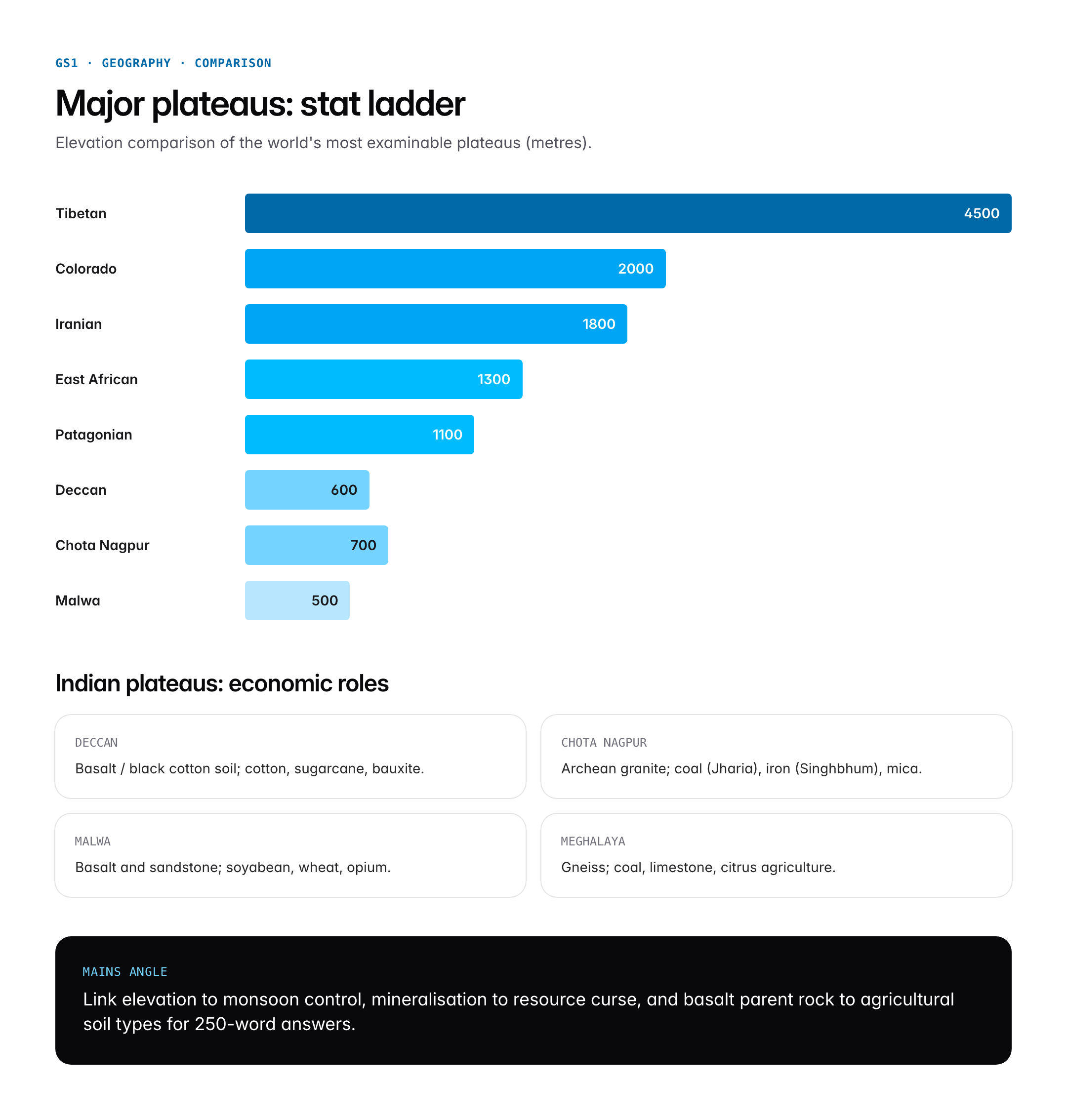
| Deccan Plateau | South-Central peninsula | Basalt | Cotton, sugarcane, bauxite |
| Malwa Plateau | Central India (MP, Rajasthan) | Basalt, sandstone | Soyabean, opium, wheat |
| Chota Nagpur Plateau | Jharkhand, Odisha, Chhattisgarh | Archean granite, Gondwana coal measures | Coal (Jharia), iron (Singhbhum), mica |
| Meghalaya Plateau | Northeast | Archean gneiss | Coal, limestone, orange cultivation |
| Bundelkhand Plateau | UP-MP border | Granite gneiss | Drought-prone agriculture |
| Baghelkhand Plateau | Central India | Sandstone, limestone | Bauxite, limestone |
| Deosai Plateau | Ladakh (Gilgit-Baltistan) | Glacial | High-altitude grassland |
Comparative Perspective
| Plateau | Area (million sq km) | Average elevation (m) | Dominant formation |
|---|---|---|---|
| Tibetan Plateau | 2.5 | 4,500 | Collision (India-Eurasia) |
| Deccan Plateau | 0.5 | 600 | Volcanic flood basalt |
| East African Plateau | 3.0 | 1,300 | Rift and uplift |
| Colorado Plateau | 0.34 | 2,000 | Regional uplift and river incision |
| Patagonian Plateau | 0.7 | 1,100 | Piedmont aggradation |
Collision-origin plateaus (Tibet, Iran) are the highest and youngest. Volcanic plateaus are of moderate elevation but enormous areal coverage. Continental shield plateaus (Western Australia, Chota Nagpur) are the most ancient and the most mineralised.
Challenges and Criticisms
Plateaus are ecologically fragile. The Tibetan Plateau is warming at roughly double the global average, endangering the glaciers that feed ten major Asian rivers. The Deccan suffers groundwater depletion and black-cotton soil salinisation from unsustainable sugarcane cultivation in Maharashtra and Karnataka. The Chota Nagpur Plateau exemplifies the resource curse: despite hosting most of India’s coal and iron, districts like Khunti, Palamu and Chaibasa rank among the poorest in the country, with Left Wing Extremism overlapping tribal under-development. Forest Rights Act implementation has been uneven, and mining-led displacement remains controversial.
Globally, flood-basalt plateaus are increasingly recognised as drivers of mass extinctions through CO2 and sulphur release, as with the Deccan Traps and the end-Cretaceous event. Climatic reconstructions suggest plateau uplift (especially the Tibetan) altered monsoon patterns and contributed to global cooling cycles through silicate weathering, a process that remains actively debated.
Prelims Pointers
- The Tibetan Plateau is the highest and largest plateau on Earth.
- The Deccan is a volcanic plateau formed by Cretaceous-Paleogene flood basalts.
- Intermontane plateaus are enclosed by mountains on multiple sides.
- The Colorado Plateau contains the Grand Canyon.
- Angel Falls in Venezuela descends from the Guiana Highlands (tepui).
- The Chota Nagpur Plateau is India’s mineral storehouse.
- Malwa Plateau is drained by the Chambal and Betwa rivers.
- Meghalaya Plateau is separated from the peninsular block by the Garo-Rajmahal gap.
- The Massif Central of France is an example of a volcanic-uplifted plateau.
- Patagonian Plateau lies in the rain shadow of the Andes.
- Black cotton soil (regur) of the Deccan develops on basalt parent rock.
- The Ethiopian Plateau is the source of the Blue Nile.
Mains Practice Questions
Q1. “Plateaus are the storehouses of minerals and the cradles of civilisations.” Discuss with reference to the plateaus of India. (15 marks, 250 words)
- Outline the three broad Indian plateau regions: peninsular (Deccan), northeastern (Meghalaya) and foreland (Malwa, Bundelkhand).
- Detail mineral endowments: Chota Nagpur coal-iron, Deccan bauxite, Meghalaya limestone, Malwa basalt soils.
- Explain civilisational significance: megalithic cultures of the Deccan, Gondwana tribal heartland, Chola and Vijayanagar capitals on plateau margins.
Q2. Analyse the role of the Tibetan Plateau in shaping the climate and hydrology of Asia. (10 marks, 150 words)
- Note elevation and area; describe the Asian monsoon mechanism with plateau heating.
- Identify the ten major rivers sourced on or near the plateau (Indus, Brahmaputra, Ganga tributaries, Yangtze, Yellow, Mekong).
- Conclude with climate change vulnerability and downstream water security implications.
Conclusion
Plateaus are the Earth’s great stone tables, storing minerals, guiding rivers, shaping climate and sheltering unique cultures. From the collision-born heights of Tibet to the lava-layered Deccan, from the dissected ravines of Chota Nagpur to the rift-lifted plains of East Africa, they illustrate every major process in physical geography, from plate tectonics to flood basalt volcanism to river incision.
For UPSC aspirants, plateaus are not merely a chapter in NCERT Geography; they are a cross-cutting theme that links physical geography to mineral economics, monsoon science to tribal policy, and historical settlement patterns to contemporary climate change. A firm grasp of the typology, formation processes, and the major world and Indian plateaus pays dividends across both Prelims MCQs and Mains answer-writing.
Frequently Asked Questions
What is a plateau?
A plateau is an extensive flat-topped upland that rises abruptly above the surrounding country, usually by at least 300 metres, bounded by steep scarps or fault lines on one or more sides. Plateaus cover about 18 percent of Earth’s land area and host two-thirds of the world’s minerals along with many major river systems.
Why are plateaus important for UPSC?
Plateaus appear in GS1 Geography for Prelims and Mains, and overlap with GS3 through minerals, hydropower, and ecology. UPSC regularly asks about typology (intermontane, piedmont, continental, volcanic, dissected), formation, and major examples like the Tibetan, Deccan and Chota Nagpur plateaus. They are foundational to Indian peninsular geology.
How are plateaus related to mountains?
Intermontane plateaus like Tibet are enclosed by mountain ranges and form by the same collisional tectonics that build the flanking ranges. Piedmont plateaus lie at the foot of mountains and form from aggraded erosion products. Thus plateaus and mountains are often genetically linked, sharing uplift history, rock types, and drainage divides.
What are the main types of plateaus?
Five principal types exist. Intermontane plateaus are enclosed by mountains (Tibet, Iran). Piedmont plateaus sit at mountain feet (Patagonia). Continental plateaus rise from lowlands (Central Africa, Western Australia). Volcanic plateaus are built by lava flows (Deccan, Columbia). Dissected plateaus are heavily incised by rivers (Chota Nagpur, Allegheny).
How are plateaus formed?
Four mechanisms dominate: uplift of long-eroded peneplains (African Plateau), continental collision that thickens crust (Tibet), flood-basalt volcanism that deposits lava sheets (Deccan), and crustal extension with faulting in rift zones (East Africa). Many real plateaus combine two or more processes, often followed by river incision.
What is the largest plateau in the world?
The Tibetan Plateau is both the largest and the highest plateau on Earth, with an average elevation of about 4,500 metres and an area of roughly 2.5 million square kilometres. Known as the Roof of the World, it is bordered by the Himalaya, Karakoram, Kunlun and Pamir ranges and feeds ten of Asia’s major rivers.
What is the Deccan Plateau?
The Deccan is a triangular volcanic plateau covering most of peninsular India south of the Narmada, spanning about 500,000 square kilometres. It is built from Cretaceous-Paleogene flood basalts dating to around 66 million years ago. The Western and Eastern Ghats flank its edges. Black cotton soils support cotton and sugarcane agriculture.
Why is the Chota Nagpur Plateau important for India?
The Chota Nagpur Plateau spans Jharkhand, Odisha and Chhattisgarh and is India’s mineral storehouse, holding over 90 percent of national reserves of coal (Jharia, Raniganj), iron ore (Singhbhum, Keonjhar), mica and bauxite. It is also the cultural heartland of many tribal communities and a focus of forest rights and mining policy debates.
Tell Google you want more of this.
Add Anantam IAS as a preferred sourceOne tap, and this site shows up more often in your own Top Stories, AI Overviews and AI Mode. Remove it any time.