Narmada River: Source, Length, Tributaries, Sardar Sarovar Dam and the Narmada Bachao Andolan (UPSC Geography)
Comprehensive UPSC notes on the Narmada River — source at Amarkantak, 1,312 km course through Madhya Pradesh, Maharashtra and Gujarat, major tributaries, the Sardar Sarovar Dam, Narmada Valley Project and the Narmada Bachao Andolan led by Medha Patkar.
The Narmada River is the largest west-flowing river in Peninsular India and the fifth-longest river on the subcontinent. Rising from the Maikal range at Amarkantak in Madhya Pradesh, the Narmada flows for 1,312 kilometres before emptying into the Gulf of Khambhat in the Arabian Sea. The river is the lifeline of central India, watering parts of Madhya Pradesh, Maharashtra and Gujarat, and it carries deep cultural weight — Hindu tradition treats the Narmada as one of the seven holy rivers of India, and a parikrama (circumambulation) along both banks is an act of pilgrimage.
For UPSC aspirants, the Narmada River matters on three counts: physical geography (it occupies a rift valley between the Vindhyan and Satpura ranges, an unusual structural setting), hydrology (it is the centrepiece of the Narmada Valley Development Project, the largest river-valley scheme in India), and contemporary politics (the Narmada Bachao Andolan triggered some of India’s most consequential debates on dams, displacement and environmental clearance).
Quick Facts About the Narmada River
| Attribute | Detail |
|---|---|
| Source | Narmada Kund, Amarkantak plateau, Anuppur district, Madhya Pradesh |
| Elevation at source | ~1,057 metres |
| Length | 1,312 km (longest west-flowing river of Peninsular India) |
| Basin area | ~98,796 sq km |
| Basin states | Madhya Pradesh, Maharashtra, Gujarat (small portion in Chhattisgarh) |
| Direction | West (through a rift valley) |
| Mouth | Gulf of Khambhat, Arabian Sea (near Bharuch) |
| Major tributaries | Tawa, Hiran, Sher, Banjar, Burhner, Shakkar, Dudhi, Orsang |
| Major dams | Sardar Sarovar (Gujarat), Indira Sagar, Omkareshwar, Maheshwar (MP), Tawa |
| Cultural status | One of seven sacred rivers in Hindu tradition; Narmada parikrama |
Source and Course of the Narmada River
The Narmada rises at Narmada Kund, a small tank on the Amarkantak plateau in the Maikal range of Madhya Pradesh. From here it descends through a series of cascades — the Kapildhara and Dugdhdhara falls — and enters the central Indian uplands.
The Rift Valley Setting
Unlike most Peninsular rivers, which flow eastward into the Bay of Bengal, the Narmada flows west because it occupies a rift valley — a structural depression between two parallel faults. The Vindhyan range runs along its northern bank and the Satpura range along its southern bank. This rift, formed during the Cretaceous period, gives the Narmada its straight, narrow course and explains why the river has only a small drainage basin despite its length.
Three Reaches
Hydrologists divide the Narmada into three reaches:
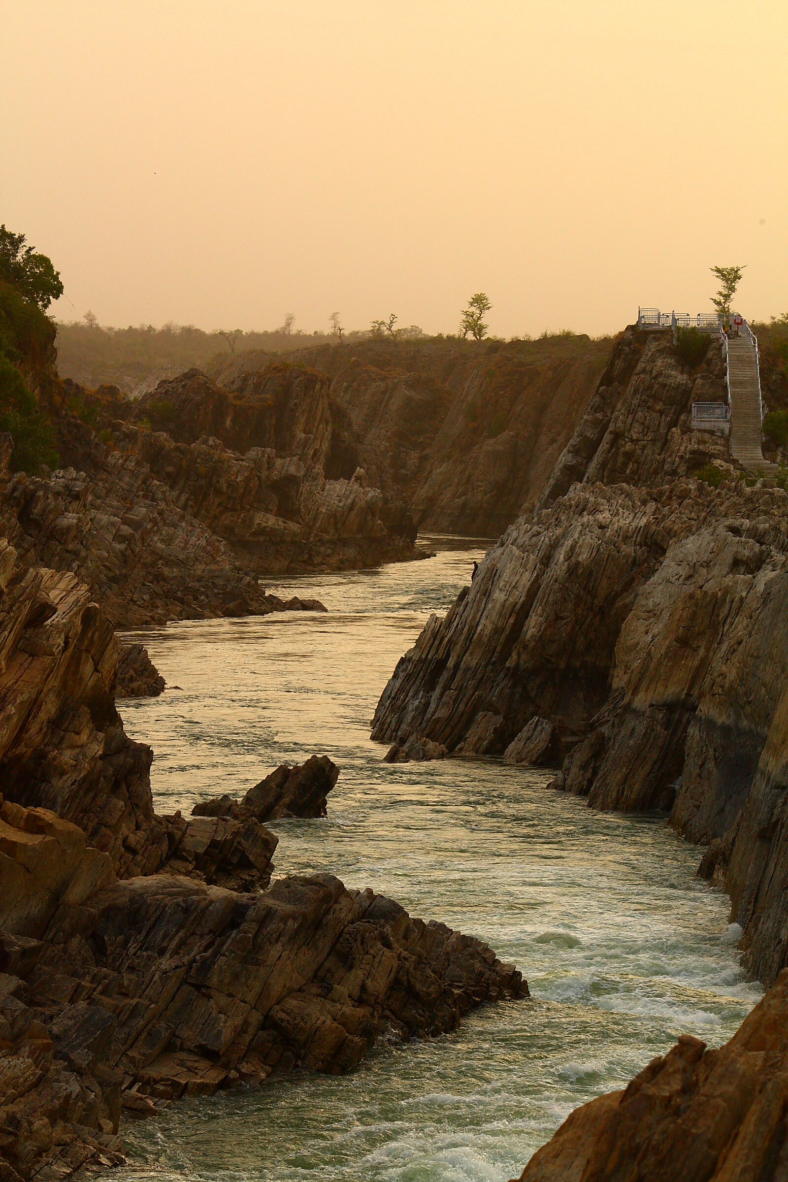
- Upper reach (Amarkantak to Jabalpur, ~320 km): the river drops sharply, carving the famous Marble Rocks gorge at Bhedaghat and tumbling over Dhuandhar Falls (15 m).
- Middle reach (Jabalpur to Handia, ~720 km): the river meanders across the wide Narmada-Sone alluvial plain, picking up major tributaries.
- Lower reach (Handia to Gulf of Khambhat, ~270 km): the Narmada widens into an estuary about 21 km wide at its mouth near Bharuch in Gujarat.
Tributaries of the Narmada
The Narmada has a comb-like drainage pattern with tributaries joining from both flanks.
Left-bank Tributaries (from the Satpura range)
- Tawa — the longest tributary; rises in the Mahadeo hills and joins near Hoshangabad. The Tawa Dam supports irrigation in MP.
- Sher
- Shakkar
- Dudhi
- Banjar — drains Kanha National Park and meets the Narmada near Mandla.
Right-bank Tributaries (from the Vindhyan range)
- Hiran
- Burhner
- Tendoni
- Choral
- Kolar
- Orsang (joins in Gujarat)
Because the Vindhyan and Satpura ranges sit close to the river, no tributary is long, and the Narmada basin (~98,796 sq km) is much smaller than that of comparable rivers like the Godavari or the Krishna.
Narmada Basin States and Geography
The Narmada River drains roughly 86% of its basin in Madhya Pradesh, with the rest spread across Maharashtra (~1.5%), Gujarat (~12%) and a fractional sliver of Chhattisgarh. The basin is shielded by the Maikal range in the east, the Vindhyas in the north, the Satpuras in the south, and the Arabian Sea coast in the west.
Climate and Soils
The basin receives most of its rainfall from the southwest monsoon (June–September), with annual precipitation averaging 1,100 mm. Soils are dominantly black cotton (regur) in the middle reach — derived from Deccan basalt — making the valley one of India’s prime cotton, wheat and pulses belts.
Narmada Valley Development Project
The Narmada Valley Project is the most ambitious multi-state river-valley scheme in independent India. It envisages 30 large dams, 135 medium dams and 3,000 small dams across the basin to irrigate roughly 4.5 million hectares, generate ~3,400 MW of hydropower, and supply drinking water to thousands of villages and towns.
Major Dams on the Narmada River
- Sardar Sarovar Dam (Gujarat) — terminal dam; 138.68 m high; 1,450 MW installed capacity.
- Indira Sagar (Madhya Pradesh) — largest reservoir on the Narmada by volume; 1,000 MW.
- Omkareshwar Dam (MP) — 520 MW; downstream of Indira Sagar.
- Maheshwar Dam (MP) — 400 MW; controversial private hydro project.
- Bargi Dam (MP) — first major dam on the Narmada; near Jabalpur.
- Tawa Dam (MP) — on the Tawa tributary; irrigation-led.
The water-sharing arrangement between MP, Maharashtra, Gujarat and Rajasthan was finalised by the Narmada Water Disputes Tribunal (NWDT) in 1979 after fifteen years of arbitration. Inter-state water disputes are governed by Article 262 and the Inter-State River Water Disputes Act.
Sardar Sarovar Dam
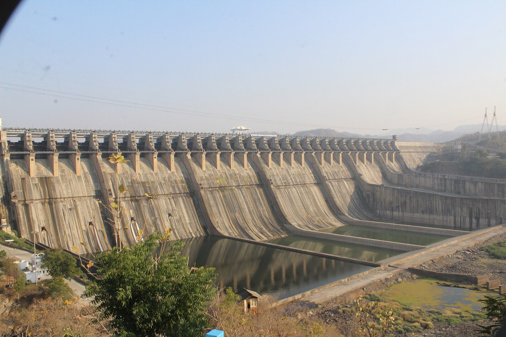
The Sardar Sarovar Dam near Kevadia (Narmada district, Gujarat) is the largest dam on the Narmada and the terminal structure of the basin’s cascade. Built in concrete gravity style, it stands 138.68 m above the deepest foundation and impounds about 9.5 billion cubic metres of water.
Benefits
- Irrigation for ~1.8 million hectares across Gujarat, Madhya Pradesh, Maharashtra and Rajasthan.
- Drinking water to over 9,000 villages and 173 urban centres in drought-prone Saurashtra, Kutch and north Gujarat.
- 1,450 MW of installed hydropower capacity (split between Gujarat, MP and Maharashtra).
- Iconic Statue of Unity (the world’s tallest statue at 182 m), commemorating Sardar Vallabhbhai Patel, stands on Sadhu-Bet island downstream of the dam.
Timeline
- 1961 — Foundation stone laid by Jawaharlal Nehru.
- 1979 — Narmada Water Disputes Tribunal award.
- 1987 — Construction begins.
- 1995–2000 — Supreme Court stayed construction during NBA litigation.
- 2000 — Supreme Court allowed construction to resume in stages.
- 2017 — Dam inaugurated at full reservoir level of 138.68 m by PM Modi.
Narmada Bachao Andolan
The Narmada Bachao Andolan (NBA) — “Save the Narmada Movement” — is one of the most influential social movements in post-Independence India. It emerged in the mid-1980s in opposition to the displacement caused by the Sardar Sarovar and Maheshwar dams.
Origins and Leadership
NBA was founded by Medha Patkar in 1985, along with activists Baba Amte, Arundhati Roy and others. The movement argued that the Narmada Valley Project would submerge hundreds of villages, displace primarily Adivasi communities, and inflict ecological damage disproportionate to its benefits.
Methods
NBA pioneered a repertoire of non-violent protest — dharnas, jal samarpan (standing in rising waters), hunger strikes, and rallies — and used litigation aggressively. In 1994, NBA petitioned the Supreme Court against further construction.
Supreme Court Verdict (2000)
In a 2-1 verdict, the Supreme Court permitted construction to continue subject to compliance with the relief-and-rehabilitation (R&R) policy. Critics argue that R&R obligations were never met in full; many oustees received cash compensation but no agricultural land.
World Bank Withdrawal (1993)
The World Bank withdrew funding for Sardar Sarovar in 1993 after the Morse Commission report criticised the project’s environmental and social safeguards — a rare instance of multilateral disengagement driven by civil-society pressure.
Narmada River and Hydroelectricity
The Narmada basin’s hydropower potential is estimated at about 5,000 MW. Beyond Sardar Sarovar and Indira Sagar, smaller plants at Omkareshwar, Maheshwar, Bargi and Tawa add up to a significant non-Himalayan hydro pool. Power generated is shared on agreed percentages between Madhya Pradesh, Maharashtra and Gujarat.
Cultural and Religious Significance
The Narmada has a unique place in Hindu sacred geography. The Narmada parikrama — a 2,600-km circumambulation on foot along both banks, traditionally taking 3 to 4 years — is considered uniquely meritorious because, unlike the Ganga or Yamuna, one must not cross the river during the parikrama. The Narmada is also said to be older than the Ganga, and pilgrims believe that the mere sight (darshan) of the Narmada cleanses sin.
Key tirtha sites include Amarkantak (source), Maheshwar, Omkareshwar (one of twelve Jyotirlingas), Bhedaghat (Marble Rocks) and Bharuch (mouth).
Environmental Concerns
The Narmada faces several pressures:
- Sediment loss behind dams reducing fertility of the lower Narmada delta and accelerating coastal erosion at Bharuch.
- Submergence of forests — the Sardar Sarovar reservoir submerged about 13,400 ha of forest in MP, Maharashtra and Gujarat.
- Loss of riparian biodiversity, including the gharial population in the upper Narmada.
- Inadequate rehabilitation of approximately 200,000 oustees, most of them Adivasis and farmers from submerged villages.
Narmada River — UPSC Significance
The Narmada River appears across the UPSC syllabus:
- GS-I Geography: rift valley formation, west-flowing peninsular rivers, drainage patterns, Indian monsoon and basin hydrology.
- GS-II Polity: Inter-state water disputes (Article 262), federalism, NWDT award, role of Supreme Court.
- GS-III Environment: large dams vs ecology, displacement, R&R policy, sustainable hydropower.
- Essay: development vs displacement, civil society movements, ecological federalism.
Related basins worth studying together include the Cauvery water dispute, the Hirakud Dam on the Mahanadi, the Bhakra Dam on the Sutlej, and the Tehri Dam on the Bhagirathi — each illustrates a different model of river-valley planning. The Narmada also offers comparison points with flood management in India and drought in India.
Frequently Asked Questions
What is the source of the Narmada River?
The Narmada River rises at the Narmada Kund, a small tank on the Amarkantak plateau in the Maikal range of Anuppur district, Madhya Pradesh, at an elevation of about 1,057 metres.
How long is the Narmada River?
The Narmada River is 1,312 km long, making it the longest west-flowing river in Peninsular India and the fifth-longest river in the Indian subcontinent.
Why does the Narmada flow westward unlike most Peninsular rivers?
The Narmada flows through a rift valley — a structural depression between the Vindhyan range to its north and the Satpura range to its south. This fault-controlled course directs the river westward into the Arabian Sea instead of east into the Bay of Bengal.
What are the major tributaries of the Narmada?
The longest left-bank tributaries are the Tawa, Sher, Shakkar, Banjar and Burhner (from the Satpuras). The major right-bank tributaries are the Hiran, Burhner, Tendoni, Kolar and Orsang (from the Vindhyas).
What is the Sardar Sarovar Dam?
The Sardar Sarovar Dam is a 138.68-m high concrete gravity dam on the Narmada in Gujarat. It is the largest dam in the Narmada Valley Project, supplies water and power to Gujarat, MP, Maharashtra and Rajasthan, and stands near the Statue of Unity.
What was the Narmada Bachao Andolan?
The Narmada Bachao Andolan, led by Medha Patkar from 1985, was a non-violent movement opposing the displacement and ecological costs of the Sardar Sarovar and Maheshwar dams. It led to the World Bank’s 1993 withdrawal and a landmark Supreme Court verdict in 2000.
Which states share the Narmada basin?
The Narmada basin is shared mainly by Madhya Pradesh (~86%), Gujarat (~12%), Maharashtra (~1.5%) and a small fraction of Chhattisgarh. The 1979 Narmada Water Disputes Tribunal allocated water shares between these states and Rajasthan.
Why is the Narmada considered sacred?
Hindu tradition counts the Narmada among the seven holy rivers. Pilgrims perform the Narmada parikrama — a circumambulation on foot along both banks — and tirthas like Amarkantak, Omkareshwar (a Jyotirlinga) and Maheshwar lie on its course.