Why in News?
Yemen’s Houthi movement announced on 20 July 2026 that it would impose a maritime embargo on Saudi-linked shipping through the Bab el-Mandeb Strait. The Hindu and The Indian Express reported the declaration as a renewed threat to the southern gateway of the Red Sea, while Saudi Arabia rejected the blockade claim and said it would protect commercial vessels.
The declaration isn’t the same as a verified closure of all traffic. It was framed as a targeted measure against Saudi-linked vessels, its enforcement method was initially unclear, and claims that ships had been forced to reroute lacked independent confirmation. The exam issue is the risk created by a credible threat near a narrow sea lane, even before a complete physical closure occurs.
- The threatened route connects the Gulf of Aden and the Red Sea, forming the southern approach to the Suez Canal.
- The Houthis said the embargo was retaliation for what they described as a Saudi blockade of Yemen and a recent strike on Sanaa airport.
- Saudi Arabia’s official response described the blockade narrative as false and invoked UNCLOS and protection of commercial navigation.
- The threat comes after repeated Houthi attacks on merchant shipping since November 2023, which had already pushed carriers toward the Cape of Good Hope.
- A selective threat can still raise war-risk insurance, freight rates and voyage times because shipowners price uncertainty, not only confirmed closures.
The development matters in the context of:
- This matters in the context of simultaneous pressure on two different chokepoints: Bab el-Mandeb on the Red Sea route and the Strait of Hormuz at the exit of the Persian Gulf.
- It also tests the rules governing transit passage, the protection of civilian shipping and the limits of coercion by non-state armed groups.
- For India, the exposure runs through energy prices, Asia-Europe trade, marine insurance, delivery schedules and the safety of Indian seafarers.
UPSC Relevance
Prelims Relevance
- Bab el-Mandeb connects the Red Sea with the Gulf of Aden and, beyond it, the Arabian Sea and Indian Ocean.
- The strait lies between Yemen on the Arabian Peninsula and Djibouti and Eritrea in the Horn of Africa.
- Perim Island, also called Mayyun, divides the strait into eastern and western channels.
- The Suez Canal connects the Red Sea with the Mediterranean Sea; a normal Asia-Europe voyage using Suez must also pass Bab el-Mandeb.
- The alternative around southern Africa passes the Cape of Good Hope and avoids both Bab el-Mandeb and Suez.
- The Strait of Hormuz is a separate waterway connecting the Persian Gulf with the Gulf of Oman; it does not connect the Red Sea and Gulf of Aden.
- Under Part III of UNCLOS, straits used for international navigation are generally governed by the regime of transit passage.
- The SUMED pipeline in Egypt links Red Sea and Mediterranean terminals and has an EIA-listed capacity of 2.5 million barrels per day.
- Saudi Arabia’s East-West Pipeline, or Petroline, moves crude from the east to the Red Sea coast and can bypass Hormuz, but Asia-bound cargo from Yanbu may still face Bab el-Mandeb.
Mains Relevance
GS Paper 2
- West Asian geopolitics, Yemen’s conflict and the use of maritime coercion by a non-state armed group.
- Freedom of navigation, UNCLOS transit passage and multilateral responsibility for civilian shipping.
- India’s strategic autonomy while engaging Gulf partners, regional states and maritime security coalitions.
GS Paper 3
- Transmission of a shipping-risk shock into freight costs, imported inflation, trade competitiveness and the current account.
- Energy security through supplier, route and transport-mode diversification, supported by strategic petroleum reserves.
- Sea-lane security, maritime domain awareness and the role of the Information Fusion Centre-Indian Ocean Region.
GS Paper 1
- Map-based geography of the Red Sea, Gulf of Aden, Horn of Africa, Suez Canal, Hormuz and Cape of Good Hope.
Essay
- A narrow passage can cast a long economic shadow.
- Energy security is inseparable from maritime security.
- Rules-based navigation in an age of asymmetric warfare.
Background and Context
Geography: The Southern Gate of the Red Sea
Bab el-Mandeb is valuable because it compresses a major intercontinental route into a narrow passage.
- Its name is commonly translated as the Gate of Tears, and the strait separates Yemen from the Horn of Africa.
- To its north lies the Red Sea; to its southeast lies the Gulf of Aden, which opens into the Arabian Sea and Indian Ocean.
- Ships travelling between the Indian Ocean and Europe normally follow the chain: Gulf of Aden → Bab el-Mandeb → Red Sea → Suez Canal → Mediterranean Sea.
- Perim Island splits the passage into two channels. This physical concentration makes surveillance and attack easier than on an open-ocean route.
- A disruption doesn’t make trade impossible. It makes the principal substitute, the route around the Cape of Good Hope, longer and more expensive.
Bab el-Mandeb Is Not the Strait of Hormuz
The two straits affect overlapping energy networks but occupy different geographic and commercial positions.
- Bab el-Mandeb links the Gulf of Aden with the Red Sea and is essential to the Suez-based Asia-Europe route.
- Hormuz links the Persian Gulf with the Gulf of Oman and is the sea outlet for most exports from Gulf producers located inside the Persian Gulf.
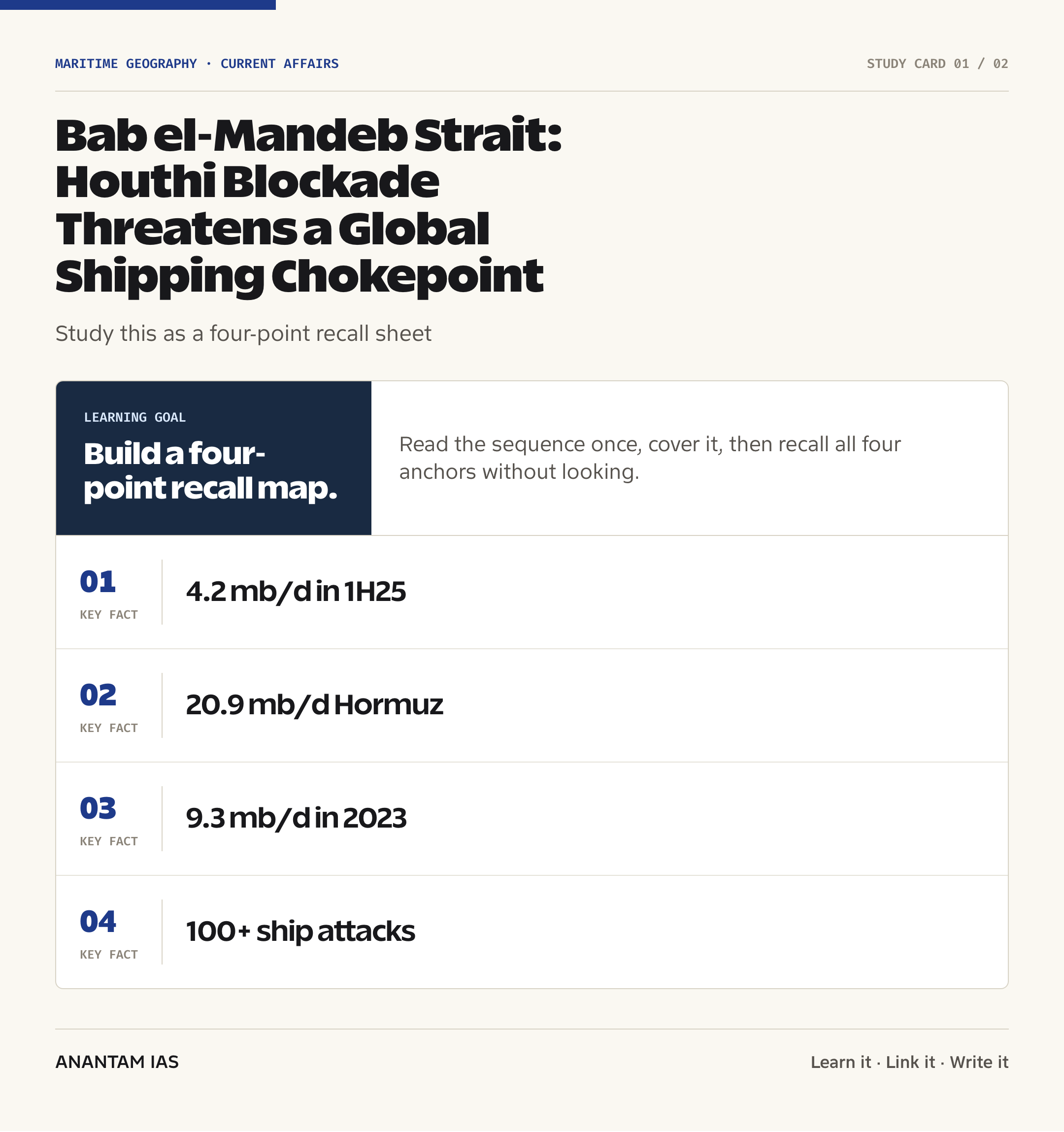
- The U.S. Energy Information Administration estimated 4.2 million barrels per day of oil flows through Bab el-Mandeb in the first half of 2025, against 20.9 million barrels per day through Hormuz.
- Bab el-Mandeb’s 2025 flow was about half its 9.3 million barrels per day level in 2023 because security threats had already diverted vessels.
- Saudi Arabia’s East-West Pipeline can move crude to the Red Sea without using Hormuz. But an Asia-bound tanker leaving the Red Sea port of Yanbu must sail south through Bab el-Mandeb.
- For a visual and legal comparison, see the Anantam IAS note on the Strait of Hormuz transit-route dispute.
Reading Shipping-Share Claims Carefully
Different percentages measure different years, commodities and route segments, so they shouldn’t be treated as interchangeable.
- The often-cited 12% of global trade figure describes the broader Red Sea-Suez artery under normal conditions; it isn’t a live measure of traffic physically crossing Bab el-Mandeb during disruption.
- UN Trade and Development’s 2024 review placed the Suez route at about 11.1% of global seaborne trade volume in 2023, again a route measure rather than a current Bab el-Mandeb count.
- The EIA’s older 12% of seaborne oil trade and 8% of LNG trade estimates refer specifically to the first half of 2023, before widespread rerouting.
- The newer EIA series shows 4.2 million barrels per day of oil at Bab el-Mandeb in the first half of 2025 and near-zero LNG flows there in 2024 and 1H25.
- A good answer should name the metric and period: total trade, container trade, seaborne oil, LNG or barrels per day. A bare percentage hides more than it explains.
Blockade Claim, Capability and Maritime Risk
A declared blockade and an effective closure are separate legal, military and commercial questions.
- The July announcement targeted Saudi-linked shipping; it wasn’t presented as an indiscriminate closure of every vessel using the strait.
- The Houthis don’t control the Yemeni coastline directly at the narrowest part of Bab el-Mandeb, but they operate from territory close enough to threaten vessels using missiles, drones and explosive boats.
- The U.S. Maritime Administration recorded more than 100 Houthi attacks on commercial vessels affecting over 60 nations between November 2023 and October 2025.
- Commercial disruption can arise without continuous territorial control. One successful attack, a credible warning or uncertain vessel-identification rules can alter insurer and carrier behaviour.
- Claims that several ships had been forced to reroute were initially not independently verified. UPSC answers should distinguish an actor’s claim from confirmed operational effect.
- Saudi Arabia briefly suspended oil shipments through the strait in July 2018 after attacks on two tankers, showing how limited incidents can trigger precautionary closures.
International Law and Security Architecture
The legal baseline protects continuous navigation, but enforcement in a conflict zone depends on capable states and risk-conscious shipowners.
- Under UNCLOS Articles 37-44, ships and aircraft enjoy transit passage through straits used for international navigation, subject to continuous and expeditious transit and lawful safety rules.
- States bordering such straits must not hamper transit passage and must publicise known dangers; transit passage cannot be suspended.
- A non-state armed group’s coercive claim doesn’t acquire legality merely because it can impose practical risk. Attacks must also be assessed under international humanitarian law where an armed conflict exists.
- Naval patrols, escorts and information-sharing can reduce risk, but they don’t erase long-range missile, drone or mine threats. Security planning needs layered defence and accurate vessel identification.
- India’s Gulf of Aden anti-piracy deployments show the value of mission-based presence, while the IFC-IOR helps fuse commercial shipping information across the Indian Ocean.
Economic and Strategic Stakes for India
India’s exposure extends beyond imported crude because the route carries exports, containers, inputs and Indian seafarers.
- A Cape diversion raises fuel use and voyage time. The EIA compared a Persian Gulf-to-northwest Europe petroleum voyage of about 19 days through Suez with nearly 35 days around the Cape.
- Longer voyages tie up ships for more days, reducing effective fleet capacity and pushing up freight and insurance costs even when cargo remains available.
- Indian petroleum-product exports to Europe and India’s wider trade with Europe use the Red Sea-Suez route, so disruption can weaken export margins and delay inputs.
- If oil prices and shipping costs rise together, India faces pressure through the import bill, rupee, current-account deficit and transport-linked inflation.
- The safety of Indian crews requires timely advisories, company-level risk assessment and coordination among the Indian Navy, Directorate General of Shipping and maritime information centres.
- The strategic lesson is redundancy: supplier diversification alone is insufficient when several suppliers and buyers depend on the same sea lane of communication.
How a Chokepoint Shock Travels Through the Economy
The first impact appears in voyage planning, but the cost moves through several linked markets before reaching households and firms.
- A carrier that avoids the Red Sea must buy more bunker fuel, pay crews for longer and keep the same vessel occupied for additional days. The immediate result is a higher cost per voyage.
- When many vessels take longer routes, available ship capacity tightens even if the physical fleet is unchanged. This capacity effect can raise freight rates across routes that never enter the Red Sea.
- War-risk underwriters reassess the probability and potential loss from missile, drone, mine and boarding attacks. A higher insurance premium becomes part of the landed cost of oil, machinery, chemicals and consumer goods.
- Importers respond by holding larger inventories or ordering earlier, which raises working-capital needs. Smaller firms bear this burden more heavily because they have less bargaining power and fewer routing options.
- Energy markets react to expected disruption as well as lost barrels. A threat to Saudi-linked flows can add a risk premium to crude prices before measurable supply disappears from the market.
- For India, dearer crude widens the merchandise trade deficit; demand for dollars can pressure the rupee, and currency depreciation makes other imports costlier in domestic terms.
- The inflation effect isn’t automatic or uniform. It depends on global demand, the duration of disruption, refinery inventories, tax policy and whether firms absorb or pass on transport costs.
- A balanced Mains answer should trace this chain while noting the buffers: alternative suppliers, Cape routing, inventories, pipelines and diplomatic de-escalation. None is a cost-free substitute for a stable Red Sea corridor.
Way Forward
Separate verified traffic data from wartime claims
- Track AIS patterns, port calls and insurer advisories before describing the strait as closed.
- Publish dated metrics with clear denominators so policy isn’t built on an outdated headline percentage.
Protect civilian navigation through coordination
- Strengthen information exchange among UKMTO, regional navies, IFC-IOR and shipping companies.
- Use escorts and defensive measures based on vessel-specific risk while keeping de-escalation and seafarer safety central.
Build trade and energy redundancy
- Diversify crude suppliers, ports, shipping contracts and delivery windows; maintain adequate strategic petroleum reserves.
- Stress-test Cape routing, Suez-SUMED options and inventory buffers instead of assuming any one bypass can replace the full corridor.
Defend the legal norm without widening conflict
- Reaffirm UNCLOS transit passage and condemn attacks on civilian shipping through broad diplomatic coalitions.
- Pair deterrence with Yemen-focused diplomacy because maritime security won’t hold if the underlying conflict keeps regenerating threats.
Prepare India's economy for freight shocks
- Monitor pass-through from freight and crude into inflation, fertilizer, logistics and export competitiveness.
- Create contingency protocols for seafarers, insurers, refiners and exporters before a warning becomes an operational crisis.
Conclusion
Bab el-Mandeb demonstrates why a maritime chokepoint can be economically disrupted without being physically sealed. A targeted Houthi threat can change insurance, routing and inventory decisions across continents, while loose reporting can exaggerate a declared embargo into a confirmed universal closure.
For India, the durable answer is to combine accurate maritime awareness, rules-based diplomacy, naval readiness and economic redundancy. The most useful exam comparison is with Hormuz: different geography and traffic scale, but the same warning that concentrated sea lanes turn regional conflict into global economic risk.
UPSC Practice Questions
Prelims MCQ 1
With reference to the Bab el-Mandeb Strait, consider the following statements:
- It connects the Red Sea with the Gulf of Aden.
- It lies between Yemen and the Horn of Africa.
- Perim Island divides the strait into two channels.
How many of the above statements are correct?
(a) Only one (b) Only two (c) All three (d) None
Answer: (c) All three
Explanation:
All three statements are correct. Bab el-Mandeb is the southern gateway of the Red Sea, bordered by Yemen and the African side represented by Djibouti and Eritrea, and Perim Island divides its navigable passage.
Prelims MCQ 2
Which one of the following correctly distinguishes Bab el-Mandeb from the Strait of Hormuz?
(a) Bab el-Mandeb links the Persian Gulf to the Gulf of Oman, while Hormuz links the Red Sea to the Gulf of Aden (b) Bab el-Mandeb links the Red Sea to the Gulf of Aden, while Hormuz links the Persian Gulf to the Gulf of Oman (c) Both connect the Mediterranean Sea directly to the Indian Ocean (d) Both lie between Yemen and Djibouti
Answer: (b) Bab el-Mandeb links the Red Sea to the Gulf of Aden, while Hormuz links the Persian Gulf to the Gulf of Oman
Explanation:
Bab el-Mandeb is the southern Red Sea chokepoint. Hormuz is the outlet of the Persian Gulf toward the Gulf of Oman and Arabian Sea.
UPSC Mains Questions
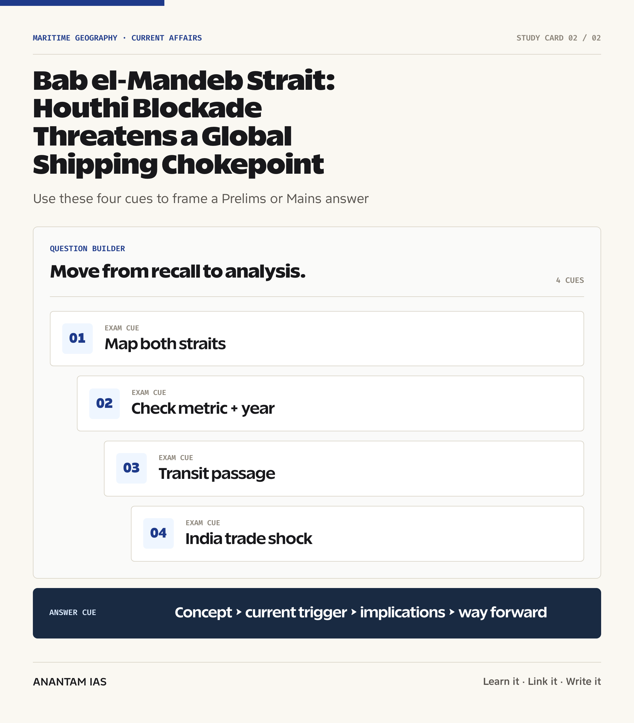
- A maritime chokepoint need not be fully closed to disrupt global commerce. Analyse this statement with reference to the Houthi threat at Bab el-Mandeb, distinguishing declared blockade, operational capability and commercial risk. (250 words)
- Compare the geographic and economic significance of Bab el-Mandeb and the Strait of Hormuz. Discuss how simultaneous stress at both passages could affect India’s energy security, external trade and maritime strategy. (250 words)
Sources: U.S. Energy Information Administration and The Hindu Explained and The Indian Express Explained.
Frequently Asked Questions
Where is Bab el-Mandeb?
Bab el-Mandeb lies between Yemen on the Arabian Peninsula and Djibouti and Eritrea in the Horn of Africa. It connects the Red Sea with the Gulf of Aden, which opens into the Arabian Sea and Indian Ocean. It is the southern gateway for ships using the Red Sea-Suez route.
Is Bab el-Mandeb fully closed?
The July 2026 announcement was a Houthi declaration aimed at Saudi-linked shipping, not verified proof that all traffic had stopped. Enforcement details were initially unclear, and some rerouting claims lacked independent confirmation. Traffic can still be disrupted through threat perception, insurance costs and voluntary carrier avoidance without a universal physical closure.
How is Bab el-Mandeb different from Hormuz?
Bab el-Mandeb connects the Gulf of Aden and Red Sea, supporting the Suez route between Asia and Europe. Hormuz connects the Persian Gulf and Gulf of Oman, carrying much larger oil flows from Gulf producers. EIA estimated 4.2 million barrels per day at Bab el-Mandeb and 20.9 million at Hormuz in 1H25.
How much oil uses Bab el-Mandeb?
The U.S. Energy Information Administration estimated about 4.2 million barrels per day of crude oil, condensate and petroleum products through Bab el-Mandeb in the first half of 2025. The comparable 2023 flow was 9.3 million barrels per day, before security-driven diversions sharply reduced traffic.
Why does the strait matter to India?
The route carries India-Europe trade and Indian petroleum-product exports, and instability can raise crude prices, freight, insurance and delivery times. Those costs can feed into the import bill, rupee, current-account deficit and inflation. Indian seafarers and merchant vessels also face direct safety and operational risks.
What is the Cape alternative?
Ships can avoid Bab el-Mandeb and Suez by sailing around the Cape of Good Hope at Africa’s southern end. The route is safer from Red Sea threats but longer. EIA compared roughly 19 days through Suez with nearly 35 days around the Cape for a Persian Gulf-to-northwest Europe petroleum voyage.
Tell Google you want more of this.
Add Anantam IAS as a preferred sourceOne tap, and this site shows up more often in your own Top Stories, AI Overviews and AI Mode. Remove it any time.