Why in News?
A Doppler Weather Radar was inaugurated at Sambalpur, Odisha, on 17 September 2026 to strengthen weather observations and early-warning inputs for western Odisha and adjoining regions.
- Commissioned facility: The ministry identifies Sambalpur as an addition to Odisha’s existing radar infrastructure at Gopalpur and Paradip.
- Regional purpose: The installation addresses an observation gap affecting the monitoring of weather systems over western Odisha.
- Complementary measurements: The announcement also emphasizes automatic weather stations, rain gauges and upper-air observations.
- Risk reduction: Better observations can improve understanding of an approaching weather hazard, but protective decisions still require local knowledge and timely communication.
- Scientific distinction: A radar measures signals from the atmosphere; a forecast interprets how weather may evolve, and a warning connects expected hazards with action.
UPSC Relevance
Prelims Relevance
- Doppler Weather Radar: active remote sensing
- Reflectivity and radial velocity
- Nowcasting and numerical weather prediction
- Rain gauges and automatic weather stations
- Hazard observations versus impact-based warnings
Mains Relevance
GS Paper 3
- Observational infrastructure and disaster preparedness
- Warning communication, forecast uncertainty and local response
GS Paper 1
- Weather observation and regional rainfall variability
Essay
- Scientific information protects communities when public institutions turn it into timely decisions.
Background and Context
What radar observations actually tell a forecaster
Doppler radar sends electromagnetic pulses and examines returned signals, providing different kinds of information about precipitation and motion that should not be confused with one another.
- Reflectivity describes the strength of the radar return after processing. It helps locate precipitation and compare its structure, but conversion into surface rainfall requires assumptions about the particles producing the signal and their distribution.
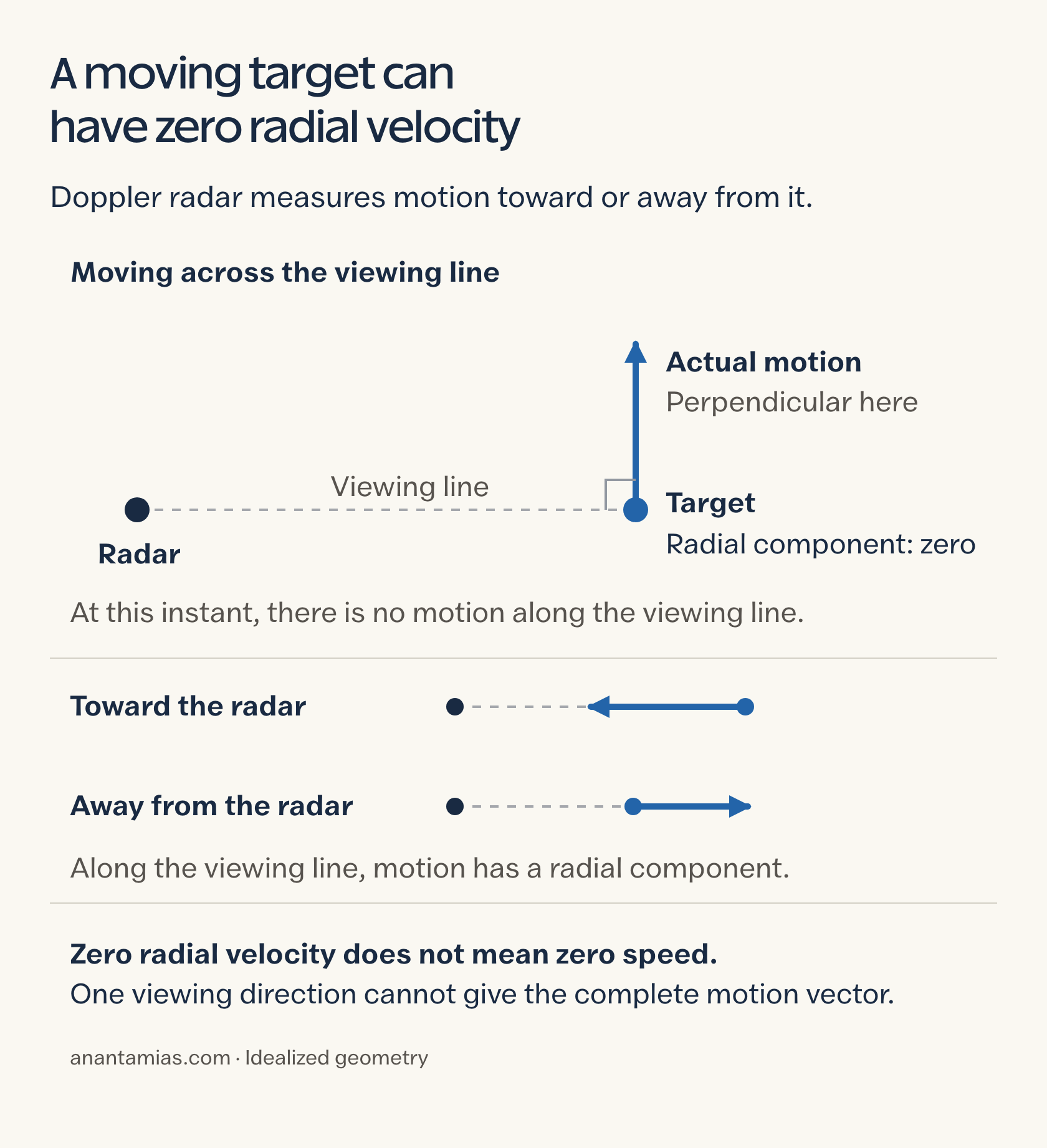
- Radial velocity measures motion toward or away from the radar along its viewing direction. It is only a component of movement, so a single measurement does not directly reveal the complete wind vector.
- The Doppler effect links relative motion to a shift in the returned signal. Motion directly across the viewing direction can have little radial component even when the target is moving quickly through the atmosphere.
- Repeated scans help forecasters examine changes in precipitation structure and movement. Comparing successive observations is more informative than reading one image as a prediction, because weather systems may strengthen, weaken or change direction after observation.
- Rainfall estimation is a derived product, not the same measurement as collecting rain in a gauge. A strong echo can support interpretation of an intense system without proving the exact amount falling at ground level.
Why Sambalpur needs a network, not an isolated instrument
The new radar supplies a regional view of developing weather, while other instruments help check conditions near the surface and across the atmosphere around it.
- Western Odisha is the commissioning announcement’s central geographic focus. The additional observations can help meteorological agencies follow developing systems in this area; the release does not establish a guaranteed forecast accuracy for every locality.
- Rain gauges measure accumulated precipitation at particular sites, while radar provides broader spatial information. Comparing them can reveal discrepancies in estimated rainfall, helping forecasters interpret whether a radar-derived pattern agrees with conditions on the ground.
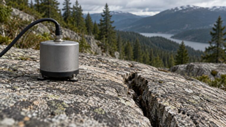
- Automatic weather stations add local measurements, while upper-air instruments describe atmospheric conditions above the surface. Their complementary roles matter because an evolving storm cannot be understood fully through a single type of observation alone.
- Radar limitations include unwanted echoes and differences between precipitation sampled aloft and rain reaching the surface. Quality checks and correction methods are part of producing useful observations; more equipment does not remove measurement uncertainty automatically.
- The earlier Wayanad radar discussion offers a comparison in network planning. However, its project specifications cannot be transferred to Sambalpur: frequency band, useful range and coverage depend on the particular installation and its operation.
How observations become useful warnings
Observation, forecast and action are separate stages: failure in interpretation or communication can waste the additional preparation time that improved monitoring is intended to provide.
- Nowcasting addresses weather developing over the immediate future, drawing on current observations and their evolution. Radar is useful here, but extrapolating an existing rain cell cannot guarantee that new cells will not develop elsewhere.
- Forecast interpretation combines observations with wider meteorological analysis and model guidance. Forecasters must assess uncertainty rather than equate a clear radar image with certainty about the timing, location or severity of the next event.
- Impact assessment adds information about exposed people, drainage, roads and essential services. Similar rainfall can create different consequences in different places, which is why a weather signal alone cannot determine the required local response.
- Warning delivery should specify the threatened area, expected timing and recommended action in language recipients understand. The related monsoon-warning framework explains why administrative readiness and public communication belong alongside technical forecasting in disaster preparedness.
- Evaluation should follow the whole chain: whether the hazard was detected, whether a useful alert arrived and whether protective action followed. Counting instruments or messages sent cannot establish that vulnerable communities actually received effective protection.
Way Forward
Test the observation-to-action chain
- Maintain reliable observations: Check instrument performance and compare radar estimates with ground measurements before relying on derived products.
- Prepare local decisions: Link warnings with agreed responsibilities for schools, transport operators, utilities and district authorities.
- Review real events: Examine missed hazards, false alarms and communication delays together so that technical and administrative weaknesses are corrected.
Conclusion
- Sambalpur strengthens weather observation in western Odisha. Its significance lies in additional information about developing systems, while the scientific distinction between reflectivity, radial motion and estimated rainfall remains essential for interpreting what radar can show.
- Early warning requires early action. Better observation becomes public protection when forecasts are interpreted with local risk information, communicated promptly and connected with practical decisions that communities and institutions are ready to carry out.
UPSC Practice Questions
Prelims MCQ 1
With reference to Doppler Weather Radar, consider the following statements:
- Radial velocity represents movement toward or away from the radar along the viewing direction.
- A single radial-velocity measurement directly gives the complete wind vector.
- Surface rainfall estimates derived from radar require interpretation and can be compared with rain-gauge observations.
How many of the above statements are correct?
(a) Only one (b) Only two (c) All three (d) None
Answer: (b) Only two
Explanation:
Statements 1 and 3 are correct. Radial velocity is one component of motion. Radar-derived rainfall involves assumptions and corrections, so it is not identical to direct surface measurement.
Prelims MCQ 2
A useful weather alert reaches a district office but does not reach the affected villages in time. Which part of early warning has most directly failed?
(a) Generation of the electromagnetic pulse (b) Measurement of radial velocity (c) Last-mile communication (d) Calculation of radar reflectivity
Answer: (c) Last-mile communication
Explanation:
The scenario specifies that a useful alert already exists and reaches the district. The immediate failure is timely delivery to affected communities, demonstrating that observation and forecasting alone are insufficient.
UPSC Mains Questions
- Explain the information supplied by Doppler Weather Radar and its limitations as a tool for local disaster preparedness.
- Using the Sambalpur commissioning as context, examine why a weather-observation network must be linked with impact assessment, communication and institutional readiness.
Sources: PIB, Ministry of Earth Sciences and India Meteorological Department, Radar Meteorology.
Frequently Asked Questions
What is the significance of the Sambalpur radar?
The commissioned installation strengthens observations over western Odisha and adjoining regions. It adds information for tracking weather systems and informing warnings, while ground measurements and local preparedness remain necessary for effective disaster-risk reduction.
What is radial velocity?
It is the component of motion toward or away from the radar along the viewing direction. Motion across that direction may have little radial component, so one measurement does not provide the complete wind vector.
Is radar reflectivity the same as rainfall measured on the ground?
No. Reflectivity concerns the returned radar signal. Estimating surface rainfall from it requires assumptions and corrections, while a rain gauge measures precipitation collected at a particular location on the ground.
Does better radar coverage guarantee an accurate forecast?
No. Observations improve the available evidence, but measurement limits and the changing atmosphere create uncertainty. Forecasters combine radar with other observations and analysis before issuing predictions or warnings for particular places.
Can the new radar prevent floods or thunderstorms?
No. Radar observes weather rather than stopping hazardous processes. It can inform warnings and protective decisions, but reduced losses depend on appropriate forecasts, communication, preparedness and timely action by institutions and communities.
Tell Google you want more of this.
Add Anantam IAS as a preferred sourceOne tap, and this site shows up more often in your own Top Stories, AI Overviews and AI Mode. Remove it any time.