Disclosure: this guide contains Amazon affiliate links. As an Amazon Associate, Anantam IAS earns from qualifying purchases — at no extra cost to you.
If you’re prepping for UPSC in Hindi medium and searching “indian geography hindi” — you’ve probably hit the same wall most aspirants hit. English-medium notes use “physiographic divisions” and “drainage patterns” as if everyone grew up reading Wren and Martin. Hindi NCERTs translate the terms but skip the Mains-level depth. Coaching material in Hindi often runs ten years out of date. I’ve watched Hindi-medium toppers — and they exist, plenty of them — solve this by treating English notes as primary and Hindi NCERTs as a glossary anchor. This article does the same. Indian geography hindi content here is in English (because Anantamias is an English-medium UPSC site), but every key term carries its Hindi equivalent (Devanagari + transliteration), and the closing section maps you to Hindi-medium books that actually work.
Note for Hindi-medium aspirants — यह लेख अंग्रेज़ी में है, लेकिन सभी प्रमुख भौगोलिक शब्दों के हिंदी अनुवाद और transliteration दिए गए हैं। अंत में हिंदी माध्यम के स्रोत और किताबें भी सूचीबद्ध हैं।
What is Indian geography (भारत का भूगोल)?
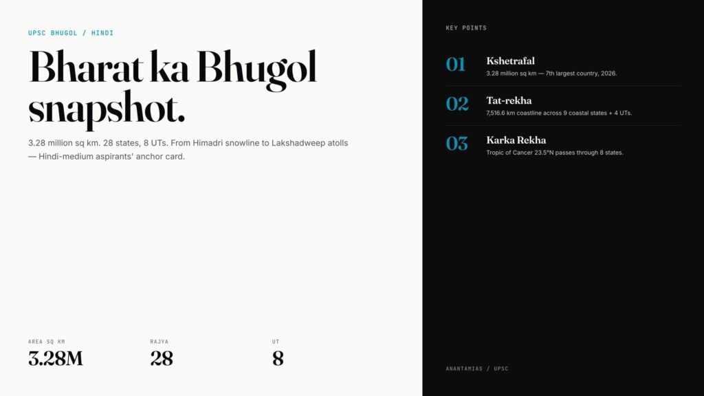
Indian geography (Bharat ka Bhugol — भारत का भूगोल) is the systematic study of India’s physical features, climate, drainage, soils, vegetation, and human-economic patterns across 3,287,263 sq km of land — split among 28 states (rajya — राज्य) and 8 Union Territories (kendra-shasit pradesh — केंद्र शासित प्रदेश) as of 2026.
Three quick facts:
- Area — 3.28 million sq km — kshetrafal (क्षेत्रफल) — 7th largest country.
- Population — over 1.42 billion (2024) — jansankhya (जनसंख्या) — most populous country.
- Coastline — 7,516.6 km — samudra tat (समुद्र तट) — across 9 coastal states + 4 UTs.
Branches of Indian geography (भूगोल की शाखाएँ)
UPSC tests four branches — and Hindi-medium aspirants need to know all four by their Hindi labels:
- Physical Geography — Bhautik Bhugol (भौतिक भूगोल) — relief, drainage, climate, vegetation, soils.
- Human Geography — Manav Bhugol (मानव भूगोल) — population, settlements, migration.
- Economic Geography — Arthik Bhugol (आर्थिक भूगोल) — agriculture, industry, transport.
- Political Geography — Rajneetik Bhugol (राजनीतिक भूगोल) — boundaries, states, geopolitics.
NCERT Class 11 (Bharat: Bhautik Paryavaran) covers physical. Class 12 (Bharat: Log Aur Arthavyastha) covers human + economic. Hindi-medium aspirants get both books from NCERT directly — see NCERT books for UPSC for the full list.
The 5 physiographic divisions (पाँच भू-आकृतिक प्रदेश)
This is where Indian geography hindi syllabi start. Memorise the Hindi labels — Mains essays sometimes ask candidates to use Hindi terminology when answering in Hindi.
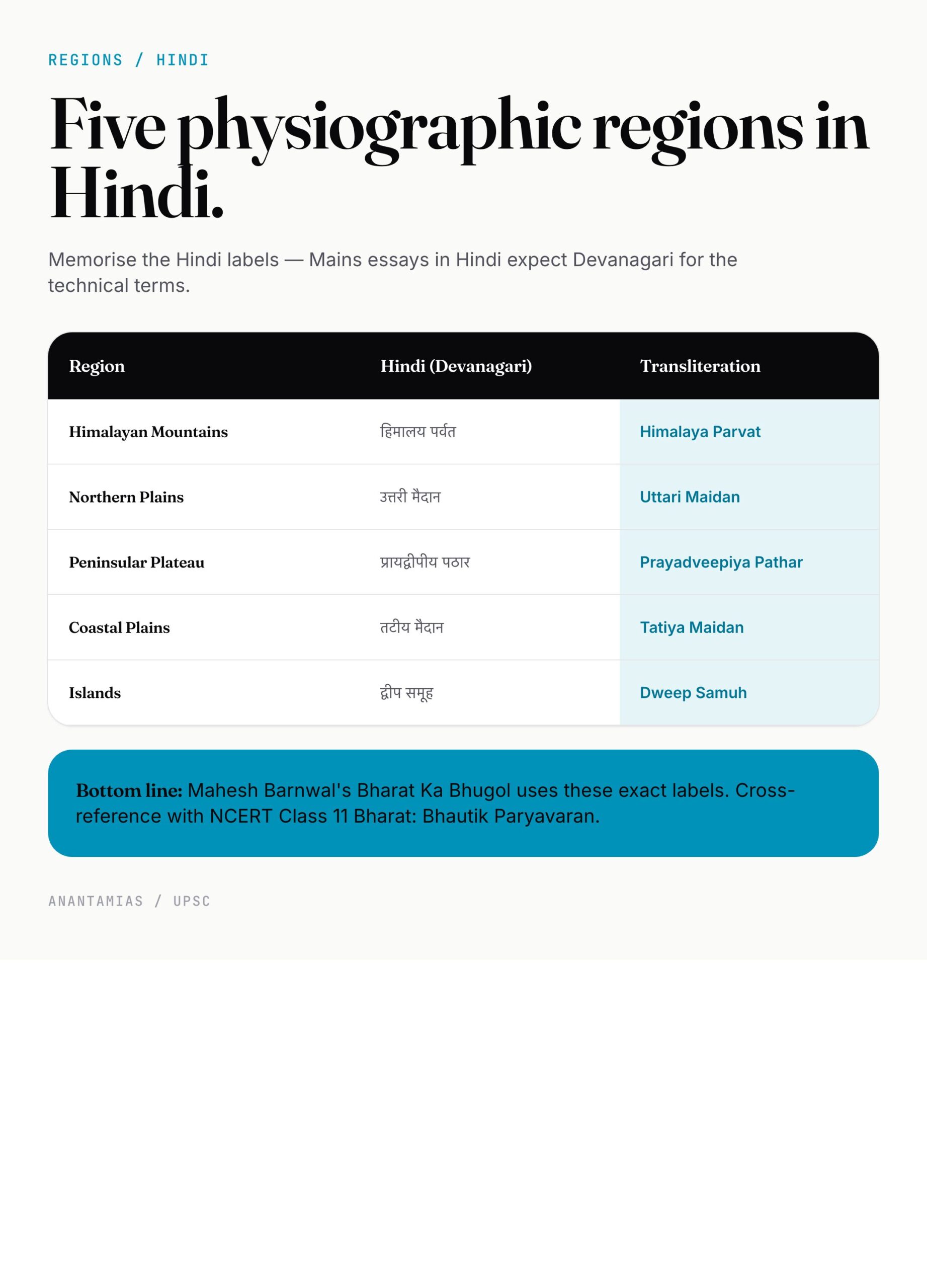
| # | English | Hindi (Devanagari) | Transliteration |
|---|---|---|---|
| 1 | Himalayan Mountains | हिमालय पर्वत | Himalaya Parvat |
| 2 | Northern Plains | उत्तरी मैदान | Uttari Maidan |
| 3 | Peninsular Plateau | प्रायद्वीपीय पठार | Prayadveepiya Pathar |
| 4 | Coastal Plains | तटीय मैदान | Tatiya Maidan |
| 5 | Islands | द्वीप समूह | Dweep Samuh |
The Himalaya mountain, Northern Plains, and peninsular plateau articles each go deeper.
The Himalayas are India’s youngest fold mountains — Naveentam Vali Parvat (नवीनतम वलित पर्वत). Three parallel ranges: Himadri (Greater), Himachal (Lesser), Shivalik (Outer). India’s highest peak — Kangchenjunga (कंचनजंगा) — sits at 8,586 m in Sikkim.
The Peninsular Plateau is the oldest landmass — Pracheentam Bhubhag (प्राचीनतम भूभाग) — over 600 million years old. It carries nearly all of India’s metallic mineral wealth.
Drainage system (अपवाह तंत्र)
Indian rivers (nadiyan — नदियाँ) split into two systems:
Himalayan rivers (हिमालयी नदियाँ) — perennial (saritprabhi — सरितप्रभी), snow + rain fed. Three groups:
- Indus system — Sindhu Tantra (सिंधु तंत्र) — Indus, Jhelum, Chenab, Ravi, Beas, Sutlej.
- Ganga system — Ganga Tantra (गंगा तंत्र) — Ganga + Yamuna, Ghaghara, Gandak, Kosi, Son. India’s longest at 2,525 km.
- Brahmaputra system — Brahmaputra Tantra (ब्रह्मपुत्र तंत्र) — origin in Tibet, enters via Arunachal.
Peninsular rivers (प्रायद्वीपीय नदियाँ) — seasonal (mausami — मौसमी), rain-fed.
- East-flowing — Mahanadi, Godavari (1,465 km — 2nd longest in India), Krishna, Cauvery — form deltas.
- West-flowing — Narmada (नर्मदा), Tapi (तापी) — flow through rift valleys, form estuaries.
For more, see river systems of India and Ganga river system.
Climate (जलवायु) and monsoon (मानसून)
India’s climate is monsoonal — the word mansoon (मानसून) comes from Arabic mausim (season). Four IMD-recognised seasons:
- Cold weather — Sheet Ritu (शीत ऋतु) — December to February.
- Hot weather — Greeshm Ritu (ग्रीष्म ऋतु) — March to May.
- Southwest monsoon — Dakshin-Pashchim Mansoon (दक्षिण-पश्चिम मानसून) — June to September. Brings 75% of annual rainfall.
- Retreating monsoon — Lautata Mansoon (लौटता मानसून) — October–November. Tamil Nadu’s main rainy season.
Mawsynram in Meghalaya — wettest place on Earth, 11,872 mm annual average. Thar (थार) — the great Indian desert in Rajasthan, under 200 mm. Same country, 60x rainfall difference. The monsoon in India article explains the mechanism.
Soils (मिट्टियाँ) and vegetation (वनस्पति)
ICAR’s eight soil types — Hindi labels worth memorising:
- Alluvial — Jalodh Mitti (जलोढ़ मिट्टी)
- Black — Kali Mitti (काली मिट्टी) / Regur (रेगुर)
- Red and Yellow — Lal Aur Peeli Mitti (लाल और पीली मिट्टी)
- Laterite — Latrite Mitti (लैटराइट मिट्टी)
- Arid/Desert — Marusthaliya Mitti (मरुस्थलीय मिट्टी)
- Saline/Alkaline — Lavni-Khari Mitti (लवणी-क्षारीय मिट्टी)
- Peaty/Marshy — Peati Mitti (पीटी मिट्टी)
- Forest/Mountain — Vaniya Mitti (वनीय मिट्टी)
Five vegetation types — Vanaspati ke Prakar (वनस्पति के प्रकार):
- Tropical Evergreen — Ushnakatibandhiya Sadabahar (उष्णकटिबंधीय सदाबहार).
- Tropical Deciduous (Monsoon) — Patjhad Van (पतझड़ वन). Largest forest type in India.
- Tropical Thorn — Kantedaar Van (कांटेदार वन). Rajasthan, Gujarat.
- Montane — Parvatiya Van (पर्वतीय वन).
- Mangrove — Madbhumi Van (मद्भूमि वन) / Kachhar Van.
Read soil types of India and natural vegetation of India for full coverage.
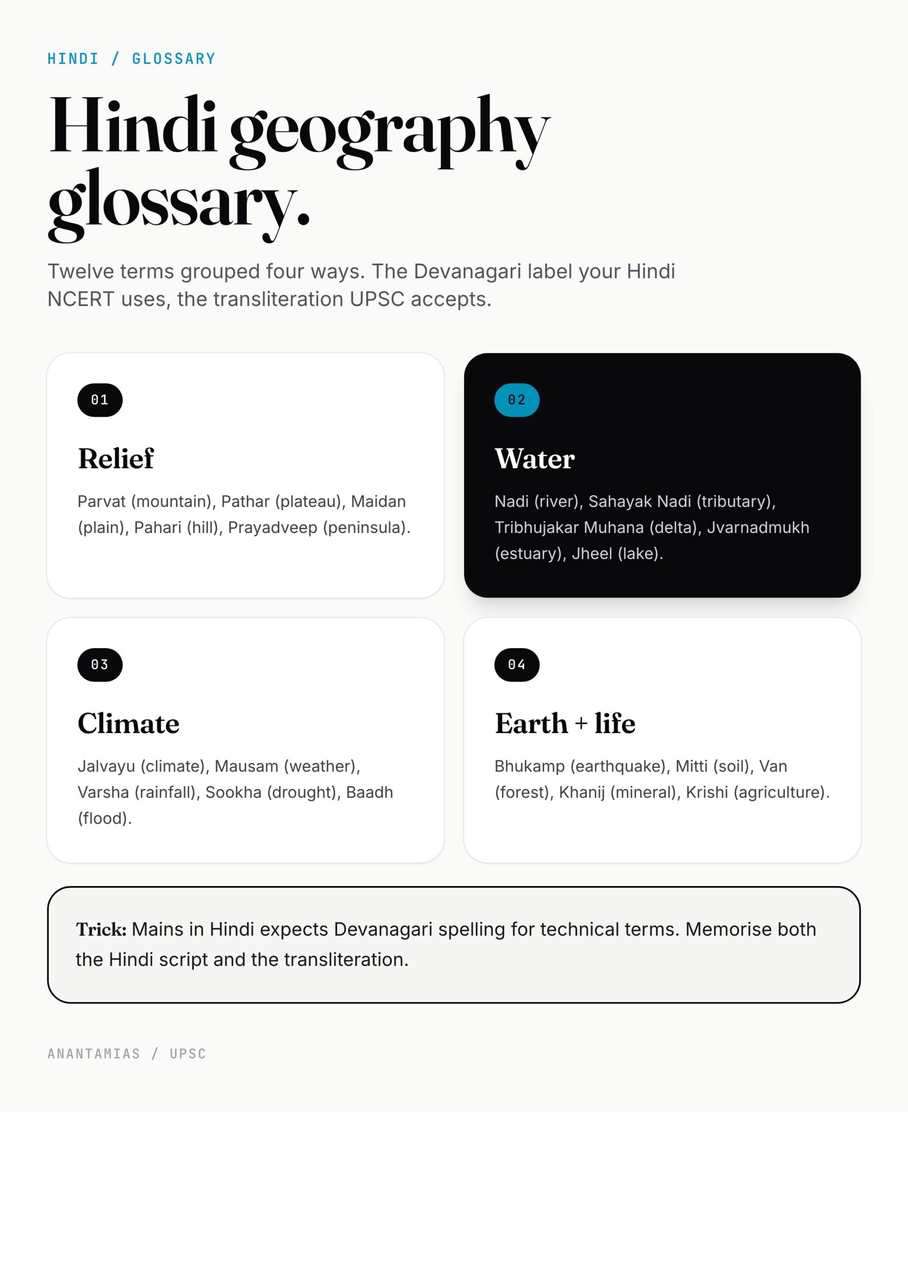
Hindi-English geography glossary (30 essential terms)
| English | Hindi | Transliteration |
|---|---|---|
| Geography | भूगोल | Bhugol |
| Mountain | पर्वत | Parvat |
| Plateau | पठार | Pathar |
| Plain | मैदान | Maidan |
| Plateau | पठार | Pathar |
| Hill | पहाड़ी | Pahari |
| River | नदी | Nadi |
| Tributary | सहायक नदी | Sahayak Nadi |
| Delta | डेल्टा / त्रिभुजाकार मुहाना | Tribhujakar Muhana |
| Estuary | ज्वारनदमुख | Jvarnadmukh |
| Glacier | हिमनद / ग्लेशियर | Himnad |
| Lake | झील | Jheel |
| Sea | समुद्र | Samudra |
| Ocean | महासागर | Mahasagar |
| Island | द्वीप | Dweep |
| Peninsula | प्रायद्वीप | Prayadveep |
| Coast | तट | Tat |
| Bay | खाड़ी | Khari |
| Climate | जलवायु | Jalvayu |
| Weather | मौसम | Mausam |
| Rainfall | वर्षा | Varsha |
| Drought | सूखा | Sookha |
| Flood | बाढ़ | Baadh |
| Cyclone | चक्रवात | Chakravat |
| Earthquake | भूकंप | Bhukamp |
| Forest | वन | Van |
| Soil | मिट्टी | Mitti |
| Mineral | खनिज | Khanij |
| Agriculture | कृषि | Krishi |
| Population | जनसंख्या | Jansankhya |
Key map features for UPSC (मानचित्र की मुख्य विशेषताएँ)
A map question in Prelims rarely asks “where is X” — it asks the connection. Here are 10 high-yield map facts every Hindi-medium aspirant must lock down:
- Tropic of Cancer (Karka Rekha — कर्क रेखा) passes through 8 states: Gujarat, Rajasthan, MP, Chhattisgarh, Jharkhand, West Bengal, Tripura, Mizoram.
- Standard Meridian — 82°30’E — passes through Mirzapur (UP).
- Indian Standard Time is +5:30 GMT.
- Highest peak in India — Kangchenjunga, Sikkim — 8,586 m.
- Longest river — Ganga — 2,525 km.
- Largest state by area — Rajasthan.
- Smallest state by area — Goa.
- Largest UT — Ladakh (post-2019 reorganisation).
- Highest waterfall — Kunchikal (Karnataka) — 455 m.
- Active volcano — Barren Island (Andaman).
Why Indian geography matters for UPSC
Prelims — every year sees 8–12 geography questions. Heavy on map-based MCQs and physical geography.
Mains GS-I — Indian geography is one of three pillars (along with society and history). Expect questions on monsoon, drought, soil erosion, landslides, urbanisation.
Mains GS-III — disaster management, agriculture, infrastructure all draw from geography.
Optional — Geography is the most popular optional subject after PSIR. Hindi-medium aspirants who pick Geography as optional save preparation time because the GS overlap is massive.
How to study Indian geography in Hindi (हिंदी में कैसे पढ़ें)
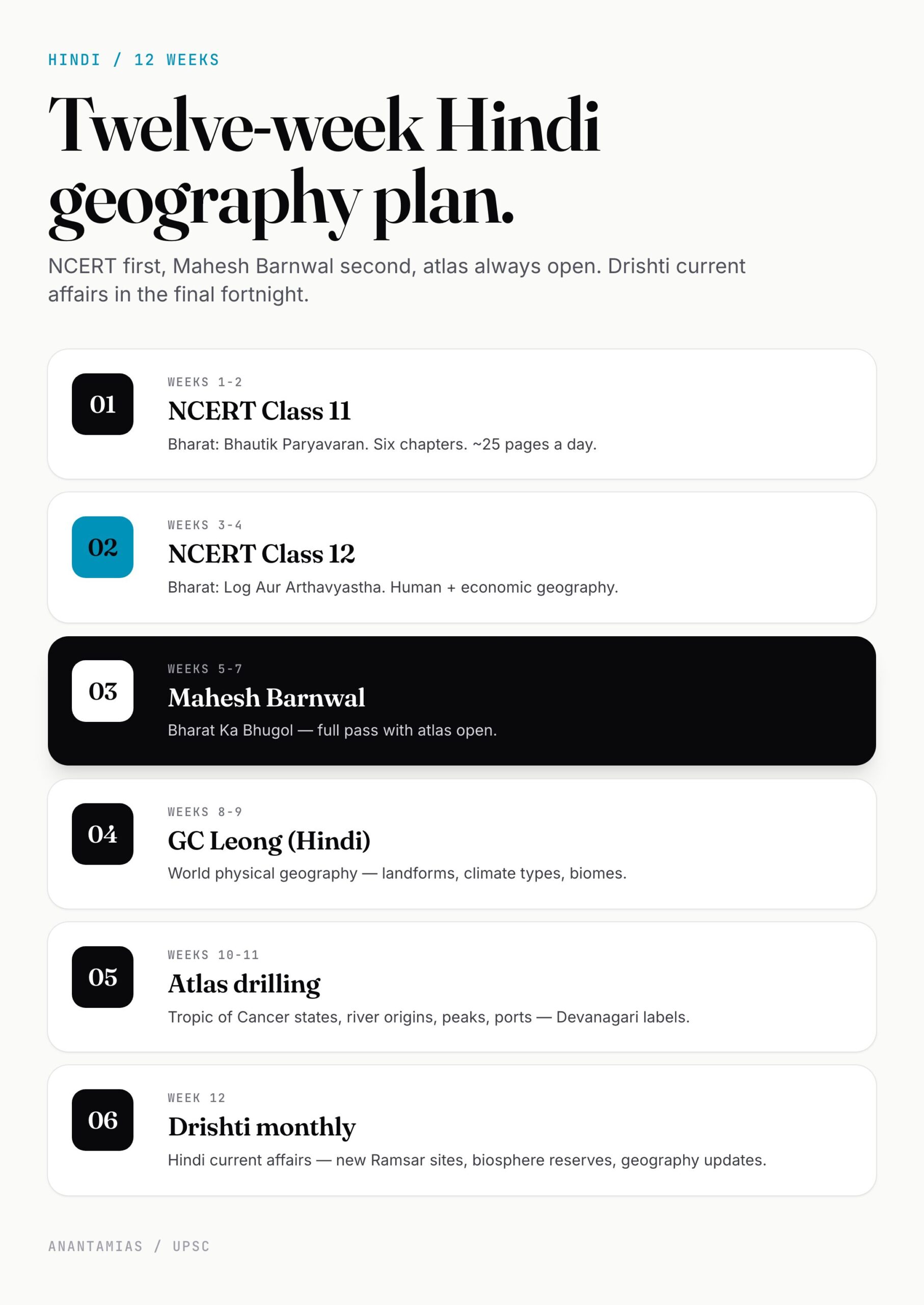
Source priority for Hindi-medium aspirants:
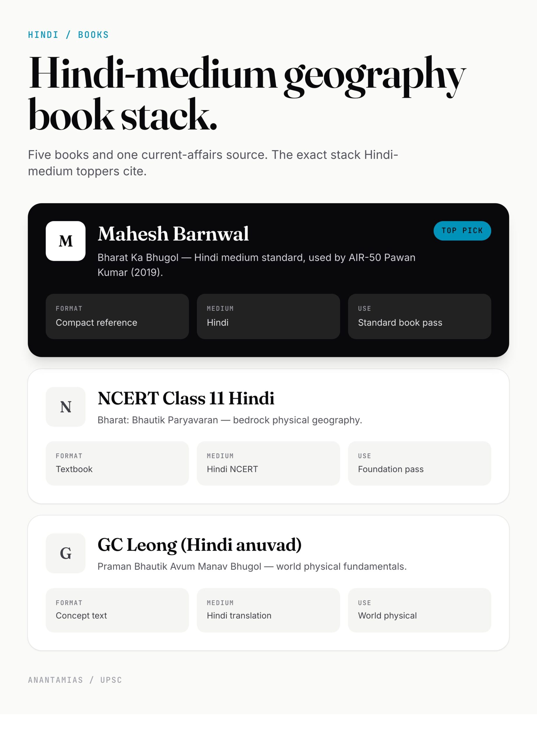
- NCERT Class 11 (Hindi) — *Bharat: Bhautik Paryavaran (भारत: भौतिक पर्यावरण). Foundation. Every chapter is exam-relevant.
- NCERT Class 12 (Hindi) — *Bharat: Log Aur Arthavyastha (भारत: लोग और अर्थव्यवस्था). Human and economic geography.
- GC Leong — *Praman Bhautik Avum Manav Bhugol* (Hindi anuvad). Best for world physical geography basics.
- Mahesh Barnwal — *Bharat Ka Bhugol* (Hindi). Compact, UPSC-aligned, used by Hindi-medium toppers.
- Drishti IAS Bhugol Notes (Hindi) — well-organised current affairs + concept blend.
- Atlas — Orient Blackswan ya NCERT Atlas (Hindi). Open atlas while reading. Always.
Drishti and Vision IAS both publish Hindi monthlies for current affairs — use them for the geography section especially (new Ramsar sites, biosphere reserves, Ladakh changes, etc).
Common misconceptions
- “Hindi-medium loses marks in Geography” — Wrong. UPSC explicitly weights both mediums equally. Toppers like Pawan Kumar (AIR 50, 2019) cleared in Hindi.
- “Hindi NCERTs are just translations” — Mostly true, but the translation quality is high. The Hindi NCERT’s terminology is what UPSC examiners use in their own Hindi question papers.
- “You need to study in English first” — No. You can study entirely in Hindi using the NCERT + Mahesh Barnwal + Drishti combination. The English layer is helpful for cross-reference, not mandatory.
How to revise this in 30 minutes
- NCERT Class 11 Hindi — chapters 1–6 — skim headings (10 min).
- Atlas — trace Tropic of Cancer states, major rivers, peaks (10 min).
- Mahesh Barnwal — soils + vegetation tables (5 min).
- Drishti monthly — geography current affairs (5 min).
Frequently Asked Questions
Indian geography hindi mein kaun si kitab best hai?
NCERT Class 11 (Bharat: Bhautik Paryavaran) and Mahesh Barnwal’s Bharat Ka Bhugol together cover 80% of UPSC syllabus.
Bharat mein kitne physiographic divisions hain?
Five — Himalaya Parvat, Uttari Maidan, Prayadveepiya Pathar, Tatiya Maidan, Dweep Samuh.
Bharat ki sabse lambi nadi kaun si hai?
Ganga — 2,525 km. Sabse lambi prayadveepiya nadi (longest peninsular) — Godavari, 1,465 km.
Bharat ka sabse uncha shikhar kaun sa hai?
Kanchenjunga (कंचनजंगा) — Sikkim — 8,586 m.
Mansoon kya hai aur kab aata hai?
Mansoon (मानसून) is the seasonal reversal of winds. Southwest monsoon (June–September) brings 75% of India’s rainfall. Northeast monsoon (October–November) waters Tamil Nadu and the eastern coast.
Hindi medium ke liye Geography optional sahi hai?
Yes — it’s the most popular optional after PSIR. Hindi NCERTs and Hindi-medium coaching are both well-developed.
Bharat mein kitne states aur UT hain 2026 mein?
28 states aur 8 union territories — 2019 ke baad Jammu & Kashmir aur Ladakh alag UT bane.
Kya Hindi medium se IAS bana ja sakta hai?
Bilkul. Har saal Hindi medium se 30–50 candidates final list mein aate hain. Topper interviews mein bhi confirm hota hai.
Tell Google you want more of this.
Add Anantam IAS as a preferred sourceOne tap, and this site shows up more often in your own Top Stories, AI Overviews and AI Mode. Remove it any time.