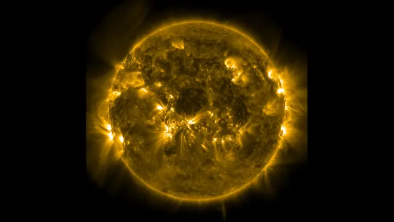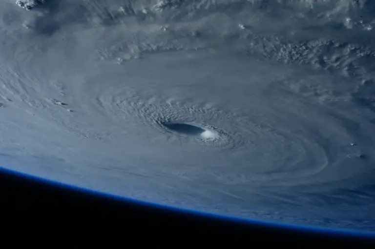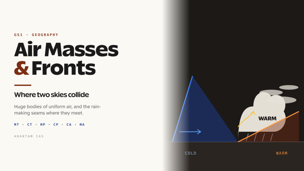
Stand outside on a clear winter morning in Delhi when the wind has swung round to the northwest, and the air feels different — drier, sharper, colder than the day before. Nothing local changed overnight. What changed is that a vast slab of air, cooled and dried over the plains of Central Asia, has slid down over you, carrying the temperature of a place hundreds of kilometres away. That slab is an air mass, and the day-to-day drama of weather — the sudden squall, the grey drizzle that won’t lift, the brilliant blue that follows a storm — is mostly the story of these huge bodies of air drifting across the planet and colliding along sharp boundaries called fronts.
For a geography aspirant, air masses and fronts are the hinge between two big chapters. They sit downstream of pressure belts, winds and the general circulation, and upstream of cyclones, rainfall types and regional climates. Get them right and a whole set of topics — temperate cyclones, the weather map, even India’s winter western disturbances — suddenly reads as one connected system rather than a list of definitions to memorise. So it pays to understand them properly: what makes an air mass, how meteorologists sort them into a handful of types, and what happens at the violent, rain-making seams where two of them meet.
What an Air Mass Is and Where It Comes From
An air mass is a large body of air — often thousands of kilometres across and stretching up through much of the troposphere — that has roughly uniform temperature and humidity at any given height. The key word is uniform. Within a single air mass you could fly for a day and the basic character of the air would barely change. That homogeneity is what makes the concept useful: instead of tracking every parcel of air, a meteorologist can treat the whole slab as one moving entity with one set of properties.
Air masses acquire that uniform character by sitting still. They form over what climatologists call source regions — large, flat, physically uniform stretches of the Earth where air can stagnate for days or weeks, slowly taking on the temperature and moisture of the surface beneath it. A good source region needs two things: a settled, anticyclonic (high-pressure) circulation that lets air linger, and a uniform surface. The great deserts, the snow-covered polar continents, the warm tropical oceans and the cold high-latitude seas all qualify. Air parked over the Sahara bakes dry and hot; air parked over the Arctic ice grows bitterly cold and dry; air resting on a warm tropical sea turns warm and heavy with moisture. The middle latitudes, by contrast, are a zone of constant movement and mixing, so they rarely make air masses — they are where air masses go to fight.
Once an air mass leaves its source region, it begins to change — a process called modification. As it travels over warmer ground it is heated from below and grows unstable; over colder ground it is chilled at the base and turns stable; crossing a sea it picks up moisture, and crossing mountains it is wrung dry. So the weather an air mass delivers depends not only on where it was born but on the journey it took to reach you. A polar air mass that has crossed a long stretch of warm ocean arrives far moister and more turbulent than the same air would over land. This is why two cold spells can feel so different — one crisp and sunny, the other raw and showery.
Two extra ideas are worth carrying into the exam hall. First, an air mass is described as warm or cold relative to the surface it is moving over, not in absolute terms — a “cold” air mass is simply one colder than the ground beneath it, which is why it is cooled from below and turns stable, while a “warm” air mass is warmer than the surface, heated from below and made unstable. Stability decides everything that follows: a stable air mass suppresses vertical motion and gives clear or hazy, layered skies, while an unstable one encourages towering clouds and showers. Second, the same air mass can behave very differently in summer and winter, because the contrast between its temperature and the surface flips with the seasons. The result is that a handful of source regions, feeding a handful of air-mass types, between them set the basic weather mood of half the planet — before a single front has even formed.
Classifying Air Masses: Maritime and Continental, Tropical to Arctic
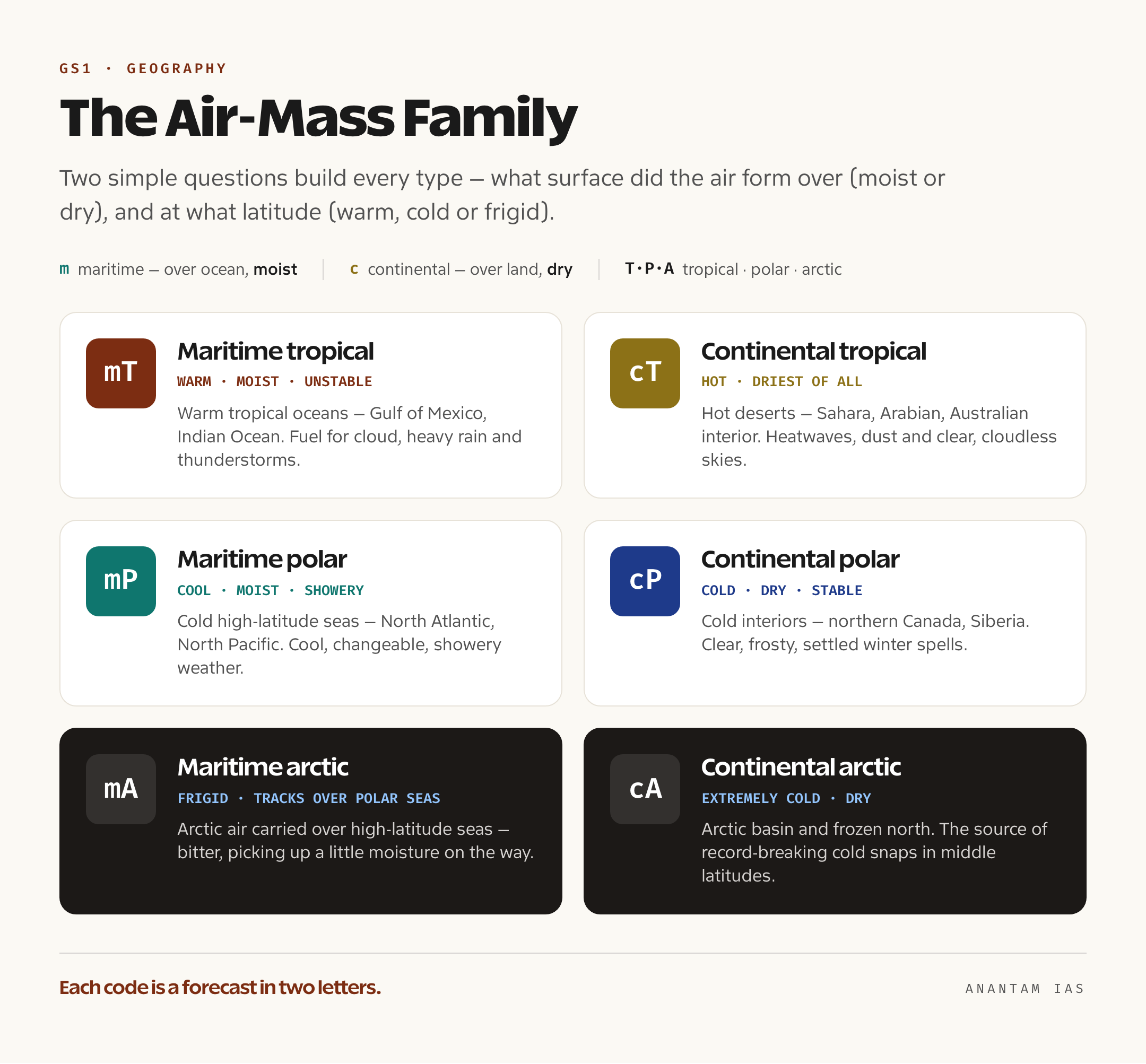
The classification looks intimidating as a string of two-letter codes, but it rests on just two simple questions, and once you see them the whole table builds itself. The first question is about moisture — what kind of surface did the air form over? Air born over an ocean is maritime, written with a lowercase m, and is moist. Air born over land is continental, written with a lowercase c, and is dry. The second question is about temperature — what latitude did it form in? This gives the capital letter: T for tropical (warm), P for polar (cold), and A for arctic or antarctic (the very coldest). Cross the two questions and you get the family of air masses, each written as a small letter plus a capital.
Run through the main types and the logic is plain. Maritime tropical (mT) air forms over warm tropical and subtropical oceans — the Gulf of Mexico, the warm western Pacific, the Indian Ocean — and is warm, very moist and unstable near the surface, the classic fuel for clouds, heavy rain and thunderstorms. Continental tropical (cT) air forms over hot deserts like the Sahara, the Arabian and the Australian interior; it is hot and the driest air mass of all, bringing heatwaves and clear, cloudless skies. Maritime polar (mP) air forms over cold high-latitude oceans such as the North Atlantic and North Pacific; it is cool and moist, and after a long sea crossing it arrives unstable, delivering the showery, changeable weather of places like northwestern Europe. Continental polar (cP) air forms over the cold continental interiors of northern Canada and Siberia; it is cold, dry and stable, the source of clear, frosty winter spells. Colder and more extreme still are the arctic and antarctic masses — continental arctic (cA) over the Arctic basin and the frozen north, and maritime arctic (mA) where that frigid air tracks over polar seas — bringing the record-breaking cold snaps of the high and middle latitudes.
A neat way to hold this in your head is a two-by-three grid: maritime versus continental down one axis, tropical-polar-arctic across the other. That single mental table answers most questions, because every air mass on a weather map is some combination of “moist or dry” and “warm, cold or frigid.” And it carries a built-in prediction: an mT air mass means muggy and stormy, a cP air mass means cold and clear, an mP air mass means cool and showery, a cT air mass means hot and dust-dry. The codes are not jargon for its own sake — each one is a forecast in two letters.
Some textbooks add a finer twist by tagging each type with a small w or k — w for an air mass warmer than the surface it is crossing, k for one colder. A cold air mass moving over warmer ground (cPk, say) is heated from below, grows unstable and breaks into showers; a warm one over colder ground (mTw) is chilled, stabilises and tends to fog or low stratus. You don’t need to memorise every permutation, but the principle behind it — that the same air behaves differently depending on what it travels over — is the single most useful idea in the whole classification, and it explains why forecasters care as much about an air mass’s path as about its birthplace.
Fronts: What Happens Where Two Air Masses Meet
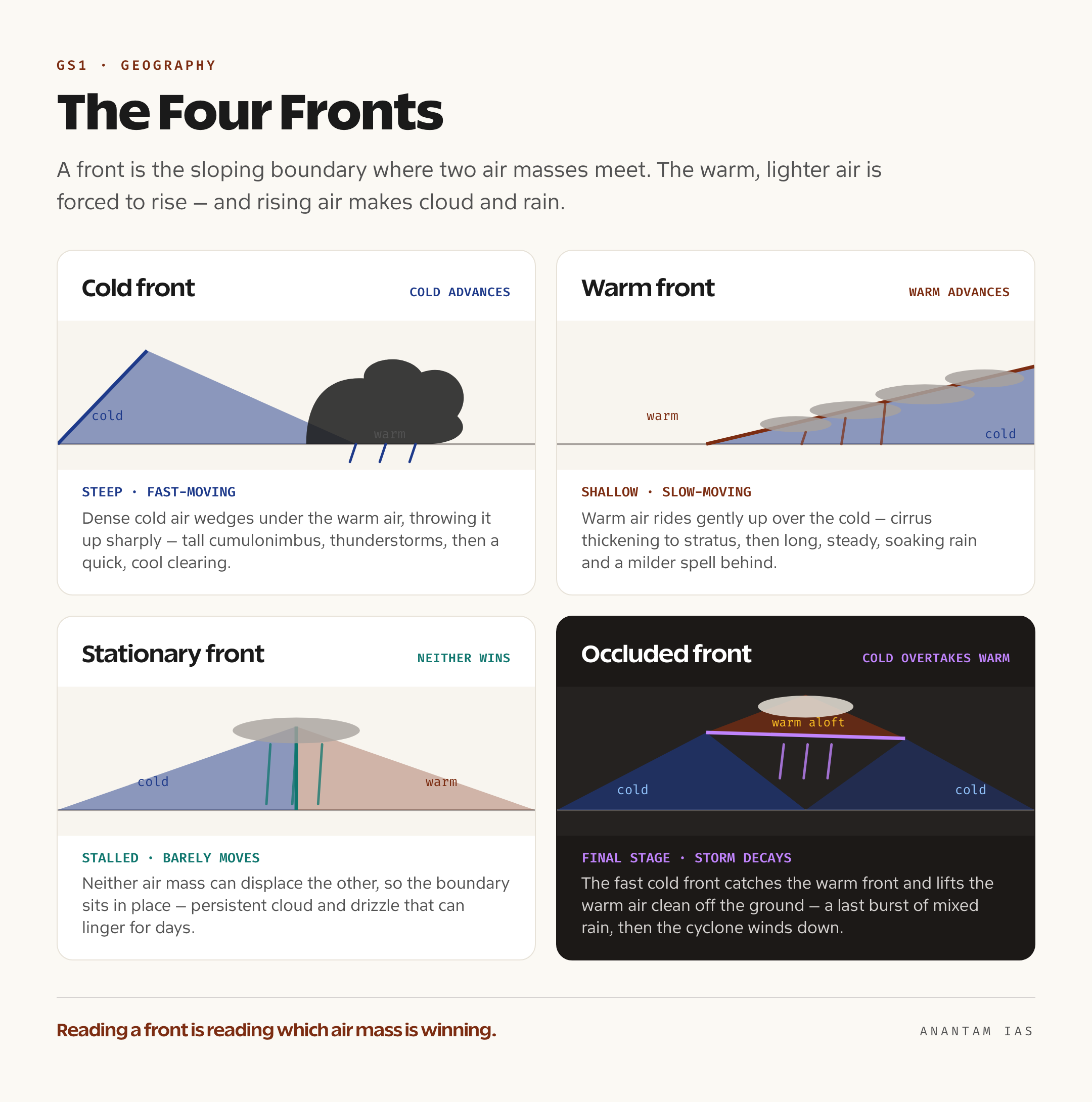
Air masses do not blend gently. Because each has its own temperature and density, when two of them meet they resist mixing and instead press against each other along a sloping boundary — and that boundary is a front. The term was borrowed deliberately from the battlefronts of the First World War by the Norwegian meteorologists who first mapped these systems: a front really is a line of conflict, where warm and cold armies of air collide and the lighter, warmer air is forced to climb over the denser, colder air. That forced ascent is the whole point, because rising air cools, its moisture condenses, and clouds and rain are born. Almost all the organised rainfall of the middle latitudes happens along fronts.
There are four kinds, and they differ in who is advancing and how steeply the warm air is lifted. A cold front forms where a cold air mass actively pushes into and under a warmer one. Cold air is dense, so it shoves beneath the warm air like a wedge and throws it sharply upward. The boundary is steep and the front moves fast, so the lifting is violent: tall cumulonimbus clouds, short bursts of heavy rain, thunderstorms, gusty winds, and then a sudden clearing with colder, fresher air behind. On a weather map a cold front is drawn as a blue line with triangles pointing the way it moves.
A warm front is the gentler opposite. Here the warm air mass is the one advancing, and being lighter it cannot bulldoze the cold air ahead — instead it rides up and over it along a long, shallow slope. Because the ascent is gradual and spread over hundreds of kilometres, the cloud comes in a slow, layered sequence — high wispy cirrus first, thickening to sheets of stratus and nimbostratus — followed by long, steady, soaking rain rather than sharp storms, and a milder spell once the front has passed. It is drawn as a red line with semicircles. A stationary front is the stalemate: two air masses meet but neither is strong enough to displace the other, so the boundary barely moves. Along it the weather sits and sulks — persistent cloud and drizzle that can linger for days over the same place until one side finally gains the upper hand. It is drawn with alternating blue triangles and red semicircles facing opposite ways.
The fourth type, the occluded front, is the climax of the sequence. Because a cold front travels faster than the warm front ahead of it, it eventually catches up and overtakes it, lifting the warm air mass clean off the ground so it no longer touches the surface at all. The two cold air masses then meet, and the warm air is left squeezed aloft. An occlusion brings a final burst of mixed cloud and precipitation and usually signals that the parent storm is winding down. It is drawn as a purple line carrying both triangles and semicircles. These four — cold, warm, stationary, occluded — are the complete vocabulary of the weather map, and reading them is just reading which air mass is winning.
Frontogenesis, Temperate Cyclones and India’s Western Disturbances
Fronts are not permanent fixtures; they are born and they die, and meteorologists have names for both. Frontogenesis is the formation or sharpening of a front — the process by which a temperature contrast between two air masses tightens into a clear boundary, usually where converging winds pack the isotherms (lines of equal temperature) close together. Its opposite, frontolysis, is the weakening and dissolving of a front, when the contrast fades and one air mass quietly absorbs the other. A useful shorthand: frontogenesis is the war breaking out, frontolysis is the peace that follows once one side has won.
Frontogenesis matters because it is the engine of the temperate cyclone, also called the mid-latitude or extratropical cyclone — the travelling low-pressure storm that dominates the weather of the middle latitudes. The classic model, worked out by the Norwegian school in the 1920s, runs like this: along a stationary front between cold polar air and warm tropical air, a kink develops; the warm air bulges poleward into the cold air, drawing a warm front ahead and a cold front behind, and a low-pressure centre spins up at the apex. The whole system drifts eastward with the westerly winds, the faster cold front gradually overtakes the warm front, the warm air is lifted away in an occlusion, and the storm decays. So a temperate cyclone is, in effect, the life cycle of a pair of fronts — which is why understanding fronts unlocks the entire topic of mid-latitude weather.
This is also where the story comes home to India. The winter rain and snow that northwestern India depends on — over Jammu and Kashmir, Himachal Pradesh, Punjab, Haryana and Delhi — is delivered by western disturbances, which are nothing other than temperate cyclones that form far away over the Mediterranean region and travel eastward, steered by the subtropical westerly jet stream, to arrive over the subcontinent. They carry moisture gathered over the Mediterranean, Caspian and Black Seas, and as that air is lifted over northern India it falls as the rain and snow that are vital for the rabi (winter) crop and for replenishing Himalayan snowpack. The same frontal machinery that brings a wet, grey day to northwestern Europe, in other words, brings the cold-weather showers to Punjab — a direct reminder that air masses and fronts are not a distant Western textbook abstraction but a living part of India’s own climate. Master the boundary where two air masses meet, and you have mastered a mechanism that reaches from a Harappan winter to next year’s wheat.
For Your Mains Answer
This is a foundational topic for GS Paper 1, under the physical-geography heading of climatology and world weather systems. Questions on air masses, fronts, temperate (mid-latitude) cyclones, and the western disturbances that feed India’s winter rainfall can all be answered with this material, and it underpins related topics — rainfall types, the general circulation, and regional climates. The skill examiners reward is the ability to move cleanly from a clear definition to a mechanism and then to an Indian or global application, ideally with one labelled diagram.
How to Build the Answer
Start with the definition that anchors everything — an air mass is a large body of air with near-uniform temperature and humidity, formed over a uniform source region. Then classify it on two axes (maritime/continental for moisture, tropical/polar/arctic for temperature) and give one or two examples with the weather they bring. Move to fronts as the boundaries where air masses meet, describe the four types by who is advancing and the weather each delivers, and close by linking frontogenesis to the temperate cyclone and to India’s western disturbances. That arc — define, classify, collide, apply — fits almost any question on this theme.
Common Mistakes to Avoid
Don’t confuse the air mass (the body of air) with the front (the boundary between two of them) — they are different things and examiners notice the slip. Don’t mix up cold and warm fronts: the cold front is steep, fast and stormy, the warm front is shallow, slow and drizzly. Don’t forget the moisture-versus-temperature logic of the codes — mT is moist and warm, cP is dry and cold; reversing the letters reverses the weather. And don’t treat western disturbances as tropical storms — they are temperate cyclones of Mediterranean origin, which is the whole reason they arrive in winter.
A Compact Answer Spine
Air mass = large body of air, uniform temperature and humidity, formed over a uniform source region → classified by surface (maritime m / continental c) and latitude (tropical T / polar P / arctic A) → six types: mT (warm, moist, stormy), cT (hot, driest), mP (cool, moist, showery), cP (cold, dry, clear), cA and mA (frigid) → front = sloping boundary where two air masses meet, lifting warm air to make cloud and rain → four fronts: cold (steep, fast, thunderstorms), warm (shallow, slow, steady rain), stationary (stalled, persistent drizzle), occluded (cold overtakes warm, warm air lifted aloft) → frontogenesis builds the temperate cyclone → western disturbances = Mediterranean-origin temperate cyclones giving northwest India its winter rain.
Diagram or Flowchart Idea
Draw the two-by-three classification grid (maritime/continental against tropical/polar/arctic) on one side, and beside it a simple cross-section of a cold front and a warm front — the cold front a steep wedge with a towering cumulonimbus, the warm front a long gentle ramp with layered cloud. A single occluded-front sketch showing the warm air lifted off the ground ties the whole answer together and is quick to draw.
A Balanced-Conclusion Line
A line that lands the marks: “Air masses and fronts turn the abstract physics of heat and moisture into the weather we actually live through — and in the western disturbance, that same global machinery becomes the rain that decides India’s winter harvest.”
How to Use Data Without Cramming
You don’t need statistics here — you need the right anchors: the two-letter codes (mT, cT, mP, cP), the four front types in order of weather (cold = stormy, warm = steady rain, stationary = persistent drizzle, occluded = lifting and decay), and one named Indian application (western disturbances over the northwest in winter). Attribute the framework plainly — “in the Norwegian frontal model” — rather than dressing it up.
FAQ
What is the difference between an air mass and a front? An air mass is a large body of air — often thousands of kilometres wide — with roughly uniform temperature and humidity, formed by sitting over a uniform source region such as a desert, an ocean or a polar continent. A front is the sloping boundary where two different air masses meet and resist mixing. So the air mass is the body of air; the front is the seam between two of them, and it is along that seam that most clouds and rain form.
How are air masses classified, and what do the codes mean? By two properties. The lowercase first letter marks the surface where the air formed — m for maritime (over ocean, so moist) or c for continental (over land, so dry). The capital second letter marks the latitude and temperature — T for tropical (warm), P for polar (cold), and A for arctic or antarctic (frigid). Combining them gives types like mT (maritime tropical: warm, moist, stormy), cT (continental tropical: hot, very dry), mP (maritime polar: cool, moist, showery) and cP (continental polar: cold, dry, clear).
What weather does each front bring? A cold front, where cold air shoves under warm air, is steep and fast and brings tall storm clouds, heavy showers and thunderstorms, then a sharp clearing. A warm front, where warm air rides slowly up over cold air, brings layered cloud and long, steady rain. A stationary front, where neither air mass can displace the other, brings persistent cloud and drizzle that linger for days. An occluded front, where a cold front overtakes a warm front and lifts the warm air off the ground, brings a final burst of mixed precipitation as the storm decays.
How do air masses and fronts relate to India’s western disturbances? Western disturbances are temperate (mid-latitude) cyclones — frontal storms born along the boundary between warm and cold air over the Mediterranean region. Steered eastward by the subtropical westerly jet stream, they reach northwestern India in winter, carrying moisture picked up over the Mediterranean, Caspian and Black Seas. As that air is lifted, it falls as the winter rain and snow that northwest India relies on for the rabi crop and for Himalayan snowpack.
Practice Questions
Prelims MCQs
- An air mass is best defined as which of the following?
(a) A narrow boundary between two regions of differing pressure
(b) A large body of air with roughly uniform temperature and humidity formed over a uniform source region
(c) A rotating storm system in the tropics
(d) A belt of high pressure along the subtropics
Answer: (b) An air mass is a vast, homogeneous body of air that acquires its uniform character by stagnating over a flat, uniform source region. - Match each air mass with its character: 1. mT 2. cT 3. cP 4. mP — and weather: (i) cold, dry, clear (ii) warm, moist, stormy (iii) cool, moist, showery (iv) hot, very dry. Choose the correct match.
(a) 1-ii, 2-iv, 3-i, 4-iii
(b) 1-iv, 2-ii, 3-iii, 4-i
(c) 1-ii, 2-i, 3-iv, 4-iii
(d) 1-i, 2-iii, 3-ii, 4-iv
Answer: (a) Maritime tropical is warm and stormy, continental tropical is hot and the driest, continental polar is cold and clear, and maritime polar is cool and showery. - Which of the following is a characteristic of a cold front?
(a) Warm air rides gently up a shallow slope, giving steady rain over days
(b) Neither air mass can displace the other, so the boundary stalls
(c) Cold air pushes under warm air along a steep boundary, giving thunderstorms and a quick clearing
(d) The warm air is lifted entirely off the ground
Answer: (c) A cold front is steep and fast-moving; the dense cold air wedges beneath the warm air, throwing it up sharply to form cumulonimbus clouds and thunderstorms. - An occluded front forms when:
(a) A warm front overtakes a cold front
(b) A cold front overtakes a warm front and lifts the warm air off the surface
(c) Two warm air masses merge
(d) A stationary front dissolves without any lifting
Answer: (b) Because cold fronts move faster, the cold front catches the warm front, the warm air is squeezed aloft, and the storm begins to decay. - Western disturbances that bring winter rain to northwestern India are best described as:
(a) Tropical cyclones forming over the Bay of Bengal
(b) Local convective thunderstorms
(c) Temperate (mid-latitude) cyclones of Mediterranean origin steered by the westerly jet stream
(d) Monsoon depressions from the Arabian Sea
Answer: (c) Western disturbances are extratropical frontal storms that form near the Mediterranean and travel east on the subtropical westerly jet to reach India in winter.
Mains Practice Questions
- Define an air mass and explain the conditions necessary for the formation of a source region. How does an air mass change as it moves away from its source region? (10 marks, 150 words)
- Explain the classification of air masses on the basis of source region, and describe the characteristic weather associated with the maritime tropical, continental tropical, maritime polar and continental polar types. (15 marks, 250 words)
- Distinguish between a cold front, a warm front, a stationary front and an occluded front, and describe the weather associated with each. (15 marks, 250 words)
- “A temperate cyclone is essentially the life cycle of a pair of fronts.” In light of the frontal theory, examine the role of frontogenesis in the formation of mid-latitude cyclones. (15 marks, 250 words)
- Discuss how the concept of air masses and fronts helps explain the western disturbances that bring winter precipitation to northwestern India, and assess their significance for Indian agriculture. (15 marks, 250 words)
Tell Google you want more of this.
Add Anantam IAS as a preferred sourceOne tap, and this site shows up more often in your own Top Stories, AI Overviews and AI Mode. Remove it any time.