Why in News?
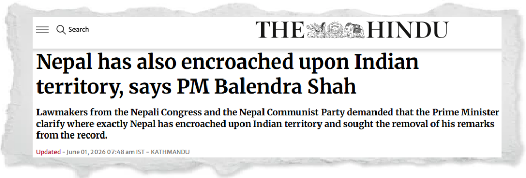
A political controversy erupted in Nepal after Prime Minister Balendra Shah stated in Parliament that Nepal had also encroached upon some Indian territories. The statement triggered protests from opposition parties and led Nepal’s Foreign Ministry to issue a clarification. The remarks have renewed attention on the long-standing India–Nepal boundary disputes, particularly in the Kalapani-Lipulekh-Limpiyadhura region.
UPSC Relevance
Prelims: India–Nepal boundary disputes, Kalapani, Lipulekh Pass, Limpiyadhura, international boundaries, India’s neighbours.
Mains:
GS-II: – India and its neighbourhood relations, bilateral disputes, diplomacy, border management, regional cooperation.
Background: India–Nepal Boundary Dispute
India and Nepal share an open international border of about 1,751 km, one of the most unique borders in the world. Citizens of both countries enjoy extensive cross-border movement for trade, employment, education and cultural interaction.
However, several boundary disputes continue to persist, the most prominent being:
- Kalapani Region
- Lipulekh Pass
- Limpiyadhura Area
- Certain disputes relating to riverine boundaries and no-man’s land (Dasgaja areas)
The current disagreement largely stems from differing interpretations of the Treaty of Sugauli (1816) signed between the British East India Company and Nepal.
The Kalapani-Lipulekh-Limpiyadhura Dispute
Origin of the Dispute
The Treaty of Sugauli defined the Kali (Mahakali) River as the western boundary of Nepal.
The dispute revolves around identifying the true source of the Kali River.
- Nepal argues that the river originates from Limpiyadhura, placing Kalapani and Lipulekh within Nepalese territory.
- India maintains that the river originates further east, making the disputed region part of India’s territory.
As a result, both countries claim sovereignty over the same area.
Strategic Importance
The disputed region possesses significant strategic value.
- It lies near the tri-junction of India, Nepal and China.
- The Lipulekh Pass serves as an important route for the Kailash Mansarovar Yatra.
- The area has military significance because of its proximity to the Tibetan Plateau and the Himalayan frontier.
Nepal’s Constitutional Amendment of 2020
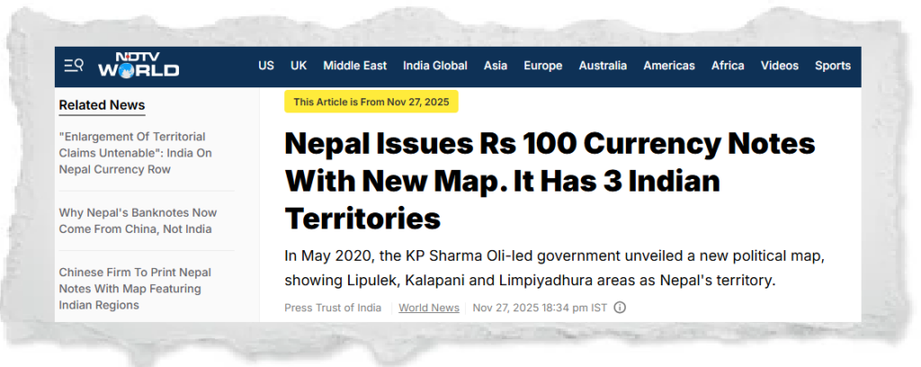
In 2020, under the government of K. P. Sharma Oli, Nepal amended its Constitution and adopted a new political map.
The map incorporated:
- Lipulekh
- Kalapani
- Limpiyadhura
as integral parts of Nepal.
The move came after India released a revised political map in 2019 showing the region within Indian territory.
This marked one of the most serious diplomatic disagreements between the two countries in recent decades.
What Did Prime Minister Balendra Shah Say?
While responding to questions in Parliament, Prime Minister Balendra Shah stated that Nepal had also encroached upon certain Indian territories.
The statement generated immediate controversy because it appeared to challenge Nepal’s long-standing official position that India alone occupied disputed territories.
Opposition lawmakers demanded:
- Clarification regarding the locations allegedly encroached upon.
- Removal of the statement from parliamentary records.
- An explanation of the factual basis behind the remark.
Clarification by Nepal’s Foreign Ministry
Following the controversy, Nepal’s Foreign Ministry issued an official clarification.
According to the Ministry:
- The Prime Minister was referring mainly to issues in Dasgaja (No-Man’s Land) areas.
- In some locations, due to historical demarcation practices and shifting river courses, land being used by Nepali citizens may technically fall on the Indian side.
- Similarly, some land occupied by Indian citizens may technically fall within Nepal.
The Ministry emphasised that these are technical boundary-management issues and not a recognition of territorial surrender.
It reiterated Nepal’s commitment to resolving disputes through diplomatic dialogue based on historical treaties, maps and agreements.
Dasgaja and Cross-Border Occupation
What is Dasgaja?
Dasgaja refers to the narrow strip of no-man’s land between India and Nepal established during boundary demarcation.
In several areas:
- Agricultural activities occur across the boundary.
- Villages have historically interacted across the border.
- Rivers changing course have altered ground realities.
Consequently, technical discrepancies occasionally emerge between legal boundaries and actual occupation.
Why Does It Matter?
Such situations can create Administrative confusion, Property disputes, Encroachment allegations, Local tensions among border communities.
Therefore, regular boundary surveys and diplomatic engagement remain important.
Importance of India–Nepal Relations
India and Nepal share deep civilisational and cultural connections.
Economic Relations
India is Nepal’s Largest trading partner, Major source of foreign investment, Key transit route for international trade.
Strategic Relations
The open border facilitates people-to-people contact but also necessitates cooperation on:
- Border management, Security concerns, Counter-smuggling operations, Disaster management.
Connectivity Cooperation
Both countries are expanding cooperation through:
- Rail links, Integrated check posts, Energy trade, Cross-border transmission lines, Petroleum pipelines.
Challenges in India–Nepal Border Management
Historical Ambiguities
Many disputes arise from differing interpretations of historical treaties and colonial-era maps.
River-Based Boundaries
Changes in river courses frequently complicate demarcation.
Nationalist Politics
Boundary issues often become politically sensitive and can be used for domestic mobilisation.
China Factor
Given Nepal’s location between India and China, geopolitical competition occasionally influences bilateral relations.
Way Forward
Strengthening Diplomatic Dialogue
Both countries should continue discussions through established bilateral mechanisms to address boundary issues peacefully.
Joint Boundary Surveys
Regular technical surveys and modern geospatial mapping can reduce ambiguities.
Depoliticising Border Issues
Boundary disputes should be addressed through evidence-based negotiations rather than domestic political rhetoric.
Enhancing Cross-Border Cooperation
Greater economic integration and connectivity can reduce mistrust and strengthen mutual dependence.
People-Centric Approach
Border communities should be actively involved in resolving local-level disputes and managing shared resources.
Conclusion
Prime Minister Balendra Shah’s remarks have introduced a new dimension to the India–Nepal border debate. While Nepal’s Foreign Ministry subsequently clarified the statement, the episode highlights the sensitivity of boundary issues in bilateral relations. The long-term solution lies not in political confrontation but in sustained diplomacy, joint technical assessments and mutual respect. Given the deep historical, cultural and economic ties between India and Nepal, peaceful resolution of border disputes remains essential for regional stability and neighbourhood cooperation.
Practice Questions
Prelims Question 1 (Inference-Based)
Consider the following statements with reference to the India–Nepal boundary dispute:
I. The Kalapani dispute primarily arises from differing interpretations regarding the origin of the Kali (Mahakali) River.
II. Nepal’s inclusion of Lipulekh, Kalapani and Limpiyadhura in its official map reflects its territorial claim over these regions.
III. Resolution of the dispute requires diplomatic engagement supported by historical treaties, maps and technical boundary assessments.
Which of the following relationships among the above statements is/are correct?
- Statement II is a political manifestation of the territorial interpretation described in Statement I.
- Statement III provides a potential mechanism for addressing the disagreement reflected in Statements I and II.
- Statement III contradicts Statement II because diplomatic negotiations eliminate the need for territorial claims.
(a) 1 only
(b) 2 and 3 only
(c) 1 and 2 only
(d) 1, 2 and 3
Answer: (c)
Explanation:
Statement I explains the root cause of the dispute. Statement II reflects Nepal’s assertion of its interpretation through constitutional and cartographic measures. Statement III offers a pathway for dispute resolution and therefore complements rather than contradicts Statements I and II. Hence, statements 1 and 2 are correct, while statement 3 is incorrect.
Prelims Question 2
Consider the following statements regarding the India–Nepal border:
- The Treaty of Sugauli was signed between Nepal and the British East India Company.
- Lipulekh Pass is associated with the Kailash Mansarovar Yatra route.
- Dasgaja refers to the designated no-man’s land between India and Nepal.
- Nepal amended its Constitution in 2020 to incorporate Kalapani, Lipulekh and Limpiyadhura in its official map.
Which of the statements given above are correct?
(a) 1 and 2 only
(b) 2, 3 and 4 only
(c) 1, 3 and 4 only
(d) 1, 2, 3 and 4
Answer: (d)
Explanation:
All four statements are correct. The Treaty of Sugauli (1816) forms the historical basis of the dispute. Lipulekh is an important pilgrimage route. Dasgaja denotes the no-man’s land along the border, and Nepal incorporated the disputed territories into its official map through a constitutional amendment in 2020.
Mains Questions
- Examine the historical and strategic dimensions of the Kalapani-Lipulekh-Limpiyadhura dispute between India and Nepal. How can the two countries resolve the issue through diplomatic means?
- Border disputes between neighbouring countries often involve both legal interpretations and political sensitivities. Discuss with reference to India–Nepal relations.
Tell Google you want more of this.
Add Anantam IAS as a preferred sourceOne tap, and this site shows up more often in your own Top Stories, AI Overviews and AI Mode. Remove it any time.