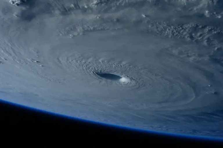
The Fujiwhara effect is what happens when two tropical cyclones come close enough to start orbiting a common centre of mass. Named after the Japanese meteorologist Sakuhei Fujiwhara, who described it in 1921, it is one of the main reasons cyclone track forecasts occasionally fail badly. For an exam answer the definition has to be precise: it is binary vortex interaction, not simply two storms merging.
The Mechanism
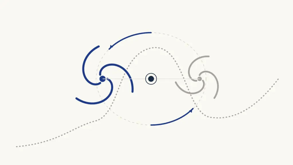
Two cyclonic vortices of broadly comparable size and strength begin to interact when they come within roughly 1,200 to 1,400 kilometres of each other. Each storm’s circulation advects the other around the midpoint between them.
- The rotation is cyclonic: anticlockwise in the Northern Hemisphere, clockwise in the Southern.
- The pair orbits a common centroid, which itself keeps moving with the larger-scale steering flow.
- The interaction strengthens as separation decreases, and is strongest when the two systems are of similar intensity.
- A much stronger storm paired with a much weaker one does not orbit; it simply absorbs or shears the weaker system.
Four Possible Outcomes
| Outcome | What happens | Typical trigger |
|---|---|---|
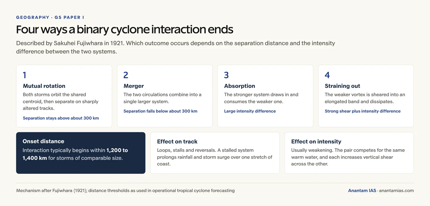
| Mutual rotation | Both storms circle the centroid, then separate on altered tracks | Separation stays above roughly 300 km |
| Merger | The two circulations combine into one larger system | Separation falls below roughly 300 km |
| Absorption | The stronger system draws in and consumes the weaker | Large intensity difference |
| Straining out | The weaker vortex is sheared into an elongated band and dissipates | Strong shear plus intensity difference |
Effect on Cyclone Movement
- Tracks become erratic, with loops, stalls and even reversals, because steering is no longer set by the environment alone.
- A storm can be pulled off its climatologically expected recurvature path, so forecast landfall point and timing lose skill.
- Stalling is the underrated danger. A system held over one coastal stretch extends the duration of rainfall and storm surge, raising flood risk even when wind speeds do not increase.
- Forecast uncertainty cones widen, which complicates evacuation decisions where lead time is everything.
Effect on Cyclone Intensity
Weakening is the more common outcome, and it happens for two reasons that work together.
- Competition for fuel. Both circulations draw on the same patch of warm ocean surface and the same moisture supply.
- Mutual shear. Each storm’s outflow increases vertical wind shear across the other, disrupting the vertical alignment of the warm core that a cyclone needs to intensify.
- Strengthening can follow a merger, when a single system inherits the combined mass, moisture and angular momentum and reorganises over warm water.
- The weaker partner almost always loses: it is sheared, absorbed, or starved of inflow.
Documented Examples
- Typhoons Marie and Kathy (1964) in the western Pacific, the textbook case of binary rotation.
- Hurricanes Hilary and Irwin (2017) in the eastern Pacific.
- Typhoons Hinnamnor and Gardo (2022), where the weaker system was absorbed.
- In the North Indian Ocean the effect is rarer because simultaneous cyclones are less common, but interaction between a Bay of Bengal system and a concurrent Arabian Sea system, or between a Bay depression and a residual monsoon low, produces similar behaviour.
Why It Matters for India
The North Indian Ocean produces roughly 7 per cent of global tropical cyclones, and twin systems on either side of the peninsula are uncommon but not rare. When they do form, the Fujiwhara effect becomes a live problem for IMD track guidance, and therefore for evacuation planning along the eastern and western coasts. The wider mechanics are covered in our notes on cyclones and tropical and temperate cyclones.
Frequently Asked Questions
What is the Fujiwhara effect in simple terms?
It is the interaction between two nearby tropical cyclones that causes them to rotate around a common centre of mass, like two skaters spinning around a shared point. It was described by the Japanese meteorologist Sakuhei Fujiwhara in 1921.
At what distance does the Fujiwhara effect begin?
It typically begins when two cyclones of comparable size come within about 1,200 to 1,400 kilometres of each other. Below roughly 300 kilometres of separation the two systems may merge into a single circulation.
Does the Fujiwhara effect make cyclones stronger or weaker?
Weaker, more often than not. The two storms compete for the same warm water and moisture, and each increases vertical wind shear across the other. Intensification can follow a full merger, when one system inherits the combined moisture and angular momentum.
Why does the Fujiwhara effect matter for forecasting?
It makes tracks erratic, producing loops, stalls and reversals that standard steering-flow reasoning does not predict. That degrades landfall forecasts, and a stalled system dumps rainfall and storm surge on one stretch of coast for far longer.
Has the Fujiwhara effect been observed near India?
Yes, though less often than in the western Pacific, because simultaneous cyclones are less common in the North Indian Ocean. Interaction has been observed between concurrent Bay of Bengal and Arabian Sea systems and between a Bay depression and a residual monsoon low.
What are the four outcomes of a Fujiwhara interaction?
Mutual rotation followed by separation, merger into a single system, absorption of the weaker storm by the stronger, and straining out, where the weaker vortex is sheared into a band and dissipates.
Practice Questions
Prelims MCQs
1. The Fujiwhara effect describes the interaction between:
- (a) A cyclone and a landmass
- (b) Two nearby cyclonic vortices
- (c) A cyclone and an ocean current
- (d) Trade winds and westerlies
Answer: (b) Two nearby cyclonic vortices
2. The Fujiwhara effect was first described in:
- (a) 1901
- (b) 1921
- (c) 1945
- (d) 1968
Answer: (b) 1921
3. In the Northern Hemisphere, two cyclones undergoing the Fujiwhara effect rotate about their common centroid in which direction?
- (a) Clockwise
- (b) Anticlockwise
- (c) Direction depends on latitude
- (d) They do not rotate
Answer: (b) Anticlockwise
4. Which is the most common effect of Fujiwhara interaction on cyclone intensity?
- (a) Both systems intensify
- (b) Weakening, due to competition for moisture and mutual shear
- (c) No change in intensity
- (d) Immediate dissipation of both
Answer: (b) Weakening, due to competition for moisture and mutual shear
5. ‘Straining out’ in the context of the Fujiwhara effect means:
- (a) The stronger storm absorbs the weaker one
- (b) Both storms merge into one
- (c) The weaker vortex is sheared into an elongated band and dissipates
- (d) The storms move apart without interacting
Answer: (c) The weaker vortex is sheared into an elongated band and dissipates
Mains Questions
- What is the Fujiwhara effect? Explain its impact on the movement and intensity of tropical cyclones.
- Discuss why binary cyclone interaction is a significant source of uncertainty in track forecasting, with reference to disaster preparedness.
- Compare the frequency and significance of the Fujiwhara effect in the North Indian Ocean with that in the western Pacific.
- “A stalled cyclone can be more destructive than a stronger one that moves quickly.” Examine.
- Explain the role of vertical wind shear in tropical cyclone intensification and decay.
Tell Google you want more of this.
Add Anantam IAS as a preferred sourceOne tap, and this site shows up more often in your own Top Stories, AI Overviews and AI Mode. Remove it any time.