Nagarhole National Park is one of India’s most photographed and most ecologically significant tiger landscapes. Set across the Coorg and Mysuru districts of Karnataka, it forms a critical core of the Nilgiri Biosphere Reserve, the country’s first biosphere reserve and one of UNESCO’s listed sites. The park’s name comes from two Kannada words, Naga meaning snake and Hole meaning stream, a reference to the snake-like Nagarhole river that winds through it.
For UPSC, Nagarhole is more than a destination. It’s a case study in how a single protected area can be a tiger reserve, a UNESCO heritage zone, a habitat for India’s rare black panther, and a contested space where tribal rights and conservation policy meet. Aspirants should know it for prelims pointers and treat it as material for mains questions on protected-area governance, biosphere reserves, and the human-wildlife interface.
Quick Facts
- State: Karnataka
- Districts: Kodagu (Coorg) and Mysuru
- Etymology: Naga (snake) + Hole (stream) in Kannada
- Wildlife Sanctuary status: 1955
- National Park status: 1988
- Tiger Reserve status: 1999 (under Project Tiger)
- UNESCO recognition: 2012, as part of the Western Ghats World Heritage Site
- Part of: Nilgiri Biosphere Reserve (India’s first, established 1986)
- Forest type: Moist deciduous, with teak and rosewood dominance
- Flagship species: Royal Bengal Tiger, Asian Elephant, Indian Leopard, Black Panther
- Major rivers: Kabini, Lakshmanateertha, Nagarhole
- Famous landmark: Kabini Backwaters and Taraka Dam
- Resident tribes: Jenu Kuruba, Betta Kuruba, Yerava
What is Nagarhole National Park?
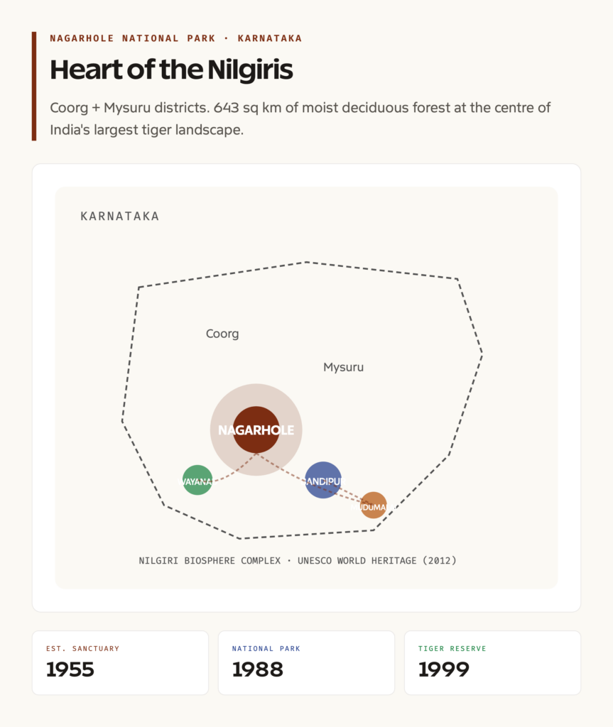
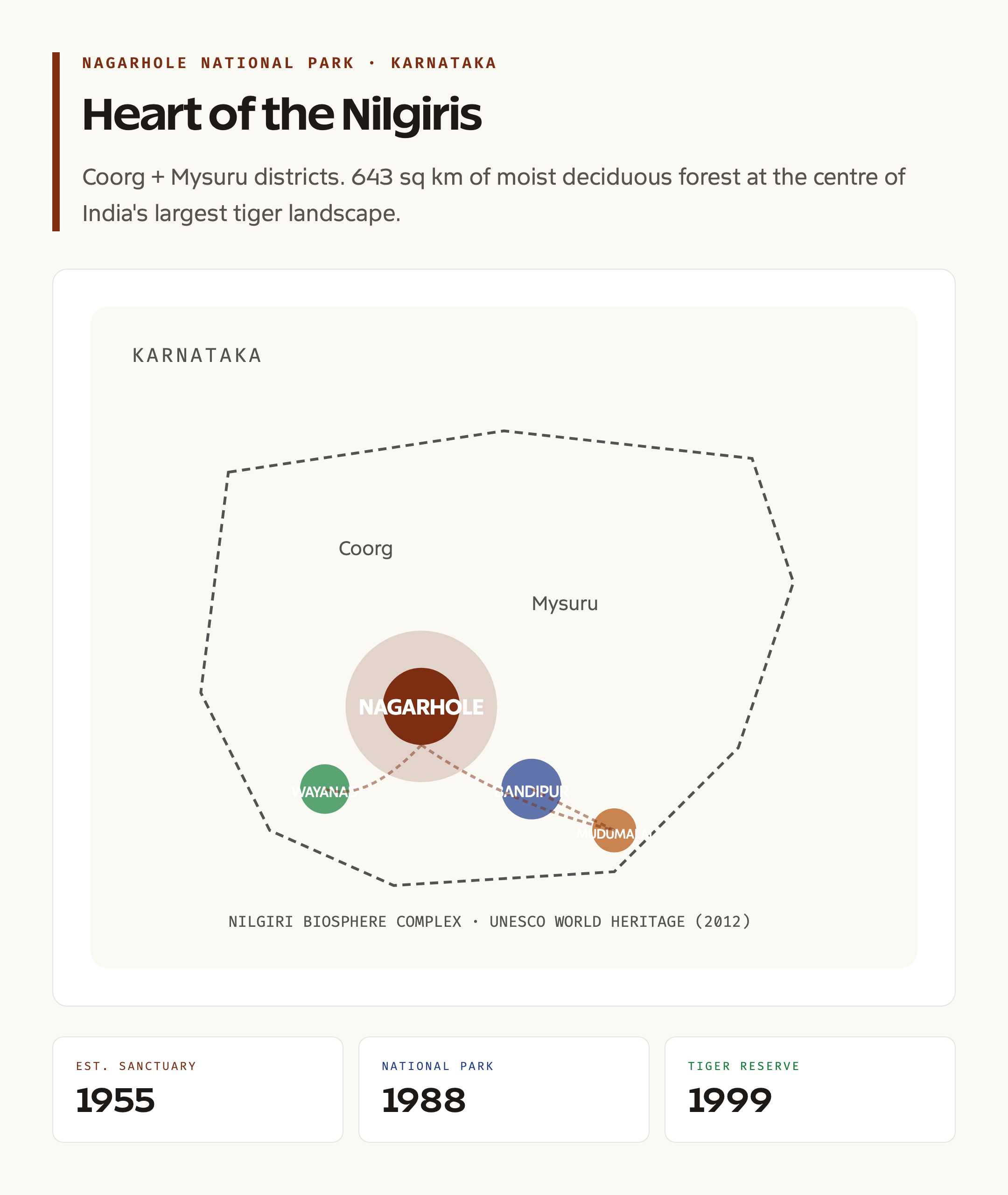
Nagarhole is a 643-square-kilometre protected area in southern Karnataka. Officially also called the Rajiv Gandhi National Park, it sits in the Western Ghats and connects to Bandipur National Park to the south, Mudumalai Tiger Reserve in Tamil Nadu, and Wayanad Wildlife Sanctuary in Kerala. Together these four protected areas form one of the largest contiguous Project Tiger landscapes on the planet, often called the Nilgiri Biosphere Reserve complex.
The park’s identity rests on three layers. It’s a national park under the Wildlife (Protection) Act, 1972. It’s a tiger reserve under Project Tiger, which adds NTCA oversight and dedicated funding. And it’s part of a UNESCO World Heritage cluster, which reflects its global biodiversity value. Each layer brings rules, resources, and constraints that interact in ways that often surface in policy and judiciary debates.
Background and Establishment
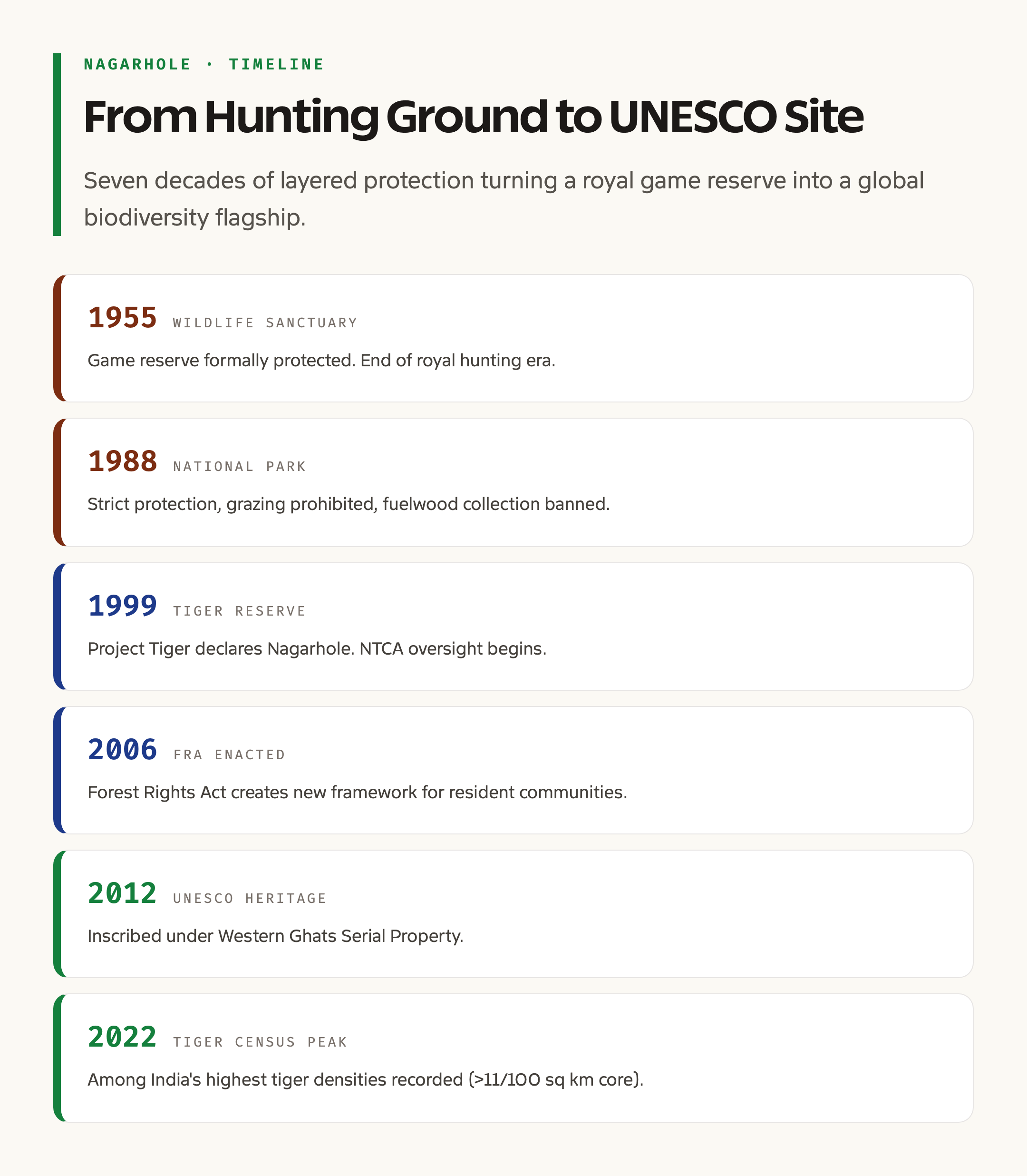
Before formal protection, the Nagarhole forests were the private hunting grounds of the Mysore royal family. Hunting blocks were demarcated in the late nineteenth century, and the area was declared a game reserve in 1955, India’s first formal step toward what would become the modern park. The 1955 wildlife sanctuary status marked the transition from royal hunting to scientific conservation.
The 1988 elevation to national park brought stricter protections, including the prohibition of grazing, fuelwood collection, and most forms of human activity inside park boundaries. The 1999 tiger reserve declaration recognised what camera-trap surveys had already shown: Nagarhole holds one of the highest densities of tigers in India, often above 11 tigers per 100 square kilometres in core zones. The 2012 UNESCO listing came as part of the Serial Property of the Western Ghats, recognising the region’s role as a global biodiversity hotspot.
Key Species and Biodiversity
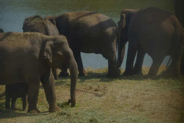
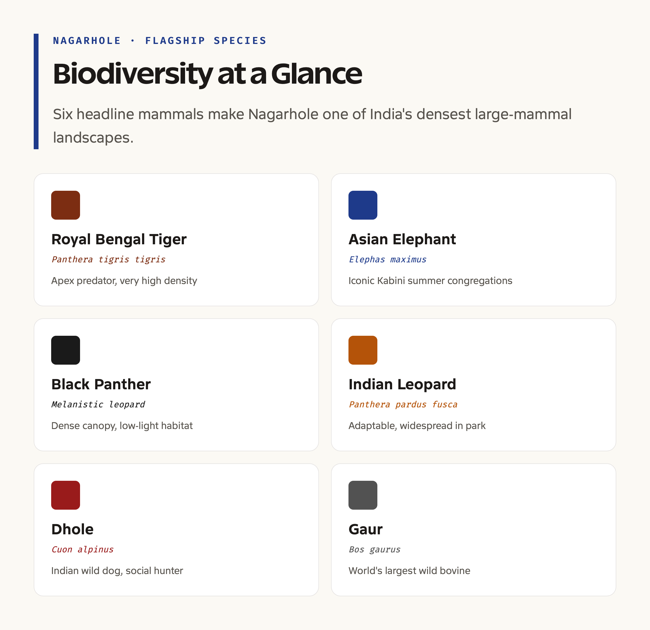
Nagarhole is famous for the diversity and density of its large mammals. The flagship is the Royal Bengal Tiger, but the park is equally celebrated for its Asian Elephant population, which moves seasonally between Nagarhole, Bandipur, Mudumalai, and Wayanad. The Kabini backwaters in summer are one of the few places in India where you can predictably see hundreds of elephants congregating to drink and bathe.
The park is one of the best-known sites for the Indian Leopard, including the melanistic black panther made famous by photographer Shaaz Jung. Other carnivores include the Dhole (Indian wild dog), Sloth Bear, and Striped Hyena. Herbivores include the Gaur (Indian bison, which is the largest wild bovine in the world), Sambar, Spotted Deer, Barking Deer, and Wild Boar. Birdlife exceeds 250 species, including the Malabar Pied Hornbill and Crested Serpent Eagle. For UPSC, remember that Nagarhole’s biodiversity is what justifies its triple protection: national park, tiger reserve, and UNESCO heritage status.
Landscape, Rivers, and Ecology
The terrain is undulating, ranging roughly from 700 to 950 metres in elevation. The dominant vegetation is moist deciduous forest, characterised by teak, rosewood, sandalwood, and silver oak. Bamboo brakes are common, particularly along streams. In the eastern parts, rainfall declines and dry deciduous patches appear, blending into the drier Bandipur landscape.
Three rivers shape the park’s hydrology. The Kabini is the largest, originating in Kerala’s Wayanad and feeding the Kabini reservoir on the park’s southern boundary. The Lakshmanateertha originates in the park itself, while the Nagarhole, the namesake stream, gives the park its identity. The Taraka Dam on the eastern boundary creates another seasonal water body that sustains wildlife through the dry months. Together these waterbodies make Nagarhole an unusually water-rich Project Tiger landscape.
Comparative Position: Nagarhole and Bandipur
| Feature | Nagarhole | Bandipur |
|---|---|---|
| State | Karnataka | Karnataka |
| District | Kodagu, Mysuru | Chamarajanagar |
| Forest type | Moist deciduous | Dry deciduous |
| Rainfall | Higher | Lower |
| Tiger density | Very high | Very high |
| UNESCO status | Yes (Western Ghats) | Yes (Western Ghats) |
| Best season | Summer (Kabini) | Winter |
| Notable feature | Black panther sightings | Open grasslands |
Both reserves are part of the same Nilgiri Biosphere complex, but their differing rainfall and forest structures support slightly different prey communities. Nagarhole’s wetter forests favour gaur and sambar, while Bandipur’s open canopy supports more chital and wild boar.
Why Nagarhole Matters
Nagarhole matters as a conservation success story. India’s tiger numbers have rebounded from a low of around 1,400 in 2006 to over 3,600 in the 2022 census, and Nagarhole has been a consistent top performer in this recovery. Its connectivity to Bandipur, Mudumalai, and Wayanad means it functions as part of a meta-population, allowing genetic exchange that small isolated reserves cannot offer.
It also matters for hydrology. The Kabini, Lakshmanateertha, and other streams feeding into the Cauvery basin originate or pass through these forests. Conserving Nagarhole is therefore a conservation of water security for downstream Karnataka and Tamil Nadu, a fact that aligns the park with India’s broader biodiversity strategy and water mission. Tribally, Nagarhole is home to the Jenu Kuruba (the honey-collectors), Betta Kuruba, and Yerava communities, whose traditional knowledge and rights under the Forest Rights Act make the park a crucial test case for inclusive conservation.
Tribal Communities and the Rights Question
The Jenu Kuruba are perhaps the most studied of Nagarhole’s resident communities. The name translates to honey-gatherer, and the community has historically lived inside the forest, collecting honey, medicinal plants, and minor produce. Other resident groups include the Betta Kuruba (hill Kurubas) and the Yerava. They worship forest deities like Mastiamma, the goddess of the forest, and their ritual calendar is closely tied to forest seasonality.
After the 1972 Wildlife Protection Act and the 1988 national park designation, several rounds of relocation moved many tribal families outside the park. Some accepted compensation; others contested the relocation. The 2006 Forest Rights Act provided new legal grounds for individual and community forest rights, and Nagarhole has been the subject of multiple petitions on the legitimacy of evictions, compensation adequacy, and rights to access traditional grounds. UPSC questions on conservation versus rights frequently use Nagarhole as a reference case.
Challenges and Conservation Threats
The park faces familiar pressures. Traffic on the Mysuru-Mananthavady highway that bisects the landscape has caused wildlife deaths and disrupted elephant corridors. Karnataka’s night-traffic ban on this stretch has reduced but not eliminated the issue. Plantation encroachment along park boundaries, particularly coffee and ginger, fragments the periphery. Invasive species like Lantana camara and Eupatorium have spread aggressively in the understorey, suppressing native regeneration.
Human-wildlife conflict, especially with elephants raiding crops in adjacent villages, remains a chronic management challenge. The Kabini reservoir, while creating excellent dry-season habitat, also forces elephants and other wildlife into closer proximity with humans during peak summer concentration. Resort tourism on the periphery generates revenue and political support for conservation but also strains park infrastructure.
Prelims Pointers
- Nagarhole is in Karnataka, across Kodagu (Coorg) and Mysuru districts.
- It became a wildlife sanctuary in 1955, national park in 1988, and tiger reserve in 1999.
- It is also called the Rajiv Gandhi National Park.
- It is part of the Nilgiri Biosphere Reserve, India’s first (1986).
- It was inscribed as a UNESCO World Heritage Site in 2012 as part of the Western Ghats Serial Property.
- The name comes from Kannada Naga (snake) + Hole (stream).
- Major rivers: Kabini, Lakshmanateertha, Nagarhole.
- Famous geographical features: Kabini Backwaters and Taraka Dam.
- Resident tribes: Jenu Kuruba, Betta Kuruba, Yerava.
- Key species: Royal Bengal Tiger, Asian Elephant, Indian Leopard, Black Panther, Dhole, Gaur.
Mains Angles
- GS-III, Environment: Discuss the ecological significance of the Nilgiri Biosphere Reserve and the role of contiguous protected areas in tiger conservation.
- GS-III, Conservation Governance: Analyse the layered protection of Nagarhole (national park, tiger reserve, UNESCO site) and its policy implications.
- GS-II, Governance: Examine the Forest Rights Act in the context of protected-area management. Use Nagarhole as a case study for balancing conservation with tribal rights.
- GS-I, Society: Discuss the cultural ecology of the Jenu Kuruba and other resident communities, and how their traditional knowledge can inform conservation strategy.
- Essay: “Conservation that excludes people is conservation that fails.” Examine in the context of India’s protected-area regime.
Way Forward
Nagarhole’s future depends on managing its multiple identities coherently. Better corridor protection between Nagarhole and Bandipur, including wildlife underpasses on the highway, would secure the meta-population. Lantana removal and native regeneration programmes need sustained funding rather than project-based bursts. Resolving FRA claims through transparent gram sabha processes would reduce litigation and allow co-management arrangements where appropriate.
Tourism revenue should flow back into community livelihoods, particularly for relocated families, and into anti-poaching infrastructure. Climate change is a longer-term threat, with shifting monsoon patterns likely to alter forest composition and prey distribution. Adaptive management, with periodic reassessment of zoning and species recovery targets, is the only honest response. Done well, Nagarhole can remain what it is now: a flagship for what protected areas in a populous democracy can achieve.
Frequently Asked Questions
Where is Nagarhole National Park located?
Nagarhole National Park is located in Karnataka, spread across Kodagu (Coorg) and Mysuru districts. It lies in the Western Ghats and adjoins Bandipur National Park to the south.
What is the meaning of Nagarhole?
The name combines two Kannada words, Naga meaning snake and Hole meaning stream. It refers to the winding Nagarhole river that flows through the park.
When was Nagarhole declared a tiger reserve?
Nagarhole was declared a tiger reserve in 1999 under Project Tiger. It had already been a wildlife sanctuary since 1955 and a national park since 1988.
Is Nagarhole a UNESCO World Heritage Site?
Yes. Nagarhole was inscribed in 2012 as part of the Western Ghats Serial Property, a UNESCO World Heritage Site that includes multiple protected areas across Karnataka, Kerala, Tamil Nadu, and Maharashtra.
Why is Nagarhole famous for black panthers?
Nagarhole’s dense moist deciduous forests offer the kind of low-light, high-cover habitat that suits melanistic leopards. Long-term photo-documentation, particularly by wildlife photographers around the Kabini zone, has made the park internationally known for black panther sightings.
What rivers flow through Nagarhole?
The major rivers are the Kabini, the Lakshmanateertha, and the Nagarhole. The Kabini reservoir on the park’s southern boundary is one of the most famous wildlife congregation points in India during summer.
Which tribes live in or around Nagarhole?
The Jenu Kuruba, Betta Kuruba, and Yerava are the prominent tribal communities historically associated with Nagarhole. The Jenu Kuruba are well known for their traditional honey-gathering practices and forest knowledge.
What is the best time to visit Nagarhole?
March to May is considered the best period for wildlife viewing because the dry season concentrates animals around water bodies, particularly the Kabini backwaters where large elephant herds gather.
Is Nagarhole part of the Nilgiri Biosphere Reserve?
Yes. Nagarhole is one of the core protected areas of the Nilgiri Biosphere Reserve, which was India’s first biosphere reserve, established in 1986.
Who is the parent agency for Nagarhole’s management?
The Karnataka Forest Department manages day-to-day operations, with overarching National Tiger Conservation Authority oversight under Project Tiger and adherence to the Wildlife (Protection) Act, 1972.
Tell Google you want more of this.
Add Anantam IAS as a preferred sourceOne tap, and this site shows up more often in your own Top Stories, AI Overviews and AI Mode. Remove it any time.