Disclosure: this guide contains Amazon affiliate links. As an Amazon Associate, Anantam IAS earns from qualifying purchases — at no extra cost to you.
The Orient BlackSwan atlas can help with UPSC map work, but the name covers several products. Buying the School Atlas while expecting the competitive-exam edition can leave you looking for maps or support that belong to another book. Check the full title and ISBN before comparing covers.
For a new UPSC purchase, I’d choose the Atlas for Competitive Examinations if you need its exam-focused thematic coverage. If you already own a usable School Atlas, start practicing with it. An atlas you can read and recall is more useful than a replacement you only browse.
Choose The Right Series
The publisher lists the competitive and school atlases as separate products. Their edition numbers belong to their own series; a ninth edition is not automatically newer than a third edition in another series.
| Product | Publisher-Listed Edition | Publishing Year | ISBN | Listed Length |
|---|---|---|---|---|
| The Orient BlackSwan Atlas for Competitive Examinations | Third | 2025 | 9789354428944 | 140 pages |
| The Orient BlackSwan School Atlas | Ninth | 2024 | 9789354427695 | 124 pages |
The competitive atlas publisher page gives its contents and specifications. The School Atlas publisher page identifies a different school-oriented series.
For the matching product, you can check the competitive atlas on Amazon. This is an affiliate link; a purchase may earn us a commission. Check the seller’s title, edition and ISBN together because a search can show several listings for the same edition.
The competitive edition’s published contents include:
- Physical and political maps of India and world regions.
- India maps covering river basins, natural hazards, climate, agriculture, minerals and industries.
- World maps covering drainage, tectonics, ocean currents and other themes.
- An index, topographical fold-outs and a pull-out map.
The publisher also describes Smart App support. Check the QR code and current access conditions of your own copy rather than assuming every older copy has identical digital material.
Keep Or Replace Your Atlas
A readable existing atlas can support location practice even when it isn’t the product you’d buy today. Replace it for a specific missing function or an important update, not simply because a newer cover exists.
| What You Need | Decision |
|---|---|
| Basic location, neighboring regions and physical features | Use the atlas you own if its maps and index are readable |
| The competitive edition’s listed thematic maps | Choose that edition after checking its contents |
| A newly changed boundary, designation or statistic | Check the relevant official source before updating notes |
| A comparison with another publisher | Use the existing Oxford guide and geography booklist before buying a second atlas |
The Oxford Student Atlas guide covers that alternative. The geography books for UPSC article helps you choose supporting reading. You don’t need both atlases just to begin map practice.
An atlas has a publication date and each statistical map may have an earlier reference date. The School Atlas description, for example, explicitly identifies some population maps as based on the 2011 census. A newer edition label doesn’t make every figure a current estimate.
Read A Map In Layers
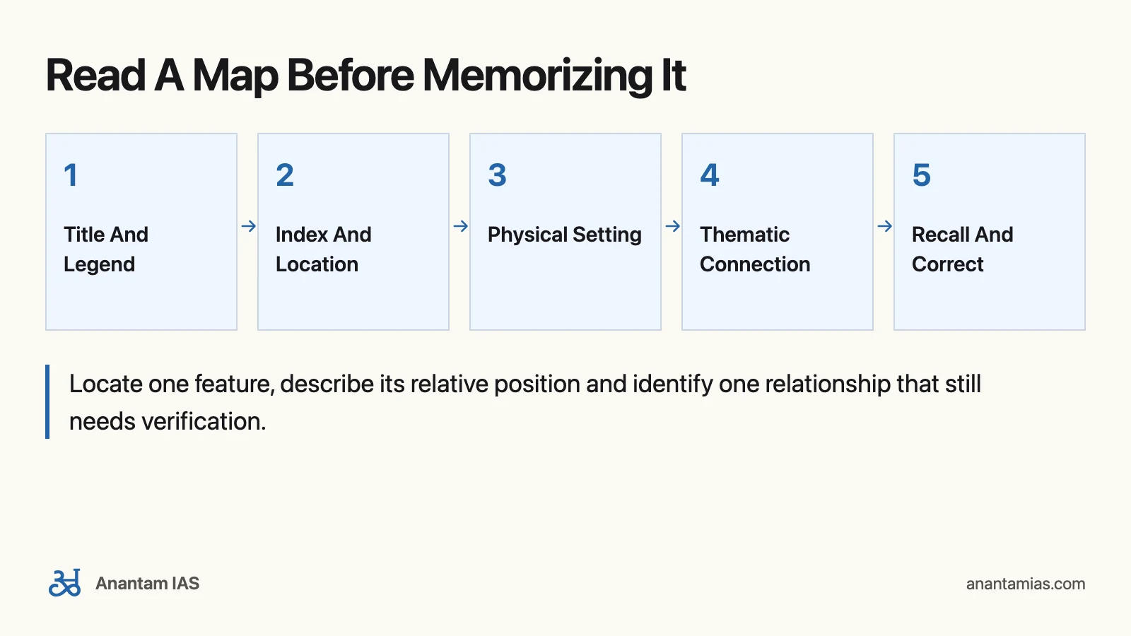
Start with the map’s title, legend and scale before studying its labels. The legend explains what the symbols mean; the scale explains how map distance relates to ground distance. A dot representing a town is not its entire built-up area.
An index is a directory that gets you to the right map. It can’t explain why a place matters. Once you’ve found the location, add a physical or thematic map to understand its setting.
| Map Or Tool | Study Task | Finished Output |
|---|---|---|
| Index | Find the exact place name and follow its locator | Map title and locator recorded in your log |
| Physical map | Identify nearby terrain, river or coast | One sentence placing the location relative to a feature |
| Political map | Identify the surrounding administrative area | A checked country/state relationship |
| River-basin map | Trace basin shape and major connections | An arrow sketch without invented coordinates |
| Minerals or industry map | Compare symbols with transport or terrain | A question about the relationship, not an unsupported causal claim |
| Natural-hazard map | Read the mapped hazard and legend | A hazard-setting note with the map’s reference date |
For passes, rivers or resources, record the geographic relationship you actually checked. Don’t fill gaps with a remembered spelling or a guessed point on a sketch.
Work Through Scale And Inference
This original practice example uses imaginary points, not measured locations from the Orient BlackSwan atlas. Suppose a map has a scale of 1:5,000,000 and two points are 3 cm apart along a straight line.
The calculation is:
- Interpret the ratio: 1 cm on the map represents 5,000,000 cm on the ground.
- Convert the unit: 100,000 cm equals 1 km, so 5,000,000 ÷ 100,000 = 50 km.
- Multiply: 3 × 50 = 150 km of straight-line ground distance under the stated scale assumption.
- Check the inference: that is not a road journey of 150 km. A route can curve, cross difficult terrain or use a different connection.
Now imagine a second thematic map marks a mineral near one point and an industrial center near the other. Their proximity suggests a relationship worth investigating. It doesn’t prove that this mineral supplies that plant. The map may omit supply routes, production quantities or other sources.
Your study note should therefore contain two separate lines:
- Observed: the symbols and their relative locations, plus the calculated distance in this invented example.
- To verify: an actual supply relationship and route, using an appropriate official or industry source.
If scale conversion takes time at first, that’s fine. Write the units at every step. The common error is converting centimeters to kilometers too early or treating a map’s graphical symbols as measured boundaries.
Build A Map-Practice Log
A short log makes weak recall visible. You can keep it on paper; a spreadsheet isn’t necessary.
| Date | Feature | Map And Locator | Relative Location Checked | Closed-Book Recall | Correction |
|---|---|---|---|---|---|
| Your date | River, pass, city or resource | Actual title and locator | Neighbor, terrain or water body | Correct, partial or missed | Specific error to revisit |
A 15-minute session can contain:
- 5 minutes: locate 3 features and read the legend.
- 5 minutes: close the atlas and describe each feature’s relative position.
- 5 minutes: check and correct the descriptions, then explain one physical or economic connection.
Three checked features are a starting workload, not an exam requirement. Reduce to one when the setting is unfamiliar. Increase only when recall stays accurate.
Use A Four-Week Cycle
The first cycle should establish a repeatable routine. More advanced readers can move faster; beginners can repeat a week.
| Week | Focus | Recall Task |
|---|---|---|
| 1 | India physical and political maps | Place features relative to a state, region or water body |
| 2 | Rivers, climate and agriculture | Explain one location-environment relationship |
| 3 | Resources, transport and hazards | Compare two thematic layers and identify a claim to verify |
| 4 | World regions and locations in current reading | Find the location, recall its neighborhood and revisit earlier errors |
For India outline practice, use a Survey of India base map. Avoid drawing disputed boundaries from memory or relying on an unverified online outline. A text-only relative-location note is useful when you don’t have a suitable base map.
Return to mistakes the following day and again after a week. If you’ve memorized a page layout but can’t place the same feature on another map, change the cue. Ask for the nearest major physical feature or neighboring region rather than the exact position of the printed label.
Your next atlas session should end with one location you can describe accurately and one relationship you can explain. That gives the book a clear job in your preparation.
Frequently Asked Questions
Which Orient BlackSwan atlas should a new UPSC reader choose?
The Atlas for Competitive Examinations is the sensible new purchase when you need its listed exam-focused thematic coverage. A usable School Atlas can still support basic location practice.
What edition is the competitive atlas?
The publisher lists the Third Edition, published in 2025, with ISBN 9789354428944 and 140 pages.
Is the School Atlas ninth edition the same product?
No. It is a separate series. The publisher lists the Ninth Edition in 2024 with ISBN 9789354427695 and 124 pages.
Does a new edition mean all statistics are from the publication year?
No. A statistical map can use an older reference period. The School Atlas description identifies some population maps as using the 2011 census.
Does the worked 150 km distance represent a real journey?
No. It is a hypothetical straight-line scale calculation. It neither measures real atlas locations nor gives a road distance.
Do I need both Orient BlackSwan and Oxford atlases?
Not simply to start practice. Use one readable atlas, test your recall and identify a specific missing function before buying another.
Tell Google you want more of this.
Add Anantam IAS as a preferred sourceOne tap, and this site shows up more often in your own Top Stories, AI Overviews and AI Mode. Remove it any time.