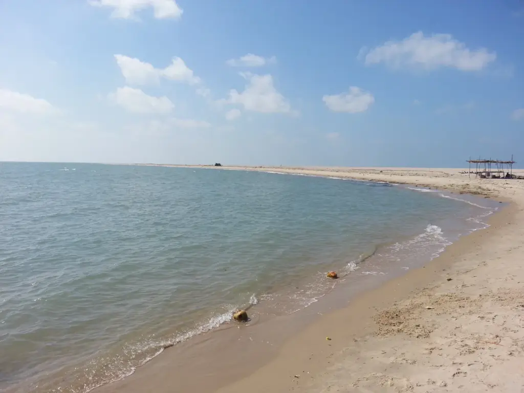
Ram Setu, also called Adam’s Bridge or Rama Setu, is a chain of limestone shoals and sandbanks that runs across the sea from Rameswaram (Pamban) Island in Tamil Nadu to Mannar Island off north-western Sri Lanka. It divides the Gulf of Mannar to the south-west from the Palk Strait to the north-east, and because most of it lies under a metre or two of water, it is the reason large ships still sail around Sri Lanka instead of through the gap.
Most readers arrive with one of two fixed ideas: that a satellite has proved it was built, or that science has proved it is only sand. Neither is what the record says. The geology is fairly settled, the age is not, and the question of whether the government should protect it as a monument is still before the Supreme Court. This note keeps the three apart.
What Is Ram Setu and Where Is It?
Ram Setu is a submerged ridge, not a single bar of rock. It is a string of shoals, some dry at low tide, most of them shallow enough to ground a fishing boat, that links the eastern tip of Dhanushkodi on the Indian side to Talaimannar on the Sri Lankan side.
| Fact | Detail |
|---|---|
| Other names | Adam’s Bridge, Rama Setu, Set Bandhai in early Arabic writing |
| Indian end | Dhanushkodi, on Rameswaram (Pamban) Island, Ramanathapuram district, Tamil Nadu |
| Sri Lankan end | Talaimannar, on Mannar Island |
| Length | About 29 km (ISRO-NRSC study, 2024); Britannica gives 48 km |
| Seas it separates | Gulf of Mannar (south-west) and Palk Strait (north-east) |
| Depth | Many shoals under 1 m; about 99.98 percent of the ridge lies below mean sea level |
| Material | Sand over coral, calcareous sandstone and conglomerate |
| Legal status | No national-monument notification; a plea seeking one is pending in the Supreme Court |
The length figures differ for a simple reason: they measure between different end points. The 2024 study counts only the shoal chain between Dhanushkodi and Talaimannar, while older references include the island tips on both sides. In December 2022, the Minister of State for Space told the Rajya Sabha that “if you go by history” the bridge was about 56 km long. Treat 29 km as the measured length of the shoals and the larger numbers as end-to-end descriptions.
How Did Adam’s Bridge Form?
The short answer: Adam’s Bridge is a natural landform, built by sand and coral on a shallow shelf that once connected India and Sri Lanka above water. What scientists still argue about is the order of events and the date.
Britannica summarises the two main explanations, and both start from the same fact that the strait is shallow because it sits on the continental shelf.
- Tectonic and coral origin. One view holds that the Palk Strait and Gulf of Mannar were once part of the Kaveri river basin. Slow crustal movement shaped the outline of the area, coral grew on the high ground, and the coral trapped sand into a broken line of banks.
- Longshore current origin. The other view starts with currents. Longshore currents, the currents that run parallel to a coast and drag sand along it, dumped sand in a roughly straight line, and coral then grew over those deposits.
Sea level is the hinge in both stories. When the sea stood lower during cold phases, the whole shelf was dry land, and the ridge was a walkable neck of land that geographers call the Palk isthmus. When the sea rose, only the highest strip stayed near the surface.
The Age Question
This is where sources genuinely disagree. Studies by the Geological Survey of India have dated coral on Rameswaram Island to about 125,000 years ago. Other studies suggest the present form of the bridge is only about 3,500 years old. Both can be partly true, because the coral foundation and the loose sand on top are not the same age.
Old British drilling surveys, cited in the 2024 paper, found 7 to 9 m of sand before reaching a harder base of Holocene conglomerate or calcareous sandstone (sandstone cemented by lime from marine organisms). In plain words, the ridge is a pile of shifting sand sitting on older reef rock. That is why the sandbanks move from season to season, and why dredged channels kept filling up.
What Did the 2024 ISRO Map Show?
The 2024 map settled the shape of the ridge, not its origin. Scientists from ISRO’s National Remote Sensing Centre published the study in Scientific Reports on 28 June 2024, using laser data from NASA’s ICESat-2 satellite collected between October 2018 and October 2023.
ICESat-2 fires a green laser that can reach the seafloor to a depth of about 40 m in clear water. The team gathered about 0.2 million seafloor photons and built a 10 m resolution depth model of the whole ridge. Its main findings:
- the ridge is a submarine continuation of Dhanushkodi and Talaimannar, so it is joined to land at both ends;
- its volume is about 1 cubic km, and only 0.02 percent of it sits above mean sea level, which means about 99.98 percent is submerged;
- narrow channels 2 to 3 m deep cut across it at intervals and let water flow between the Gulf of Mannar and the Palk Strait;
- the slopes are steeper on the Gulf of Mannar side, which tells you the stronger wave energy comes from the south-west.
Here is the trap. News reports called this a map of “Ram Setu” and some readers took it as confirmation of the epic. The paper says nothing about construction. It describes a natural ridge in its current form. The Minister’s 2022 answer in Parliament said the same thing in simpler words: satellites show limestone shoals that “can’t be accurately said to be remnants or parts of a bridge.”
Why Is It Called Ram Setu and Adam’s Bridge?
The two names come from two different traditions, and neither is a geological term.
In the Ramayana, Rama’s vanara (monkey) army builds a causeway across the sea to reach Lanka and rescue Sita, with the engineer Nala supervising the work. The Indian end of the ridge, on Rameswaram, carries the name Setu in this tradition, and Rameswaram’s temple town grew around it.
The name Adam’s Bridge comes from a Muslim legend in which Adam crossed the bridge to Adam’s Peak in Sri Lanka. Britannica notes the term seems to have arisen around the time of al-Biruni (973 to about 1052), and that earlier Arabic writings called it Set Bandhai, the bridge of the sea.
One more claim travels with the bridge: that it was whole and walkable until a storm breached it in 1480. Britannica reports this as what “records suggest.” It is a claim from temple and historical records, not a dated geological finding, so write it that way in an answer.
The honest position for an aspirant is simple. The faith tradition is real and politically weighty. The ridge is natural. Saying so is not an insult to either side, and the courts have treated the two questions separately.
What Was the Sethusamudram Ship Channel Project?
The Sethusamudram Ship Channel Project was a plan to dredge a navigable channel through the shallow sea between India and Sri Lanka so that ships could move between India’s west and east coasts without circling Sri Lanka. Approved in 2005, it stopped at the ridge in 2007 and has not restarted.
The idea is old. The earliest known dredging took place in 1838, and a British naval officer proposed a canal in 1860. Both ran into the same problem: the sand refilled every cut. After Independence several committees studied the route.
The Cabinet Committee on Economic Affairs cleared the project on 19 May 2005 at a cost of a little over Rs 2,427 crore. Its chosen route, known as alignment 6, was to cut an 83 km deep-water channel by dredging through the limestone shoals of Adam’s Bridge.
Why It Stalled
Opposition came from three directions, and they reinforced each other:
- Faith. Groups for whom the ridge is Rama’s bridge objected to cutting it, and a public interest petition by Subramanian Swamy reached the Supreme Court.
- Ecology. The Gulf of Mannar holds coral reefs, seagrass beds and dugongs, and the Indian side is one of the country’s biosphere reserves. Critics feared that dredging and ship traffic would damage it. Britannica also records concerns about tsunami risk on a coast that the 2004 Indian Ocean tsunami had struck a few months before approval, and about the coast’s thorium-bearing sands.
- Economics. A channel that has to be dredged again and again is expensive to keep open, and it would suit only smaller ships.
In 2007 the Supreme Court stayed work on the Ram Setu stretch. The government then asked an expert committee under R.K. Pachauri to examine an alternative route, alignment 4A. Its 2013 report found that neither alignment met the benchmark 12 percent internal rate of return and called the project unviable on both economic and ecological grounds. The government of the day rejected that report, but no work resumed.
The Legal Position on Ram Setu Today
Ram Setu today is not a notified monument, and the Sethusamudram project is frozen on the ridge. The live dispute is about protection, not dredging.
- 16 March 2018. The Ministry of Shipping told the Supreme Court that it would explore an alternative to the earlier alignment “without affecting/damaging the Adam’s Bridge/Ram Setu in the interest of the nation.”
- 12 January 2023. The Tamil Nadu Assembly unanimously asked the Centre to implement the Sethusamudram project without delay. The state BJP backed it on the condition that Ram Setu is not touched.
- 19 January 2023. The Solicitor General told a bench led by Chief Justice D.Y. Chandrachud that the question of national heritage status was under process in the Ministry of Culture. The Court allowed Swamy to file a representation with the ministry.
- 3 October 2023. A bench of Justices Sanjay Kishan Kaul and Sudhanshu Dhulia declined a separate plea for monument status and a protective wall, calling these administrative matters for the government.
- 29 August 2025. A bench of Justices Vikram Nath and Sandeep Mehta issued notice to the Ministry of Culture and the Archaeological Survey of India on Swamy’s fresh plea, which says no decision had been communicated on his representation of 13 May 2025.
So the government has given up cutting the ridge but has not formally protected it. A monument of national importance is declared under the Ancient Monuments and Archaeological Sites and Remains Act, 1958, which is built for structures and sites of human origin. That is the quiet legal difficulty in the case: a natural landform with deep religious value does not fit neatly into a law written for human-made heritage. The Court’s notice keeps the question open.
For the relationship around the ridge, the neighbouring dispute over Katchatheevu island in the Palk Bay and the wider India-Sri Lanka relations note are the right companions. For the shipping side, see how India plans coastal routes under the Sagarmala programme.
How to Study Ram Setu for Exams
Ram Setu sits in three places in the syllabus: physical and Indian geography (shelf landforms, Palk Strait, coral), environment (Gulf of Mannar ecology) and governance or international relations (Sethusamudram, the court case and India-Sri Lanka ties). Prelims tends to test location and the two seas it separates; Mains uses it as an example in answers on infrastructure versus ecology, or on how domestic politics shapes ties with Sri Lanka.
Revision facts to carry into the hall:
- It runs from Dhanushkodi (Rameswaram Island) to Talaimannar (Mannar Island).
- It separates the Gulf of Mannar (south-west) from the Palk Strait (north-east).
- The 2024 ISRO-NRSC study measured about 29 km and found about 99.98 percent of it submerged.
- The data came from NASA’s ICESat-2 laser satellite, at 10 m resolution.
- The Sethusamudram project was cleared in 2005, and the Supreme Court stayed work on the ridge in 2007.
- The Pachauri committee (report 2013) found neither alignment 6 nor 4A met a 12 percent return.
- In 2025 the Supreme Court issued notice on a plea for a time-bound decision on monument status.
Common confusions and how to keep them apart:
- Palk Strait vs Palk Bay. Palk Bay is the shallow bay immediately north of the ridge, and Katchatheevu lies in it. The Palk Strait is the wider channel further north that opens into the Bay of Bengal. The standard shorthand, that the ridge separates the Gulf of Mannar from the Palk Strait, treats the bay as part of the strait.
- Map vs proof. The 2024 map describes shape and depth. It makes no finding on construction.
- Approved vs built. Sethusamudram was approved in 2005, but no channel crosses the ridge.
| Feature | Ram Setu | Katchatheevu | Pamban Bridge |
|---|---|---|---|
| What it is | Natural shoal chain | Uninhabited islet | Rail and road bridges |
| Where | Dhanushkodi to Talaimannar | Palk Bay | Mandapam to Pamban Island |
| Why it is in the news | Sethusamudram and monument plea | 1974 India-Sri Lanka maritime agreement and fishing | Railway connectivity to Rameswaram |
The Mains bank has one question that genuinely fits the political side: Mains 2013 GS Paper II asked, “In respect of India-Sri Lanka relations, discuss how domestic factors influence foreign policy.” Tamil Nadu’s push for Sethusamudram is a usable example there. In the Prelims question bank, geography accounts for 82 of the 1,403 questions, so it is worth searching that set for the Palk Strait and Gulf of Mannar before the exam.
Ram Setu rewards the aspirant who can hold two registers at once: the measured, dated science and the faith claim reported as a claim. If you can write one paragraph that gives the 29 km, the 99.98 percent and the 2007 stay without taking sides on Rama, you have learned the topic the way an examiner wants it. For the coral context, revise coral reefs alongside it.
Frequently Asked Questions
What is Ram Setu?
Ram Setu, also called Adam’s Bridge, is a chain of limestone shoals and sandbanks between Rameswaram Island in Tamil Nadu and Mannar Island in Sri Lanka. It separates the Gulf of Mannar from the Palk Strait and is mostly submerged in very shallow water.
How long is Ram Setu?
A 2024 study by ISRO’s National Remote Sensing Centre measured the shoal chain at about 29 km from Dhanushkodi to Talaimannar. Britannica gives 48 km, which includes the island tips, so the difference comes from where the measurement starts and ends.
Is Ram Setu man-made or natural?
The scientific evidence describes Ram Setu as a natural ridge of sand over coral and sandstone on a shallow shelf. The Ramayana tradition holds that Rama’s army built it, and that belief is a matter of faith rather than a geological finding. In 2022 the government told Parliament that satellites show shoals that cannot accurately be called remnants of a bridge.
What did ISRO find about Ram Setu in 2024?
ISRO scientists used NASA’s ICESat-2 laser data to build a 10 m resolution depth map of the ridge. They found that about 99.98 percent of it lies below mean sea level and that narrow channels 2 to 3 m deep cross it at intervals.
What is the Sethusamudram project?
The Sethusamudram Ship Channel Project was a plan, cleared in 2005, to dredge a shipping channel through the shallow sea between India and Sri Lanka. The Supreme Court stayed work on the Ram Setu stretch in 2007, and an expert committee later found the project economically and ecologically unviable.
Is Ram Setu a national monument?
No. Ram Setu has not been notified as a monument of national importance. In January 2023 the Centre told the Supreme Court the question was under process in the Ministry of Culture, and in August 2025 the Court issued notice on a plea seeking a time-bound decision.
Why is it called Adam’s Bridge?
The name comes from a Muslim legend in which Adam crossed the bridge to reach Adam’s Peak in Sri Lanka. Britannica notes the term seems to date from around the time of al-Biruni in the 11th century.
Practice Questions
Prelims
1. Consider the following statements about Ram Setu (Adam’s Bridge): 1. It separates the Gulf of Mannar from the Palk Strait. 2. Its Indian end lies at Point Calimere. Which of the statements given above is/are correct?
- (a) 1 only
- (b) 2 only
- (c) Both 1 and 2
- (d) Neither 1 nor 2
Answer: (a) The Indian end is Dhanushkodi on Rameswaram Island, not Point Calimere.
2. The 2024 high-resolution depth map of Adam’s Bridge was built mainly from data of which satellite?
- (a) Cartosat-3
- (b) ICESat-2
- (c) Sentinel-1
- (d) Oceansat-3
Answer: (b) NRSC scientists used seafloor photons from NASA’s ICESat-2 laser altimeter.
3. Consider the following statements: 1. The Sethusamudram project’s alignment 6 was to pass through the Adam’s Bridge shoals. 2. The Pachauri committee found the alternative alignment 4A economically viable. Which of the statements given above is/are correct?
- (a) 1 only
- (b) 2 only
- (c) Both 1 and 2
- (d) Neither 1 nor 2
Answer: (a) The committee found neither alignment 6 nor 4A met the 12 percent return benchmark.
4. Talaimannar, the Sri Lankan end of Ram Setu, lies on which island?
- (a) Delft Island
- (b) Jaffna Peninsula
- (c) Mannar Island
- (d) Katchatheevu
Answer: (c) Talaimannar is on Mannar Island off north-western Sri Lanka.
5. Under which law would a site be declared a monument of national importance in India?
- (a) Environment (Protection) Act, 1986
- (b) Ancient Monuments and Archaeological Sites and Remains Act, 1958
- (c) Biological Diversity Act, 2002
- (d) Coastal Regulation Zone Notification, 2019
Answer: (b) The AMASR Act, 1958 governs monuments of national importance under the ASI.
Mains
- In respect of India-Sri Lanka relations, discuss how domestic factors influence foreign policy. (10 marks, 200 words) Previous year: Mains 2013, GS Paper II.
- Explain the geological processes that formed Adam’s Bridge and why its age remains disputed. (10 marks, 150 words)
- The Sethusamudram Ship Channel Project shows how infrastructure, ecology and faith can collide. Critically examine. (15 marks, 250 words)
- How has satellite remote sensing changed our understanding of submerged landforms such as Adam’s Bridge? (10 marks, 150 words)
- Should natural landforms with religious significance be protected under heritage law? Discuss with reference to Ram Setu. (15 marks, 250 words)
Tell Google you want more of this.
Add Anantam IAS as a preferred sourceOne tap, and this site shows up more often in your own Top Stories, AI Overviews and AI Mode. Remove it any time.