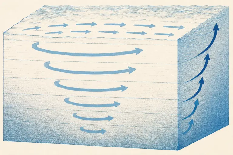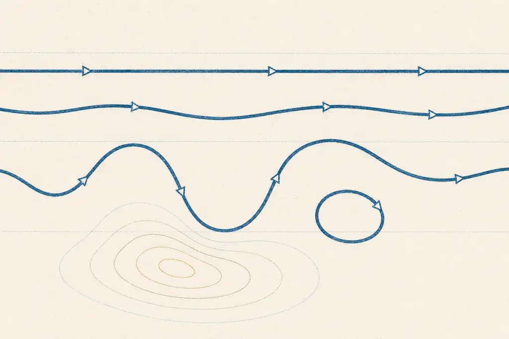
Rossby waves are the long meanders in the upper westerly flow, and they are the reason mid-latitude weather arrives in spells rather than evenly. The surface pressure belts and wind systems explain the general circulation; the waves aloft explain why a particular week is wet, a particular fortnight is a heatwave, and why a monsoon takes a break. Three quantities carry the whole account: vorticity, wave amplitude and the index cycle.
The Balance of Forces Aloft
Wind at the surface blows across the isobars because friction drags it. Above the friction layer it does not, and two balances describe what happens instead.
- Geostrophic wind results when the pressure gradient force is exactly balanced by the Coriolis force. The air then flows parallel to straight isobars rather than across them, with low pressure on its left in the northern hemisphere.
- Gradient wind is the same balance corrected for curved flow, with the centripetal acceleration included. It explains why wind is subgeostrophic around a low and supergeostrophic around a high.
Why the Flow Waves
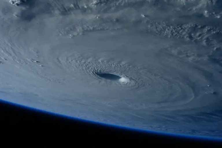
Rossby waves arise because the Coriolis parameter varies with latitude. Air displaced polewards moves into a region of greater planetary rotation, acquires relative vorticity of the opposite sign to conserve its total spin, and turns back equatorward. Displaced equatorward it does the reverse. The result is an oscillation with a wavelength of thousands of kilometres, of which there are typically three to six around the hemisphere.
Vorticity is the measure of spin about a vertical axis, and it is what converts the wave pattern into surface weather. Air moving through the base of an upper trough gains cyclonic vorticity and diverges above the surface, drawing air upward beneath it. The rule that follows is the single most useful statement in synoptic meteorology:
A surface low deepens where the upper air is diverging over it, and fills where it is not.
This is why depressions do not form at random. They form and intensify at preferred positions relative to the upper wave, ahead of the trough and downstream of the jet’s exit region.
The Index Cycle
The waves are not of constant amplitude. The flow alternates between two states on a cycle of roughly four to six weeks, and naming both states is what explains spells of weather.
| High index | Low index | |
|---|---|---|
| Flow | Strongly zonal, nearly straight west to east | Strongly meridional, large amplitude waves |
| Wave amplitude | Small | Large, sometimes with cut-off cells |
| Depression tracks | Fast, west to east, well-defined | Slow, erratic, often blocked |
| Weather | Changeable but unremarkable; mild in winter | Persistent extremes; cold outbreaks and heatwaves |
| Meridional exchange | Weak | Strong: warm air far north, cold air far south |
The low-index state is where extremes come from. Large-amplitude waves carry warm air far poleward on their eastern limbs and cold air far equatorward on their western ones, and when a wave amplifies enough it can pinch off a closed circulation that detaches from the main flow.
Blocking
A blocking high is a persistent anticyclone that stalls the westerly flow and diverts depressions around it, holding the same weather over a region for a week or more. Two configurations are standard: the omega block, named for the shape the flow traces, and the Rex block, a high sitting directly above a cut-off low.
Blocking is the mechanism behind a large share of mid-latitude extremes. European heatwaves, prolonged cold spells and persistent flooding episodes are usually a block holding one pattern in place. In the Indian context, blocking over Eurasia is one of the recognised influences on prolonged breaks in the monsoon, since it disturbs the upper flow that the monsoon circulation sits under.
Jet Streams
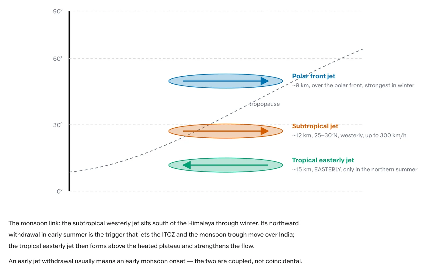
Jet streams are the fast cores embedded within this flow, and the two that matter for India are worth separating carefully.
- The subtropical westerly jet sits at around 25 to 35 degrees north at about 12 km. It lies south of the Himalaya through the winter, and its northward retreat in early summer is a precondition for the monsoon’s onset. It also steers the western disturbances that bring winter rain to north-west India.
- The tropical easterly jet forms over peninsular India and Africa in summer at about 15 km, once the Tibetan plateau has heated and reversed the upper-air temperature gradient. Its presence is associated with a strong monsoon and its weakness with a poor one.
The sequence is worth holding as a chain: Tibetan heating reverses the upper temperature gradient, the subtropical jet withdraws north of the Himalaya, the tropical easterly jet establishes, and the monsoon bursts. Each step is a precondition for the next.
What This Explains That the Surface Pattern Does Not
- Why weather comes in spells. The index cycle, not day-to-day chance.
- Why extremes persist. Blocking holds a pattern rather than letting it pass.
- Where depressions deepen. Upper-level divergence, not surface conditions alone.
- Why monsoon breaks happen. Upper-flow disturbance, including remote blocking.
- Why forecasting beyond a few days is hard. The waves are sensitive to small differences in initial state, which is the practical face of chaos in the atmosphere.
What are Rossby waves?
Large-amplitude waves in the upper westerly flow, with wavelengths of thousands of kilometres, arising because the Coriolis parameter varies with latitude. Air displaced polewards acquires opposite relative vorticity and turns back, setting up an oscillation with typically three to six waves around the hemisphere.
What is vorticity and why does it matter?
Vorticity measures the spin of air about a vertical axis. Air moving through the base of an upper trough gains cyclonic vorticity and diverges aloft, drawing air upward beneath it. A surface low deepens where the upper air is diverging over it and fills where it is not.
What is the difference between geostrophic and gradient wind?
Geostrophic wind results when the pressure gradient force is exactly balanced by the Coriolis force, so air flows parallel to straight isobars. Gradient wind is the same balance corrected for curved flow, which is why wind is subgeostrophic around a low and supergeostrophic around a high.
What is the index cycle?
The alternation between a high-index state, where the westerlies run nearly straight and depressions move quickly west to east, and a low-index state, where the waves reach large amplitude, blocking occurs and weather becomes persistent. The cycle runs over roughly four to six weeks.
What is a blocking high?
A persistent anticyclone that stalls the westerly flow and diverts depressions around it, holding the same weather over a region for a week or more. Omega blocks and Rex blocks are the standard configurations, and blocking causes many mid-latitude heatwaves and cold spells.
How do jet streams affect the Indian monsoon?
The subtropical westerly jet lies south of the Himalaya in winter and must retreat north before the monsoon can burst. The tropical easterly jet forms over peninsular India in summer once the Tibetan plateau heats, and its strength is associated with the strength of the monsoon.
Practice Questions
Prelims
1. Rossby waves owe their existence to
- (a) the rotation of the earth alone
- (b) the variation of the Coriolis parameter with latitude
- (c) friction at the surface
- (d) the distribution of continents
Answer: (b)
2. A surface depression intensifies most readily where the upper air is
- (a) converging
- (b) diverging
- (c) stationary
- (d) descending
Answer: (b)
3. In a low-index situation the upper westerlies are
- (a) strongly zonal with small waves
- (b) strongly meridional with large waves
- (c) absent
- (d) confined to the tropics
Answer: (b)
4. The tropical easterly jet over India forms chiefly because of
- (a) the withdrawal of the subtropical jet
- (b) heating of the Tibetan plateau reversing the upper temperature gradient
- (c) the ITCZ shifting south
- (d) the Coriolis force at the equator
Answer: (b)
5. An omega block is a configuration of
- (a) ocean currents
- (b) the upper westerly flow
- (c) monsoon depressions
- (d) trade winds
Answer: (b)
Mains
- Explain how Rossby waves form and why their wavelength is so long. (10 marks)
- What is vorticity, and how does upper-level divergence control surface cyclone development? (10 marks)
- Describe the index cycle and explain why weather arrives in spells. (15 marks)
- “Blocking is the mechanism behind mid-latitude extremes.” Discuss with examples. (15 marks)
- Trace the chain from Tibetan plateau heating to monsoon onset, naming the jets involved at each step. (20 marks)
Tell Google you want more of this.
Add Anantam IAS as a preferred sourceOne tap, and this site shows up more often in your own Top Stories, AI Overviews and AI Mode. Remove it any time.