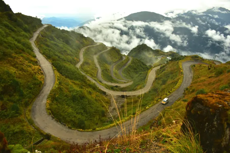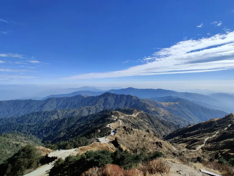
Stand at Dhalai on the India-Bangladesh border in Tripura and the line between two countries can be a knee-deep stream, a paddy bund, or a house whose kitchen is in one nation and whose courtyard is in another. Drive a few thousand kilometres north-east to the Sela Pass in Arunachal Pradesh and the frontier is a 13,000-foot wall of ice and rock where, until recently, snow shut the only road for months at a stretch. Sail south to the waters off Mumbai and the border vanishes altogether into open sea — the same sea that ten armed men crossed in a hijacked fishing trawler in November 2008.
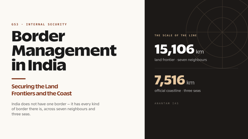
That is the problem in one breath. India does not have a border so much as it has every kind of border there is, all at once. Roughly 15,106 kilometres of land frontier touching seven neighbours, and around 7,516 kilometres of coastline facing three bodies of water. Managing all of it — keeping out what should stay out, letting through what should pass, and developing the people who live along the edge — is one of the hardest standing jobs the Indian state has. And it is squarely a UPSC GS3 internal-security subject, because almost every other threat the syllabus names, from terrorism to smuggling to trafficking, has to cross one of these lines to reach us.
The Challenge, Framed
Border management is the whole apparatus a country uses to control, secure and develop its international boundaries — the guarding forces, the fences and sensors, the roads and outposts, the laws, and the development schemes for border communities. It is broader than “border security,” which is just the guarding part. The Ministry of Home Affairs makes this distinction official: it runs a dedicated Department of Border Management, created in January 2004, precisely to handle land and coastal borders, border policing and the infrastructure — roads, fencing, flood-lighting — that lets guarding actually happen.
The scale is the first thing to grasp, and the numbers are worth memorising. India’s land border runs to about 15,106 kilometres. Take it neighbour by neighbour and you get the shape of the problem: Bangladesh is the longest at roughly 4,097 km, then China at about 3,488 km, Pakistan at around 3,323 km, Nepal at 1,751 km, Myanmar at 1,643 km, Bhutan at 699 km, and a short notional stretch with Afghanistan of about 106 km that runs through Pakistan-occupied territory India does not control. The coastline adds another 7,516 km by the long-standing official figure — though, as we’ll see, even that number is now contested. So why does this matter now, more than it did a decade ago? Because the threats have multiplied while the lines have not moved. Drones now drop heroin and pistols across the Punjab fence. The 2020 Galwan clash showed that an undemarcated mountain frontier can turn lethal without a shot being a settled thing. And the sea route that 26/11 exposed is still, by its nature, the hardest edge of all to seal.
A Frontier of Many Kinds
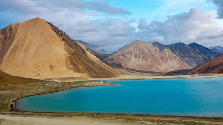
Start with the terrain, because geography writes the rules here, not policy. India’s frontiers cut through the highest mountains on earth, the Thar desert, the marshy salt flats of the Rann of Kutch, the dense riverine maze of the Sundarbans, and the jungle hills of the Northeast. No single fence, sensor or doctrine fits all of that. A floodlit double fence works in the flat Punjab plains; it is meaningless in a river that changes course every monsoon, or on a ridge buried under twenty feet of snow.
Then there is the legal and political character of each line, which differs sharply. Some are settled international boundaries, surveyed and largely fenced — much of the India-Pakistan and India-Bangladesh borders. Some are open by design: the India-Nepal and India-Bhutan borders have no fence and no passport regime, a deliberate expression of old treaty friendship and free movement of people. And one, the most dangerous, is not a border at all in the legal sense — the Line of Actual Control with China is not a mutually agreed, demarcated line but a perception of where each side’s control ends, which is exactly why patrols bump into each other and 2020 happened.
The threats track the terrain. Across the western fence with Pakistan, the concerns are cross-border terrorism, infiltration, smuggled weapons and fake currency, and increasingly the drone-dropped narcotics and arms that make a static fence look dated. Along the eastern border with Bangladesh, the issues are illegal migration, cattle and contraband smuggling, and human trafficking through porous riverine gaps. On the Myanmar frontier, insurgent groups have long used the jungle and the hill-tribe kinship that straddles the line to move men and guns. The northern frontier with China is less about infiltration and more about strategic posture: roads, troops and the slow contest over an undefined line. Each calls for a different answer, which is the whole reason border management is so much harder than the phrase suggests.
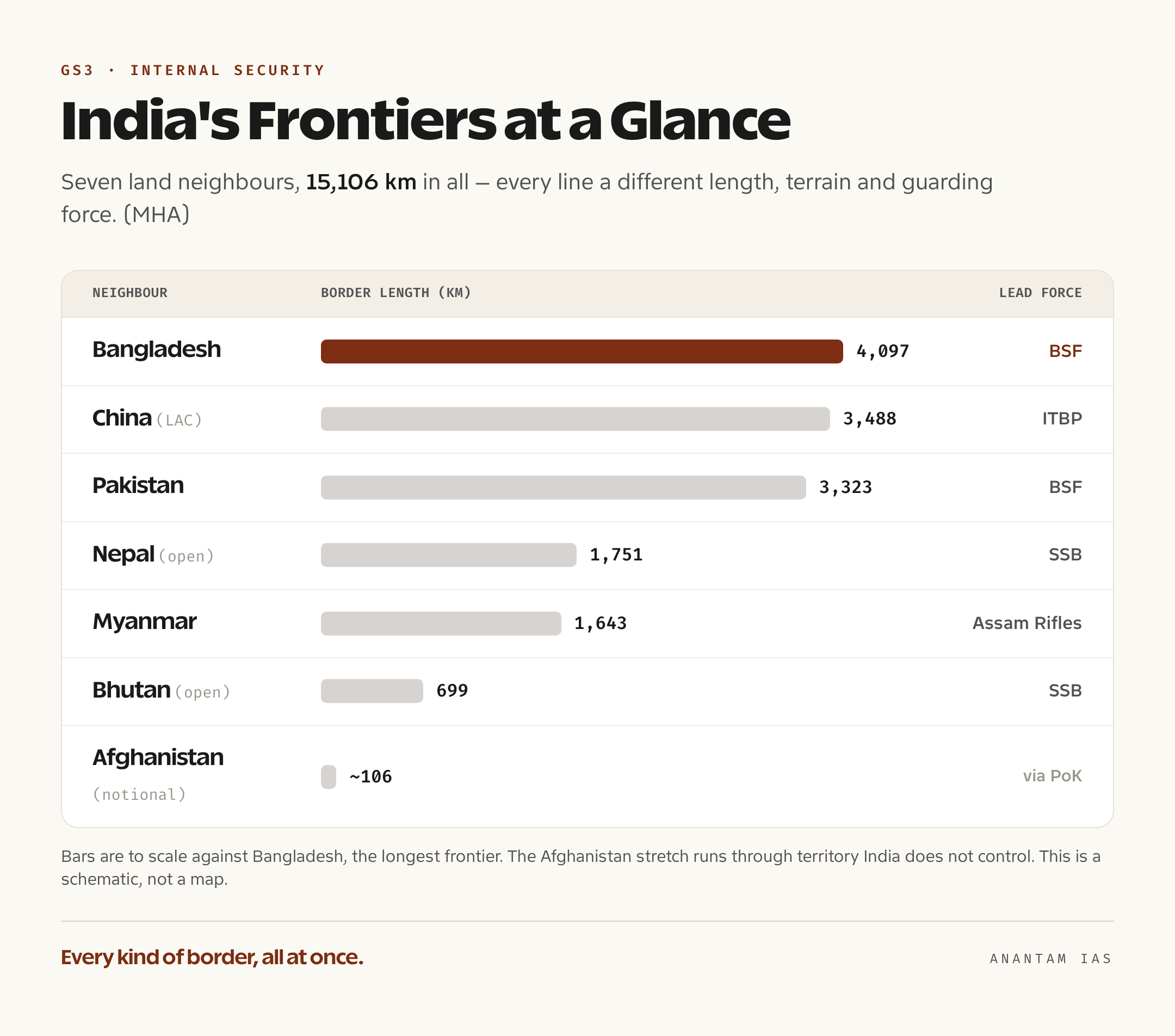
India’s Institutional Response
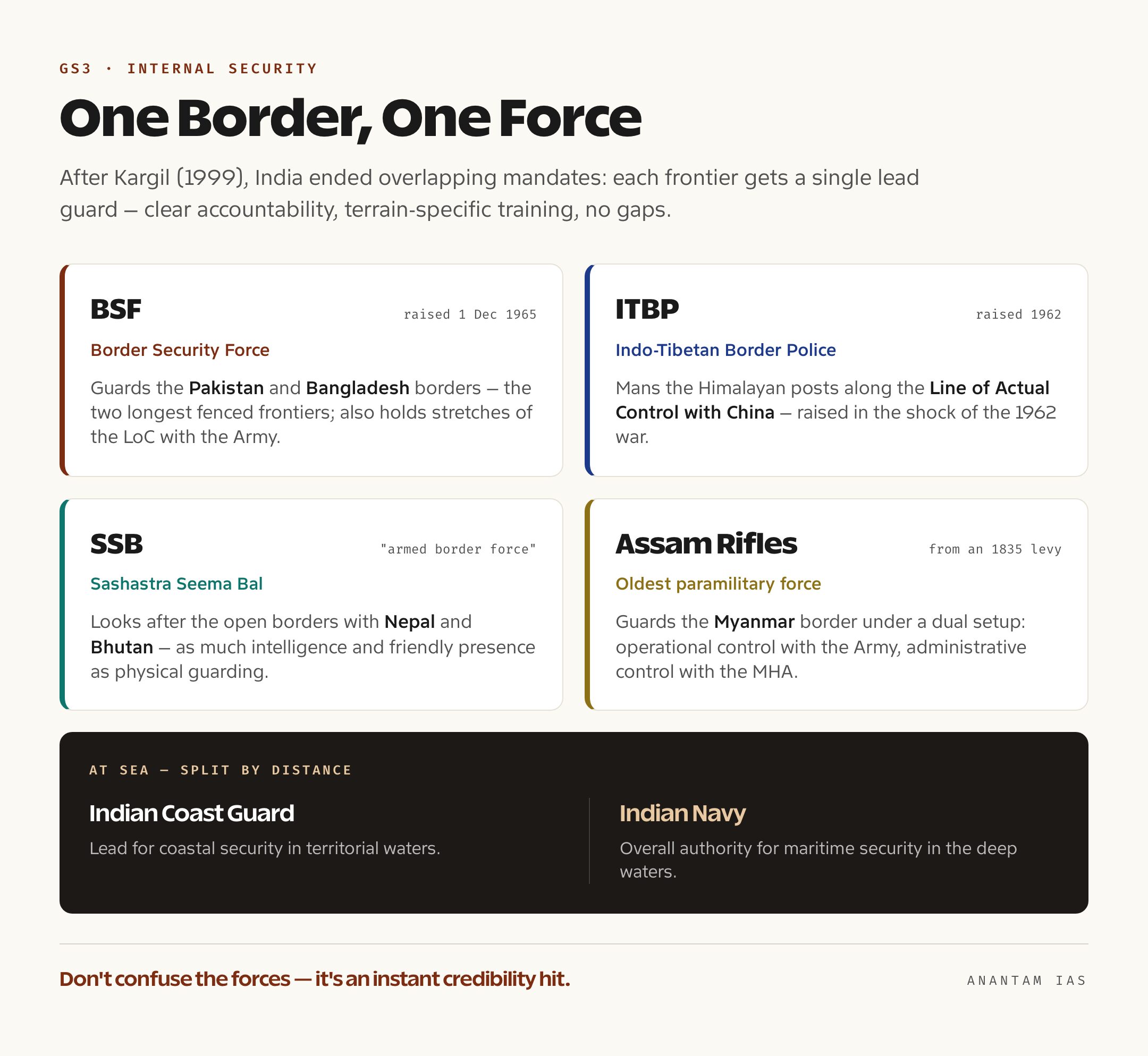
The organising idea on the land borders is a phrase worth knowing cold: “one border, one force.” After the Kargil conflict of 1999, the review of what had gone wrong recommended that India stop letting multiple forces share the same stretch with muddy responsibility, and instead give each frontier a single designated guarding force. The logic is simple — clear accountability, specialised training for that terrain, and no gaps where one force assumes another is watching.
In practice, four Central Armed Police Forces — the CAPFs, the armed police under the MHA — carry the bulk of the land-border job, each matched to its frontier. The Border Security Force, raised on 1 December 1965 after that year’s war with Pakistan, guards both the India-Pakistan and the India-Bangladesh borders, India’s two longest fenced frontiers; it also holds stretches of the Line of Control alongside the Army. The Indo-Tibetan Border Police, raised in 1962 in the immediate shock of the war with China, mans the Himalayan posts along the Line of Actual Control. The Sashastra Seema Bal — the name means “armed border force” — looks after the open borders with Nepal and Bhutan, where its job is as much intelligence and friendly presence as physical guarding. And the Assam Rifles, India’s oldest paramilitary force, traced back to an 1835 colonial levy, guards the India-Myanmar border under a dual arrangement: operational control with the Army, administrative control with the MHA. At sea, the line is split by distance — the Indian Coast Guard is the lead for coastal security in territorial waters, and the Indian Navy carries overall responsibility for maritime security, a structure we’ll come to.
Guarding is only half of it. The development half runs through two schemes you should be able to name and distinguish. The older one is the Border Area Development Programme, the BADP, which dates back to the Seventh Five-Year Plan in the late 1980s and now funds roads, schools, health posts and water in well over a hundred border districts — the idea being that a developed, rooted border population is itself a security asset. The newer, sharper instrument is the Vibrant Villages Programme. Its first phase, approved in February 2023 with a 4,800-crore-rupee outlay through 2025-26, deliberately targeted the northern border facing China — the villages of Arunachal Pradesh, Himachal Pradesh, Sikkim, Uttarakhand and Ladakh that had been emptying out through migration, a phenomenon strategists call “ghost villages.” The aim is to reverse that drift, because a lived-in village is a watchful one. A second phase, Vibrant Villages Programme-II, was cleared by the Cabinet in 2025 as a fully centrally funded scheme with a 6,839-crore-rupee outlay through 2028-29, extending the same approach to the other land borders — Punjab, Rajasthan, Gujarat, the Northeast and West Bengal among them.
On technology, the centrepiece is the Comprehensive Integrated Border Management System, or CIBMS — an attempt to replace the limits of a physical fence with an electronic one. It bundles thermal imagers, infra-red and laser intrusion alarms, ground sensors, radars, aerostats for aerial watch, sonar to cover riverine stretches, and fibre-optic lines, all feeding a single command-and-control room that sees the border in real time. Smart-fencing pilots were launched from 2017-18, including a much-publicised stretch on the Indo-Bangladesh border in Assam, and the MHA’s stated ambition is to extend the system to the roughly 1,955 kilometres of frontier that simply cannot be physically fenced — rivers, ravines and slopes where a wall is impossible. On the China frontier the response is infrastructure rather than fencing: the Border Roads Organisation has been pushing all-weather roads and tunnels to the LAC, the most visible being the Sela Tunnel in Arunachal Pradesh, inaugurated in March 2024 at around 13,000 feet, which finally gives year-round road access toward Tawang.
The most consequential recent decision is on the Myanmar border. For years a Free Movement Regime, formalised in 2018 under the Act East policy, let people living near that frontier travel up to 16 kilometres into each other’s territory without documents — a humane nod to the fact that the same ethnic communities live on both sides. In February 2024, citing internal security and the demographic pressures on the Northeast, the Home Minister announced the government’s decision to scrap the Free Movement Regime and to fence the entire 1,643-kilometre border with a patrol track alongside. It is a clean illustration of the central tension in this whole subject: the security case for sealing the border runs straight into the human and federal cost of cutting communities, and states like Mizoram and parts of Manipur have pushed back hard.
Where the System Falls Short
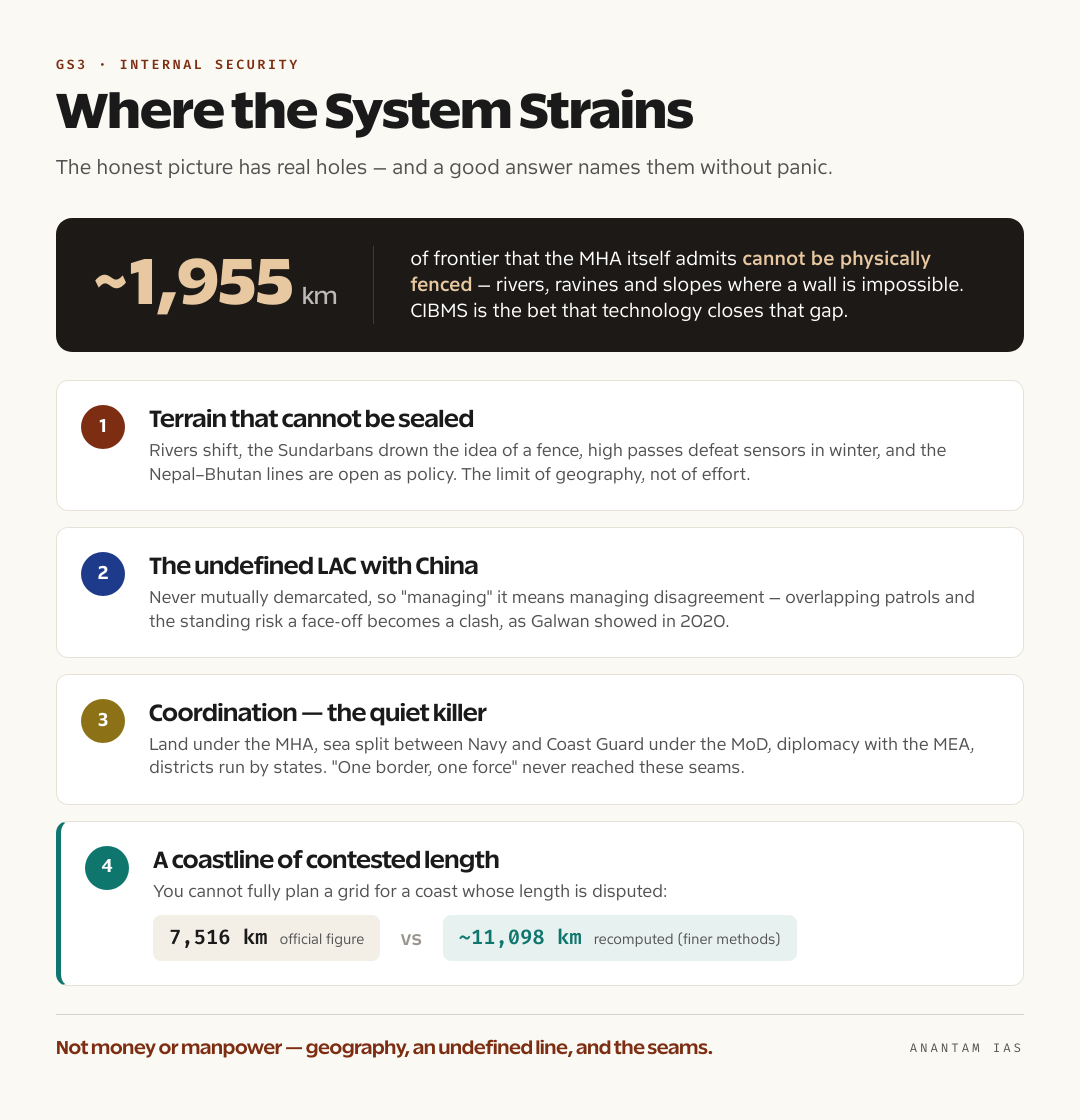
For all that machinery, the honest picture has real holes, and a good answer names them without panic. The first is the one geography guarantees: large stretches of border genuinely cannot be sealed. Rivers shift, the Sundarbans drown the idea of a fence, high passes defeat sensors in winter, and the open Nepal and Bhutan borders are unfenced as a matter of policy. The roughly 1,955 km the MHA itself admits cannot be physically fenced is not a failure of effort — it is the limit of the terrain. CIBMS is the bet that technology closes that gap, but it is being scaled slowly, in pilots, and an electronic line still needs people to respond to the alarm it raises.
The second gap is the unsettled China frontier. Because the LAC has never been mutually demarcated, “managing” it means managing disagreement itself — patrols that overlap, infrastructure races on both sides, and the standing risk that a face-off becomes a clash, as Galwan showed in 2020. No amount of road-building resolves the underlying fact that the two armies do not agree where the line is.
The third is coordination, the quiet killer of border management. Land borders sit under the MHA; the sea is shared between the Navy and Coast Guard under the Ministry of Defence, with state marine police and fisheries departments in the mix; diplomacy runs through the MEA; and the actual border districts are governed by states. “One border, one force” cleaned up the guarding side, but the seams between ministries, between the centre and the states, and between intelligence agencies remain where things slip. Even the headline numbers are contested — the official 7,516-km coastline now sits beside a recomputed figure of around 11,098 km that the hydrographic authorities produced using finer methods, and a state cannot fully plan a security grid for a coast it cannot agree on the length of.
The coast deserves its own line here, because 26/11 reset the entire approach. When ten Lashkar-e-Taiba attackers reached Mumbai by sea in 2008, having hijacked the trawler Kuber, they exposed a coastline that nobody clearly owned. The fix was a three-tier grid: state marine police patrol the shallow waters out to 12 nautical miles, the Indian Coast Guard takes the belt from there out to the edge of the territorial and contiguous zones, and the Indian Navy holds the deep waters and the wider Exclusive Economic Zone, with the Navy designated the overall authority for maritime security. Stitching it together is the National Command Control Communication and Intelligence network, the NC3I, which links around fifty Navy and Coast Guard radar stations for near-gapless surveillance, run from a maritime hub at Gurugram. On top sit coastal police stations — dozens built under the first phase of the Coastal Security Scheme and over a hundred more sanctioned under the second — plus biometric identity cards for nearly two million fishermen and joint exercises like Sagar Kavach. It is a serious build-out. But a fishing fleet of hundreds of thousands of small boats is, by its nature, the perfect crowd to hide one hostile vessel in, and that vulnerability has not gone away.
The Way Forward
- Finish CIBMS, but staff it. The smart fence is the only realistic answer for the unfenceable stretches, so scale it past the pilot phase — while remembering that a sensor is worth only the quick-reaction team that answers its alarm. Technology supplements guarding; it does not replace it.
- Keep developing the border, not just defending it. The Vibrant Villages logic is sound: a lived-in, connected, prosperous border village is a sensor in itself. Fund the second phase fully and measure it by people who stay, not just money spent.
- Handle the Myanmar fence with the states, not over them. Sealing the frontier may be defensible on security grounds, but doing it without carrying Mizoram and Manipur along will trade an external problem for an internal one. Pair fencing with a workable, documented border-pass system so kinship ties are managed, not severed.
- Settle what can be settled, manage what can’t. On the China frontier, sustained boundary talks matter as much as roads; on the demarcated borders, complete the joint surveys and resolve enclave-type anomalies so the line is at least clear.
- Fix coordination at the top. A standing mechanism that binds the MHA, MoD, MEA, the coastal states and the intelligence agencies would close the seams that “one border, one force” never reached. And agree, finally, on how long the coastline actually is.
For Your Mains Answer
This topic maps directly onto GS Paper 3, which lists “security challenges and their management in border areas” and “the linkages of organized crime with terrorism” — and border management is the connective tissue between both. It also feeds GS Paper 2 when a question turns to centre-state relations or governance of border regions, and the disaster-management and infrastructure angles overlap with development administration. Treat it as a systems question: forces, schemes, technology, and the gaps between them.
How to Build the Answer
Open with scale and variety — the 15,106 km of land border, the 7,516 km of coast, the seven neighbours, and the line that India has every kind of border at once. Then organise around three buckets: who guards what (“one border, one force”), how India develops and secures it (BADP, Vibrant Villages, CIBMS, the coastal grid), and where it falls short (terrain, the LAC, coordination). Close with a balanced way-forward that names both the security need and the rights-and-federal cost. That structure works whether the question asks about land borders, coastal security, or border management as a whole.
Common Mistakes to Avoid
Don’t confuse the forces — mixing up ITBP (China) with the Army, or handing the Myanmar border to the BSF instead of the Assam Rifles, is an instant credibility hit. Don’t treat “border management” as only fencing; the development and coordination dimensions are half the marks. Don’t slide into jingoism or communal framing on infiltration — the examiner is reading for balance. And don’t quote the coastline as a settled number without noting the revised figure exists.
A Compact Answer Spine
Every kind of border at once (terrain, legal status, threat) → “one border, one force” and which CAPF holds which line → development as security (BADP, Vibrant Villages I and II) → technology and infrastructure (CIBMS smart fencing, BRO roads, Sela Tunnel) → the coastal three-tier grid and NC3I after 26/11 → the Myanmar FMR-and-fencing decision as the live tension → gaps (unfenceable terrain, undefined LAC, coordination seams) → way forward balancing security with rights and federalism.
Diagram or Flowchart Idea
Draw India’s outline and label four arcs with the force guarding each — BSF on the west and east, ITBP on the north, SSB on the central Himalayan stretch, Assam Rifles on the east-Myanmar edge — then add three concentric arcs off the coast for marine police, Coast Guard and Navy. One clean map carries the whole “who guards what” answer faster than three paragraphs.
The Rights-and-Security Balance Angle
The sophisticated line, worth a sentence in the conclusion, is that a hard border is not automatically a secure one. The Free Movement Regime decision is the perfect case: fencing the Myanmar frontier may reduce infiltration, but cutting communities that have always lived on both sides can manufacture grievance and alienation, which is its own security risk. Real border management balances the line on the map against the people who live along it — security and federal trust are not opposites here, they are the same project.
How to Use Data Without Overclaiming
Anchor with two or three firm figures — 15,106 km of land border, the four guarding CAPFs, the 6,839-crore Vibrant Villages-II outlay — and attribute them plainly to the MHA or Cabinet rather than dropping them as if they were folklore. When a number is contested, say so: writing “the official coastline is about 7,516 km, though a recomputed figure of roughly 11,098 km now exists” reads as command of the material, not confusion. Hedge the things that are genuinely unsettled — the exact line of the LAC, the final status of the Myanmar fencing orders — and state firmly the things that aren’t.
FAQ
Which force guards which border in India? Under the “one border, one force” principle adopted after Kargil, the Border Security Force guards the borders with Pakistan and Bangladesh, the Indo-Tibetan Border Police mans the Line of Actual Control with China, the Sashastra Seema Bal looks after the open borders with Nepal and Bhutan, and the Assam Rifles guards the India-Myanmar border. At sea, the Indian Coast Guard leads coastal security in territorial waters and the Indian Navy holds overall maritime-security responsibility.
How long are India’s land border and coastline? India’s land border is about 15,106 kilometres, touching seven neighbours — Bangladesh, China, Pakistan, Nepal, Myanmar, Bhutan and a short notional stretch with Afghanistan. The coastline is officially about 7,516 kilometres including island territories, though hydrographic authorities have more recently computed a longer figure of around 11,098 kilometres using finer measurement methods.
What is the Vibrant Villages Programme? It is a government scheme to develop border villages so they don’t empty out through migration, on the logic that a lived-in, connected village is itself a security asset. The first phase, approved in 2023 with a 4,800-crore-rupee outlay, targeted the northern villages facing China; the second phase, cleared in 2025 with a 6,839-crore-rupee outlay, extends the approach to the other land borders.
Why did India scrap the Free Movement Regime with Myanmar? The Free Movement Regime, formalised in 2018, let border residents travel up to 16 kilometres into each other’s territory without documents. In February 2024 the government announced it would scrap the arrangement and fence the entire 1,643-kilometre border, citing internal security and demographic concerns in the Northeast — a decision that has drawn pushback from states like Mizoram and Manipur because it cuts across communities that live on both sides of the line.
Tell Google you want more of this.
Add Anantam IAS as a preferred sourceOne tap, and this site shows up more often in your own Top Stories, AI Overviews and AI Mode. Remove it any time.