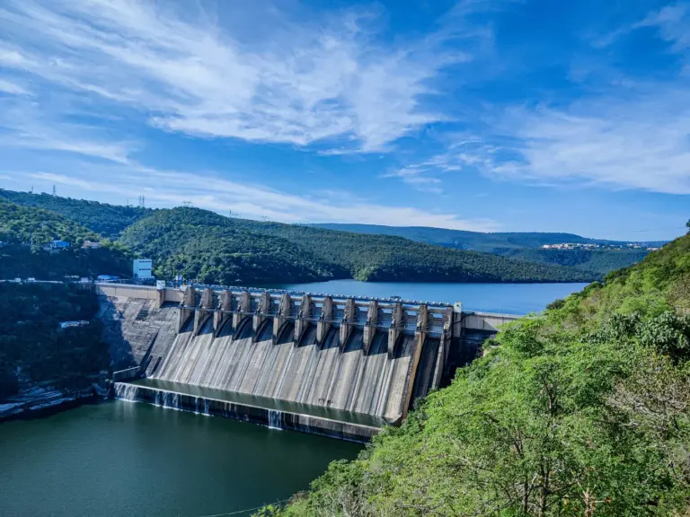
Sela Pass — also written as Se La — is a high-altitude mountain pass in the Tawang district of Arunachal Pradesh, lying at an elevation of 4,170 metres (13,700 feet). It is the only all-season road link between the rest of India and the strategically sensitive town of Tawang, which borders the Line of Actual Control (LAC) with China. For UPSC, Sela Pass is a key topic under GS1 (Indian Geography) and GS3 (Border Infrastructure & Internal Security), particularly after the inauguration of the Sela Tunnel by Prime Minister Narendra Modi on 9 March 2024.
Location and Geography
| Parameter | Details |
|---|---|
| Location | Tawang district, Arunachal Pradesh |
| Coordinates | 27°30' N, 92°06' E |
| Elevation | 4,170 m (13,700 ft) |
| Connects | Dirang (West Kameng) with Tawang town |
| Distance from Tawang | ~78 km |
| Distance from LAC | ~35–40 km (air distance) |
| Road | NH-13 (earlier NH-229) |
| Snowbound | November to May (historically) |
| Highest motorable point | Before tunnel, made Tawang unreachable in winters |
Sela Pass lies along the Eastern Himalayas and separates the Dirang valley (south) from the Tawang valley (north). Just below the pass lies the small Sela Lake (Paradise Lake) at about 4,100 m — a glacial lake that stays frozen for most of the year.
Nearby Landmarks
- Jaswant Garh War Memorial: Tribute to Rifleman Jaswant Singh Rawat, MVC, who single-handedly held back Chinese forces for 72 hours during the 1962 War.
- Nuranang Falls (Jang Falls): One of the highest waterfalls in Arunachal Pradesh.
- Tawang Monastery: 17th-century Gelug Buddhist monastery, the largest in India and second-largest in the world.
- Bumla Pass: Near the LAC, site of Indo-China troop flag meetings.
Sela Pass — Naming and History
The pass is named after Sela Tshering Boomzan, a local Monpa woman who is believed to have helped Rifleman Jaswant Singh Rawat during the 1962 Sino-Indian War by supplying him food and information while he defended the pass. She was killed in action, and Sela Pass carries her memory.
1962 Sino-Indian War — Battle of Sela
During the 1962 war, the 4 Infantry Division of the Indian Army was deployed at Sela Pass under General Brij Mohan Kaul. In November 1962, Chinese PLA forces advanced through Tawang and attacked the Sela defences. The Indian withdrawal became disorganised, leading to heavy casualties, including the death of the Division Commander Major General A.S. Pathania. The loss of Sela was a turning point that led to the capture of Bomdila by China before the unilateral ceasefire of 21 November 1962.
The battle exposed severe logistical and command failures and permanently scarred the Indian military's memory of the Eastern Sector — making Sela Pass synonymous with the 1962 debacle.
The Sela Tunnel Project
The Sela Tunnel was conceived to provide all-weather connectivity to Tawang, bypassing the snow-affected Sela Pass and enabling rapid troop and logistics movement in all seasons.
Key Facts
| Parameter | Details |
|---|---|
| Foundation laid by | PM Narendra Modi on 9 February 2019 |
| Inaugurated by | PM Narendra Modi on 9 March 2024 |
| Altitude | ~13,000 ft (3,962 m) — world's longest bi-lane tunnel at that altitude |
| Total project length | 12.04 km (tunnels + approach roads) |
| Tunnel 1 (Main tube) | 1,003 m (single tube) |
| Tunnel 2 (Twin tube) | 1,595 m main + 1,595 m escape tube |
| Approach roads | ~7.5 km |
| Cost | ~₹825 crore |
| Agency | Border Roads Organisation (BRO) under Project Vartak |
| Contractor | Joint venture of M/s Patel Engineering |
| Technology | New Austrian Tunnelling Method (NATM) |
Strategic Gains
- Reduces travel time to Tawang by ~1 hour (earlier 10+ hours from Tezpur now ~8–9 hours).
- All-weather access — earlier, Tawang was effectively cut off 4–6 months a year due to heavy snow and avalanches.
- Faster troop mobilisation — critical after the Galwan clash (June 2020) and the Yangtse/Tawang skirmish (December 2022).
- Logistics for forward posts — ammunition, rations, medical supplies can now reach Tawang year-round.
- Civilian benefits — tourism, medical emergencies, Monpa community welfare.
Strategic Significance for India
Sela Pass and its tunnel sit at the heart of India's Eastern Sector border strategy with China.
1. Gateway to Tawang
Tawang is the most contested town along the LAC — China claims it as part of "South Tibet" and has historical religious claims (it is the birthplace of the 6th Dalai Lama). Whoever controls the road to Tawang controls the military balance of the sector.
2. LAC Tensions
- Galwan Valley clash, June 2020: 20 Indian soldiers martyred in Ladakh; accelerated infrastructure build-up across the LAC.
- Yangtse skirmish, 9 December 2022: PLA troops attempted to intrude along the LAC in Tawang; repulsed by the Indian Army with non-lethal clashes.
- Ongoing construction by China — PLA villages, roads, and heliports on the Chinese side mandate matching Indian infrastructure.
3. Border Roads Organisation (BRO) — Project Vartak
The BRO, established in 1960, operates in the Eastern sector under Project Vartak. Major BRO projects in Arunachal Pradesh include:
- Sela Tunnel (inaugurated 2024)
- Bomdila–Tawang road upgradation
- Nechiphu Tunnel (500 m, opened alongside Sela in March 2024)
- Balipara–Charduar–Tawang (BCT) Road
- Trans-Arunachal Highway
4. Frontier Highway
The upcoming Arunachal Frontier Highway (NH-913) — ~1,748 km long — will run parallel to the LAC, connecting Mago near Bhutan–China–India trijunction to Vijaynagar near the Myanmar border. The Sela axis is a southern feeder to this highway.
Other Important Passes of Arunachal Pradesh
| Pass | Location | Strategic Importance |
|---|---|---|
| Bumla Pass | Tawang | India–China BPM (Border Personnel Meeting) site |
| Yonggyap Pass | Upper Siang | Links India to Tibet via Zayul |
| Diphu Pass | Eastern tip | Tri-junction of India, Myanmar, China |
| Dihang Pass | Upper Siang | Brahmaputra enters India as Siang |
| Kibithu Pass | Anjaw district | Easternmost military post |
| Hathi La | West Kameng | Foot-patrol pass |
Tawang — Why It Matters
- Second-largest Buddhist monastery in the world (Tawang Monastery).
- Birthplace of the 6th Dalai Lama, Tsangyang Gyatso.
- Home to the Monpa tribe, India's only Tibetan Buddhist ethnic group.
- 1959 refuge route — the 14th Dalai Lama crossed into India through Tawang after fleeing Lhasa.
- China's claim rests on this religious connection, making Tawang politically symbolic.
Environmental and Engineering Challenges
Building at 13,000 ft involves unique problems:
- Extreme cold — temperatures drop to -25°C; construction windows limited to May–October.
- Seismicity — Arunachal lies in Seismic Zone V (highest risk).
- Landslides and glacier melt affect approach roads.
- Oxygen-deficient work conditions — specialised ventilation and worker rotation needed.
- Ecologically sensitive area — parts of the route cross biodiversity hotspots.
The Sela Tunnel used NATM (rock-reinforcement method) to minimise excavation and protect the mountain's stability.
UPSC Relevance
GS1 (Geography): Himalayan passes, physical geography of Arunachal Pradesh, drainage and climate of the Eastern Himalayas.
GS2 (IR): India–China relations, LAC disputes, South Tibet issue.
GS3 (Security & Infrastructure): Border Roads Organisation, Sela Tunnel, border infrastructure parity with China, defence logistics.
Key Prelims facts:
- Location: Tawang district, Arunachal Pradesh.
- Elevation of Sela Pass: 4,170 m (13,700 ft).
- Connects: Dirang (West Kameng) to Tawang.
- Sela Tunnel inaugurated: 9 March 2024 by PM Modi.
- Altitude of Sela Tunnel: ~13,000 ft — world's longest bi-lane tunnel at that altitude.
- Total length (project): ~12.04 km (tunnels + approaches).
- Built by: Border Roads Organisation (BRO) — Project Vartak.
- Named after: Sela Tshering Boomzan (Monpa woman, 1962 War).
- Battle of Sela: November 1962, Sino-Indian War.
- Nearby passes: Bumla, Yonggyap, Diphu, Dihang.
- Recent LAC flashpoint: Yangtse clash, 9 December 2022.
- Arunachal Frontier Highway NH-913 is under construction along LAC.
Tell Google you want more of this.
Add Anantam IAS as a preferred sourceOne tap, and this site shows up more often in your own Top Stories, AI Overviews and AI Mode. Remove it any time.