Why in news?
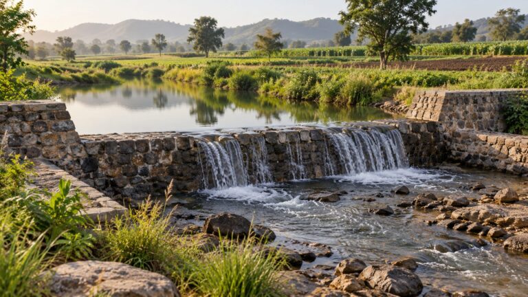
A barge carrying 540 tonnes of methanol left Bogibeel (Dibrugarh) for Bangladesh via the Brahmaputra (National Waterway 2), which is Assam’s first international cargo since Independence.
UPSC Relevance –
- Prelims: National Waterways, IWAI, Indo-Bangladesh Protocol Route.
- Mains GS3: Infrastructure – ports, waterways; inclusive growth; Internal security and development of border areas (North-East connectivity).
Inland Water Transport (IWT) in India
IWT means moving goods and people on rivers, canals, backwaters and creeks. India has around 14,500 km of navigable waterways, yet IWT carries only about 2% of the country’s freight, far lower than in China, the USA or Europe.
Constitutional and legal framework
- Union List, Entry 24: Shipping and navigation on inland waterways declared by Parliament as national waterways (for mechanically propelled vessels).
- State List, Entry 13: Inland waterways and traffic on them, subject to Lists I and III. So waterways not declared ‘national’ remain largely with States.
- Inland Waterways Authority of India (IWAI): Statutory body set up in 1986 under the IWAI Act, 1985, under the Ministry of Ports, Shipping and Waterways. It develops and maintains NWs.
- National Waterways Act, 2016: Declared 106 new waterways, taking the total to 111 NWs.
- Inland Vessels Act, 2021: Replaced the colonial Inland Vessels Act, 1917. Brought a single all-India registration and certificate for vessels in place of State-wise rules.
- Indo-Bangladesh Protocol on Inland Water Transit and Trade (PIWTT)
- Origin: First signed in 1972. Since 2015 it renews automatically every five years.
- What it allows: Vessels of both countries use designated routes in each other’s territory for trade and transit. The route links Kolkata–Haldia with Assam (NW-2 via Dhubri) and Karimganj (NW-16) through rivers of Bangladesh.
Important National Waterways
| National Waterway | Stretch | Why it matters |
| NW-1 (Ganga–Bhagirathi–Hooghly) | Haldia to Prayagraj, about 1,620 km | Longest NW ; Jal Marg Vikas Project (World Bank support) |
| NW-2 (Brahmaputra) | Sadiya to Dhubri, 891 km (declared 1988) | Lifeline of Assam; terminals at Pandu, Jogighopa, Bogibeel, Dhubri |
| NW-3 (West Coast Canal) | Kottapuram to Kollam, Kerala | Among the first three NWs; tourism and local cargo |
| NW-16 (Barak) | Lakhipur to Bhanga, about 121 km | Connects south Assam, Mizoram, Manipur and Tripura to the protocol route via Karimganj |
Why waterways matter – especially for the North-East
- Cheap and fuel-efficient: One horsepower moves about 4,000 kg on water against roughly 500 kg by rail and 150 kg by road. Lower cost per tonne-km for bulk goods like coal, cement, fertiliser, food grains and petroleum products.
- Beating the ‘chicken’s neck’: The North-East is linked to the rest of India by the narrow Siliguri corridor (about 22 km at its narrowest). Rivers through Bangladesh give a shorter and alternative route.
- Act East and regional links: Waterways can tie in with Bangladesh Bhutan India Nepal (BBIN) cooperation and the Kaladan Multimodal Project (Kolkata–Sittwe port–Kaladan river–Mizoram) with Myanmar.
- Local economy: New market for the region’s products (tea, petrochemicals, fertiliser, bamboo, cement), jobs at terminals and revival of river towns like Dibrugarh.
- Greener: Less fuel burnt per tonne and fewer trucks on highways. Helps India’s net zero 2070 goal and decongests roads.
- Diplomacy: Shared use of rivers builds interdependence with Bangladesh and earns it transit revenue.
Challenges
- Nature of the Brahmaputra: A braided, heavily silt-laden river that keeps shifting its channel. Lean-season depth falls, so frequent dredging is needed. The region is also seismically active (the 1950 quake changed the river bed).
- Draft and navigation aids: Inadequate depth on several stretches, limited night navigation and river information systems.
- Last-mile connectivity: Weak road and rail links to terminals; cargo needs multiple handling which adds cost and time.
- Lack of return cargo: Vessels often come back empty, making trips costly. Traders still prefer trucks for speed and door-to-door delivery.
- Dependence on Bangladesh: The route works only as long as the political climate in Dhaka is favourable. Relations have seen ups and downs since 2024. Navigability of Bangladeshi stretches also depends on their dredging.
- Too many ‘paper’ waterways: Many of the 111 NWs are not yet navigable; only a few carry most of the traffic.
- Ecological concerns: Dredging and heavy traffic can harm species such as the Gangetic river dolphin (National Aquatic Animal) and wetland habitats.
- Shortage of vessels and trained crew in the region, and slow private investment.
Government initiatives
- Jal Marg Vikas Project: Capacity building of NW-1 (Haldia–Varanasi) with World Bank help.
- Jalvahak scheme (2024): Cargo promotion scheme that reimburses up to 35% of operating costs for long-distance cargo on NW-1, NW-2 and NW-16, along with fixed scheduled services.
- Maritime India Vision 2030 and Maritime Amrit Kaal Vision 2047: Targets a big jump in waterway cargo. Cargo on NWs has already risen from about 18 million tonnes (2013-14) to around 145 million tonnes (2024-25).
- Harit Nauka guidelines (2024): Roadmap for shifting inland vessels to green fuels.
- Terminals and Customs points in the North-East such as Pandu, Jogighopa, Bogibeel, Dhubri and Karimganj have been operationalised.
Way forward
- Assured depth: Year-round fairway with regular, scientific dredging and river training works, done in consultation with Bangladesh.
- Multimodal integration: Connect terminals to rail and highways under PM Gati Shakti so cargo moves smoothly.
- Anchor cargo: Tie up long-term contracts with PSUs (oil, fertiliser, cement, food grains) so vessels run full both ways.
- Make river diplomacy stable: Keep waterway cooperation insulated from short-term political swings. The Ganga Water Treaty (1996), due for renewal in December 2026, is part of the same larger picture.
- Local shipbuilding and skilling: Encourage river vessel building and training of crew from the region.
- Ecology first: Environmental impact studies before dredging and speed limits in dolphin habitats.
The Bogibeel shipment is small in size but big in meaning. Whether it becomes a regular corridor will depend less on the river and more on steady policy, dependable depth and good relations with Bangladesh.
Practice MCQ
Q1. Consider the following pairs:
| National Waterway | River/Canal |
| NW-1 | Ganga–Bhagirathi–Hooghly |
| NW-2 | Brahmaputra |
| NW-3 | Mahanadi |
| NW-16 | Barak |
How many of the pairs given above are correctly matched?
(a) Only one
(b) Only two
(c) Only three
(d) All four
Answer: (c). NW-3 is the West Coast Canal in Kerala (Kottapuram–Kollam), not Mahanadi.
Q2. Consider the following statements regarding transit infrastructure in North-East India:
- National Waterway-2 connects directly to the Bay of Bengal through the Indo-Bangladesh Protocol Route.
- Dibrugarh served as an active inland river port connected by regular steamship services to Kolkata prior to the 1947 Partition.
Which of the statements given above is/are correct?
(a) 1 only
(b) 2 only
(c) Both 1 and 2
(d) Neither 1 nor 2
Answer: (c)
Explanation: Statement 1 is correct: NW-2 connects to the Indo-Bangladesh Protocol route at the border, allowing movement toward Bangladeshi ports and international maritime routes.
Statement 2 is correct: Government-run steamers connected Dibrugarh with Kolkata as early as 1856, carrying tea, timber, and cargo until border shifts and conflict halted regular operations.
Mains Practice Question
“Inland water transport can reduce the North-East’s dependence on the Siliguri corridor, but its success depends as much on diplomacy as on dredging.” Discuss the potential and challenges of developing the Inland Water Transport in India. (15 marks, 250 words)
Tell Google you want more of this.
Add Anantam IAS as a preferred sourceOne tap, and this site shows up more often in your own Top Stories, AI Overviews and AI Mode. Remove it any time.