
Why in News?
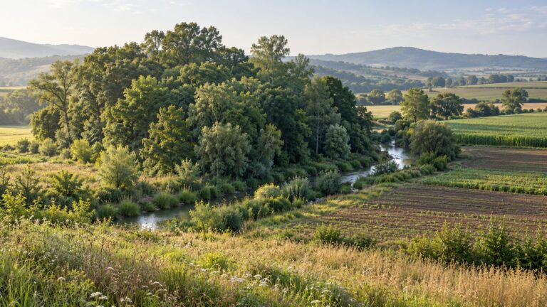
On 28 October 2026, the Ministry of Jal Shakti launched Punah Bharan, a geospatial application intended to help identify potential artificial groundwater recharge zones and suitable structures.
- The tool combines rainfall, groundwater levels and yield with slope and drainage information to support recharge planning.
- Its mobile interface identifies potential zones within a radius of up to 3 km; the web portal provides village-level zonation maps and thematic layers.
- The announcement establishes a planning capability, not proof that every suggested location is suitable or that groundwater storage has already increased.
- Recharge planning connects surface-water availability with the capacity of underground formations to receive and retain water.
- A map can narrow the search, but field investigation must establish whether the proposed intervention fits local geology, water quality and seasonal conditions.
UPSC Relevance
Prelims Relevance
- Meaning of artificial recharge and infiltration
- Distinction between the unsaturated zone and an aquifer
- Role of permeability and subsurface storage
- Source-water quality and pretreatment
- Groundwater-level and quality monitoring
Mains Relevance
GS Paper 3
- Using geospatial evidence in water-resource planning
- Matching recharge interventions to local hydrogeology and monitoring outcomes
GS Paper 1
- Relationships between drainage, landforms and groundwater movement
Essay
- Useful technology improves decisions when local evidence tests its recommendations.
Background and Context
What a Recharge Map Can Establish
Geospatial layers help identify promising locations, but they represent different parts of a water system rather than a completed engineering assessment.
- Rainfall indicates a possible water source, while slope and drainage describe how runoff moves across land. Combining these layers can identify areas worth investigating before committing money to a particular recharge structure.
- Groundwater levels and yield add information about subsurface conditions. A productive well, however, does not by itself establish available storage or prove that surface water can reach the same water-bearing formation safely.
- Zonation groups places by assessed potential using available datasets. Conditions within a mapped zone can still vary, including soil thickness, rock fractures and water quality; the individual construction site needs closer examination.
- The CGWB manual treats regional maps and satellite information as useful inputs, followed by detailed hydrogeological investigation to select promising formations and decide the location and type of structures built in the field.
- Structure selection follows the local problem. A spreading structure slows water over a permeable surface, whereas other methods reach deeper formations; a popular design cannot be copied across contrasting geological settings without investigation.
How Water Reaches Underground Storage
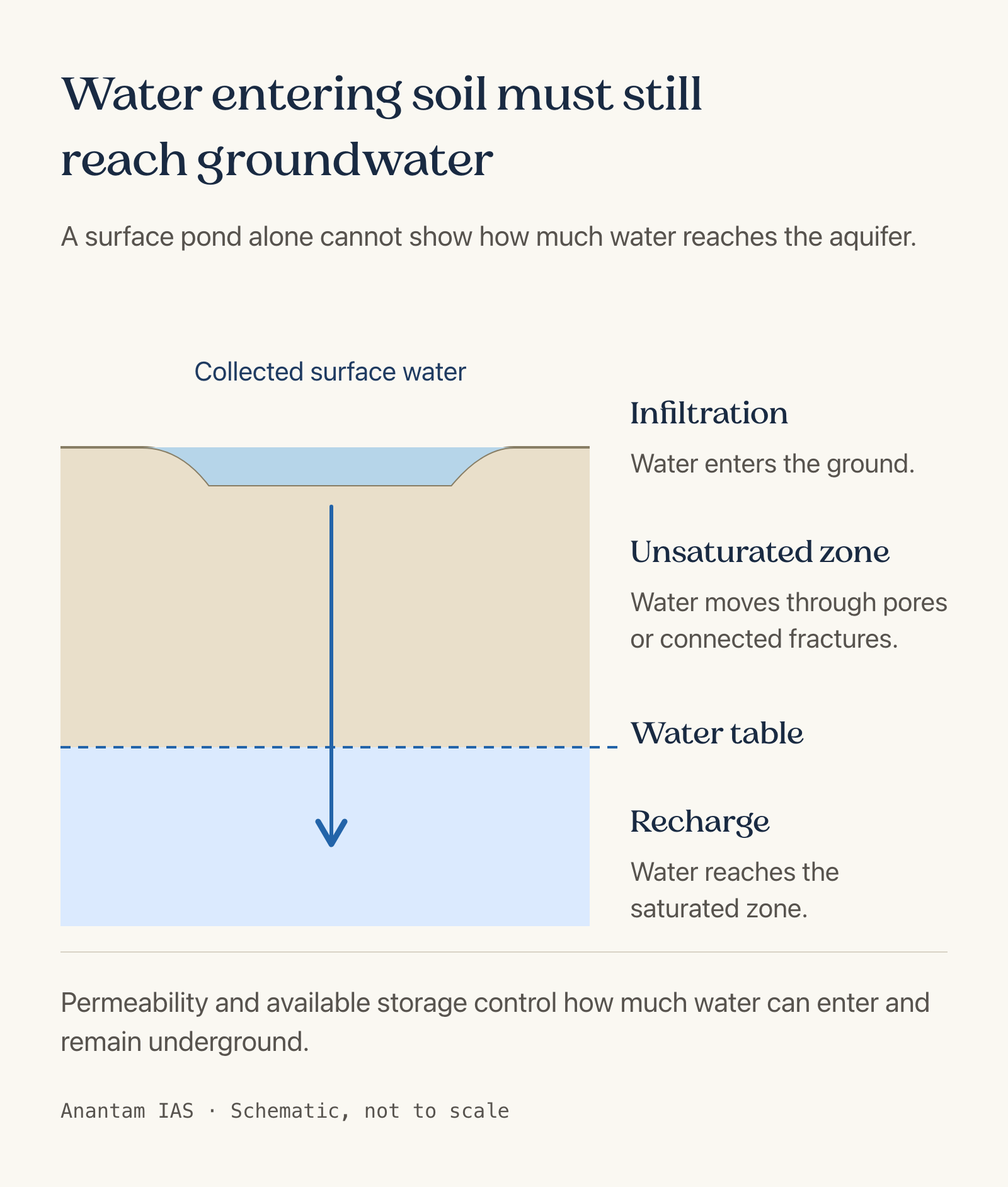
Successful recharge requires a usable water source, a pathway into the ground and space in a formation that can receive and retain it.
- Infiltration is water entering the ground at the surface. In a suitable setting, that water moves downward through an unsaturated zone and contributes recharge when it reaches the saturated groundwater system beneath it.
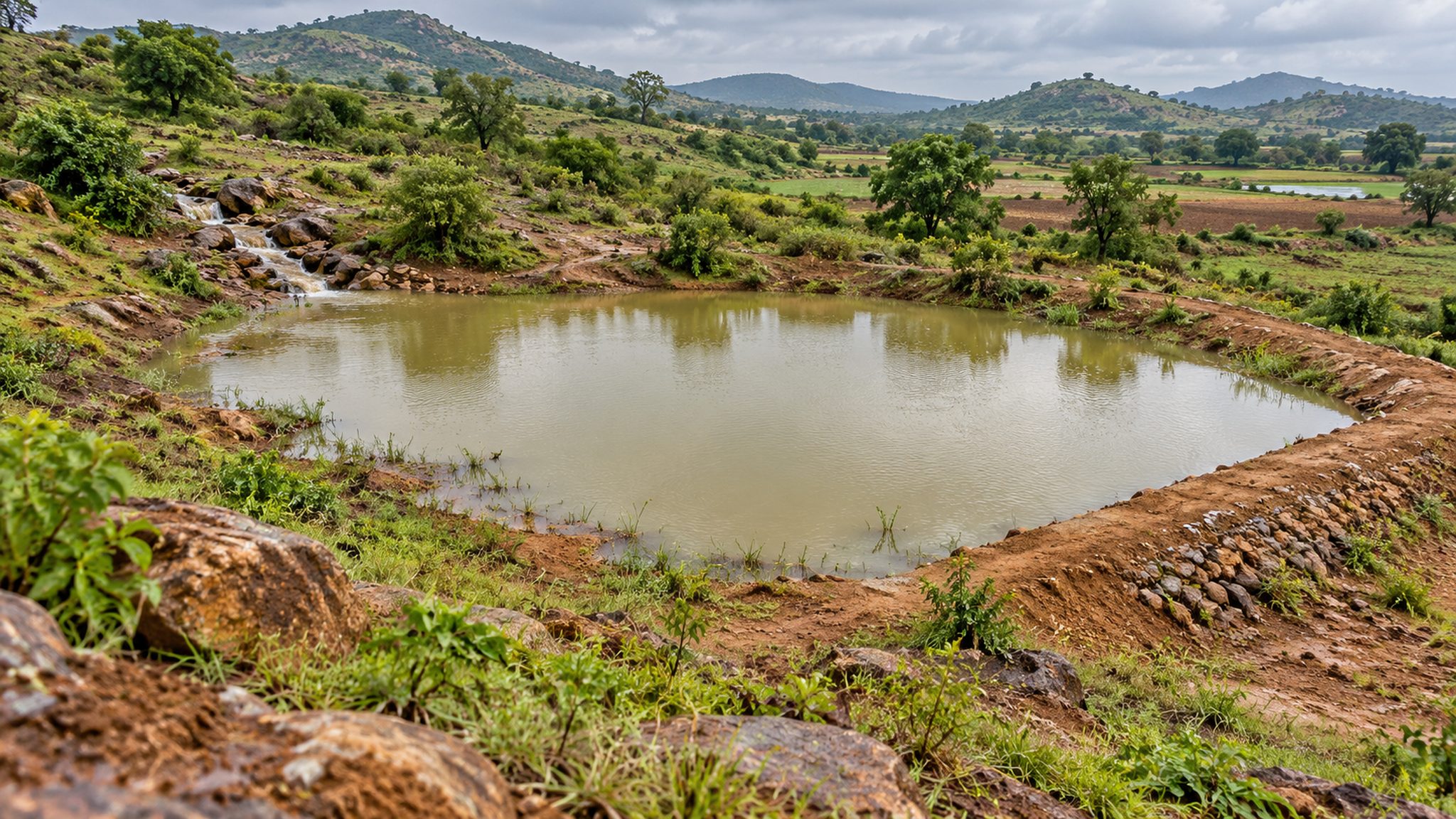
- Permeability governs how readily water moves through pores or connected fractures. A structure can hold visible water while a poorly transmitting layer restricts downward movement, making surface storage an unreliable measure of aquifer recharge.
- Storage space matters alongside entry pathways. CGWB assesses the thickness and extent of water-bearing formations and their replenishment capacity; adding water where suitable subsurface space is limited can create different problems from correcting depletion.
- Source availability must be assessed seasonally. The manual emphasises non-committed surplus runoff, its quantity and timing; a structure sized without a dependable source may remain underused even where the receiving formation is suitable.
- Aquifer response is local rather than automatic. Water may move away from the recharge site through the formation, so planning must examine boundaries, flow directions and discharge as well as the point where water enters.
Why Quality and Monitoring Decide Performance
A recharge structure becomes useful through safe operation and measurable groundwater benefits, not merely because construction is complete or a map recommends the location.
- Source-water quality and required pretreatment must be assessed before recharge. Introducing polluted water can damage the receiving resource; the visible clarity of water cannot establish that it is chemically or microbiologically suitable for recharge.
- Clogging can reduce performance when material accumulates or chemical interactions obstruct flow. CGWB specifically discusses compatibility between native groundwater and injected water because salt precipitation can clog wells and the surrounding aquifer.
- Observation wells help track water-level changes around a recharge facility. Monitoring locations should reflect the expected influence zone and local hydrogeology, allowing the effect of an individual structure to be examined over time.
- Quality monitoring checks whether recharge changes the receiving groundwater. The distinction explained in water-quality assessment is relevant: satisfactory results for one parameter cannot establish safety across every important contaminant or intended use.
- Operation and maintenance need an assigned owner and resources. The issue raised by rural water maintenance finance also applies here: a completed asset can lose usefulness when routine upkeep and performance checks are neglected.
Way Forward
Test the Site Before Building
- Combine mapped screening with field checks of source availability, geology, aquifer capacity and water quality before selecting a structure.
- Specify pretreatment and maintenance responsibilities alongside the design, including access for inspecting and cleaning the facility.
- Record baseline groundwater levels and quality, then compare subsequent observations while accounting for rainfall and abstraction.
- Evaluate performance through water-system evidence rather than counts of applications downloaded or structures completed.
Conclusion
- Geospatial screening can improve recharge planning by directing field investigation towards promising areas. Its value depends on matching available water, a suitable receiving formation and safe, maintainable structures.
- For an exam answer, connect mapping, hydrogeology and monitoring. The launch supplies a planning tool; groundwater benefits require site-specific assessment and evidence from operation.
UPSC Practice Questions
Prelims MCQ 1
With reference to artificial groundwater recharge, consider the following statements:
- Mapped potential alone establishes the suitability of an individual construction site.
- Source-water quality and pretreatment requirements are relevant to planning.
- Available subsurface storage and hydraulic characteristics influence recharge performance.
How many of the above statements are correct?
(a) Only one (b) Only two (c) All three (d) None
Answer: (b) Only two
Explanation:
Statements 2 and 3 are correct. CGWB requires detailed hydrogeological investigation and assessment of source water; a regional map alone does not complete site appraisal.
Prelims MCQ 2
Which observation most directly tests the groundwater response to a recharge facility?
(a) The number of users who viewed its location online (b) The amount of concrete used during construction (c) Water-level observations from appropriately located monitoring wells (d) A photograph showing water collected at the surface
Answer: (c) Water-level observations from appropriately located monitoring wells
Explanation:
Observation wells provide evidence of groundwater-level response. Surface water, construction quantities and platform use cannot establish how the receiving aquifer has responded.
UPSC Mains Questions
- Explain why geospatial identification of recharge potential must be followed by hydrogeological investigation before constructing artificial recharge structures.
- Discuss the role of source-water quality, maintenance and monitoring in assessing the effectiveness of groundwater recharge interventions.
Sources: PIB, Ministry of Jal Shakti and Central Ground Water Board.
Frequently Asked Questions
What did the Punah Bharan launch provide?
It provided a geospatial planning tool using rainfall, groundwater and terrain information to identify potential recharge zones and explore structures. The announcement does not establish that every suggested site is suitable or that recharge benefits are already achieved.
Is infiltration the same as groundwater recharge?
Infiltration is water entering the ground at the surface. Groundwater recharge requires that water reach the saturated groundwater system. Local layers and hydraulic conditions influence how much infiltrated water completes that pathway.
Why should recharge water be assessed for quality?
Water introduced for recharge can affect the receiving aquifer. Planning must assess source quality, pretreatment and compatibility with native groundwater, followed by monitoring for contamination or changes that obstruct water movement.
How can a recharge structure’s effect be monitored?
Appropriately placed observation wells can track groundwater levels and water quality around the facility. The monitoring design should reflect local hydrogeology, expected influence and the method used for recharge.
Tell Google you want more of this.
Add Anantam IAS as a preferred sourceOne tap, and this site shows up more often in your own Top Stories, AI Overviews and AI Mode. Remove it any time.