Why in News?
On 1 July 2025 the India Meteorological Department (IMD) released its outlook for July rainfall, forecasting above-normal all-India rain even as it flagged sharp regional unevenness. The month carries the heaviest weight in the four-month southwest monsoon, on which most of India’s agriculture and reservoirs depend.
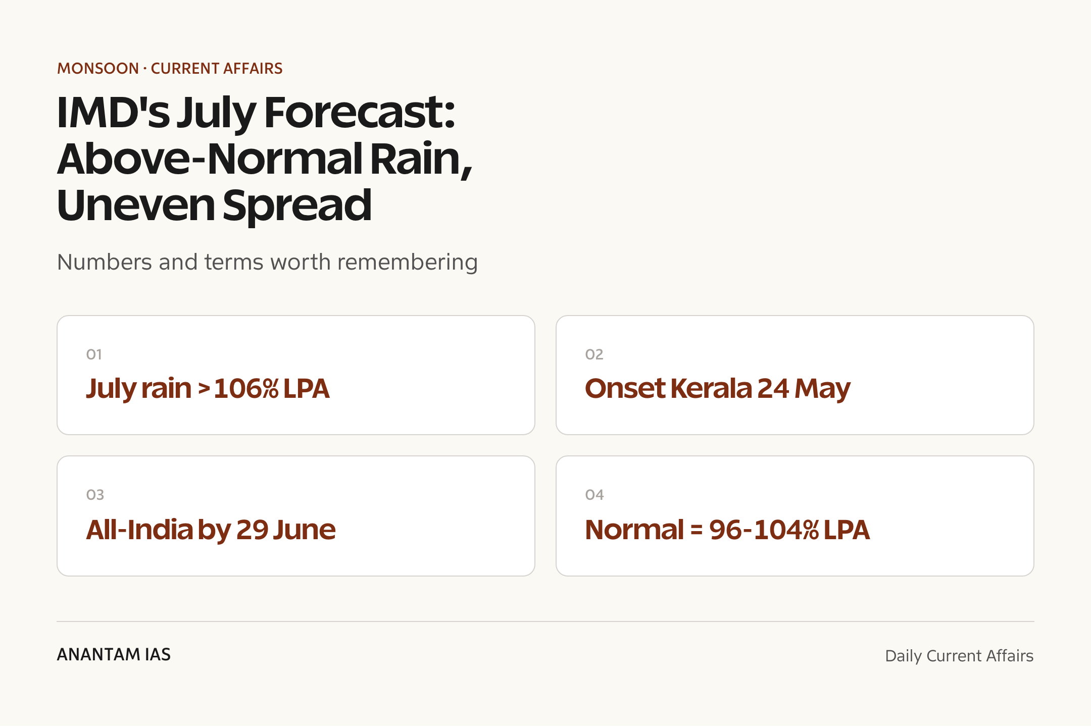
IMD said July rainfall is most likely to be above normal, exceeding 106% of the Long Period Average (LPA), while warning that parts of the Northeast, East India and the extreme southern Peninsula could see below-normal rain — a reminder that a healthy national average can still mask local stress.
- July rainfall forecast: above normal, over 106% of the LPA (the long-term July average).
- Below-normal rain likely over most of the Northeast and East India, many areas of the extreme South Peninsula and some parts of Northwest India.
- The 2025 monsoon set in over Kerala on 24 May — the earliest onset in 17 years (since 2009).
- It covered the entire country on 29 June, nine days ahead of the normal date of 8 July.
- June 2025 rain was 180 mm against a normal of 165.3 mm — but East and Northeast India got only 272.9 mm versus a normal 328.4 mm.
- IMD Director General Mrutyunjay Mohapatra said most of the country is likely to see normal to above-normal rainfall in July.
The development matters in the context of:
- Why it matters: July–August is the core kharif sowing window; its rainfall sets the crop, reservoir and rural-demand outlook for the year.
- Why it matters: a strong national average can hide damaging regional deficits and floods — distribution matters as much as the total.

UPSC Relevance
Prelims Relevance
- India Meteorological Department (IMD): national weather service under the Ministry of Earth Sciences (MoES), founded 1875, headquartered in New Delhi.
- Long Period Average (LPA): the average rainfall over a long reference period (currently 1971–2020) used as the benchmark for forecasts.
- IMD rainfall categories: Normal = 96–104% of LPA; below normal 90–96%; above normal 104–110%; deficient <90%; excess >110%.
- Southwest (summer) monsoon: June–September; brings ~75% of India’s annual rainfall.
- Normal monsoon onset over Kerala: around 1 June; in 2025 it arrived early on 24 May.
- Normal date for full-country coverage is 8 July; in 2025 coverage was complete by 29 June.
- Inter-Tropical Convergence Zone (ITCZ) and the seasonal low over Northwest India drive the monsoon’s onshore flow.
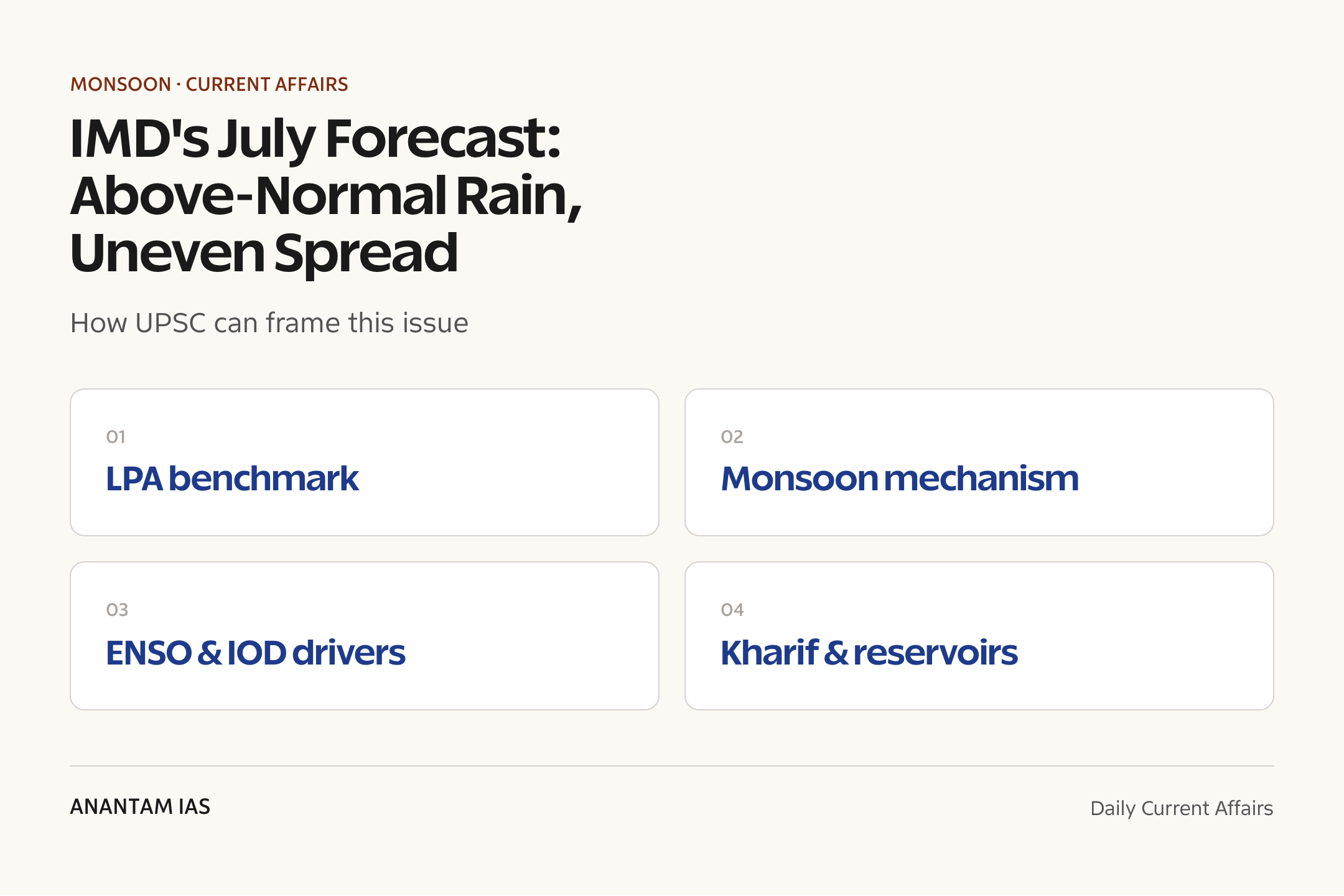
- ENSO (El Nino–Southern Oscillation) and the Indian Ocean Dipole (IOD) are the key ocean-atmosphere drivers IMD tracks for monsoon skill.
- IMD uses a dynamical Monsoon Mission Coupled Forecasting System (MMCFS) alongside statistical models.
Mains Relevance
GS Paper 1
- The mechanism of the Indian monsoon — differential heating, the ITCZ shift, the low-pressure trough and ocean drivers (ENSO, IOD).
- Spatial and temporal variability of monsoon rainfall and its geographic causes.
GS Paper 3
- Monsoon dependence of Indian agriculture and the kharif economy; irrigation and reservoir buffers.
- Disaster management: managing the twin risk of floods (excess) and drought (deficit) within a single ‘normal’ season.
Essay
- Living with uncertainty: India’s economy and the gamble of the monsoon.
- An average tells you little — why distribution decides who eats and who floods.
Background and Context
What IMD actually forecast
The headline number is encouraging, but the small print is about spread.
- July rain pegged at above normal, over 106% of LPA — the most rain-rich month of the four-month season.
- Deficits flagged for Northeast and East India, the extreme South Peninsula and patches of Northwest India.
- Coming after an early, fast onset, the forecast pointed to a generally well-supplied but patchy July.
- IMD updates these monthly outlooks alongside its seasonal (June–September) Long Range Forecast.
Long Period Average (LPA) and the rainfall categories
Every IMD rainfall statement is read against the LPA benchmark.
- LPA is the average rainfall over a long reference window (IMD currently uses 1971–2020), giving a stable yardstick.
- The all-India season LPA is about 87 cm; a forecast is then expressed as a percentage of this base.
- Normal = 96–104% of LPA; below normal 90–96%; above normal 104–110%.
- Deficient = below 90%; excess = above 110%. July’s >106% so sits in the ‘above normal’ band.
- The percentage device lets one number summarise a month or a season across the whole country.
How the Indian monsoon works
The monsoon is a giant seasonal sea-breeze driven by land–sea heating.
- Intense summer heating of the landmass creates a deep low-pressure trough over Northwest India, pulling in moist air.
- The Inter-Tropical Convergence Zone (ITCZ) migrates north over the subcontinent, anchoring the monsoon trough.
- Moisture-laden southwesterly winds from the Indian Ocean split into the Arabian Sea and Bay of Bengal branches.
- The Western Ghats and the Himalaya–Northeast hills force orographic uplift, producing the heaviest rain.
- Withdrawal begins from Northwest India by September as the land cools and the trough retreats southward.
The ocean drivers IMD watches
Ocean-atmosphere oscillations shift the odds for a good or poor monsoon.
- ENSO (El Nino–Southern Oscillation): El Nino (warm central-east Pacific) tends to suppress the monsoon; La Nina (cool phase) tends to favour it.
- Through mid-2025 the Pacific sat in ENSO-neutral conditions — neither El Nino nor La Nina — removing the strongest drag on rainfall.
- The Indian Ocean Dipole (IOD): a positive IOD (warm western Indian Ocean) boosts monsoon rain, a negative IOD weakens it.
- The Madden–Julian Oscillation (MJO) modulates rainfall on shorter, intra-seasonal timescales of weeks.
- Neutral-to-favourable drivers underpinned IMD’s above-normal seasonal and July outlooks for 2025.
Why distribution matters more than the average
An above-normal national figure can still leave large areas dry.
- June 2025’s 180 mm beat the 165.3 mm norm, yet East and Northeast India ran a clear deficit at 272.9 mm against 328.4 mm.
- A few intense spells in one region can lift the all-India average while others endure dry breaks.
- Kharif sowing — paddy, pulses, oilseeds, cotton — needs rain at the right place at the right time, not just enough rain overall.
- Skewed distribution drives both floods in surplus zones and localised drought in deficit zones within one ‘normal’ season.
Stakes for agriculture and the economy
The monsoon remains the backbone of the kharif economy.
- Roughly half of India’s net sown area is rain-fed, so monsoon timing shapes the harvest.
- July–August rain refills reservoirs that supply irrigation, drinking water and hydropower into the dry months.
- A good monsoon supports rural incomes and demand, eases food inflation and steadies the wider economy.
- An early, well-spread monsoon also lets farmers advance sowing and plan a second crop.
Way Forward
Read the spread, not just the headline
- Track IMD’s sub-divisional and weekly bulletins, not only the national percentage, to spot deficit pockets early.
- Pair the monthly outlook with reservoir-storage data to judge real water availability.
Build buffers against unevenness
- Expand micro-irrigation, watershed work and farm ponds so rain-fed belts can ride out dry spells.
- Use crop-contingency plans and short-duration, drought-tolerant varieties for late-onset or deficit areas.
Strengthen forecasting and warnings
- Keep improving dynamical models and dense observations to push skill from monthly to district-level, actionable forecasts.
- Link IMD alerts to advisories for farmers, reservoir managers and urban flood agencies.
Conclusion
IMD’s 1 July 2025 outlook of above-normal, 106%-plus July rainfall was good news for the kharif season — but its real lesson was in the asterisk. Behind a comfortable national average lay deficits over the Northeast, East and the far South, where a ‘normal’ monsoon can still mean local stress.
For exam purposes the episode is a clean illustration of the toolkit: the LPA benchmark, IMD’s rainfall categories, the monsoon’s land–sea-and-ITCZ mechanism, and the ocean drivers (ENSO, IOD) that tilt the odds. The durable takeaway is that distribution, not the headline number, decides the monsoon’s verdict on farms and reservoirs.
UPSC Practice Questions
Prelims MCQ 1
With reference to the India Meteorological Department’s rainfall classification, consider the following statements:
- Rainfall between 96% and 104% of the Long Period Average is termed ‘normal’.
- The Long Period Average is computed afresh every year from that year’s rainfall.
- Rainfall exceeding 110% of the Long Period Average is classified as ‘excess’.
How many of the above statements are correct?
(a) Only one (b) Only two (c) All three (d) None
Answer: (b) Only two
Explanation:
Statements 1 and 3 are correct: normal is 96–104% of LPA and excess is above 110%. Statement 2 is wrong — the LPA is a long-term average over a fixed reference window (currently 1971–2020), not a single-year figure.
Prelims MCQ 2
Which of the following ocean-atmosphere conditions is generally associated with a stronger Indian southwest monsoon?
(a) El Nino in the Pacific Ocean (b) A negative phase of the Indian Ocean Dipole (c) La Nina conditions in the Pacific Ocean (d) A weakening of the low-pressure trough over Northwest India
Answer: (c) La Nina conditions in the Pacific Ocean
Explanation:
La Nina (cool central-east Pacific) generally favours a stronger monsoon, while El Nino suppresses it. A positive — not negative — IOD aids the monsoon, and a strong low-pressure trough enhances, rather than weakens, monsoon flow.
UPSC Mains Questions
- Explain the mechanism of the Indian southwest monsoon, highlighting the roles of differential land-sea heating, the Inter-Tropical Convergence Zone and the major ocean-atmosphere drivers. (250 words)
- “An above-normal national rainfall figure can still leave large parts of India water-stressed.” Examine, with reference to the spatial variability of the monsoon and its implications for agriculture and disaster management. (250 words)
Sources: India Meteorological Department (IMD) and NewsOnAir (Prasar Bharati).
Frequently Asked Questions
What does ‘above normal’ rainfall mean for IMD?
In IMD’s classification, ‘above normal’ means seasonal or monthly rainfall between about 104% and 110% of the Long Period Average (LPA). The July 2025 forecast of more than 106% of LPA falls within this band. ‘Normal’ is 96–104%, while anything above 110% is classed as ‘excess’.
What is the Long Period Average (LPA)?
The LPA is the average rainfall over a long reference period, which IMD currently fixes as 1971–2020. It acts as a stable benchmark: forecasts are expressed as a percentage of the LPA rather than in raw millimetres, so a single number can summarise rainfall for a month or the whole June–September season across the country.
When did the 2025 monsoon reach Kerala and cover India?
The southwest monsoon set in over Kerala on 24 May 2025, the earliest onset in 17 years since 2009. It then advanced rapidly and covered the entire country by 29 June, nine days ahead of the normal full-coverage date of 8 July, giving farmers an early start to kharif sowing.
How do El Nino and La Nina affect the monsoon?
El Nino, a warming of the central and eastern Pacific, tends to weaken the Indian monsoon, while La Nina, the cooler phase, tends to strengthen it. Through mid-2025 the Pacific was in ENSO-neutral conditions, neither El Nino nor La Nina, which removed the strongest drag and supported IMD’s above-normal outlook.
Why does rainfall distribution matter more than the average?
Because a healthy all-India average can hide sharp regional deficits. In June 2025, for example, the country beat its normal even as East and Northeast India ran a clear shortfall. Crops and reservoirs need rain at the right place and time, so skewed distribution can cause floods in surplus zones and drought in deficit zones within one ‘normal’ season.
Which ministry does the IMD function under?
The India Meteorological Department functions under the Ministry of Earth Sciences (MoES). Founded in 1875 and headquartered in New Delhi, it is India’s national weather service, responsible for weather forecasting, monsoon outlooks, cyclone warnings and seismology-related observation across the country.
Tell Google you want more of this.
Add Anantam IAS as a preferred sourceOne tap, and this site shows up more often in your own Top Stories, AI Overviews and AI Mode. Remove it any time.