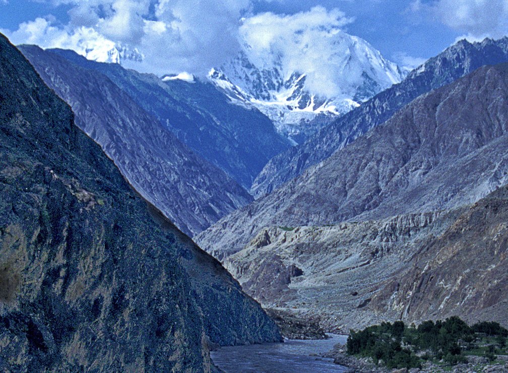
The Indus River and antecedent drainage together explain one of the most striking facts in physical geography: a major river that begins on the Tibetan plateau, north of the Himalayas, and yet succeeds in cutting straight through the mountain wall to reach the Arabian Sea. The Indus River rises near Lake Mansarovar in southwestern Tibet, flows northwest along the Indus suture zone, swings around the Nanga Parbat massif, and then plunges south through Ladakh, Gilgit-Baltistan, Punjab and Sindh before discharging into the Arabian Sea below Karachi. The transverse Himalayan gorge it carves is the textbook example of antecedent drainage — a river that predates the mountain it cuts across, deepening its channel at the same rate at which the mountain rises.
For UPSC, the Indus River and antecedent drainage feature in (rivers, drainage patterns, fluvial geomorphology), in international relations (the Indus Waters Treaty with Pakistan), and in current affairs whenever the Treaty’s suspension or revision is discussed. A prelims question typically tests the source, the five major tributaries, the irrigation system it feeds, and the surprising absence of a distributary-rich delta of the kind found in the Ganga-Brahmaputra system.
Where the Indus Begins
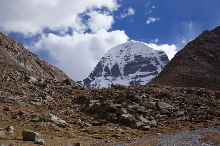
The Indus rises in the Trans-Himalayas of Tibet from a glacier-fed spring on the northern slopes of the Kailas range, at an altitude of about 5,500 metres. The classical Hindu and Tibetan tradition associates the source with the area near Lake Mansarovar — the same general region from which the Sutlej and the Brahmaputra also rise on the southern flank of Kailas. The river is called Sindhu in Sanskrit, Singi-Khabab (“from the mouth of the lion”) in Tibetan, and Sindh in Pakistan today.
From the source the river flows northwest, parallel to the Himalayan strike, in a long subsequent (strike-aligned) valley before turning sharply south around Nanga Parbat — the famous “Indus knee” — and entering Indian-administered territory through Ladakh.
Antecedent Drainage: What It Means
A drainage system is antecedent when the river is older than the structural relief it crosses. As the mountain belt rose, the river maintained its course by cutting downwards at a rate roughly matched to the uplift, producing a deep transverse gorge rather than being deflected around the obstacle.
Three river systems are routinely cited as antecedent in the Himalayan context:
- the Indus,
- the Sutlej,
- the Brahmaputra (across the Eastern Himalayas near Namcha Barwa).
The Ganga and most of its Himalayan tributaries, in contrast, are largely consequent — they follow slopes that came into being with the Himalayan uplift.
The transverse gorges of antecedent rivers are some of the deepest in the world. The Indus gorge near Nanga Parbat falls more than 5,000 metres from the summit to the river in a horizontal distance of barely 25 kilometres.
The Tributaries
Below the Himalayan gorge, the Indus collects five major left-bank tributaries that give Punjab its name — panch (five) ab (waters).
- Jhelum — rises at Verinag spring in Kashmir.
- Chenab — formed by the union of Chandra and Bhaga in Lahaul, Himachal Pradesh.
- Ravi — rises in the Bara Bhangal area of Himachal Pradesh.
- Beas — rises near the Rohtang Pass.
- Sutlej — antecedent, rising near Mansarovar from Rakshastal.
These five rivers, after coursing through Punjab, join progressively and ultimately fall into the Indus at Mithankot in Pakistani Punjab as the Panjnad.
On the right bank, the Indus receives the Shyok, the Gilgit, the Kabul (joining at Attock from Afghanistan), the Kurram, the Tochi, and the Gomal — rivers that drain the western mountains.
The Indus Waters Treaty
The Indus Waters Treaty (IWT) was signed by Jawaharlal Nehru and Mohammad Ayub Khan in Karachi on 19 September 1960 under World Bank mediation. It allocates:
- the three “eastern rivers” — Ravi, Beas, Sutlej — to India for unrestricted use,
- the three “western rivers” — Indus, Jhelum, Chenab — primarily to Pakistan, with limited Indian rights for non-consumptive use, domestic supply, run-of-river hydroelectricity, and specified storage.
The IWT created the Permanent Indus Commission, mechanisms for neutral expert and court-of-arbitration resolution, and has survived three Indo-Pak wars. It is, however, currently under strain: India formally communicated a notice in 2023 seeking modification, and operational tensions over the Kishenganga and Ratle hydropower projects have continued.
Irrigation Importance
The Indus River and its tributaries underwrite one of the largest contiguous canal-irrigated tracts on the planet. In India, the Indus system irrigates parts of Jammu and Kashmir, Ladakh, Himachal Pradesh, Punjab, Haryana and Rajasthan. The Bhakra-Nangal complex on the Sutlej, the Pong dam on the Beas, the Thein dam on the Ravi, and the Indira Gandhi Canal — which carries Punjab-Haryana waters to the Thar Desert in Rajasthan — are the most visible Indian works.
In Pakistan, the Indus Basin Irrigation System is the largest of its kind in the world, with the Mangla, Tarbela and Chashma dams, link canals such as the Marala-Ravi, Chashma-Jhelum and Trimmu-Sidhnai, and a vast distributary network in Punjab and Sindh.
A Curious Delta
A common UPSC question concerns the Indus delta. Unlike the Ganga-Brahmaputra delta with its dense network of distributaries reaching the Bay of Bengal, the Indus delta has very few active distributaries reaching the Arabian Sea. Several reasons combine.
- Upstream diversion. The Indus Basin Irrigation System abstracts an enormous fraction of the river’s flow upstream, leaving little water to feed the distributary network in Sindh.
- Tectonic setting. The Indus delta sits on an active subducting margin with rapid coastal subsidence and a strong long-shore current that redistributes sediment.
- Sediment trapping. Dams along the river trap most of the sediment that would otherwise prograde the delta.
The result is a degraded delta with shrinking mangroves, seawater intrusion deep inland in Sindh, and persistent salinisation of agricultural land. This is precisely why a prelims statement claiming the Indus “forms a large delta with numerous distributaries reaching the ocean” is incorrect.
Frequently Asked Questions
Where does the Indus River originate?
Near Lake Mansarovar in southwestern Tibet, on the northern slopes of the Kailas range, at an altitude of about 5,500 metres. The river is initially called Singi-Khabab in Tibetan.
Why is the Indus called an antecedent river?
Because it predates the Himalayan uplift. As the mountains rose, the river cut down at roughly the same rate, maintaining its course and producing a deep transverse gorge across the range.
Which countries does the Indus flow through?
Tibet (China), India and Pakistan. From its source in Tibet it crosses Ladakh in India and then flows through Pakistan to the Arabian Sea below Karachi.
What are the five tributaries that give Punjab its name?
The Jhelum, Chenab, Ravi, Beas and Sutlej — together forming the Panjnad, the u0022five-riveru0022 system that joins the Indus at Mithankot.
What is the Indus Waters Treaty?
A 1960 treaty between India and Pakistan mediated by the World Bank, allocating the eastern rivers (Ravi, Beas, Sutlej) to India and the western rivers (Indus, Jhelum, Chenab) primarily to Pakistan, with a Permanent Indus Commission to settle disputes.
Does the Indus form a large delta with many distributaries?
No. The Indus delta has few active distributaries reaching the Arabian Sea because upstream irrigation withdrawals, sediment trapping by dams, coastal subsidence and long-shore currents have starved the delta of water and sediment.
Why is the Indus important for irrigation?
It supports one of the world’s largest canal-irrigated tracts, including in India the Bhakra-Nangal, Pong, Thein and Indira Gandhi Canal works, and in Pakistan the Indus Basin Irrigation System with Mangla, Tarbela and Chashma dams.
Which Himalayan rivers are also antecedent?
The Sutlej and the Brahmaputra are also commonly classified as antecedent, both because they rise on the Tibetan side and cross the Himalayan range in deep transverse gorges.
Tell Google you want more of this.
Add Anantam IAS as a preferred sourceOne tap, and this site shows up more often in your own Top Stories, AI Overviews and AI Mode. Remove it any time.