


The Tibetan Plateau, also called the Qinghai–Tibet Plateau or the Roof of the World, is the largest and highest plateau on Earth. Covering roughly 2.5 million square kilometres with an average elevation of about 4,500 metres (14,800 ft), it is bordered by the Himalayas in the south, the Kunlun Mountains in the north, the Karakoram in the west, and the Hengduan Mountains in the east.
Often called the Third Pole because it holds the largest store of frozen freshwater outside the Arctic and Antarctic, the plateau is the source of ten major Asian rivers that sustain nearly two billion people. Its altitude, climate, and hydrology make it a lynchpin of Asia's environment — and a focus of India's strategic calculations.
Physical Geography
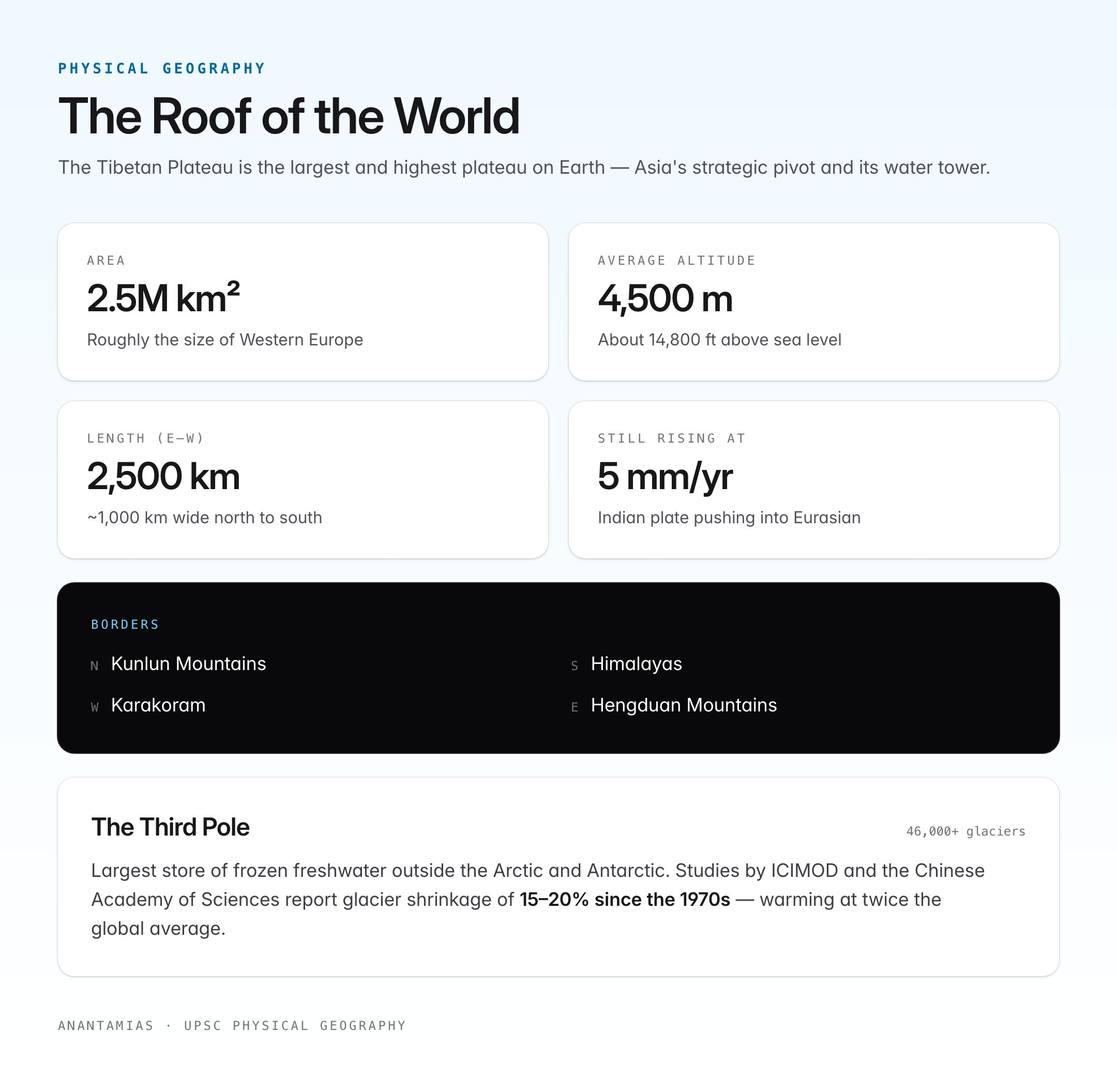
| Feature | Value |
|---|---|
| Area | ~2.5 million sq km |
| Average altitude | ~4,500 m (14,800 ft) |
| Length (E–W) | ~2,500 km |
| Width (N–S) | ~1,000 km |
| Highest peak bordering | Mount Everest (Qomolangma) — 8,849 m |
| Lowest point | ~2,800 m (valley near Indian border) |
| Largest lake | Qinghai Lake (Tso Ngonpo) — China's largest saltwater lake |
| Continental plates | Formed by Indian Plate colliding with Eurasian Plate (~50 Ma) |
| Political location | Tibet Autonomous Region + Qinghai + parts of Xinjiang, Gansu, Sichuan, Yunnan (China); Ladakh (India); tiny parts of Nepal, Bhutan, Pakistan |
The plateau's uplift began roughly 50 million years ago with the collision of the Indian plate and the Eurasian plate. It is still rising at about 5 mm per year and is seismically active — major earthquakes in the region are common.
The Asian Water Tower: Rivers Originating Here
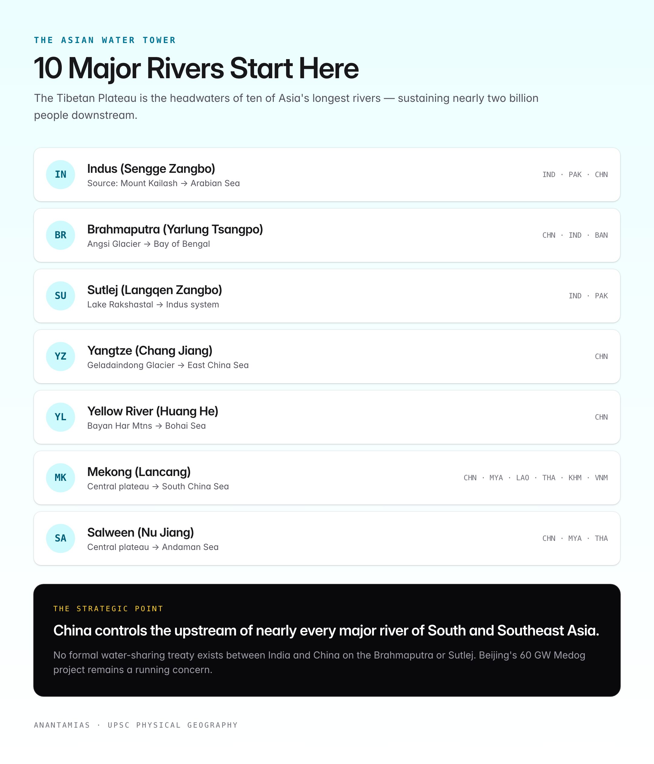
The Tibetan Plateau is the headwaters region for ten of Asia's longest rivers, giving rise to the term Asian Water Tower.
| River | Source on the plateau | Flows to | Dependent countries |
|---|---|---|---|
| Indus (Sengge Zangbo) | Near Mount Kailash | Arabian Sea | India, Pakistan, China |
| Brahmaputra (Yarlung Tsangpo) | Angsi Glacier, near Mount Kailash | Bay of Bengal | China, India, Bangladesh |
| Sutlej (Langqen Zangbo) | Lake Rakshastal | Indus system | India, Pakistan |
| Ganga (tributaries) | Southern slopes | Bay of Bengal | India, Bangladesh |
| Yangtze (Chang Jiang) | Geladaindong Glacier | East China Sea | China |
| Yellow River (Huang He) | Bayan Har Mountains | Bohai Sea | China |
| Mekong (Lancang) | Central plateau | South China Sea | China, Myanmar, Laos, Thailand, Cambodia, Vietnam |
| Salween (Nu Jiang) | Central plateau | Andaman Sea | China, Myanmar, Thailand |
| Irrawaddy (tributaries) | South-east plateau | Andaman Sea | Myanmar |
| Amu Darya (tributaries) | Pamir edge | Aral Sea basin | Tajikistan, Turkmenistan, Uzbekistan |
Key point: China controls the upstream of nearly every major river of South and Southeast Asia. Dam construction on the Brahmaputra and Mekong is a running geopolitical concern.
Climate and Weather
- Alpine arid to semi-arid. Rain shadow of the Himalayas gives less than 500 mm of precipitation in most of the plateau; parts of the northwest receive under 100 mm.
- Temperature range: Annual mean of 0 °C to −5 °C; summer highs of 15–20 °C in Lhasa; winter lows below −40 °C in the north.
- Thin atmosphere: Air pressure about 60% of sea level; high solar radiation and UV.
- Strong seasonal wind systems drive the Indian summer monsoon — plateau heating creates a thermal low that pulls moisture-laden air from the Indian Ocean.
- Permafrost covers nearly half of the plateau; it is thinning due to climate change.
Glaciers and the Third Pole
The plateau, together with the adjoining Himalayas and Karakoram, holds over 46,000 glaciers and the largest store of frozen freshwater outside the polar regions. Hence the term Third Pole popularised since the 2000s.
- Glacier retreat: Studies by ICIMOD and the Chinese Academy of Sciences report glacier shrinkage of 15–20% since the 1970s.
- Black carbon deposition from South Asian and East Asian emissions accelerates melt.
- Loss of glacial mass threatens dry-season flow in rivers like the Indus and the Brahmaputra.
Ecology and Biodiversity
- Flora: High-altitude grasslands (Changtang), alpine meadows, cold deserts, cushion plants.
- Fauna: Tibetan antelope (chiru), wild yak, Tibetan wolf, snow leopard, Kiang (Tibetan wild ass), black-necked crane (the only high-altitude crane).
- Protected areas: Changtang Nature Reserve (China), Chang Chenmo and Hanle (India, Ladakh), Sanjiangyuan National Park (headwaters of Yangtze–Yellow–Mekong).
Human Geography
- Population: ~7 million across the plateau, with Lhasa (elevation 3,656 m) as the historic capital of Tibet.
- Ethnic groups: Tibetans (largest), Monpa, Lhoba, Han Chinese (post-1950 migration), Qiang.
- Economy: Pastoral nomadism (yak, sheep), barley farming in valleys, mineral extraction (lithium, chromite, copper, gold), tourism, and hydropower.
- Religion: Predominantly Tibetan Buddhism centred on institutions like the Potala Palace, Jokhang Monastery, and Tashilhunpo.
Geopolitical Significance
India–China Dimension
- The plateau's southern edge is the McMahon Line (1914) — the basis for India's Arunachal Pradesh boundary, contested by China.
- Aksai Chin, a north-western extension, is under Chinese control since 1950s; India claims it as part of Ladakh.
- 1962 Sino-Indian War was fought on and near the plateau.
- Chinese infrastructure push — Qinghai–Tibet Railway (2006), Sichuan–Tibet Railway (phased), G219 highway, new airports at Lhasa, Nyingchi, Shigatse — has sharpened military logistics.
Water Diplomacy
- Brahmaputra dams: China has built several dams on the Yarlung Tsangpo and in 2023 announced a 60 GW hydropower project at the Great Bend in Medog — the largest planned dam in the world. India has raised concerns about flow regulation and sediment delivery to Assam and Bangladesh.
- No formal water-sharing treaty exists between India and China on the Brahmaputra or Sutlej.
Tibet Question
- 1950: People's Liberation Army entered Tibet.
- 1951: Seventeen-Point Agreement.
- 1959: Tibetan uprising; the 14th Dalai Lama fled to India and was granted asylum at Dharamshala.
- Tibetan Government-in-Exile (Central Tibetan Administration) is based at McLeod Ganj, Himachal Pradesh.
Climate Change Impact
- Plateau is warming at twice the global average (0.3 °C per decade).
- Accelerating permafrost thaw releases methane and destabilises infrastructure.
- Shifts in the Indian monsoon linked to plateau heating have implications for South Asian agriculture.
- Glacial Lake Outburst Floods (GLOFs) pose rising risk — e.g., the 2021 Chamoli event and 2023 Sikkim Teesta-III disaster.
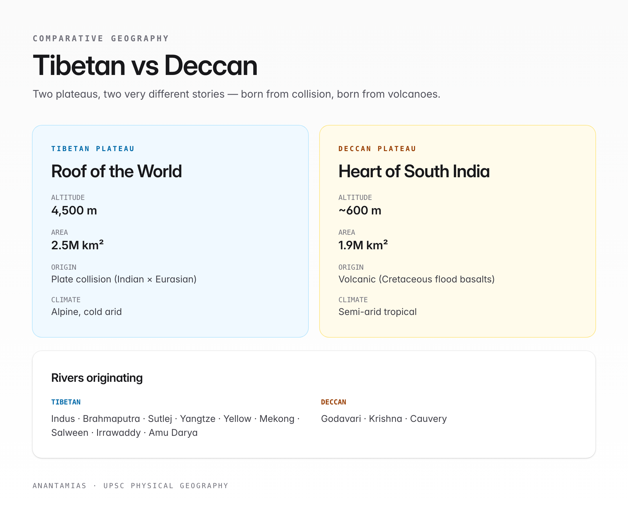
Quick Comparison — Tibetan vs Deccan Plateau
| Feature | Tibetan Plateau | Deccan Plateau |
|---|---|---|
| Average altitude | ~4,500 m | ~600 m |
| Origin | Plate collision | Volcanic (Cretaceous flood basalts) |
| Climate | Alpine, cold arid | Semi-arid tropical |
| Rivers originating | 10+ major Asian rivers | Godavari, Krishna, Cauvery |
| Area | ~2.5 million sq km | ~1.9 million sq km |
UPSC Relevance
Prelims (GS Paper I): Direct questions on the origin of major rivers, Tibetan Plateau altitude, Asian Water Tower, Third Pole terminology, and the geography of Aksai Chin and the Trans-Himalayas.
Mains (GS Paper I — Geography):
- "The Tibetan Plateau is not just a geographic feature but Asia's strategic pivot." Discuss.
- Examine the impact of climate change on the Third Pole and its downstream consequences for India.
Mains (GS Paper II — International Relations): India–China boundary dispute, Brahmaputra dam issue, and water-sharing diplomacy draw directly on plateau geography.
Mains (GS Paper III — Environment): Glacier retreat, black-carbon deposition, permafrost thaw, and Himalayan biodiversity — all tied to the plateau system.
Essay: Themes of "Asia's water future," "shared rivers, contested borders," and "climate change at high altitudes" map cleanly onto the Tibetan Plateau.
Tell Google you want more of this.
Add Anantam IAS as a preferred sourceOne tap, and this site shows up more often in your own Top Stories, AI Overviews and AI Mode. Remove it any time.






