


The Yangtze River, known in Chinese as Chang Jiang ("Long River"), is the longest river in Asia and the third longest in the world after the Nile and the Amazon. Flowing for approximately 6,300 km entirely within China, it drains a basin of about 1.8 million square kilometres — nearly one-fifth of China's landmass — and supports over one-third of the country's population. The river is home to the world's largest hydroelectric project, the Three Gorges Dam, and functions as China's commercial, industrial, and ecological backbone. For UPSC aspirants, the Yangtze is a recurring case study in physical geography, transboundary water politics, and comparative river systems.
Source, Course, and Mouth
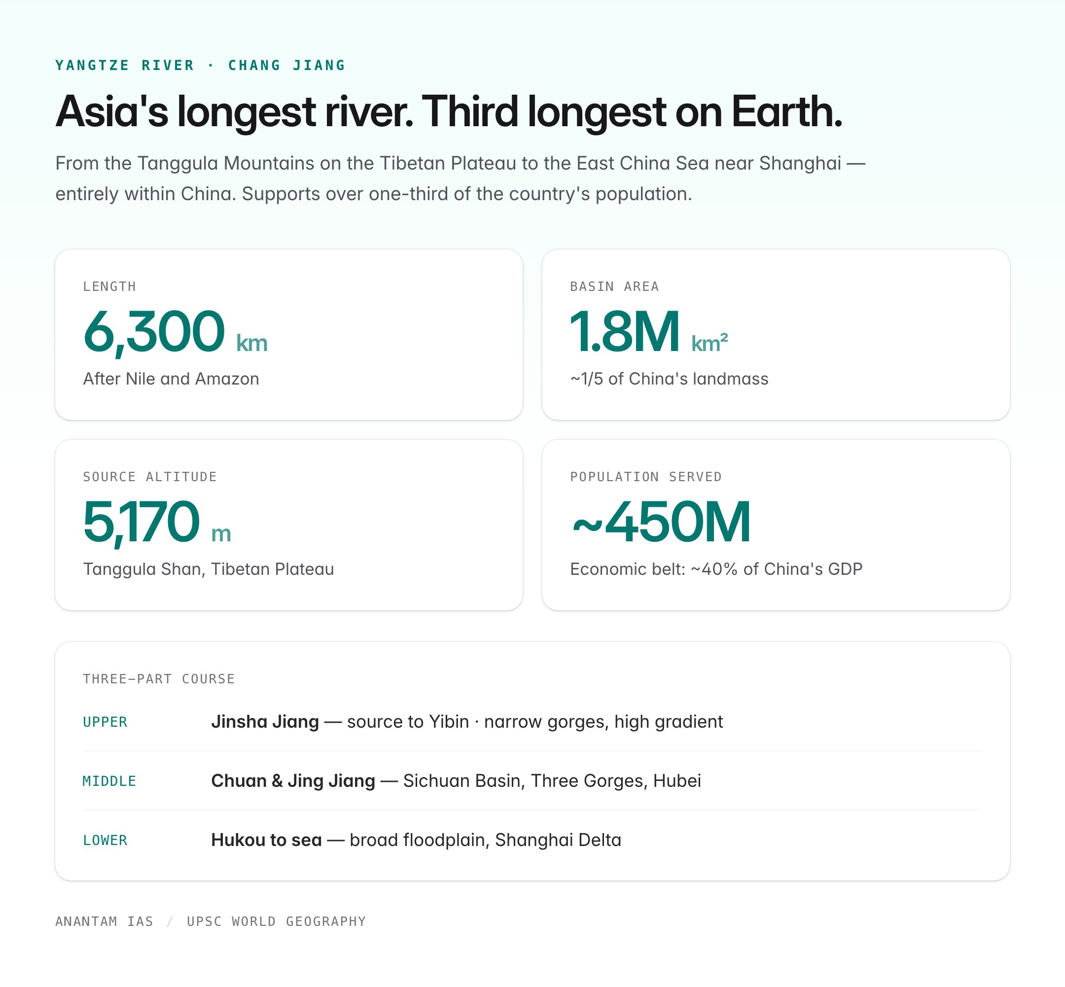
The Yangtze rises from the Tanggula Mountains in the Tibetan Plateau at an altitude of about 5,170 m — near the headwaters of the Mekong and the Salween (known as the “Three Parallel Rivers” UNESCO site in Yunnan). It flows east across China and empties into the East China Sea near Shanghai.
| Segment | Geography |
|---|---|
| Upper course | From Tanggula Shan through Qinghai, Sichuan; narrow gorges, high gradient |
| Middle course | Enters Sichuan Basin, passes Three Gorges (Qutang, Wu, Xiling) through Hubei |
| Lower course | Enters lowlands at Yichang; broad floodplain through Hubei, Hunan, Jiangxi, Anhui, Jiangsu |
| Delta | Shanghai Delta; major distributaries Huangpu, Wusong |
The river is conventionally divided into three sections: upper (Jinsha Jiang) from source to Yibin, middle (Chuan Jiang and Jing Jiang) from Yibin to Hukou, and lower Yangtze from Hukou to the sea.
Major Tributaries
The Yangtze receives water from hundreds of tributaries, the most important of which are worth memorising.
| Tributary | Bank | Source / Feature |
|---|---|---|
| Yalong Jiang | Right (north) | Longest tributary by length, from Tibetan Plateau |
| Min Jiang | Right | Dujiangyan ancient irrigation system |
| Jialing Jiang | Left (south) | Meets at Chongqing |
| Wu Jiang | Left | From Guizhou |
| Han Jiang | Left | Longest tributary by discharge; meets at Wuhan |
| Gan Jiang | Left | Feeds Poyang Lake |
| Xiang Jiang | Left | Feeds Dongting Lake |
Two enormous freshwater lakes — Poyang (China's largest) and Dongting — act as natural flood-regulation basins in the middle Yangtze.
The Three Gorges Dam
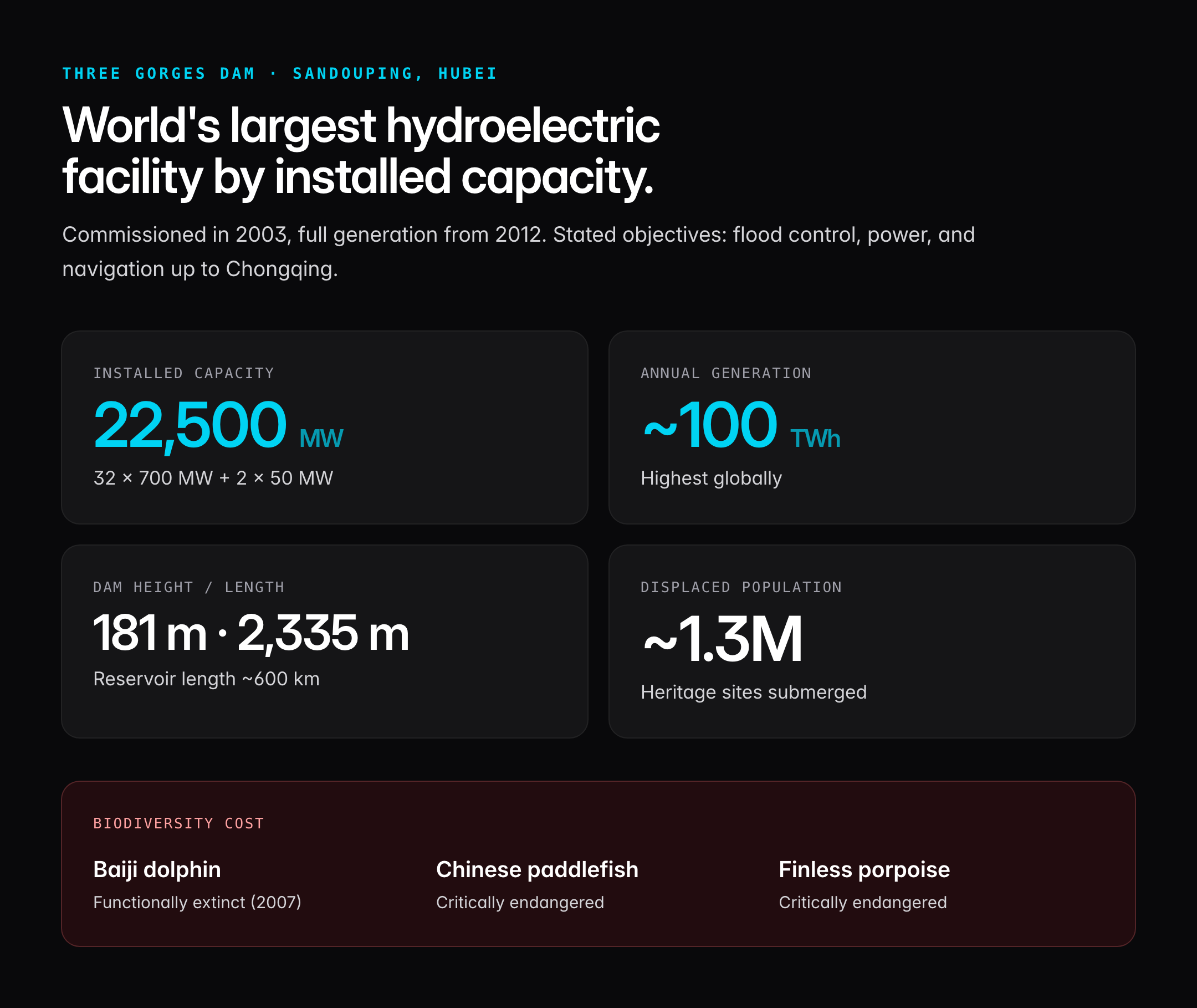
The Three Gorges Dam at Sandouping, Hubei, is the world's largest hydroelectric facility by installed capacity.
| Feature | Detail |
|---|---|
| Commissioned | 2003 (partial), full generation 2012 |
| Installed capacity | 22,500 MW (32 × 700 MW + 2 × 50 MW) |
| Dam height | 181 m |
| Dam length | 2,335 m |
| Reservoir length | ~600 km |
| Annual generation | ~100 TWh (highest globally) |
| Displaced population | ~1.3 million |
The dam's stated objectives are flood control for the middle Yangtze, power generation, and navigation improvement (enabling 10,000-tonne ships to reach Chongqing). Critics flag reservoir-induced seismicity, landslides, loss of cultural heritage (including sites submerged in the Three Gorges), and biodiversity impacts — most notably the functional extinction of the Yangtze river dolphin (Baiji) and the critical endangerment of the Chinese paddlefish and finless porpoise.
Yangtze vs Ganga vs Indus: A Comparative Snapshot
| Parameter | Yangtze | Ganga | Indus |
|---|---|---|---|
| Length | ~6,300 km | ~2,525 km | ~3,180 km |
| Source | Tanggula, Tibet | Gangotri, Uttarakhand | Mansarovar, Tibet |
| Mouth | East China Sea | Bay of Bengal | Arabian Sea |
| Basin area | 1.8 million sq km | 1.08 million sq km | 1.12 million sq km |
| Countries | China only | India, Nepal, Bangladesh, China | India, Pakistan, China, Afghanistan |
| Largest dam | Three Gorges (22,500 MW) | Tehri (2,400 MW) | Tarbela (4,888 MW) |
| Population dependent | ~450 million | ~600 million | ~300 million |
| Treaty regime | None (single country) | Ganga Water Treaty (IND-BGD 1996) | Indus Waters Treaty 1960 |
The Yangtze is wholly Chinese, which means China faces no external negotiation over it — a contrast with the Brahmaputra (Yarlung Tsangpo) where Indian concerns over upstream Chinese dams are geopolitically charged.
Economic and Strategic Significance
The Yangtze basin is China's economic spine:
- Shipping: Over 2.9 billion tonnes of cargo annually — the busiest inland waterway in the world. Shanghai, at the mouth, is the world's largest container port.
- Industry: Heavy industry corridor — Chongqing (automobiles), Wuhan (steel, optoelectronics), Nanjing (petrochemicals), Shanghai (finance, shipping).
- Agriculture: Accounts for ~70% of China's rice production and 40% of grain.
- Population: The Yangtze River Economic Belt covers 11 provinces and ~40% of China's GDP.
Environmental Challenges
- Water pollution: Agricultural runoff, industrial effluent, and untreated sewage — particularly in the middle and lower reaches.
- Biodiversity loss: The Baiji dolphin was declared functionally extinct in 2007. The Yangtze Fishing Ban (2021–2030) imposes a full ten-year ban on commercial fishing in the main stem and key tributaries — the largest such measure globally.
- Siltation and landslides: Three Gorges reservoir fluctuations have destabilised slopes.
- Climate stress: Record droughts (2022) and floods (1998, 2020) reflect climate variability.
- Groundwater subsidence: Shanghai has subsided over 2 m since the 1920s.
Cultural and Historical Importance
The Yangtze is the cradle of Chinese rice civilisation, with Neolithic paddy sites at Hemudu (7,000 BP). It features in Tang and Song poetry, the Three Kingdoms epic, and Mao Zedong's 1966 symbolic swim. The river divides Northern wheat-based China from Southern rice-based China — a cultural fault line older than any dynasty.
Strategic Relevance for India
Though the Yangtze flows entirely within China, it matters for India for three reasons:
- Benchmark for dam diplomacy: China's willingness to dam the Yangtze at scale signals its willingness to dam the Yarlung Tsangpo (Brahmaputra) — including the proposed Medog mega-dam in Arunachal's vicinity.
- Comparative river governance: India cites Yangtze-era ecological damage in arguments for cautious Himalayan hydropower.
- Trade logistics: Shanghai and Yangtze delta ports handle much of India–China trade.
UPSC Relevance
The Yangtze River appears in both static Geography and current affairs. For Prelims, memorise: longest river in Asia, ~6,300 km, source in Tanggula (Tibet), mouth at East China Sea near Shanghai, and that the Three Gorges Dam is the world's largest hydroelectric station (22,500 MW). A high-probability Prelims question links the Yangtze to the Three Parallel Rivers UNESCO site (with Mekong and Salween) or to the Baiji dolphin. For GS Paper I, use the Yangtze to contrast Himalayan vs non-Himalayan river systems, monsoonal vs glacial regimes, and east-flowing rivers of Asia. In GS Paper II, it feeds into India–China relations, transboundary rivers, and Brahmaputra hydropolitics. For GS Paper III, Three Gorges is a marquee case of mega-dam environmental impact, useful alongside Polavaram and Sardar Sarovar. Connect the Yangtze fishing ban (2021–2030) with India's fisheries management and biodiversity conservation debates. The river is not a standalone fact — it is a comparative instrument for answer writing.
Tell Google you want more of this.
Add Anantam IAS as a preferred sourceOne tap, and this site shows up more often in your own Top Stories, AI Overviews and AI Mode. Remove it any time.






