Location-based questions quietly decide UPSC Prelims every year. Three to five Prelims questions on average pivot on where a place sits, what river it touches, which biosphere it belongs to, or which country it borders. Skip those, and a strong aspirant slides from a comfortable cushion to the cut-off. That’s why we run this column every month.
This is the inaugural edition of our “Location in News” series. We’ve pulled 20 places that drove headlines in May 2026 across conservation, infrastructure, foreign policy, and climate. For each one, you get a Wikipedia locator map, three short paragraphs of context, and the Prelims hooks that examiners reuse year after year. Bookmark this page, revise at month-end, and again forty-eight hours before Prelims.
The mix this month leans roughly 60-40 toward Indian locations. Conservation news drove the Indian side — Kuno’s cheetah census, D’Ering’s surprise tiger sighting, the cheetah Phase II move into Gandhi Sagar, Kaziranga’s rhino count, and Similipal’s tiger estimation all landed in the same window. Infrastructure pulled the rest, with Vizhinjam crossing its first million TEU and Subansiri Lower’s commissioning timeline becoming official. International news was equally rich. Operation Project Freedom in the Strait of Hormuz, the India-Vietnam ECSP, the India-Oman CEPA going live, Uzbekistan’s Connect Central Asia Plus upgrade, the Yavarí-Tapiche corridor in the Amazon, and the unprecedented Aralkum dust storm reaching Tashkent gave us a tidy spread across regions.
What Counts as Location in News
“Location in News” is shorthand for places that featured in current affairs during a defined window. UPSC tests them not by demanding pin-point geography but by asking what kind of place it is, what river or biome surrounds it, what protection status it carries, or which country it borders.
The categories that recur in Prelims:
- National parks, tiger reserves, wildlife sanctuaries (IUCN, WPA Schedule, biosphere reserves)
- Rivers and tributaries (basin, riparian states, dams, sediment behaviour)
- Wetlands and lakes (Ramsar status, brackish vs freshwater, threats)
- Ports and infrastructure (transshipment capacity, deep-water status, hinterland)
- Tribes and indigenous regions (PVTGs, Scheduled Areas, isolated peoples)
- International chokepoints and straits (oil trade routes, naval significance)
- Foreign countries in news (capital, neighbours, recent India engagement)
A monthly column like this one matters because the news window matches the way Prelims is set. UPSC sets the paper in late April or early May for a June Prelims, so May news is the last cycle that can realistically appear. Examiners also recycle locations from the previous twelve months, which is why a stable monthly archive is more useful than a single year-end compilation. If you stack twelve months of “Location in News” pages by the time you sit the exam, you’ll have covered roughly 240 distinct places — far more than any monthly magazine or coaching booklet packs in.
Indian Locations in News (May 2026)
India’s May 2026 news cycle leaned heavily on conservation, infrastructure milestones, and climate-risk geographies. Twelve places stood out. We’ve sequenced them roughly north to south, then east to west, but you can dip in wherever your revision plan needs you.
1. Kuno National Park
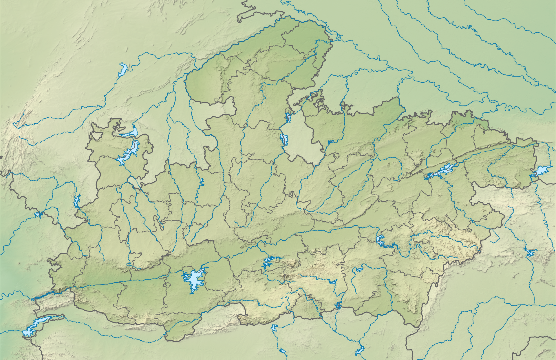
Kuno sits in Sheopur district of Madhya Pradesh, in the upper Chambal basin. The park spans about 748 sq km of dry deciduous forest and grassland, with the Kuno river cutting through it. It shares administrative neighbourhood with the Chambal sanctuary and forms part of the proposed Kuno-Madhav landscape.
May 2026 was a milestone month. India’s cheetah reintroduction project completed its annual census and reported 57 cheetahs alive in Kuno, including 32 cubs born on Indian soil. Two cheetahs were translocated to Gandhi Sagar to launch the second-habitat phase. The Cheetah Project Steering Committee met in Bhopal and approved Phase II expansion.
Prelims hooks: Kuno is a national park (notified 2018), not a tiger reserve. It’s the world’s first intercontinental large carnivore translocation site. Cheetahs are Schedule I under the Wildlife (Protection) Act 1972 and IUCN Vulnerable globally, though Asiatic cheetahs are Critically Endangered. The Kuno river is a tributary of the Chambal, itself a tributary of the Yamuna.
2. D’Ering Memorial Wildlife Sanctuary
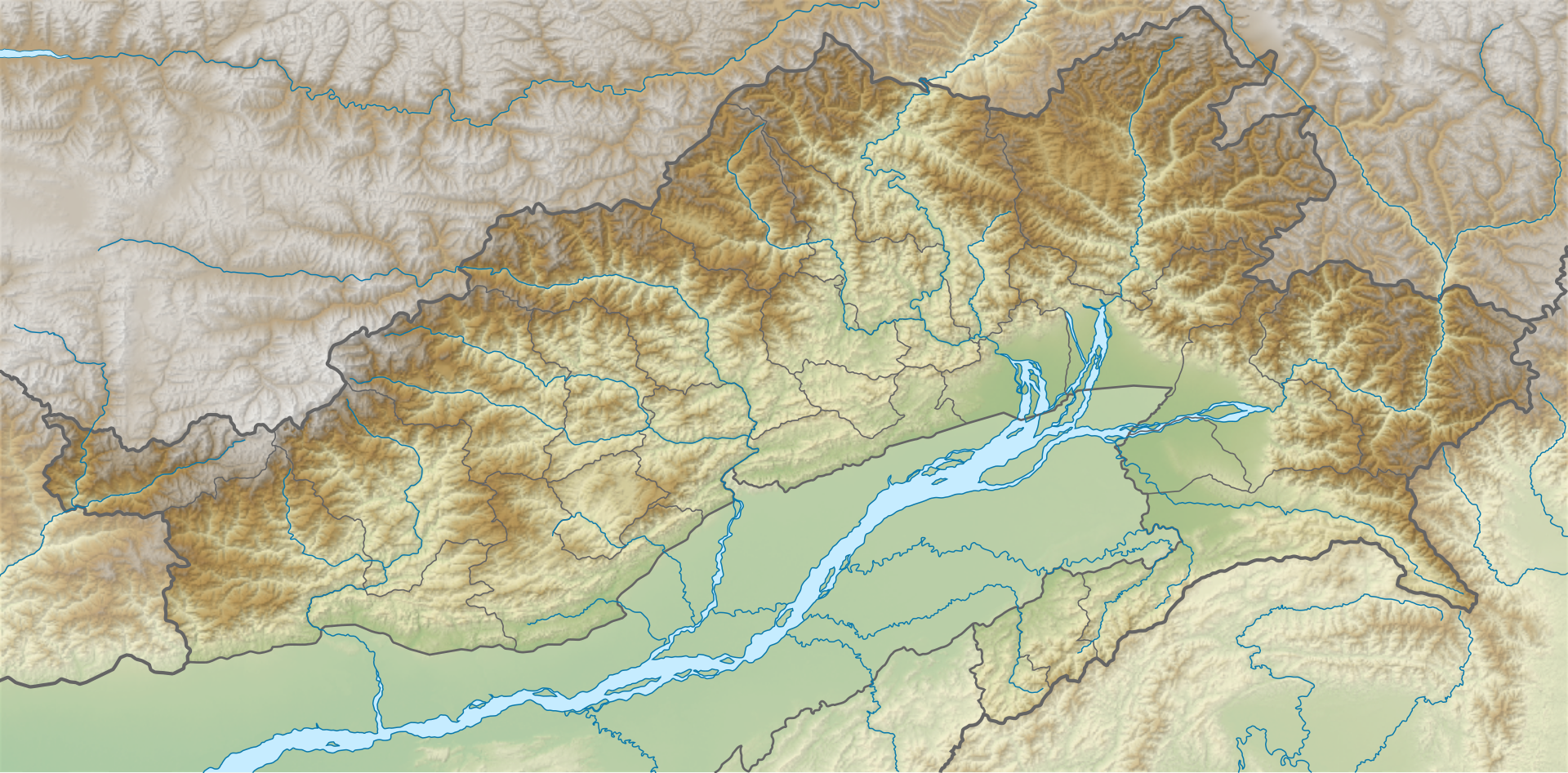
D’Ering sits on a flat alluvial island where the Siang river spreads out before merging with the Lohit and Dibang to form the Brahmaputra. Administratively it lies in East Siang district of Arunachal Pradesh, near Pasighat. The sanctuary covers about 190 sq km of grassland, swamp, and riverine forest.
In May 2026, camera traps recorded a Royal Bengal tiger inside D’Ering — the first confirmed tiger presence in over twenty years. The sighting triggered fresh debate on tiger corridor connectivity in eastern Arunachal and on protection upgrades for the sanctuary. The Wildlife Institute of India and state forest department began joint patrolling.
Prelims hooks: D’Ering was named after Daying Ering, the first chief executive councillor of the erstwhile NEFA. It’s part of the Brahmaputra floodplain ecosystem. Tigers here connect potentially to Namdapha and Pakke landscapes. The sanctuary is famous as habitat for Bengal florican, hog deer, and wild buffalo.
3. Binsar Wildlife Sanctuary
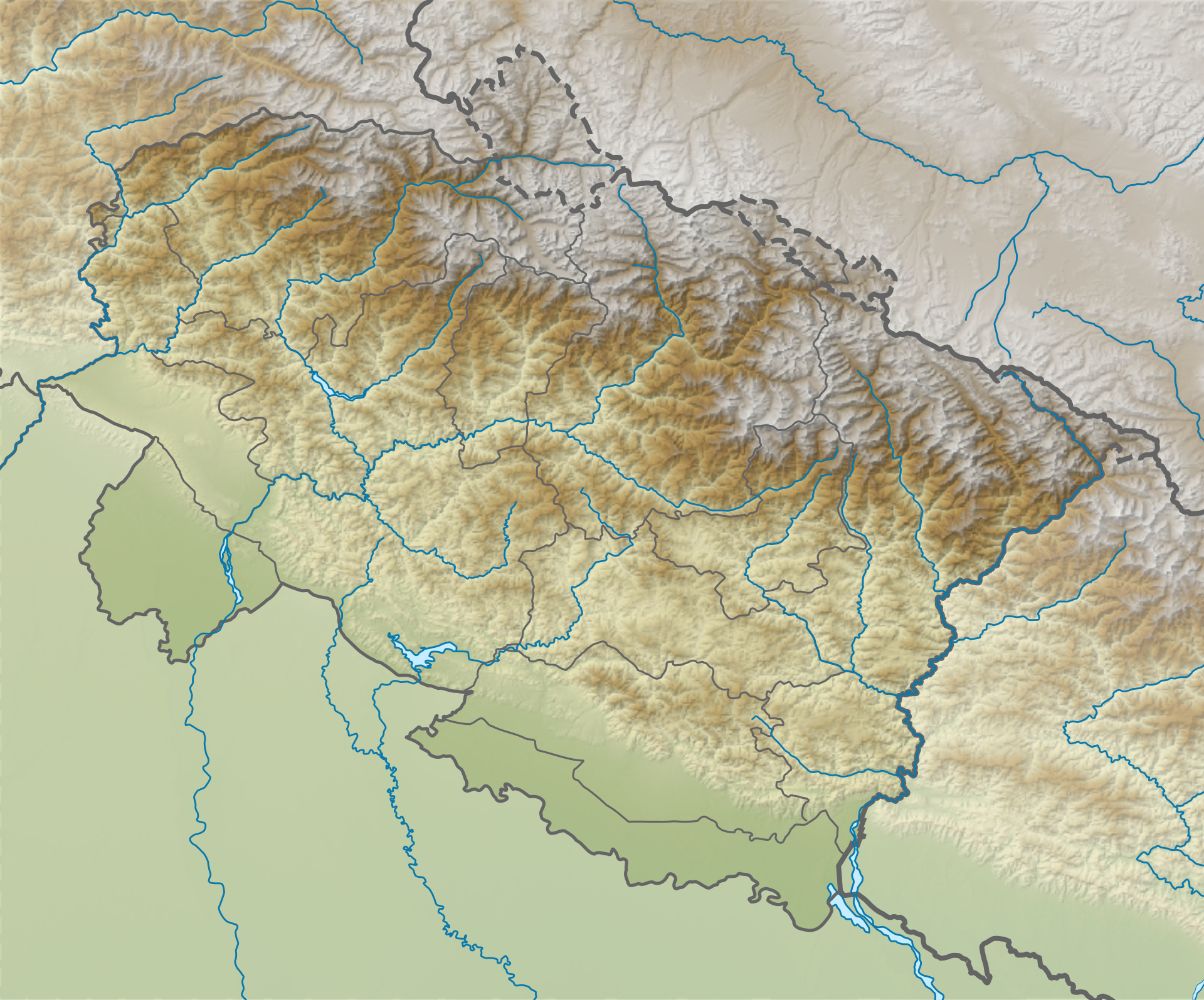
Binsar sits at roughly 2,400 metres above sea level in the Almora district of Uttarakhand, in the Kumaon Himalaya. The sanctuary covers about 47 sq km of oak and rhododendron forest. From the Zero Point inside Binsar, you can see Kedarnath, Chaukhamba, Trishul, Nanda Devi, and Panchachuli on a clear day.
In May 2026, Uttarakhand notified an expanded eco-tourism plan for Binsar, capping daily visitor numbers, banning private vehicles beyond Ayarpani, and routing all entries through electric shuttles. Conservation groups welcomed the cap; local home-stay operators worried about livelihoods.
Prelims hooks: Binsar was declared a sanctuary in 1988 to protect the Kumaon oak forests. Its dominant vegetation is montane temperate forest, not subtropical. Key fauna include Himalayan goral, leopard, musk deer, and pheasants. The sanctuary lies in the upper Kosi catchment, not the Ramganga.
4. Subansiri River
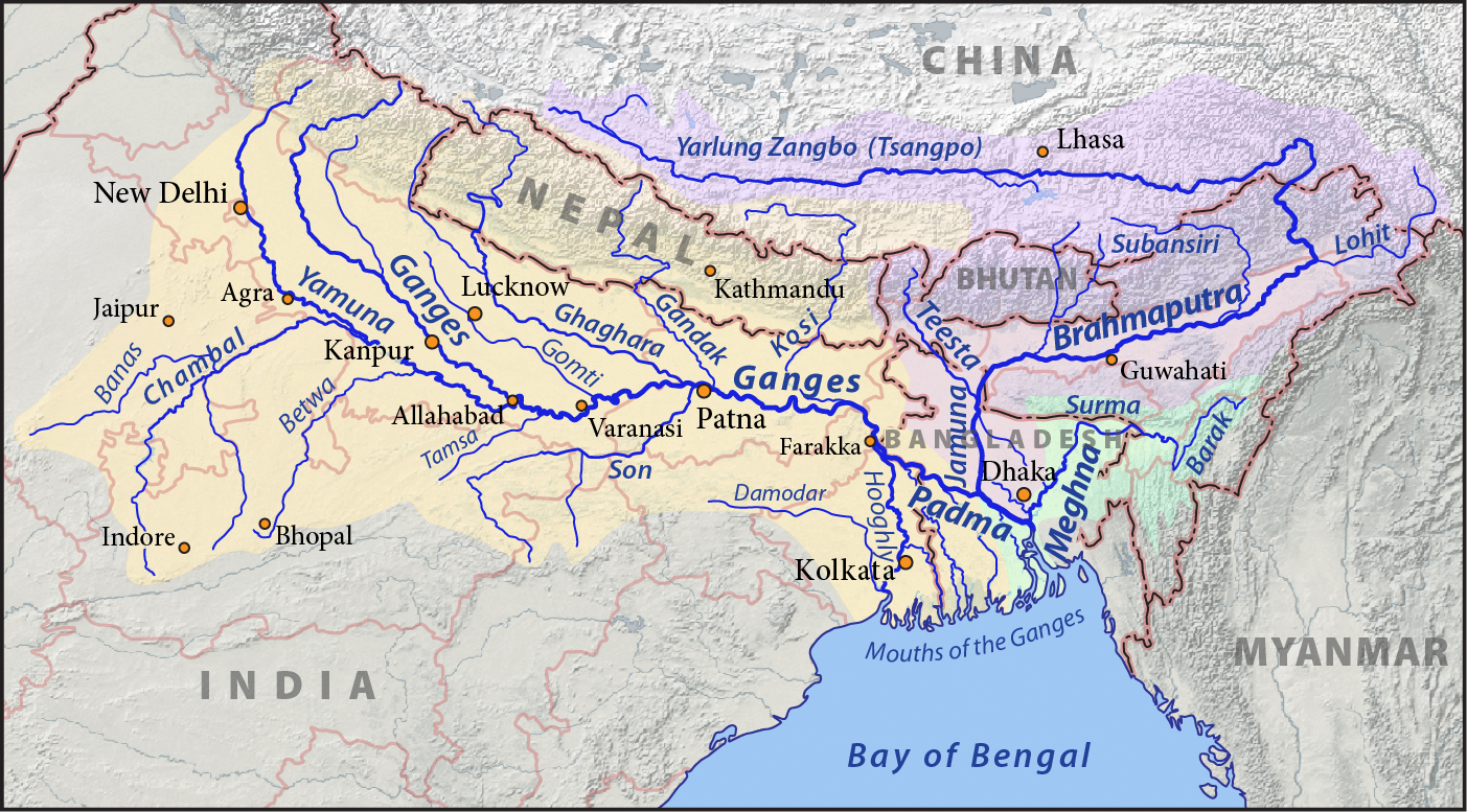
The Subansiri rises in Tibet, enters India through Arunachal Pradesh, runs roughly 442 km through Lower Subansiri and Upper Subansiri districts, then joins the Brahmaputra in Lakhimpur district of Assam. It’s the largest tributary of the Brahmaputra by discharge, contributing about 7.9% of the Brahmaputra’s flow.
In May 2026, NHPC announced that wet-commissioning of the 2,000 MW Subansiri Lower Hydroelectric Project would begin from the second week of June. It will be India’s largest operational hydro project by capacity. The announcement reignited downstream protests in Assam over silt load, fish kills, and dam-induced floods.
Prelims hooks: Subansiri is the Brahmaputra’s largest tributary by volume, ahead of the Manas and the Lohit. The Subansiri Lower project is at Gerukamukh on the Arunachal-Assam border. The river’s name in Tibetan is Tsari Chu. Riparian states are Arunachal Pradesh and Assam only.
5. Vizhinjam International Seaport
Vizhinjam lies on the Arabian Sea coast about 16 km south of Thiruvananthapuram in Kerala. The port has a natural draught of around 18-20 metres without dredging, putting it among the deepest harbours in South Asia. Adani Ports is developing it under a public-private partnership with the Kerala government.
In May 2026, Vizhinjam handled its millionth TEU since commercial operations began in July 2024, becoming India’s first transshipment hub capable of berthing the largest container vessels afloat. PM Modi virtually inaugurated Phase II civil works, which will lift capacity to 4.5 million TEU by 2028.
Prelims hooks: Vizhinjam is India’s first deep-water multi-purpose seaport built specifically for transshipment. Until Vizhinjam, more than 75% of India-bound transshipment ran through Colombo, Singapore, and Salalah. It lies just 10 nautical miles from the international east-west shipping lane. Mother vessels here are typically over 18,000 TEU. The port uses a landlord-port PPP model where the Kerala Maritime Board owns the land and Adani Ports operates the concession for forty years with a fifteen-year extension option.
6. Kolleru Lake
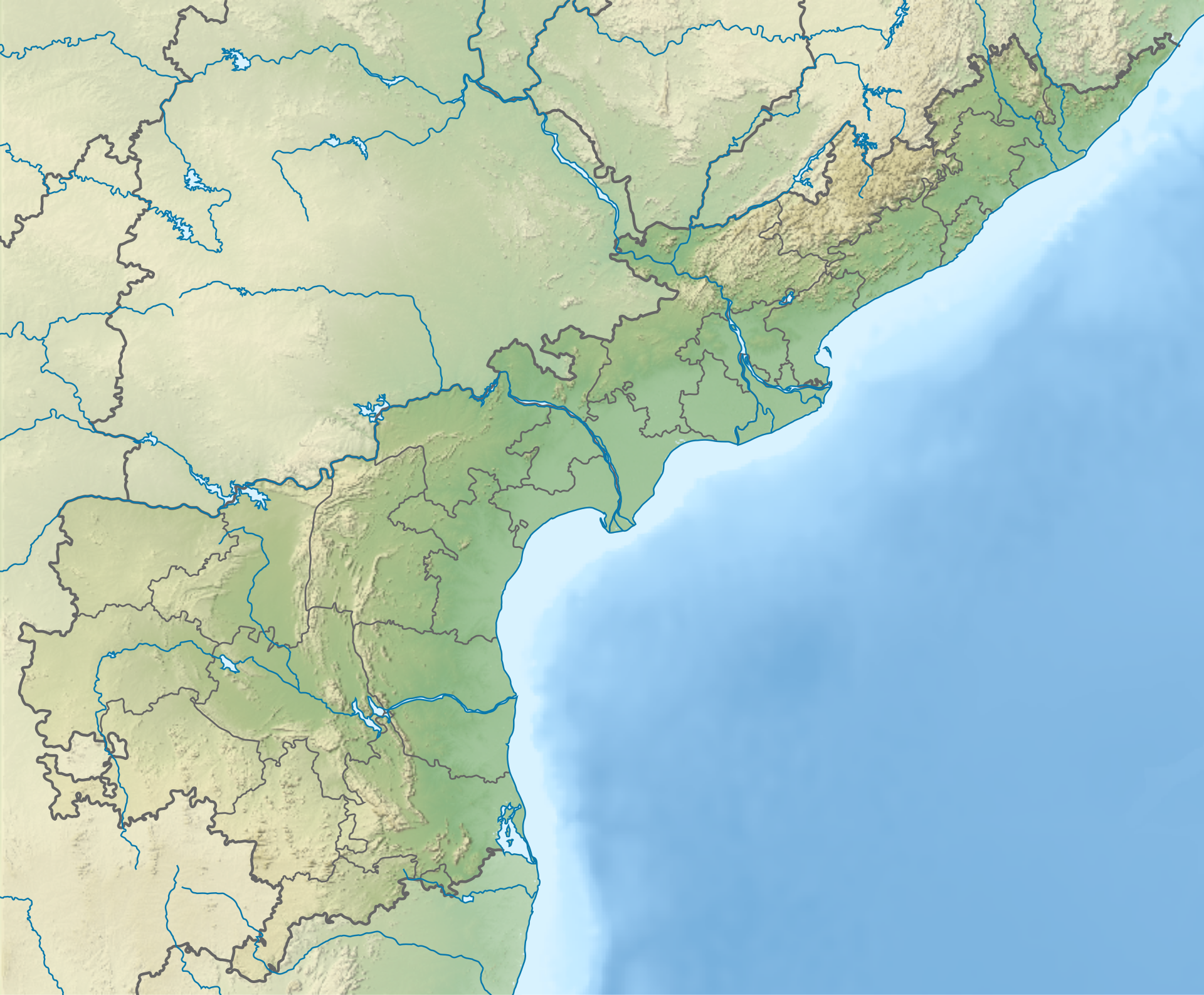
Kolleru Lake lies between the Krishna and Godavari deltas in Andhra Pradesh, sprawling across Eluru and West Godavari districts. It’s India’s largest freshwater lake by area in the natural floodplain category, fed by the Budameru and Tammileru streams and connected to the sea through the Upputeru drain.
In May 2026, the National Green Tribunal directed the Andhra Pradesh government to file a fresh action-taken report on aquaculture encroachment inside Kolleru’s plus-5 contour. The order followed petitions alleging that over 12,000 acres of seasonally inundated lake bed had been converted into shrimp ponds.
Prelims hooks: Kolleru is a Ramsar wetland (designated 2002). It was notified as a wildlife sanctuary in 1999. The +5 contour defines the protected lake boundary. Migratory birds include grey pelican, painted stork, glossy ibis, and Asian openbill. The lake is a tank-cascade type, not a coastal lagoon.
7. Similipal National Park
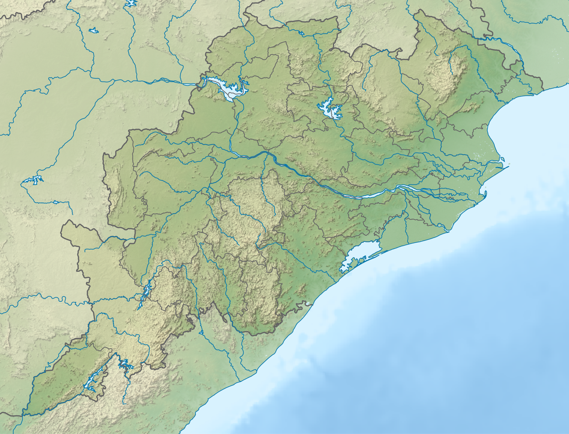
Similipal sits in Mayurbhanj district of Odisha, on the Eastern Ghats. The park covers about 2,750 sq km of sal-dominated moist deciduous forest and is the source of several rivers including the Budhabalanga, Khairi, Salandi, and Bhandan. Joranda and Barehipani waterfalls lie within it.
In May 2026, Similipal’s annual tiger estimation reported 27 tigers, up from 16 in 2022, including India’s only stable population of melanistic tigers. The Odisha government also approved a fresh village-relocation package for three forest villages inside the core.
Prelims hooks: Similipal is a tiger reserve, a UNESCO Biosphere Reserve, and a national park (the dual notification matters for MCQs). It’s home to Project Tiger, Project Elephant, and Mugger crocodile populations. The Saoras and the Kolhas live in the buffer zone. Pseudo-melanistic tigers, found nowhere else in the wild, are the standout fauna.
8. South Lhonak Lake
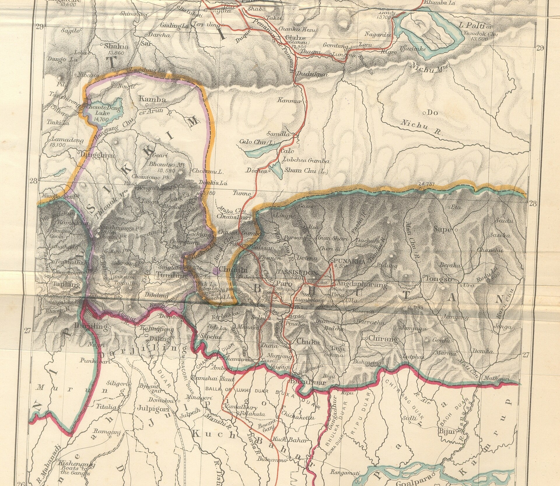
South Lhonak is a glacial lake at about 5,200 metres elevation in Mangan district of North Sikkim, near the Tibet border. It formed in recent decades as the Lhonak glacier retreated, and by 2023 covered roughly 1.6 sq km, making it one of the fastest-growing supraglacial lakes in the Himalaya.
In May 2026, ISRO released satellite imagery showing renewed water accumulation inside the lake basin two years after the October 2023 GLOF event that destroyed the Teesta-III dam and killed over 100 people downstream. Sikkim launched a fresh GLOF early-warning installation programme covering 17 lakes.
Prelims hooks: GLOF stands for Glacial Lake Outburst Flood. The 2023 South Lhonak GLOF was caused by a lateral moraine collapse, not by ice avalanche. The Teesta is the major river system at risk. South Lhonak feeds the Goma Chu, which joins the Lhonak Chu and finally the Teesta. North Sikkim’s tehsil reorganisation in 2021 placed Lhonak inside Mangan district.
9. Great Nicobar
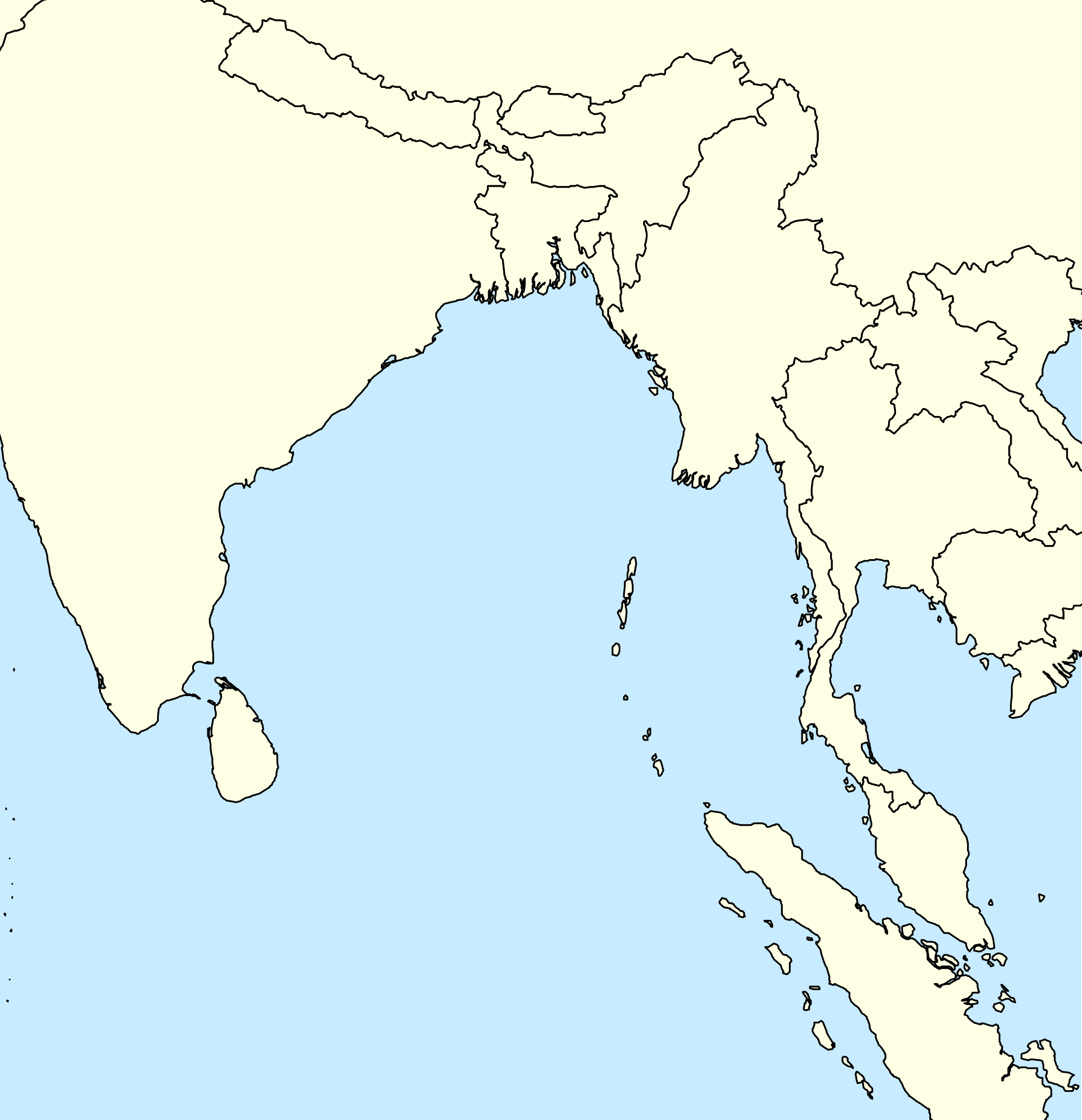
Great Nicobar is the southernmost island of the Andaman and Nicobar archipelago, with Indira Point as India’s southernmost land point. It covers about 1,045 sq km and houses the Galathea Bay biosphere reserve. Two PVTGs live here: the Shompen in the interior and the Nicobarese along the coast.
In May 2026, the Nicobarese Tribal Council formally rejected the proposed denotification of the Galathea Bay Wildlife Sanctuary, which would clear the path for the holistic development project’s container port and airport components. The Ministry of Tribal Affairs sought a fresh consultation cycle.
Prelims hooks: The Shompen are a Particularly Vulnerable Tribal Group (PVTG), classified under Schedule I of the WPA-equivalent tribal protection lists. Indira Point lies at about 6.7°N. Galathea Bay is critical leatherback turtle nesting habitat. The Andaman and Nicobar archipelago lies in the Bay of Bengal, separated from the Andaman group by the Ten Degree Channel.
10. Gandhi Sagar Wildlife Sanctuary
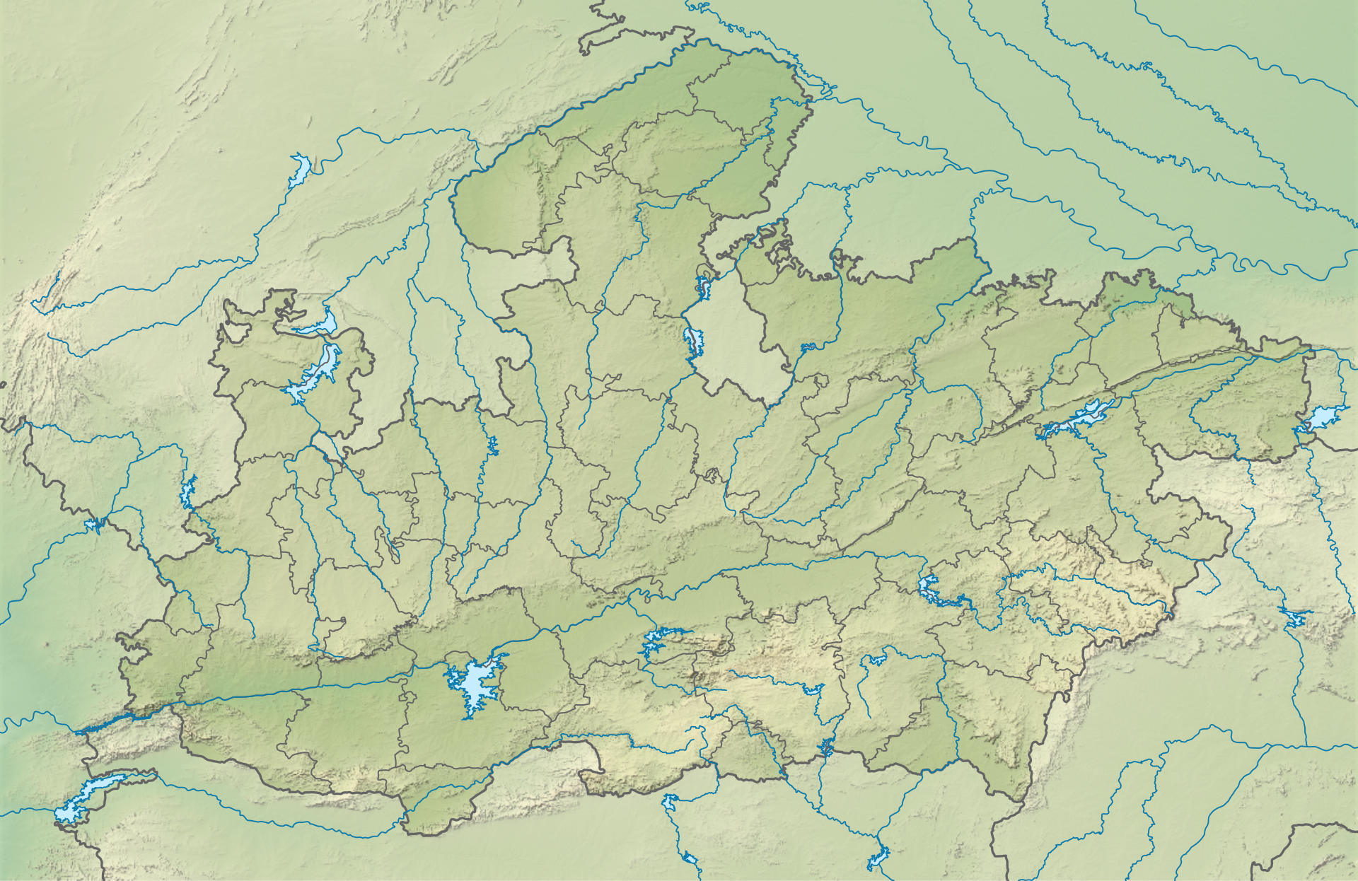
Gandhi Sagar straddles Mandsaur and Neemuch districts of Madhya Pradesh, on the Chambal river. The sanctuary covers about 368 sq km of khathiar-gir dry deciduous forest and grassland, adjacent to the Gandhi Sagar reservoir built on the Chambal in 1960.
In May 2026, two cheetahs translocated from Kuno arrived at Gandhi Sagar’s purpose-built 64 sq km soft-release boma, marking India’s second free-ranging cheetah habitat. The cheetahs were named Prabhash and Pavak. A third batch from South Africa is scheduled for July 2026.
Prelims hooks: Gandhi Sagar is a wildlife sanctuary, not a national park. The Gandhi Sagar dam is one of four major dams on the Chambal (the others are Rana Pratap Sagar, Jawahar Sagar, and Kota Barrage). The sanctuary borders Bhainsrodgarh sanctuary in Rajasthan. The cheetah Phase II is run jointly by MP forest department, NTCA, and Wildlife Institute of India.
11. Baksa district
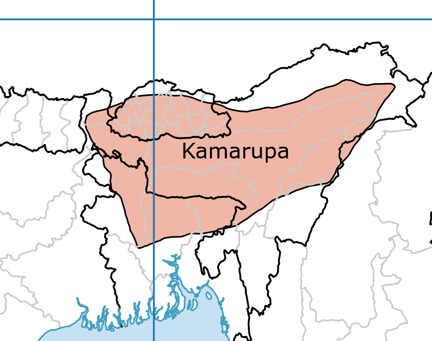
Baksa lies in lower Assam, carved out of Barpeta, Nalbari, and Kamrup districts in 2003. It’s one of five districts under the Bodoland Territorial Region. The district headquarters is Mushalpur. The Manas National Park forms its northern boundary along the Bhutan border.
In May 2026, the Assam government cleared a first-of-its-kind shipment of Baksa wild honey to the United States under the One District One Product programme. The honey commanded a 43% premium over standard Indian wild honey prices, owing to its sub-Himalayan multi-floral origin and tribal-cooperative provenance.
Prelims hooks: ODOP is administered by the Department for Promotion of Industry and Internal Trade (DPIIT), not the Ministry of Commerce directly. Baksa is part of the Bodoland Territorial Region created under the Sixth Schedule. The Manas river runs along its western edge. Baksa is the home district of the BTR Chief Executive Member.
12. Kaziranga National Park
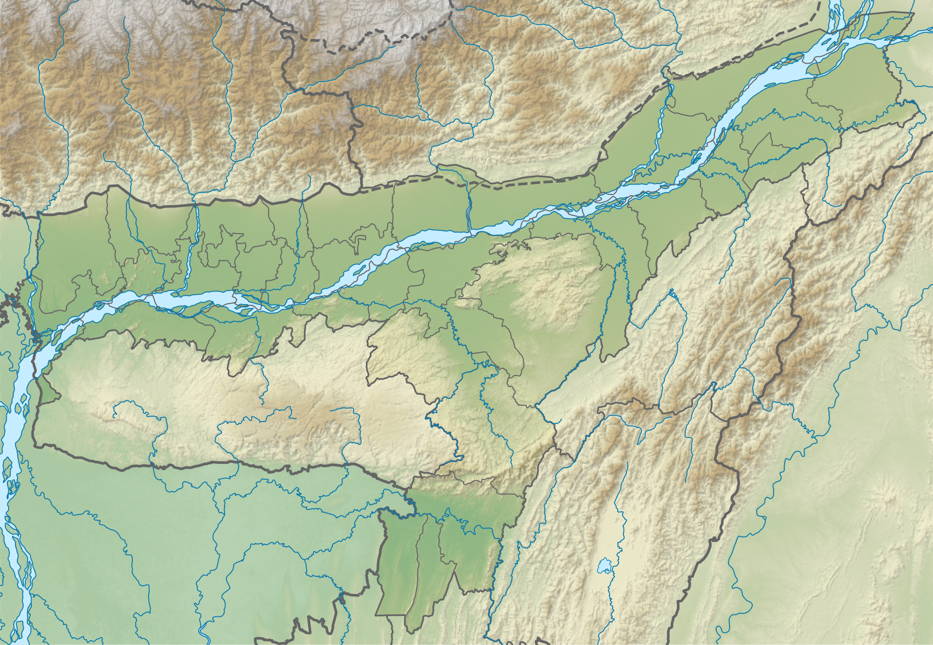
Kaziranga lies on the southern bank of the Brahmaputra in Golaghat and Nagaon districts of Assam. It covers about 1,090 sq km of tall elephant grass, marshland, and tropical moist mixed deciduous forest. It holds two-thirds of the world’s wild one-horned rhinoceros population.
In May 2026, the Assam government released the annual rhino census: 2,786 individuals, an increase of 173 over the 2022 count and a fresh all-time high. The state also flagged a 19% rise in poaching attempts intercepted, suggesting renewed cross-border syndicate activity through Bhutan and Bangladesh.
Prelims hooks: Kaziranga is a national park, a tiger reserve (notified 2007), and a UNESCO World Heritage Site (1985). It’s home to the “Big Five” — rhino, elephant, tiger, wild water buffalo, and eastern swamp deer. The Brahmaputra floods Kaziranga every monsoon, and animals migrate to the Karbi Anglong hills. The Diphlu river forms its southern boundary.
International Locations in News (May 2026)
International geography is half the story. May 2026’s foreign-policy and global news cycle threw up eight places that UPSC examiners will almost certainly draw from. The same logic applies: know where they sit, what they border, and why they made headlines.
13. Strait of Hormuz
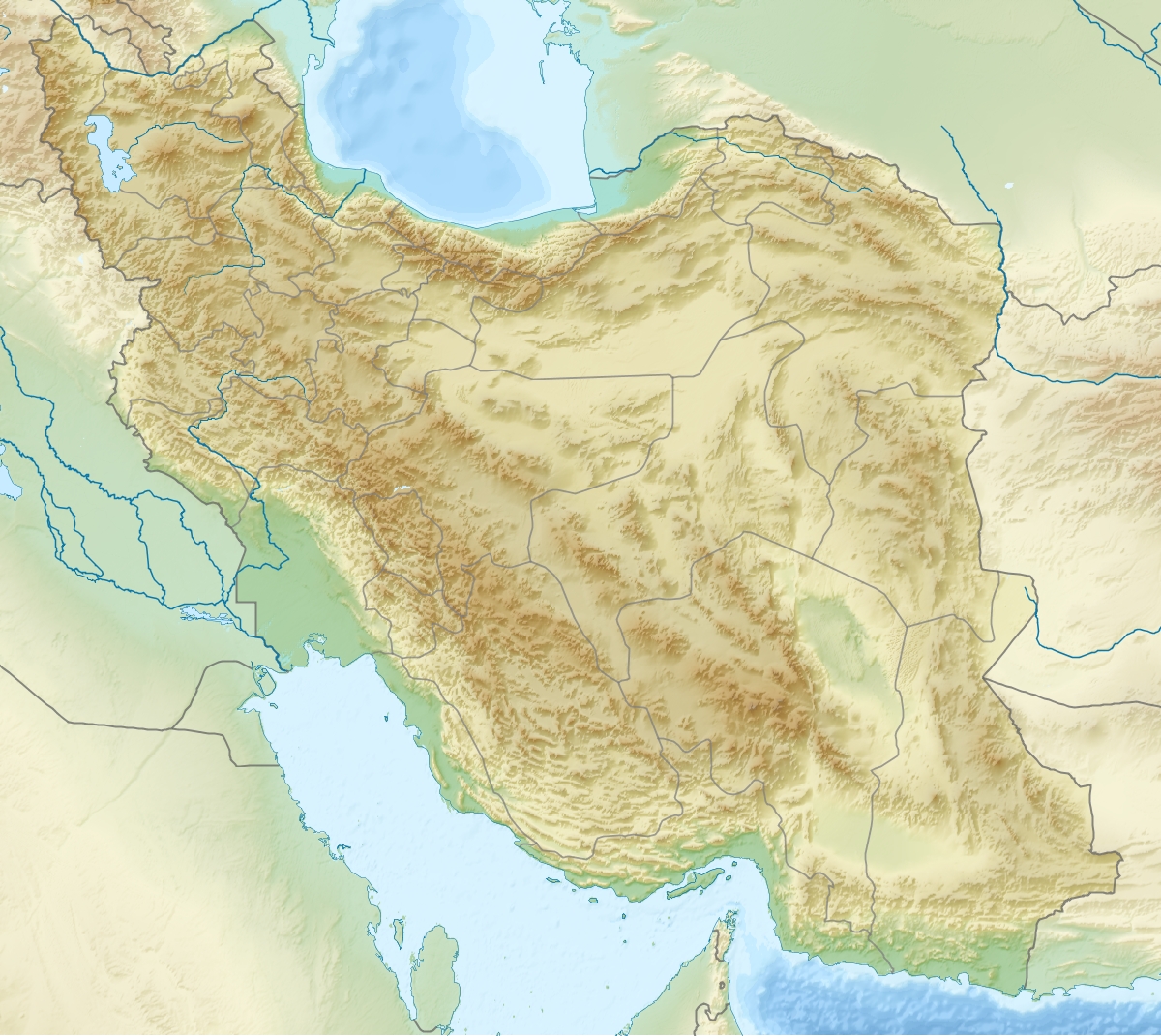
The Strait of Hormuz is a narrow waterway between the Persian Gulf and the Gulf of Oman, separating Iran on the north from Oman’s Musandam exclave on the south. At its narrowest point, the strait is just 33 km wide, with two-mile-wide shipping lanes for inbound and outbound traffic. Roughly 20% of the world’s seaborne oil passes through it.
In May 2026, the US Fifth Fleet launched Operation Project Freedom, a convoy-escort initiative after Iran-flagged fast-attack craft harassed three commercial tankers in two weeks. India joined as a non-NATO partner under the framework, providing two destroyers under Operation Sankalp-II.
Prelims hooks: The Strait separates the Persian Gulf (also called the Arabian Gulf) from the Gulf of Oman, not from the Arabian Sea directly. Musandam is an Omani exclave separated from mainland Oman by UAE territory. Iran and Oman jointly police the strait under the 1975 maritime delimitation. Hormuz Island itself is Iranian.
14. Cape Verde
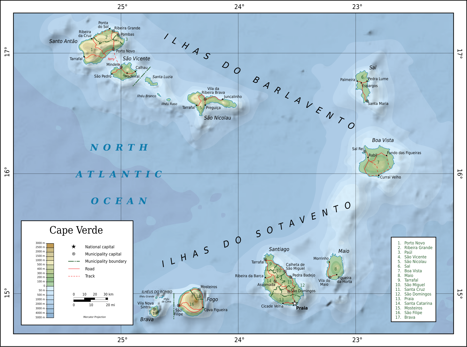
Cape Verde, officially Cabo Verde, is an archipelago of ten volcanic islands in the central Atlantic Ocean, about 570 km off the West African coast. The country’s capital is Praia on the island of Santiago. Population is roughly 600,000. It’s a member of ECOWAS and the African Union.
In May 2026, the cruise ship MV Hondius docked at Mindelo with eight confirmed hantavirus pulmonary syndrome cases and one fatality among passengers. WHO classified the cluster as a public-health event of regional concern and dispatched a rapid-response team. India’s MEA issued a travel advisory for Indian seafarers.
Prelims hooks: Cape Verde is a Macaronesian archipelago, grouped geologically with the Azores, Madeira, and Canary Islands. It’s the westernmost African country (excluding remote islands). Hantavirus is primarily rodent-borne, with the deer mouse as the main reservoir in the Americas. The MV Hondius is a Dutch-flagged expedition cruise vessel. Cape Verde was a Portuguese colony until 1975 and uses the Cape Verdean escudo, pegged to the euro under a special arrangement that predates the eurozone itself.
15. Yavarí River
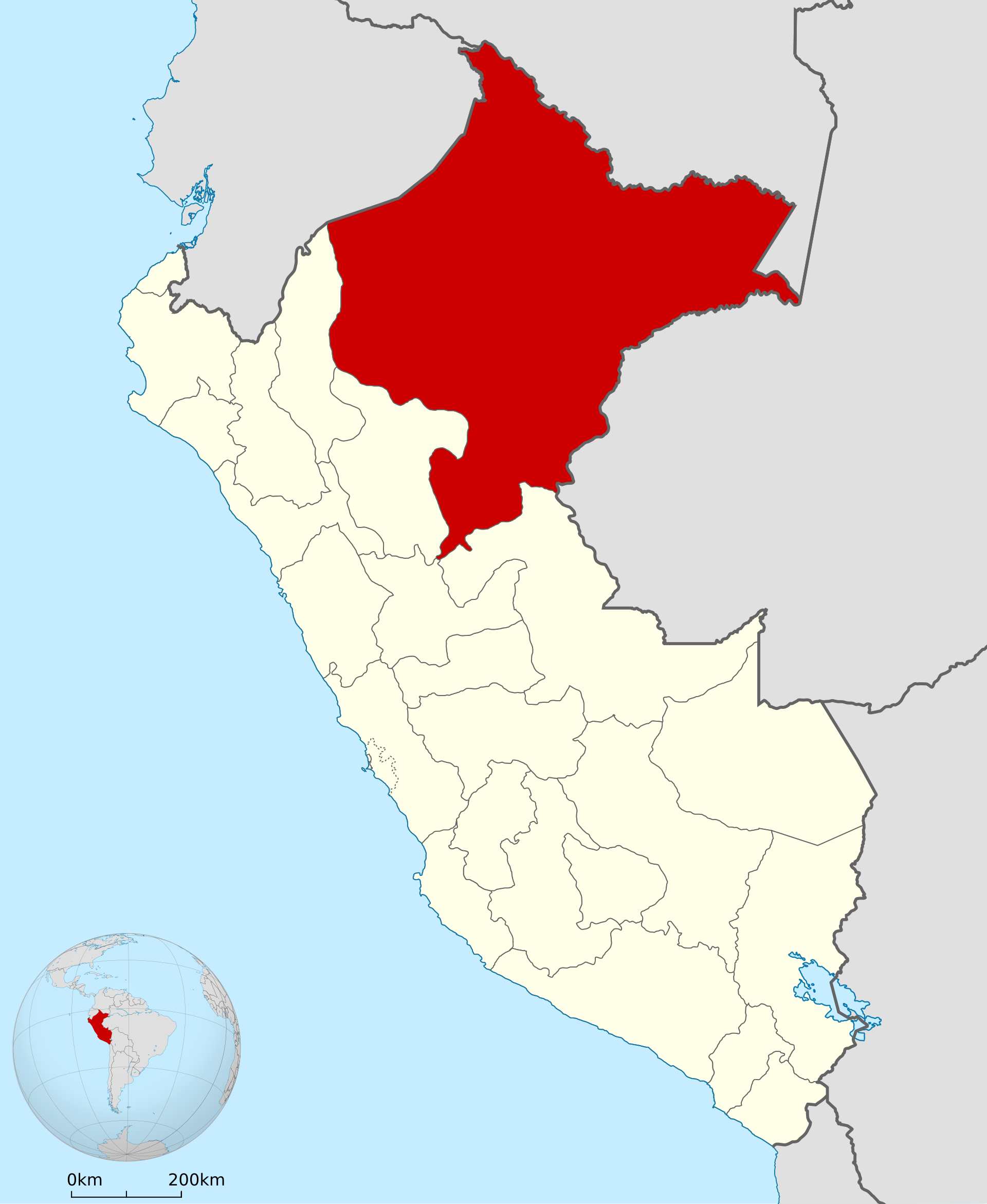
The Yavarí, called Javary in Portuguese, rises in the Peruvian Andes and flows roughly 1,200 km northeast before joining the Amazon at the Brazil-Peru-Colombia tri-border. The river forms the international boundary between Peru and Brazil for most of its length. The basin houses several uncontacted indigenous groups.
In May 2026, Peru, Brazil, and Colombia signed the Leticia Pact extension creating the Yavarí-Tapiche Indigenous Corridor — a transboundary protected area of roughly 75,000 sq km for isolated peoples. The corridor connects existing reserves in all three countries.
Prelims hooks: The Yavarí basin lies within the Western Amazon biogeographic region. Uncontacted tribes here include the Korubo, the Mayoruna (Matsés), and groups within the Vale do Javari indigenous land. The Amazon is the largest river in the world by discharge. India is an observer at the Amazon Cooperation Treaty Organization (ACTO).
16. Vietnam
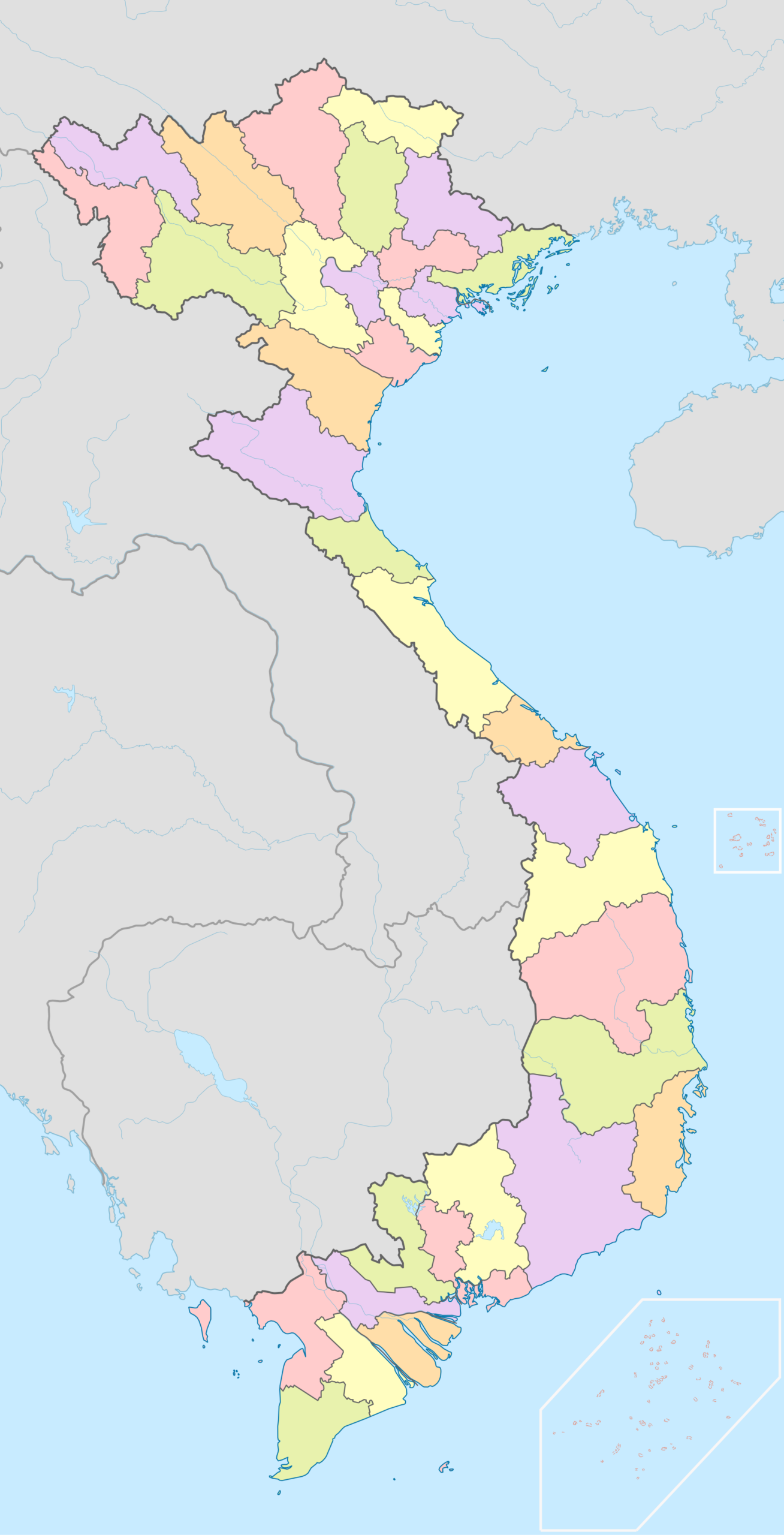
Vietnam occupies the eastern coast of mainland Southeast Asia along the South China Sea (which Vietnam calls the East Sea). The country is shaped like an “S” stretching 1,650 km from north to south. Hanoi is the capital, Ho Chi Minh City the commercial hub. Borders: China, Laos, and Cambodia.
In May 2026, Vietnamese General Secretary Tô Lâm visited New Delhi and India signed the Enhanced Comprehensive Strategic Partnership — an upgrade from the 2016 CSP. The package included a USD 500 million defence line of credit and expanded BrahMos cooperation.
Prelims hooks: Vietnam is one of five countries (with India, China, Russia, Japan) operating BrahMos. It joined ASEAN in 1995 and the WTO in 2007. The Mekong Delta is its rice bowl. The country’s communist political system runs under a single party — the Communist Party of Vietnam. The Red River and Mekong are its two principal river systems.
17. Mozambique
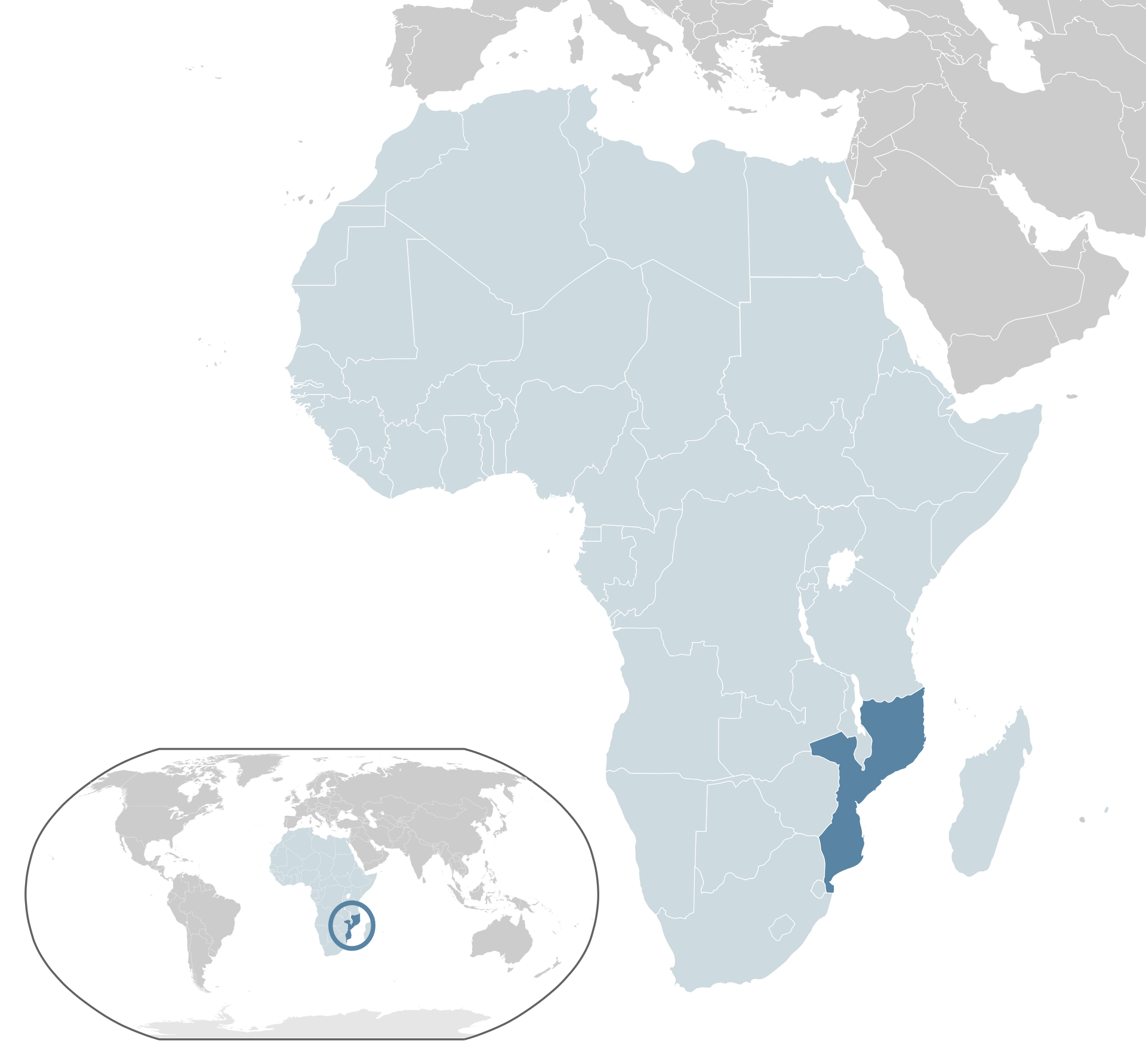
Mozambique stretches along the southeast African coast on the Indian Ocean for about 2,500 km. Maputo, in the far south, is the capital. The country borders South Africa, Eswatini, Zimbabwe, Zambia, Malawi, and Tanzania. The Mozambique Channel separates it from Madagascar.
In May 2026, India hosted Mozambican Foreign Minister Verónica Macamo for the first India-Mozambique Strategic Dialogue. Agreements covered a USD 200 million LoC for railway modernisation and joint development of the Mocímboa da Praia port on the gas-rich Cabo Delgado coast.
Prelims hooks: Mozambique is a Lusophone country (Portuguese is the official language). It joined the Commonwealth in 1995 despite no British colonial history. The Zambezi cuts through the country en route to the Indian Ocean. The Mozambique Channel separates it from Madagascar and is a major shipping lane. India and Mozambique conduct the IBSAMAR naval exercise with Brazil and South Africa. India was the first country to which Mozambique exported pigeon peas under a long-term contract — a deal that has anchored India’s pulses-import strategy since 2016.
18. Uzbekistan
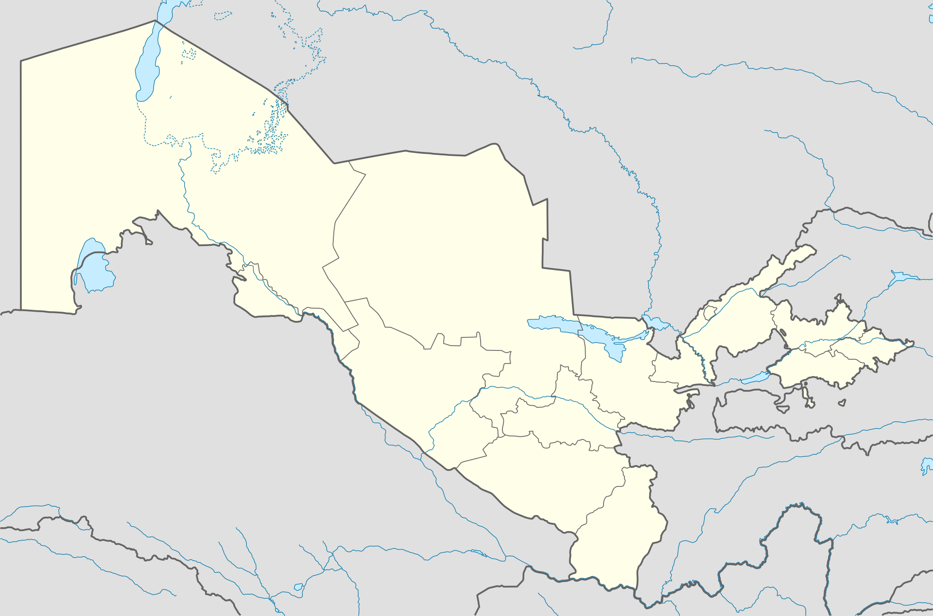
Uzbekistan sits at the heart of Central Asia, bordering Kazakhstan, Kyrgyzstan, Tajikistan, Afghanistan, and Turkmenistan. It’s one of only two doubly landlocked countries on Earth (Liechtenstein is the other). The capital is Tashkent. The Aral Sea forms part of its northwestern boundary.
In May 2026, Uzbekistan and India signed an upgraded Connect Central Asia Plus action plan during President Mirziyoyev’s New Delhi visit. The plan formalised Uzbek participation in the International North-South Transport Corridor (INSTC) via Chabahar port, and announced direct Tashkent-Mumbai air cargo from August 2026.
Prelims hooks: A doubly landlocked country is surrounded entirely by other landlocked countries. Tashkent is the largest city in Central Asia by population. The Amu Darya and Syr Darya are the main rivers, both flowing toward the shrinking Aral Sea. Uzbekistan is a member of the SCO, CIS, and EAEU observer. India launched the India-Central Asia Dialogue in 2019.
19. Oman
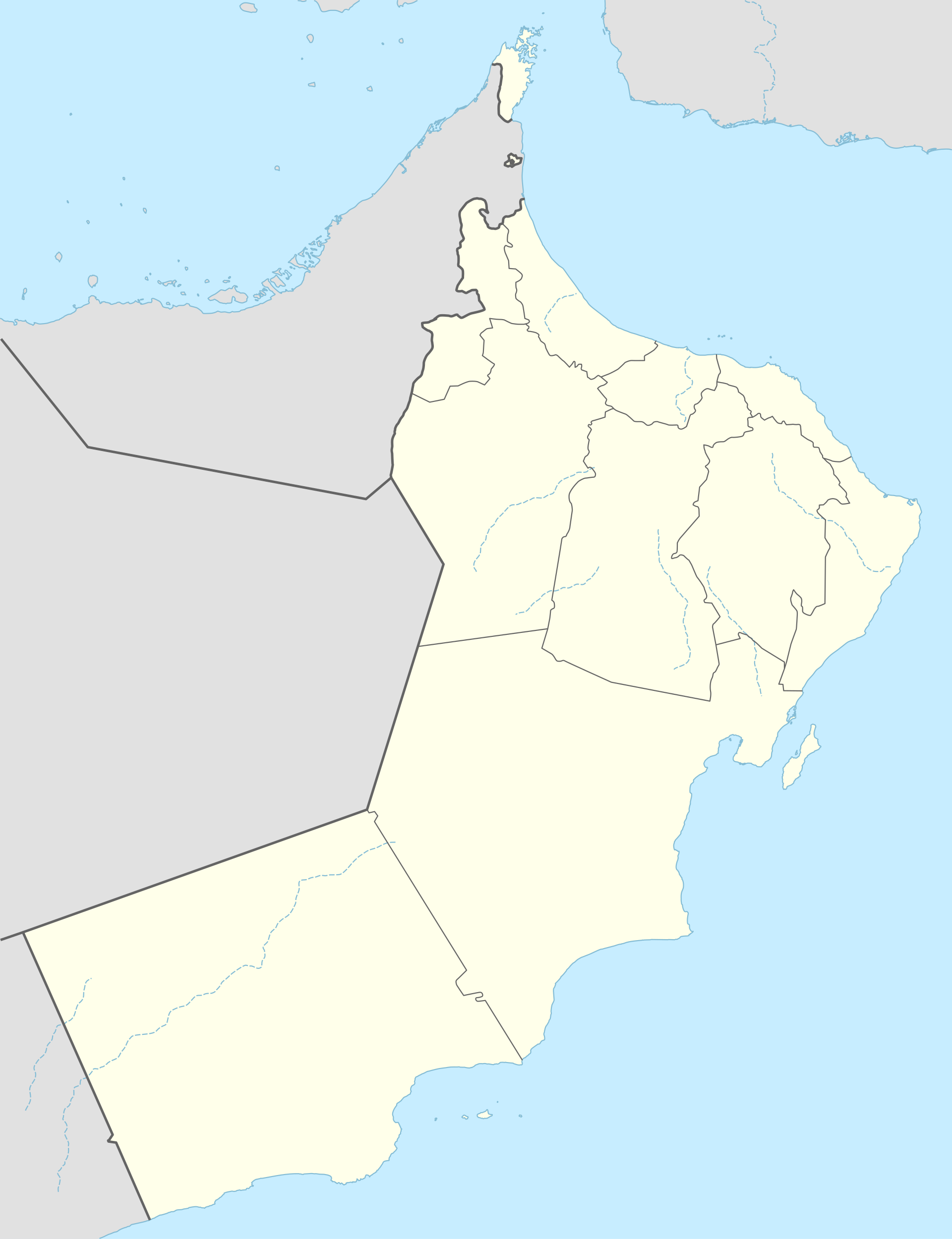
Oman lies on the southeastern coast of the Arabian Peninsula, fronting the Arabian Sea, the Gulf of Oman, and the Persian Gulf through its Musandam exclave. Muscat is the capital. The country borders Saudi Arabia, the UAE, and Yemen. The Hajar Mountains run along its northern coast.
In May 2026, the India-Oman CEPA cleared its final ratification hurdle and took effect from 1 June 2026 — India’s first CEPA with a Gulf Cooperation Council member. The agreement eliminates duties on 99% of Indian exports and grants Oman duty-free access for 92% of its trade lines.
Prelims hooks: Oman is a sultanate, not a monarchy in the strict sense — the head of state is the Sultan. CEPA stands for Comprehensive Economic Partnership Agreement. Oman is the seat of the Indian Navy’s Duqm Port logistics access for IOR operations. The Strait of Hormuz separates Oman’s Musandam from Iran. Frankincense from Dhofar is a UNESCO heritage trade good.
20. Aral Sea
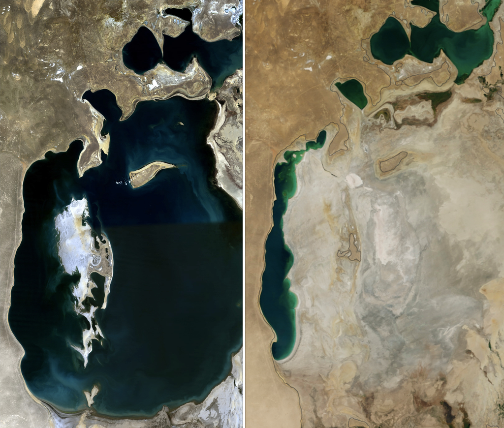
The Aral Sea straddles the border of Uzbekistan (Karakalpakstan) and Kazakhstan in Central Asia. Once the world’s fourth-largest lake at 68,000 sq km, it has shrunk to roughly 10% of that size after decades of Soviet-era diversion of the Amu Darya and Syr Darya for cotton irrigation. The exposed bed is now called the Aralkum desert.
In May 2026, a Karakalpakstan dust storm carrying salt and pesticide residues from the Aralkum reached Tashkent for the first time on record, prompting an air-quality emergency. The Uzbek government accelerated the Million Trees programme on the Aralkum and called for fresh international climate finance.
Prelims hooks: The Aral Sea was the world’s fourth-largest lake in 1960. The Amu Darya and Syr Darya are the main feeder rivers. The northern Aral is being partially restored via the Kok-Aral dam (a World Bank project in Kazakhstan). Karakalpakstan is an autonomous republic within Uzbekistan. The Aral crisis is a textbook case of human-induced desertification. The dust from the Aralkum is rich in DDT and other persistent organic pollutants from decades of cotton agrochemicals, which makes the storms a transboundary public-health hazard, not just a meteorological one.
Prelims-Ready Map Drill
Twenty locations, one table. Cover the third column with your hand, name the why-in-news from the location alone, then check yourself. Two passes here are worth ten passes through any textbook.
| Location | State or Country | Why in News (May 2026) | UPSC Hook |
|---|---|---|---|
| Kuno National Park | Madhya Pradesh | 57 cheetahs in annual census | Schedule I species, Chambal basin |
| D’Ering WLS | Arunachal Pradesh | First tiger sighting in 20 years | Brahmaputra floodplain |
| Binsar WLS | Uttarakhand | Eco-tourism cap notification | Kumaon oak-rhododendron forest |
| Subansiri River | Arunachal Pradesh / Assam | Lower HEP wet commissioning | Brahmaputra’s largest tributary |
| Vizhinjam Port | Kerala | 1M TEU + Phase II launch | India’s first deep-water transshipment |
| Kolleru Lake | Andhra Pradesh | NGT order on aquaculture | Ramsar wetland, +5 contour |
| Similipal | Odisha (Mayurbhanj) | 27 tigers, melanistic stable | Biosphere + tiger reserve + NP |
| South Lhonak Lake | Sikkim | Renewed GLOF risk imagery | Teesta basin, supraglacial lake |
| Great Nicobar | A&N Islands | Nicobarese reject denotification | Shompen PVTG, Indira Point |
| Gandhi Sagar WLS | Madhya Pradesh | Cheetah Phase II site | Chambal basin, second cheetah habitat |
| Baksa | Assam (BTR) | Honey exports to USA, 43% premium | ODOP, Sixth Schedule |
| Kaziranga | Assam | 2,786 rhinos, all-time high | World Heritage, tiger reserve |
| Strait of Hormuz | Iran / Oman | Operation Project Freedom | 20% of seaborne oil |
| Cape Verde | West Africa (Atlantic) | MV Hondius hantavirus outbreak | Macaronesia, ECOWAS |
| Yavarí River | Peru / Brazil border | Indigenous corridor pact | Amazon basin, ACTO |
| Vietnam | Southeast Asia | ECSP with India, Tô Lâm visit | ASEAN, BrahMos partner |
| Mozambique | Southeast Africa | First Strategic Dialogue with India | Lusophone, Indian Ocean |
| Uzbekistan | Central Asia | Connect Central Asia Plus | Doubly landlocked, INSTC |
| Oman | Persian Gulf | CEPA effective 1 June 2026 | First GCC CEPA |
| Aral Sea | Uzbekistan / Kazakhstan | Aralkum dust storm in Tashkent | Amu + Syr Darya |
How to Revise Location in News for UPSC
The trick with places-in-news isn’t intensity. It’s spacing. Read this column twice — once at month-end as part of your regular current-affairs revision, and once again forty-eight to seventy-two hours before the Prelims exam. The second pass is purely for muscle memory of “where it sits.”
For each location, do a thirty-second exercise. Close your eyes, picture an outline of the relevant region (India, the Arabian Peninsula, Central Asia), and place a dot where the location sits. Open your eyes, check the map above. If you missed by more than two states or two countries, mark it for a third pass.
What UPSC actually tests: positional knowledge (“located in which state”), thematic association (“which Ramsar site”), and joint identifiers (“which biosphere reserve is also a tiger reserve”). UPSC almost never tests exact coordinates, exact areas, or year-of-notification. Don’t waste cycles memorising those.
International locations matter as much as Indian ones. In recent years Prelims has lifted geography questions from Indian government press releases on bilateral visits, climate summits, and trade pacts. Treat the foreign-policy news cycle as a geography reading list.
A few specific habits help. Keep a physical world atlas open while you read this article — a paper atlas, not a phone map. Phone maps zoom too fast and don’t build spatial memory the way a paper atlas does. For each international location, find it on the atlas, trace the borders with your finger, and name the four nearest countries out loud. For Indian locations, do the same with state boundaries and the nearest river. The motor memory pays off in the exam hall when you face a static map question with no internet to fall back on.
The other habit worth building: link locations to themes rather than to dates. UPSC examiners think in themes — conservation, infrastructure, foreign policy, climate, indigenous rights. When you revise this list, group the twenty locations by theme first, then by region. That’s how examiners pick their question stems. If you can recite “the three Indian locations linked to cheetah Phase II” without thinking, you’ve internalised the right unit of revision.
Frequently Asked Questions
What is “Location in News” in UPSC?
“Location in News” refers to places that featured in current affairs over a defined window, typically a month or a quarter. UPSC Prelims tests them through indirect questions on protection status, river basins, neighbouring countries, or thematic identifiers like Ramsar sites and biosphere reserves. The pattern shows up in three to five Prelims questions on average each year.
Which locations are most important for May 2026 Prelims?
For May 2026, the highest-yield locations are Kuno (cheetah Phase II), Vizhinjam (first deep-water transshipment), Strait of Hormuz (Operation Project Freedom), South Lhonak (GLOF imagery), Uzbekistan (INSTC and Connect Central Asia Plus), Oman (CEPA), and Great Nicobar (Nicobarese consultation). These have a high probability of generating direct or indirect Prelims hooks because they cluster around recurring UPSC themes — conservation, infrastructure, foreign policy, and tribal protection.
How many map questions does UPSC ask in Prelims?
On average, three to five out of one hundred Prelims questions test location knowledge directly or indirectly. Some years it’s higher, especially when international relations or environment dominate the question paper. The number rarely drops below two. That puts location-in-news worth about four to six marks in a paper where the cut-off swings by ten marks.
Should I memorise exact coordinates?
No. UPSC has almost never asked for exact coordinates of any place. What examiners test is positional knowledge — “in which state is X” or “which country borders Y.” You should know the broad latitude band (tropical vs temperate), the river basin, the neighbouring states or countries, and one or two thematic identifiers like Ramsar or biosphere status.
Are international locations as important as Indian ones?
Yes, increasingly so. Over the last five Prelims cycles, international geography has shown up in roughly the same proportion as Indian geography in current-affairs-linked questions. Treat the foreign-policy news cycle as a geography reading list — every bilateral visit, climate summit, and trade pact comes with a map you should know.
How often should I revise places in news?
Twice per location is the standard schedule. The first pass happens at month-end as part of your regular monthly current-affairs revision. The second pass happens forty-eight to seventy-two hours before the Prelims exam itself. Aspirants who want belt-and-braces revision add a third pass at the end of each quarter, focused on the highest-yield locations only.
Where can I find the source maps?
Every map in this article is a Wikipedia locator or relief map, picked for clarity and for matching UPSC’s positional question format. For deeper map study, use the Survey of India open-data portal for Indian locations and the UN OCHA ReliefWeb for international ones. Atlases from Oxford, Orient Blackswan, or TTK work too, but the Wikipedia maps are sufficient for Prelims.
How is this article structured for revision?
The article is structured to support the two-pass schedule. The first pass at month-end should be a slow read of each H3 section, paragraph by paragraph, building context. The second pass before the exam should focus only on the Prelims-Ready Map Drill table and the UPSC hooks under each location. The introduction and revision-strategy sections are background reading, not active study material. Aspirants who use spaced-repetition flashcard apps can lift the third-paragraph Prelims hooks directly into Anki or RemNote — the hook lines are written in fact-per-bullet format precisely so they convert cleanly into cards.
Tell Google you want more of this.
Add Anantam IAS as a preferred sourceOne tap, and this site shows up more often in your own Top Stories, AI Overviews and AI Mode. Remove it any time.