Disclosure: this guide contains Amazon affiliate links. As an Amazon Associate, Anantam IAS earns from qualifying purchases — at no extra cost to you.
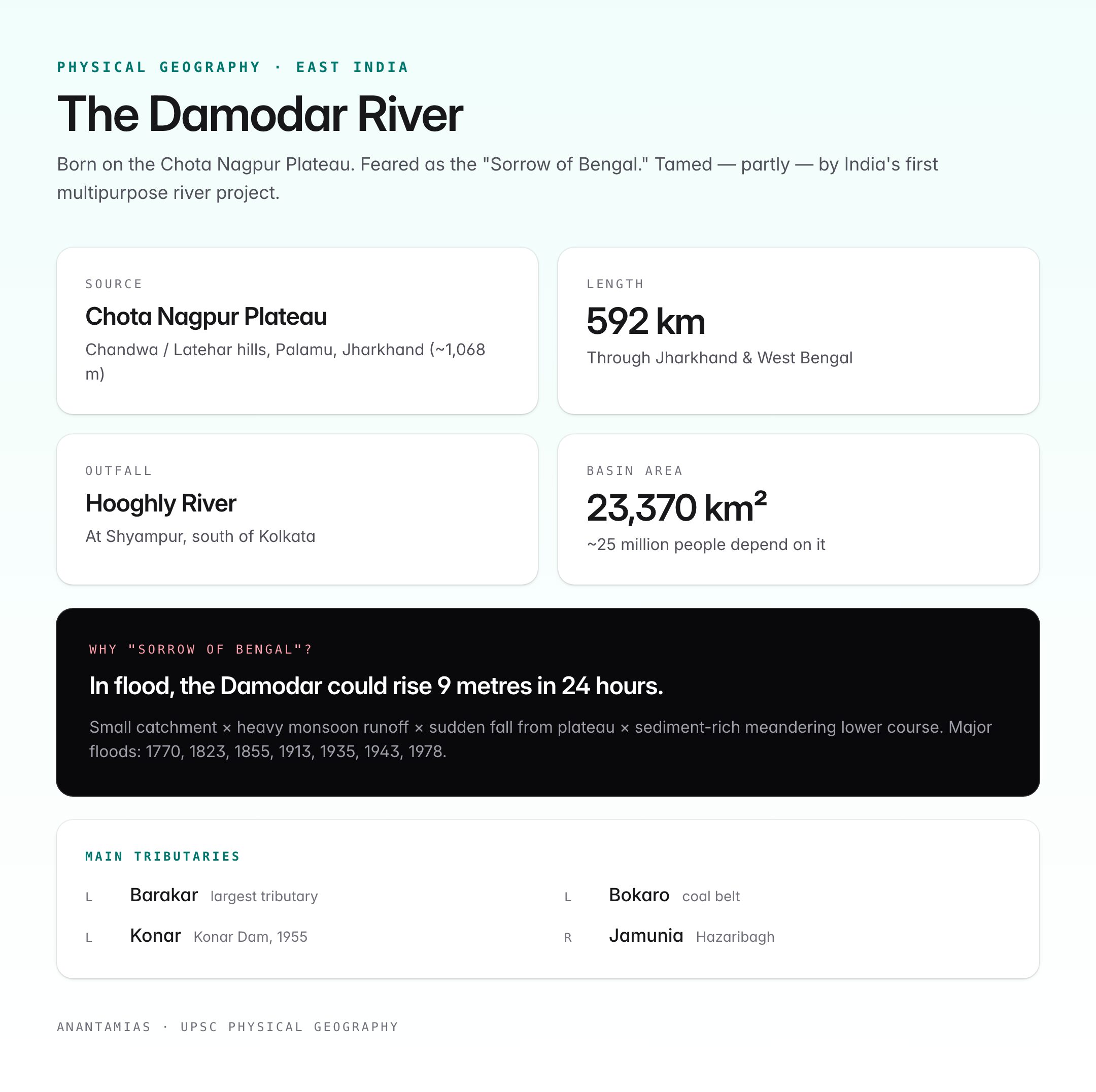
The Damodar River, historically known as the “Sorrow of Bengal”, rises in the Chota Nagpur Plateau and flows eastward through Jharkhand and West Bengal before joining the Hooghly River south of Kolkata. Notorious for devastating floods in the lower basin through the 19th and early 20th centuries, the Damodar was transformed after independence by India’s first multipurpose river valley project — the Damodar Valley Corporation (DVC), modelled on the American Tennessee Valley Authority (TVA).
Today, the Damodar basin is India's richest coal belt, a vital source of thermal power, and a case study in river valley planning, water-sharing federalism, and the environmental costs of development.
Physical Profile
| Feature | Detail |
|---|---|
| Source | Chandwa / Latehar hills, Chota Nagpur Plateau, Palamu district, Jharkhand (~1,068 m) |
| Total length | ~592 km |
| States covered | Jharkhand + West Bengal |
| Outfall | Joins Hooghly River at Shyampur (south of Kolkata), ~50 km from the Bay of Bengal |
| Basin area | ~23,370 sq km |
| Basin population | ~25 million |
| Nature | Rain-fed; seasonal with heavy monsoon flow |
| Main mouth | Hooghly distributary system of the Ganga delta |
Because the river originates on the hard Gondwana rocks of the plateau and falls rapidly into the alluvial plains of Bengal, it historically spread floodwaters and silt across the lower basin — the origin of the "Sorrow of Bengal" name.
Course of the River

Oxford Student Atlas for India — 7th Edition
- 160 pages, Oxford University Press, the current edition
- India-focused thematic maps: physical, political, rivers, climate, soils, vegetation, plus world maps
- Made for UPSC and state PSC map work; slim enough to stay open beside the textbook
- Upper course (Jharkhand): Rises near Chandwa, flows east through Palamu, Hazaribagh, Ramgarh, Dhanbad, Bokaro. Steep gradient, rocky bed.
- Middle course: Enters the Damodar Valley coal belt near Dhanbad. Joined by the Barakar (largest tributary) at Dishergarh.
- Lower course (West Bengal): Enters at Asansol–Durgapur, flows past Bardhaman, and meets the Hooghly near Falta. At Paikpara the river divides into two distributaries — the Mundeswari (southern) and the main Damodar (northern).
Main Tributaries
| Tributary | Bank | Notes |
|---|---|---|
| Barakar | Left | Largest tributary; Maithon Dam across it |
| Bokaro | Left | Drains Bokaro coalfield |
| Konar | Left | Konar Dam (1955) |
| Jamunia | Right | Drains Hazaribagh |
| Mundeswari | Distributary in delta | Carries much of the monsoon discharge |
Why "Sorrow of Bengal"?
Before the DVC dams, the Damodar in flood could rise 9 metres in 24 hours. Major historic floods:
- 1770, 1823, 1840, 1855, 1866, 1887, 1913, 1935, 1943, 1944, and 1978 all caused massive destruction.
- The 1943 flood — during the Bengal famine — inundated 3,900 sq miles and pushed the colonial government towards a permanent solution.
- The 1978 flood, despite the DVC system, remains the benchmark for flood magnitude.
The root cause: a small catchment with heavy monsoon runoff, a sudden fall from the plateau, and a meandering, sediment-rich lower course prone to avulsion.
Damodar Valley Corporation (DVC): India's First Multipurpose Project
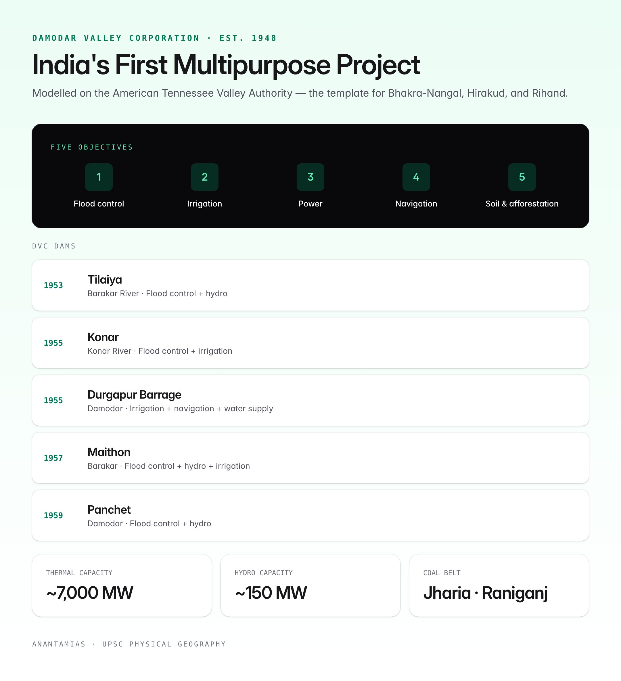
Established under the Damodar Valley Corporation Act, 1948, DVC was India's first multipurpose river valley project after independence. Modelled on the Tennessee Valley Authority (TVA) of the United States, it became the template for later projects on the Bhakra-Nangal, Hirakud, and Rihand.
DVC Membership
| Member | Role |
|---|---|
| Government of India | Majority |
| Government of Jharkhand (earlier Bihar) | Co-partner |
| Government of West Bengal | Co-partner |
DVC Objectives
- Flood control on the Damodar and its tributaries.
- Irrigation in the lower basin.
- Hydro and thermal power generation.
- Navigation on the lower reaches.
- Afforestation, soil conservation, health and sanitation in the basin.
DVC Dams
| Dam | River | Year | Primary purpose |
|---|---|---|---|
| Tilaiya | Barakar | 1953 | Flood control, hydro |
| Konar | Konar | 1955 | Flood control, irrigation |
| Maithon | Barakar | 1957 | Flood control, hydro, irrigation |
| Panchet | Damodar | 1959 | Flood control, hydro |
| Durgapur Barrage | Damodar | 1955 | Irrigation, navigation, water supply |
Original plans envisaged seven dams; the Aiyar, Balpahari and Bermo dams were dropped because of resettlement costs and hydrology revisions.
DVC Power Capacity
- Thermal: ~7,000 MW installed (major plants at Bokaro, Chandrapura, Durgapur, Mejia, Koderma, Raghunathpur).
- Hydro: ~150 MW from Maithon, Panchet, Tilaiya.
- DVC supplies Jharkhand, West Bengal, Odisha, Bihar grids.
Economic Importance
- Coalfields: The Damodar basin hosts Jharia, Raniganj, Bokaro, North Karanpura, Ramgarh, Giridih — India's largest coal reserves, supplying the majority of coking coal.
- Industry: Steel plants at Bokaro, Durgapur, Burnpur-Kulti; locomotives at Chittaranjan; mining and explosives industry.
- Irrigation: Durgapur Barrage irrigates ~3.6 lakh hectares in West Bengal through a canal network.
- Navigation: Limited — the Durgapur–Falta stretch was part of the original DVC plan but remains under-utilised.
Ecology and Environmental Concerns
- Pollution: Coal washeries, fly-ash from thermal plants, and untreated urban effluent (Asansol–Dhanbad–Durgapur belt) make the Damodar one of India's most polluted rivers.
- Jharia underground fires: Burning since 1916; destroy coking coal reserves and contaminate groundwater in the basin.
- Fly-ash ponds: Periodic breaches have dumped toxic sludge into the river (notable events in 2021 and 2022).
- Biodiversity: Indigenous fish like Tor tor (mahseer) have declined; invasive species and sand mining add pressure.
- Silting of reservoirs: DVC dams have lost significant storage capacity to sedimentation, weakening their flood-buffer role.
DVC Performance: Assessment
Strengths
- Reduced peak flood discharge — 1978 was contained better than pre-DVC events.
- Stable irrigation supply to the West Bengal rice bowl.
- Backbone of the eastern India thermal power grid.
Weaknesses
- Floods not eliminated — 2007, 2009, 2021 all saw severe lower-basin inundation.
- Inter-state water disputes between Jharkhand and West Bengal over release schedules.
- Environmental degradation underweighted in the original design.
- DVC's financial viability has been a recurring concern; tariff and restructuring issues.
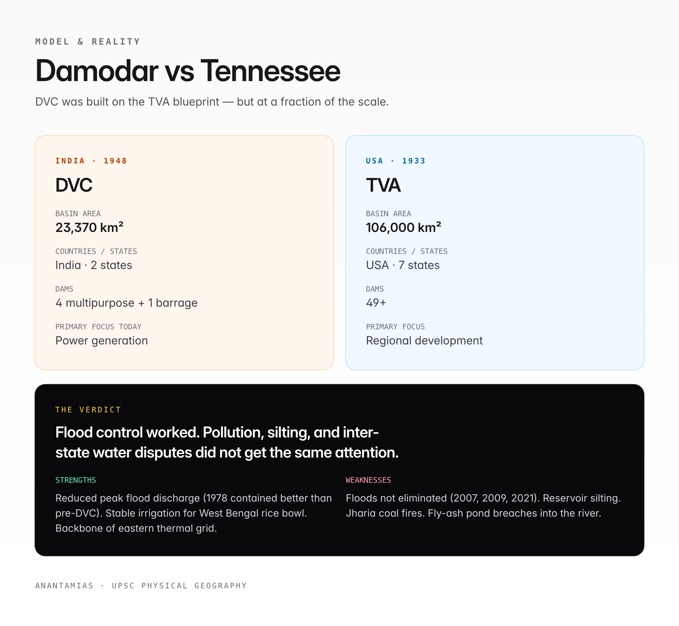
Comparison: Damodar vs Tennessee Valley
| Parameter | Damodar | Tennessee |
|---|---|---|
| Basin area | 23,370 sq km | 106,000 sq km |
| Countries / States | India, 2 states | USA, 7 states |
| Agency | DVC (1948) | TVA (1933) |
| Dams | 4 multipurpose + 1 barrage | 49+ |
| Focus | Flood control, power, irrigation | Same, plus regional development |
While TVA remade an entire American region economically, the DVC's remit narrowed over time to power generation, with flood control and regional development receiving less sustained attention.
Damodar in Culture
- Referenced as "Damuda" in medieval Bengali and Odia literature.
- Raja Rammohan Roy and later Bengali poets wrote about its floods.
- Mahasweta Devi's short stories portray displacement and coal-belt life along the Damodar.
Quick Revision
- Source: Chota Nagpur Plateau, Jharkhand.
- Mouth: Hooghly River, West Bengal.
- Main tributary: Barakar.
- DVC: First multipurpose project post-independence (1948).
- Dams: Tilaiya, Konar, Maithon, Panchet + Durgapur Barrage.
- Nickname: Sorrow of Bengal.
UPSC Relevance
Prelims (GS Paper I): Direct questions on the source, tributaries, DVC dams, and the "Sorrow of Bengal" label. Associated topics — Chota Nagpur plateau, coal belt mapping, and Jharia fires — are recurring.
Mains (GS Paper I — Geography):
- Discuss the geographical factors that made the Damodar the "Sorrow of Bengal" and assess how effective multipurpose projects have been in mitigating them.
- Examine the role of the DVC in eastern India's industrial development.
Mains (GS Paper III — Environment / Economy):
- Evaluate the environmental costs of coal-based development in the Damodar basin.
- Discuss sediment management and ageing reservoirs in the Indian context, using the DVC as an example.
Essay: Themes like "river valley projects — promise and reality," "industrialisation and environment," and "inter-state water sharing" map closely onto the Damodar story.
Tell Google you want more of this.
Add Anantam IAS as a preferred sourceOne tap, and this site shows up more often in your own Top Stories, AI Overviews and AI Mode. Remove it any time.