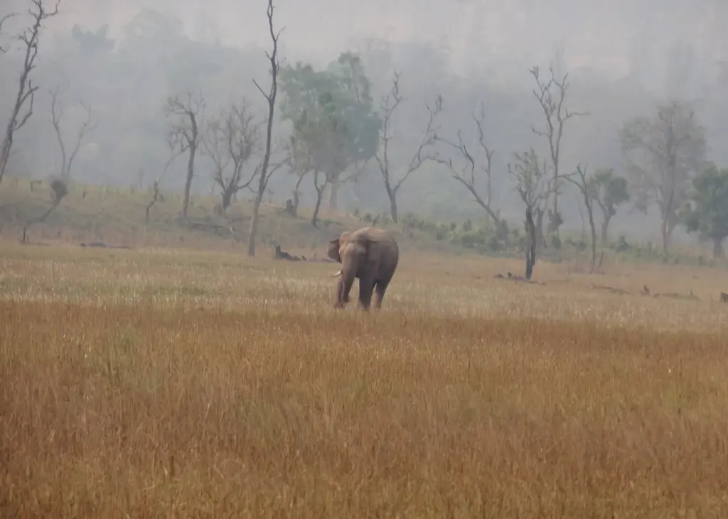
The Delhi Dehradun Expressway is a 213 km, six-lane, access-controlled highway that runs from Akshardham in east Delhi through western Uttar Pradesh to Dehradun, the capital of Uttarakhand. Prime Minister Narendra Modi opened it on 14 April 2026, and it cuts the drive from over six hours to about two and a half. Officially it’s called the Delhi-Dehradun Economic Corridor, and its most studied feature is a 12 km elevated stretch built so that elephants and deer can keep crossing the Shivalik forests underneath the traffic.
Most readers carry two ideas about it. One is that the road runs straight through Rajaji National Park. The other is that the elevated corridor settled the environmental question. The first is loose and the second is premature. The flyover crosses reserve forests on Rajaji’s western flank and its eco-sensitive belt, and whether it works for wildlife is still being measured. This note settles the route, the forest section and what the record shows so far.
What Is the Delhi Dehradun Expressway?
It’s a mixed project. Part of it widens old roads, part of it is a new alignment through farmland, and the last 20 km is a realignment through forest. The Ministry of Road Transport and Highways built it through the National Highways Authority of India, in EPC mode (engineering, procurement and construction: the government pays a contractor to build, and keeps the road).
| Fact | Detail |
|---|---|
| Length | 213 km (PMO, April 2026); 210 km in the 2021 project papers |
| Route | Akshardham (Delhi), Baghpat, Shamli, Saharanpur, Ganeshpur, Dehradun |
| States | Delhi, Uttar Pradesh, Uttarakhand |
| Cost | Over Rs 12,000 crore (PMO, April 2026) |
| Foundation stone | 4 December 2021, Dehradun |
| Opened | 14 April 2026, Dehradun |
| Travel time | Over 6 hours to about 2.5 hours |
| Wildlife works | 12 km elevated corridor, 8 animal passes, two 200 m elephant underpasses, 370 m tunnel near Daat Kali temple |
| Programme | Listed among the greenfield corridors of Bharatmala Pariyojana (PIB, February 2024) |
Two numbers in that table need a word. The length moves between 210, 213 and 239 km depending on the document. The 2021 papers said 210 km, the PMO said 213 km at the opening, and a February 2024 list of Bharatmala Pariyojana corridors gave 239 km for “Delhi-Saharanpur-Dehradun”. The larger figure most likely counts more of the wider project than the road that opened; that’s an inference, so the safe answer is “about 210-213 km”. The tunnel also grew, from 340 m in the 2021 papers to 370 m in the 2026 release.
How Does the Route Run?
The route runs north-northeast from the Yamuna in Delhi to the Doon valley, and the government split it into four sections. Knowing the four sections is the easiest way to remember the whole road, because each one solved a different problem.
- Section 1, Akshardham to the Eastern Peripheral Expressway. A six-lane urban stretch in two packages: 14.75 km in Delhi, of which 6.4 km is elevated, and 16.85 km in Uttar Pradesh, of which 11.2 km is elevated. It passes Geeta Colony, Khajuri Khas and Mandola, and was meant to decongest north-east Delhi.
- Section 2, the greenfield run. A wholly new six-lane alignment through Baghpat, Shamli, Muzaffarnagar and Saharanpur districts, across the sugarcane belt of the upper Ganga-Yamuna doab.
- Section 3, Saharanpur bypass to Ganeshpur. An existing four-lane road, upgraded with underpasses and service roads to make it fully access-controlled.
- Section 4, Ganeshpur to Dehradun. About 20 km, of which 5 km widens the old road and 15 km is a new line with the elevated wildlife corridor and the tunnel.
Access control is the idea that holds it together. An access-controlled road has entry and exit only at interchanges, with no direct joining from roadside villages or shops. That’s what lets a design speed of 100 km/h hold for the whole length. The 2021 plan put seven major interchanges at points connecting Haridwar, Muzaffarnagar, Shamli, Yamunanagar, Baghpat, Meerut and Baraut. By the opening, the official count was 10 interchanges, along with 3 railway overbridges, 4 major bridges and 12 wayside amenities.
Tolling follows a closed system: you pay for the distance you actually drive, not a flat fee at a plaza. It’s the same principle the NHAI’s access-controlled highway guidelines build on.
Why Does the Forest Section Matter?
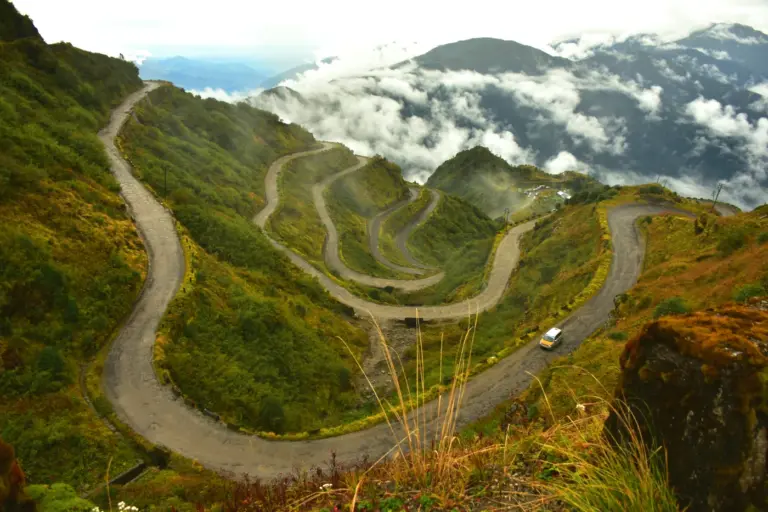
The last 20 km is where engineering and ecology collide. North of Ganeshpur the road climbs through the Shivalik hills, the youngest and outermost range of the Himalaya, into the Doon valley. These sal and mixed deciduous forests link the Rajaji forests in Uttarakhand to the Shivalik forests of Saharanpur, and Asian elephants move through them between seasons. Roads that cut such routes are a national problem, covered in the note on protecting elephant corridors.
An old two-lane road already ran here. Widening it on the ground would have meant a wider barrier of asphalt, fencing and traffic across an animal route. So the planners lifted the new carriageway onto pillars for 12 km and left the forest floor below open. The 2021 backgrounder also capped the right of way at 25 m here, against the much wider land take elsewhere on the route.
Here’s how the wildlife works fit together:
- Elevated corridor (12 km). Animals walk under the viaduct rather than across the carriageway.
- Elephant underpasses (two, 200 m each). Spans built tall and wide enough for elephants, which avoid low, dark openings.
- Animal passes (eight). Smaller crossings for deer, jackals and other species.
- Daat Kali tunnel (370 m). Takes the road through the ridge near the Daat Kali temple at the Uttarakhand end instead of cutting across it.
Think of the viaduct as a bridge over a river, except that the river is a herd of elephants. The comparison holds for the corridor, but it stops at the two ends. A bridge works for any river below it; a wildlife bridge works only if animals choose to use it, and that depends on noise, light and human activity underneath. That’s why the monitoring matters more than the concrete.
Rajaji itself sits next to this stretch. The note on tiger reserves in India covers its status; this route touches the reserve’s western forests and the protected belt around them. Areas around a national park can be notified as eco-sensitive zones, where some activities are regulated, and that belt is part of why the clearance went to court.
What Did the Courts Decide?
The courts allowed the road and put conditions on it. That’s the short answer, and it’s the pattern India’s linear projects usually follow.
Petitioners challenged the forest clearance for the Ganeshpur-Dehradun section, which reports at the time put at about 57 hectares of forest and nearly 11,000 trees. The National Green Tribunal heard the matter after the Supreme Court sent it back in November 2021. In December 2021 the NGT upheld the clearance but directed that mitigation measures be carried out and watched by an independent mechanism.
The Supreme Court then stepped in on who would do the watching. In an order of 19 April 2022 it reconstituted the monitoring committee and placed it under the Director General of Forests, rather than the state’s chief secretary, and added independent members. It asked the committee to examine underpass heights, compensatory afforestation and other mitigation.
Compensatory afforestation means planting forest elsewhere to make up for forest cut. It’s legally required, but a new plantation miles away doesn’t restore a crossing route that animals have used for generations. That gap is the core of the critics’ argument, and it’s why an elevated corridor was a stronger answer than tree planting alone.
Delhi Dehradun Expressway Today
The road has been fully open since 14 April 2026. On the day of the inauguration the Prime Minister first visited the elevated wildlife section near Saharanpur, then opened the corridor at a public event in Dehradun.
The first field evidence on the wildlife works arrived the same week. A study by the Wildlife Institute of India with the NHAI, reported on 13 April 2026, monitored an 18 km stretch between Ganeshpur and Asharodi for 40 days with 150 camera traps and 29 acoustic recorders. Here’s what it recorded:
- 18 wild species using the underpasses, golden jackal most often, then nilgai, sambar and spotted deer.
- 60 instances of elephants crossing safely through the corridors.
- Sensitive species, elephants and spotted deer among them, chose the quieter underpass segments, while jackals got used to traffic noise.
That last finding is the useful one. It says the design works only as well as the noise under it allows. Forty days is a short window, though, and one season can’t show how herds behave over years. The fair reading in 2026: early use is real, and long-term success isn’t yet proven.
Why does the 25 m cap on land matter so much? Every extra metre of cleared width is more open ground that a shy animal has to cross in daylight, and more edge where weeds and people move into the forest. Keeping the footprint narrow and lifting the road off the ground attack the same problem from two sides. The design also keeps water moving: the 2021 plan provided rainwater harvesting every 500 m and more than 400 recharge points along the corridor, which matters in a hill stretch where a raised embankment could otherwise block seasonal streams.
Two connections matter beyond the main road. A greenfield spur from Halgoa near Saharanpur to Bhadrabad near Haridwar was announced in 2021 to carry the corridor’s benefit to Haridwar. And the road now forms one more spoke of the expressway grid around Delhi, alongside the Eastern Peripheral and Delhi-Meerut expressways.
How to Study the Delhi Dehradun Expressway for Exams
The topic sits in three places in the syllabus. In General Studies Paper III it belongs to infrastructure (roads, Bharatmala, the road sector) and to environment (linear infrastructure in forests, impact assessment). In Prelims it turns up as a map-and-fact question about routes, protected areas and wildlife crossings.
Revision facts to keep:
- Length about 210-213 km; Akshardham to Dehradun through Baghpat, Shamli and Saharanpur.
- Foundation stone 4 December 2021; opened 14 April 2026.
- Built by NHAI in EPC mode; listed under Bharatmala Pariyojana.
- 12 km elevated wildlife corridor, among the longest in Asia, in the Ganeshpur-Dehradun section.
- Two 200 m elephant underpasses, eight animal passes and a 370 m tunnel near Daat Kali temple.
- Supreme Court order of 19 April 2022 put the monitoring committee under the Director General of Forests.
- WII-NHAI study (April 2026): 18 wild species and 60 elephant crossings in 40 days.
Three confusions trip people up. The elevated corridor is not inside Rajaji’s core; it crosses the Shivalik reserve forests on its western side. The project isn’t a toll-operate-transfer or annuity deal; it was built on EPC terms. And “the country’s first highway with a 12 km wildlife corridor” was the ministry’s own framing in 2021; the safer phrase is the PMO’s 2026 wording, “one of the longest in Asia”.
| Feature | Delhi-Dehradun Expressway | Purvanchal Expressway | Ganga Expressway |
|---|---|---|---|
| Builder | NHAI (Union government) | UPEIDA (Uttar Pradesh) | UPEIDA (Uttar Pradesh) |
| Length | About 210-213 km | About 341 km | 594 km |
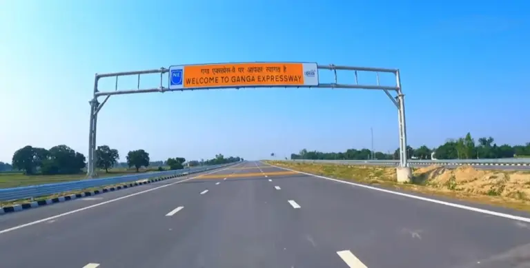
| Opened | 14 April 2026 | 16 November 2021 | 29 April 2026 |
| Signature feature | 12 km elevated wildlife corridor | 3.2 km airstrip near Sultanpur | 3.5 km airstrip in Shahjahanpur |
The Purvanchal Expressway note covers the state-built sibling; the Ganga Expressway gets its own note in this series.
How is the theme tested? Mains asks about the clash between infrastructure and ecology rather than about a single road. Mains 2026 GS Paper III asked: “Discuss how the contradiction between ‘rapid infrastructure development’ and ‘disaster-risk reduction’ in ecologically-sensitive areas of India can be managed, with suitable examples.” This corridor is one of the best recent examples to cite. Environment questions also carry real weight in the Prelims bank: 249 of the 1,403 questions from 2013 to 2026 come from Environment.
The judgment for your preparation is simple. Learn this road as a case, not a statistic. An answer that can say what the elevated corridor fixes, what compensatory afforestation can’t fix and what the first camera-trap data showed will stand out from one that only recites 213 km and 2.5 hours.
Frequently Asked Questions
When was the Delhi Dehradun Expressway opened?
Prime Minister Narendra Modi inaugurated the Delhi-Dehradun Economic Corridor on 14 April 2026 at a public function in Dehradun. Before that he visited the elevated wildlife section near Saharanpur. The foundation stone had been laid on 4 December 2021.
How long is the Delhi Dehradun Expressway?
The Prime Minister’s Office gave the length as 213 km at the opening in April 2026. Project papers from 2021 used 210 km, and a 2024 Bharatmala list gave 239 km for the wider corridor. For an answer, about 210 to 213 km is the safe figure.
What is the route of the Delhi Dehradun Expressway?
It starts at Akshardham in east Delhi, meets the Eastern Peripheral Expressway, runs on a new alignment through Baghpat, Shamli and Saharanpur districts, joins the Saharanpur bypass to Ganeshpur, and then climbs through the Shivalik forests to Dehradun. It covers Delhi, Uttar Pradesh and Uttarakhand.
Does the Delhi Dehradun Expressway pass through Rajaji National Park?
Not through its core. The last 20 km crosses reserve forests in Uttar Pradesh and Uttarakhand on the western side of the Rajaji forests and their protected belt. That’s why the stretch carries a 12 km elevated corridor and was monitored under court orders.
What is the elevated wildlife corridor on the expressway?
It’s a 12 km stretch where the road runs on a viaduct so that elephants, deer and other animals can cross underneath. It’s backed by eight animal passes, two 200 m elephant underpasses and a 370 m tunnel near the Daat Kali temple.
Is the Delhi Dehradun Expressway part of Bharatmala?
Yes. A February 2024 reply from the Ministry of Road Transport and Highways listed the Delhi-Saharanpur-Dehradun corridor among the greenfield access-controlled corridors under Bharatmala Pariyojana. It was built by the NHAI on EPC terms.
Is the wildlife corridor working?
Early evidence says animals are using it. A 40-day Wildlife Institute of India and NHAI study reported in April 2026 recorded 18 wild species and 60 elephant crossings. Elephants and spotted deer preferred quieter segments, so noise control will decide how well it works over the years.
Practice Questions
Prelims
1. Consider the following statements about the Delhi-Dehradun Economic Corridor: 1. It was built by the Uttar Pradesh Expressways Industrial Development Authority on a toll-based PPP model. 2. Its Ganeshpur-Dehradun section includes a 12 km elevated wildlife corridor. Which of the statements given above is/are correct?
- (a) 1 only
- (b) 2 only
- (c) Both 1 and 2
- (d) Neither 1 nor 2
Answer: (b) The NHAI built it in EPC mode; the 12 km elevated corridor is in the Ganeshpur-Dehradun section.
2. The Delhi-Dehradun Expressway passes through which of the following districts?
- (a) Meerut, Hapur and Bulandshahr
- (b) Baghpat, Shamli and Saharanpur
- (c) Aligarh, Mathura and Agra
- (d) Bijnor, Moradabad and Rampur
Answer: (b) The greenfield section runs through Baghpat, Shamli, Muzaffarnagar and Saharanpur districts.
3. Consider the following statements: 1. The Supreme Court’s order of 19 April 2022 placed the expressway’s monitoring committee under the Director General of Forests. 2. The National Green Tribunal quashed the forest clearance for the Ganeshpur-Dehradun section in 2021. Which of the statements given above is/are correct?
- (a) 1 only
- (b) 2 only
- (c) Both 1 and 2
- (d) Neither 1 nor 2
Answer: (a) The NGT upheld the clearance with conditions; the Supreme Court reconstituted the committee under the DG Forests.
4. The 370 m tunnel on the Delhi-Dehradun Expressway lies near which of the following?
- (a) Har Ki Pauri
- (b) Daat Kali temple
- (c) Mansa Devi temple
- (d) Neelkanth Mahadev temple
Answer: (b) The tunnel takes the road through the ridge near the Daat Kali temple at the Dehradun end.
5. Which of the following best describes an access-controlled expressway?
- (a) A road on which only government vehicles may travel
- (b) A road where vehicles can enter and exit only at designated interchanges
- (c) A road that charges a flat toll at a single plaza
- (d) A road with no speed limit
Answer: (b) Access control limits entry and exit to interchanges, which allows sustained high design speeds.
Mains
- Discuss how the contradiction between ‘rapid infrastructure development’ and ‘disaster-risk reduction’ in ecologically-sensitive areas of India can be managed, with suitable examples. (10 marks, 150 words) Previous year: Mains 2026, GS Paper III.
- Elevated wildlife corridors are often presented as a solution to the conflict between highways and forests. Examine their strengths and limits with reference to the Delhi-Dehradun Expressway. (15 marks, 250 words)
- Compensatory afforestation cannot replace an ecological corridor. Critically examine this statement in the context of linear infrastructure in the Shivalik region. (15 marks, 250 words)
- What role have the National Green Tribunal and the Supreme Court played in shaping mitigation measures for highway projects in forest areas? Illustrate with an example. (10 marks, 150 words)
- Access-controlled expressways are reshaping regional connectivity in north India. Discuss their economic benefits and the concerns they raise for land, farmers and wildlife. (15 marks, 250 words)
Tell Google you want more of this.
Add Anantam IAS as a preferred sourceOne tap, and this site shows up more often in your own Top Stories, AI Overviews and AI Mode. Remove it any time.