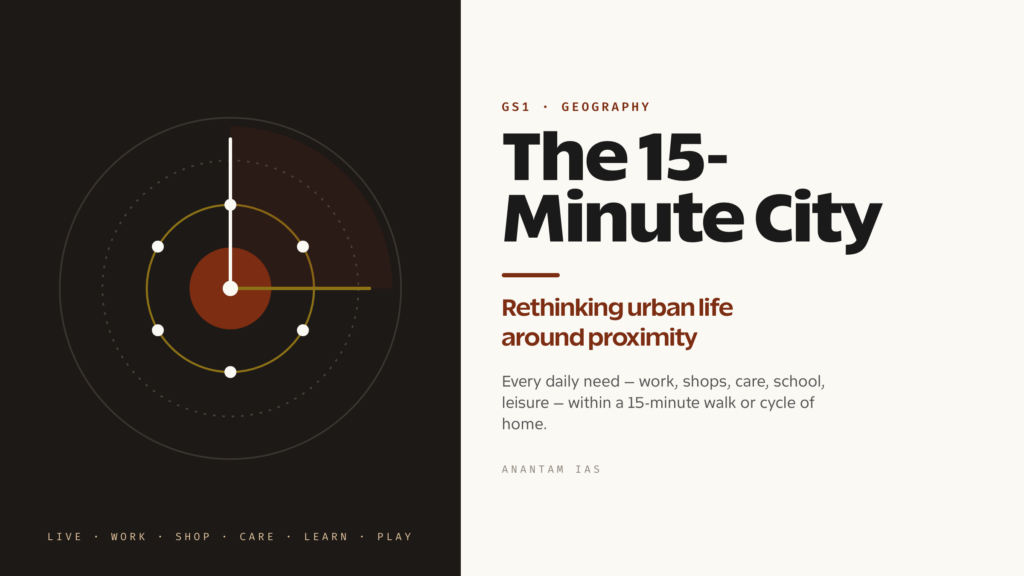
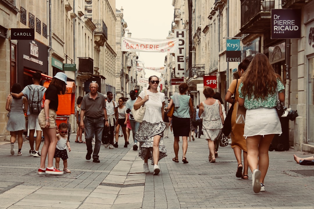
Walk out of your front door and start a stopwatch. In a quarter of an hour, on foot or on a cycle, what can you reach — a school, a clinic, a grocer, a park, your actual workplace? For most people in most modern cities the honest answer is “almost none of it”, because the twentieth century built cities for the car, slicing daily life into zones you can only stitch together by driving. The 15-minute city is the idea that flips this on its head. Coined by the Franco-Colombian urbanist Carlos Moreno in a 2016 piece for the French business magazine La Tribune, it argues that a good city is one where residents can meet most of their daily needs — living, working, shopping, health, education and leisure — within a 15-minute walk or bike ride of home.
It sounds almost too modest to be controversial, and yet in the past few years this small idea has become one of the most fought-over concepts in global urbanism. Paris rebuilt a re-election campaign around it, dozens of cities adopted local versions of it, and then a wave of conspiracy theorists decided it was a plot to lock people inside their neighbourhoods. For a UPSC aspirant, that arc is exactly what makes it valuable. The 15-minute city sits at the meeting point of urban geography, sustainable development, governance and even disinformation — a single concept you can deploy across GS1’s urbanisation themes, GS2’s governance and service-delivery debates, and GS3’s environment and infrastructure questions, provided you understand both why it excites planners and why it doesn’t transplant neatly onto a city like Patna or Pune.
What the 15-Minute City Actually Means
Strip away the slogan and the core claim is about time, not distance. Moreno calls his approach “chrono-urbanism” — planning a city around how people spend their hours rather than how their land is zoned. The argument is that the most precious, non-renewable thing a city can give back to its residents is time: the hours lost crawling through traffic to reach a job, a hospital or a school that planning had pushed far from where people live. So the 15-minute is a budget, not a boundary. Nobody is asked to stay inside a circle; the point is that the basics of a decent life should be close enough that you could reach them without a car if you wanted to.
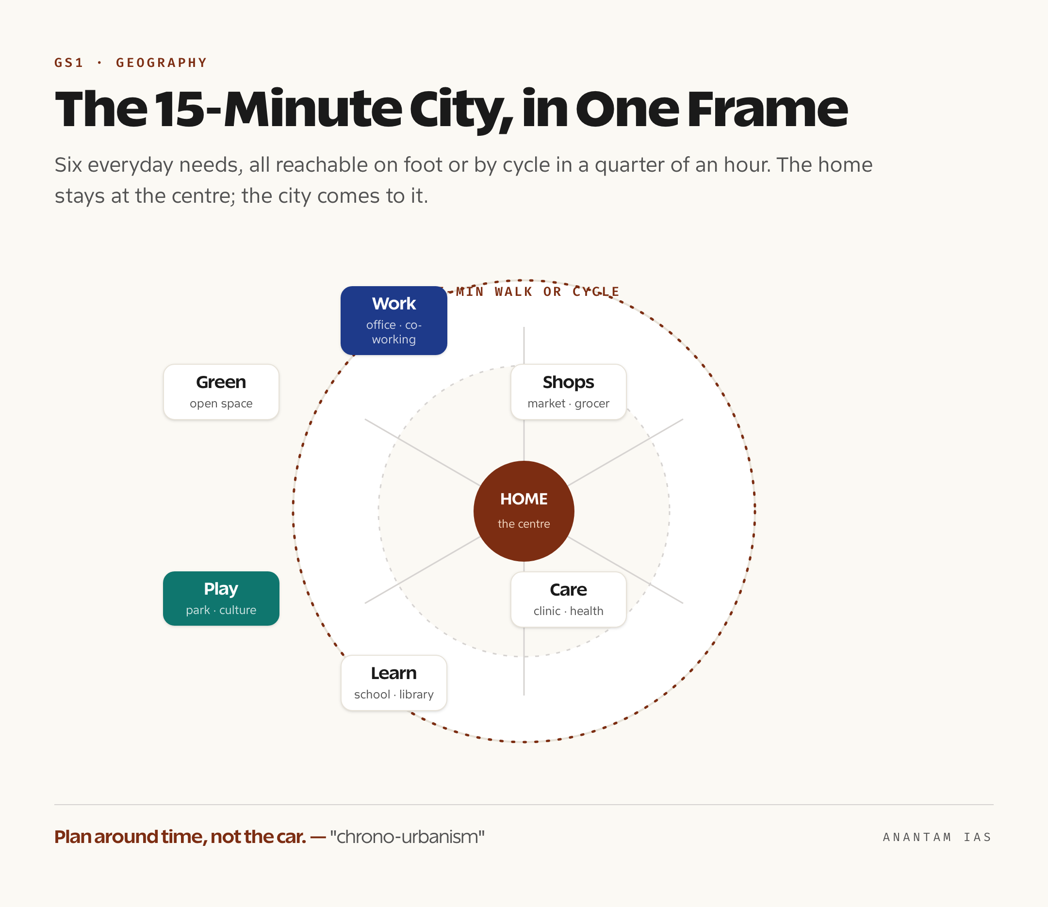
Moreno usually frames the city around six everyday social functions that should all sit within that short reach — dwelling, work, supplies (shops and food), care (health), education, and leisure or culture. A neighbourhood that bundles all six is doing the quiet work that car-dependent suburbs outsource to the road network. And because not every settlement is dense enough for a 15-minute walk to cover all of that, the concept stretches gracefully: planners often talk about a “30-minute territory” for lower-density towns, where the same logic applies but the radius is drawn around walking plus a quick bus or tram ride. The unit is the human body and the clock, not the car and the kilometre.
This is also why the idea is best understood as a target that reorganises existing planning tools rather than a brand-new technology. Mixed land use, walkable streets, local high streets, neighbourhood parks, schools within pram-pushing distance — none of this is new. What Moreno did was give planners a single, memorable yardstick to test any proposal against: does this decision bring daily life closer, or push it further away? That testability is a large part of why mayors found it so easy to adopt.
The Four Pillars and the Promised Benefits
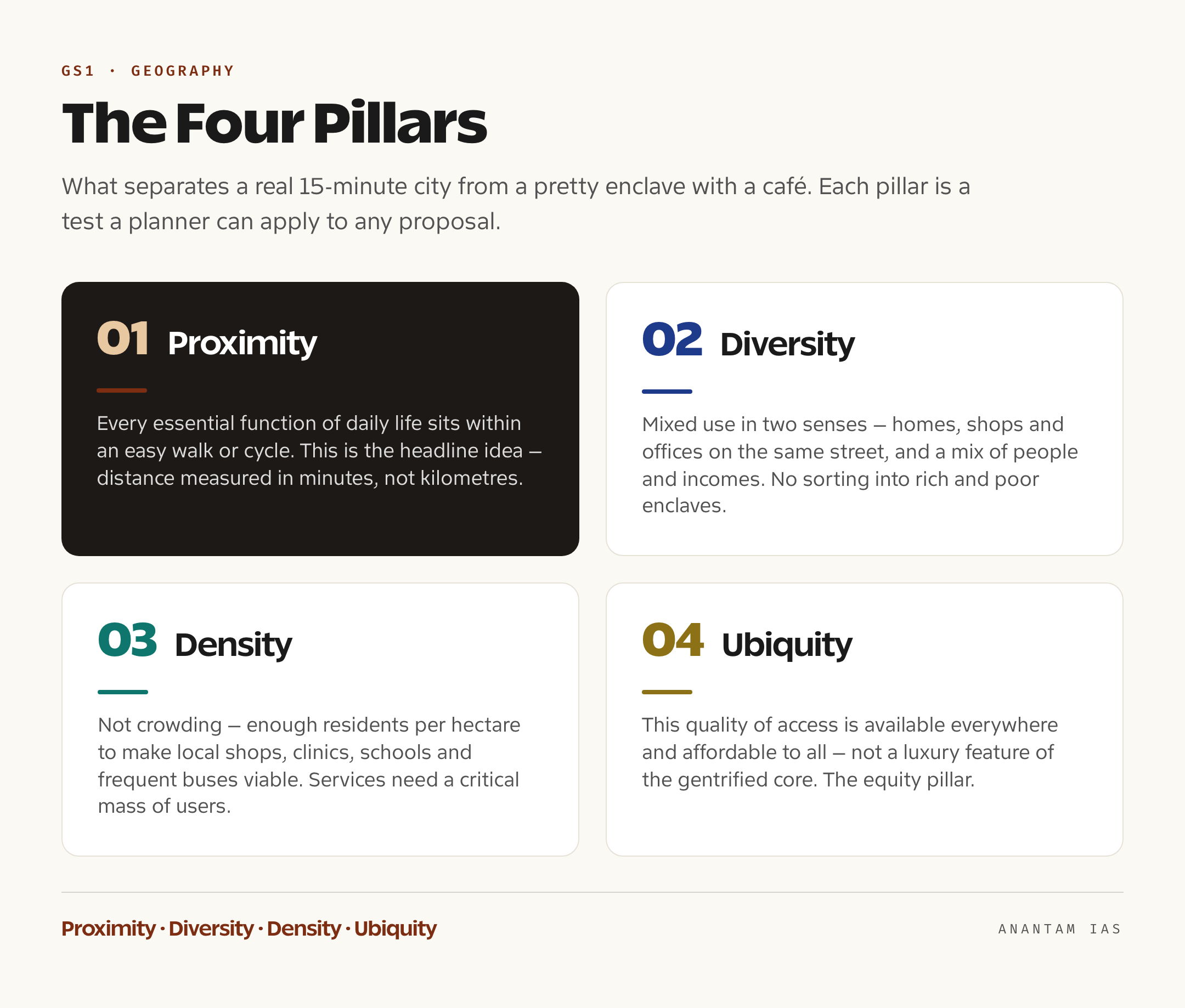
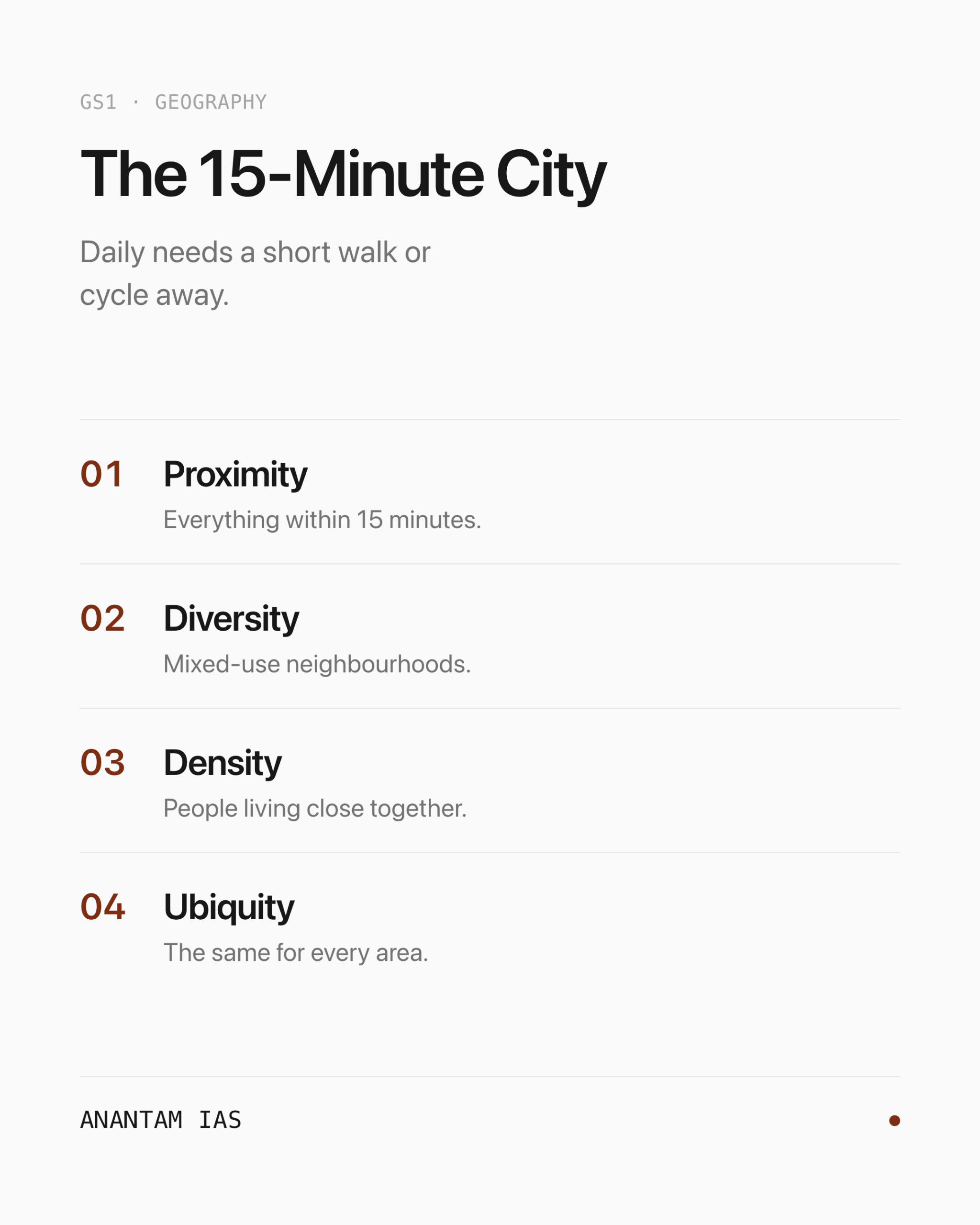
Planners formalise the concept through four pillars, and an examiner who can name and explain them has the spine of any answer. The first is proximity — placing the essential functions of daily life within easy walking or cycling reach, which is the headline idea itself. The second is diversity, meaning mixed use in two senses: a mix of functions on the same street (homes above shops above offices) and a mix of people and incomes, so neighbourhoods are socially varied rather than sorted into rich and poor enclaves. The third is density — not crowding, but enough people per hectare to make local shops, clinics, schools and frequent buses commercially and practically viable, because services need a critical mass of users to survive. The fourth is ubiquity, the insistence that this quality of access is available everywhere across the city and affordable to all, not just a luxury feature of the gentrified core. Proximity, diversity, density, ubiquity: the four together are what separate a genuine 15-minute city from a wealthy enclave that happens to have a nice café.
The benefits flow directly from the design. The biggest is environmental: if daily trips shrink to a walk or a cycle, car use falls, and with it the carbon emissions and air pollution that road transport pours into urban air. The C40 group of climate-focused mayors, which has championed the model, treats it as a frontline tool for cutting transport emissions precisely because the cleanest trip is the one short enough not to need an engine. Health gains come bundled in: more walking and cycling means more daily physical activity, less time breathing exhaust, and fewer road deaths. The local economy benefits too, as spending that would have leaked to distant malls and big-box retailers stays with the corner shop, the neighbourhood clinic and the local market — the small businesses that a 15-minute city is built around.
Two softer benefits matter just as much in an answer. One is livability and reclaimed time — the chrono-urbanism payoff — where hours once burned in commuting are returned to family, rest or local life. The other is social cohesion: when people live, work and relax in the same few streets, they bump into the same faces, use the same parks, and a neighbourhood becomes a community rather than a dormitory. That mix-of-people pillar is what gives the model an equity argument, at least in theory — a city where a good school and a decent clinic sit within walking distance of every home is a fairer city than one where access depends on owning a car. As the C40 network frames it, the 15-minute vision is as much about justice and quality of life as it is about carbon.
From Paris to Bogotá: Who Is Actually Building It
The concept left the seminar room because one big city ran with it. In Paris, Mayor Anne Hidalgo made la ville du quart d’heure a centrepiece of her 2020 re-election campaign and then governed by it — adding protected cycle lanes on streets and bridges across the city, opening school playgrounds as evening parks to plug gaps in green space, pushing co-working hubs into residential districts, and steadily reclaiming road and parking space for people on foot. Paris became the proof of concept: a dense, historic city visibly remaking itself around proximity, and a template other mayors could point to.
What is striking is how many cities arrived at the same destination under their own names. Melbourne built its planning strategy around “20-minute neighbourhoods”, a slightly looser version tuned to a more spread-out Australian city. Barcelona pursued its superilles, or superblocks — grouping nine city blocks and pushing through-traffic to the edges so the interior streets become walkable, plantable public space, with the city’s own estimates suggesting a full rollout could prevent hundreds of premature deaths a year from cleaner air and fewer crashes. Bogotá folded the idea into its land-management plan as barrios vitales, “vital neighbourhoods” knitted together by green corridors. Buenos Aires speaks of a “human-scale city”, Portland of “complete neighbourhoods”. The label changes; the underlying move — bring daily life closer, design for the pedestrian first — does not. The timing helped too: when the C40 group published a “build back better” framework in 2020, it held up post-pandemic proximity plans in Milan, Madrid, Edinburgh and Seattle as exactly the kind of recovery cities should pursue.
But the same period produced a backlash that every aspirant should be able to narrate, because it is a clean case study in how good policy can be hijacked by disinformation. From early 2023, the 15-minute city got swept into a conspiracy theory — the claim that it was a stalking horse for “climate lockdowns”, a scheme to confine citizens to their districts, ban their cars and strip their freedoms. In Oxford, where the council had introduced ordinary traffic filters to cut congestion, roughly 2,000 demonstrators marched, with placards branding 15-minute cities as “ghettos” and “tyranny”. The theory spread through a loose alliance of anti-lockdown activists, climate deniers and the far right, conflating a voluntary planning ideal — you can reach things nearby — with a coercive control — you may not leave. The factual answer is simple: the concept adds choices, it does not remove them, and no 15-minute-city plan anywhere bars anyone from travelling. That distinction, between proximity offered and movement forbidden, is the heart of any sensible discussion of it.
The Genuine Critiques and the India Angle
Set the conspiracy aside, because there are serious critiques that do deserve marks. The sharpest is gentrification. Make a neighbourhood genuinely walkable, green and well-served, and you also make it more desirable — which pushes up rents and property prices and can quietly displace the very low-income residents the equity argument was meant to protect. Evidence from several European and American cases shows that improving local access, without also building enough affordable housing, can accelerate classic gentrification and turn a fairness tool into an exclusion tool. The second critique is applicability: the model was conceived in dense, historic, relatively wealthy European cities, and it fits awkwardly onto sprawling, car-built American suburbs or onto poor, fast-growing cities where the constraint isn’t the design of streets but the basic shortage of jobs, services and money.
That second critique is where India gets interesting, because the relationship is genuinely two-sided. On one hand, India’s older cities are, in form, already 15-minute cities — and arguably the originals. The dense, mixed-use cores of Jaipur, Varanasi or any bazaar town, where homes sit above shops, the temple, the school and the clinic are a few lanes away, and an informal economy of street vendors puts food and supplies within minutes, look exactly like what European planners are now trying to retrofit. India’s own town-planning tradition, from the Town Planning Schemes of Gujarat to the compact layouts of historic quarters, embedded proximity long before it had a hashtag. India’s challenge is the opposite of Europe’s: not how to create density and mixed use, which it has in abundance, but how to keep them as the city grows, instead of letting car-centric ring roads, gated enclaves and zoned satellite townships pull life apart.
On the other hand, the harder Indian truth is that proximity is not the same as opportunity. As an Observer Research Foundation analysis put it, in Indian cities proximity often masks profound inequalities in quality and reliability. A clinic may be 15 minutes away but understaffed; a government school may be next door but lack basic facilities; nearly 43% of Indian cities still lack universally accessible footpaths, so the “walk” the model assumes is often unsafe or simply absent. Worse, the model’s core promise — work within 15 minutes — collides with the structure of the Indian job market, where employment clusters in a few corridors like Gurugram, Bengaluru’s Whitefield or Mumbai’s BKC, forcing average one-way commutes that stretch towards an hour. You can put a park and a kirana store nearby; you cannot put a salaried job there by zoning alone. So the honest Indian framing is that the country needs proximity with quality and opportunity, not proximity for its own sake.
This is exactly why the concept connects to India’s live urban-policy machinery rather than floating free of it. The right vehicle is transit-oriented development (TOD) — concentrating dense, mixed-use, walkable neighbourhoods within roughly 400 to 800 metres of metro and bus stations — which marries the 15-minute idea of local living to the reality that Indian workers must still reach jobs across a large metropolis. The Smart Cities Mission and AMRUT (the Atal Mission for Rejuvenation and Urban Transformation) already fund the raw materials — footpaths, public transport, parks, water and sanitation — and the lesson urbanists draw is that this money should flow to the walkable public realm and neighbourhood amenities, not only to digital command-centre dashboards. India’s deeper push to govern its cities well, from urban master-planning reform to better municipal finance, is the precondition for any of this to hold; the broader story of how the country is managing its great urban transition is covered in our explainer on urbanisation in India. The 15-minute city, used carefully, is less a foreign import for India than a reminder of what its own cities already knew — and a warning about what they stand to lose.
For Your Mains Answer
This is a flexible, high-value topic that spans papers. It sits most naturally in GS Paper 1 under urbanisation — the problems of growing cities, their character, and remedies — and in GS Paper 2 under governance and the delivery of services, since the concept is really a service-access and equity question. It also feeds GS Paper 3 on environment, sustainable development and infrastructure, because the headline benefit is lower transport emissions. And it is a ready-made example for Essay themes on sustainability, inequality, technology versus humane planning, or “the city of the future”. The skill examiners reward is the one this article uses: define the concept crisply, give it a real-world spine of examples, then localise it honestly to India rather than praising it uncritically.
How to Build the Answer
Open by defining the 15-minute city in one line — daily needs within a 15-minute walk or cycle — and credit Carlos Moreno and the chrono-urbanism idea of planning around time. Then move through a clear chain: the four pillars (proximity, diversity, density, ubiquity), the benefits (emissions, health, local economy, time, cohesion), real adoption (Paris, Melbourne, Barcelona, Bogotá), the critiques (gentrification and limited applicability, plus a one-line dismissal of the climate-lockdown conspiracy), and finally the India angle (already-compact cores, the proximity-versus-opportunity gap, and TOD plus Smart Cities and AMRUT as the delivery vehicles). Close with a balanced verdict. That arc — define, pillars, benefits, examples, critiques, India, judge — fits almost any version of the question.
Common Mistakes to Avoid
Don’t treat it as a Western novelty to be admired; India’s bazaar towns are arguably the original 15-minute cities, and saying so signals depth. Don’t ignore the dark side — an answer that only lists benefits looks naive, so name gentrification and the exclusion risk. Don’t confuse proximity with quality or opportunity; the strongest Indian point is that a nearby school or job that is understaffed or non-existent defeats the model. And don’t dignify the conspiracy theory with more than a sentence — note it, debunk it (it adds choices, never removes the freedom to travel), and move on.
A Compact Answer Spine
15-minute city = daily needs (live, work, shop, health, education, leisure) within a 15-min walk/cycle; Carlos Moreno, 2016, “chrono-urbanism” → four pillars: proximity, diversity (mixed use), density, ubiquity → benefits: lower emissions/car use, health, local economy, reclaimed time, social cohesion → adoption: Paris (Hidalgo), Melbourne’s 20-minute neighbourhoods, Barcelona superblocks, Bogotá → critiques: gentrification, poor fit for sprawl/poor cities; the climate-lockdown claim is a debunked conspiracy → India: cores already compact and mixed-use, but “proximity without opportunity” (jobs cluster in corridors, services uneven, 43% of cities lack safe footpaths); deliver via transit-oriented development + Smart Cities Mission + AMRUT → verdict: a humane target, but India needs proximity with quality and opportunity.
Diagram or Flowchart Idea
Draw a simple home at the centre of a circle, with six labelled spokes — work, shops, health, school, leisure, green space — each tagged “≤15 min walk/cycle”, and write the four pillars (proximity, diversity, density, ubiquity) along the rim. A small second panel can show an arrow from “proximity” to “proximity + opportunity” to make the India point. This single visual carries the whole concept and is quick to sketch under time pressure.
A Balanced-Conclusion Line
A line that lands the marks: “The 15-minute city is less a blueprint to import than a yardstick to apply — for India, whose older cities were proximate by design, the task is not to invent closeness but to defend it as cities sprawl, and to make sure that what lies within 15 minutes is not just present but genuinely good and open to all.”
How to Use Data Without Cramming
You need only a handful of anchors: the 2016 origin and Moreno’s name; the four pillar-words in order; one or two adopter cities (Paris, Barcelona); the roughly hour-long average Indian commute that exposes the jobs gap; and the figure that nearly 43% of Indian cities lack universally accessible footpaths. Attribute them plainly in prose — “as an Observer Research Foundation analysis noted” — rather than scattering numbers loose.
Frequently Asked Questions
What is the 15-minute city in one sentence?
It is the planning idea, coined by urbanist Carlos Moreno in 2016, that a good city lets residents meet most daily needs — living, working, shopping, healthcare, education and leisure — within a 15-minute walk or bike ride of home, so the city is organised around people’s time rather than around the car. Moreno calls this time-focused approach “chrono-urbanism”.
What are the four pillars of the 15-minute city?
Proximity (essential functions within easy walking or cycling reach), diversity (mixed land use and a social mix of people and incomes), density (enough residents to make local shops, schools, clinics and frequent transit viable), and ubiquity (this quality of access available everywhere and affordable to all, not just in wealthy districts). Together they turn a slogan into a planning checklist.
Why did the 15-minute city become a conspiracy theory?
From early 2023 it was swept into a “climate lockdown” conspiracy claiming it was a scheme to confine people to their districts and ban their cars — fuelling protests such as the roughly 2,000-strong march in Oxford against ordinary traffic filters. The claim is false: the model adds the choice to reach things nearby and removes no one’s freedom to travel. It is a useful example of how sound urban policy can be distorted by disinformation.
Does the 15-minute city apply to India?
Partly, and in a revealing way. India’s older, dense, mixed-use city cores are arguably the original 15-minute cities, so the form already exists. But the Indian challenge is “proximity without opportunity” — jobs cluster in a few corridors, public services nearby are often poor or overstretched, and nearly 43% of cities lack safe footpaths. The realistic route is transit-oriented development plus channelling Smart Cities Mission and AMRUT funds into the walkable public realm, aiming for proximity with quality and opportunity.
Practice Questions
Prelims MCQs
- The concept of the “15-minute city” is most closely associated with which of the following?
(a) The idea that all citizens must remain within their district
(b) Planning a city so that daily needs are reachable within a 15-minute walk or cycle
(c) A limit on the speed of urban vehicular traffic
(d) A digital surveillance framework for smart cities
Answer: (b) Coined by Carlos Moreno in 2016, it organises the city so essentials like work, shops, health, education and leisure sit within a short walk or bike ride of home. - Which of the following correctly lists the four pillars of the 15-minute city?
(a) Proximity, diversity, density and ubiquity
(b) Proximity, mobility, technology and finance
(c) Density, surveillance, zoning and connectivity
(d) Walkability, electrification, taxation and housing
Answer: (a) The four pillars are proximity, diversity (mixed use), density, and ubiquity (access available everywhere and affordable to all). - The term “chrono-urbanism”, linked to the 15-minute city, refers to which idea?
(a) Planning cities around the history of their monuments
(b) Synchronising all city clocks for efficiency
(c) Designing a city around how residents spend their time rather than how land is zoned
(d) Limiting construction to fixed time windows
Answer: (c) Carlos Moreno uses “chrono-urbanism” to describe planning that returns time to residents by reducing the hours lost to travel. - Which of these is a recognised real-world adaptation of the 15-minute-city idea?
(a) Melbourne’s “20-minute neighbourhoods”
(b) Barcelona’s “superblocks”
(c) Bogotá’s “vital neighbourhoods”
(d) All of the above
Answer: (d) Cities adopt the same proximity principle under different names — Melbourne’s 20-minute neighbourhoods, Barcelona’s superblocks and Bogotá’s barrios vitales among them. - In the Indian context, the critique “proximity without opportunity” mainly highlights which problem?
(a) That Indian cities are too spread out to be walkable
(b) That nearby services and jobs are often poor in quality or absent, even where physical proximity exists
(c) That India lacks any mixed-use neighbourhoods
(d) That metro systems make walking unnecessary
Answer: (b) Indian cores are already compact and mixed-use, but nearby schools, clinics and jobs are frequently understaffed, unreliable or clustered far away, so closeness alone does not deliver opportunity.
Mains Practice Questions
- Explain the concept of the “15-minute city” and its four pillars. Critically examine its relevance for India’s rapidly urbanising cities. (15 marks, 250 words)
- “India’s older cities were 15-minute cities long before the term existed; the challenge is to preserve proximity as they grow.” Discuss, with reference to mixed-use planning and transit-oriented development. (15 marks, 250 words)
- The 15-minute city promises lower emissions, better health and stronger local economies, yet it has drawn both serious critiques and baseless conspiracy theories. Distinguish between the two and assess the genuine limitations of the model. (15 marks, 250 words)
- “In Indian cities, proximity often masks profound inequalities in quality and reliability.” In light of this, evaluate how schemes such as the Smart Cities Mission and AMRUT can advance proximity-based planning. (10 marks, 150 words)
- Sustainable urban mobility requires reducing the need to travel, not just easing the act of travelling. Examine this proposition in the context of the 15-minute city and India’s transit-oriented development policy. (15 marks, 250 words)
Tell Google you want more of this.
Add Anantam IAS as a preferred sourceOne tap, and this site shows up more often in your own Top Stories, AI Overviews and AI Mode. Remove it any time.