Ask most aspirants which is the most densely populated state in India and you’ll hear “Uttar Pradesh” or “Delhi” more often than the right answer. It’s an easy trap. UP has the most people, so surely it’s the most crowded? And Delhi feels packed, so it must top the list? Both instincts miss the same distinction: total population is not the same as population density, and density is what examiners actually ask about. Get the difference straight and one clean fact falls out that trips up almost everyone. So let’s build it from the ground up, from what density counts to which state wins and why.
What population density actually means
Population density is the number of people living per unit of land area, and in India it’s measured in persons per square kilometre. That’s the whole definition. Take the population of a place, divide it by its area in square kilometres, and you get how tightly packed the people are.
Here’s the tiny worked example that makes it stick. Uttar Pradesh had about 19.98 crore people in the 2011 Census, the most of any state. But it also covers a huge area, roughly 240,928 square kilometres. Divide one by the other and UP’s density comes to about 829 persons per sq km. Now take Bihar: fewer people at 10.4 crore, but crammed into a much smaller 94,163 square kilometres. That gives 1,106 persons per sq km. So Bihar, with barely half of UP’s population, is far more densely settled. That’s the gap between “how many” and “how crowded.”
The reason this matters is that density, not raw headcount, tells you how hard the land is working. A state can be the largest by population and still have room to breathe, while a smaller state can be under real pressure on its soil, water, and services. When you read that India’s average density is 382 persons per sq km as of the 2011 Census, up from 325 in 2001, that single number is telling you the country as a whole got more crowded by 57 persons per sq km in a decade.
One more thing to fix before we go further. All the state-level figures serious answers use come from the Census of India, 2011, conducted by the Office of the Registrar General and Census Commissioner under the Ministry of Home Affairs. That’s the last completed census. The decadal census due in 2021 was postponed, so 2011 remains the authoritative source. We’ll come back to what that means for your notes at the end.
How population density is calculated
The formula is deliberately simple: population density equals total population divided by total land area. If a state has 10 crore people and an area of 1 lakh square kilometres, its density is 1,000 persons per sq km. No weighting, no adjustment, just people over land.
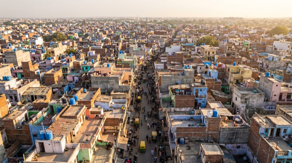
But here’s the smart objection an alert reader raises. If it’s only people divided by land, why does Delhi feel so much denser than Bihar even though both are “crowded”? Because the answer depends entirely on how you draw the boundary. Delhi is essentially one large city with almost no rural hinterland, so nearly every square kilometre is urban. Bihar spreads its 10 crore people across thousands of villages, so its density is high but its landscape is mostly fields, not high-rises.
This is why geographers distinguish arithmetic density, the plain people-over-area figure the Census reports, from physiological density, which divides population only by the arable or habitable land. India’s arithmetic density looks manageable at 382, but a large share of the land is mountain, desert, or forest where few people can live. The Census uses arithmetic density because it’s clean and comparable, and that’s the number you should quote unless a question specifically asks about cultivable land.
The measurement also hides internal variation. A state’s single density figure is an average, so it flattens the difference between a packed district capital and an empty upland block. Bihar’s own districts range from the extraordinarily crowded to the merely dense, and the state number is just the midpoint of that spread. Keep that in mind whenever you cite one figure for an entire state.
Which state has the highest population density
Bihar is the most densely populated state in India, with 1,106 persons per square kilometre as per the Census of India, 2011. That’s the headline fact, and it’s the one worth locking in cold, because the common guesses of Uttar Pradesh or Maharashtra are both wrong.
West Bengal comes second among the states at 1,028 persons per sq km, close behind Bihar and for similar reasons. Then there’s a real gap before Kerala at 860 and Uttar Pradesh at 829. Notice how UP, the population giant, sits only fourth on density. That’s the whole point of the distinction we started with.
| Rank (states) | State | Density (persons/sq km, 2011) |
|---|---|---|
| 1 | Bihar | 1,106 |
| 2 | West Bengal | 1,028 |
| 3 | Kerala | 860 |
| 4 | Uttar Pradesh | 829 |
| 5 | Haryana | 573 |
| 6 | Tamil Nadu | 555 |
| 7 | Punjab | 551 |
There’s a subtlety worth flagging so you don’t get caught out. This ranking counts full states only. If the question opens up to Union Territories as well, the answer changes completely, and that catch is exactly where a hurried candidate loses a mark. We’ll handle the UTs next, because that’s where the truly extreme densities live.
The densest region overall is not a state at all
The most densely populated region in India is the National Capital Territory of Delhi, at about 11,320 persons per square kilometre, roughly ten times Bihar’s figure. Delhi is a Union Territory with legislature, not a full state, which is why it doesn’t appear in the states table above, but if a question asks for the densest part of India without restriction, Delhi is the answer.
Why the gulf? Because Delhi is almost entirely urban. It packed 1.67 crore people into just 1,483 square kilometres in 2011, with practically no rural land to dilute the average. Compare that to a state, which always carries thousands of square kilometres of low-density countryside.
| Rank (all States/UTs) | State/UT | Density (persons/sq km, 2011) |
|---|---|---|
| 1 | NCT of Delhi | 11,320 |
| 2 | Chandigarh | 9,258 |
| 3 | Puducherry | 2,547 |
| 4 | Daman and Diu | 2,169 |
| 5 | Lakshadweep | 2,013 |
So the precise, exam-safe formulation is a two-parter you should be able to recite: Delhi is the densest Union Territory and the densest region overall, while Bihar is the densest full state. State that way and you’ve covered both versions of the question in one breath. The smaller UTs like Chandigarh and Puducherry post very high densities for the same reason as Delhi, they’re essentially cities administered as territories, with little empty land.
The least densely populated: the other end of the scale
Arunachal Pradesh is the least densely populated state in India, with just 17 persons per square kilometre. Hold that next to Bihar’s 1,106 and the range across Indian states becomes vivid: the most crowded state is about 65 times denser than the emptiest.
The reason is geography doing exactly what you’d expect. Arunachal Pradesh is a large Himalayan state of steep mountains, dense forest, and thin valley settlement, so a big area holds few people. The same logic governs the rest of the bottom of the table, which is almost entirely the northeastern and Himalayan states.
| Least dense states | Density (persons/sq km, 2011) |
|---|---|
| Arunachal Pradesh | 17 |
| Mizoram | 52 |
| Sikkim | 86 |
| Nagaland | 119 |
| Manipur | 128 |
If the question includes Union Territories, the least dense is the Andaman and Nicobar Islands at 46 persons per sq km, a scatter of islands where most of the land is forested and protected. So the mirror of the Delhi-Bihar pair is an Arunachal-Andaman pair at the empty end, mountains and islands both keeping people spread thin.
Why Bihar and the Gangetic plains are so crowded
Bihar’s density comes down to one dominant factor: it sits on the fertile alluvial plain of the Ganga, some of the most productive farmland on earth, which has drawn and held dense human settlement for thousands of years. Rich soil supports intensive agriculture, intensive agriculture supports many people per acre, and many people per acre is exactly what density measures.
Look at the top of the states table again and the pattern is unmistakable. Bihar, West Bengal, and Uttar Pradesh all lie across the Indo-Gangetic plain, the flat, well-watered belt fed by the Ganga and its tributaries. Flat land is easy to farm and easy to build on, perennial rivers guarantee water, and the region has been continuously settled since ancient times, so the population had centuries to accumulate. Geography set the table, and history filled the seats.
There’s a second driver stacked on top of the first: fertility. Bihar has long recorded one of India’s highest total fertility rates, well above the replacement level, which means the population keeps growing quickly even within a fixed area. Combine a high birth rate with limited land and slower urban out-migration than states like Maharashtra, and density climbs. Kerala shows the reverse logic and proves the rule. It’s densely settled because of a narrow habitable coastal strip and historically dispersed but continuous rural settlement, yet its fertility has fallen below replacement, so its density is high but no longer rising fast.
Contrast all of this with the empty states and the causes line up neatly. The Himalayan and northeastern states have little flat, farmable land, harsher terrain, and smaller historical populations, so they stay sparse. Density, in the end, is mostly a story about how much of the land people can actually use.
Why population density matters for policy
Density is not a trivia figure, it’s a planning variable that shapes real decisions across governance. Representation is the clearest example. The number of Lok Sabha seats a state holds is tied to its population, and the redrawing of constituency boundaries by the Delimitation Commission depends directly on where people are concentrated. States that grew fastest, many of them dense northern states, stand to gain seats whenever delimitation is next carried out, which is why the subject is politically charged.
Density also drives resource allocation and per-capita pressure. A dense state has more people competing for the same water, farmland, schools, hospitals, and jobs, so per-person availability of everything from groundwater to teacher time is squeezed. That feeds into everything from central transfers under the Finance Commission to the design of welfare schemes. High density can be an asset too. A large, concentrated workforce is exactly what an economy needs to reap a demographic dividend, provided the jobs and skilling keep pace.
For urban planning, density is the master input. Where people cluster tightly, as in Delhi or Chandigarh, planners must think vertically, invest heavily in public transport, and manage sanitation and housing at a scale that low-density regions never face. A congested city and an empty hill district need almost opposite policies, and the density figure is the first thing that tells an administrator which problem they’re dealing with. So when you cite Bihar at 1,106 or Delhi at 11,320, you’re not reciting a number, you’re naming a specific governance challenge.
How to study and remember these figures
Anchor the whole topic on four numbers and one distinction, and the rest follows. The four numbers: India’s average density is 382, Bihar leads the states at 1,106, Delhi leads all regions at 11,320, and Arunachal Pradesh is lowest among states at 17. The one distinction: total population versus density, which is the single most tested idea here and the reason UP is a wrong answer to a density question.
For revision, tie each fact to its cause rather than memorising it flat. Bihar is dense because of the fertile Gangetic plain and high fertility. Delhi is dense because it’s all city and no countryside. Arunachal is empty because it’s all mountain. Cause-linked facts survive exam pressure far better than bare figures, and they let you write an explanation instead of just an answer. You can cross-reference the underlying data in our note on the Census of India and place the growth angle within India’s population policy and its demographic dividend.
One honest caveat to carry into the exam. Every figure here is from the 2011 Census, now over a decade old. The postponed next census will revise all of it, and dense states have almost certainly grown denser since. Quote 2011 as your source, note that it’s the latest available, and you’ve shown the examiner you know exactly how current your data is, which is worth as much as the number itself.
Frequently Asked Questions
Which is the most densely populated state in India?
Bihar, with 1,106 persons per square kilometre as per the Census of India, 2011. West Bengal is second at 1,028 and Kerala third at 860. Note that this counts full states only; if Union Territories are included, Delhi is far denser.
Which is the most densely populated region in India overall?
The National Capital Territory of Delhi, at about 11,320 persons per sq km, roughly ten times Bihar’s figure. Delhi is a Union Territory with legislature, not a full state, and it’s densest because it’s almost entirely urban with little rural land.
Why is Bihar the most densely populated state?
Bihar sits on the fertile alluvial plain of the Ganga, which supports intensive agriculture and has drawn dense settlement for millennia. It also has one of India’s highest fertility rates, so its population keeps growing within a relatively small area.
Which state has the lowest population density in India?
Arunachal Pradesh, with just 17 persons per sq km, is the least densely populated state. Its steep Himalayan terrain and dense forest leave little land for settlement. Among Union Territories, the Andaman and Nicobar Islands are lowest at 46.
What is the population density of India?
India’s average population density is 382 persons per sq km as per the Census of India, 2011, up from 325 in 2001. This is arithmetic density, meaning total population divided by total land area.
How is population density calculated?
Divide the total population of an area by its land area in square kilometres. The Census reports arithmetic density. Geographers also use physiological density, which divides population only by arable or habitable land, giving a truer sense of pressure on usable ground.
Why is Uttar Pradesh not the most densely populated state despite having the most people?
Because density measures crowding, not headcount. UP has India’s largest population, about 19.98 crore, but it’s spread over a very large area, giving a density of 829 persons per sq km, lower than Bihar, West Bengal, and Kerala.
Practice Questions
1. Which is the most densely populated state in India as per the Census of India, 2011?
a) Uttar Pradesh
b) West Bengal
c) Bihar
d) Kerala
Answer: c) Bihar (1,106 persons per sq km)
2. Which region has the highest population density in India overall?
a) Bihar
b) NCT of Delhi
c) Chandigarh
d) Mumbai
Answer: b) NCT of Delhi (about 11,320 persons per sq km)
3. Which state has the lowest population density in India?
a) Sikkim
b) Mizoram
c) Nagaland
d) Arunachal Pradesh
Answer: d) Arunachal Pradesh (17 persons per sq km)
4. Population density in India is expressed as:
a) Persons per hectare
b) Persons per square kilometre
c) Persons per square mile
d) Households per square kilometre
Answer: b) Persons per square kilometre
5. What was India’s average population density as per the Census of India, 2011?
a) 325 persons per sq km
b) 382 persons per sq km
c) 411 persons per sq km
d) 267 persons per sq km
Answer: b) 382 persons per sq km
Mains-style questions
1. Distinguish between arithmetic density and physiological density of population, and explain why the two can give very different pictures of pressure on land in India.
2. Account for the high population density of the Indo-Gangetic plain with reference to physical geography, agriculture, and historical settlement.
3. “Population density, not total population, is the more meaningful variable for policy.” Examine this statement with reference to resource allocation and urban planning in India.
4. Discuss how uneven population distribution across Indian states affects political representation and the process of delimitation.
5. Analyse the geographical and demographic factors that keep the Himalayan and northeastern states among the least densely populated regions of India.
Density is one of those figures that looks like a fact to memorise and is really a diagnosis to read. Bihar at 1,106 isn’t just a number to beat West Bengal in a quiz; it’s shorthand for fertile land, deep history, and a young, fast-growing population pressing on limited ground. Learn the figures with their causes, keep the state-versus-region distinction sharp, and treat 2011 as the honest limit of your data, and you’ll handle any version of this question with room to spare.
Tell Google you want more of this.
Add Anantam IAS as a preferred sourceOne tap, and this site shows up more often in your own Top Stories, AI Overviews and AI Mode. Remove it any time.