Disclosure: this guide contains Amazon affiliate links. As an Amazon Associate, Anantam IAS earns from qualifying purchases — at no extra cost to you.
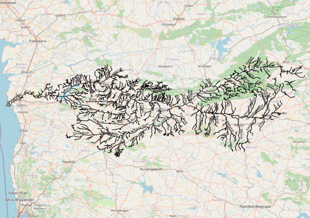
The Tapti River, also written Tapi, is one of the three major peninsular rivers that flow westward into the Arabian Sea. The other two are the Narmada to its north and the Mahi much further north in Gujarat. Stretching about 724 kilometres from its source at Multai in Madhya Pradesh to the Gulf of Khambhat near Surat, the Tapti drains a basin of roughly 65,000 square kilometres across central and western India and supports irrigation, urban water supply, and hydropower along its course.
What makes the Tapti unusual is its direction. Almost every other major Indian river flows east into the Bay of Bengal because the Peninsular Plateau gently tilts eastward. The Tapti, like the Narmada, runs the other way. It uses an old rift valley between two parallel ranges of the Satpura Mountain Range and squeezes through that trough until the Western Ghats let it through to the sea. That single fact, that the Tapti is a westward-flowing river running in a rift valley, is the most heavily examined point about it in UPSC prelims.
In this article we cover the Tapti River’s origin, course, tributaries, dams and reservoirs, ecological character, economic and cultural importance, and the comparative geography that ties it to the wider Peninsular drainage. The aim is to leave you with one clear mental map of the basin and a set of factual hooks that will hold up under any prelims or mains question.
Quick Facts About the Tapti River
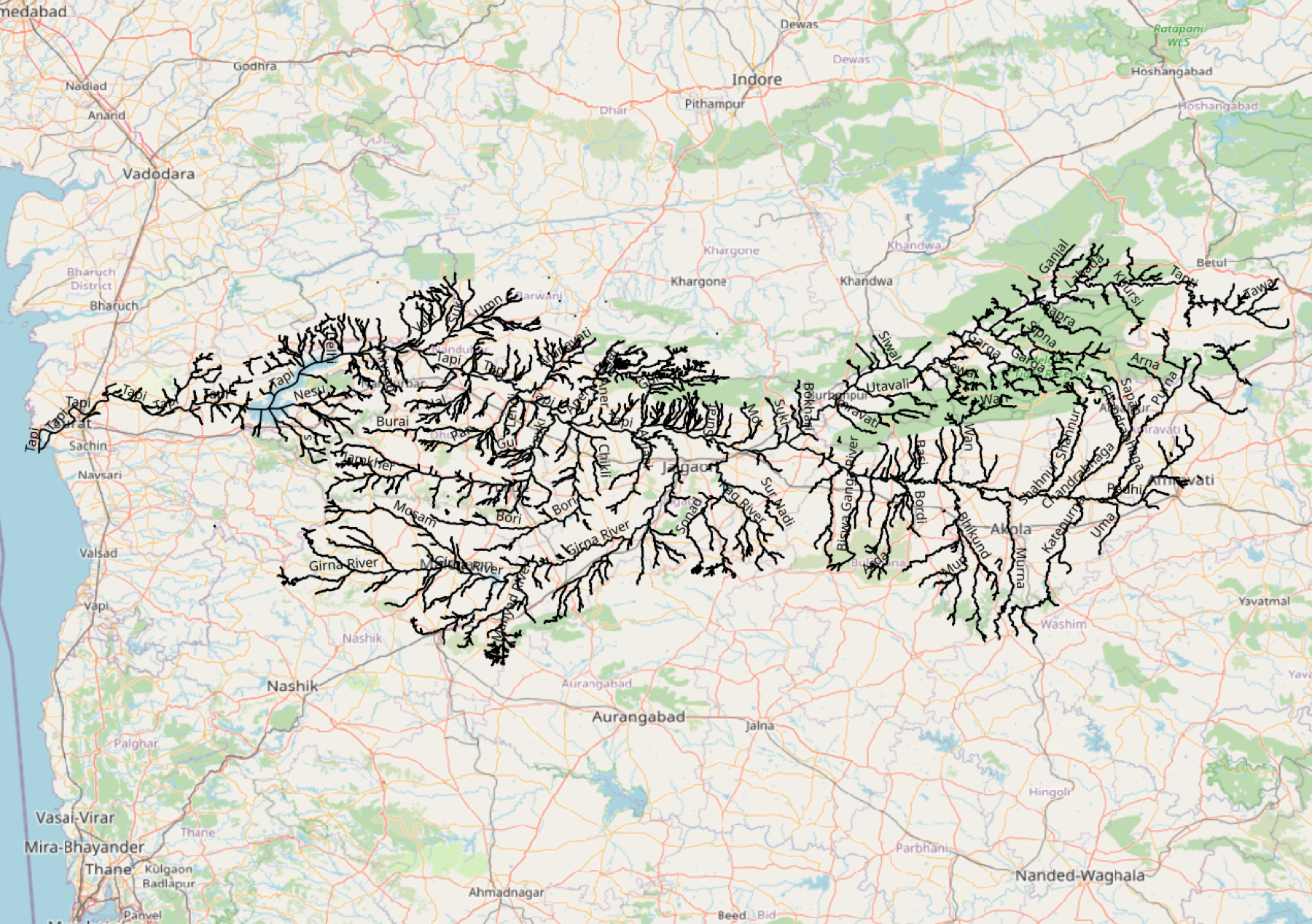
The Tapti River is a peninsular westward-flowing river. Its key vital statistics are worth memorising as a block.
- Total length: about 724 km
- Origin: Multai, Betul district, Madhya Pradesh
- Mouth: Gulf of Khambhat (Arabian Sea), near Surat in Gujarat
- States drained: Madhya Pradesh, Maharashtra, Gujarat
- Basin area: approximately 65,145 sq km
- Major tributaries: Purna, Girna, Panjhra, Waghur, Bori, Aner
- Major dams: Ukai (Gujarat), Hathnur (Maharashtra), Kakrapar (Gujarat)
- Major cities on its banks: Burhanpur, Bhusawal, Surat
- Direction of flow: west, into the Arabian Sea
- Drainage type: rift valley (graben) between two Satpura spurs
The Tapti is the second-longest westward-flowing river in India after the Narmada, which is about 1,312 km long.
Origin of the Tapti River at Multai
The Tapti rises at Multai in Betul district of Madhya Pradesh. The name Multai is a colloquial form of the Sanskrit Mool-Tapi, meaning the source of the Tapi. A small temple tank in the town is the traditional source, though the actual hydrological catchment of the headwaters extends across the surrounding Satpura plateau at an elevation of about 752 metres above sea level.
From Multai the young river flows southwest for the first stretch of its course, gradually picking up volume from monsoon-fed seasonal streams. The headwaters lie on the southern flank of the Satpura range, which is part of the older Gondwanan landmass and largely composed of Deccan Trap basalt. This basaltic terrain gives the upper Tapti its dark, sediment-heavy character during the monsoon months.
Hindu tradition treats the Tapti as a sacred river. It is referred to in the Puranas as the daughter of the Sun god, Surya. The name Tapi itself derives from Sanskrit “tap” meaning to heat. Pilgrims visit Multai on full-moon days, especially during the month of Kartik.
Course of the Tapti Through Three States
The Tapti’s course is conventionally divided into three reaches, one for each state it crosses. The river is wholly Indian and does not touch any international boundary.

Oxford Student Atlas for India — 7th Edition
- 160 pages, Oxford University Press, the current edition
- India-focused thematic maps: physical, political, rivers, climate, soils, vegetation, plus world maps
- Made for UPSC and state PSC map work; slim enough to stay open beside the textbook
In Madhya Pradesh the Tapti drains the southern Satpura uplands. It flows west and southwest, picking up small left-bank streams. The terrain is hilly and the river is largely seasonal in this reach. The town of Multai is the only major settlement in the upper basin.
In Maharashtra the river enters the Khandesh region and assumes its characteristic westward flow. It cuts through the rift valley between the Satpura Range to the north and the Ajanta and Satmala hills to the south. This is the longest and most productive reach of the Tapti. The towns of Burhanpur, in the upper Maharashtra section near the MP border, and Bhusawal, the railway junction city, sit on its banks. The Hathnur Dam, the major upstream reservoir of the Tapti, lies in this section.
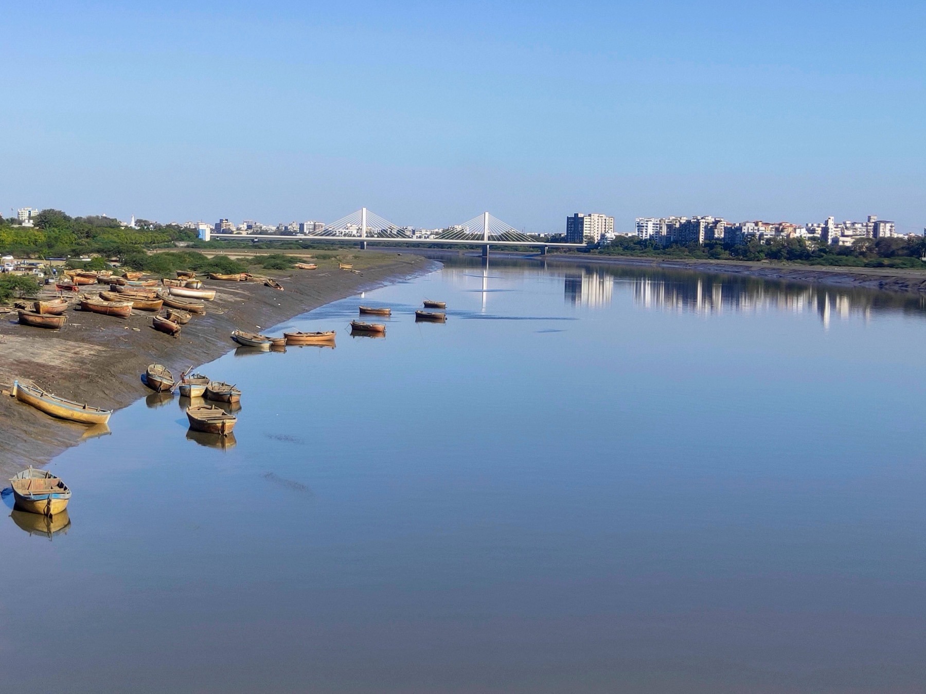
In Gujarat the river enters the western coastal lowland after crossing the Western Ghats through a series of rapids and gorges. The Ukai Dam, the largest reservoir on the Tapti, lies in this section. Below Ukai the river spreads out across the deltaic plain around Surat, one of India’s largest port cities, before emptying into the Gulf of Khambhat. The Tapti is tidal up to about thirty kilometres inland from its mouth.
The Tapti’s estuary is not a true delta. Like the Narmada it ends in a single drowned river mouth (an estuary), partly because the steep gradient of the rift valley does not allow much sediment to settle and partly because the strong tidal range of the Gulf of Khambhat sweeps sediment back out.
Tributaries of the Tapti River
The Tapti has both left-bank and right-bank tributaries, though the right-bank ones from the Satpura side are usually shorter and steeper. The single most important tributary is the Purna.
The Purna River rises in the Gawilgarh hills of the Satpura range in Maharashtra and joins the Tapti at Changdev in Jalgaon district. It is about 334 km long and drains a substantial part of Vidarbha. The Purna is the largest tributary of the Tapti by both length and discharge.
Other significant tributaries include:
- Girna, a right-bank tributary that drains the western Khandesh plateau
- Panjhra, a tributary that joins from the south in Dhule district
- Waghur, which joins near Bhusawal
- Bori, a tributary near Erandol
- Aner, a small right-bank tributary
Most of these are seasonal rivers that swell during the southwest monsoon and shrink to thin channels in the dry season. The Tapti basin receives a sharp monsoon rainfall from June to September, with the upper basin receiving about 600 to 800 millimetres a year and the lower basin near Surat receiving over 1,200 millimetres.
Why the Tapti Flows West: The Rift Valley Story
The single most important geomorphological fact about the Tapti River is that it occupies a rift valley, also called a graben. A graben is a block of crust that has dropped down between two parallel faults, leaving a flat trough between two upraised ridges.
In the Tapti’s case the two ridges are the main Satpura range to the north and the Ajanta-Satmala hills (a southern spur of the Satpura) to the south. The Tapti flows through the trough between them. The same mechanism explains the Narmada, which uses a parallel rift valley between the Vindhyas to the north and the main Satpura to the south.
Both rift valleys probably formed during the breakup of Gondwana between 150 and 65 million years ago, when the Indian plate broke away from the African and Antarctic plates and the central Indian crust stretched and faulted. The Deccan Trap basalt that covers most of the basin was laid down at the end of this period, around 65 million years ago, in a series of massive volcanic eruptions.
Because the Tapti and Narmada flow through fault-bounded valleys rather than carving their own channels across the Peninsular tilt, they go west when every nearby river goes east. The Peninsular Plateau as a whole tilts gently toward the Bay of Bengal, which is why the Godavari, Krishna and Cauvery all flow east.
Major Dams and Reservoirs on the Tapti
The Tapti has been progressively dammed over the twentieth century for irrigation, drinking water and modest hydropower. The two largest reservoirs are Ukai and Hathnur.
Ukai Dam in Gujarat is the second-largest reservoir in the state after Sardar Sarovar on the Narmada. Built in 1972, it lies about 100 km upstream of Surat. The reservoir has a gross storage of around 7,414 million cubic metres and supports irrigation across south Gujarat, hydropower of about 305 megawatts, and the water supply for Surat city and the surrounding industrial belt.
Hathnur Dam in Jalgaon district of Maharashtra is the major upstream storage on the Tapti. It is a gated barrage rather than a tall storage dam, but it stabilises river flows for irrigation across Khandesh.
Kakrapar Weir in Gujarat, just downstream of Ukai, diverts water into a major canal network and into the Kakrapar Atomic Power Station, which uses Tapti water for cooling.
Smaller barrages and lift schemes line the river through Maharashtra. The Tapti basin is, in terms of regulated storage per unit area, one of the more heavily managed peninsular basins.
Tapti River Compared with Other Peninsular Rivers
The Tapti shares features with both the Narmada (its sister westward-flowing river) and the larger eastern rivers (Godavari, Krishna, Mahanadi). The differences are useful to fix in memory.
The Narmada River is longer (1,312 km versus 724 km for the Tapti), drains a larger basin, and flows in a parallel rift valley one range to the north. The Narmada has a much wider catchment in central India, more major tributaries, and a longer reach through Gujarat before its estuary at the Gulf of Khambhat. Both rivers share the unusual estuarine mouth instead of a delta.
The Godavari, Krishna and Cauvery all flow east, drain larger basins, and form well-developed deltas on the Bay of Bengal coast. They are part of the standard Peninsular Plateau drainage that follows the gentle eastward tilt of the plateau. See our river systems of India overview for the wider comparison.
The Mahanadi and the rivers of Odisha are also eastward-flowing and have well-developed deltas, with their own interstate water sharing issues (the Mahanadi water dispute is a useful comparison point for any peninsular drainage question).
Cities, Economy and Culture Along the Tapti
The Tapti basin supports several historically important cities. Burhanpur, in Madhya Pradesh near the Maharashtra border, was a major Mughal city and a node on the Deccan trade route. Its medieval water-harvesting system, the Khooni Bhandara, is one of the oldest functioning underground aqueducts in India.
Bhusawal in Maharashtra is one of the largest railway junctions in central India and the headquarters of a Central Railway division. The town grew during the colonial period because the Bombay-to-Nagpur railway crossed the Tapti here.
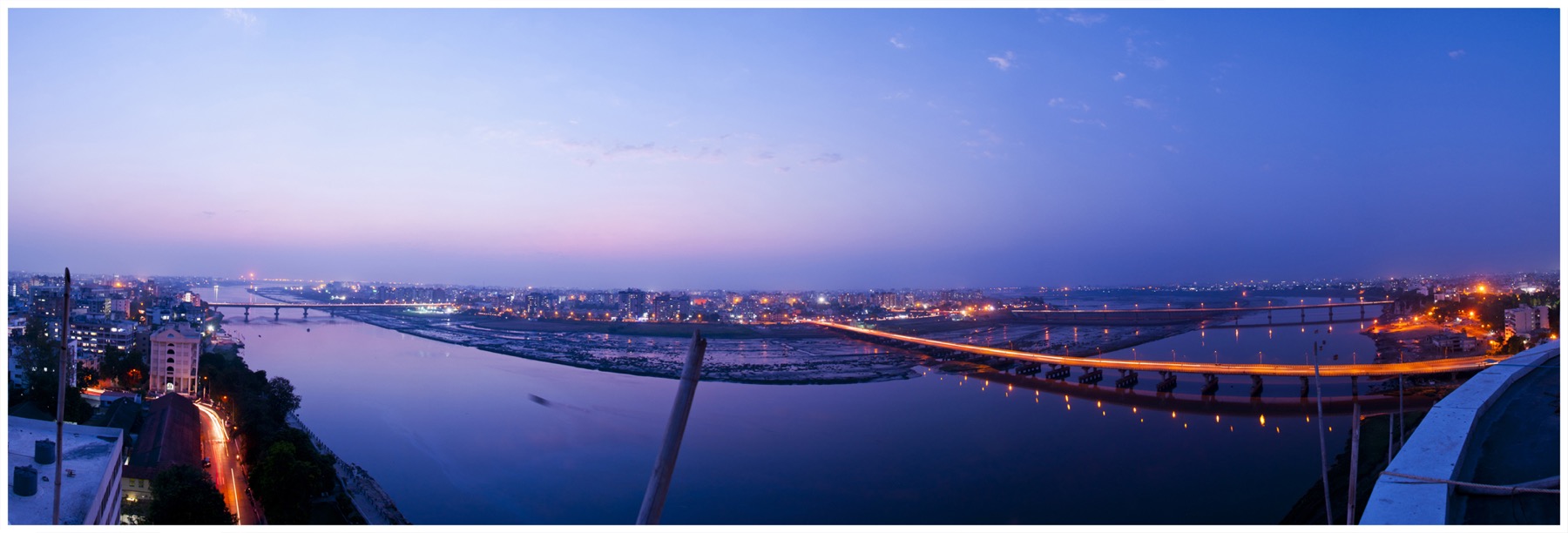
Surat in Gujarat is the largest city on the Tapti and the most economically important. Located near the estuary, Surat has been a major port since at least the sixteenth century, when it served as the principal western seaport of the Mughal Empire. Today it is a global centre for diamond cutting and synthetic textile manufacturing. The Tapti supplies drinking water and industrial water to Surat through the Ukai reservoir.
Religiously, the Tapti is one of the seven sacred rivers (sapta sindhu) in some traditions, along with the Ganga, Yamuna, Godavari, Saraswati, Sindhu and Cauvery. Multai temple tank, the source of the river, draws pilgrims year round.
Ecology and Conservation Issues
The Tapti basin is heavily cultivated, and the river itself is under pressure from irrigation withdrawals, urban pollution near Surat, and silt loading from deforested upper catchments. The Hathnur and Ukai reservoirs both trap large volumes of sediment, which is changing the natural sediment budget of the lower river.
The fish fauna includes catla, rohu, mahseer and several mullets in the estuary. The estuary itself, where freshwater meets the highly tidal Gulf of Khambhat, is a productive nursery for marine fish. The shoreline mangroves along the Surat coast are part of a small but ecologically important fringe of Gujarat mangrove cover.
Urban and industrial effluent from Surat is the biggest water-quality challenge in the lower basin. The Central Pollution Control Board has classified parts of the Tapti, especially the stretch around Surat, as moderately polluted.
Tapti River in UPSC Examinations
The Tapti River appears regularly in UPSC prelims and in the geography optional. The most frequently asked points are:
The Tapti is one of the three major westward-flowing rivers of peninsular India (Narmada, Tapti, Mahi). It rises at Multai in Madhya Pradesh and flows through Madhya Pradesh, Maharashtra and Gujarat. Its principal tributary is the Purna. It flows in a rift valley between the Satpura range to the north and the Ajanta hills to the south. Its mouth is at the Gulf of Khambhat and is an estuary, not a delta. The major reservoirs are Ukai and Hathnur.
Common prelims trip-ups include confusing the Tapti’s source with the Narmada’s source (the Narmada rises at Amarkantak in Madhya Pradesh, not Multai), or assuming the Tapti has a delta (it has an estuary). The Tapti also does not flow through any international boundary, unlike the Indus or Brahmaputra.
Frequently Asked Questions
Where does the Tapti River originate and where does it end?
The Tapti River originates at Multai in Betul district of Madhya Pradesh at an elevation of about 752 metres above sea level. It ends at the Gulf of Khambhat (an arm of the Arabian Sea) near Surat in Gujarat, after a course of about 724 kilometres.
What is the total length of the Tapti River?
The Tapti River is approximately 724 kilometres long, making it the second-longest westward-flowing river in peninsular India after the Narmada.
Which states does the Tapti River flow through?
The Tapti flows through three states: Madhya Pradesh (where it rises), Maharashtra (its longest reach through the Khandesh region), and Gujarat (where it crosses the coastal plain and reaches the sea at Surat).
Why does the Tapti River flow westward unlike most Indian rivers?
The Tapti flows westward because it occupies a rift valley, also called a graben, between two parallel ridges of the Satpura system. The valley was created by faulting during the breakup of Gondwana. The same mechanism explains the parallel westward flow of the Narmada one range to the north.
What are the main tributaries of the Tapti River?
The main tributaries are the Purna (the largest, joining at Changdev in Jalgaon), Girna, Panjhra, Waghur, Bori and Aner. Most of these are seasonal monsoon-fed streams.
Which are the major dams on the Tapti River?
The two largest dams are Ukai in Gujarat (the major storage and hydropower reservoir) and Hathnur in Maharashtra (an upstream barrage). Kakrapar weir downstream of Ukai supports a canal network and the Kakrapar atomic power station’s cooling water supply.
Does the Tapti River form a delta?
No. The Tapti ends in an estuary at the Gulf of Khambhat, not a delta. This is because the rift valley’s steep gradient and the strong tidal range of the gulf sweep most sediment back out instead of letting it accumulate.
Tell Google you want more of this.
Add Anantam IAS as a preferred sourceOne tap, and this site shows up more often in your own Top Stories, AI Overviews and AI Mode. Remove it any time.