The Western Ghats is one of the world’s eight “hottest hotspots” of biodiversity — and one of India’s most ecologically fragile mountain systems. From the Wayanad landslides of July 2024 to repeated flash floods and urban encroachment, the Ghats have sat at the centre of India’s environment-vs-development debate for over a decade. For UPSC, this is a high-probability topic that spans biodiversity, conservation law, disaster management, and the politics of federalism. This guide covers the geography, biodiversity, threats, the Gadgil and Kasturirangan reports, and recent conservation developments.
Geography and extent
- A mountain range running nearly parallel to India's western coast.
- Stretches 1,600 km from the mouth of the Tapi River (Gujarat–Maharashtra border) to Kanyakumari.
- Spans six states: Gujarat, Maharashtra, Goa, Karnataka, Kerala, Tamil Nadu.
- Older than the Himalayas; influences the southwest monsoon.
- UNESCO World Heritage Site (2012) — 39 sites inscribed as serial property.
Key subdivisions
| Section | Highlights |
|---|---|
| Northern Ghats | Sahyadri range in Maharashtra; Mahabaleshwar, Koyna |
| Central Ghats | Kudremukh, Bababudangiri, headwaters of Tunga-Bhadra |
| Southern Ghats (after Palghat Gap) | Nilgiris, Anamalais, Cardamom Hills; highest biodiversity |
Anamudi (2,695 m) in Kerala is the highest peak south of the Himalayas.
Biodiversity significance
The numbers
- Over 30% of India's plant, fish, herpetofauna, bird, and mammal species.
- At least 325 globally threatened species (IUCN Red List).
- Endemic to the Ghats: lion-tailed macaque, Nilgiri tahr, Malabar grey hornbill, Travancore frog, Myristica swamp tree.
- Home to three Nilgiri Biosphere Reserve-linked national parks: Silent Valley, Mukurthi, Indira Gandhi Wildlife Sanctuary.
Shola-grassland ecosystem
The shola forests — stunted montane evergreen patches in valleys — interspersed with grasslands are a unique high-altitude mosaic. Shola-grasslands are critical water catchments and host species like the Nilgiri tahr, Nilgiri marten, and endemic frogs.
Hydrological and climatic role
- Approximately 245 million people depend on rivers rising in the Ghats.
- Sources of Godavari, Krishna, Cauvery, plus numerous west-flowing rivers (Periyar, Mandovi, Sharavathi).
- Acts as a monsoon wall — intercepting southwest monsoon and feeding Deccan plateau rain-shadow zones.
Economic significance
- Minerals — iron, manganese, bauxite (Kudremukh, Goa, Ratnagiri).
- Plantations — tea, coffee, cardamom, rubber, pepper.
- Wild relatives of cultivated plants — pepper, cardamom, mango, jackfruit, plantain — making the Ghats a gene bank of incalculable value.
- Hydropower — Koyna, Sharavathi, Kalinadi, Idukki dams.
- Tourism — Hill stations (Mahabaleshwar, Coorg, Munnar, Ooty, Wayanad).
Threats
Land-use and development pressure
- Mining — iron ore in Goa, Karnataka; bauxite in Kolhapur.
- Hydropower — large dams drown forests; fragmented river ecology.
- Plantation expansion — tea/coffee estates displacing primary forest.
- Road and rail infrastructure — fragmentation, roadkill.
- Quarrying — stone and sand quarries dot fragile slopes.
Climate change and disasters
- Landslides — extreme rainfall events (Wayanad 2024, Kodagu 2018, Idukki 2018) trigger catastrophic slope failures.
- Forest fires — dry season intensification.
- Flash floods and urban flooding — downstream impact.
Biodiversity losses
- Illegal hunting — wild meat demand.
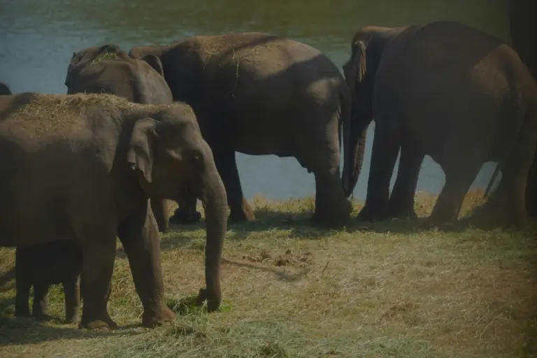
- Human-wildlife conflict — elephants in Hassan/Wayanad; leopards near Mumbai.
- Invasive species — Lantana camara, Mikania micrantha, Senna spectabilis.
- Fuelwood and NTFP extraction — from adjacent settlements.
The Gadgil Report (WGEEP, 2011)
The Western Ghats Ecology Expert Panel, chaired by Prof. Madhav Gadgil, submitted its report in August 2011.
Headline recommendations
- Declare the entire Western Ghats as an Ecologically Sensitive Area (ESA).
- Classify 142 taluks within into three Ecologically Sensitive Zones:
- ESZ-1 — strictest; no new dams, mining, thermal plants.
- ESZ-2 — moderate restrictions.
- ESZ-3 — promotion of sustainable activities.
- Create a Western Ghats Ecology Authority (WGEA) as a statutory body under the Environment (Protection) Act, 1986.
- Decentralised, participatory governance — decisions through Gram Sabhas.
- Phase out environmentally damaging activities in ESZ-1.
Reaction
The report faced strong resistance from state governments (especially Kerala, Karnataka, Maharashtra) and industry. It was seen as overly restrictive of livelihoods and development.
The Kasturirangan Report (HLWG, 2013)
The High-Level Working Group, chaired by Dr K Kasturirangan, was constituted to reconcile Gadgil's recommendations with development concerns.
Key findings
- Only 37% of the total Western Ghats area (about 60,000 sq km) should be notified as ESA.
- Distinguished between cultural landscapes (settlements, plantations — 58.44%) and natural landscapes (41.56%).
- Of the natural landscape, 90% was identified as ESA — where complete ban on mining, quarrying, sand mining, thermal power plants, large-scale construction was proposed.
Reaction
Kasturirangan was more accommodating than Gadgil, but states still resisted. Kerala and Karnataka have contested boundary delineation; the final MoEFCC ESA notification has been repeatedly drafted and withdrawn.
ESA notification — an unfinished story
The MoEFCC has issued multiple draft notifications since 2014 based on the Kasturirangan recommendations. The sixth draft notification (July 2024), issued after the Wayanad landslides, proposed declaring 56,826 sq km as ESA across the six states. Implementation remains pending due to state objections.
Legal and institutional framework
| Instrument | Role |
|---|---|
| Environment (Protection) Act, 1986 — Section 3 | Basis for ESA notification |
| Forest Conservation Act, 1980 (amended 2023) | Forest diversion controls |
| Wildlife Protection Act, 1972 (amended 2022) | Protected area framework |
| Biological Diversity Act, 2002 (amended 2023) | Genetic diversity |
| UNESCO World Heritage Convention, 1972 | Serial property inscription |
Latest developments (2024-26)
Updated context: verify specific figures against MoEFCC releases.
- Wayanad landslides, 30 July 2024 — triggered by extreme rainfall; killed over 400 people. Supreme Court-constituted panels re-opened the ESA debate.
- Sixth ESA draft notification, July 2024 — proposes 56,826 sq km as ESA; state consultations under way.
- Biosphere reserve additions — Sharavathi Valley (Karnataka) notified domestically; UNESCO-MAB submissions under review.
- Supreme Court monitoring — continuing mandamus on Western Ghats, particularly around illegal construction and quarrying.
- Tiger reserve additions — Veerangana Durgavati (MP) was notified (outside WG); discussions on a Nagarhole–Wayanad–Mudumalai–Bandipur landscape-level tiger corridor.
UPSC relevance
GS-III mapping
- Conservation and environmental pollution.
- Disaster management (landslides).
- Environmental impact assessment.
Prelims bullets
- Length: 1,600 km; covers six states.
- UNESCO World Heritage Site since 2012.
- Three ESZ categories recommended by Gadgil (2011).
- Kasturirangan (2013) recommended 37% as ESA.
- Anamudi — highest peak (2,695 m); Palghat Gap divides Nilgiris from Anamalais.
- Biosphere reserves within/adjoining WG: Nilgiri (1986, first in India), Agasthyamalai, Nilgiri.
Mains angles
- "Discuss the ecological significance of the Western Ghats and the recommendations of the Gadgil and Kasturirangan committees."
- "Critically examine the delay in notifying Western Ghats as an Ecologically Sensitive Area and its consequences."
- “How is climate change amplifying disaster risk in the Western Ghats? Discuss with reference to recent landslides.”
Essay hooks
- Ecology vs livelihoods — the classic Western Ghats dilemma.
- Biodiversity as a climate resilience asset.
- The federal politics of environmental regulation.
Quick revision
| Feature | Detail |
|---|---|
| Length | 1,600 km |
| States | Gujarat, Maharashtra, Goa, Karnataka, Kerala, Tamil Nadu |
| UNESCO | World Heritage Site (2012) |
| Hotspot | One of 8 "hottest" globally |
| Gadgil | Entire WG as ESA; 3 ESZs |
| Kasturirangan | 37% as ESA |
| Unique ecosystem | Shola-grassland mosaic |
| Highest peak | Anamudi (2,695 m) |
For UPSC, the safe framing is: the Western Ghats are India's ecological spine — biodiversity-rich, climatically essential, and politically contested. Without a firm ESA notification and consistent enforcement, India's monsoon, water, and biodiversity security all remain at risk.
Tell Google you want more of this.
Add Anantam IAS as a preferred sourceOne tap, and this site shows up more often in your own Top Stories, AI Overviews and AI Mode. Remove it any time.